The Journal Of Antiquities

Ancient Sites In Great Britain & Southern Ireland


Clegyr Boia Hillfort, Near St David’s, Pembrokeshire (Sir Benfro), Wales

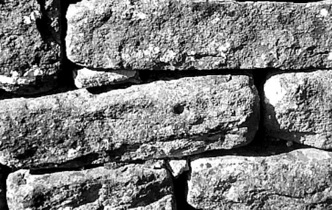
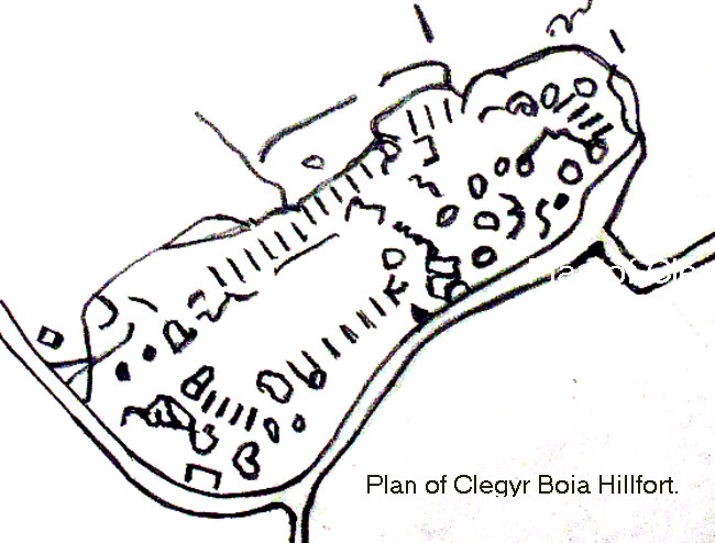
Plan of Clegyr Boia Hillfort, Pembrokeshire.

OS Grid Reference: SM 73719 25062. About 1 mile to the west of St David’s, at Nant-Y-Felin, in Pembrokeshire (Sir Benfro), Wales, is the prehistoric hill-top settlement site and hillfort of Clegyr Boia, which derives its name from a 6th Century pirate; however, the place was settled long before that in the Neolithic Age, and continued to be settled, in one way or another, up until the Dark Ages. The rectangular-shaped hillfort and earlier Neolithic settlement occupy the summit of this small rocky hill (named after an Irish pirate leader called Boia) and are enclosed by ramparts that join up with the existing rock outcrops – forming a secure, defensive site. Legend tells that the fort was destroyed by fire. Archaeological excavations took place on Clegyr Boia in the early 1900s and, more recently in the 1970s. There are two holy wells: one being Ffynnon Dunawd and, at the southwest side, there is Ffynnon Llygaid. From the western side of St David’s: take Pit Street and then Feidr Treginnis road until you see the hillfort in front of you. At least two footpaths lead up to the hillfort from the lane.

Timothy Darvill (1988) tells us that: “The rocky summit of this steep-sided hill on the coastal plain of south-west Dyfed was first occupied in early Neolithic times, and is one of the largest settlements of the period in Wales.

“About 3800BC, at least two rectangular houses stood on the hilltop. Their occupants were probably cattle farmers, and in addition to the large quantity of pottery recovered there were flint tools and polished stone axeheads made from locally outcropping rocks. Whether this settlement was defended is not known, but in Iron Age times a substantial rampart, which still stands 1m high, encircled most of the hilltop. The entrance, fortified with a long entrance tunnel, lay at the south-west corner of the site.”

Darvill adds that: “Legend attributes the site to Boia, an Irish pirate of the 6th century AD. Boia’s wife apparently sacrificed her stepdaughter Dunawd to heathen gods but on the same night Boia himself was slain by a second pirate, named Lisci, and his castle was consumed by fire from heaven.”  

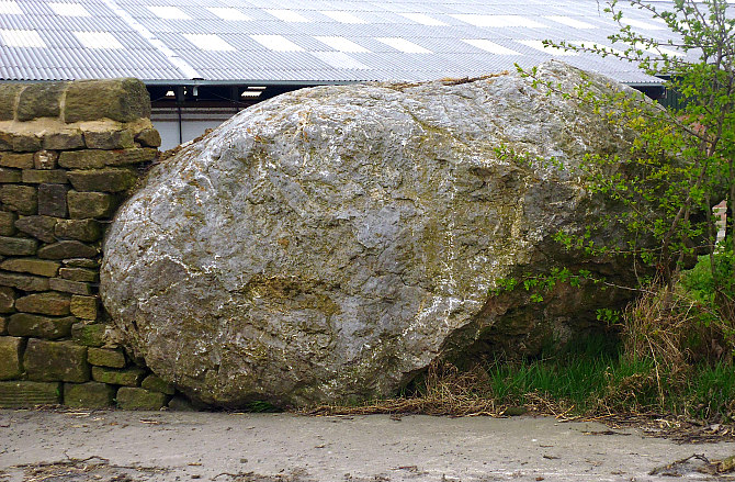
Chris Barber (1987) says that: “This small fort is situated on the summit of a large mass of igneous rock which rises about 45 feet above the surrounding farmland and is roughly 320 feet long by 100 feet wide. ……the summit has been fortified by a bank of stones mingled with earth. Originally, the bank would have been faced on both sides with large slabs set on end, in a similar fashion to the camp of Bwrdd Arthur on Anglesey. Most of the facing stones at Clegyr Boia have been removed for building purposes, but some still remain in place.

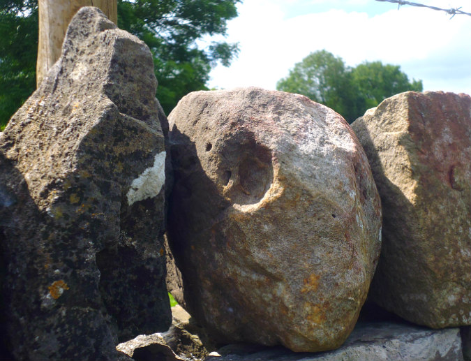
“The camp is roughly a rectangular parallelogram with an outpost on the north-eastern extremity. The interior of the main camp and the annexe have been hollowed out, and these excavations have, of course, provided the stone and earth to build the ramparts. In the sixth century the site was occupied by Boia, a Gwyddel chief who gave St David considerable problems, although the latter eventually dealt with him by causing fire to fall from heaven and consume the fortress. There is reputed to be a well here that is a small hollow in the rock, just large enough for a fist to be inserted. It is claimed that the water is good for soothing sore eyes.” 

Children & Nash (2002) tell us more, saying that: “Clegyr Boia is set within rectangular ramparts, measuring 100m by 25m, that may be of Iron Age date. The settlement, excavated in 1943, consists of two Neolithic house structures, a fire pit and a midden (Williams, 1953, 24-9). An earlier excavation revealed a possible third hut, located centrally within the rampart area (Baring-Gould, 1903). Outside the settlement area, a large number of Mesolithic flint scatters suggest continuous occupation of the peninsula for well over 4,000 years.

“One of the houses is oval, the other rectangular. The rectangular structure (7m by 3m) comprised two rows of posts, which may have supported a timber roof. An “unused pit” investigated inside this structure by Audrey Williams was compared by the excavator to similar pits discovered under the Pentre Ifan monument. She also suggested a link between the two sites on the basis of pottery evidence.

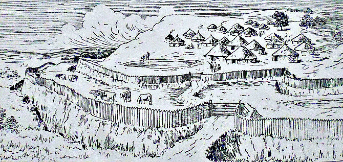
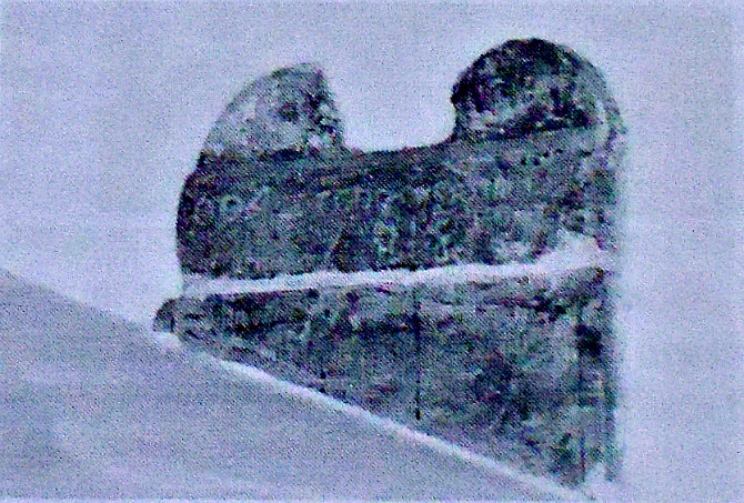
* Drawing of a typical Neolithic hill settlement.

Children & Nash go on to tell that: “The oval hut yielded evidence of extensive burning. Barker (1992) has suggested that the burning, plus the deposition of pottery in each of the contexts, indicates possible ritual abandonment. We would argue that the settlement and the two nearby monuments are contemporary, and that the former may have suffered natural abandonment towards the end of the Neolithic, only being re-occupied in the Iron Age. Pottery from the oval hut appears to be identical to examples found in the rectangular structure and in the midden to the west. Three different Neolithic pottery styles have been identified in all, and are similar to wares found in Cornwall, Southern Ireland and the Wessex region. The evidence suggests that a possible exchange network linked these areas. Barker (1992) proposes a Middle Neolithic (4,300 to 3,300 BC) date for the pottery from Clegyr Boia. Recovered from the floors of two huts were shouldered bowls, a number of animal bones, mainly of wild cattle, and limpet shells. 

“A series of hearths to the west of the oval hut yielded a flint arrow-head and a partly-polished stone axe of gritty volcanic tuff (Houlder, 1988). Limpet shells, pottery, and oak and birch charcoal were recovered from the midden. Cattle bone was found in both huts. The bone, together with the shells, suggest that the people of Clegyr Boia existed on a mixed economy of hunting/gathering/fishing with an element of domesticated herding. The settlement may have supported only two or three small family units at any one time.”  

Christopher Houlder (1978) adds to the above saying that: “The rocky summit of a small hill has been enclosed by ramparts joining outcrops to form a secure Iron Age dwelling site, for which precise dating evidence was lacking in excavation. Important Neolithic remains included the substantial rectangular house of a group of cattle farmers, whose pottery indicates an Irish connection in the third millennium B.C.”

Sources / References & Related websites:-

*Airne, C. W, M.A. (Cantab.), The Story of Prehistoric & Roman Britain — Told in Pictures, Sankey, Hudson & Co. Ltd., Manchester.

Barber, Chris, More Mysterious Wales, Paladin, London, 1987. 

Children, George & Nash, George, Monuments In The Landscape . Volume 5 — Neolithic Sites of Cardiganshire Carmarthenshire & Pembrokeshire, Logaston Press, Little Logaston Woonton Almeley, Herefordshire, 2002.

Darvill, Timothy, AA Glovebox Guide — Ancient Britain, Publishing Division of the Automobile Association, Basingstoke, Hampshire, 1988.

Houlder, Christopher, Wales: An Archaeological Guide, Faber & Faber, London, 1978. 

https://en.wikipedia.org/wiki/Clegyr_Boia

https://ancientmonuments.uk/128978-clegyr-boia-camp-st-davids-and-the-cathedral-close#.XT4mhlLsZjo

https://www.megalithic.co.uk/article.php?sid=5988

https://getoutside.ordnancesurvey.co.uk/local/clegyr-boia-pembrokeshire-sir-benfro

https://coflein.gov.uk/en/site/305389/details/clegyr-boia

© Ray Spencer, The Journal of Antiquities, 2019.


Greenberfield Lane Cup-Marked Stones, near Barnoldswick, Lancashire

Cup-marked stone on Greenberfield Lane. Red arrow marks the spot.

Cup-marked stone beside Greenberfield Lane, Barnoldswick.

NGR: SD 8852 4806. A “new find” and “an unrecorded carving” in the wall at the side of Greenberfield Lane, near Barnoldswick, Lancashire. It is a tiny cup-mark, but it is very easily missed; and there is another “possible” cup-marked stone in the wall further along the lane on the opposite side. There is a carpark at Green-berfield Locks on the Leeds & Liverpool Canal. So where did these carved stones come from? The tiny cup-marked stone is located just past Greenberfield farm (with the large glacial erratic boulder by the side of the entrance) and the nice farmhouse (with a smaller boulder in front of it). There doesn’t appear to be a ring carving around this tiny cup-mark but, if there is it’s very, very faint, though the more I look at the photo the more I think there might be!

Glacial boulder beside the entrance to Greenberfield farm.

“Possible” cup-marked stone beside Greenberfield Lane,

The second stone is located a little to the southwest at (NGR: SD 8847 4802) and is on the top of the wall further along on the op-posite side of the lane. This is a smooth round-shaped stone with   a well-pronounced circular hole, but whether it is a cup-mark carving is uncertain. It could be a hole left by a fossil that has dropped out, or it could be some Geological feature? At certain angles though it does look like a prehistoric cup-mark. Whatever it is, it is a very interesting stone. There are other round-shaped stones along the top of the wall. The large glacial erratic boulder (mentioned earlier, above) is between 4 and 5 foot high, and was dug out of the boulder-clay (10 foot deep) by a 13 ton digger when the new farm building (where the cows are milked) was under construction, and had not seen the light of day since the last Ice Age. The smaller boulder (in front of the farmhouse) was probably dug out of the ground around the same time. Greenberfield lies within ‘the Craven lowland drumlin field’, according to Nick Livsey.

Thanks to Nick Livsey for the above information.

https://www.visitlancashire.com/things-to-do/greenberfield-picnic-site-p561340

© Ray Spencer, The Journal of Antiquities, 2019.


Roman Altar-Stone in All Saints Church, Wigan, Lancashire

Roman-Altar Stone in All Saints Church, Wigan, Lancashire.

NGR: SD 58168 05667. All Saints parish church on Bishopgate, Wigan, Lancashire, houses part    of a Roman altar-stone that is said to have come from the Roman station of COCCIUM (COCCIO) – Wigan, which was probably built in 70 AD, and was located on the hill where the parish church now stands. There is no trace of this roman fort or camp today – the parish church of All Saints taking its place. The altar-stone, which has curved, scroll-like features at each end, has a 17th century inscription on its visible side whereas a Latin inscription on the opposite side is ‘not visible’. It was probably dedicated to the Roman god Mithras. A “presumed” Roman road runs west from MAMVCIVM (Manchester), converging in the centre of the town and then running northwest to Walton-le-Dale, while another Roman road runs south from Wigan towards Warrington, Wilderspool and on to Northwich (CONDATE). A Roman bath-house has recently been excavated where the Shopping Arcade now stands in the town centre. All Saints church, a mid 19th Century building, is easy to find at the southeast corner of Bishopgate, just off Market Street, in Wallgate, and opposite the War Memorial. 

The Church guide book says of the Roman altar, that: “Of special interest under the Tower are the window in the west wall which, though much restored, dates from the 13th century, and part of a pagan Roman Altar which is built into the splay of the east side of the modern window in the north wall. It was found in the rebuilding of 1845-1850 buried beneath the High Altar and was placed in its present position then. It is unfortunately only partly visible, so that it is impossible to tell whether it has a Roman inscription on the hidden side. On the exposed face is a half obliterated modern inscription, dated 1604. It was probably used in the Roman station of Coccium, which can almost certainly be identified with modern Wigan, and which probably stood on the hill now occupied by the parish church.” 

D. C. A. Shotter (1973) tells about the Roman site of Coccium, saying: “The next site northwards in probably Wigan, although no structural remains of Roman occupation have been found there. The chief evidence for the existence of a Roman site under the present town comes from Route 10 of the Antonine Itinerary, which gives distances on a route from Ravenglass (Cumberland) to Whitchurch (Shropshire). The middle section of this route is given as GALACUM (probably Burrow in Lonsdale). BREMETENNACUM (certainly Ribchester), COCCIUM and MAMUCIUM (almost certainly Manchester). The distances given are too great to refer to any settlement between Ribchester and Manchester on the direct route, but they will fit a route that runs from Ribchester to the Coastal road at its junction in Ribblesdale, then south to Wigan, and thence to Manchester on the road attested by the 19th Century observers. Thus Wigan would provide an identification for the elusive site of COCCIUM, and in Roman times it will have been entered from the South, the East and the North respectively by Wallgate, Millgate and Standishgate.

“Further evidence comes from the finds made in and around Wigan. To judge from cinerary urns recovered from the area of the gas works, a cemetery appears to have lain on the South side; the Church has a Roman altar built into it; further, various coins have been found in the area, including a hoard of some 200 coins recovered in Standish in the late 17th Century; this hoard contained coins from the late 1st to the mid-3rd Century A.D. Another important find, this time from Dalton (five miles north-west of Wigan) is the headless statue of Cautopates………, one of the attendants of the god, Mithras.” 

Joseph P. Pearce (2005) says that: “Here, on the rising land within a loop of the river Douglas, the Roman Conquerors of Britain have founded their camp and castlefield. The Roman road leading from Warrington to Preston and Walton-le-Dale, passed through the very centre of the town of Wigan, bearing the traffic of the Legions and the Guilds and Trades of old. Four streets radiate from the Market Place—Standishgate, Wallgate, Millgate, and Hallgate; all bearing a Roman stamp. A stone from a Roman altar has been found, embedded within the walls of Wigan Church. Here the Romans ruled until that day when Rome, herself, was beset by barbarian hordes. Then the Roman soldiers were withdrawn from Britain and the ancient British race was left to the cruel mercy of the Norsemen.”

All Saints Church, Wallgate, Wigan, Lancashire.

Besides the Roman stone there are other interesting features in All Saints. In the Crawford Chapel   is a tomb with recumbent and battered effigies of Lady Mabel de Bradshaw of Haigh Hall and her husband William, a now rather forlorn and somber monument that has stood here since the 14th century. Lady Mabel is the heroine of the famous Wigan Cross or Mab’s Cross in Standishgate, which dates back to 1338 when it was set up by Mabel, a saintly and charitable lady…… who endowed her chapel with property in Haigh and Wigan to enable a priest to celebrate divine service at the Altar of the Blessed Virgin Mary in Wigan Church, remembering especially the souls of herself after death, King Edward II, her husband, Sir William, her parents and all her ancestors, Roger, then Bishop of Coventry and Lichfield, and all the faithful departed, says the Church guide book. The very ornate font in the south aisle is 14th-15th Century and its large gritstone bowl can be seen close-by. It has a band of quarter foils run-ning around its outer surface; apparently this was in use as a water butt in the gardens of the hall before being being restored   to the church.

And finally, there was at one time in the past a school of thought indicating perhaps that the Roman station of Coccium was located on Castle Hill, 3 miles east of Wigan, at Hindley, in Lancashire (NGR: SD 62460485). However, this thought, account, or suggestion now seems to have been ‘completely discounted’, and is not the case with Coccium, which is nowadays considered to have been where the parish church of All Saints is now to be found in Wigan town centre. There was, however, a Medieval structure on Castle Hill, at Hindley, which was probably a timber castle.

The Historic England List Entry No. is:- 1384556.

Sources / References and related websites:-

Church guide book, The Parish Church of All Saints, Wigan — A Short History and Guide, 2003. The two images (above) are from this guide.

Pearce, Joseph P., Lancashire Legends, Book Clearence Centre, Wigan, 2005. (Originally published by The Ormskirk Advertiser, 1928. This edition is re-published with the kind permission of the Liverpool Daily Post & Echo Group).

Shotter, D. C. A., Romans in Lancashire, Dalesman Publishing Company Ltd, Clapham, Yorkshire, 1973. 

https://thejournalofantiquities.com/2014/11/07/mabs-cross-standishgate-wigan-lancashire/

https://en.wikipedia.org/wiki/All_Saints%27_Church,_Wigan

https://historicengland.org.uk/listing/the-list/list-entry/1384556

https://www.british-history.ac.uk/vch/lancs/vol4/pp57-68

http://www.wiganarchsoc.co.uk/content/Projects/Millgate/wbe1.html

Roman Roads

© Ray Spencer, The Journal of Antiquities, 2019.