The Journal Of Antiquities

Ancient Sites In Great Britain & Southern Ireland


3 Comments

The Ring of Brodgar, Stenness, Orkney Island, Scotland

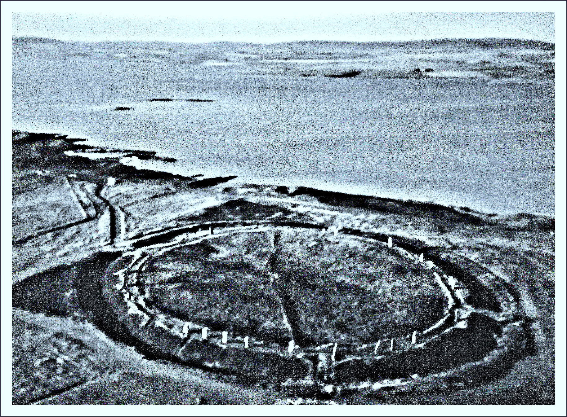
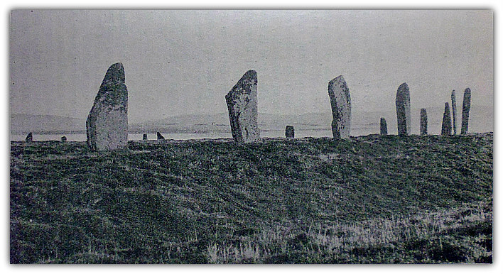
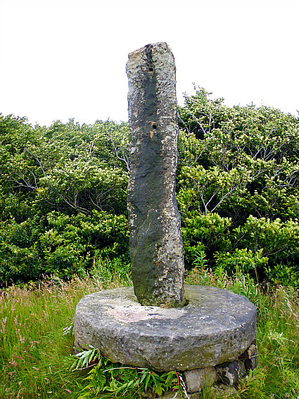
Ring of Brodgar Stone Circle and Henge at Stenness, in Orkney.

NGR: HY 29456 13361.  The Ring of Brodgar (or Brogar) is a Late Neolithic stone circle and henge monument situated on a narrow spit of raised land (Ness of Brodgar) between the Lochs of Stenness and Harray, just east of the B9055 road, in Orkney. The monument lies in the Parish of Stenness and is roughly halfway between Hestwall and Stenness. There used to be 60 standing stones forming the huge circle which has a diameter of 340 feet, but today less than half the stones remain standing; some of the fallen stones were recently re-erected. It is almost circular in design and is surrounded by a rock-cut ditch, the circle and outer ditch probably built in sections, rather than all at once. The monument dates from 2500-2000 BC. Whether the monument was built as a site for Druidic worship is not certain, but that would seem to be the case here, and, with that in mind, there are several burial cairns in the vicinity, and, also nearby are the equally impressive ‘Stones of Stenness’ and ‘Ring of Bookan’ which are all part of a ceremonial complex which also in-cluded Maeshow. All-in-all, then, the Ring of Brodgar was, and still is, a very sacred, magical and mystical place. From Hestwall take the B9055 road southeast to Wasbister, then continue southeast along the same road for a few miles in the direction of Stenness to reach the Ness of Brodgar – the stone circle soon coming into view on your right.

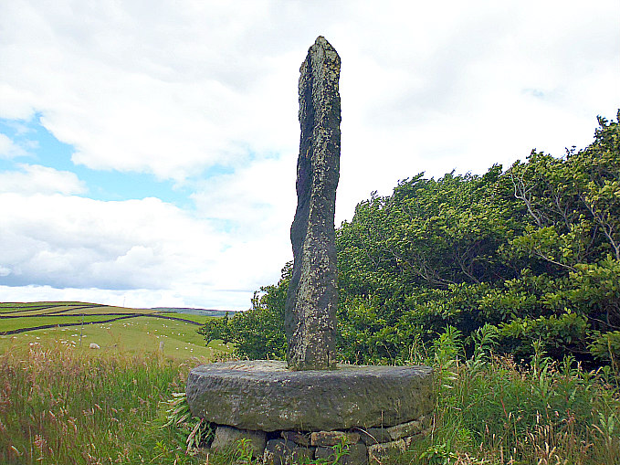
A part of the Ring of Brodgar Stone Circle at Stenness, in Orkney.

Childe & Simpson (1959) tell us: “The Ring of Brogar, on the isthmus between the Lochs of Harry and Stenness is one of the great complex of monuments of which Maes Howe is also a member. The ring stands not quite on the crest of the ridge separating the two lochs. It now consists of 27 upright slabs, set with their broad faces tangential to a circle 340 feet in diameter. Some stones are clearly missing. Many of the survivors are mere stumps and others are badly weathered. The tallest now stands 15 feet above the ground, and none is likely to have been less than 8 feet high. It is thought that the slabs have been brought from an ancient quarry on Vestra Fiold, some 6 miles away. On one upright on the north is cut an undeciphered runic inscription and a cross.  The stones stand on a gently sloping space, 10 feet to 12 feet from the inner lip of the enclosing fosse. This seems on an average 30 feet wide, but has never been excavated. It is spanned by a causeway on the north-west and south-east, but no trace of bank is visible outside it.

“The adjacent fields have yielded quite a harvest of flint arrowheads and broken stone mace-heads of Bronze Age type. To the north, just across the boundary of Sandwick Parish, is a ruined chamber tomb and close by, the Ring of Bookan, an irregular area surrounded by a fosse. Nearer to Brogar are several large earthen barrows, most probably heaped in the Bronze Age. There is a similar concentration of Bronze Age barrows round Stonehenge.  South of Brogar a series of five Standing Stones may be the remnants of an alignment or even an avenue leading across the narrow isthmus called the Bridge of Brodgar to another sacred enclosure.”  

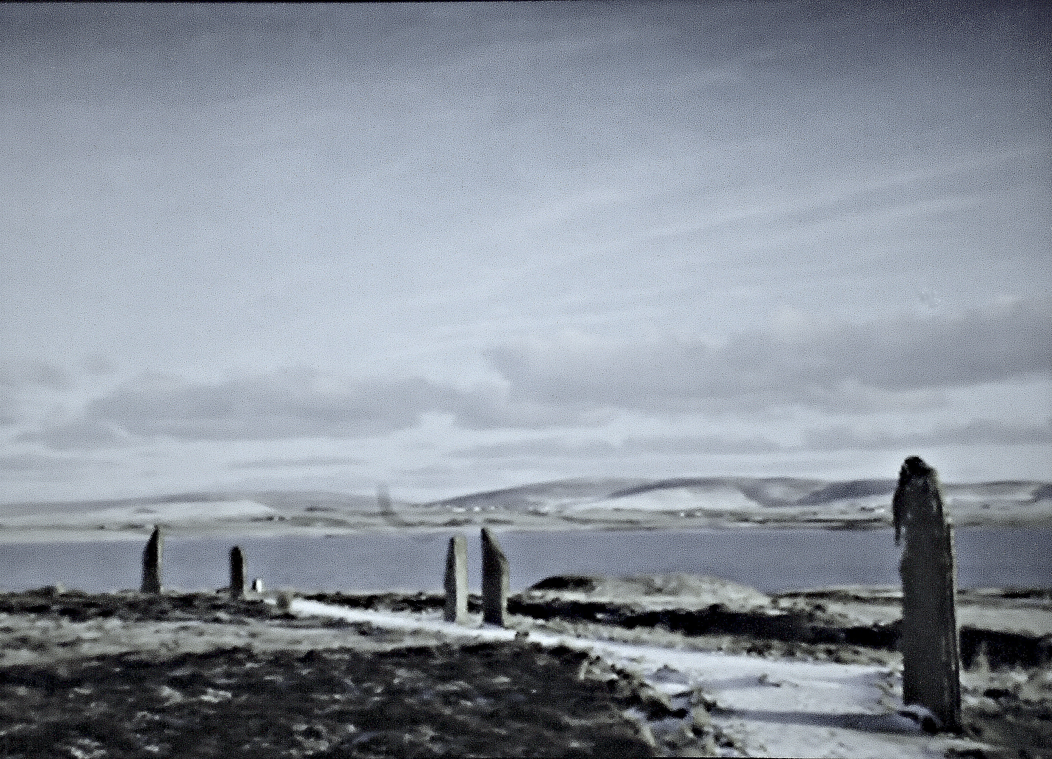
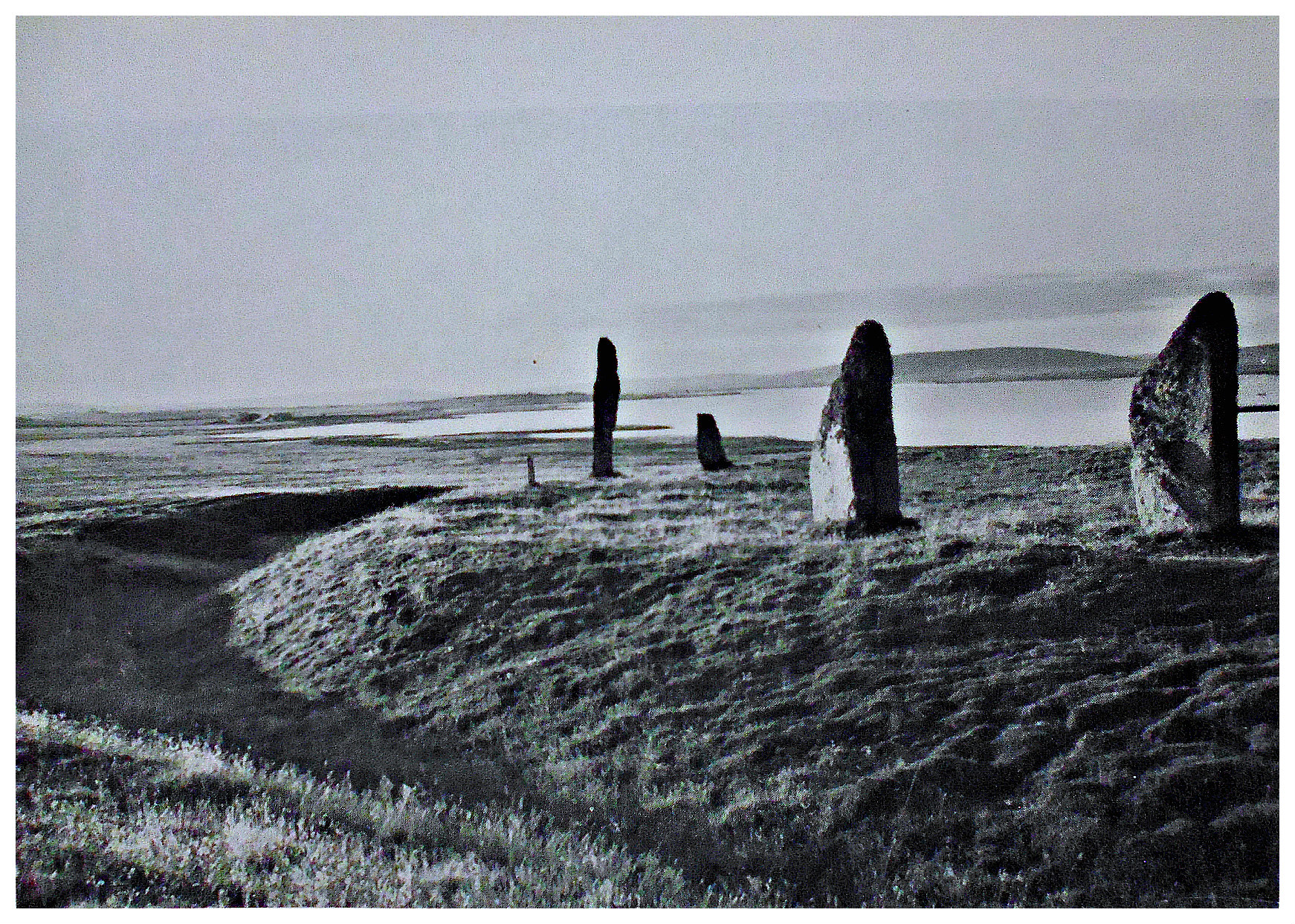
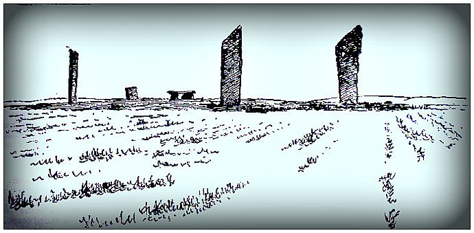
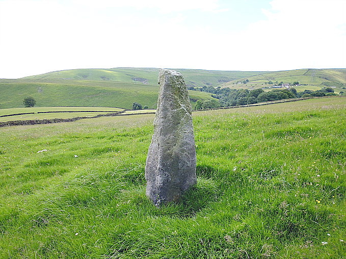
Some of the standing stones that make up The Ring of Brodgar.

Charles Tait (1999) says: “The Ring of Brodgar (HY294133). One of the finest stone circles any-where, this great henge monument is superbly situated on the Ness of Brodgar, in a confluence of water and sky, surrounded by the agricultural heart of Orkney. The feeling of spaciousness is enhanced by the size of the circle which is 103.7m or 125 megalithic yards in diameter. Of the original 60 stones, 27 remain standing, varying between 2m and 4.5m in height. The site is laid out very accurately in a perfect circle, with the stones approximately 6 degrees apart. One on the North side is inscribed by some cryptographic Norse tree runes, thought to stand for “Biorn”.  The surrounding rock-cut ditch is 10m across and more than 3m deep, though now half silted up. Radiocarbon dating from the excavation of this ditch places the building of the ditch in the third millennium BC. Despite the size of the ditch there is no trace of a surrounding earthwork, and an estimated 4,700 cubic metres of rock must have been shifted to complete the excavation. All this implies an organised society with a united belief in some form of cosmology or religion.

“Nearby is an isolated menhir, the Comet Stone, set on a platform beside the stumps of two other stones. Several other stones stand between this and the Bridge of Brodgar. There are also several large mounds and smaller tumuli in the area, which are probably Bronze Age, as well as another circular mound to the north-west called the Ring of Bookan (HY284145). It seems that theBrodgar area remained important during the 3rd and 2nd millennia BC. at least, and today it still has a magnetic attraction.” 

Tait adds more, saying: “There are a variety of astronomical alignments which may have been intended by the builders of the Standing Stones. While many stones are missing, simple observation suggests many possibilities. These relate to the solstices and the equinoxes as well as times such as Beltane (Old May Day). At winter and summer solstices the sunrises and sunsets align with the stones and notches in the hills. Other outlying standing stones may be markers for specific times of the year also. At spring and autumn equinoxes, viewed from the Comet Stone, the sun sets just glancing of the westernmost stone.”  

Reader’s Digest (1977) adds: Stenness, Mainland Orkney. Couples in the parish (Stenness) once made betrothal vows among the two famous stone circles in the district. They then swore constancy at the Odin Stone (a monolith destroyed in the 19th century) by joining hands through the hole in the stone’s centre.” The AA (1968) also tells us: “Stenness Mainland, Orkney. The Ring of Bookan is really a cairn of the Maes Howe type, but has been largely destroyed. The great surrounding ditch, however, is still in existence. Half a mile to the north-east is the Ring of Brodgar, a henge monument. The external bank has now disappeared, but the circling ditch still exists and encloses an area of 370 ft across, with two entrances.” 

Sources / References & Related Websites:-

Childe, Gordon & Simpson, Douglas, Ancient Monuments — Scotland — Illustrated Guide Volume VI,  H.M.S.O., Edinburgh, 1959.

Reader’s Digest, Folklore, Myths and Legends of Britain, The Reader’s Digest Association Limited, London, 1977.

Tait, Charles, The Orkney Guide Book (Edition 2.1), Charles Tait photographic, Kelton, St. Ola, Orkney, 1999.

The AA, Treasures of Britain And Ireland, Drive Publications Limited, London, 1968.

https://en.wikipedia.org/wiki/Ring_of_Brodgar

https://www.historicenvironment.scot/visit-a-place/places/ring-of-brodgar-stone-circle-and-henge/

https://www.visitscotland.com/info/see-do/ring-of-brodgar-p669061

https://www.orkneyology.com/ring-of-brodgar.html

https://www.orkney.com/listings/ring-of-brodgar

More info here:  https://perceptivetravel.com/blog/2021/08/23/ring-of-brodgar-scotland/

Copyright © Ray Spencer, The Journal of Antiquities, 2021.


1 Comment

Stones of Stenness, Orkney Island, Scotland

Stones of Stenness, in Orkney Island, Scotland

NGR: HY 30683 12513. At the far south-western edge of Loch Harray – beside the B9095 (Brodgar road), on the Island of Orkney, Scotland, is the famous henge monument known as ‘Stones of Stenness’ or ‘Ring of Stenness’, which is considered to date from around 3,000 BC – the Neolithic age of prehistory. There used to be twelve tall standing stones forming the circle, but now there are only four (one of these having been damaged and is now only half the size) – the other stones apparently vanished into thin air or, more likely, they were toppled and broken up to be used for building material, though there are outliers close by: one in particular stands beside the road, while close to the centre of the henge there are two smaller stones and one large recumbent, which may have been a cist grave, or a hearth? The four stones are surrounded by a (slight) low bank or fosse and, a rock-cut ditch now filled-in. The thinking was that this monument was either a temple to the sun, a ritualistic place sacred to the Druids, or an astronomical site? Stenness is 5 miles northeast of Stromness, 5 miles west of Finstown and 1 mile southeast of the ‘Ring of Brodgar’, which is another Stone Circle, just to the north of Stenness.

Charles Tate (1999) tells us a lot about the site, saying: “The Standing Stones of Stenness……were originally a circle of 12 stones with a diameter of 30m and now comprises of 4 uprights, the tallest of which is over 5m high. The circle was surrounded by a rock-cut ditch 2m deep, 7m wide and 44m in diameter which has become filled-in over the years. Excavation has revealed a square setting of stones and bedding holes for further uprights, either stone or wooden.

“Remains of domestic animals , including cattle, sheep and dog bones as well as a human finger and sherds of Grooved Ware pottery were found in the ditch. Radiocarbon dating indicates that the circle was constructed about 3000 BC, which is older than many henge monuments further south in Britain.

Tate goes on to add, that: “Nearby, at the Bridge of Brodgar, stands the Watchstone, (HY 305128 – 5.6m). At the Winter solstice the sun sets into a notch in the Hoy Hills as seen from this stone, clearly marking the shortest day. A recent observation suggests that there is an interesting alignment from the Watch Stone at Old New Year – still celebrated in Shetland with Up Helly Aa. At this date at the end of January, the sun disappears behind the Hoy Hills just before sunset and then reappears from the other side, before finally setting into a notch in the skyline.

“This impressive menhir and the Barnhouse Stone (HY312122 – 3.2m), in a field near the main road, as well as the Stone of Odin, which was destroyed in 1814, must have had some connection with the stone circles and Maeshowe. Since so many stones are missing, interpretation of the remaining stones remains problematical. This of course serves to add to the mystery of the purpose of the monuments. Other standing stones at Stoneyhill (HY320158), Howe and Deepdale (HY272118) may also form part of this Neolithic complex.

“The stone destroyed in 1814 was used as lintels by the farmer at Barnhouse, who was incidentally an incomer. Apparently the part with the hole was used as the pivot for a horse mill but was destroyed after World War II. Luckily the selfish farmer was stopped from demolishing the rest of the Standing Stones, but only after he had toppled two more of the menhirs, one of which he broke up. The threat of Court action finally stopped this 19th century vandal, and the fallen stone was re-erected in 1906. Luckily the vast majority of landowners over the millennia have had great respect for our antiquities.

“The Odin Stone had a hole in it through which lovers clasped hands and swore their everlasting love. The Oath of Odin was then said and the contract was binding thereafter. The stone was also credited with healing powers, in association with the well at Bigswell (HY345105) and especially at Beltane and midsummer. Recently the probable sockets of both this stone and another were found between the Standing Stones and the Watch Stone.”

Timothy Darvill (1988) says: “Little now remains of the bank and ditch of this site which was originally 61m in diameter, but a single entrance lies to the north. Four massive stones remain of the ring of 13 slabs that once stood inside the monument. Cists and pits containing burials have been found in the henge, and radiocarbon dates suggest that it was constructed about 2900BC.”

Childe & Simpson (1959) tells us: “The Ring of Stenness is now a flat-topped mound or platform, encircled by a fosse with a bank outside it and traversed by a causeway on the northwest. On the platform four monoliths stand on the circumference of a circle, some 52 feet in diameter.

Stones of Stenness, Orkney Island. An early photo by T. Kent.

J. Gunn (1941) tells us that: “As regards the Standing Stones, a common theory has been that they had some connection with the religion of the Druids, and may have been places of sacrifice. Another theory is that they had some astronomical significance. Neither of those beliefs is now accepted by serious students of archaeology. On the other hand it is certain that such stones are in almost every case associated with graves and burial mounds, and in this connection they seem to have had a religious or ritualistic origin. It is probable that the religion of these circle-builders was some form of sun worship which had spread into Europe from the East. In Scandinavia there are many Bronze Age pictorial rock carvings which point to such a worship, and it has been thought that the practice of cremation, which became so general in Western Europe during that period, was due to new ideas regarding the persistence of the soul after death. In more southerly parts of Britain there is no doubt that fresh immigrations took place during this Bronze Age, but whether Orkney was affected by these to any extent we cannot tell. It may well be that the Stone Circles and Standing Stones were the work of the same racial stock, who had retained the megalithic tradition, and had found fresh forms of expression for it under the compel-ling influence of a new world of thought.” 

Sources / References & Related Websites:

Childe, Gordon & Simpson, Douglas, Ancient Monuments—Scotland—Illustrated Guide, H. M. Stationery Office, Edinburgh, 1959.

Darvill, Timothy, AA Glovebox Guide—Ancient Britain, Publishing Division of The Automobile Association, Basingstoke, Hampshire, 1988.

Gunn, J., Orkney—The Magnetic North, Thomas Nelson And Sons, Ltd., London, 1941.

Tate, Charles, The Orkney Guide Book (Edition 2.1), Charles Tait photographic, St. Ola, Orkney, 1999.

The AA, Illustrated Road Book Of Scotland, The Automobile Association, London, 1963.

https://en.wikipedia.org/wiki/Standing_Stones_of_Stenness

https://www.historicenvironment.scot/visit-a-place/places/stones-of-stenness-circle-and-henge/

https://canmore.org.uk/site/2105/stones-of-stenness

https://www.nationalgeographic.com/magazine/2014/08/neolithic-orkney/

https://www.orkney.com/listings/standing-stones-of-stenness

© Ray Spencer, The Journal of Antiquities, 2019.


Torphichen Sanctuary Stone, West Lothian, Scotland

Torphichen Sanctuary Stone

   OS Grid Reference: NS 96842 72506. An ancient standing stone known as the ‘Torphichen Sanctuary Stone’ is to be found at the west-side of the kirkyard and preceptory of Torphichen parish church, 2¼ miles to the north of Bathgate in west Lothian, Scotland. The stone has five small prehistoric cup-marks, but also a Celtic-style carving from the Dark Ages when St Ninian lived here, while on the top of the stone there is a medieval incised cross and a small hollow.  It is the central-most stone of three – the other two being within a 1 mile radius of the preceptory. The thinking is that the santuary stone came from the ancient site of Cairnpapple Hill, about 1½ miles to the east. Torphichen’s medieval church and preceptory are located at the east-side of the village on The Bowyett, which runs off from the B792 road. You will find the little standing stone set amongst the gravestones at the west-side of the grassy kirkyard.

   The little standing stone was set up here in the 12th century by the Knights Hospitallers (Knights of St John) to mark out a place of sanctuary or refuge for local people and pilgrims from further afield who wished to seek ‘a place of safety here’, or more likely the stone was already here when the Knights founded their preceptory/hospital and church in 1168; an incised cross was carved on the top of the stone and the little hollow carved to either hold a cross or maybe holy water? But the stone was used at an earlier date by St Ninian, who had settled here in the 4th century and, in the 7th century St Fechin, an Irish monk and missionary from the monastery of Fore, County Westmeath, apparently also made use of this standing stone – the Celtic-style carving on the stone would date from this time. The five small cup-marks on the side of the stone date from the early Bronze Age when it stood on Cairnpapple Hill where there is a Neolithic henge monument and Bronze Age cairn. The pre-ceptory which was the Knight’s Hospitallers Scottish base, is now in ruins although the central tower, west tower-arch and transepts remain; the nave was rebuilt in the 17th century and now forms part of the present parish church. Some of the domestic buildings and parts of the hospital also still stand.

   There are two other associated sanctuary (refuge) stones (West and East) both of which stand about 1 mile distant from the central stone here in the Torphichen kirkyard. The W stone, which had a Maltese cross carved upon it, is located at Westfield farm (OS grid ref: NS 9437 7211) while the E stone is at Easter Gormyre farm near the hamlet of Gormyre (OS grid ref: 9806 7311), according to the Canmore website entries.

Sources of information and related websites:-

Ancient Monuments — Scotland, Volume VI, H. M. Stationery Office, Edinburgh, 1959.

Bottomley, Frank, The Abbey Explorer’s Guide, Kaye & Ward, London, 1981.

The AA, The Illustrated Road Book Of Scotland, The Automobile Association, London, 1963.

http://www.megalithic.co.uk/article.php?sid=30653

https://en.wikipedia.org/wiki/Torphichen_Preceptory

http://www.armadale.org.uk/torphichen.htm

https://canmore.org.uk/site/47929/torphichen-churchyard-refuge-stone

https://canmore.org.uk/site/48010/westfield-farm-refuge-stone

https://canmore.org.uk/site/47915/gormyre-refuge-stone

                                                                                     © Ray Spencer, The Journal Of Antiquities, 2017. 


Les Causeurs Menhirs, I’le de Sein, Finistere, (Bretagne) Brittany

Les Causeurs Menhirs (photo credit: portalix - Wikimedia).

Les Causeurs(photo credit: portalix – Wikimedia).

    Latitude: 48.038149. Longitude: 4.851246. On a grassy mound at the south-west side of St Guénolé’s church on the I’le de Sein (Sein Island) – five miles off the Finistere coast at Pointe du Raz (Bretagne), Brittany, are two tall granite standing stones (menhirs) that are said to date from the Neolithic. These two standing stones may originally have been part of a stone circle. There are a number of myths and legends associated with these menhirs, and also the surrounding area in which they stand. The island, known as Enez Sun in Breton, is also steeped in pre-Christian myths and legends associated with druidic ritual. The standing stones can be seen on a low, grassy mound at the south-western side of St Guénolé’s Church (Eglise Saint-Guénolé) on the Place Francois-Le-Sud – just to the west of Port du Men-Briel.

    The two menhirs (long stones) are also known in the Breton language as Ar Brigourien – the Talkers, and Ar Fistillerian – the Orators or Gossipers, and sometimes Ar Predicateurs – the preachers. The smaller stone seems to lean toward the taller one – hence the name “The Talkers”. They stand on a low grassy mound which long ago may have supported a circle of standing stones – these two are all that remain of that, but where the other stones went to is not known. Or maybe they originally formed part of a stone row or sacred way. It is thought they were erected here in the Neolithic period of prehistory (6,000-2,500 BC). Les Causeurs menhirs stand respectively at 2.8m (9 ft 3′) and 2.3m (7 ft 6′) in height. The church of Saint Guenole (alias St Winwaloe) was obviously built close to the stones to Christianise what was, long ago in the island’s dark past, a pagan ritualistic site associated with the druids and, mysterious pagan priestesses called “The Senes” – the island taking its name from them

    The Breton author Henri Queffelec in his work ‘Un Recteur De L’ile De Sein’, tells us more about the island’s dark past. He says that: “In early times, the île de Sein was thought to be the haunt of supernatural beings. In the first recorded mention of the island in 43 A.D., in the work of the Roman geographer, Pomponius Mela, we are told that the Insula Sena possessed an oracle which was served by nine vestal virgins who had the capacity to control the elements and cure the apparently incurable. This tradition is later exploited by Chateaubriand in book IX of Les Martyrs (1809) in his description of the sacrificial activities of the Celtic druidess Velleda some of which take place on the “île de Sayne, île venerable et sacrée”. In the Middle Ages, the île de Sein is caught up in the Arthurian legends and according to some storytellers, is the birthplace of two of the most accom-plished magicians, the wizard Merlin, and Morgan La Fée.”

    Queffelec goes on to inform us about the legendary ville d’ Ys, which was the kingdom of King Gradlon: “the ville d’ Ys, according to legend, was once the kingdom of King Gradlon in the sixth century A.D. situated somewhere between the Point du Raz and the île de Sein, and protected from the sea  by a system of dykes. King Gradlon’s daughter, Dahut or Ahès, was captivated by the charms of a handsome young man who was really the devil in disguise; as a proof of her love for him, he ordered her to get the keys of the dykes from Gradlon, her father. Once in possession of the keys, the devil opened the dykes and the town of Ys was submerged for ever. Gradlon managed to escape and went to Quimper where his statue can be seen on the cathedral; Ahès was changed into a siren, the Marie Morgane who lures unsuspecting sailors to their end. The story of the submerging of the ville d’ Ys is related by Queffelec in his novel, Tempête sur la ville d’ Ys, published in 1962.”

    The Insight Guide ‘Brittany’, says of: “the fabled, drowned city of Is, [it was] the legendary capital of the kingdom of Cornouaille (echoes of Cornwall here).” It goes on to say that: I’le de Sein was the: “last refuge for the druids in Brittany.”

Sources and related websites:-

Insight Guide, Brittany, (First Edition), APA Publications (HK) Ltd., 1994.

Queffelec, Henri, Un Recteur De L’ile De Sein, George G. Harrap & Co. Ltd., London, 1972.

https://fr.wikipedia.org/wiki/Les_Causeurs                                                                                                                                      (Photo displayed under the Licence Creative Commons 3.0).

http://www.megalithic.co.uk/article.php?sid=8863

https://en.wikipedia.org/wiki/Winwaloe

http://www.lafermedekerscuntec.fr/peninsulas-islands-brittany.htm

http://www.brittanytourism.com/discover-our-destinations/quimper-cornouaille/unmissable-sites/sein

The Ile de Sein


Standing Stones At Stones, Near Todmorden, West Yorkshire

Tall standing stones at the hamlet of Stones, near Todmorden.

Tall standing stone at the hamlet of Stones, near Todmorden.

    OS grid reference: SD 9252 2359. There are three standing stones at the hamlet of Stones near Todmorden, West York-shire, but in this case they seem to be reasonably “modern” in date. This off-the-beaten-track hamlet with the name “stones” is a curious one. It seems to be ‘in another time or realm of its own’, but an idyllic one. It lies just south-west of the imposing Victorian ediface Dobroyd Castle, once home to the industrious Fielden family of Todmorden. At least one of the standing stones was erected in the early 19th century, while the other two were put up around the same time or a bit later – perhaps in more recent times? And there is a fourth stone but this is recumbent and now lies in front of a well. To reach these standing stones it is best to drive into Bacup town centre, then the A681 (Bacup Road) through Sharneyford, and at Cloughfoot turn left onto the steep Sour Hall Road, then turn right onto Parkin Lane which soon becomes Stones Lane. The tallest of the stones is in front of you on the left-hand side. It will, however, be difficult to find a parking place on this narrow lane and difficult to turn around again!

Stone No 1 viewed from different angle.

Stone No 1 viewed from a different angle.

    The tallest of the three standing stones known as (No 1) is said to be 12 feet high and can be found in a farmer’s field beside Stones Lane and just to the west of Stones Farm. It is a hefty pillar of grey-black millstone grit from a local quarry that was obviously long exposed to the industrial chimney smoke of Todmorden in days gone by. We don’t really know when the gigantic stone was set up, and whether this is its original position, though it looks to be well supported at its base by a number of sturdy stones. It may have been erected after the Battle of Waterloo in 1812, rather like the other standing stone over to the north on the hillock called Centre Hill, or maybe this stone was placed here following another, perhaps, more recent battles like those of The Great War 1914-18. This seems more likely as there is evidence saying it was placed here in 1921, but other than that, we may never really know with any certainty. It is the fourth tallest standing stone in Yorkshire (Billingsley, John, ‘Folk Tales from Calderdale – Volume 1’.

Standing stone on Centre Hill. This is known as Stone No 2.

Standing stone No 2 on Centre Hill.

Stone No 2 on Centre Hill (from a different angle).

Stone No 2 on Centre Hill (from a different angle).

    The slightly shorter and thinner standing stone known as (No 2) stands atop a grassy hillock called Centre Hill (OS grid ref: SD 9254 2369) which is partly surrounded by a wooded area at the south-side and, just below that, a private residence called Model Farm. It is located some 95m north-east of, but more or less, in the same field as Stone No 1, although there is a low wall in between this and the little hillock.  This particular stone is held in place through the central hole of a large millstone – which is in turn supported below that on some other flat stones arranged in an equally circular fashion. We do know, however, with some sort of certainty that this stone was brought to its present position after 1812 and erected to commemorate ‘The Battle of Waterloo’. Centre Hill was originally the site of a beacon, according to author Paul Bennett, The Northern Antiquarian. It looks as if this standing stone has at some point been used as a gatepost!

Stone No 3 at Stones Lane, near Todmorden.

Stone No 3 at Stones Lane, near Todmorden.

Stone No 4 lies in front of the well near Stones Lane.

Stone No 4 lies in front of the well near Stones Lane.

    Standing stone No 3 is located at the east side of a farmer’s field some 330m to the north-west along Stones Lane (OS grid ref: SD 9225 2380). It stands at just 4½ feet high and is a thin pillar compared to the other two stones, but it is quite a nice little standing stone. We do not know when this stone was placed here though it looks as if it might have been here for a much longer period of time. A little to the south of this stone, close to the wall, there is a well that has a ‘good’ constant supply of fairly clear water that comes down from the low hillside above. At the front of the well there is a 5 foot long, flat recumbent stone; this is considered to be the former standing stone No 4. The spring apparently began to flow or re-emerge when the stone was being dug-up, according to Paul Bennett, The Northern Antiquarian. However, this well is not marked on recent OS maps nor are any of the standing stones for that matter!

    I think that in the recent past there were many other standing stones here but unfor-tunately these have been dug up and moved elsewhere in the locality, many being broken up and put to use in nearby walls.  The standing stones can be photographed from Stones Lane, but a word of caution here:  It is ‘unwise to climb over the walls’ to look at these standing stones.  There are gates, however, and if the farmer is driving along the lane in his tractor he might open these gates to allow access for one to get up closer!

Sources and related websites:-

Billingsley, John, Folk Tales from Calderdale, Northern Earth, Mytholmroyd, Hebden Bridge, West Yorkshire, 2008.

https://megalithix.wordpress.com/2011/04/16/stonesfarm/

http://www.megalithic.co.uk/article.php?sid=10342

http://davidraven-uk.blogspot.co.uk/2010/01/stones-of-stone-lane-in-er-stone-near.html

https://en.wikipedia.org/wiki/Dobroyd_Castle


The Calderstones, Allerton, Merseyside

The Calderstones (Photo Credit: Sue Adair (Geograph)

The Calderstones  (Photo Credit: Sue Adair (Geograph)

Os grid reference: SJ 4052 8757. Inside the palm house of the Calderstones Park Botanical Gardens at Allerton, Merseyside (originally in the county of Lancashire), stand 6 prehistoric megaliths known as The Calderstones, or the Caldwaye Stones, which are said to have come from a burial mound in the Allerton area back in the 1840s, although there is a record of them as far back as 1568 when they were being used as boundary markers and, at that time there were only three of them on view; the other three stones were excavated in the mid-19th century. These stones are thought to have ‘once circled’ the low mound which apparently had a burial chamber, or possibly a passage-grave at its centre. They are of interest, also, because they have carvings (rock-art) on them. The six standing stones, as they have always been referred to, were eventually brought to the Palm House in Calderstones Park, having stood near the entrance on Calderstones road (A562) and, opposite the aptly-named Druids Cross road. Liverpool city centre is 1 mile to the east.

The Calderstones, Allerton (1824)

The Calderstones, Allerton (1824)

The six stones range in height between 3-8 feet and probably date from the Bronze-Age. They are made of a hard sandstone. Of great interest are the carvings on them, there are a number of cup-and-ring marks on each one as well as spirals, and some other carvings that are more uncertain. When the mound at Allerton was excavated clay urns containing cremated bones and other artefacts were found, according to Mr W.A.Herdman in his work ‘A Contribution To The History of The Calder Stones near Liverpool’ (1896), adding credence to the probability that this was a burial chamber or passage-grave, but it could well have been a cairn circle due to the very fact that ‘these’ six megaliths had been discovered here; the stones would have almost certainly surrounded the chamber within the low burial mound (tumulus).

In 1845 the six Calder Stones were re-erected at the entrance to the park, and in 1864 they were examined by Sir James Simpson who declared them to be ‘part of a stone circle’; it was Sir James who identified the cup-marks and spirals and also wrote about them in 1865-7. In 1964 the stones were re-housed inside the Palm House (also called the Harthill Greenhouses), and here they stand as a fitting tribute to the antiquarians who discovered them back in the Victorian age. The stones have recently been re-sited in a special glass exhibition building in the Harthill Greenhouses buildings.

Sources:

Photo credit:  Sue Adair (Geograph) © Copyright Sue Adair and licensed for reuse under this Creative Commons Licence.

Geograph: http://www.geograph.org.uk/photo/401915

Fields, Kenneth., Lancashire Magic & Mystery, Sigma Leisure, Wilmslow, Cheshire, 1998.

Herdman, W.A., “A Contibution To The History of The Calderstones, near Liverpool”, Proceedings & Transactions of the Liverpool Biological Society, volume 11, 1896.

Simpson, James., “On the cup-cuttings and ring-cuttings on the Calderstones, near Liverpool”, Proceedings & Transactions of the Liverpool Biological Society, Volume 17, 1865.

Please see Paul Bennett’s very interesting, enthusiastic and in-depth site-page on The Northern Antiquarian: http://megalithix.wordpress.com/2014/07/08/calderstones/


Gray Hill Stone Circle, Llanfair Discoed, Monmouthshire (Sir Fynwy)

Gray Hill Standing Stone (Photo credit Paul Sheppard/Geograph)

Gray Hill Standing Stone (Photo by Steve Sheppard)

Os grid reference: ST4380 9352. On the southern ridge of Gray Hill* (Mynydd Llwyd) 260 metres (854 feet) above sea-level and overlooking Penhein, Shirenewton, Caerwent and the Bristol Channel, in southern Monmouthshire, stands Gray Hill Stone Circle, a Bronze Age monument said by some historians to be older than Stonehenge! This ancient monument is best reached from Wentwood reservoir, then by ‘climbing up’ the hill and along the eastern ridge, and then dropping down the south-side of the hill to where there are some ancient quarry workings and, just below stands the circle of stones, quite a few of which now lie recumbant. There is another single standing stone over on the north-west side of the hill and another stone to the east on Mynydd Alltir-Fach (also known as Money Turvey Hill) which is aligned with Gray Hill Stone Circle. Llanfair Discoed is 1 mile to the south of the hill, Penhein is 2 miles to the south and the Roman town of Caerwent is 2 miles south-east. Caldicot is about 3 miles to the south-east. [*Gray Hill can also be spelt as ‘Grey Hill’].

Two Standing Stones on Gray Hill (Photo Credit: Wikipedia)

Two Standing Stones on Gray Hill (Photo Credit: Wikipedia)

There are at least 13 stones ranging in height/length between 1.5 and 2.3 metres in a resonably well-defined (albeit broken) circle that is 32 feet (9.8 metres) in diameter, but there are also a few outliers; the stones are ‘said’ to have come from the quarries back up the hill. The circle is broken, miss-shapen at the west and east sides, the stones from these sides having been robbed-away in the mid 19th century. Only two of the thirteen stones are now standing, these are at the north and north-east of the circle, while a third stone has fallen over; one outer stone is still up-right, while another is recumbant. The outer up-right stone may well line-up with the Midwinter sunrise; the north-east stone and the fallen inner stone could also line-up with the Midwinter sunset. The two standing menhirs, which may be part of the cove, are rather jagged and ridged on their tops, one being quite tall, the one other small, but all the stones here are very sturdy and very substantial. It would have been quite a sight when they were all standing in the circle. A sort of ‘processional way’ to the second (outer) standing stone and barrow cemetary are evident at the east side of the circle, according to authors George Children & George Nash in their work ‘Prehistoric Sites of Monmouthshire’ 1996. Aubrey Burl described the monument as a cairn circle in 1977. So, with that in mind it’s plausable to say that there may have been a burial in the centre of the circle.

Fred Hando in ‘Hando’s Gwent’ 1987 seems quite passionate about the monument and informs us about his own theory regarding the circle and says: “when the ancient observers saw their stones in line with these horizon sunrises and sunsets they were able to advise their agricultural tribesmen what the seasons were. Such knowledge was power!”

Authors George Children & George Nash in their work ‘Prehistoric Sites of Monmouthshire’ mention that there is a ‘second possible stone circle’ to the west on Garn Wen at SO2803 2553 which is over 500 metres above sea-level and overlooks the Afon Honddu Valley and, and they go on to say there is a barrow cemetary at ST4410 9320 and a field system in the area of Gray Hill. Children & Nash say that “Gray Hill is regarded as one of the most important Bronze Age landscapes in the whole of Monmouthshire.”

An amusing end piece to this site is given by the author Chris Barber in his book ‘Mysterious Wales’  1987 in which he says: Historian W.H.Greene, in 1893, claimed to discover not one stone circle, but “acres of them” on Gray Hill. He recalled “that the hill was covered with prehistoric monuments and that the number could be counted in thousands.”

Sources:

Photo Geograph:  Copyright Steve Sheppard and licensed for reuse under this Creative Commons Licence

Photo Wikipedia:  http://en.wikipedia.org/wiki/Gray_Hill,_Monmouthshire

http://www.ggat.org.uk/cadw/fun_rit/english/stone_circles/sc2.html

Children, George & Nash, George., Prehistoric Sites of Monmouthshire, Logaston Press, Almeley, Herefordshire, 1996.

Hando, Fred., Hando’s Gwent, ed. Chris Barber, Blorenge Books, Abergavenny, Monmouthshire, 1987.

Barber, Chris., Mysterious Wales, Paladin, London W1X, 1987.

Palmer, Roy., The Folklore of (Old) Monmouthshire, Logaston Press, Almeley, Herefordshire, 1998.

Barber, Chris & Williams, John Godfrey., Ancient Stones of Wales, Blorenge Books, Abergavenny, 1989.


Men-an-Tol, Madron, Cornwall

Men-an-Tol, Cornwall, by J.T.Blight, 1874. (Photo courtesy of Wikipedia)

Men-an-Tol, Cornwall, by J.T.Blight, 1864. (Photo courtesy of Wikipedia)

OS grid reference: SW 4264 3494. On the moors about halfway between Morvah and Madron, in Cornwall, stands the late Neolithic monument known as Men-an-Tol (the holed stone), with three standing stones and one now lying down, dating back to between 2,000-3,000 BC the late Neolithic to early Bronze-Age. This alignment of stones lies on a moorland footpath which branches off a track just to the west of the site. Here there is an alignment of three standing stones, the central stone (the Crick Stone) has a very large hole, while the fourth stone is recumbant; there may have been others here when the site was much bigger – quite a bit of the monument having been robbed-away over the centuries, prior to which it may have formed a circle of stones. Nearby, there are other prehistoric sites of interest. Madron village is 3 miles to the south-east, the town of Penzance is 3 miles to the south, and St Just is 4 miles to the south-west.

The three standing stones are all roughly 1.0 to 1.2 metres (3 foot 5 inches to 4 feet) high, the large ‘perforated’ hole in the central, round-shaped stone being 0.5 metres (1 foot 6 inches) in diameter (though Borlase, in 1749, says it is 1 foot 2 inches), and each stone is about the same distance apart (8-9 feet); the western-most stone was moved to its present position in the early 19th century and aligned with the others – along with the recumbant stone there are five or maybe six other outliers buried in the ground close-by, which make-up this circular ancient site, covering upto 18 metres (59 feet). To the south-east there are the faint earthworks of a cairn, its low mound just visible. Over the last two hundred years or so antiquarians have often ‘pondered,’ and been ‘rather puzzled’ as to whether these standing stones once formed a much larger stone circle and, some go even further, in thinking there was once a burial chamber or mound here, though today there are no signs of either of these, very sadly.

Men-an-Tol Standing Stones in Cornwall.

The holed-stone was obviously used for fertility rituals and, maybe even magic, and the pointed stones next to it being ‘phallic in shape’; this being borne-out through the folklore and customs of the locality and its people in ‘days gone by’. The well-known authors Janet and Colin Board in their book ‘Mysterious Britain’, 1984, say that: Many of these stones are supposed to be helpful in curing certain illnesses, and children were once passed through the Men-an-Tol when they were suffering from rickets. Stones with holes big enough to crawl through, and with similar beliefs attached to them, can be found all over the world. There may once have been some benefits to be gained from such customs, …….certain stones can hold powerful currents passing through the earth, could not the hole serve as a focus for this power, which would pass into the body of, and give renewed vitality to, anyone climbing through the hole?” Young people would come to the holed-stone in order to consult the stone (oracle) with regard to their future love life, and two pins would be placed like a ‘cross’ on top of the stone and then they would, hopefully, move in a certain way. “This was interpreted in answer to a question put to the stone,” according to Bill Anderton in his book ‘Guide To Ancient Britain,’ 1991. Young children with tuberculosis, rickets and spinal problems were passed through the holed-stone three times, while a ‘childless’ women would have to crawl through the hole nine times to receive a cure. After that, hopefully they were cured!

There are several other important prehistoric monuments close by, the closest to Men-an-Tol being Men Scryfa Standing Stone, half a mile to the north, and The Nine Maidens Stone Circle, 1 mile to the north-east. And 2 miles to the southwest is Lanyon Quoit.

Sources:

Bord, Janet & Colin., Mysterious Britain, Paladin Books (Granada Publishing Ltd)., London, 1984.

Anderton, Bill., Guide To Ancient Britain, Foulsham & Co. Ltd., London, 1991.

Darvil, Timothy., Ancient Britain (Glovebox Guide), The Automobile Association (The Publishing Division), Basingstoke, 1988.

http://www.megalithics.com/england/menantol/mentmp.htm

http://sacredsites.com/europe/england/men-an-tol_cornwall.html

Wikipedia  http://en.wikipedia.org/wiki/Mên-an-Tol

https://en.wikipedia.org/wiki/M%C3%AAn-an-Tol

© Ray Spencer, The Journal of Antiquities, 2014 (up-dated 2019).


Inveryne Standing Stones, Argyll And Bute, Western Isles, Scotland

Os grid reference: NR9156 7496. In a field some 200 metres from the shoreline of Auchalick Bay in the west Cowal region and the parish of Kilfinan, Argyll and Bute, are three prehistoric standing stones known as the Inveryne Standing Stones or Auchalick Standing Stones, which are in fact a stone row, an alignment of shaped and jagged stones placed here 4,000 years ago. To reach these stones you need to come off the B8000 road about halfway between Kilfinan and Portavadie and ‘trek’ up a steep track passing Corr Mheall and then towards Inveryne farm – there are a number of other footpaths that lead in the same westerly direction but, be prepared for a long, arduous walk. The standing stones are approx 800 metres south-west of the farm, just to the north of Tigna Cladaich house. You can also reach the site from Melldalloch further to the east. Lochgilphead, the nearest town, is 8 miles to the northwest across Loch Fyne.

In the corner of a field near the footpath and a wooded area are three standing stones in a row looking rather forgotten and lonely in this rugged windswept landscape overlooking Loch Fyne and, in the distance the town of Tarbert. According to Canmore RCAHMS site no 39914 (1988) the three slabs vary in height and shape. The first stone at the north-east side stands at 0.75m (2ft 5) high and is straight-sided with a rounded top; the central stone is 0.95m (3ft 1) high, mainly rounded in shape with a natural depression, and the third south-westerly most stone is 1.05m (3ft 6) high and has a jagged top with slanting sides. A fourth stone, which is rarely mentioned lies recumbent and abandoned on the ground close-by. There may have been other stones forming this alignment and, if that’s the case these must have been robbed away?

I don’t know why these ancient stones are standing in this windswept location, unless they are in some way connected to a cup-marked rock to the northeast, at OS grid reference NR9217 7578, which can be found beside the footpath to Inveryne farm, southwest of Corr Mheall and the B5000 road. There are other standing stones and ancient burial sites in the Cowal region, and, also over on the Isle of Bute.

Sources: Canmore RCAHMS  http://canmore.rcahms.gov.uk/en/site/39914/details/inveryne/

Cowal and Bute Essential guide 2012, E & R Inglis Ltd., Dunnon, Argyll and Bute, 2012.

The Megalithic Portal  http://www.megalithic.co.uk/article.php?sid=1984&m_distance=0.0


St Patrick’s Chair, Marown, Isle Of Man

St Patrick's Chair, Marown.

St Patrick’s Chair, Marown.

OS grid reference SC 3050 7650. In a field called Magher-y-Chairn just west of the B35 road between Braaid and Crosby, in the parish of Marown, Isle of Man, and north of Garth farm are three standing stones stood together that are known locally as St Patrick’s Chair or Chairn-y-Pherick. Two of the slabs have early Christian crosses carved on them. In the same field is a holy well. Local legend has it that St Patrick came to preach here in the mid 5th century AD, but actually there is no hard evidence to support this. However, three Irish bishops – namely St Runius (Ronan), St Lonan and St Connachan (Onchan) are said to have lived and possibly died here. Indeed, they may lie in St Runius’ churchyard at Kirk Marown, about half a mile to the north-east. Also in that churchyard at the east end of the old church are the remains of a keeill, a primitive chapel dating from the early Christian period. The parish of Marown (Ma-Ronan) takes it’s name from the saint; and the town of Douglas is 4 miles to the east.

Originally there were five granite standing stones here but two have now fallen over and they lie amongst a jumble of other stones that may have once formed a burial site. Two of the slabs have simple but intricately carved thin crosses on their front faces from the early Christian period. It would appear that early missionaries have christianised these stones at some point between the 7th-9th centuries AD, as the standing stones themselves almost certainly pre-date Christianity by a few thousand years, making them prehistoric in age. Was this the meeting place for early Christians, or was it the burial place for an ancient chieftain? who knows! At the south-eastern side of the very same field is a holy well called Chibber y Chairn (Well of the Chair), also known as St Ronan’s Well.

Local legends say that St Patrick himself came here and used the stones as a seat to preach from in the 5th century AD; however this cannot be substantiated and is thought highly unlikely, but it is likely that Irish bishops preached in front of the stones – one bishop in particular could well have been St Ronan, known locally as St Runius or Runy (Ma-Ronan) who founded a tiny chapel (keeill) a short distance to the north-east in the 7th or 8th century? and has given his name to Marown parish. His feast-day is still celebrated in the Isle of Man on 7th February. He was apparently third bishop of Man following St Maughold (d 498) who “was” a convert of St Patrick. Whether this St Ronan is one and the same as St Ronan, bishop of Kilmaronen in Lennox, Innerleithen, Scotland, is uncertain, but ‘he’ is credited with attending the famous Synod of Whitby in 664 AD, according to the Venerable Bede.

The remains of the saint’s humble little chapel, built from wattle and daub with earthen walls stone-faced on the inside and roughly measuring 16 feet by 10 feet, can be seen at the east-side of St Runius’ old church. The little building dates from c1200 AD, but was enlarged and then rebuilt in the mid 18th century. It eventually fell in to decay only to be restored and re-opened again in 1959 by local people. Housed within are some crude Manx-style crosses, one of which was found beneath the porch. Could it be that these crosses once marked the resting places of the three Irish saints? This is certainly a very holy site.

Sources:-

The Manx Museum And National Trust, The Ancient And Historic Monuments of The Isle Of Man, Fourth (Revised) Edition, Douglas, 1973.

Farmer, David., Oxford Dictionary Of Saints, Oxford University Press, Oxford, 2004.

Click on the link http://www.iomguide.com/historical-sites/st-patricks-chair.php


Talayot de Trepuco, Mahon, Minorca, Balearics

Deutsch: Taula in Trepucó, Menorca

Taula in Trepucó, Menorca (Photo credit: Wikipedia)

Latitude 39.873607. Longitude 4.265410. About 1 mile to the south of Mahon (Mao) at the far south-eastern side of the Island of Minorca (Menorca) stands the ancient settlement of Talayot de Trepuco – with the megalithic table-shaped Taula monument in the middle of the circular enclosure walls. This prehistoric village-settlement of Trepuco is located less than 1 mile to the south of Mahon town and just a little east of the ME-8r Carretera de Sant Mao highway near the Cam Verdi and Villa Carlos roads.

In the centre of the circular ancient settlement or village (Talayot) a complex of excavated houses surrounded by a defensive wall and watchtower, stands the tallest megalithic monument (Taula) on Minorca. The whole site is thought to date back to the Bronze-Age 2,000-1,200 BC although there is some uncertainty about this. The tall granite megalithic slab-stone stands at 4 metres or 13 feet high with a second huge retangular-shaped slab on top that is 3.75 metres or 12 foot 4 inches long by 1.84 metres or 6 feet wide. The monument is typically shaped like a letter “T” and what looks to many like a table – perhaps in the form of a table-tomb. More than likely it was set up as a shrine or altar to the dead or perhaps rituals to the gods took place here. The burials would have originally lain beneath or around the taula.

Deutsch: Westlicher Talayot in Trepucó, Menorca

Talayot in Trepucó, Menorca (Photo credit: Wikipedia)

The talayot settlement-cum-village is enclosed by low defensive, drystone walls, but originally they would have been much higher. A watchtower would have stood along the walls – this is now not easy to make out. The site consists of a number of prehistoric houses forming the settlement that have been excavated, as well as some grassy mounds, that as yet, have not been looked at. There are five houses here that are made of rough, un-mortered dry stone-walling and at intervals tall slabs which acted as roof supports indicate their original height. Each house is different in shape, layout and style. Today the rough walls of these ancient buildings only stand to a quarter of their original height. Also, two excavated rooms adjoin the houses and a smaller talayot house is built onto the defensive wall. It seems obvious that there has been much robbing-away of stonework over the centuries here. The grassy mounds have not yet been excavated archaeologically, and it is unclear what they are, but it  is likely they are houses, rather than for the burial of the dead. This will only be known when a proper excavation is done.

Sources:

https://de.wikipedia.org/wiki/Trepuc%C3%B3


Kerloas Menhir, Plouarzel, Finistere, Brittany

Français : Le menhir Kerloas à Plouarzel en Br...

Kerloas Menhir (Photo credit: China_Crisis Wikipedia)

Longitude 48.426638 Latitude 4.679393. The Kerloas Menhir or Menhir de Kerloas stands on a low mound in open countryside 2 miles east of the village of Plouarzel in northern Finistere. The nearest town is Ploudalmezeau 7 miles to the north. A footpath takes you 200 metres south from the D5 Kerloas road to the giant standing stone that dates from the Bronze-Age around 3,000-4,000 BC and, to a prehistoric monument that can be seen for many, many miles around – although today it is missing it’s top section after lightning apparently struck it at some point in the distant past. The menhir stands at the southern edge of the Bois de Kervealouz forest. This is probably the tallest “standing” stone in Europe.

At 9.5 metres or 31 feet high this smooth granite standing stone which was quarried at L’Aber Ildut a couple of miles to the north-west is quite a remarkable sight. But originally it was approx 40 feet high before it lost the top 2 metres or so during a severe thunderstorm 200 years ago. The top part was blasted away by a lightning strike, some of the large pieces being sent over a large area landing in the nearby forest and on a farmhouse. It has a huge girth with a “quadrangular” tapering base; the shaft also gradually tapering away near the top where the breakage has occured. It’s estimated weight is 150 tonnes. Beneath the small round-shaped mound on which it stands there are said to be a several more metres of stone. About three feet up from ground-level on two sides there are two strange feminine-like humps or protuberances in the menhir – giving it the appearance of a hunchback person, but nobody seems to know why, or what, they are for. They are, however, probably associated with fertility? The mound beneath the stone is probably the remains of a tumulus where there was a burial of a chieftain, or maybe more than one chieftain – indeed the area around the site is called Kerglass ‘field of grief’.

Kerloas Menhir, Finistere, Brittany.

According to local legend, upto 100 years ago young, newly married couples would visit the Kerloas menhir on their wedding night in order to improve their family prospects. The woman would rub her naked body against one of the humps in the stone, while her husband would do the same to the other hump. These strange occurrences were performed in order that the man would receive a male child, while the woman would become the dominant one in the house. It also seems probable that the woman would help her childbearing on by climbing the menhir to the top naked and then sliding back down it again, but whether all this clambering all over the stone helped we don’t know, it probably would have caused the woman much bruising and friction burn in the meantime! Other legends claim there was buried treasure beneath the stone (grave-goods), while a very far-fetched legend claims the big stone wanders off every night to take a drink from a river, or even the sea! Now that is indeed far-fetched.

Source:-

Briard, Jacques., The Megaliths of Brittany (Giseserot Edition), Rennes, 2001.

https://en.wikipedia.org/wiki/Menhir


2 Comments

La Grand Menhir Brise, Locmariquer, Morbihan, Brittany

the Great Menhir of Er Grah, the largest known...

The Grand Menhir (Photo credit: S.Moller Wikipedia)

Latitude 47.571647 Longitude 2.949593. The site of the massive monolith or menhir is at the northern side of the village of Locmariquer, Morbihan region, and just west of the cemetery on the D781 (Route d’Auray). The nearest town, Auray, is 10 miles to the north. It’s name means ‘great broken standing stone’ because that it what it is today. But a more romantic name for the broken standing stone is ‘the fairy stone’ (Menhir Hroeg or Er Grah) because it was thought to have been erected by the little people, or the fairy folk lived there and, maybe still do. But in actual fact it was set up by Neolithic tribesmen in 4,500 BC – the huge stone being brought here from an outcrop of rocks near the estuary of the river Auray, some 7 miles to the north of Locmariquer.

Today, sadly the grand menhir lies on the ground having been broken into four sections by a lightning strike, or some think by an earthquake, but originally there were five sections – probably a small fragment has been lost. It is now thought that the menhir was broken by human involvement in two distinct stages. When it stood upright, if it ever did, then it would have been over 20 metres or between 64-66 feet high and it’s weight calculated to be around 300 tonnes or more, perhaps making it the largest monolith in Europe – or one of the largest in western Europe? However, the menhir would have been placed several feet into a round-shaped pit which has now been partially filled in. The girth of the stone at it’s base being approx 4 metres. The four remaining lumps of stone are carved and shaped smoothly around their narrower edges and also on the broad faces, and there is a carving of what is perhaps an axe in it’s wooden haft on one of the stones.

Near the top of the menhir the stone narrowes to form a roughly pointed shape, something that might cause it to be seen as phallic in appearence, but more than likely the stone was, or would have been used, for astronomical purposes. There were probably other standing stones here because a number of socket holes have been excavated running in a straight northerly direction for 180 feet, but of these only small stones remain. The grand menhir and it’s accompanying stone row were no doubt aligned with the winter and summer solstices and, quite probably a lunar happening such as an eclipse at the time of construction.

The 'Table des Marchand' dolmen in Locmariaque...

Table-de-Marchand (Photo credit: Myrabella Wikimedia Commons)

Behind the grand menhir is another prehistoric site that is linked. This is La Table des Marchand also known as The Merchants’ Table, a Neolithic passage-grave that has now been reconstructed. Actually, it is a dolmen that stands within the remains of a burial mound (tumulus) that measures over 36 metres or nearly 120 feet across. As the name suggests the monument is very like a stone table albeit three tables or capstones that are supported by 17 curved and slightly pointed upright stones. Below the largest stone table there is a gallery with stone-built walls around the chamber; the large stone table resting at one end on one of these curved supports, this one in particular has carvings of sun-ripened wheat ears. And the underside of the large table or capstone has an interesting carving depicting what is thought to be a plough in the form of an axe that connects up by a shaft that has slight traces of a harness and oxen (long-horned cattle), the back legs of one of these animals can be just made out, although it is rather faint now.

There are two more dolmens in the village. At the northern side stands The Dolmen of Mane Lud and in the centre The Dolmen of Mane Rethual – both of which are worth looking at if time is not too tight.

Sources:-

https://en.wikipedia.org/wiki/Locmariaquer_megaliths

Michelin, Brittany Tourist Guide, Michelin Tyre Limited, London, 1983.

Scarre, Chris (edited)., The Seventy Wonders Of The Ancient World – The Great Monuments And How They Were Built, Thames & Hudson, London, 1999.

© Ray Spencer, The Journal of Antiquities, 2012.


Carnac Stone Rows, Morbihan, Brittany

Carnac Stone Rows, the Morbihan Region, in Brittany.

Latitude 47.595977 Longitude 3.066988. The countryside around Carnac in the Morbihan region of southern Brittany abounds with standing stones that stride across the fields like ancient warriors – forming alignments or stone rows – perhaps the most famous being ‘Alignments de Kermario’ about 1 mile north-east of the village of Carnac, beside the D196 road (Route de Kerlescan). The nearest town is Auray 10 miles to the north-east. You can’t really miss these rows or avenues of prehistoric menhirs as they can be seen from three other country lanes running off the D196, or you can walk beside the stones if you wish. The stone rows start just a little to the north of the village of Kermario and fan out in the form of geometric patterns in a north-easterly direction for over half a mile (1,300 metres) standing like ageless sentinels in the landscape, often oblivious to the lanes that cut through the sides of them, and even then the stones have not lost out.

There are 10 stone rows or avenues at Kermario and upto 1,030 standing stones, seven of the rows being very well preserved. They are thought to date back to the Neolithic age between 3,300-4,500 BC and to have probably been placed here for astronomical purposes, perhaps in relation to the stars, but also to align with the summer and winter solstices, and also being used to predict lunar eclipses. One local legend says the stones are actually Roman soldiers turned to stone by St Cornely (Cornelius), the local healing saint of Carnac, who is patron saint of cattle and whose (pardon) is still held on the second sunday of September – the nearest sunday to his feast-day 16th September. St Cornelius should probably be identified with the pope and martyr of that name who died in 253 AD?

The stones were locally quarried and rolled along on shaped timbers by thousands of workers always ensuring a straight line was kept to. Some of the menhirs are now recumbant, while others tilt at various odd angles, but most of them remain in a relatively up-right position considering how long it is since they were placed there. The stones vary in size, but some are 20 foot high. At the north-eastern end of the alignment, near the Kerloquet road, a stone circle has been identified, and here the smaller scale Alignment de Kerlescan made up of over 500 stones takes over.

Sources:-

https://en.wikipedia.org/wiki/Carnac_stones

https://en.wikipedia.org/wiki/Stone_row

Thom, A & Thom, A.S., ‘The Carnac Alignmenents’, Journal for the History of Astronomy, 1972.

Copyright © Ray Spencer, The Journal of Antiquities, 2012 (up-dated 2021).


La Gran’ Mere Du Chimquiere, St Martin, Guernsey, Channel Islands

La Gran'mère du Chimquière, Statue menhir, St ...

La Gran’mère du Chimquière, St Martin, Guernsey (Photo credit: Wikipedia)

Latitude 49.437841 Longitude 2.554598. Located about 2 miles south-west of St Peter Port on the island of Guernsey is the parish of St Martin with it’s medieval church. The church stands beside Le Grande Rue, a site that was originally a pagan one but was Christianised in the 6th century AD by Celtic missionaries from Wales and the west of England. In the churchyard there is a large granite standing stone menhir that was carved into a female form some four thousand years ago and is said to represent an earth goddess or earth mother figure, hence the name La Gran’ Mere – the grand-mother.

The granite statue menhir stands guarding the entrance to the churchyard of St Martin’s parish church and is between 5-6 feet high. Dating from around 2,000 BC when it was probably a square-shaped standing stone or “long stone”, it was fashioned into a female figure with head and shoulders in either the Celtic or Roman period. The carvings are of a typical female figure, an earth mother form that depicts a pagan fertility goddess which, rather strangely, guards and protects a Christian church. Perhaps the old pagan goddesses still have their uses!

Newly married couples would, and still do, place coins or flowers on the statue’s head and shoulders to bring them luck, seeing it as a fertility symbol perhaps. In the 16th century a disgruntled churchwarden decided to split the stone in two, regarding it as a pagan relic, but the local people rallied round and restored the statue. The split in the stone can still be seen today. There is another similar standing stone figure in St Marie’s churchyard at Castel on the west coast of the island, although that one is much more defaced.