
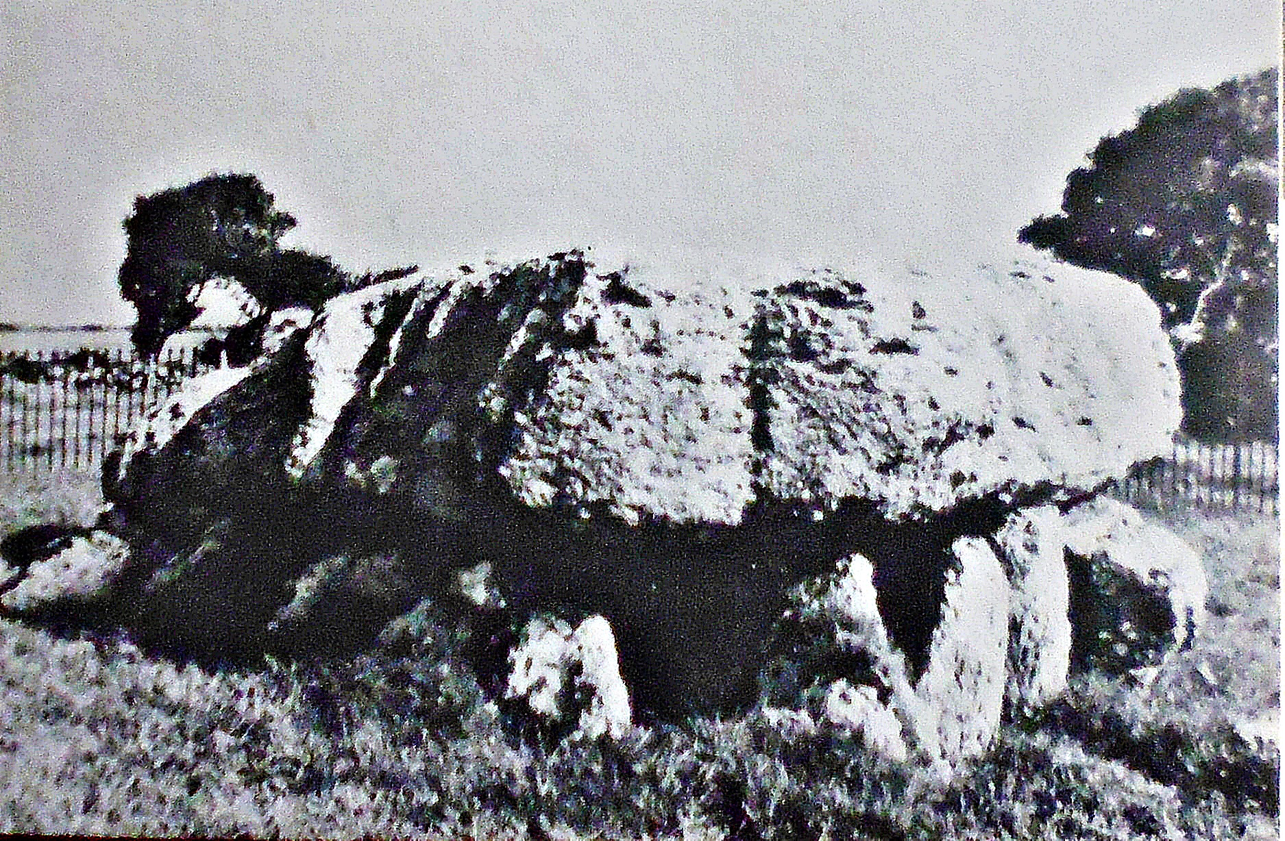
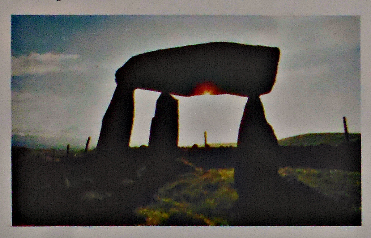
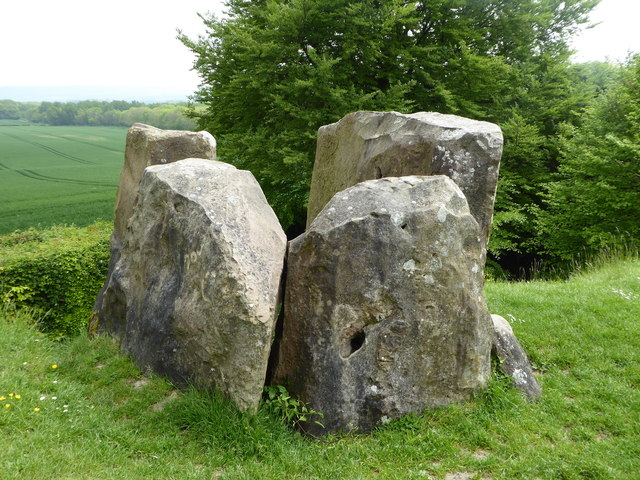
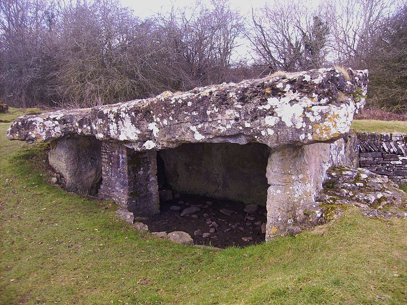
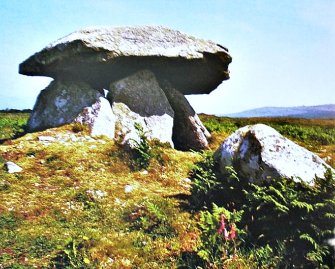
Lligwy Burial Chamber, near Moelfre, Anglesey.
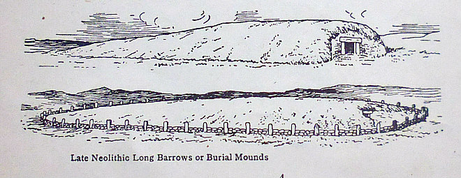
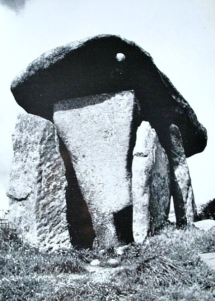
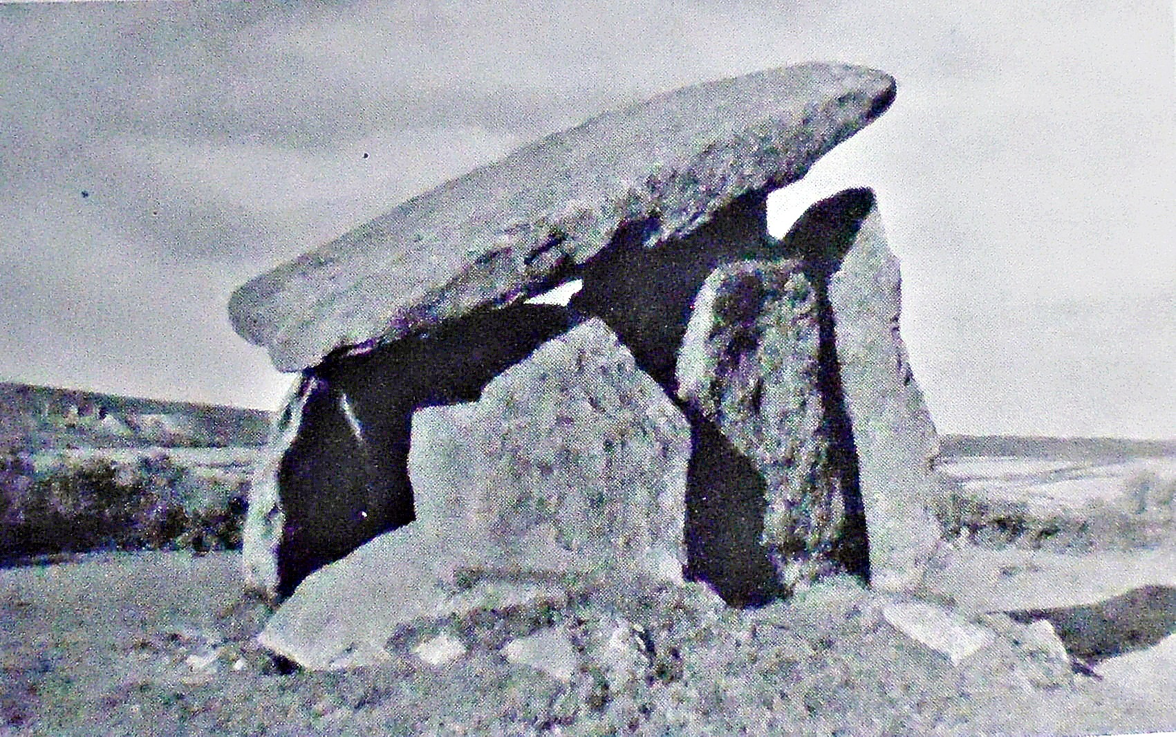
NGR:- SH 5014 8604. Lligwy Chambered Tomb, ½ a mile west of Moelfre, Anglesey (Ynys Mon), is also known as a Cromlech or Dolmen, a Dolmen being like a stone table, and that is what it resembles. It has a huge 25-ton capstone that is supported on small and large lumps of stone, which look as if they are being crushed into the ground by the weight. The ancient Megalithic tomb, which dates back to the Neolithic age, is surrounded by iron railings and stands in a field beside some trees at the side of a country lane to the southeast of Capel Lligwy, a roofless 12th-century chapel. And 400 meters away to the west is the ancient settlement of Din Lligwy. The Lligwy chambered tomb was built on a Limestone plateau, the builders making use of a natural hollow in the ground in which to construct a burial chamber, and the supporting odd-shaped lumps of stone (uprights) placed almost together to support the weight of the massive, heavily weathered and eroded capstone, which is said to be the biggest of its kind in Wales. This was obviously a burial tomb for a high-status individual of an ancient community that inhabited the area thousands of years ago in the New Stone Age. It would originally have been covered by a mound of earth and stones. When excavated in the early 1900s, many skeletons were discovered, along with pottery from different periods of prehistory. Lligwy Burial Chamber is a scheduled Ancient Monument and is in the care of Cadw.
Lligwy Burial Chamber, Anglesey (Ynys Mon).
Peter Clayton, writing in 1976, says of the site that: “…… in the north-east corner by Moelfre Bay, are two sites situated close together but of very widely separated periods. The earlier of the two is the Lligwy burial chamber. Its huge capstone, 18 x 15 feet and weighing around 25 tons, sits oddly on a series of small uprights. The chamber itself makes use of a natural crevice in the rock surface and thus about two-thirds of its height is underground, giving the monument a rather stunted appearance. It was used as a communal burial place and the remains of some 30 bodies were found when it was excavated in 1908. From the pottery evidence, as well as the skeletal remains, it seems to have been in use over a considerable period from Neolithic times into the early Bronze Age. A couple of hundred yards away is the settlement site of Din Lligwy (SH 496862).”
Christopher Houlder, writing in 1978, tells us more about Lligwy Burial Chamber. He says: “The huge capstone rests on several stones and slabs inserted in a rock-cut pit, which accounts for two-thirds of the 1.5 m height of the chamber. Pottery found in 1908 with the bones of 30 individuals shows continuity of use from Neolithic to Early Bronze Age times, but detail is lacking for comparative study of the tomb. In state care, open always without charge. The same continuity was also apparent at Pant-y-saer Burial Chamber (509 824), similarly sunk in a pit, but covered by an oval mound along with its forecourt.”
Chris Barber, writing in 1987, tells a strange story about Lligwy Cromlech (also called Arthur’s Quoit). He says: “A farm steward was once heard to remark that he intended to dig for treasure that night by the cromlech. One of his friends decided to play a joke on him. He dug a hole in the ground near the cromlech and pressed the bottom of a crochan (pot) into the hole and then removed it in order to give the impression that someone had been there and found a pot of gold. Having provided himself with a sheet he took up a position a short distance away. Later the treasure seeker arrived and was dumbfounded when he saw the impression of the pot, but this was nothing to what was in store for him. Looking up, he was terrified to see a ghostly white figure rise from the ground. The treasure seeker threw down his lamp and tools and scuttled off home as fast as his legs would carry him, to the great satisfaction of the “ghost”’.
Sources / References and Related Websites:-
Barber, Chris, Mysterious Wales, Paladin Books, London, 1987.
Clayton, Peter, Archaeological Sites Of Britain, Weidenfield And Nicholson, London, 1976.
Houlder, Christopher, Wales: An Archaeological Guide, Faber & Faber Limited, London, 1978.
Senior, Michael, Anglesey − The Island’s Story, Gwasg Carreg Gwalch, Capel Garmon, Llanrwst, 1987.
Cadw Website: https://cadw.gov.wales/visit/places-to-visit/llugwy-chambered-tomb
https://en.wikipedia.org/wiki/Lligwy_Burial_Chamber
https://wildanglesey.com/listings/lligwy-burial-chamber/
https://www.isleofalbion.co.uk/sites/319/lligwy.php
More Info here: https://howardwilliamsblog.wordpress.com/2017/10/25/lligwy-burial-chamber/
Copyright © Ray Spencer, 2026.


")


