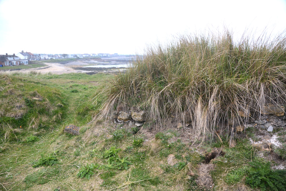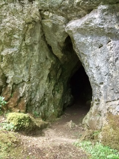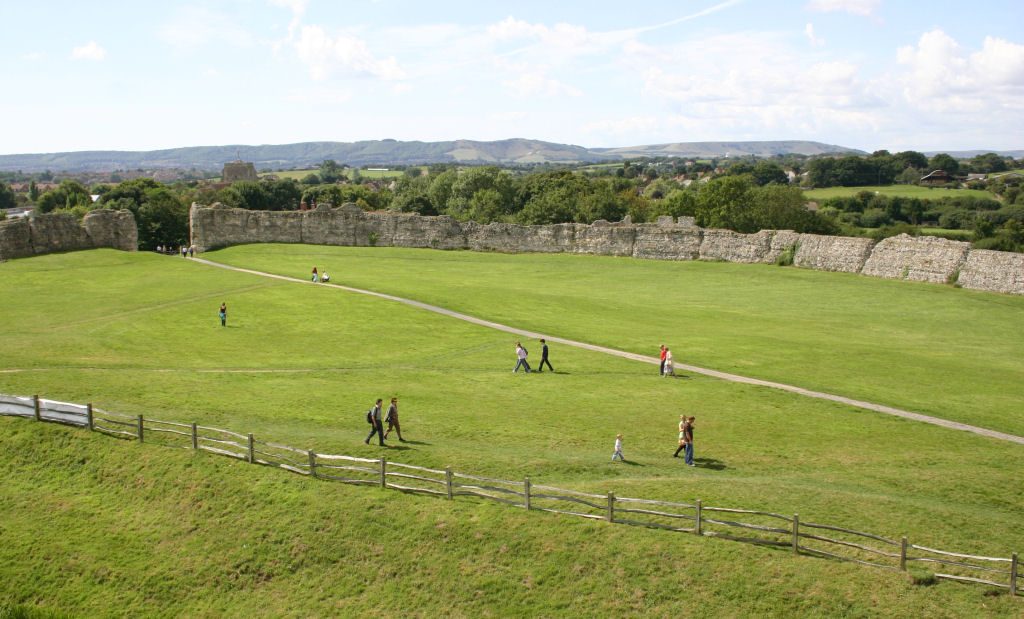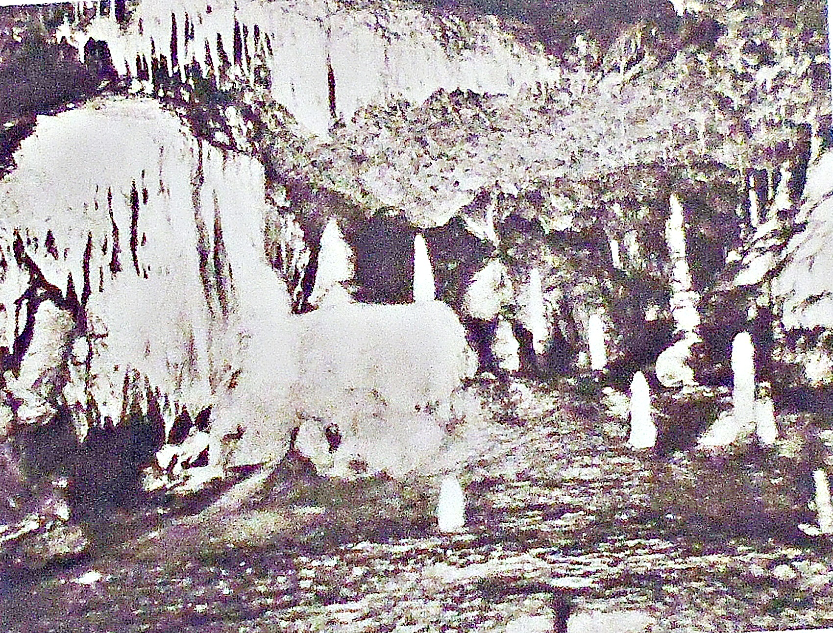
Kent’s Cavern, Torquay, Devon.
NGR: SX 9345 6418. Kent’s Cavern Prehistoric Caves are located on Ilsham Road at Wells-wood, 1 mile east of Torquay in Devon. During excavations back in 1860, finds from as far back as the Old Stone Age or Palaeolithic were found in the cave system by Cornish Geologist and antiquarian William Pengelly (1812-1894), who is still fondly remembered in Torquay for his archaeological discoveries. Pengelly went on to found a Natural History Society in the town. Pengelly excavated the remains of animals that roamed the area many thousands of years ago, which are long extinct in the West Country and in the rest of Britain too. He also dis-covered the remains of prehistoric man, including the remains of Mousterian men and Magdalenian culture, as well as finds from the Ice Age, the Bronze Age, and the more recent Medieval period. Earlier, however, in 1823, a local priest had apparently discovered ancient remains in Kent’s Cavern. The finds excavated by Pengelly are now housed in the Torquay Museum in Babbacombe Road, where you can also see displays of local and surrounding history and social heritage. Entrance to Kent’s Cavern is through the visitor centre, where there are numerous displays and exhibitions.
James Dyer wrote in 1973 that: “Although occupied for much of the Palaeolithic period, little has been done to make this show-cave of interest to archaeologically minded visitors. Two main chambers and a series of galleries have produced material ranging in date from 100,000 to 8000 B.C., including a wide range of flint implements, antler and bone tools, including three harpoons, one double barbed, a sewing needle and an ivory rod. Digging has been carried on spasmodically since about 1824, also producing evidence of prehistoric fauna, including mammoth, woolly rhinoceros, cave-hyena, cave-bear and cave-lion. Visitors will probably gain more from the cave material displayed in the Museum of the Torquay Natural History Society, Babbacombe Road…… and the Natural History Museum in South Kensington, London, than from the site itself.”
Arthur Mee, in his great tome of 1961, describes the history of Kent’s Cavern and the man who explored it back in the 1860s, and tells us: “……… Another remarkable man of Torquay is remembered in a thousand books for a great adventure of knowledge which has carried the name of Torquay to the ends of the earth. He is William Pengelly, whose bust is in the Natural History Museum in Babbacombe Road, where we may see the relics of the Ice Age and evidence of the existence of prehistoric man from the famous Kent’s Cavern, which he explored. In this now famous place fossils had been found as early as 1823, but not until 40 years later did Pengelly receive from the British Association the help he needed to convince the world that this cavern was one of its rich treasure houses.
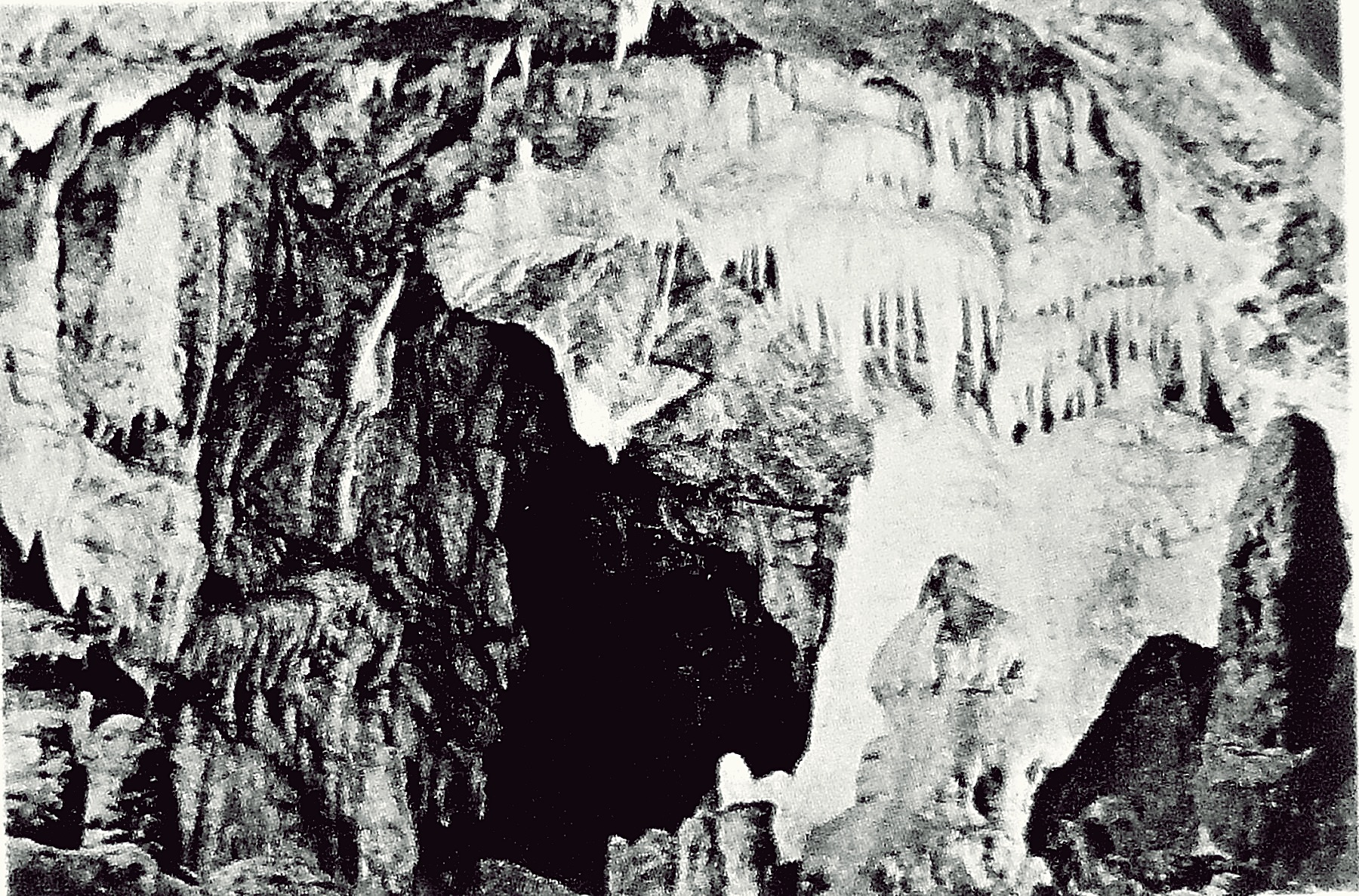
Kent’s Cavern, near Torquay, Devon.
“Kent’s Cavern was hollowed out of the limestone in the side of a small valley thousands of years ago by the chemical action of water. It came to be used in prehistoric times, like all other caves, by men and animals, and it happened at the beginning of last century that a Roman Catholic priest started investigations and found in the cave flint implements and fossil bones dating back to a world of long ago. He was convinced that here was evidence that man had lived in very ancient times in associ-ation with animals now extinct. But that was in 1823, and the mind of the world was not prepared for a thought so revolutionary. The priest dare not make public his conclusions, and it was a long time before the facts were published.
“But men continued to make discoveries, and the time came when William Pengelly, a Cornishman born at Looe, came to Torquay and opened a school. He founded the Torquay Natural History Society and began lecturing on geology and archaeology. He searched Brixham Cave and Kent’s Cavern, and he gave 15 years of his life on this cave at Torquat in which he found stone instruments and weapons fashioned by human hands, together with a huge accumulation of the bones of the cave-bear, the sabre-toothed tiger, the cave-lion, the woolly rhinoceros, the mammoth, and other prehistoric beasts. Since his day an examination of the cavern has shown that the deposits of the remains of prehistoric life are about eleven feet thick. The implements found here, in the lowest layer of the deposits, were made when the English climate was very warm, and when the cave was inhabited by huge bears whose bones have been found in great quantity. In one case a complete skeleton was found. The deposit containing these ancient remains is sealed by a floor of stalagmite material, and above it is a deposit of red clay in which flint implements and the fossil bones of the rhinoceros have been found. The discoveries in the clay are later than those in the lower layer, and represent a period when our climate was very cold. After that the cavern appears to have been uninhabited for a long time, and another floor of stalagmite was laid down. Above thisis a deposit of black earth in which have been found objects of the Bronze Age as well as remains of modern times.
“So in this small cave have come to light witnesses of the life of man reaching back perhaps half a million years, and between the oldest and the newest of these layers of life would come the Great Ice Age.
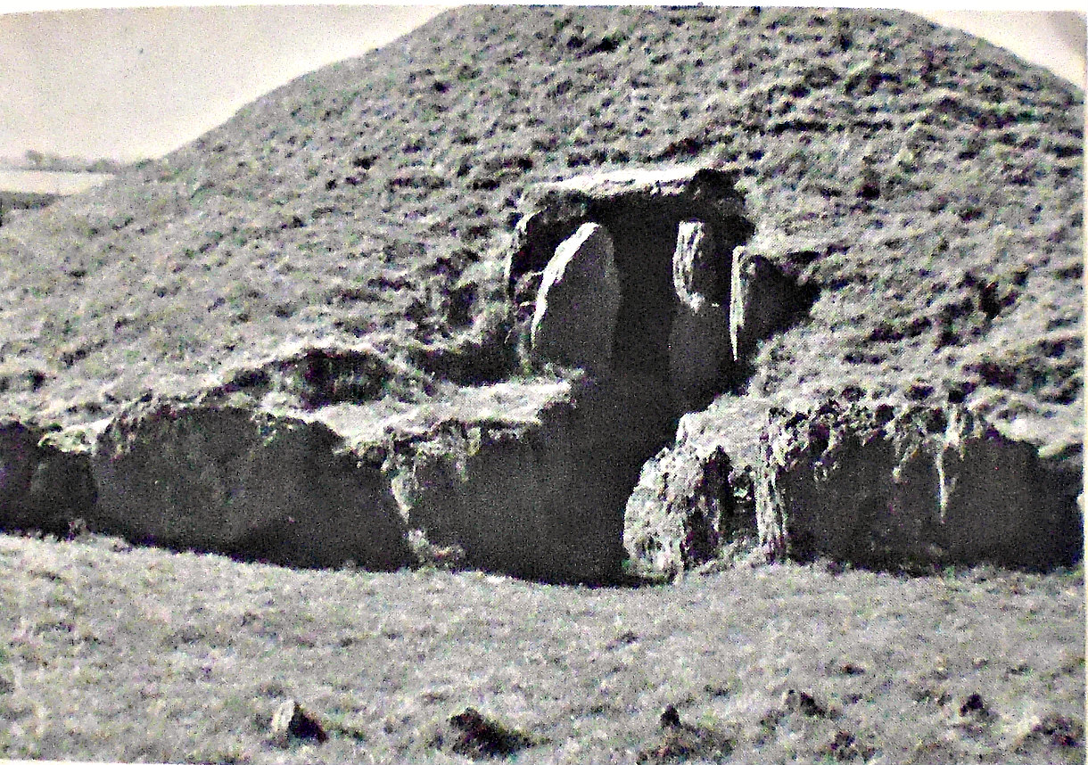
“The museum in which we find these treasures from the chambers and galleries of Kent’s Cavern has an immense variety of exhibits from all parts of Devon. In the entrance hall are four granite blocks with a cover-stone over them: they are a tomb 3000 years old found on Dartmoor near Chagford. Also in the hall are 17 curious oak figures of the 16th century brought from the dining-room of an old house on the River Dart. There are prehistoric, geological, and botanical collections, fine examples of bird life in the county, and many specimens of animal life; but the museum will appeal to the traveller chiefly for the Kent’s Cavern exhibits and the valuable things it has collected from homes and farms in the West Country.”
Jacquetta Hawkes, writing in 1975, tells us more about Kent’s Cavern. She says: “Careful excavation was begun at Kent’s Cavern as early as 1825, when the Roman Catholic priest, Father MacEnery, was able to satisfy himself that humanly-worked flints were contemporary with the bones of an extinct species of rhinoceros and other long vanished beasts. But society and the intellectual climate were not yet ready for this discovery: it was still almost universally accepted that man had enjoyed a special creation some six thousand years before. These new horizons were too wide for the human eyes of their day. Excavation under various hands went on at Kent’s Cavern during the second quarter of the century, but its evidence was steadily denied; it was declared that the deposits had been disturbed and that the implements were not of the same age as the extinct animals. Then in 1858 quarrymen working above Brixham Harbour discovered new caves, and a powerful committee, including the geologists Ramsay, Prestwich and Lyell was set up to direct their excavation. Here, in the Windmill Hill Cave, the close association of tools and bones under a sealing layer of stalagmite could not reasonably be contradicted. Nevertheless, the evidence was not really much better than it had been at Kent’s Cavern, its acceptance was due to the development of scientific thought in the intervening years. Lyell and Prestwich were declaring their belief in the Brixham discoveries in 1859, the very year of the publication of the Origin of Species. In 1858, the Neanderthal skull had been found. So knowledge and discovery gathered to a point in the strange way that they will when the moment for their comprehension has arrived. From that time, forbetter or for worse, thinking men were bound to accept the immense antiquity of their species and to accept in some form or other the doctrines of evolution.
“At Brixham the flint implements and other remains of the human inhabitants of the caves were few and poor, but at Kent’s Cavern there is one of the best series of Old Stone Age finds in the country. Human occupation of the caves began much earlier than in any of those on Mendip; it began in that part of the Old Stone Age once known as the Middle Palaeolithic, when the Neanderthal type of man was dominant in Europe. In other layers and other parts of the cavern flints dating from at least two periods of the succeeding Upper Palaeolithic were recovered—enough to show that hunters were living here on the Devon shore at roughly the time when related tribes hunted on the Mendip Hills.
“Visitors to Brixham, to Torquay, this old fishing town and this modern seaside resort, may like to let their minds wander round the caverns thinking alike of the revolutions in human thought which they helped to bring about, and of the ancient hunters who left the materials for such a revolution in the squalid litter of their cave dwellings.”
Sources of information & related websites:-
Dyer, James, Southern England —An Archaeological Guide, Faber and Faber Limited, London, 1973.
Hawkes, Jacquetta, A Guide To The Prehistoric And Roman Monuments In England And Wales, Cardinal, London, 1975.
Mee, Arthur, The King’s England — Devon, Hodder And Stoughton Limited, London, 1961.
https://en.wikipedia.org/wiki/Kents_Cavern
https://www.kents-cavern.co.uk/https://www.kents-cavern.co.uk/
More info here: https://www.bgs.ac.uk/discovering-geology/maps-and-resources/office-geology/kents-cavern-torquay-devon/
https://explorebritain.uk/attractions/kents-cavern/
Copyright © Ray Spencer, 2026.