The Journal Of Antiquities

Ancient Sites In Great Britain & Southern Ireland


St Mary’s Well, Clitheroe, Ribble Valley, Lancashire

St Mary’s Well, Clitheroe, Lancashire.

St Mary’s Well seen from the other side.

NGR:- SD 74503 42170.  On Well Terrace, Clitheroe, in Lancashire, stands a rectangular-shaped, walled stone structure locally known as St Mary’s Well. It is to be found just around the corner at the far end of Church Brow, close to a bus shelter, and downhill from St Mary Magdalene’s Church.  There are, in fact, three wells in the Ribble Valley town of Clitheroe: St Mary’s, Hield Well and Stocks Well, though they are not used today and have not been since the mid 19th century when water started to flow through pipes, but before that, though, these wells would have supplied water to various parts of the town. St Mary’s Well is obviously the ‘church well’ taking its name from St Mary Magdalene, but, whether it was ever a holy well is not known, though it could have been originally. The well could date back to Medieval times which makes it the oldest of the three wells. St Mary Magdalene’s Church dates from the 1820s; the church there before that was 15th century, but, there is likely to have been a Norman church as far back as the early 12th century, so perhaps the well dates from around that time?

St Mary’s Well interior.

St Mary’s Well interior

The rectangular well structure is surrounded by a wall that looks quite old and some of the coping stones are well-worn. There are two entrances opposite each other with well-trodden steps that lead down into the inner part of the well which has a raised, flag-ged bed or gangway that has a water channel running across and, opposite that, a lower, flagged area (pool) for water, and, in the centre a large square-shaped stone. But what was the stone used for; was it for someone to sit on or maybe wash clothes on? Beside one of the entrances is a small, shaped stoop stone. There is a rusty iron hole sort of thing which the water obviously flowed through, but it looks as though there has not been any water in this well for a long time. On the side of the wall there is a brass plaque which says: THIS WELL WAS ORIGINALLY ONE OF THE THREE PUBLIC WELLS  WHICH FORMED THE WATER SUPPLY OF THE BOROUGH UNTIL THE ESTABLISHMENT OF THE WATERWORKS ON GRINDLETON FELL UNDER THE WATERWORKS ACT OF 1854 – Soroptimist International 1992. The well is a Grade II listed building.

Even today people from the local area and beyond, you might call them modern-day pilgrims, still come to visit St Mary’s Well and maybe look over the wall into the well and try to imagine what it looked like when the pool had water in it, and was in use.

Sources / References & Related Websites:-

https://lancashirepast.com/2018/08/02/clitheroes-town-wells/

More local info here:  https://www.visitribblevalley.co.uk/events/clitheroe-town-wells-visits-cry-out/

https://britishlistedbuildings.co.uk/101362227-saint-marys-well-clitheroe

https://www.heritagegateway.org.uk/Gateway/Results_Single.aspx?uid=44674&sort=4&search=all&criteria=clitheroe&resourceID=19191

https://en.wikipedia.org/wiki/St_Mary_Magdalene%27s_Church,_Clitheroe

Copyright © Ray Spencer, The Journal of Antiquities, 2021.


1 Comment

Dupath Well, Near Callington, Cornwall

Dupath Well, Cornwall. Porches & Fonts by J. Charles Wall  (1912).
Wikimedia Commons

NGR: SX 37499 69220. At the southeast side of Dupath Farm, 1 mile southeast of Callington, Cornwall, is a late medieval wellhouse-cum-chapel-cum-baptistry known as Dupath Well. The ornate wellhouse is built from local granite and stands beneath some trees at the corner of the farmyard and is surrounded by a wooden fence. It was built over an existing holy well/spring which was dedicated to St Ethelred, King of Mercia, who died in 709. Augustinian canons from St German’s Abbey, near Saltash, built the wellhouse sometime between 1500-1510. The building was restored in the Victorian period. It was to became a place of pilgrimage when water flowing into a stone basin inside the building was found to have miraculous healing properties. The well water was reportedly able to cure whooping cough, but also other diseases too.  Dupath Well is the site of a legendary fight between two local notaries over the love of a lady. The wellhouse is a Grade I listed building and is under the guardianship of Historic England, and managed by the Cornwall Heritage Trust. From the A390 at the NE side of Callington take Dupath Lane SE for about 1 mile. Dupath farm is on the left-hand side. The wellhouse is on private land. However, it may be closed due to the current Covid-19 re-strictions, so please do check before visiting the site.

Robert Charles Hope (1893 & 2012) tells us that: “Dupath Well is a pellucid spring, once the resort of pilgrims and still held in esteem. It overflows a trough, and entering the open archway of a small chapel, spreads itself over the floor and passes out below a window at the opposite end. The little chapel, 12 feet long by 11½ wide, is a complete specimen of the baptisteries anciently so common in Cornwall. It has a most venerable appearance, and is built of granite, which is gray and worn by age. The roof is constructed of enormously long blocks of granite, hung with ferns, and supported in the interior by an arch, dividing the nave and chancel. The doorway faces west; at the east end is a square-headed window of two lights, and two openings in the sides. The building is crowned by an ornamental bell-cote. The well is famed for the combat between Sir Colam and Gotlieb for the love of a lady; Gotlieb was killed, and Sir Colam died of his wounds.”

Garry Hogg (1968) says of the: “Well-Chapel, Dupath, Cornwall, off A388, two miles south-east of Callington. The best-preserved of Cornwall’s well-chapels, built in the sixteenth century to serve as a baptistery and preserve the holy well beneath its massive roof of moorstone. The site (as so often) was probably a pagan one, sanctified in medieval times by the Christian Church as the new Faith spread further into this ‘outlandish’ corner of the country. Inevitably it has an accretion of legend. Local belief is that it was built as a penance by a Cornishman who had slain a rival for the hand of the woman he loved.” 

Dupath Well.

As for St Ethelred to whom the well-chapel at Dupath was dedicated, Stenton (1942), says: “Ethelred, King of Mercia, founded Abbingdon Abbey. Abingdon is in S. Oxfordshire. The abbey was more likely founded by Cissa. St Wilfrid was under the protection of Ethelred and was a close friend. Ethelred was the benefactor of many churches in the various provinces of his kingdom. and in 704 he retired into the monastery of Bardney in Lindsey.” King Etherlred had founded the Benedictine monastery of Bardney in 697 and became its abbot sometime after 704. He died there in c 709 and his relics were interred there. His feast-day is on the 4th May. Butler & Given-Wilson (1979) add that: “Ethelred gave his consent to the founding of a double monastery at Gloucester 674-81 being founded by Osric, whose sister Cyneburh was 1st abbess.”     

Sources / References & Related Websites:-

Butler, Lionel & Given-Wilson, Chris, Medieval Monasteries of Great Britain, Michael Joseph Limited, London, 1979.

Hogg, Garry, Odd Aspects of England, David & Charles, Newton Abbot, Devon, 1968.

Hope, Robert Charles, The Legendary Lore Of The Holy Wells Of England — Including Rivers, Lakes, Fountains and Springs, (orig. published by Eliot Stock, London, 1893. Classic Reprint Series: Forgotten Books, 2012).

Stenton, F. M., Anglo-Saxon England, Oxford University Press, London, 1943.

https://www.english-heritage.org.uk/visit/places/dupath-well/

More info here:-  https://www.cornwallheritagetrust.org/our_sites/dupath-well/

https://en.wikipedia.org/wiki/Dupath_Well

And more history:  https://cornishbirdblog.com/2019/03/31/dupath-well-a-romantic-history/

Cornwall’s mysterious Dupath’s Well

Copyright © Ray Spencer, The Journal of Antiquities, 2020.


St Patrick’s Well, Heysham, Lancashire

St Patrick’s Well or Church Well at Heysham, Lancashire.

NGR: SD 41093 61591.  At the corner of Main Street in Heysham, Lancashire, and just down the slope from St Peter’s Church is St Patrick’s Well (also known as Church Well). It is built into the wall at the side of the street at the bottom of the rectory garden (Glebe Garden).  However, it would seem that it has never been a holy well despite being named after the Irish patron saint, but merely ‘a spring’ that was used by the local church, St Peter’s, and its rectory.  Perhaps it should be called St Peter’s Well. The village, it would seem, needed the divine help of a great saint such as St Patrick and, after all the ruined Saxon chapel on the headland above the parish church already bore his name. Today, in the rectangular-shaped arched walled recess above two stone steps and pebble-filled basin there is a hand-operated pump contraptiuon, but whether this still pumps water is anyone’s guess – though it might do!? The present structure only dates from the early 1900s but it stands in the place of an earlier 18th Century well that had collapsed. It is Grade II listed.  Heysham is a very attractive village situated about 1¾ miles to the southwest of Morecambe on the A589.  

The ‘British Listed Buildings’ website has the following information: “Well head. Possibly C18. Well set in a roughly semi-circular recess in a rubble retaining wall, spanned by a lintel.  The kerb stone at the front of the wall is level with the top     of a second lower wall which contains a recess with two steps in front of the well.” See their website:   https://britishlistedbuildings.co.uk/101355054-st-patricks-well-lancaster-heysham-central-ward#.XqoLVlLsZjo

Eileen J. Dent (2003) says of St Patrick that: “The popular myth that St Patrick came to Heysham can be discounted by his “Confessions” written towards the end of his life:

“‘Wherefore then, even if I wished to leave them to go to Britain–and how I would have loved to visit my country and my parents and also Gaul in order to visit my brethren and to see the face of the saints of                my Lord. God knows it that I desired it, but I am bound by the Spirit, who gives evidence against me if                       I do this, telling me that I shall be guilty; and I am afraid of losing the labour which I have begun – nay,                not I but Christ the Lord who bade me come here and stay with them for the rest of my life,  if the Lord             will, and will guard me from every evil way that I may not sin before Him.”’   

“This was St Patrick’s reply to his fellow bishops who had criticised him for remaining in Ireland and not evangelizing abroad.”

Ken Fields (1987) tells us that: “A saint whose name has become linked with holy wells is the patron of Ireland, Saint Patrick. Little is known about his early life before he rose to become the great missionary, but we have a tradition that an important episode in his youth occurred on the north-west coast.

St Patrick’s Well at Heysham, Lancashire (b/w photo view).

“Patrick was born about AD385 of noble stock at a place named Banavem Taberniae, which some people say is the village of Bewcastle near Carlisle. The story of his capture by pirates while still a boy, and his imprisonment in Ireland is well docu-mented. Just how he managed to escape by sea and was subsequently ship-wrecked is less well known and his landing place is not documented at all.  Some historians claim it was Gaul, but others disagree, pointing to what is now part of the Lancashire coast as a likely spot.  It is at a point close to lovely Hey-sham Village that the young Patrick is said to have landed; a stony bank visible only at low water is still known as St Patrick’s Skier. The ruin of an ancient chapel on the cliff edge marks the spot where he came ashore and alongside are some unusual graves hewn out of the rock.  Now empty these probably once held the bodies of monks.  After his landing at Heysham, the weary saint began the long journey home on foot.  The route he took can still be followed on a map, for many of his stopping places recall his name. At Hest Bank, a few miles north of Heysham lies the first St. Patrick’s Well, a place where the holy man stopped to drink. Near the small town of Milnthorpe lies Preston Patrick, and the magnificent valley of Patterdale in the heart of Lakeland was originally St. Patrick’s Dale.  Patterdale church is dedicated to the saint,  and on the road to nearby Glenridding is yet another St. Patrick’s Well. The village of Bampton near Haweswater, has a pub named St. Patrick’s Well, and its Anglican church is one of only ten in all England dedicated to the saint. North of Maryport, lies the town of Aspatria, which is said to be yet another settlement derived from his name. Thus it is possible to travel northwards from Heysham, following in the saint’s footsteps through some of our most attractive countryside. Here is a link with a journey that took place sixteen centuries ago.”  

There used to be another well in Heysham which was called Sainty Well or Saintly Well, but this was capped and covered over in recent times. This second ‘holy well’ is now on private land half-way along St Mary’s Road, Heysham. See History of Heysham website Link: http://www.sandhak.co.uk/html/history_of_heysham.html

Sources / References & Related Websites:

‘British Listed Buildings’ website Link:  https://britishlistedbuildings.co.uk/101355054-st-patricks-well-lancaster-heysham-central-ward#.XqoLVlLsZjo

Dent, Eileen J., Heysham − a History, The Rector and Parochial Church Council of St Peter’s Church, Heysham, and Heysham Heritage Association, 2003.

Fields, Ken, The Mysterious North, Countryside Publications, 1987.

‘History of Heysham’ website Link:  http://www.sandhak.co.uk/html/history_of_heysham.html

https://megalithix.wordpress.com/2010/04/29/st-patricks-well-heysham/

https://www.megalithic.co.uk/article.php?sid=48439

https://www.pastscape.org.uk/hob.aspx?hob_id=41448#aRt

http://www.heyshamheritage.org.uk/html/visiting_heysham.html

https://en.wikipedia.org/wiki/Heysham

© Ray Spencer, The Journal of Antiquities, 2020.


2 Comments

Church Well (St Mary’s Well), Thornton-in-Craven, Lancashire

Church Well / St Mary’s Well, at Thornton-in-Craven, Lancashire.

NGR: SD 90135 48324.  At the southwest side of St Mary’s parish church (on Church Road) at Thornton-in-Craven, Lancashire, is ‘Church Well’ or ‘St Mary’s Well’. The octagonal wellhouse enclosing the spring was built by Henry Richardson, rector of St Mary’s in 1764, but the spring itself dates to far earlier times maybe the pre-Christian period (the site being not far from a Roman road). Later, the well was almost certainly being venerated by the 7th Century AD but with the tenuous link and dedication to St Oswald, the King and martyr, who was beheaded (654 AD). There is an interesting Latin inscription running around the top of the wellhouse. St Mary the Virgin parish church, which is situated above the well, was built in the early 16th Century but it stands on the site of an earlier 12th Century church and, possibly a Saxon building before that? St Mary’s Church and holy well are on the Lancashire side of the north Yorkshire border on Church Road (Skipton Road) opposite the lane to Thornton Hall, some 2 miles east of Barnoldswick and 6½ miles south-west of Skipton. An iron gate gives access to the churchyard and the wellhouse, which is over to the left.

Church Well / St Mary’s Well (close-up view).

Derek D. Clabburn  (2007) says: “We have no means of discovering why Richardson should have chosen to build an octagonal random stone cover over the well in Thornton churchyard. As far as can be deduced, the waters from the well possess no medicinal properties such as found at Harrogate or Bath or the nearby sulphur wells at Broughton and possibly near Crickle Hall at East Marton. Richardson’s Account Book reveals that he suffered from gout as early as 1748 and there are frequent references to remodeling or repair of a ‘gouty shoe’ and for administrations from a Dr. Kitchen, but it seems unlikely that the covering of the well was prompted by medical considerations, nor was it likely to be a source of water for any dwelling in the vicinity of the church. The well being situated in a hollow some 12 to 15 feet below the level of the main burial ground on the south side, the likelihood of water contamination is possible, although this would have been virtually unrecognized by scientific minds in the mid eighteenth century. If it was to provide ease of access for watering his livestock on his adjoining glebe lands, then the act of covering the well makes sense.

Church Well (an inside view of the well-house)

“But why lavish an enigmatic Latin commemorative inscription around the frieze of the building? Its manifest purpose eludes us nearly 250 years after it was erected. Another curiosity of the building is its capping formed from a large millstone. Its grooving is clearly seen as the ceiling within the cover. The axle shaft hole at its centre is capped by a turned sphere, which is kept in place by its own weight and forms a plug to the roof cover. The construction at the base of the octagonal cover forms a square some 3 feet deep with steps descending into the well proper. The depth of water within the well is controlled by a wooden plug in the well floor, which when removed drains away the stored water. When in place, the water depth rises to a point where it flows out in a channel beneath the doorstep and fills a drinking stoup. Hereafter the water drains away to supply the Rectory Farm on a regular daily basis.

Mr Clabburn goes on to adds that: “The Latin inscription reads: Fontem hunc salutiferum et perantiquum Tecto munivet Anno Aerae Christianae MDCCLXIV. Quod Publicae Sanitate bene vortat H. RICHARDSON RECTOR. (One translation reads: That it might prove of benefit for the health/salvation of the community, H. Richardson, Rector, built a covering for the health/salvation-giving and most ancient font/spring, in the year 1764 of the Christian era.” 

John & Phillip Dixon (1990) say of St Mary’s Church: “The embattled Perpendicular tower dominates the edifice, the south face of which bears an inscription and arms that I cannot make out along with a date, 1510. The inside of the church holds no hidden delights, but of interest is the churchyard draw well.”

Sources / References & Related Websites:

Clabburn, Derek D., Henry Richardson 1710-1778 — Life and Legacy of a Thornton Rector, Earby & District Local History Society, 22 Salterforth Road, Earby, Barnoldswick, BB18 6ND, 2007.

Dixon, John & Phillip, Journeys Through Brigantia Volume One: Walks in Craven, Airedale and Wharfedale, Aussteiger Publications, Barnoldswick, 1990.

https://en.wikipedia.org/wiki/Thornton_in_Craven

https://britishlistedbuildings.co.uk/101167634-church-of-st-mary-thornton-in-craven#.Xf0VVlJCdjo

https://www.megalithic.co.uk/article.php?sid=28058

http://www.thorntonincraven.co.uk/st-marys-church-thornton-in-craven/

https://www.achurchnearyou.com/church/6930/page/6047/view/

© Ray Spencer, The Journal of Antiquities, 2019.


Scotlandwell (Holy Well), Perth And Kinross, Central Scotland

Scotlandwell (Holy Well) in Central Scotland.

OS Grid Reference: NO 1847 0161. At the western side of Scotlandwell village in the Portmoak District of Perth & Kinross, Central Scotland, there is an ancient holy well and also a 19th century wash-house. The village is 4 miles west of Glenrothes and 4 miles east of Kinross (across Loch Leven). In the late 1st century AD the Romans came by the well and named it ‘Fons Scotiae’ and in the late 13th century the local friars were using the water in their hospice and, in the early 14th century the well was visited by Robert the Bruce, King of Scotland, who took the waters here in the hope of a cure. Later the well was visited by Mary, Queen of Scots (1542-87). The well became a place of pilgrimage in the Middle Ages and continued as such for several centuries thereafter. To reach the site (signposted) head west from Kinross on the A911 (Leslie Road) and go through Scotlandwell village. Where the A911 ends cross over Main Street and walk along the short lane (Little Arnot); the well is on the left at the far end.

Scotlandwell by Euan Nelson  (Geograph).

The ancient curative spring known as Scotlandwell or ‘Fons Scotiae’ (Well of Scotland) at the foot of Bishop Hill (Portmoak Moss) bubbles up from deep underground through the sandy earth and into the stone-built well with its Victorian (Gothick) well-house structure, most of which is a clever reconstruction of 1858, although some of the lumps of stonework at the front of the well predate this and are probably from the earlier Medieval structure. Its healing waters were ‘said’ to be a cure for leprosy and other diseases. The green-painted wood and stone structure at the back with its canopy roof also dates from the mid 19th century. This whole site is now in a fairly well-preserved state thanks to a local community project. A plaque with the date 1858 is carved onto the stone well-head along with the architect’s name and also the benefactors’ names in capital letters. The nearby Wash House, built in 1860, which local people called ‘The Steamie’ and where laundry was washed, was presumably connected to the well’s underground water source, but sadly it has not been in use since the 1960’s. 

In 1250 the Trinitarian Friars (Red Friars) moved into the area and established a hospital or hospice. They used the curative waters from the holy well for patients in their new hospital of St Mary. Nothing much remains of that building on Friar Place today, however, as it was demolished after 1587. The Trinitarian order of friars was founded near Paris in the late 12th century by St John of Matha (d 1213).

Frank Bottomley (1981) tells us more about the Trinitarians: “An order, f. 1198, at Gerfroid in diocese of Meaux, also known as Maturins and Red Friars. They were not Mendicants but an austere order of priests based on the Augustinian rule. Their revenues were divided equally between their own support, charity to poor, especially travelers, and the redemption of prisoners in the hands of the infidel. The houses were usually small, consisting, of a superior (called minister or prior), three priest-brethren and three lay brothers. Sometimes the number was enlarged and the disappearing lay brothers seem to have been replaced by novices in 1267. They were relatively strong in Scotland with eight houses (visible remains at Dunbar and Peebles).” 

Bill Anderton (1991) tells us that: “It is said to be at this holy well that Robert Bruce was cured of leprosy, and records show that Charles II travelled from his Dunfermline Palace to take the waters, while Mary Queen of Scots too visited the well. An inscription above the water fount gives the date 1858, but this refers to the reconstruction. The well, like all Scottish holy places, is very ancient. The waters from the fount can be drunk from a special metal cup which hangs nearby.” Mr Anderton says this site has a ‘power point’. 

Janet & Colin Bord (1986) mention the well at Scotlandwell, saying that: “This elaborate well is in the centre of the village, and its water is said to have cured Robert the Bruce of leprosy.”

They also tell us that: “An example of present-day usage is quoted by Ruth and Frank Morris in their Scottish Healing Wells. In 1978 at the well in the centre of the village of Scotlandwell (Kinross) they met a women, her husband and brother who had travelled 40 miles from Edinburgh to fetch well water. One of the men had cancer and claimed that the water did him good: “If it was good enough for Robert the Bruce, it’s good enough for me,” he declared, referring to the belief that water from the well cured Robert the Bruce of his leprosy.”

The Bord’s add that: “Robert Bruce, King of Scotland (1306-29) suffered from leprosy, and at least three wells were reputedly used by him in his search for a cure. He is said to have been responsible for a well at Prestwick (Ayr) which flowed where he stuck his spear in the sand while resting from his struggles with the English. He stayed for several days, and his leprosy was reputedly cured. He is said to have built a leper hospital for those who could not afford treatment. He also visited the St Lazarus Well at Muswell Hill (London) being granted a free pass by the King of England to do so.”

Sources and related websites:

Anderton, Bill, Ancient Britain, W. Foulsham & Co. Ltd., Slough, Berkshire, 1991. 

Bord, Janet & Colin, Sacred Waters, Paladin Books, London, 1986.

Bottomley, Frank, The Abbey Explorer’s Guide, Kaye & Ward, London, 1981. 

The AA, Illustrated Road Book Of Scotland, The Automobile Association, 1963.

Photo (2nd down) by Euan Nelson:   http://www.geograph.org.uk/photo/4393647

https://en.wikipedia.org/wiki/Scotlandwell

http://www.scottish-places.info/towns/townfirst1211.html

https://crystalgalleries.org.uk/2012/05/the-sacred-well/

http://www.wellwashhouse.co.uk/

https://www.tripadvisor.co.uk/ShowUserReviews-g186565-d11890324-r445448188-Scotlandwell_Wash_House_and_Well-Perth_Perth_and_Kinross_Scotland.html

© Ray Spencer, The Journal Of Antiquities, 2018.


9 Comments

St Corentin’s Chapel, I’le de Sein, Finistere, (Bretagne) Brittany

St Corentin’s Chapel on I’le de Sein, by Ji-Elle (Wikimedia Commons)

Latitude: 48.041993. Longitude: -4.867500. At the far northwestern side of the I’le de Sein at the sacred place called Goulénez, just 8 kms off the Finistere Coast at Pointe de Raz, (Bretagne) Brittany, stands the restored chapel dedicated to St Corentin (Cury), a 5th century Celtic saint who became bishop of Quimper; he was apparently also the adviser and confessor of King Gradlon le Grand – whose Breton kindom of Caer Ys (or Is) was both legendary and, almost certainly, mythical. Quimper eventually being the location of his new royal palace. The lonely little chapel, of ancient origins but restored in the early 1970s, is a short distance from the rocky seashore of the island’s northwest coast. There is also a holy well/spring and close to that is the ‘Hermit’s Garden’. St Corentin’s Chapel and holy well have long been a place of pilgrimage and veneration for the islanders themselves; but further back into the mists of time the island was home to the druidic priestess, Velleda, and then the Romans probably camped on the island, which ‘they’ were to call: Insula Sena. To reach the site: follow the Route du Phare coastal path around the north and northwest side of the island.

The Insight Guide (1994), says of the island: “Bretons call Ile de Sein Enez Sun, and it is suggested that this helps to identify it as the Isle of the Dead, a burial place of the druids. It is also said to be the Romans’ Insula Sena, a mysterious island where sailors used to consult an oracle tended by nine priestesses.”

The Insight Guide (1994) adds: “The home of King Gradlon, Is, was protected by a dyke and the key to its gates was always carried by the king. His daughter, named variously as Dahut or Ahés, had become attracted by the Devil in the shape of a handsome young man. The Devil requested that she steal the key to the gates that protected a dyke surrounding the king’s palace at Is. At the Devil’s request she stole the key and opened the gates allowing the sea to pour into the city. King Gradlon managed to escape on his horse with his daughter clinging onto him for dear life, but a voice from heaven informed him that he could only be saved if he ditch this evil spirit. He did this, and the sea withdrew, but his kingdom of Is was completely submerged and destroyed.

“The king then chose Quimper as his new capital for the kingdom of Cornouaille, and his statue stands between the two towers of the cathedral. For the rest of his days, he lived a life of holiness and piety, helped by the first bishop of Cornouaille, St Corentin. As for his daughter, Dahut, she became a mermaid (siren) known as Marie-Morgane, and today still lures sailors to watery graves,” according to the Legend.

The Insight Guide (1994) goes on to say that “As for St Corentin, he is remembered for his diet, which consisted purely of the flesh of one miraculous fish. Each day he would eat half of the fish and throw the rest back into the river, only to find it restored to full size the following day. Corentin was one of the first Celtic religious leaders to move to Brittany in the 5th century and, like the others, he became a saint.”

David Hugh Farmer (1982), says of St Corentin that he was: “Cornish founder and patron of Cury in the Lizard. He was a Celtic hermit who later became a Bishop in Brittany. An ancient cross stands near his church; in 1890 a fresco was discovered in Breage (the mother-church of the Lizard), which depicts him in cope and mitre with a pastoral staff. Beside him is a fish, from which he was reputed to have cut and eaten one slice each day, without any diminution in the size of the fish. An ancient Breton cult in his honour was revived by a private revelation in the 17th century, when several old shrines there were restored. His feast (translation?) at Quimper is the occasion for presents of blessed cakes. Ancient feast: 1st May.”

Map of I’le de Sein (North)

St Corentin or Corentinus, was a native of Armorica (Brittany), but he may have visited the southwest of England and maybe Wales at some point. At least one church is dedicated to him at Cury in Cornwall, where he is called St Cury. However, he was more likely a hermit living on the I’le de Sein (440 AD), a small island in the Atlantic, just off the Finistere coast, and later at Plomodiérn near Ménéz-Hom in Crozon. St Guenole (Winwaloe) was his disciple. Indeed, St Guenole also has a church dedication on the island. Corentin established a hermitage and church on the island and imparted his holiness into the waters of a well there. The site being of pre-historic importance. A modern wood statue of the saint stands inside the tiny chapel along with one of the Virgin Mary, and other Breton saints. Eventually, King Gradlon installed Corentin as first bishop of Quimper, in Cornouaille; the Cathedral of St Corentin now stands on the site of his church. He died at Quimper in 460, 490 or 495 AD. His feast-days are 1st May (translation) and 12th December.

Henry Queffélec (1945 & 1972), says of St Corentin’s hermitage on I’le de Sein: “the Chardin an Iarmit, or “‘Hermit’s Garden”‘, was situated on the western end of the ile de Sein next to a small chapel dedicated to St Corentin. Although the chapel has now fallen into ruins the site is still regarded by the people of Sein as a place of pilgrimage and special veneration. Cambray in his Voyage dans le Finistère of 1794 described the chapel and garden.”

Queffélec adds that: “There is no evidence whatsoever that the chapel dedicated to St Corentin was ever destroyed by fire or that its stones were used to build another church on the island. This chapel, unfortunately, has simply been allowed to fall into ruins and very little remains of it today.”  [The chapel was, however, rebuilt in 1971 by the people of the island and the priest.] 

He also adds more information with regard to the History of the island, saying that: “In early times, the ile de Sein was thought to be the haunt of supernatural beings. In the first recorded mention of the island in 43 A.D, in the work of the Roman geographer, Pomponius Mela, we are told that the Insula Sena possessed an oracle which was served by nine vestal virgins who had the capacity to control the elements and cure the apparently incurable. This tradition is later exploited by Chateaubriand in Book IX of Les Martyrs (1809) in his description of the sacrificial activities of the Celtic druidess Velleda some of which take place on the “‘ile de Sayne, ile venerable et sacrée”‘. In the Middle Ages , the ile de Sein is caught up in the Arthurian legends and according to some  storytellers, is the birthplace of two of the most accomplished magicians, the wizard Merlin, and Morgan La Fée.” 

Sources and related websites:

Insight Guide, Brittany, (Ed. by Brian Bell), APA Publications (HK) Ltd., 1994.

Farmer, David Hugh, The Oxford Dictionary of Saints, Oxford University Press, 1982.

Queffélec, Henri, Un Recteur De L’ile De Sein, George G. Harrap & Co. Ltd., London, 1972. Originally pub. in French Language (1945) by Éditions Stock.

https://commons.wikimedia.org/wiki/Ile_de_Sein

https://en.wikipedia.org/wiki/Corentin_of_Quimper

https://en.wikipedia.org/wiki/%C3%8Ele_de_Sein

http://audierne.info/la-chapelle-st-corentin/

https://www.breizh-poellrezh.eu/bretagne/%C3%AEle-de-sein/

http://www.earlybritishkingdoms.com/bios/gradlmby.html

© Ray Spencer, The Journal Of Antiquities, 2018.


3 Comments

St Robert’s Cave-Chapel And Holy Well, Knaresborough, North Yorkshire

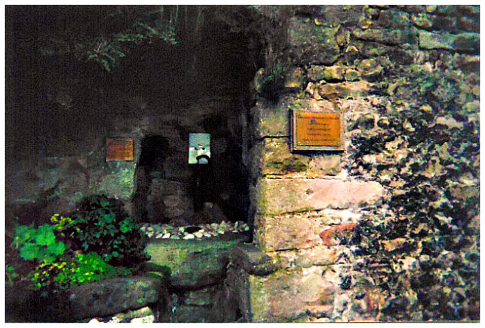
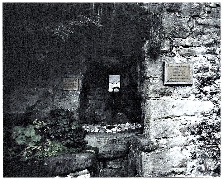
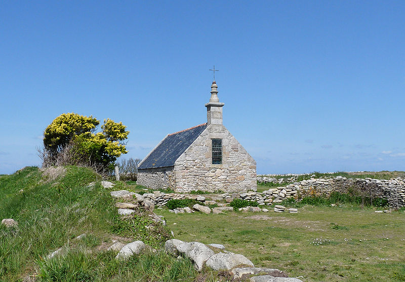
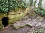
St Robert’s Cave by Storye book (Wikimedia Commons).

OS Grid Reference: SE 36083 56059. In a secluded wooded area near Grimbald Bridge between Abbey Road and the River Nidd at Knaresborough, North Yorkshire, is St Robert’s Cave & Holy Cross Chapel. Nearby, another chapel, but a 15th century wayside chapel and shrine, hewn out of the rock, which is today dedicated to Our Lady of The Crag. This particular chapel is not how-ever associated with St Robert. About 470m to the north is St Robert’s holy well, a healing spring resorted to by the faithful in times past. Robert Flower (1160-1218) was a hermit who spent many years here – more especially his latter years – but also at a number of other monastic sites across Yorkshire. He was said to have performed some miracles and devoted much of his time to the poor, though he was never canonised by the Church.  You can reach St Robert’s Cave from the newer bridge on Wetherby Road (B 6164). Go down the steps onto Abbey Road and a bit further south beside the river is the cave. The medieval Chapel of ‘Our Lady of the Crag’ is ½ a mile to the west at the other end of Abbey Road. St Robert’s Well was located on Monkswell Park Road about a ¼ of a mile north of town.

David Hugh Farmer (1982) says that St Robert was: “The son of an important townsman of York and became a cleric early in life. As a subdeacon he was a novice at the Cistercian abbey of Newminster, but stayed only a few months. He then chose to live as a herm at Knaresborough in a cave where another hermit, also in residence, was a knight in hiding from Richard I, on whose death (1199) he returned to his wife. Robert continued there for some years, until a wealthy widow offered him a cell and chapel at Rudfarlington, near by. A year later this hermitage was destroyed by bandits, so Robert lived at Spofforth under the church wall for a few months, then at Hedley near Tadcaster, where he found the monks to easy-going, before returning to Rudfarlington. Here he had four servants and kept livestock, but was soon in trouble with William de Stuteville, constable of Knaresborough Castle, for harbouring thieves and outlaws. The charge may have been true, for Robert was well known for charity to the destitute. The hermitage was destroyed by William; Robert returned to his cave at Knaresborough, where he lived for the rest of his life.

Farmer goes on to say of St Robert: “His benefactors included King John who gave him forty acres of land in 1216, which he eventually accepted for the poor  and so refused to pay tithes on it. William de Stuteville also gave him land and cows. Robert had a companion called Yves, who  remained with him for the rest of his life.

Farmer also adds that: “Robert’s death, like much of his life, was controversial. Cistercian monks from Fountains tried unsuccessfully to aggregate him to their Order on his death-bed and, after his death on 24th September, to bury his body in their church. But he refused the first and foiled the second by arranging for his burial at the chapel beside his cave. Later the Trinitarian house at Knaresborough acquired the hermitage: papal records for 1252 offered  an indulgence for ‘Building the monastery of St. Robert at Gnaresbur, where the saint’s body is buried’. This document followed his translation, but preceded any official process of canonization, for which a book of Lives and prayers was prepared. Official canonization never took place, but implicit approval was given to the cult. The chapel became a place of pilgri-mage, where oil flowed from the tomb. Matthew Paris regarded Edmund of Canterbury, Elizabeth of Hungary and Robert of Knaresborough as outstanding saints of the early 13th century.”

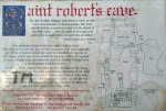
Sign at St Robert’s  Cave by Caruso 308 (Wikipedia)

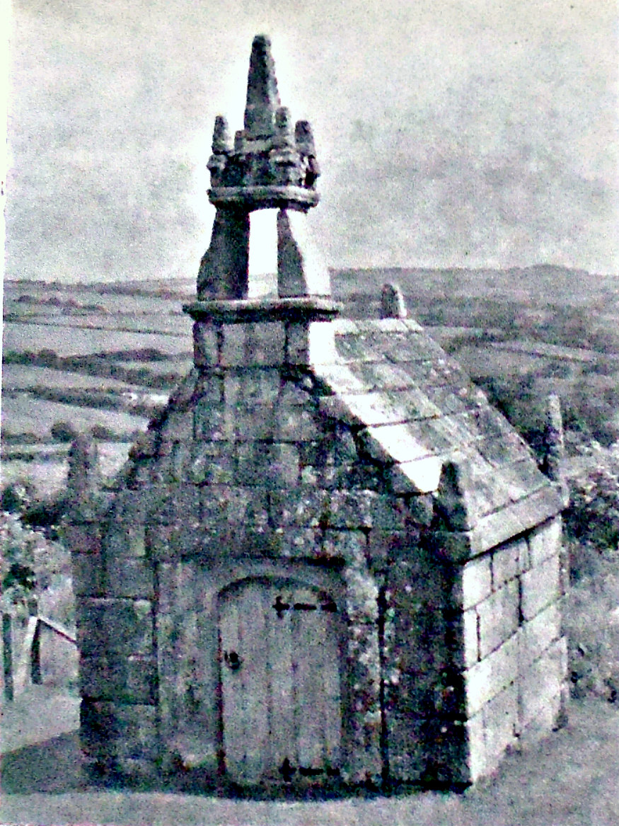
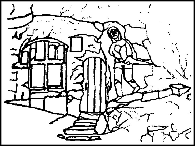
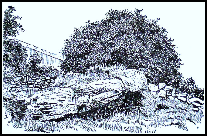
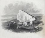
St Robert’s Cave on Abbey Road, with its connecting chambers and the grotto-like inner chapel, were carved out of the solid Limestone cliff beside the river Nidd. It’s thought the saint himself enlarged the chapel and hermitage which has a stone altar, stone seat, two alcoves, medieval carved cross and more recent graffiti; building this structure must have taken a considerable amount of both energy and time. The chapel was dedicated in honour of the Holy Cross and maybe also St Giles? Pilgrims visited the hermit-saint knowing him to be a miracle worker, and even some eminent local people were known to seek his good council. However, the cave and chapel were frequently flooded by the river Nidd and for long periods remained uninhabited and cut off – this more so in recent times. After the death of St Robert in 1218 his body lay in a tomb that was located in the cave-chapel. There is a church dedicated to him at Knaresborough and another at Pannall, north Yorkshire. Morley church, Derby-shire, has some very nice stained-glass windows depicting the Life of St Robert of Knaresborough. His feast-day is 24th September.

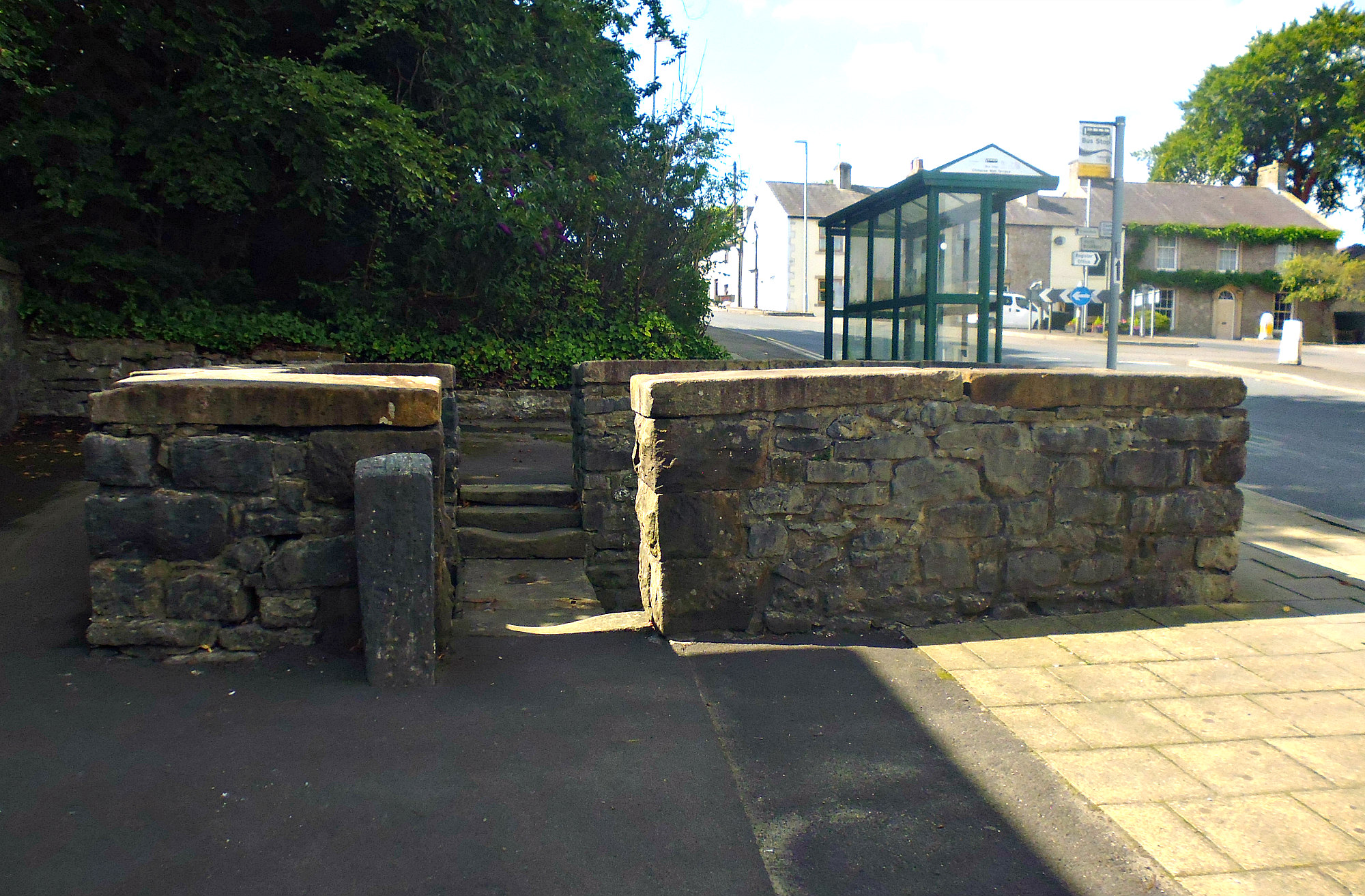
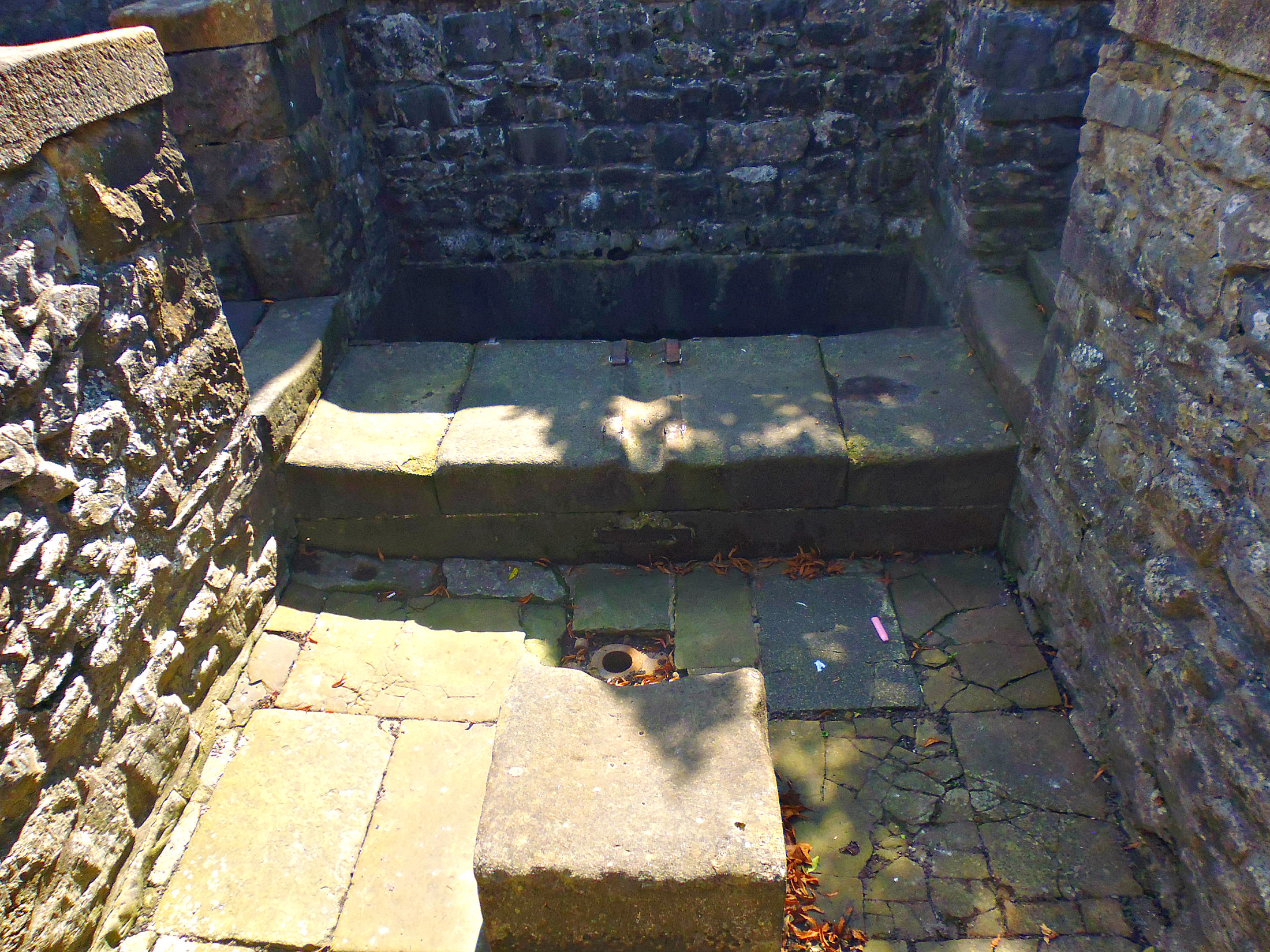
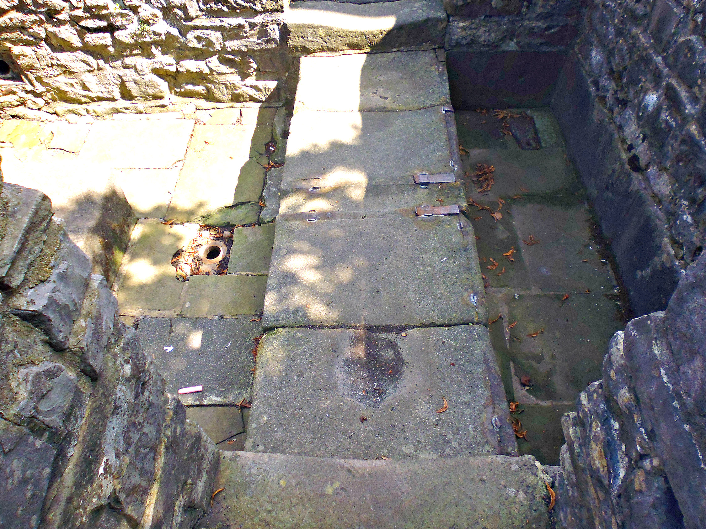
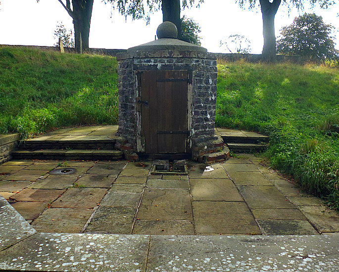
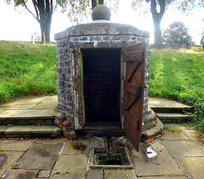
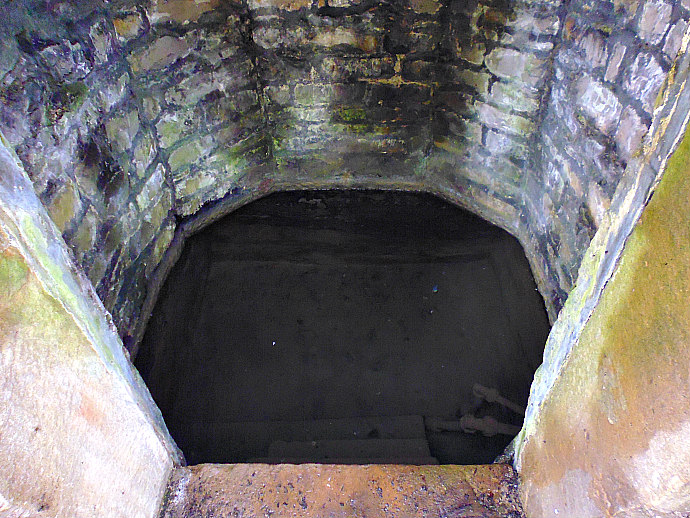
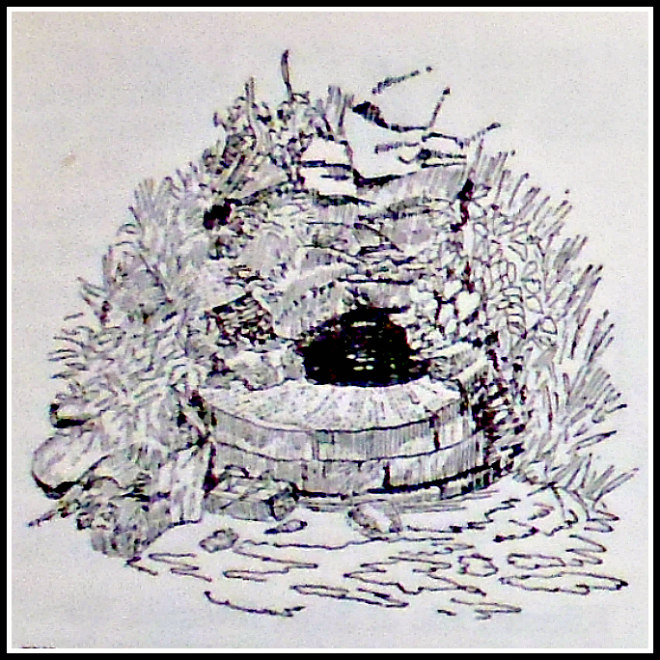
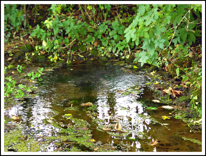
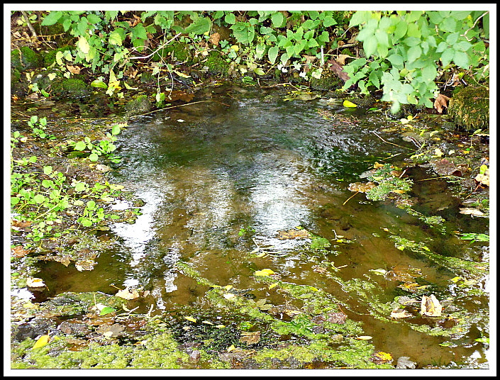
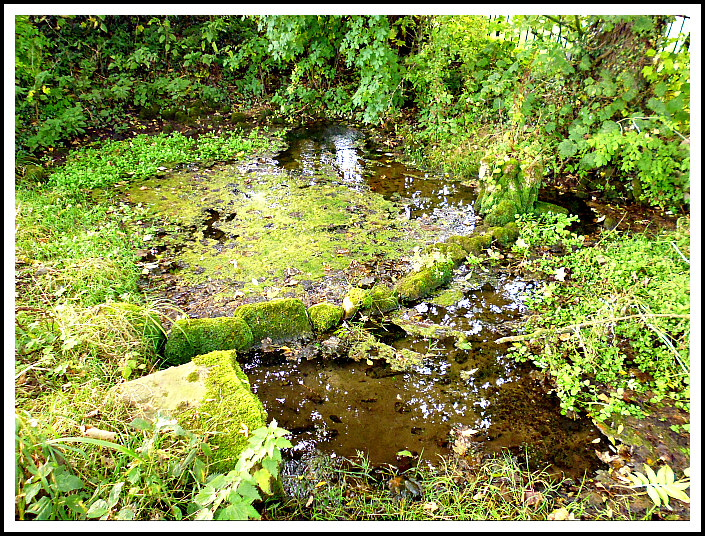
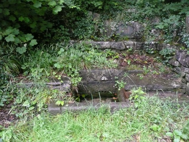
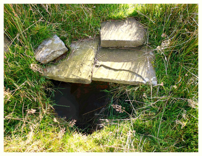
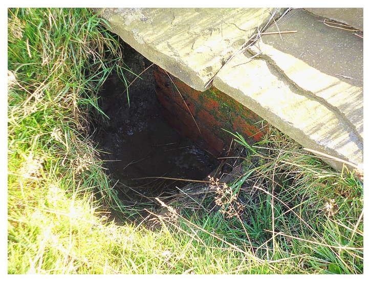
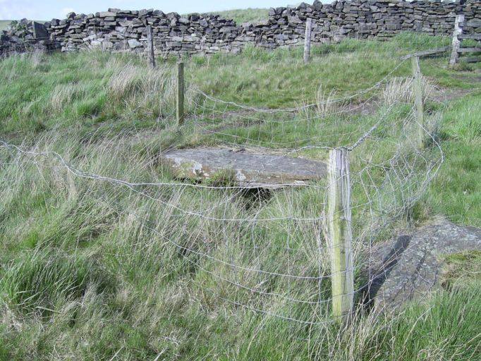
There used to be a holy well named for St Robert 470m to the north of the saint’s cave (at SE 3629 5650), but today that holy spot is the Monkswell Business Park, Manse Lane. However, the last vestiges of the said well/spring can still be seen although today it is a ‘wishing well’ into which locals throw coins! Robert Charles Hope (1893) said of this well that: “A short distance above Grimbald’s Bridge, in a field called Halykeld Sykes, on the north side of the river Nidd, is “”St Robert’s Well.”” There is also a chapel of St. Robert of Knaresborough, which was confirmed by charter to the Brethren of the Order of the Holy Trinity at Knaresborough by Richard, Earl of Cornwall.” Another holy well, said to be named after St Robert, can still be seen just to the southeast of Levisham, north Yorkshire.

Our Lady of The Crag, Knaresborough. (Drawing)

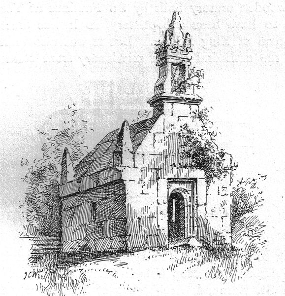
About ½ a mile to the west, at the other end of Abbey Road, is the medieval chapel of  ‘Our-Lady-of-the Crag’, which has sometimes mistakenly been called St Robert’s Chapel, but this folly-like structure was built 200 years after the saint. The chapel, with its tiny inner shrine, was carved out of the sandstone rock-face in c1408 by a local mason by the name of John, whose son was almost killed in a rock fall. John prayed to Our Lady for a miracle. His son survived, and to thank Our Lady for the miracle he built the Chapel in thanks. The inside of the chapel is very tiny but there is an altar and a lovely modern statue of Mary. It has a carved vaulted ceiling with bosses and gargoyles. Church services do still occasionally take place at the chapel and groups of pilgrims come on visits (see the St Mary of Knaresborough website, below, for more informa-tion). By the chapel’s entrance and ‘standing guard’ is an 18th century carved statue of a very life-like knight in armour holding his sword. The chapel is Grade I Listed.

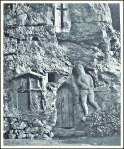
Our Lady Of The Crag Chapel.

Headley & Meulenkamp (1999) add with regard to this chapel and saying that: “………it is a wayside shrine with beautiful Gothic decoration, immediately above it is Fort Montague, an 18th century folly.” They say of Knaresborough that: “it resembles parts of Derbyshire, not least because of the large number of hermits caves.” Fisher & Pennington (1953) say that: “It was originally a wayside chapel, founded at the beginning of the fifteenth century. It won its unenviable place in the annals of notoriety when Eugene Aram hid in it the body of his victim. Aram was convicted of murder and executed in 1759 many years after his crime, which was given a romantic interest quite undeser-ved by a novel of Bulwer Lytton. The figure is of a knight drawing his sword.”  

Sources and related websites:-

Farmer, David Hugh, The Oxford Dictionary of Saints, Oxford University Press, 1982.

Fisher, Graham & Pennington, John, Historic Britain, Odhams Books, Feltham, Middlesex, 1953.

Headley, Gwyn & Meulenkamp, Wim, Follies Grottoes And Garden Buildings, Aurum Press Ltd., London, 1999.

Hope, Robert Charles, The Legendary Lore Of The Holy Wells Of England, Forgotten Books, 2012 (originally published 1893)

https://commons.wikimedia.org/wiki/File:St_Roberts_Cave_008

https://en.wikipedia.org/wiki/Robert_of_Knaresborough

http://www.stmarysknaresborough.org/shrine.html

https://www.visitharrogate.co.uk/things-to-do/st-roberts-cave-p1203201

http://www.crsbi.ac.uk/site/1970/

http://www.halikeld.f9.co.uk/holywells/north/robert1.htm

http://www.megalithic.co.uk/article.php?sid=26391

© Ray Spencer, The Journal Of Antiquities, 2017.


Robin Hood’s Well, Helmshore, Lancashire

Robin Hood’s Well near Helmshore, Lancashire.

   OS Grid Reference: SD 77860 19544. At the north-eastern edge of Holcombe Moor and beside Moor Road, locally called Stake Lane, 1 mile south of Helmshore, Lancashire, is Robin Hood’s Well/Spring. The well is located at the side of the old pilgrim’s route that led to Whalley Abbey and which passes close to the medieval Pilgrim’s Cross, that is now nothing more than a stone-base on the moor. There are no records to say that Robin Hood’s Well ever had healing powers, or to it being a sacred spring, but it must have had some holiness attributed to it by the monks and pilgrims who visited it and drank of its waters back in the mists of time. And there is nothing that says Robin Hood the outlaw of Sherwood Forest ever visited the well, though there is a Robin Hood’s Inn down in Helmshore village. It may originally have been called Pilgrim’s Well.  To reach it walk south along Moor Lane for 1 mile from the village of Helmshore, or go up the footpath from the B6214 (Helmshore Road) near Pleasant View Farm. Follow the path across the farm track and up over the fields over the wall stiles to the rough track (Stake Lane) at the top. Go through the wooden gate on the right and the well is below the wall in front of you.

Robin Hood’s Well.

Close-up of the pool below the spring.

   The author John Crawshaw writing in Source – The Holy Wells Journal, gives us a fair bit of interesting information with regard to the well. He says that: “Situated near Helmshore, on the edge of the ancient  Forest of Rossendale in Lancashire is Robin Hood’s Well. This well is near an ancient pilgrim’s route which passes by the Pilgrim’s Cross (which was in existence in A.D. 1176), on Holcombe Moor, and goes through the town of Haslingdon on its way to Whalley. In Anglo Saxon times Whalley church was an important minster and the mother church of an enormous parish. Later, in the medieval period, several chapels-of-ease were attached to Whalley church for the “ease” of the scattered population providing access to the Mass and the sacraments

   “After the move made by the Cistercian monks of Stanlow to Whalley at the end of the thirteenth century, traffic would have increased along this route. About one mile to the north of Pilgrim’s Cross, near this pilgrimage route is Robin Hood’s Well.

Pyramid-shaped stone above the well/spring.

   “The spring issues  out from beneath a large, worn stone capping: shaped rather like a flattened pyramid with a blunt apex. This is set against a drystone wall by the side of Stake Lane. The water falls from the well-head into a small pool and the whole arrangement of stones has the appearance of great age. The flattened pyramid-shaped piece of sandstone covering the well has several worn, carved indentations upon it, one of which, near the left-hand side at the front, is a wide groove. It is possible that this was made by the wearing down of the stone by a chain securing a drinking cup at its end. However, no trace of any chain or cup can now be discerned.”

   Mr Crawshaw goes on to say that: “Though it is reasonable to assume that this well was used by pilgrims on their way to Whalley church and later, the great Cistercian abbey there. I have not been able to discover any recorded references to its original dedication: nor does there seem to be any written record reciting any healing properties attributed to the water. It is possible of course that any such references are lost or were never recorded, or perhaps the well’s reputation  in the middle-ages was merely that of a providential source of drinking water on a pilgrim’s route, where prayers were said in gratitude for the slaking of the pilgrim’s thirst.

   “I have a theory that in fact the name of the well may have been brought into use following the 16th century religious reformation. I understand the term , “the play of  Robin Hood” was used by the 16th century Lancastrian religious reformers as a derogatory nick-name to describe the rituals and ceremonies of the old English Catholic Church. These reformers had no use for pilgrimages to holy sites such as the ancient parish churches, the shrines of saints or holy wells; indeed they denounced them as being of no spiritual value.

   “One of the most famous Lancastrian reformers, John Bradford, in his Christmas sermon delivered in Manchester in 1552, threatened the people that, if the town did not “readily embrace the Word of God, the Mass would be said again in that church, and the play of Robin Hood acted there”, ¹ which did indeed come to pass during the reign of Queen Mary. I believe that this ancient spring derives its name from this time, when the practice of visiting such wells was being denounced as “superstitious”.

   “The Elizabethan “settlement of religion”, having swept away the piety and traditional Catholic practices of the old Ecclesia Anglicana, had no use for pilgrimages which, in theory at least, it had outlawed. So, following the dissolution of Whalley Abbey and the official prohibition of the old Faith, this spring on an ancient pilgrim’s route appears to have fallen into being regarded merely as a source of water by the side of a little-used moorland lane.” 

Sources of information and related websites:-

Crawshaw, John, (Robin Hood’s Well), Source—The Holy Wells Journal,  New Series No 6—Summer 1998, Pen-y-Bont, Bont Newydd, Cefn, St Asaph, Clwyd, 1998.

¹ Haigh, Christopher, Reformation and Resistance in Tudor Lancashire, 1975, Cambridge University Press, Ch.11, 168.

http://www.pastscape.org.uk/hob.aspx?hob_id=44289

https://en.wikipedia.org/wiki/Helmshore

https://haslingdens.blogspot.co.uk/2016/01/historic-water-troughs-and-spring-fed.html

                                                                                  © Ray Spencer, The Journal Of Antiquities, 2017.


St Fillan’s Holy Well And Chapel, Kilallan, Renfrewshire, Scotland

St Fillan's Holy Well at Kilallan, Renfrewshire, Scotland.

St Fillan’s Holy Well at Kilallan, Renfrewshire, Scotland.

OS Grid Reference: NS 3840 6899. The healing well of St Fillan lies at the edge of a wooded area 140 metres to the east of the ruined and roofless chapel, also named for the saint, at the east-side of Kilallan Farm, and near the village of Kilmacolm in the parish of Houston, Renfrewshire. And 55 metres to the south of the holy well, beside Corsliehill Road, is the famous St Fillan’s Seat, a large rock shaped as such. St Fillan or Foelan was an 8th century saint from Munster in Ireland. The little hamlet of Kilallan (meaning the cell of Fillan) with its old ruined church of St Fillan and graveyard was a holy and sacred site and also a place of pilgrimage in the Middle Ages – as was the nearby holy well and rock-seat. The church was last used for services in the latter part of the 18th century. Although the church is without its roof it does still retain some interesting medieval features, and there used to be a 10th century stone here. The holy well, ruined chapel and stone seat lie just off Corsliehill Road in the vicinity of Kilallan Farm, some 2 miles to the south-east of Kilmacolm, near Houston.

The holy well of St Fillan was almost certainly a pre-Christian spring that was used by the saint himself in the 8th century for baptismal purposes. It’s water flowed from beneath a rock in the ground and into a round-shaped brick and stone basin. Long ago the holy water apparently miraculously cured children of rickets when they were bathed there; pieces of cloth and rags being hung on trees beside the well as votive offerings, although this ceased at the end of the 17th century when the local priest filled the well with stones. The water was also used for baptisms in the nearby church of St Fillan, which now stands roofless beside Kilallan farm. The well gets a brief mention in Janet & Colin Bord’s work ‘Sacred Waters’.

St Fillan’s Old Church at the east-side of Kilallan (Kilellan) Farm (NS 38268 68934) is now roofless but the walls you see here are still very sturdy and solid-looking. This building stands on the site of an older, medieval church, but there are still parts of this “older” building in the fabric of the walls. The doorway is said to date from 1635. In the churchyard wall there is a ancient baptismal font, or stoup, from the older church; and there used to be a 10th century stone standing inside the present edifice, but this seems to have been removed for safety reasons. In 1772 St Fillan’s was finally abandoned to the elemants. The British Listed Buildings site says of this: “Church ruin; roofless; walls and major part of gables remain; dated lintel “1635”. Later E gable, thick crowstepped W gable, with bipartite window at clerestory level. N wall with tomb of Fleming of Barochan family. Doorways in N and S walls. Moulded cornice to all but E. 3 doors to S blocked up. Stone stoup built into wall. Early gravestones in kirkyard.” Historic Scotland Building ID is:- no 12897. (See the link below*).

St Fillan's Seat beside Corsliehill Road, Kilallan, Renfrewshire

St Fillan’s Seat beside Corsliehill Road, Kilallan, Renfrewshire

A little further to the south-east of the ruined chapel, beside the road and opposite the farm building, is a large flat rock of ancient origins that is locally called St Fillan’s Seat or Chair at (NS 38419 68937). Legend records that the holy man sat here and baptized the local children. We don’t, however, know a great deal about the life of the saint other than he was born in (c703) and was a monk at Cluain Moescna, Co. Westmeath, but in his youth (c717 AD) sailed from Ireland to Scotland and was accompanied by his mother, St Kentigerna, and his uncle, St Comgan. We know that Fillan buried his uncle on the Island of Iona. His father was said to have been Feriach. There are though another 14 saints called Fillan, Foelan and Faelan. At least two of these came to Scotland between the 6th and 8th century AD. This has undoubtedly led to confusion, but St Fillan of Kilallan was abbot of Glendochart, Perthshire, and died in 776 AD. His feastday is generally 9th January but sometimes 19th Jan, whereas the other St Fillan was a disciple of St Columba – probably at Pittenweem – in Fife. He died in 593 AD  and is honoured on either 20th or 25th June.

The author Donald Attwater in his work ‘A Dictionary Of Saints’, adds more to the information but, perhaps, adds to that confusion regarding the 8th century St Fillan. He says that: “Fillan was abbot of a monastery near St Andrews; was a solitary in Perthshire, and was buried in Strathfillan, also in Perthshire.”

Sources and other related websites:-

Attwater, Donald, A Dictionary Of Saints, Burns & Oates, London, 1958.

Bord, Janet & Colin, Sacred Waters, Paladin, London, 1986.

MacKillop, James, Dictionary Of Celtic Mythology, Oxford University Press, Oxford, 1998.

The AA, Illustrated Road Book Of Scotland, The Automobile Association, London, 1963.

http://www.britishlistedbuildings.co.uk/sc-12897-killellan-kirk-and-churchyard-houston#.WE3p5C975jo

https://canmore.org.uk/site/42250/kilallan-st-fillans-church-and-churchyard

https://canmore.org.uk/site/42246/kilallan-st-fillans-well

https://en.wikipedia.org/wiki/Houston_and_Killellan

History

http://www.guard-archaeology.co.uk/news13/kilallanNews.html

                                                                                       © Ray Spencer, The Journal Of Antiquities, 2016.


4 Comments

St Helen’s Holy Well, Caernarfon, Gwynedd, Wales

    OS grid reference: SH 48238 62224. St Helen’s Well, also known as Ffynnon St Helen, is located close to South Road at Coed Helen, in the area called Hen Waliau (a Roman walled enclosure), which is about ½ a mile west of Llanbeblig parish church, Caernarfon. Sadly, the well has become ‘overlooked’ and ‘forgotten’ beneath a canopy of trees almost next to the main railway line that runs through a secluded cutting. Long ago a Medieval chapel called Capel Helen stood close to the well, but today all signs of that are virtually gone. The well is located on private land close to a large house. Further along the lane there is an iron gate and, from here a path runs along a raised bank beside the railway line and passes by the well. Permission “may” be needed to visit the holy well.

     The well and its associated ancient chapel were dedicated to the 4th century St Elen of Caernarfon, a Welsh princess who was the daughter of Eudaf Octavius of Ewyas in western Herefordshire, and Aurelia Carausia. She was to figure strongly in the celebrated 14th century Mabinogion Tales. In these “tales” she marries the Roman general Magnus Clemens Maximus (Macsen Wledig) after he dreams about her while stationed in Rome. He then sets out (c 383 AD) to find this beautiful young woman and, after crossing the mountains of Snowdonia, he finally finds the woman of his dream. And so begins the well-known story of Helen and Maximus. But much confusion has arisen over time because Helen and Maximus had a son called Constantine (Custennin Fendigaid), and because of that confusion has arisen with Helen of Caernarvon being mistaken for St Helena of Constantinople (d 330 AD) and her son Constantine the Great – the first Christian Roman emperor. With this in mind I should add that this Welsh Helen was the granddaughter of Constantine the Great.

    According to legend, Elen (often referred to as Elen Luyddog – Helen of the Hosts), had earlier led an army into north Wales where her father owned large areas of land, one of these being Caernarvon. Another legend states that Maximus, now made emperor in the west (including Spain where he was born), gives his wife Helen the Roman fortifications of Caerleon, Caernarvon and Carmarthen, as a wedding gift. Later, Helen and her sons Constantine and Publicius accompany Maximus to Gaul, but shortly after his return to Rome Maximus is “defeated and killed by the Emperor of the East, Theodosius” (Ashe, Geoffrey, 1976). His death probably took place at Aquileia, northern Italy (388 AD). The family later visit St Martin at Trier, according to St Gregory and St Sulpicius Severus, before travelling back to Wales – St Helen is then credited with introducing a new form of Celtic (Gaulish) monasticism into south-east Wales.

    Ffynnon St Helen was still in use up until the 1920s when local people visited it in order to be healed and they would take away bottles of its curative water, which was described as being plentiful (Hughes & North, 1924). The well stood on a raised area of land and its water was contained in a slate cistern with a flight of modern steps leading to it. Today not a great deal survives of the well’s original structure. But the water is still flowing somewhere beneath the well, certainly the sound of running water can still be heard along-side, though no structural remains are visible (Berks, Davidson & Roberts, 2005). The well site was often said to be ‘overgrown and generally abandoned’. There are apparently another five holy wells named after St Elen in Caernarfonshire! Unfortunately, we don’t know what ailments, conditions and diseases were cured by the water from Ffynnon St Helen, and we will probably never know. Over the years Roman coins have been dug up in the vicinity of the well.

    The author Francis Jones in his respected publication ‘The Holy Wells of Wales’, says of Ffynnon Helen that it is: “On the outskirts of Llanbeblig village, near the river Seiont. The ground has been raised round the well, which is now approached by a flight of modern steps: the water is still taken away in bottles for use as medicine: there is said to have been a chapel called Capel Helen near the well. St Helen is listed in ‘Lives of the British Saints’ by S. Baring Gould & J. Fisher, 1913.”

    There are at least three churches dedicated to St Elen in Caernarfon, and there are a few others named for her in Monmouthshire and west Glamorgan, while her sons have church dedications at Llanbeblig near Caernarfon and Welsh Bicknor (Llangystenin), in Hereford-shire; and the Roman road system called ‘the Sarn Helen’ is often attributed to her, although she probably had ‘no’ real connection with it,  but this might be why she is sometimes called ‘Helen of the Legions’. We learn that Helen and Maximus had other sons and daughters who are not quite so well-known: Annun (Eunan), Antonius, Dimit, St Ednyfed, Gratianna (Graciana), Severa and Victor (Gwythr). St Elen is thought to have died sometime between 390-400 AD, and she is venerated by the Church In Wales and the Roman Catholic and Orthodox Churches in Wales. Her feast-day is observed on 22nd May.

Sources:

Ashe, Geoffrey., The Quest for Arthur’s Britain, Paladin, St Albans, Herts, 1976.

http://www.cofiadurcahcymru.org.uk/arch/gat/english/gat_interface.html

http://orthodoxwiki.org/Helen_of_Caernarfon

http://www.geni.com/people/St-Elen-Lwyddog-of-the-Host-of-Britain/377649183480004232

http://www.traditionalharp.co.uk/Caer_Feddwyd/articles/Elen.htm

Jones, Francis., The Holy Wells of Wales, University of Wales Press, Cardiff, 1992.

Spencer, Ray., A Guide to the Saints of Wales and the West Country, Llanerch Enterprises, Lampeter, Dyfed, 1990.


1 Comment

St Helen’s Well, Eshton, North Yorkshire

St Helen's Well, Eshton, North Yorkshire.

St Helen’s Well, Eshton, North Yorkshire.

     SD 9309 5704. St Helen’s holy well stands in a walled and railed-off enclosure beside Eshton Lane, tucked in between the water-works and a wooded area, about halfway between Gargrave and Rylstone – in what is the district of Craven, north Yorkshire. Skipton lies a few miles to the east. The holy well has been a sacred site, not just since the late Roman period, but ‘long’ before that. However, almost certainly it had been ‘a sacred place’ in the so-called Dark Ages when the well/spring was dedicated to St Helen, the wife of Constantius Chlorus and mother of the first Christian emperor of the Roman Empire Constantine the Great, who was converted to Christianity in 312 AD. St Helen, also known as Helena, died in 330 AD; she was much honoured in the west where her feast-day was celebrated on 18th August. A number of churches and holy wells were dedicated to her in the north of England and a few in the south and south-west of England.

St Helen's Well at Eshton.

St Helen’s Well at Eshton.

    In the Anglo-Saxon age and later the Medieval period it became a place of pilgrimage and healing; the water of the well having the miraculous ability to cure diseases and ailments of the body.Today the well is still ‘a sight to behold’ with the water gushing forth (often with gusto) into the circular-shaped pool – although the carved stones that apparently lie in the pool are very often well below the mud and water-level! An ancient cross was found opposite the well in the 18th century, but then it went missing, though later pieces of this were deposited in St Andrew’s church at Gargrave.

    The authors John & Phillip Dixon in ‘Journeys Through Brigantia’ (Volume One), say that: “The practice of regarding water, and in particular a well, as having sacred and healing qualities is well attested among the Celtic peoples. Holy wells have their origins in the pre-English period and many occur on a number of Roman sites in West and North Yorkshire. With the coming of Christianity the pagan deities to whom the wells were dedicated were converted and replaced by a Christian saint — St Helen was especially popular in those early times.

    “St Helen was the mother of Constantine the Great and said to be of Northern British origin, an ancestor of Coel Hen Godebog — the post-Roman overlord of Northern Britain who came down in legend as ‘Old King Cole’. After her conversion to Christianity she made an energetic and devout pilgrimage to Jerusalem, and founded several churches in Palestine.

    “Her popularity began to crystallize about seventy years after her death after the story went round that she was privileged to discover the cross of Christ on the site of the Passion. She is usually depicted wearing a crown and holding a long T-cross” (John & Phillip Dixon, 1990).

    It was Geoffrey of Monmouth who ‘claimed’ that St Helena was a British princess and of the family of Old King Cole, but she was, according to David Farmer in his work ‘Oxford Dictionary of Saints’, born at Drepanum (Helenopolis) in Bithynia. Maybe Geoffrey had genuinely mistaken Bithynia for Britain, or that he hoped and wanted her to originate from Britain! Her son Constantine the Great did, however, have strong associations with Britain, particularly the city of York, known as Eboracum to the Romans.

St Helen's Well at Eshton in North Yorkshire.

St Helen’s Well at Eshton in North Yorkshire.

    The water issues from a hole low down in the bank below the railings and flows into a circular shaped pool. At the front and sides of this pool (in a curved formation) there are a number of shaped stones that make up the outer perimeter of the sacred pool. Just in front of the point of entry for the water coming in there are ‘said’ to be two carved stones that resemble Celtic stone heads, but these are often covered by thick mud – and therefore not often visible – unless you feel around for them with your hands! The water goes out into a more modern drain at the side of the wall entrance. In the past devout people used to hang coloured rags on the branches of a tree, though this seems to have ceased now. There are records of a chapel existing in Chapel Field, close to the holy well but this has gone. In the 18th century an Anglo-Saxon cross was discovered opposite the well (John & Phillip Dixon, 1990), but this then to disappeared. It’s thought the carved stones in St Andrew’s church, Gargrave, are from “this” site opposite St Helen’s Well. According to John & Phillip Dixon the cross was very similar to the ones in Whalley churchyard, dating probably from the 11th century.

Sources:-

Dixon, John & Phillip., Journeys Through Brigantia (Volume One) Walks in Craven, Airedale and Wharfedale, Aussteiger Publications, Barnoldswick, 1990.

Farmer, David., Oxford Dictionary Of Saints, Oxford University Press, 2003.


1 Comment

Maen Ceti (Arthur’s Stone), Cefn Bryn, Reynoldston, Gower, Wales

Maen Ceti (Arthur's Stone) illustration.

Maen Ceti (Arthur’s Stone) illustration.

    OS grid reference: SS 4914 9055. On the south-facing ridge of Cefn-y- Bryn, overlooking the village of Reynoldston, on the Gower Peninsula, stands the Neolithic burial chamber known as Maen Ceti, but more commonly known as ‘Arthur’s Stone’. Maen Ceti means just that – ‘The Stone of Ceti’. This well-known ancient, megalithic chambered tomb, with its huge capstone is variously known as a cromlech, a dolmen and a quoit, but they all mean the same thing in reality – a burial chamber. It is located 300 yards to the north of the main road that crosses Cefn Bryn – between Reynoldston and Cillibion  – ¾ a mile to the east of Reynoldston village.  There are many footpaths criss-crossing the 609 foot-high Cefn Bryn Hill, which is locally called ‘the common’, but at least two of these moorland paths head to Maen Ceti from the road; the ancient monument can quite easily be seen once you start to climb up onto the ridge itself. The village of Llanrhidian is a further mile to the north of Maen Ceti.

Plan of Maen Ceti (Arthur's Stone).

*Plan of Maen Ceti (Arthur’s Stone)

    The monument is a double chambered tomb that consists of a huge capstone, a glacial boulder of millstone grit measuring 12 feet across, which is supported on four small up-rights, with a large part of the capstone having fallen to the ground at the side and another bit partly lying beneath the capstone, and there are six other small stones lying around the monument and beneath it, which presumably were up-rights that “now” don’t support the great stone. Maen Cetti burial chamber is 8 feet high and dates from the Neolithic – 2, 500 BC, or maybe earlier. The capstone weighs as much as 25 tons, or it used to do, so it would have been ‘a great fete of strength’ on the part of the builders of the monument.

    “The raising of the huge stone onto its supports has also be summed up in ancient records as one of ‘the three arduous undertakings accomplished in Britain, the old proverb: Mal gwaith Maen Ceti – ‘Like the labour of the Stone of Ceti” supports that fact, according to Chris Barber ‘More Mysterious Wales’. The burial chamber has taken a battering from the elements on the high ridge of Cefn Bryn, being very exposed to high winds and driving rain, ‘causing the capstone to split in two places – though this feature is often put down to other things in legend including King Arthur’s sword Excalibur and, even St David, who took a dislike to the pagan stone. Long ago a large mound of earth and stones covered the burial chamber, but nothing much of that remains – although there are traces of a ring cairn.

    Barber in ‘The Ancient Stones of Wales’, says that: “It is marked as Arthur’s Stone on the first Ordnance Survey map of 1830 and later editions.” He says that in its Welsh name “It is first mentioned in a Triad of the 10th century.” And that: “There are over 70 literary references to Arthur’s Stone and it is better documented than any other prehistoric stone monument in Wales.” Maen Ceti is “one of the wonders of  the ancient isle of Britain” (The Gower Society, 1989).

    We know, however, that Maen Ceti pre-dates King Arthur and St David by thousands of years, but it is always a good thing to have a British king and a Welsh saint on-board. According to the legend: “When one day King Arthur was walking in Carmarthenshire he felt a pebble in his shoe and plucked it out and threw it into the air; it landed in Gower and became the capstone of Maen Ceti.  So does the historical Arthur become inflated to gigantic stature” (Jacquetta Hawkes, 1973).

Arthur's Stone near Swansea (depicted c 1840 by Henry G. Gastineau - Wikipedia)

Arthur’s Stone (as depicted c 1840 by Henry G. Gastineau – Wikipedia)

    Beneath the ancient monument there is “said” to be a spring called Ffynnon Fawr which apparently ‘ebbs and flows’ with the tide, although the sea is several miles south of Maen Ceti. However, one other legend says that the stone “goes down to the sea to drink on New Year’s Eve” (The Gower Society, 1989). Maybe St David, patron saint of Wales, ’caused the spring to flow when he came by here in the 6th century. In a sense then St David had attempted to Christianise the pagan stone, though of course, we know the spring was here long before Christianity was established in Gower. About 500 metres to the south-east there is, though, a holy well called Ffynnon Fair (St Mary’s Well), which was for a long time one of the main sources of water supply for the Gower. Chris Barber ‘Mysterious Wales’, tells us more about the myths and legends:

    At midnight on nights of the full moon maidens from the Swansea area used to place cakes made of barley meal and honey, wetted with milk and well kneaded, on the Stone. Then on hands and knees the girls would crawl three times around the stones. This was done to test the fidelity of their lovers. If the young men were faithful to their sweethearts they would appear. If they did not come, the girls regarded it as a token of  their fickleness, or intention never to marry them. The water (of Ffynnon Fawr).….. used to be drunk from the palm of the hand and one had to make a wish at the same time. On nights with a full moon a figure wearing shining armour emerges from under the stone and makes his way to Llanrhidian. Those who have seen this  mysterious spectre claim that it was King Arthur.”

    Arthur’s Stone (Maen Ceti) is regarded as one of the most magical stones in Wales, according to Bill Anderton ‘Guide To Ancient Britain’, and he goes on to say that: “the holy well (Ffynnon Fair) along Cefn Bryn, as well as a number of standing stones, are all involved in a complex of ley lines. And says Anderton: “The name Arthur is probably a corruption of a more ancient word, yet it is the same Arthur who was supposed to have split the capstone with his sword.” There are other ancient burial tombs, cairns, hill-forts and earthworks in this particular area.

Sources:-

Anderton, Bill., Guide To Ancient Britain, W. Foulsham, & Co. Ltd., Slough, Berkshire, 1991.

Barber, Chris., More Mysterious Wales, Paladin Books, London W1X, 1987.

Barber, Chris & Williams, John Godfrey., The Ancient Stones of Wales, Blorenge Books, Abergavenny, Gwent, 1989.

Barber, Chris., Mysterious Wales, Paladin Books, London W1X, 1987.

Hawkes, Jacquetta., A Guide To The Prehistoric And Roman Monuments In England And Wales, Cardinal, London, 1975.

https://en.wikipedia.org/wiki/Cefn_Bryn

*The Gower Society, A Guide To Gower, The Publication Committee of The Gower Soc., (orig. prepared 1965. Edt. 1989).


The Ebbing And Flowing Well, Giggleswick, North Yorkshire

Ebbing and Flowing Well, Giggleswick (photo credit: Humphrey Bolton for Geograph)

Ebbing and Flowing Well, Giggleswick (photo credit: Humphrey Bolton for Geograph)

   OS grid reference SD 8039 6538. The Ebbing and Flowing Well is, perhaps rather annoyingly, located at the side of the busy B6480 (old Clapham road) out of the village of Giggleswick, about two-thirds of the way up the steep and ‘often very busy’ Buck Haw Brow, opposite Settle Golf-course. It’s about 1 mile north-west of Giggleswick and one-and-three-quarter miles from the town of Settle. The rocky and tree-covered Giggleswick Scar, formed from the South Craven Fault, towers above the curious holy well, which has long been famous for its abilities to “ebb and flow” though this does not occur as much as it used to do – due probably to the mining that now takes place over and on top of the scar, or some other atrocity. I should point out here that ‘it is quite dangerous to stand and view the well’ as there is a constant flow of vehicles rushing past the site and, it is therefore very difficult, if not dangerous to attempt to take photographs – so please “be warned” and do please stay very safe.

   The well has been famous over the centuries for its strange and curious ability to ‘ebb and flow’, indeed so much so that in the past local people have tried to dig down below the well in order to find out ‘why it does this’, though probably without actually establishing what causes such a thing to take place, if it really does, and now on rare occasions. We take the word “ebb” to mean flow back, fall, drain and subside, and the word “flow” to mean issue forth, pour forth, pour outward, refill and well-up. So is that what the well does? When the well does flow it flows under the road to emerge in a wet, muddy mess, on the opposite side of the road and, sometimes flows over the road itself, but mostly it simply wells-up to fill its square-shaped stone chamber, and then without much warning drains-away and ‘goes back’ into the limestone scar – probably from one of the deep caves that is undoubtedly linked-up with the well somewhere along the way. Author Brian Spencer in his book ‘The Visitor’s Guide To The Yorkshire Dales, says of this strange phenomana:

“On the rare occasions that the well functions, it rapidly drains, and then after a pause refills itself. This is due to a unique double chambered cave somewhere behind the well which causes a sudden syphoning effect inside the hole and temporarily cuts off the flow of water.”

   In the much acclaimed tome ‘Folklore Myths and Legends of Britains’, by Reader’s Digest, we are given a more Folklore-ish angle to this:

“Near to Giggleswick Scar is an oddity of nature, the Ebbing and Flowing Well. An explanation for its behavior is that a nymph who was being chased by a satyr prayed to the gods for help. They turned her into a spring of water, which still ebbs and flows with her panting breaths. 

The 17th-century highwayman, John Nevison, is said to have evaded capture by letting his horse drink at the well. The water gave the horse strength and Nevison escaped by leaping from the top of a cliff, still known as Nevison’s Leap.”

   In the past a few historians have tried to associate the Ebbing and Flowing Well with a local north-country saint – in this case St Alkelda – who is still venerated at the church in Giggleswick and, also at the church in Middleham, north Yorkshire, where she is said, according to the legend, to have been murdered by two Danish women in c 800 AD, or maybe in the 10th century so say some. Alkelda was an Anglo-Saxon princess and also a ‘devout’ Christian. One day she was approached by two pagan women who murdered her with a ‘thick scarf’ which they pulled tightly around her neck; this terrible crime probably took place where the church of Sts Mary & Alkelda now stands, or ‘maybe’ beside the well that is also named for her; and the church houses some fragments of a 15th century stained-glass window which depicts the saint’s martyrdom.

   The church of St Alkelda at Giggleswick apparently still uses water from the Ebbing and Flowing Well in its baptism services and, “a 19th century stained-glass window depicts the spirit of the well in the form of an angel hovering above the waters. This is a Christianised version of the pagan water-spirits, called undines”, according to author Bill Anderton in his work ‘Guide To Ancient Britain’. But did St Alkelda even exist because her name could simply be a corruption of the Old English words ‘Hal Keld’ (Halig Keld) – meaning “holy well”. The renowned author Jessica Lofthouse explains this in her book ‘Lancashire Countrygoer’, she says:

“Ghikel was probably a Norseman whose “wick” or farm was here. Also the ebbing and flowing well, not so far away, was a “gugglian” or bubbling spring: the wick by the gurgling well could be a derivation. But who caresor whether or no there was a Saxon Princess martyred at the hand of pagan Danes to give St. Alkelda’s its name. Or was the well where the Celts worshipped a spirit of water, later sanctified as a holy well, and as the “helig keld” did it give the first church its unusual name?”

   Authors Janet & Colin Bord in their renowned work ‘Sacred Waters’, have little if anything to say about the well only that: “Sadly the well no longer ebbs and flows.”

Sources:

Anderton, Bill., Guide To Ancient Britain, Foulsham, Slough Berkshire, 1991.

Bord, Janet & Colin, Sacred Waters, Paladin Books, London W1X, 1986.

http://www.geograph.org.uk/photo/925879   © Copyright Humphrey Bolton and licensed for reuse under this Creative Commons Licence.

https://megalithix.wordpress.com/2008/09/12/ebbing-flowing-well-giggleswick-north-yorkshire-holy-well/

Lofthouse, Jessica., Lancashire Countrygoer, (second edition), Robert Hale, London SW2, 1974.

Reader’s Digest, Folklore Myths And Legends Of Britain, (Second Edition), The Reader’s Digest Association Limited, London, 1977.

Spencer, Brian., The Visitor’s Guide To The Yorkshire Dales, Hunter Publishing Inc., Edison, NJ, USA, 1986.


1 Comment

St Chad’s Well, Tinedale Farm, Spen Brook, Lancashire

St Chad's Well, Near Tinedale Farm, Spen Brook, Lancashire.

St Chad’s Well, Near Tinedale Farm, Spen Brook, Lancashire.

   St Chad’s Well is located in a boggy field with reed beds, just east of Tinedale Farm, 1 mile south of Newchurch-in-Pendle. From above Hoarstones, Fence, go north along the country lane, then at the very top walk along the straight farmtrack with a sign for Rigg of England and Tinedale Farm. After a while take the second wall-style leading into the field. At the centre of this, often boggy field where the power cables intersect, look for a large area of reeds, here hidden away is the largerly forgotten holy well. It is covered by two flat stones, together measuring 3 feet across, while the well-basin is roughly 1 foot in depth, and is lined at one side by brickwork (which looks recent). There is a layer of mud at the bottom, but the water is quite clear ‘upon cupping’ one’s hands in the water, though probably ‘not drinkable’ today!

St Chad's Well near Tinedale Farm, Spen Brook.

St Chad’s Well

   According to local legend St Chad, a 7th century Anglo Saxon saint, who became Archbishop of York, came to this area during his travels in the north of England. However it is more likely one of his many disciples came here and dedicated the well to his master. It is though, as we already know, a pre-Christian well/spring. I am not aware of any cures happening at this well, though I’m not saying they didn’t happen here long ago. I am told that the water was used by local farms in the area of Tinedale, according to a gentleman who is a member of ‘The Pendle Forest Historical Society’. The well is “now” only marked on old maps of the area. Regarding St Chad, who died in 672 AD, one or two historians have ‘suggested’ albeit tenuously, that the village of Chatburn, near Dowham, is named after the well-known northern saint, though there does not appear to be any credible link with the saint to the actual place.  However, the name is usually taken to mean Ceatta’s Stream in the ‘Old English’ form – meaning Ceatta/Ceada (a personal name) and burn (a stream); the two other forms of Chad’s name are, of course, Ceadda and Ceatta! 

   The local author/historian John A. Clayton informs us in his excellent book ‘Burnley And Pendle Archaeology – Part 1 – Ice Age to Early Bronze Age’, that: “in 1978 a small stone bust, possibly of the Romano-British goddess Sulis/Minerva, was discovered near to the well.” And he says: ‘This, along with Roman pottery recently found by [himself] in nearby Sabden Fold, strongly suggests that the ridge-top site [above the holy well,] sitting as it does on a major ancient trade route, was of importance in the Roman Iron Age.” The ridge-top site which Clayton alludes to is called ‘Standing Stone Height’.

    The well stands close to an ancient trackway, which apparently pilgrims used in order to get to Whalley Abbey, 4 miles to the north-west. Tinedale (Tynedale) farm is “said” to be haunted, and it was associated at the beginning of the 17th century with the Pendle Witches, who met at Malkin Tower, a scant ruin to the north of the farm – between the farms of Bull Hole and Moss End, according to the late John Dixon in his work ‘Historic Walks Around The Pendle Way’. Tinedale farm dates from 1750 but the original building was of 1600. In this area, too, we are told ‘the ancient fire festival of Beltaine’ used to take place – long ago back in the mists of time.

Sources:

Clayton, John A., Burnley And Pendle Archaeology – Part 1 – Ice Age to Early Bronze Age, Barrowford Press, 2014.

Dixon, John & Mann, Bob., Historic Walks Around The Pendle Way, Aussteiger Publications, Barnoldswick, 1990.

Farmer, David., Oxford Dictionary of Saints, Oxford University Press, 2004.

http://kepn.nottingham.ac.uk/map/place/Lancashire/Chatburn


1 Comment

Mary Hoyle Well, Hyndburn Moor, Lancashire

May Road Well, Hyndburn (Photo Credit: Peter Worrell - Geograph)

May Road Well, Hyndburn (Photo Credit: Peter Worrell – Geograph)

Os grid reference: approx. SD 792 283. On Hyndburn Moor between Huncoat and Dunnockshaw, Lancashire, is the now rather forgotten Mary Hoyle Well, a natural spring and former healing well named for St Mary the Virgin. It is also called ‘May Road Well’ on the Ordnance Survey map and ‘May Hole Well’ and, perhaps more locally ‘Mere Royde Well’. Today there is not much to see, apart from a thick stone-slab which has an inscription carved onto it that by all accounts is probably a recent addition. In the past pilgrimages and fairs took place here, usually on the first Sunday of May, but were also associated with the feast-days of the Blessed Virgin Mary in February, March, May, July and September, which the local Roman Catholic community held in great reverence. The well is located at the south-western side of Hameldon Hill, some 400 metres east of the King’s Highway, an ancient moorland road that links Huncoat with Haslingden; it stands beside a junction of moorland tracks, one of which leads to the east in the direction of Dunnockshaw, Clowbridge, Goodshaw and Loveclough. Mitchell’s Reservoir is just a little to the north-west of the well.

Back in the 17th and 18th centuries the well was visited by pilgrims on the ‘feast-days’ associated with the Blessed Virgin Mary – at which time fairs were “also” held here at the beginning of May but, by the 19th century the fairs had stopped and veneration of the well was in decline. There were numerous reports of healings casused by the well water, which was quite deep down in the ground beneath the slab and was never known to dry up, even in times of drought. At some point in the 1970s the large stone-slab, recorded as being over 90 inches long, 50 inches wide, and 7 inches thick, was badly damaged and cracked in two; today this slab is only half its original size. The faint carved inscription on the stone says ‘Mary Hoyle Well’ and a cross has been carved onto it by some devotee – but these inscriptions are from fairly recent times – again probably the 1970s.

The Accrington author Rowland Joynson in his book ‘Join Joynson’ published in conjunction with ‘Accrington Observer & Times’ tells us quite a bit about Mary Hoyle’s Well. Mr Joynson say that: “The water cannot be seen. It is piped from somewhere down beneath the erstwhile flagstone and emerges somewhere near the dam of Mitchell’s Reservoir. It is reputed never to run dry”. “Certainly around 1957 there was a great drought and much worry about reserves at Mitchell’s, but Mary Hoyle’s kept on trickling”. “There are all sorts of speculations about the origin of the name. It is generally assumed to have been the Mere Royd Well, but many ancient wells are associated with the Virgin, and Mary Hoyle does leave you thinking”. The author also speculates that the well is the original source of the Hynd burn “as the spring rising at the greatest altitude”. At one time, long ago, the well was the ‘most important’ source of the drinking water for the higher part of Accrington, according to Joynson.  It now, apparently, flows underground into the nearby Mitchell’s Reservoir.

Mary Hoyle Well is one of the places included in the book ‘The Holy Wells and Mineral Springs of N.E. Lancashire’ by Clifford Byrne, where he mentions similar customs happening at Calf Hey Well at Cockden, Briercliffe, near Burnley, but there are many other wells and springs dotted about the area, many of them now largerly forgotten. Henry Taylor in his great antiquarian work of 1902‘The Ancient Crosses of Lancashire’ also mentions Mary Hoyle Well.

Sources:

Byrne, Clifford., The Holy Wells and Mineral Springs of N.E. Lancashire, Marsden Antiquarians, Nelson, 1982.

http://www.geograph.org.uk/photo/767569     © Copyright Peter Worrell and licensed for reuse under this Creative Commons Licence.

Joynson, Rowland., Join Joynson, Clough & Son, Great Harwood, Lancs, England, 1975.

Taylor, Henry., The Ancient Crosses of Lancashire, Richard Gill, Manchester, 1902.