The Journal Of Antiquities

Ancient Sites In Great Britain & Southern Ireland


1 Comment

The Discovery of Roman Shrines on Scargill Moor, County Durham

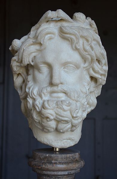
Head of  Silvanus crowned with pine by Carole Raddato. (Creative Commons).

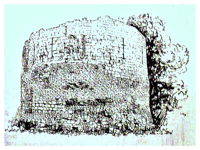
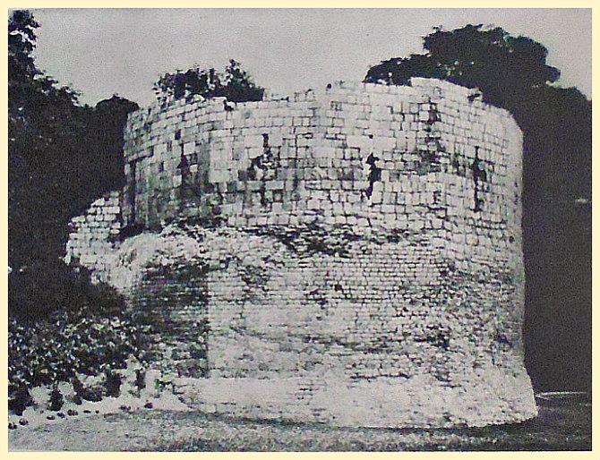
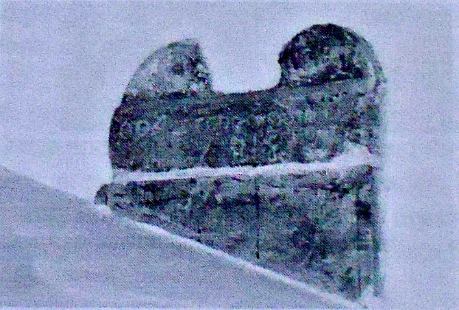
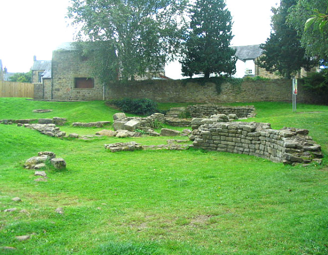
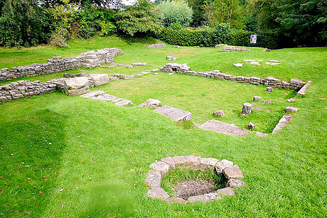
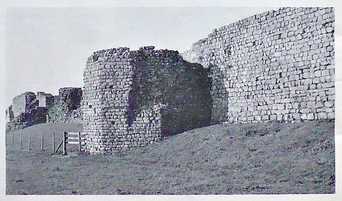
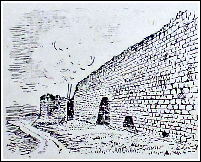
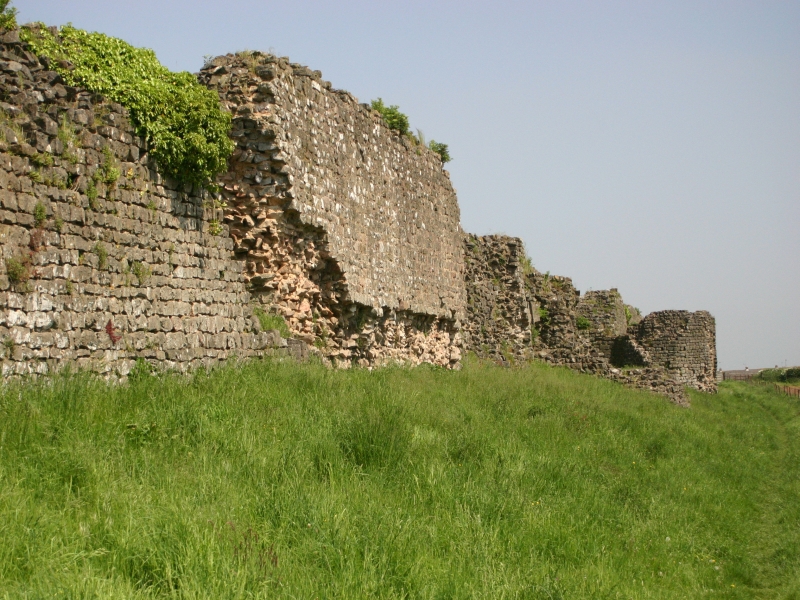
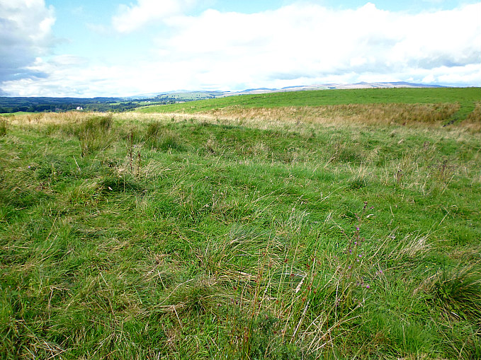
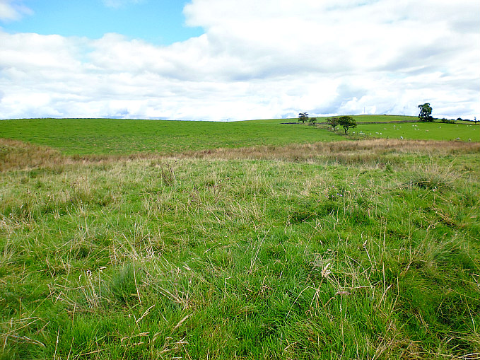
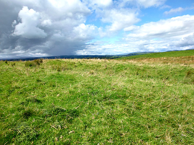
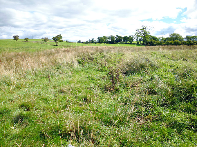
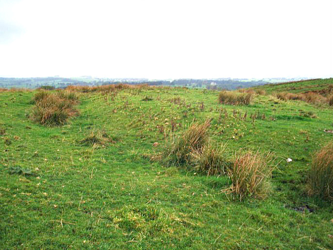
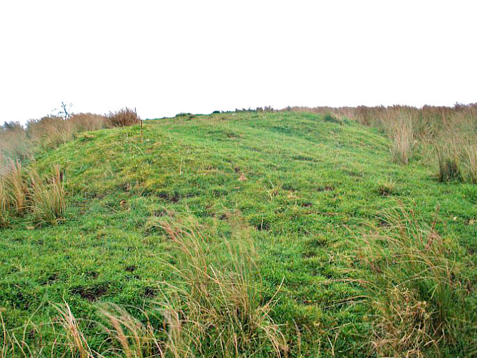
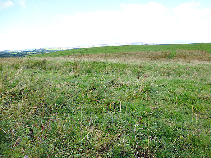
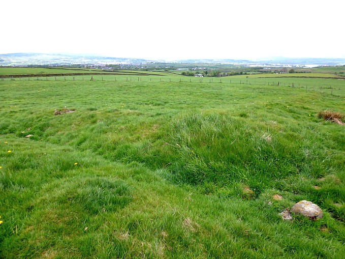
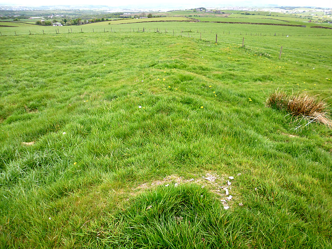
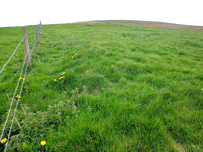
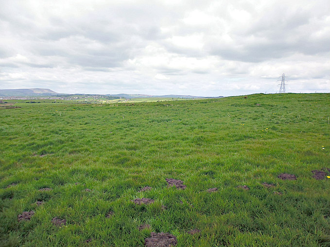
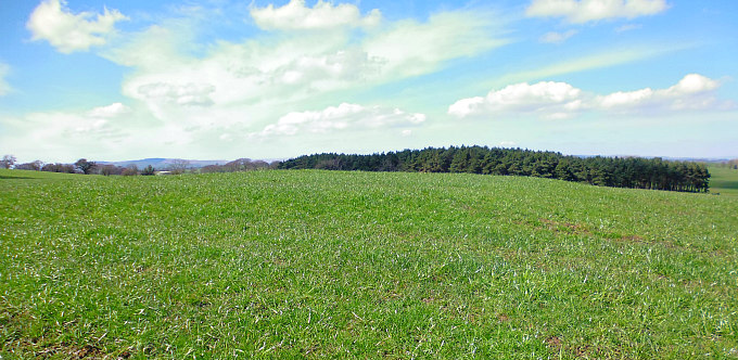
NGR: NY 9987 1030. In 1945 two Roman shrines about 15 metres apart were discovered by a shepherd on the bleak Scargill High Moor, in County Durham, about 3 miles to the south of the Roman fort of Lavatrae (Bowes). Inside these stone structures were altar-stones with inscriptions to the Roman god Vinotonus, also known as Silvanus, who was the god of the countryside, the moorland, the woodland, and animals. The two shrines were built at the western side of the East Black Syke, a stream which runs off the larger Eller Beck, and due to this the little buildings have suffered from erosion from the stream and some of the stonework having been washed away. Both shrines were set-up by Roman officers of the Thracian Cohort who were stationed at nearby Lavatrae (Lavatris). A year after the discovery of the shrines County archaeologists exca-vated and removed the altars and other artefacts, and deposited them in the Bowes Museum. From Gilmonby head S then SE on country lanes to The Rigg, then take the track heading SSE for a few miles to link up with a track heading W and then S onto the moor; this track heads down the East Black Syke beck on the opposite side from where the shrines were discovered. The Bowes Museum is on Newgate in Barnard Castle, while Bowes Roman fort lies under the Castle and St Giles’ Church on The Street in Bowes.

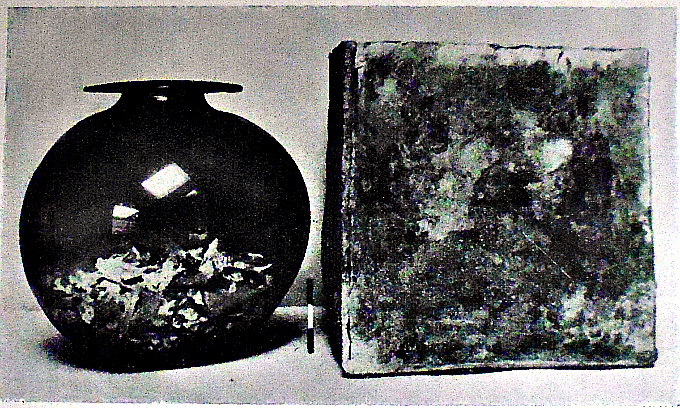
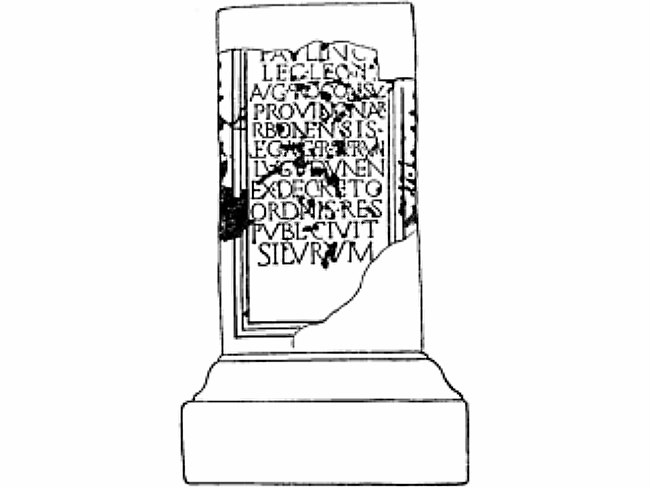
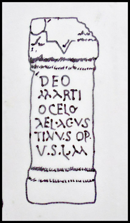
Arthur Raistrick (1972) tells us more about this, saying: “During 1945 two shrines were found on the side of a small stream, East Black Sike, just above its junction with the Ellerback. This is on the wild Scargill Moor about two miles south of the Bowes fort, at NY 998105. One shrine is a small rectangular building 12 ft 8 in. by 6 ft 3 in. inside, with walls 2 ft thick built of partly-dressed grit stones, and still standing in part to more than 3 ft high. The wall towards the stream has been destroyed by erosion. The floor was flagged and the burnt remains of a thatched roof covered it. The second shrine was of similar structure but was circular, 17 ft in diameter. At the middle of the back wall of each was an altar, and in the circular shrine the bases and fragments of six other altars, with some coins and pottery. The altar in the rectangular shrine has an inscription:                                                                                                                                              VINOTONO                                                                                                                                                                                                                  SILVANO. IVI                                                                                                                                                                                                              SECUNDVS                                                                                                                                                                                                                  COH.I.THRAC.                                                                                                                                                                                                           V.S.L.L.M.                                                                                                                     and this can be translated: ‘To Vinotonus Silvius Julius Secundus Centurion of the First Cohort of Thracians gladly and willingly fulfilled his vow’. The inscription on the altar of the circular shrine can be read: To the God Vinotonus, Lucius Caesius Frontinu prefect of the First Cohort of Thracians from Parma, gladly, willingly, and deservedly fulfilled his vow’.

“Silvanus was the god of the wild uncultivated land and of the wild creatures in it. At Scargill, the first altar identifies him with Vinotonus, the god of stream and place. The altars belong to the early part of the third century and the pottery suggests that the shrines were used intermittently into the fourth century, when the Roman officials felt like thanking the gods for a successful hunt. 

Raistrick writing in 1972 adds to the above, saying: “In the wild moorlands of Bollihope, tributary to the Wear valley, an altar was erected to Silvanus Invictus by Gaius Tetius Veturius Micanus, prefect of the Sebosian cavalry regiment, who gave thanks ‘after catching a lovely boar which previous hunters had hunted in vain’. In Weardale at Eastgate (the gate-house of the Bishop of Durham’s hunting park some centuries later), Aurelius Quirinus, a prefect of the first cohort of Ligonians, and commandant at Lanchester, erected an altar to Silvanus between A.D. 234 and 244. It may well be that natives found employment or were con-scripted into the hunt, driving, carrying, tending horses, and acting as general followers, or possibly by their local knowledge and skill contributing to the success of the hunt.”  

Richmond (1963) tells us that: “More romantic relics of ancient hunting are the shrines of Silvanus which sprang up in lonely cloughs on the high moors of the Pennines. These were erected by the commandants of Roman forts, wealthy men, mostly on the first rungs of their careers in the Imperial Civil Service, to commemorate successful hunting expeditions. Two are attested by altars only: one stone dedicated by Aurelius Quirinus, commandant at Lanchester (Co. Durham) and found at Eastgate in Weardale; the other erected by Sibinianus, commandant of a cavalry regiment, in remote Bollihope, ‘after catching a lovely boar which previous hunters had hunted in vain’. The third, boasting both altars and shrines, lay higher still, on the Eller Beck, south of Bowes (Yorkshire), 1,275 feet above sea-level. There the local commandant, Caesius Frontinus, and one of his centurions set up separate shrines to Vinotonus, a stream-god whom the centurion identified with Silvanus. The temples were simple structures, one round and the other rectangular, with stone walls and thatched roofs. Their ruins still half buried the altars when they were first observed by a shepherd.”   

More recently a flat stone, possibly a Roman tablet, was found in the East Black Syke stream near the shrines, but this was without any inscription, or maybe it has been eroded away by the water. Other fragments of stones and altars from the two shrine structures were deposited into the Bowes Museum, although some of them were probably washed down the stream.

Sources / References & Related Websites:-

Johnston, David E., Discovering Roman Britain, Shire Publications, Princes Risborough, Buckinghamshire, 2002.

Raistrick, Arthur, The Pennine Dales, Arrow Books Ltd., London, 1972.

Richmond I. A., The Pelican History of England — Roman Britain, Penguin Books Ltd., Harmondsworth, Middlesex, 1963.

File:Head of Silvanus crowned with pine, Centrale Montemartini, Rome (21952718528).jpg – Wikimedia Commons

1602 ‒ Scargill Moor Roman shrines | Roman Inscriptions of Britain

RIB 732. Altar dedicated to Vinotonus Silvanus | Roman Inscriptions of Britain

Roman shrine on Scargill Moor, Scargill – 1002317 | Historic England

Heritage Gateway – Results

The Bowes Museum > Home

Copyright © Ray Spencer, The Journal of Antiquities, 2021.


Ditchley Roman Villa, Near Charlbury, Oxfordshire

A typical Roman villa in England, although Ditchley was smaller.*

NGR: SP 39932 20104. In a field about ½ a mile southeast of Ditchley Park, near Charlbury, Oxfordshire, are the visible earthworks of a Roman villa. This grassy, rectangular-shaped earthwork is to be found just to the east of a wooded area (Harry’s Plantation) in the location known as Watts Wells Field – northeast of Lodge Farm. Although it has always been called “Roman villa” more than likely it was a Roman farmstead, which had a boundary ditch (dyke) enclosing it and an entrance at the south side; but because it was still inhabited into the 5th century AD, ‘Romano-British’ farmstead seems more appropriate. The rectangular earthwork is said to be 330 x 300m. Nearby are remains of a Roman bath-house, ancient field system and Grim’s Dyke, and 1½ miles south is the Roman road (Akeman Street). 1½ miles northeast of Charlbury at the B4437 (Woodstock Road) take the lane north to Lodge Farm, then follow the footpath northeast and then east to the next field – the villa (site) is in this field, just a little to the south of the footpath.

The Wikipedia website has the following: “It was a collonaded house with outbuildings, threshing floors, and a granary with capacity for the produce of about 1,000 acres (400 ha) of arable land. It was surrounded by a rectangular ditch 360 yards (330 m) by 330 yards (300 m). The site is less than 2 miles (3.2 km) north of the course of Akeman Street Roman road and is one of a number of Roman villas and Romano-British farmsteads that have been identified in the area, apparently associated with the territory bounded by Grim’s Ditch. The villa site was identified by aerial archaeology in 1934 and excavated in 1935. It was found to have been first settled in about AD 70 with a set of timber-framed buildings, which were replaced in stone in the 2nd Century. In about AD 200 a fire severely damaged the stone buildings and the site was abandoned. The site was reoccupied early in the 4th century, and occupation on a more modest scale than before continued until the end of that century.” (See the link, below).

Ground plan of Ditchley Roman Villa, Oxfordshire (after Oxoniensia vol.i,p.28).

Richmond (1963) tells us that: “At Ditchley (Oxfordshire), the timber posts which formed the first version of the earliest house plainly indicate the simplest kind of structural beginning, comparable with the now rare but once common timber arcades of Norman domestic architecture, of which carpentry made a delightful thing. The first stone-built Ditchley house differed little from Lockleys or Park Street, and it is probable that only a loft-like first floor was provided, if at all. But about the turn of the first century A.D. there were added a new stone-built veranda and projecting end rooms which gave to the establishment both privacy and a new elegance. There was now room for re-creation and entertainment in what had been previously a workaday farm, wherein the whole house had lived together. Socially speaking, the new plan divided the household and accentuated the position of master and mistress. In Britain this type of house became widespread, and it brought the new province into touch with the mainstream of contemporary West-European domestic archi-tecture. For in Gaul or the Rhineland the design was generally common, and went with a sizeable farm. And so it was in Britain, for on the basis of its granary accommodation the Ditchley villa has been related to an estate of five hundred acres. This supplies, then, a kind of yardstick, however rough, by which the size and standing of different kinds of villas can be gauged. Even allowing for the fact that, on the ancient system of crop-rotation, one-third of the arable lay fallow each year, it becomes clear; that by this standard the numerous  bigger villas must have been related to very substantial estates indeed. Not enough is known about the social organization of such larger estates to say whether they were run by slaves or by crofter-labourers. But where a resident staff of labourers appears, their accommodation nearly always takes the form of a barn-dwelling, frequently ranged on one side of a farmyard or court. This structure, convenient for so many purposes, is planned with nave and aisles divided by timber columns. As in Friesian farm-houses today, the nave served for stores, tools, and livestock, while the aisles or the whole of one end of the building were partitioned to house the workers. In the form of a subsidiary building essential to the working of a farm this type of house was so general, even in the largest establishments, that its prototype has been sought in the pre-Roman days. But no proof of such antecedents has yet appeared, and it may well be that this type is borrowed from the Italian villa rustica. There are some villas also in which this type of house is the only domestic accommodation present, as for examples Clanville (Hampshire) or Denton (Lincolnshire). These represent either small tenant farms or bailiff-run establishments, where the distinction between tenant or supervisor and workers was less sharply defined. Some, as at Castlefield (Hampshire), are so primitive in their arrangements that any distinction seems out of the question.”

Hawkes (1975) with Roman villas in general, says: “These range in size and dignity from large “country houses” to quite modest farm-houses. They were most numerous and prosperous in the Home Counties, but frequent enough right across southern England, with noticeable concentrations in Hampshire, the Isle of Wight and the Cotswolds. The most elaborate villas were built round a courtyard; others had a main block with wings, very many consisted only of a single block with rooms opening on to an arcaded corridor. Their remains often include foundations of brick or stone walls, mosaic floors, small column bases, hypocaust columns from the central-heating system, and, of course, the usual Roman litter of bricks, tiles and potsherds. The buildings seem often to have been enclosed with an outer boundary ditch or wall, and the estates attached to them must sometimes have been extensive.” 

The Wikipedia websites also tells us that: “Some time before the villa was discovered, a hoard of 1,176 bronze Roman coins was found between Box Wood and Out Wood, about 600 yards (550 m) to 700 yards (640 m) northeast of the villa site. The coins range in date from about AD 270 onwards and seem to have been buried in a ceramic pot about AD 395, towards the end of the Roman occupation. The hoard was transferred to the Ashmolean Museum in Oxford in 1935.

Grim’s Ditch, which passes through the present park and estate, is an ancient boundary believed to have been constructed during the Roman occupation of Britain in about the 1st century AD. The toponym ‘Ditchley’ is derived from a compound of two English words, meaning the woodland clearing (“-ley”) on Grim’s Ditch.” (See the Wikipedia Link, below).

Sources / References & Related websites:

Hawkes, Jacquetta, A Guide To The Prehistoric And Roman Monuments In England And Wales, Cardinal (Sphere Books Ltd), London, 1975.

https://en.wikipedia.org/wiki/Ditchley

*Liversidge, Joan, Then And There Series—Roman Britain, Longman, Green And Co. Ltd., London & Harlow, 1969.

Richmond, I. A., The Pelican History Of England—Roman Britain, Penguin Books Ltd., Harmondsworth, Middlesex, 1963. 

https://historicengland.org.uk/listing/the-list/list-entry/1009420

https://www.pastscape.org.uk/hob.aspx?hob_id=334570

https://www.british-history.ac.uk/vch/oxon/vol1/pp306-324

https://www2.rgzm.de/transformation/unitedKingdom/villas/VillaeLandscapes.htm

More information here Ashmolean Museum

© Ray Spencer, The Journal of Antiquities, 2020.


2 Comments

The Multangular Roman Tower And Defensive Walls at York, North Yorkshire

The Multangular Roman Tower, Eboracum (York)

NGR: SE 60012 52072. At the east side of York city centre, just off Museum Street (A1036), and in the Yorkshire Museum’s gardens (at the north side) overlooking the River Ouse is the famous ‘Multangular Tower’, a defensive structure (with 10 sides or angles) belonging to the western corner of the Roman fort of Eburacum or Eboracum, which was built around the year 300 AD during the reign of Constantius I (Chlorus). The lower section of the tower with its nice, neat stonework is the Roman part whereas the top section with the larger stonework and arrow slits is 13th century. It is certainly the finest, and the best preserved, of all the Roman defensive structures in the city; and also there is a well-preserved 76 foot section of Roman wall (early 3rd century and still 17 feet in height, but without its parapet) running northeastwards from the Multangular Tower through the museum gardens toward Bootham Bar; along this section of wall there is the stump of an interval tower. Access to the York-shire Museum Gardens (close by Lendal Bridge) is from either Museum Street or Marygate. Also look out for the ruins of St Mary’s Abbey and St Leonard’s Hospital.

The Wikipedia website gives the following: “A low plinth or skirt extends out from the lowest course. It stands almost 30 feet (9.1 m) tall, has an external diameter of 48.5 feet (14.8 m) at the base and 46 feet (14 m) above the skirt. Length of each side varies from 7.5 feet (2.3 m) to 11 feet (3.4 m) on the inner face. The tower projects beyond the curtain wall to a distance of 36.75 feet (11.20 m). The foundations are concrete, atop which the tower extends having a rubble and mortar core between faced courses of small magnesian blocks. At 15 feet (4.6 m) a scarcement reduces the thickness of the wall from 5 feet (1.5 m) to 3.25 feet (0.99 m), which continues for a further 4 feet (1.2 m) before being capped by 11 feet (3.4 m) of 13th century masonry in which arrowslits can be seen”, according to Wikipedia. (See the Link, below).

Herman Ramm (1979) says that in: “About AD 300: The defenses were again rebuilt except for the section from the south-east to the north-east gates which includes the east corner. The new wall was similar to the old except that the facing was bonded to the core by a tile band and had a tile cornice. This can still be seen at the west angle where there is also the stump of a great projecting tower, the Multangular Tower, matched by another (not now visible) at the south angle. Along the south-west side, facing the Ouse, were six only slightly less imposing interval towers and a great gritstone gatehouse.

“The reasons for these changes are not always certain……but “is often said to be the result of another similar disaster, but the new architectural frontspiece added to the river front of the fortress suggests that it had attained a new dignity, probably that of becoming the seat of the new Dux Britanniarum, commander of the land forces of all Britain.

Herman Ramm goes on to say that: “Inside the fortress timber buildings have been found, for example near St. William’s College and off Blake Street, which must relate to the timber defences. The headquarters building was first built in stone in the early 2nd century (Trajan-Hadrian), but its next reconstruction in the early fourth century was Constantinian rather than Constantian. It was not demolished until the ninth century.”

Tom Garlick (1988) tells us that: “In the early 4th century the fortress was again strengthened by Constantius Chlorus following the troubles of 296. The river façade was now equipped with two fine polygonal angle towers, six close set interval towers and a new impressive towered gateway. These alterations made York one of the strongest defended and imposing fortresses of the Roman Empire. The south-west corner tower — the ten sided Multangular tower faced in small ashlar blocks — still survives in the Museum Gardens. Once fronted by ditches, its upper storey held powerful catapult artillery.

“Constantius I died at York and his son Constantine was proclaimed Emperor there. In the administrative reorganization of the 4th century, York became the headquarters of the Duke of Britain, a new military cavalry commander. In the third and fourth centuries Whitby jet was manufactured into rings, pins, necklaces and portrait medallions in the town and mar-keted in the Rhineland. By the late Empire there were Christian churches in the colonia and a bishop of York attended the church council in Arles in France in 314. The legionary garrison was evacuated in the late 4th century but town life seems to have continued into sub-Roman times and the Dark Ages.”

The Multangular Roman Tower at York (photo).

Mr Garlick adds more, saying that: “Today the fortress area, canabae and colonia lie buried beneath the modern city. The main lines of the camp’s streets are still preserved in Stonegate and Petergate, and the Minster stands over the Roman headquarters. Visitors can still inspect sections of the Roman defences. The Multangular tower is the finest survival, together with 35 feet of adjacent wall surviving to a height of 13 feet. Inside, the position of barracks is known, as is a bath house under the Mail Coach Inn in St. Sampson’s Square and the legionary head-quarters crosshall under the Minster. Modern buildings cover the canabae and the site of the presumed amphitheatre. No traces survive above ground of the colonia but its street plans and some of its buildings are known from excavation and chance finds. The cemeteries were extensive and lined the town’s approach roads. Visitors should establish the line of the Roman fortress and town walls as compared with the later medi-eval city walls and visit exposed Roman defences. The Yorkshire Museum contains an extensive collection of inscriptions and finds from the city which throw interesting light on the history of Eboracum and its inhabitants during the four centuries of Roman rule. In 1971 the city celebrated the 1,900 anniversary of its founding by Cerialis.” 

Richmond (1963) tells us: “At Eburacum (York) literature similarly records a shrine of Bellona, the Goddess of War, and there is a noble head of Constantine* as Caesar or newly-proclaimed Emperor.” *The head of Constantine can be seen in    The Yorkshire Museum.

Richmond goes on to tells us about jet, saying that: “Solinus describes British jet with interest, as a substance heated with water but quenched with oil and magnetic when rubbed. These paradoxical qualities endowed jet with almost magical esteem, and it became a favourite material for ornamental jewellery, much of which was manufactured at Eburacum (York). Hair-pins, spindles, finger-rings, and bracelets were made in great variety, some bracelets and many necklaces being ingeniously articulated in minute component pieces. Elaborately carved pendents and medallions, including family groups executed to order, and teddy-bears, represent either profitable lines of production.”

Sources / References & Related Websites:

Garlick, Tom, A Dalesman White Rose Guide — Roman Yorkshire, The Dalesman Publishing Company Ltd., Clapham, 1978.

Ramm, Herman, Roman York From A.D. 71, Yorkshire Architectural and York Archaeological Society, York, 1979.

Richmond, I. A., The Pelican History Of England — Roman Britain, Penguin Books Ltd., Harmondsworth, Middlesex, 1963.

The AA, The Illustrated Road Book Of England & Wales, The Automobile Association, London, 1962.

https://en.wikipedia.org/wiki/York_city_walls#Multangular_Tower

https://en.wikipedia.org/wiki/York_Museum_Gardens

Check out this website: https://yorkcivictrust.co.uk/heritage/civic-trust-plaques/roman-fortress/

http://www.historyofyork.org.uk/themes/roman-empire-governed-from-york/the-multangular-tower

https://historicengland.org.uk/services-skills/education/educational-images/multangular-tower-and-wall-museum-gardens-7913

Multangular Tower

© Ray Spencer, The Journal of Antiquities, 2020.


Roman Altar-Stone in All Saints Church, Wigan, Lancashire

Roman-Altar Stone in All Saints Church, Wigan, Lancashire.

NGR: SD 58168 05667. All Saints parish church on Bishopgate, Wigan, Lancashire, houses part    of a Roman altar-stone that is said to have come from the Roman station of COCCIUM (COCCIO) – Wigan, which was probably built in 70 AD, and was located on the hill where the parish church now stands. There is no trace of this roman fort or camp today – the parish church of All Saints taking its place. The altar-stone, which has curved, scroll-like features at each end, has a 17th century inscription on its visible side whereas a Latin inscription on the opposite side is ‘not visible’. It was probably dedicated to the Roman god Mithras. A “presumed” Roman road runs west from MAMVCIVM (Manchester), converging in the centre of the town and then running northwest to Walton-le-Dale, while another Roman road runs south from Wigan towards Warrington, Wilderspool and on to Northwich (CONDATE). A Roman bath-house has recently been excavated where the Shopping Arcade now stands in the town centre. All Saints church, a mid 19th Century building, is easy to find at the southeast corner of Bishopgate, just off Market Street, in Wallgate, and opposite the War Memorial. 

The Church guide book says of the Roman altar, that: “Of special interest under the Tower are the window in the west wall which, though much restored, dates from the 13th century, and part of a pagan Roman Altar which is built into the splay of the east side of the modern window in the north wall. It was found in the rebuilding of 1845-1850 buried beneath the High Altar and was placed in its present position then. It is unfortunately only partly visible, so that it is impossible to tell whether it has a Roman inscription on the hidden side. On the exposed face is a half obliterated modern inscription, dated 1604. It was probably used in the Roman station of Coccium, which can almost certainly be identified with modern Wigan, and which probably stood on the hill now occupied by the parish church.” 

D. C. A. Shotter (1973) tells about the Roman site of Coccium, saying: “The next site northwards in probably Wigan, although no structural remains of Roman occupation have been found there. The chief evidence for the existence of a Roman site under the present town comes from Route 10 of the Antonine Itinerary, which gives distances on a route from Ravenglass (Cumberland) to Whitchurch (Shropshire). The middle section of this route is given as GALACUM (probably Burrow in Lonsdale). BREMETENNACUM (certainly Ribchester), COCCIUM and MAMUCIUM (almost certainly Manchester). The distances given are too great to refer to any settlement between Ribchester and Manchester on the direct route, but they will fit a route that runs from Ribchester to the Coastal road at its junction in Ribblesdale, then south to Wigan, and thence to Manchester on the road attested by the 19th Century observers. Thus Wigan would provide an identification for the elusive site of COCCIUM, and in Roman times it will have been entered from the South, the East and the North respectively by Wallgate, Millgate and Standishgate.

“Further evidence comes from the finds made in and around Wigan. To judge from cinerary urns recovered from the area of the gas works, a cemetery appears to have lain on the South side; the Church has a Roman altar built into it; further, various coins have been found in the area, including a hoard of some 200 coins recovered in Standish in the late 17th Century; this hoard contained coins from the late 1st to the mid-3rd Century A.D. Another important find, this time from Dalton (five miles north-west of Wigan) is the headless statue of Cautopates………, one of the attendants of the god, Mithras.” 

Joseph P. Pearce (2005) says that: “Here, on the rising land within a loop of the river Douglas, the Roman Conquerors of Britain have founded their camp and castlefield. The Roman road leading from Warrington to Preston and Walton-le-Dale, passed through the very centre of the town of Wigan, bearing the traffic of the Legions and the Guilds and Trades of old. Four streets radiate from the Market Place—Standishgate, Wallgate, Millgate, and Hallgate; all bearing a Roman stamp. A stone from a Roman altar has been found, embedded within the walls of Wigan Church. Here the Romans ruled until that day when Rome, herself, was beset by barbarian hordes. Then the Roman soldiers were withdrawn from Britain and the ancient British race was left to the cruel mercy of the Norsemen.”

All Saints Church, Wallgate, Wigan, Lancashire.

Besides the Roman stone there are other interesting features in All Saints. In the Crawford Chapel   is a tomb with recumbent and battered effigies of Lady Mabel de Bradshaw of Haigh Hall and her husband William, a now rather forlorn and somber monument that has stood here since the 14th century. Lady Mabel is the heroine of the famous Wigan Cross or Mab’s Cross in Standishgate, which dates back to 1338 when it was set up by Mabel, a saintly and charitable lady…… who endowed her chapel with property in Haigh and Wigan to enable a priest to celebrate divine service at the Altar of the Blessed Virgin Mary in Wigan Church, remembering especially the souls of herself after death, King Edward II, her husband, Sir William, her parents and all her ancestors, Roger, then Bishop of Coventry and Lichfield, and all the faithful departed, says the Church guide book. The very ornate font in the south aisle is 14th-15th Century and its large gritstone bowl can be seen close-by. It has a band of quarter foils run-ning around its outer surface; apparently this was in use as a water butt in the gardens of the hall before being being restored   to the church.

And finally, there was at one time in the past a school of thought indicating perhaps that the Roman station of Coccium was located on Castle Hill, 3 miles east of Wigan, at Hindley, in Lancashire (NGR: SD 62460485). However, this thought, account, or suggestion now seems to have been ‘completely discounted’, and is not the case with Coccium, which is nowadays considered to have been where the parish church of All Saints is now to be found in Wigan town centre. There was, however, a Medieval structure on Castle Hill, at Hindley, which was probably a timber castle.

The Historic England List Entry No. is:- 1384556.

Sources / References and related websites:-

Church guide book, The Parish Church of All Saints, Wigan — A Short History and Guide, 2003. The two images (above) are from this guide.

Pearce, Joseph P., Lancashire Legends, Book Clearence Centre, Wigan, 2005. (Originally published by The Ormskirk Advertiser, 1928. This edition is re-published with the kind permission of the Liverpool Daily Post & Echo Group).

Shotter, D. C. A., Romans in Lancashire, Dalesman Publishing Company Ltd, Clapham, Yorkshire, 1973. 

Mab’s Cross, Standishgate, Wigan, Lancashire

https://en.wikipedia.org/wiki/All_Saints%27_Church,_Wigan

https://historicengland.org.uk/listing/the-list/list-entry/1384556

https://www.british-history.ac.uk/vch/lancs/vol4/pp57-68

http://www.wiganarchsoc.co.uk/content/Projects/Millgate/wbe1.html

http://www.wiganarchsoc.co.uk/blog/?page_id=420

© Ray Spencer, The Journal of Antiquities, 2019.


2 Comments

Uncra Roman Fort, near Keighley, West Yorkshire

Old Map of Uncra Farm, near Keighley.

The site of Uncra Farm (today).

NGR:- SE 0858 4142. The lost (forgotten) Roman fort of Uncra was located where the farmstead of that name used to be – close to the bank of the River Aire, and roughly halfway between East Riddlesden Hall and Marley – at the northeastern side of Keighley, West Yorkshire. Uncra farm was said to have been built on the site of the Roman fort or camp. The location of this “lost fort” was in the field at the north side of the present A650, which used to be called Marley Road. However, on the site ‘today’ there is the Marley Sewerage Works, which seems a great shame to me, though the field at the north side might still have slight traces; other than that there are no visible remains. Sadly, it is lost to the Mists of Time. The Roman road from Manchester to Ilkley, or maybe a medieval track, ran through this area and crossed the River Aire by way of a wooden bridge. Fragmentary sections of this, or a later bridge, were excavated in 1929, and a number of Roman coins and, some fragments of a Saxon cross, were found close to East Riddlesden Hall. There is a display of Roman coins in the hall.

Marie Campbell (1999) tells us about this site, saying that: “Long before the River Aire changed its course in about AD 78, a Roman fort is believed to have existed between East Riddlesden and Marley Hall, near Keighley. The road to the fort is thought to have stretched along Hog Holes Lane, Long Lee, cutting along Parkwood Top before its decent to Uncra and Marley. Here it passed over the ford at the River Aire to climb the steep slopes of Morton Banks and beyond. The farmstead of Uncra was supposed to have been erected over the fort’s foundations. From the August pages of the Keighley News 1883 a clue to the site of Uncra Farmstad may be gleaned. Mr F. Morgan, a tenant of Uncra farm, reported smoke rising from a haystack, the property of Mr Wallbank of High Shann Farm. The haystack was in a field by the River Aire, close to his farmstead and bordered by Keighley Corporation tip and local gasworks.”

Campbell goes on to say: “A severe drought in the 1850s at Uncra near Marley revealed an ancient oak and sycamore bridge, 120cms wide and 18 metres across. It rested ‘upon uprights fixed into three blocks of masonry with large-headed nails and wood pegs’. During the 1920s antiquarians digging at the site recovered a large block of stone with a hole in the centre. Masonry dispersed on the water’s edge was thought to be ‘the central pier, the river having changed its course since the bridge was erected’. Horsfall Turner in his History of Ancient Bingley said of Marloe/Marley Bridge. ‘”I have no memo-randum to show this bridge was destroyed”‘. The Sessions Rolls of 1650 to 1700 reveal that, ‘the ford through the water where carts and carriages with wyne and oil and iron pass from the city of York to the market town of Keighley is worn with pitts so as to be very dangerous to passengers’. In January 1687 the wooden bridge was restored at a cost of £230. In 1929 Mr C. Bailey of East Riddlesden Hall granted permission to dig part of the Aire and its banks in this location during a drought. A number of faced stones were found in the mud, about 60cms higher than the course of the river running between Marley and Riddlesden Hall. This was close by the present course of the river near How Beck. Excavations on the North bank uncovered the sycamore central trestle sighted by antiquarians way back in the 1850s. The trestle was removed from the site and presented to Keighley Museum by its finders. It was transferred to Cliffe Castle but has since disappeared, perhaps disintegrating after being dredged from the riverbed. With only obscure references to the existence of the ancient cart ways and bridge to Uncra, had it not been for two very dry spells all may have lain hidden forever from sight.”     

Marie Campbell (1999) adds that: “The dreaded Ninth Roman Legion, a body of 5000 men, was stationed somewhere near Uncra in AD117 according to two local amateur archaeologists in the 1980s. They said they believed the whole legion to have been massacred within a two-mile radius of Crossflatts. Two coffers, one containing gold and the other bronze coins, are supposed to have been hurriedly secreted near the banks of the River Aire by Roman paymasters. The Yorkshire Archaeological Society is sceptical about this theory although the archeologists have found, with the aid of a metal detector, several fragments of metal which had once been part of a spear, a metal skirt tailpiece and a medallion. They were dug from the ground close to Druid’s Altar, a plateau high above Uncra and Marley.

“In the summer of 1917, a Mr Bennet discovered a small bronze eagle in almost perfect condition in a newly ploughed field to the north of Parkwood Top Farm, Keighley. The area is identified on the 1919 OS map as enclosure 528. This spot is only a mile or so distant from where the old Roman road from Manchester to Ilkley once ran. Bennet handed the Bronze figure over to Keighley Museum. Expert Alex Curle from the Museum of Antiquities had no doubts as to its Roman authenticity. He thought it might have been a finial for a staff. Again at Parkwood, a hoard of Roman coins was found by a man named Robert Lister in Edwardian times.”

Sources / References & Related Websites:

Campbell, Marie, Curious Tales of Old West Yorkshire, Sigma Leisure, Wilmslow, Cheshire, 1999.

Ordnance Survey, Historical map and guide — Roman Britain, South Sheet, Fifth Edition, Scale: 1:625 000, Ordnance Survey, Southampton, United Kingdom, 2001. 

http://roadsofromanbritain.org/gazetteer/yorkshire/rr720a.html

https://www.nationaltrust.org.uk/east-riddlesden-hall

https://en.wikipedia.org/wiki/East_Riddlesden_Hall

Click to access L9970_CompleteRep.pdf

© Ray Spencer, The Journal of Antiquities, 2019.


Barrow Hill Tumulus (West Mersea), Mersea Island, Essex

Glass Burial Urn

Roman Glass Funery Urn & Lead Cist from West Mersea Burial Mound (tumulus).

OS Grid Reference: TM 02257 14341. At the southeastern side of Barrow Hill at West Mersea on Mersea Island, overlooking Pyfleet Channel, in Essex, there is a large tree-covered mound which is a round barrow (tumulus). In this burial mound a Romano-British king was probably buried   at the end of the 1st Century AD, or in the early 2nd Century, so the story goes. However, there seems ‘now’ to be some uncertainty about the age of the monument. When the barrow was ex-cavated in 1912 a glass cinery urn was found in a lead container. This contained a child’s remains. Locally the barrow is called ‘The Mount’. The burial mound is 1½ miles north-east of St Peter & St Paul’s Church, West Mersea, and 9 miles south of Colchester. The island, which is 5 miles long, is reached by a causeway (southeast of Peldon) called ‘The Strood’ which crosses over the creek; then follow the East Mersea road for a ¼ of a mile, keeping to the left, until you reach Barrow Hill. The tumulus is to be found beneath the tall trees close by Barrow Hill farm.

The Historic England website says that: “The monument includes the known extent and buried remains of a Roman barrow situated on relatively high ground at the north-west edge of the central plateau of Mersea Island overlooking the Pyfleet Channel. The flat-topped conical mound mound is some 35m in diameter and 7m high. The top has a diameter of some 5m. There is no enclosing ditch. Excavations carried out by the Morant Club in 1912 found that the mound contained a burial dating from the late first to early second century AD. The burial chamber, sited slightly off-center, was dug into the original ground surface so that its floor was some 38cm beneath this level. The chamber measured some 45cm wide by 54cm high. A foundation of boulders and broken tile supported a floor of two roof tiles; seven courses of flanged roofing tiles formed the walls, with the two upper courses slightly corbelled to support the roof, which was made of a single tile some 54cm square. Within the burial chamber, the cremated remains of a child were found in a glass flask placed within a small lead casket with a wooden lid. The structure of the mound comprised a consolidated central core of impure quartz sand, above which was mixed gravel and sand. Following the 1912 excavations, a passage was constructed through the excavation trench to the burial chamber; this is extant and facilitates viewing of the inner chamber. All modern fence lines, railings, walls, made-up surfaces and the wooden Wendy house are excluded from the scheduling, although the ground beneath these features is included,” according to Historic England. See their website, below.

Benham’s (1946) says of the West Mersea Sepulchral Deposit, that: “A glass urn (containing bones) and the cist in which it was discovered. Exhumed from a large tumulus at Mersea, the deposit is supposed to have been in honour of a British chieftain (1st Century).” These antiquities were to be found in Colchester Castle Museum, but they are now in the Mersea Museum. Benham’s then adds, saying: “Roman Glass: Included in this collection is the magnificent glass urn, containing burnt human bones, found in a large barrow or tumulus at West Mersea.”   

Richmond (1963) tells of: “……….Another very large tomb was the circular mausoleum at West Mersea (Essex), a stone-revetted structure with earth fill, sixty-five feet in diameter, braced by radiating walls and marginal buttresses.”

Benham’s (1946) tells of other Roman remains on Mersea Island, saying that: “When some alterations were being made in West Mersea Hall, which stands near the church, about the year 1730, a fine Roman tessellated pavement was discovered. In the chancel of the church was found a pavement of red tesserae an inch-and-a-half square, forming rays of stars. From the diversity and continuity of these tesserae, extending nearly 100 feet from east to west, by about fifty from north to south, it has been conjectured that this grand mosaic pavement was not merely the groundwork of a general’s tent, but rather that the whole belonged to the villa of some Roman officer, who might have been invited by the delightfulness of the situation to make this his summer abode. In 1920 a Roman pavement was found in fixing a telegraph pole forty feet south of Yew Tree House, and a further portion of the same pavement was uncovered in 1931 in the garden of the house.

“West Mersea Church (St. Peter and St. Paul)…….The stone upon which the church font (which has a 13th century bowl) rests has been supposed to be the cupola of a Roman column. In December, 1896, not far from the church, the foundations of a circular building were unearthed. The ground plan of this building was that of a 65-ft. diameter wheel, with six spokes, and a central hexagon “axis” five feet across. The structure is Roman and is obviously the base of a large tomb, though it has been thought by some to have been a Roman lighthouse.”

The Historic England List Entry No. is 1019019.

Sources / References and related websites:-

Benham’s, Colchester — a history and guide, Benham And Company Limited, Colchester, 1946. 

Richmond, I. A., The Pelican History Of England — 1 Roman Britain, Penguin Books Ltd., Harmondsworth, Middlesex, 1963.

https://historicengland.org.uk/listing/the-list/list-entry/1019019

https://www.merseamuseum.org.uk/mmbarrow.php

https://www.eadt.co.uk/news/mersea-mystery-of-the-island-bones-is-finally-solved-1-2246793

https://colchesterheritage.co.uk/monument/mcc6928

https://en.wikipedia.org/wiki/West_Mersea

© Ray Spencer, The Journal of Antiquities, 2019.


1 Comment

Roman Bath-House at Ribchester, Lancashire

Roman bath-house at Ribchester, Lancashire.

Roman bath-house remains, Ribchester.

OS Grid Reference: SD 65090 35206. In the village of Ribchester, Lancashire, are the excavated foundations of Roman bath-houses, dating from around 100 AD, though there may have been an earlier Flavian structure here. The ruins are to be found in a secluded area at the back of the White Bull Inn and Water Street – at the north-western side of the River Ribble, and in an area of the village that is called Greenside. It would seem that the bath-house only survived for a few hundred years, if that, being built outside of the Roman fort of (BREMETENNACVM’s) ramparts. Excavations took place in 1978. The foundations of the bath-house are now well-looked after, with green lawns in between, and excellent information boards to boot! The White Bull Inn has four Doric or Tuscan columns supporting its front porch – two of which could have come from the bath-house, the fort or a temple? In the village from Church Street (south-side) follow the footpath (east) beside the river, and then northwest through the wooded area to the bath-house site.

John & Phillip Dixon (1993) give some good information regarding the bath-house remains. They tell that: “Another Roman feature to be viewed is the excavated Bath House, located at the rear of the White Bull. Recently erected explanation boards help one to pick out the outline of the bath house amid the crumbling piles of stones (the excavation was a costly disaster and much damage was done to floor tiles, walling etc.). 

“It consisted of a furnace room with three flues, the two southerly ones leading to the Caldarium (hot room) and the Tepidarium (warm room) respectively. The third leads to the Sudatorium (sweating room), this being round in shape. A fourth room on the south east of the building was the Frigidarium (cold room) with an apodyterium (changing room) adjacent to it. A stone-lined well stands on the south west corner of the site.”

Roman Bath House ruin

Roman Bath House foundations and Well.

The authors go on to say: “The building was erected in the 2nd century, with rebuilding work in later years. The whole structure was in use well into the late 4th century. On display inside the White Bull is a conjectured reconstruction in model form of what the bath house may have looked like in its heyday, along with a good example of a Samian ware bowl that was found hereabouts: Samian ware was first identified on the Greek island of Samos, hence its name. It is a fine hard red ware, burn-ished, with moulded designs, produced and exported throughout the Empire from the potteries of Gaul. This ‘terra sigillata’ was mass produced tableware, developed in slightly simplified versions of originally Italian prototypes. This type of pottery predominated until the Gaulish factories were forced to close during the revolts of around 250.” 

Richard Peace (1997) tells us more, saying that: “An explanatory board explains the complex system of underground heating. The baths were basically a version of the modern sauna, involving heating and cooling the skin then scraping off the exposed dirt with an instrument known as a stirgil. In the museum a small model reconstructs a cross section of the bath houses. The baths were situated some way away from the main fort so as not to constitute a fire hazard and a timetable existed to segregate female from military and male use.”

D. C. A. Shotter (1973) says of the site that: “Excavation has also revealed to the North of the fort the presence of a large vicus, which apparently grew around the road outwards to the North. This seems to have been occupied from the 1st to the 4th Centuries A.D. and in the early stages at least to have consisted largely of timber buildings. Buildings known to have been included in the vicus are a temple (known from an inscription) and a large bath-house, which was shown by excavation to belong to the 2nd Century and to overlie a Flavian predecessor.”

Jessica Lofthouse, writing in 1974, has nice things to say about Ribchester: “I like it for what it is, an honest to goodness community without any frills or attempt to exploit its undoubtedly rich past. No Ye Olde Praetorium Guest Home, or Minerva Café, or Agricola Gift Shoppe about Ribchester, but it has a good, compact Museum of Roman Antiquities, an hour in which is most rewarding.

The Information board at the bath-house.

“Tracking down the Romans is fun. Their mark is found in pillars intended for temples but now holding up the porch of the White Bull Inn, the quaint façade of the Stydd Almshouses and the church gallery. You can walk the fort earthworks west of the churchyard, gaze down on granary floor and hypocaust in the Museum gardens, and trace the foundations of a gateway through which the legionaries passed. The pleasant house at the church gates is on the site of the fort commandant’s H.Q. Within the churchyard, so green and immaculate, a gem among country graveyards, you may ponder on what lies beneath, on the forms of ritual practiced by the Romans within the fort………”

Lofthouse goes on to say: “For three centuries Bremetanacum was an active cavalry fort on Julius Agricola’s military highway linking Chester and Manchester  with the Wall. The Ribble fort was at the hub of five great roads. The camp contained within five and three-quarter acres.” 

For information on the Roman fort and museum at Ribchester see the following link:  https://thejournalofantiquities.com/2012/08/02/roman-ribchester-photos/

Sources / references and related websites:-

Dixon, John & Phillip, Journeys Through Brigantia — Volume Nine — The Ribble Valley, Aussteiger Publications, Barnoldswick, 1993.

Lofthouse, Jessica, Lancashire Countrygoer, Robert Hale And Company, London, 1974.

Peace, Richard, Lancashire Curiosities, The Dovecote Press Ltd., Stanbridge, Wimborne, Dorset, 1997.

Shotter, D. C. A., Romans in Lancashire, The Dalesman Publishing Company Ltd., Clapham, Lancashire, 1973. 

https://www.pastscape.org.uk/hob.aspx?hob_id=43639

http://news.bbc.co.uk/local/lancashire/hi/people_and_places/religion_and_ethics/newsid_8973000/8973921.stm

https://historicengland.org.uk/listing/the-list/list-entry/1005110

https://www.visitlancashire.com/things-to-do/ribchester-roman-bath-house-p782220

Ribchester’s Roman Bath House

© Ray Spencer, The Journal of Antiquities, 2019.  


Pompey’s Pillar And Sphinxes, The Serapeum, Alexandria, Egypt

Pompey’s Pillar and Sphinx at Alexandria in Egypt.

Latitude:31.182515  Longitude:29.896394. On the rocky hill called ‘The Serapeum’ near the center of Alexandria, Egypt, are three monuments dating from the Roman period. The ornate granite ‘triumphal pillar’ or monolithic column (over 20m high) has wrongly been called ‘Pompey’s Pillar’ (it was probably erected to honour the Emperor Diocletion (297-300 AD) when he saved the city from famine. The pillar is also known as Awud as-Sawari (The Horseman’s Pillar). The two monuments (at either side) are Roman copies of the Sphinx, although much smaller than the more well-known Great Sphinx at Giza. Both are made from pink granite and of an earlier date than the pillar; they show the body of a lion and the head of a man. The Serapeum, at the south-west side of the city, on Shari Amûd al Sawari, northeast of the Catacombs of Kom al Shuqqafa, was the site of the Temple of Serapis and the Sanctuary and Library buildings, which were built either by Ptolemy I or III, the ruins of which are now the Acropolis Archaeological site. The  city of Alexandria was conquered by Rome in 30 BC. Pompey the Great was murdered in Egypt (48 BC).

Old Postcard showing Pompey’s Pillar at Alexandria, Egypt.

The Insight Guide – Egypt (1988) says of the site that: “Long before Alexander arrived on the scene, this hill was the citadel of Rhakotis, dedicated to the worship of Osiris. The Ptolemies in their turn built a temple of Serapis on its summit. Here, with a collection of 200,000 manuscripts given to her by Mark Antony, Cleopatra endowed the second great Alexandrian library, which was to remain attached to the Serapeum until the temple itself was destroyed by a Christian mob; and thus here, for 400 years, was the most learned spot on earth. Today not much of the Serapeum remains: some tunnels in the rocks with crypts and niches and a few marble pillars. What the Christians wiped out in 391 A.D. later vicissitudes have put paid to. But the principal attraction, a solitary 72-foot (22 meter) high pillar of pink Aswan granite, seems to touch the sky defiantly and when European travelers arrived in the 15th century it caught their attention. No scholars they, but since they had heard of Pompey, they named the pillar after him and said his head was enclosed in a ball at the top. It actually has nothing to do with Pompey: according to an inscription on its base, it was dedicated to the Emperor Diocletian in 297 A.D. and it may once have had an equestrian statue on top, which would explain its Arabic name. Even less is left of the temple to Isis that once stood on the hill than of the Serapeum. You can see a statue of Isis Pharia, found near the site of the Pharos, as well as two granite sphinxes.”  

Alice Taylor (1964) adds to that that: “Among the best-preserved remains of the Roman period in Alexandria are Pompey’s Pillar and the sphinx. The red granite pillar, eighty-five feet high, was erected by Diocletian in 297 A.D. Excavations here have unearthed dozens of fragments of other Roman objects and buildings, but they are only fragments.”

And Taylor (1964) also says that: “In the last years of the Ptolemaic era a succession of rival rulers, constantly at war with each other, fell under the rising power of Rome. Cleopatra VI, the last of them, a woman of remarkable ability, tried her best to save the dynasty.”

And further to that Alice Taylor adds with regard to Egypt that: “Most of the Roman rulers, like the Greek, considered Egypt a “”cow to be milked””, although at times the people appear to have been fairly prosperous. Gradually, despite persecutions, Christianity gained converts. Many sought refuge in the harsh lonely desert, where they created the world’s first Christian monasteries. Later, Christianity became the official religion, known as the Egyptian (Coptic) Church, and the non-Christians in turn were persecuted.”

View of Pompey’s Pillar c 1850. (Wikimedia).

Edith Flamarion (1997) writes regarding Pompey the Great that: “One man especially became the champion of Egyptian independence: the roman imperator (commander) Pompey the Great, wreathed in glory after suppressing a revolt in Rome, clearing the Mediterranean of pirates, and crushing the powerful Asian king Mithradates. In 64 BCE he over-threw the Seleucid kingdom; the following year, he reduced Syria to the status of a Roman province—thereby creating a Roman stronghold in the Middle East, at the gates of Egypt—and took Jerusalem. Auletes made an alliance with Pompey, sending him 8,000 cavalry for his wars and many gifts, among them a heavy gold crown. 

In 60 BCE, though, the pharaoh had reason to tremble, for Pompey allied himself with Julius Caesar, who became consul the following year. The Egyptian king sent to Rome the huge sum of 8,000 talents, which brought him official acknowledge-ment of his authority. Julian law declared Ptolemy XII Auletes “”an ally and friend of the Roman people,””  which made him, in reality, a vassal.

“The looming military presence of Rome may have alarmed the Alexandrians, who rebelled against the ruler. Driven out by his subjects, Auletes fled Egypt for Rome. There, beginning in 57 BCE he launched a campaign of politicking and corruption, seeking to regain the throne of Egypt and to rally to his cause every powerful citizen of the Roman capital. Auletes bribed senators, spending so much that he was obliged to borrow from Rabirius, a wealthy Roman financier. 

“In the meantime, the Alexandrians put his eldest daughter, Berenice IV, on the throne, and sent a delegation to Rome to request the Senate to arbitrate the conflict between father and daughter. While Rome hesitated, equivocated, and consulted sacred texts, Auletes simply arranged to have a number of the delegates assassinated. But Rome was reluctant to commit a large armed force to returning Auletes to power. In despair, the deposed pharaoh left Rome for Ephesus, in Asia Minor. Cleopatra, then about ten years old, remained in Alexandria, where her half-sister now reigned.

“It was then that Rome decided upon a military intervention. One of Pompey’s lieutenants, Gabinius, governor of Syria, marched on Egypt at the head of a mighty army—an expedition in which the ten thousand talents promised by Auletes undoubtedly played a part. Leading the cavalry was a fiery twenty-four-year-old officer named Mark Antony. Gabinius took Pelusium, then Alexandria; Archilaus, Berenice’s husband, died in combat. Auletes entered the Egyptian capital as its conqueror, and immediately had his daughter executed.

“With the pharaoh back on the throne, Gabinius quit Egypt, leaving behind a military guard composed in the main of German and Gallic mercenaries. The Roman Rabirius, Auletes’ creditor became his prime-minister in Egypt.”” And the rest ‘they’ say is History! 

Sources & Related Websites:

Flamarion, Edith, Cleopatra – From History to Legend, (New Horizons), English Translation – Harry N. Abrams, Inc., New York, 1997.

Ingram, David, (Insight Compact Guide), Egypt,  APA Publications GmbH & Co. Verlag KG Singapore, (Reprint 2008).

Taylor, Alice, United Arab Republic, (Around The World Program), Nelson Doubleday, Inc And Odhams Books Ltd., 1964. 

Youssef, Hisham & Rodenbeck, John, (Insight Guides – First Edition Reprint), Egypt, Hans Johannes Hoefer, APA Publications (HK) Ltd., 1988.

https://commons.wikimedia.org/wiki/File:

https://en.wikipedia.org/wiki/Pompey%27s_Pillar_(column)

https://www.ask-aladdin.com/Alex-Travel-Information/PompeyPillar.html

Serapea of Ancient Egypt

Alexandria: City of Lost Glory

© Ray Spencer, The Journal Of Antiquities, 2018.


Affetside Cross, Near Bury, Greater Manchester

Affetside Medieval Cross, near Bury, in Greater Manchester.

   OS Grid Reference: SD 75471 13676. At the edge of Affetside village green, near Bury, Greater Manchester, stands an old cross of uncertain date. It is probably Medieval but, because it stands on the old Roman road (Watling Street), some historians have even considered it to be a Roman cross or milestone, or even a Roman column, but that seems unlikely. It is probably a pilgrims cross. Watling Street runs southeast from Affetside towards Manchester, and northwest in the opposite direction towards Ribchester. The village green has some modern standing stones and a large pond. Affetside Cross is best reached from the A 676 (Ramsbottom road) and then southeast for ½ a mile along the almost straight-running lane that is the Roman road, bringing you into the picturesque little village, where you’ll find the old cross beside the green – you can’t really miss it!

Affetside Cross.

   Affetside cross is about 4¼ feet high on its three steps, well actually two steps, as the top step is in effect the base which the gritstone shaft is socketed into, while the two lower circular, tiered steps are well worn with age. The shaft is formed from one complete length of local stone. At the top of the shaft there is a collar with a round or bun-shaped capital which may originally have held a stone cross, or maybe it never did? This is perhaps why the cross-shaft has taken on the appearance of a Roman column! There looks to be some faint carving on the shaft, or is this simply the mason’s tool marks. Thought to be Medieval in date and probably a pilgrims cross that was used ‘as a place to stop and pray for a safe journey’ by those weary but very religious travelers – making their way to Whalley Abbey by way of Bury, Ramsbottom, Helmshore, Holcombe Moor and Accrington – from the late 13th/early 14th century until the Dissolution of that holy place in 1537, when pilgrimages ceased. It would seem though the present monument is a market cross and more recent in age maybe 17th century, being re-erected about 1890, according to Pastscape.

Information Plaque (now very hard to make out).

   The village of Affetside stands on the Roman road Watling Street which runs from here into Manchester (Mamucium) where there was a Roman fort and settlement, while in the opposite direction it runs to the fort at Ribchester (Bremetennacum). Is it possible that the pillar of the Affetside cross was a Roman milestone as the village is actually about halfway between the two forts; maybe it was re-fashioned by Medieval masons into what we see today. Or does the cross mark the site of a beacon – at which time an earlier monument or cross had stood here, apparently. These questions can never really be answered with certainty, we can only guess.

   Authoress Jessica Lofthouse (1964) does not say anything about Affetside cross but she mentions the village and Roman road, saying that: “Driving the civilizing power of Rome through the north-west came Julius Agricola and his road-builders in 79 A.D. Follow the line of the Manchester-Ribchester highway through Affetside and north by Blacksnape and Over Darwen.”

Sources and related websites:-

Lofthouse, Jessica, Lancashire Countrygoer, Robert Hale Limited, London, 1964.

Shotter, D. C. A., Romans in Lancashire, Dalesman Publishing Company Ltd., Clapham, Yorkshire, 1973.

http://affetside.org.uk/cross_history.htm

https://en.wikipedia.org/wiki/Affetside

http://www.pastscape.org.uk/hob.aspx?hob_id=44366&sort=4&search=all&criteria=affetside&rational=q&recordsperpage=10

http://www.bury.gov.uk/index.aspx?articleid=11677

                                                    © Ray Spencer, The Journal Of Antiquities, 2017.


1 Comment

Caerwent Roman Town, Monmouthshire, South Wales, Part 2.

Caerwent Roman Town Walls, South Wales,

Caerwent Roman Town Walls, South Wales.

OS Grid Reference: ST 4692 9062. The Roman town of Venta Silurium, founded by the Romans in 75 AD, is now the modern village of Caerwent in Monmouthshire, and is located just to the south of the A48 road and just west of the M48. It is 5 miles west of Chepstow and 11 miles east of Newport. The modern village is built around the Roman ruins, which are some of the best preserved in Europe. Large sections of the Roman town walls are still in place, according to Wikipedia. The River Severn is a couple of miles to the south. In the village is the medieval church of Saints Stephen and Tathan, an ancient foundation which may date back to the early 6th century AD? Housed in the church porch are two Roman inscribed stones. The Roman legionary fortress of Caerleon is 8 miles to the west.

Continued from part 1:-

Typical Roman shop (illustration).

A typical Roman shop (illustration).

Pound Lane Shops And Houses. Shops:- The remains of these buildings were excavated in 1947-8, part of insulae VII. As is typical of these buildings the commercial part of the property occupies the front and the residential the back. Several phases of construction and re-development are also noticeable. Two narrow-strip buildings occupied the plot in the mid-2nd century separated by a passage. Each had a large work space/shop at the front and 4 or 5 residential rooms at the back. The buildings were single storey. It is uncertain but possible that the upper parts were of timber. The floors of the living areas were of concrete and the roofs were tiled while the walls were plastered and painted. The shop to the west was probably a blacksmith, the one to the east is unknown. At the beginning of the 3rd century both buildings were joined as one with some alterations. Again, it appears to be the blacksmith who had prospered. Towards the middle of the 4th century further alterations show that the blacksmith family who lived here became even more prosperous. The rooms were enlarged, two had mosaic floors, even the roof tiles were re-placed by stone slabs, and columns added a decorative feel to the front of the building, with a courtyard replacing the front of what had been the second shop. This once again illustrates that by the mid 4th century Britain was still a prosperous place to live. The building took on the feel of a very smart townhouse. The house was still occupied by the beginning of the 5th century, but evidence of industrial activity in some of the rooms suggests that its status had declined dramatically in-line with the waning of Roman influence and fortunes.

The Courtyard House: The remains of this building lie to the rear of the shops occupying the northwest corner of insulae VII. Two wings of the house have been excavated. The plan is of standard courtyard design and dating from the fist half of the 4th Century AD. Before this date the area appears to have been just an open space. The West Wing fronts onto a side street today known as Pound Lane. A Total of 13 rooms of varying size with only the lowest courses and foundations surviving are visible. The south wing had 5 rooms as did the west wing but all smaller than the south wing so perhaps they were bedrooms. Most were found to have floors of yellow concrete but one had a mosaic laid on stone-slabs beneath which was found a hypocaust system. The Romans not only invented concrete but also central heating. During the excavation traces of painted wall-plaster were found. It is quite possible that the house had an upper storey, as there was some evidence of a staircase. In keeping with its 4th century origins the house was roofed with stone-slabs. Part of the courtyard surrounding the house was paved and an enclosure to the north suggests a small garden.

Time Team visited in 2008 – their remit to explore the areas that had not been investigated. Mick Aston had hoped to look for medieval remains as he did not like the Roman’s, but was told by the dig’s lead archaeologist that they did not have time. They did ‘goephys’ and dug trenches in Insulae XIV opposite the Romano-Celtic Temple where they found more shops and, Insulae 1, where they found a large town-house with private bathing facilities similar to others found in the suburbs of the town. The best find had to be the penknife handle with two gladiators – someone’s once prize possession and one of only two found in the UK.

Later History: After the Roman occupation ended Caerwent became the administrative centre for the Kingdom of Gwent. The name Caerwent translates from the Welsh as ‘Fort of Gwent’. Post-Roman metalwork (broaches and fastening pins have been found, dating to between the 4th-7th centuries AD). The town is mentioned in the ‘Roman Cosmology’, a treatise written in the 7th century but based on an earlier account. It is then mentioned in the Life of Tatheus written in the first half of the 12th century. The saint came from Ireland and after performing a number of miracles was given the site of the Roman Town by the local king, Caradoc, to set up a monastic settlement. In 1910 a trench was dug just outside the East Gate where 30 skeletons were found within a cist of stone slabs of post roman date across the wall of a Roman building. A number of people thought the bones included those of St Tatheus. And in 1912, with due ceremony, the bones were interred in a coffin in the south aisle of St Stephen’s church. In favour of the reburial was a later discovery that a gift of 3 bones of St Tatheus had been made to Tewkesbury abbey in 1235 and that the note records that: St Tatheus is ‘buried at Caerwent’. Against is the fact that several other cist graves dating from the 4th-9th centuries AD have been found at Caerwent. All are of Christian origin. V.E Nash Williams’ interpretation of a structure built later over the west end of the Public Baths as an early Christian Church, has also now been disproved.

There was certainly some occupation in the Norman Period as a motte can be seen in the southeast corner of the site. The parish church of Sts Stephen & Tathan is also worth a visit for the Roman artefacts in the porch. St Tathan (Tatheus) was the son of the Irish king, Tathalius. He left his father’s court to become a Christian missionary and, after receiving ‘a heavenly vision’, sailed up the Severn estuary, landing in south Wales (maybe at Portskewett) in the late 5th century. He is said to have founded a monastery at Llandathan (St Athan) in south Glamorgan – either soon after his arrival in south Wales or at a later date?

Then sometime after 500 AD Tathan founded a monastic school at Caerwent when the local king, Caradog, or maybe his son, Ynyr, gave him a ‘parcel of land’ there. St Cadoc is thought to have studied for the monastic life at this monastery. St Tathan was not made bishop of Caerwent as some historians have suggested, but he was apparently a renowned miracle-worker. The date of his death is uncertain but it was perhaps sometime after 524 AD and maybe as late as 560? His feast-day is 26th December, a day which coincides with that of St Stephen the proto-martyr. The supposed relics of Tathan lie beneath a large stone beneath the floor of the south aisle of the church. However, another legend claims that he was the son of Amwn Ddu and Anna of Glamorgan, which would make him a close relative of St Tewdric of Mathern. This alternative legend says that St Tathan’s relics were buried at Llandathan (St Athan) in the Vale of Glamorgan.

Roman Inscribed Stone. Drawing by R. G. C., (1924)

Roman Inscribed Stone. Drawing by R. G. Collingwood (1924)

The Paulinus Stone or The Civitas Silurum Stone: The large block of bath-stone is a statue base with a dedication to: Tiberius Claudius Paulinus, a commandant of the second Augustan legion about 214-17 AD. After this he held office in two Gallic provinces. In 220 he returned as Governor of Brittania Inferior (Britain had been divided into two provinces: inferior and superior at the beginning of the 3rd century by the Emperor Septimus Severus). As the inscription does not include this latter information the stone, which is a statue base (pedestal), probably predates this. Of singular importance, however, is the reference to the local civil administration: it tells us that the Silures were administered by a council. The dedication reads:-

To (Tiberius Claudius) Paulinus (once) commander of the second Augustan legion (next) proconsul of the province Gallia Narbonensis (now) Imperial Governor province of Lugdunensis by decree of the council of the community of the state of the Silures.                                                                                                                                                                                                 

The stone was found in 1903 having been re-used as part of a post-Roman construction of blocks in the centre of the village on which the war memorial now stands. It can now be seen just inside the church porch.

Roman altar stone.

Altar Stone.

A second Roman antiquity which also stands in the church porch is a stone made of yellow sandstone. This is an altar-stone dedicated to the god Mars (Ocelus). The inscription reads:-

To the God — Mars (Ocelus) — Aelius Augustinus — optio (a junior officer) — Paid his vow willingly and duly.


Caerwent’s earliest mention post-Rome and Medieval is in the works of John Leland (1540) by which time most of the internal buildings had been robbed out to create cottages and the church. In the late 18th and early 19th century the first tourists arrived leaving their impressions—the worst aspect of which, from our point of view, is that what was left of the limestone was being burned for lime!

Octavious Morgan was the first to conduct an archaeological dig in 1855 revealing a small bath-house together with another building in insulae XX. The extant ground plan of the town emerged during further excavations between 1899 and 1913 by the Clifton Antiquarian Club, funded by Lord Tredegar. Finds from this dig, which exposed 2/3% of the town, are now in the Newport Museum. Further digs in 1923 revealed the Public Bath House; in 1925 the walls on the SE side were excavated, while in 1946-7 the Pound Lane Shops and courtyard house; in 1973 the town cemetery outside the East Gate; in 1981 a large courtyard house in the NW corner, and then in 1992 the Forum Basilica was excavated.

Newport Museum and Art Gallery: The museum in John Frost Square is open Tuesday to Friday 9.30am to 5 pm, and Saturday 9.30 to 4pm. Entry is free. The museum houses many of the artefacts found at Caerwent over the years: a 2nd century broach in the form of a hare, a fragment of a painted wall depicting a girl’s face found in 1901, a statue of the mother goddess found near the temple precinct in 1908, a number of mosaic floors including the one found in the mansion, roof finials in the form of a lantern, a pine cone, locks and keys, a pewter bowl scratched with the Christian Chi Ro monogram, pots, coins and agricultural equipment. Other artefacts are housed in the National Museum of Wales, Cardiff.

Sources and other related websites:-

Barber, Chris, More Mysterious Wales, Paladin, London, 1987.

BBC Publication, Roman Britain, The British Broadcasting Corporation, London, 1966.

Brewer, Richard J., Caerwent Roman Town, Cadw Welsh Historic Monuments, 1993.

Evans, J. Barrie, The Parish Church Of St. Stephen & St. Tathan Caerwent – A Short Guide.

Spencer, Ray, A Guide to the Saints Of Wales and the West Country, Llanerch Enterprises, Felinfach, Lampeter, Dyfed, 1991.

Wilson, J. A., A Guide to the Roman Remains in Britain, 4th Edition, Constable, 2002.

https://romaninscriptionsofbritain.org/inscriptions/311

https://romaninscriptionsofbritain.org/about/terms-of-use

https://en.wikipedia.org/wiki/Caerwent

https://en.wikipedia.org/wiki/Caerwenthttps://en.wikipedia.org/wiki/Venta_Silurum

http://maryinmonmouth.blogspot.co.uk/2008/10/in-steps-oif-st-tatheus-of-caerwent.html

http://cadw.gov.wales/daysout/caerwent-roman-town/?lang=enhttps://museum.wales/1493/

https://museum.wales/1493/

                                                      © Ray Spencer, The Journal Of Antiquities, 2017.


1 Comment

Caerwent Roman Town, Monmouthshire, South Wales, Part 1.

Caerwent Roman Town Walls, South Wales,

Caerwent Roman Town Walls, South Wales,

OS Grid Reference: ST 4692 9062. The Roman town of Venta Silurium, founded by the Romans in 75 AD, is now the modern village of Caerwent in Monmouthshire, and is located just to the south of the A48 road and just west of the M48. It is 5 miles west of Chepstow and 11 miles east of Newport. The modern village is built around the Roman ruins, which are some of the best preserved in Europe. Large sections of the Roman town walls are still in place, according to Wikipedia. The River Severn is a couple of miles to the south. In the village is the medieval church of Saints Stephen and Tathan, an ancient foundation which may date back to the early 6th century AD? Housed in the church porch are two Roman inscribed stones. The Roman legionary fortress of Caerleon is 8 miles to the west.

Under the Romans Caerwent was known as Venta Silurium (Silurum) or in translation ‘market of the Silures’. The Silures had been an Iron Age tribe occupying south-east Wales and had presented an irritation to the conquest for the Romans. In the early days of the invasion they had sheltered the Romans’ public-enemy-number-one, Caratacus, until he fled to what he thought was the safety of Cartimandua’s Brigantines. She handed him over to the Romans, a good will gesture the Romans would not forget. Gradually following the establish-ment of the legionary Fortress at Caerleon around AD 74 and a series of auxiliary forts across the south – the Silures were subdued. In accordance with Roman Policy of Pax Romana once subdued the Silures were encouraged to settle, although for a time they remained under military rule. The cost of military rule was enormous so it would not have been long before a civil administration would have been established. The administrative capital Venta Silurium was sited astride the mainroad from Gloucester to Caerleon. The town sits on a slight rise in the middle of a valley surrounded by good agricultural land in an area that had been occupied by the Romans since AD 50.

Caerwent Roman Town Walls (Illustration).

Caerwent Roman Town Walls (Illustration).

The Extant Remains:  The total circuit of the wall exceeds 1 mile en-closing an area of 4 acres divided into 20 plots (insulae). The walls are the best preserved of any Roman town in Britain. The internal and external roads would have been of rammed gravel with cambered sides to allow rainwater to run off; and the local civitas (administration) was responsible for repair and resurfacing. The early settlement appears to have had a sprawl of properties along the main road. But the layout we see today is later, possibly even as late as the early third century, which might account for certain oddities – the walls are not square – the insular somewhat jumbled. The actual population was probably about 3800 individuals at its height. Public buildings are of the standard Roman variety.  A Forum Basilica complex occupied the whole insulae VIII; the site of several temple complexes are known and one is visible to the east of the Forum Basilica, another has been excavated to the south in insulae XII, and a third is possible outside the east gate. Whilst the largest houses show evidence of private baths. Public baths have been excavated in insulae XIII.  A mansio which was a kind of inn frequen-ted by members of the Postal Service and other officials has been located in insulae XVIII to the left of the south gate. This was a courtyard building with a forecourt where the weary traveler would have dismounted. Several rooms had hypocausts, at least one having a mosaic floor. A latrine lay in a corner of the courtyard surrounded on three sides by a sewer, suggesting the building was not just a domestic building.

Caerwent Roman Town Wall (photo: Mortimer-Cat - Wikipedia).

Caerwent Roman Town Wall by MortimerCat – Wikipedia).

The Town Walls:  The town had 4 gates. The main ones were the West and East gates opening onto the town’s main thoroughfare. The West Gate originally had a double arched carriageway flanked on either side by a square tower projecting out in front of the wall. Little now survives except part of the south tower and its masonry floor. The west wall, however, built of limestone running from the west gate to the south-west corner survives in places to a remarkable 5 metres (17 feet) and is backed by an earthen bank. From these remains the wall is believed to have been about 7.5 metres in height (25 feet) with a walkway and parapet – none of which survives anywhere along the wall. The wall would also have been originally vertical on both sides. But the method of construction can be determined from this section of the wall. Rows of limestone were laid front and back and the core then filled in with more pieces of limestone and mortar leaving a distinctive herringbone pattern. The wall was clearly built in sections and by different gangs.

Unlike the West Wall the South Wall is not completely straight but bows outwards in its middle section. It also stands to a magnificent 5m (17 feet) in parts. Also, unlike the West Wall the remains of six hollow 5-sided towers (bastions) project from the walls but not bonded to the wall – meaning they are later additions probably 4th century. A new outer ditch had to be made to allow for the towers. The fourth tower from the west is the best-persevered standing to a height of 4m (13ft). Internal joist holes in this tower suggest there were originally two wooded floors beside the ground floor with a top platform also of wood. The South Gate consisted of a single arched carriageway. The piers survive and may originally have supported an overhead chamber. Both sides of the passage were originally recessed allowing the heavy doors to swing back. The carriageway was made up of stones and iron clinker with a slab-lined culvert. At a later date the carriageway was blocked.

The East Wall is also bowed. As with the West Wall there are no external towers. Sadly all that remains of the East Gate, which was constructed the same as the West Gate is the inner angle of the south tower. The East Wall is some 30m shorter than the west wall so avoiding a marshy area and taking advantage of higher ground.

The North Wall is the least well preserved of the four walls. Surviving to just 1.8m (6 feet) in height in parts but it is known that, like the South Wall, it had 5 towers of which little sur-vives. Like the South Gate the North Gate is not centrally placed though the plan is similar with a single carriageway. Sockets for the gates can still be seen. Again and probably in the late Roman Period the North Gate was blocked off – being filled in with rubble from other demolished buildings. The North West Tower of the gate survives to a height if 2.4 metres (8 feet).

Roman Temple at Caerwent by andy dolman (Geograph)

Roman Temple at Caerwent by andy dolman (Geograph)

The Romano-Celtic Temple: The remains of the temple lie to the east of the forum. Excavations were begun in 1908 and concluded between 1984 and 1991. No trace of the deity worshiped here was found. The construction was of traditional Romano-Celtic design. The extant remains show a square inner shrine (cella) with an unusual back projection surrounded by another separate room known as the ambulatory. This would have contained a statue of the deity. The entrance porch would originally have had steps, whilst the small projections at the entrance are probably the bases for pilasters (rectangular columns). The temple stands in its own courtyard surrounded by a boarder wall on 3 sides and an entrance hallway with a central doorway and a tessellated floor on the fourth side facing the main street. Few people actually entered the cella; most of the congregation would have been expected to gather in the courtyard between the hallway and the temple proper.

The Forum Basilica: A central feature of all main roman towns wherever you went in the Empire was the Forum Basilica essentially an administrative assembly hall and market place. The Caerwent example occupies the whole of insulae VIII. Building began in the early second century probably under the auspices of the 2nd Augustan Legion based at Caerleon, as the design is similar to that of the headquarters building there. It was largely rebuilt in the third century probably after structural problems were identified. It continued in use as a forum basilica until after 340 AD when it seems to have been converted into industrial units and was demolished at the end of the 4th Century. It was first excavated in 1907 and again between 1987-1992. The Basilica and the northern end of the forum remain uncovered for public view.

The basilica was 56m (182ft) by 80m (260ft) and would have towered over surrounding buildings but is small by other examples in Roman Britain. Access to the basilica was by steps some of which have survived. There was also access from the side streets. In plan the basilica comprises a great hall, and a rear range of rooms and chambers. On excavation the parts of the walls were found to have survived to 1.8m (6 ft) having been incorporated into early 19th Century farm buildings. The external walls were massive requiring foundations up to 1.8m (6ft) with Corinthian columns rising to a height of about 9.2m (30ft) rendered and painted off-white. It is believed the basilica was in excess of 20m (65ft) in height. The roof initially of tile was partly replaced by sandstone slabs at the end of the third century. The hall would have been used for public meetings and ceremonies. The chambers at each end would have served as tribunals for the local magistrates to hear cases. The rear ranges of rooms were offices for local administrators and their records, while the central room would have held a statue of the reigning Emperor, and the largest room known as the curia would have acted as a council chamber. The Forum is surrounded on 3 sides by a range of rooms entered on the fourth side from the main street through an archway. These rooms would have provided space for shops, taverns and offices, with a larger open front that would have been closed with wooden shutters. A second storey above would have provided yet more rooms.

To be continued………

Sources and related websites:-

BBC Publication, Roman Britain, The British Broadcasting Corporation, London, 1966.

Brewer, Richard J., Caerwent Roman Town, Cadw Welsh Historic Monuments, 1993.

Evans, J. Barrie, The Parish Church Of St. Stephen & St. Tathan Caerwent – A Short Guide.

Wilson, J. A., A Guide to the Roman Remains in Britain, 4th Edition, Constable, 2002.  Constable,

https://en.wikipedia.org/wiki/Caerwent

https://en.wikipedia.org/wiki/Venta_Silurum

Photo from Wikipedia website – Click below for further details:   https://en.wikipedia.org/wiki/Venta_Silurum#/media/File:CaerwentWall.jpg

Caerwent Roman Temple

http://cadw.gov.wales/daysout/caerwent-roman-town/?lang=en

https://museum.wales/1493/

                                                     © Ray Spencer, The Journal Of Antiquities, 2017.


1 Comment

Cobers Laithe Earthwork, Swinden, Near Nappa, North Yorkshire

Cobers Laithe Earthwork, near Nappa (looking north-west).

Cobers Laithe Earthwork, south-side (looking north-west).

Cobers Laithe Earthwork, near Nappa (looking north-east).

Cobers Laithe Earthwork, south-side (looking north-east).

    OS grid reference: SD 8669 5340. Sadly next-to-nothing is known about the oval-shaped earth-work or enclosure near to Cobers Laithe farm on  Swinden Moor, which is also known as Swinden Earthwork and Swinden Roman Camp, just 1 mile east of Nappa, North Yorkshire. Was it a Roman camp, as a few have suggested, or was it perhaps a Brigantian settlement – at the time of the Roman invasion? Or was it a more typical Iron Age settlement or enclosure? We don’t know with any certainty. And also it is a bit of an odd sort of earthwork-enclosure as it is intersected through the middle by a stream, and there are a numble of circular pits (bell pits), especially at the N side. The earthwork lies on private land. It is located in a field close to Mill Lane at Swinden – between Bank Newton and Nappa, just 380m to the west of Swinden Moor Head farm. On the earthwork side of the lane Ash Tree Farm is about 530m up the fields to the east.

Cobers Laithe Earthwork, south-side (looking north-west).

Cobers Laithe Earthwork, south-side (looking north-west).

Cobers Laithe Earthwork, south-side (looking east)

Cobers Laithe Earthwork, south-side (looking east)

    It is quite a large earthwork measuring roughly 107m x 87m and it used to have a smaller inner earthwork with a circular bank but this seems to have disappeared altogether, maybe due to farming and the stream. At the time of my visit the outer bank and ditch of the earthwork were deep in grass and reeds in several places, but despite that they are quite pronounced at the SE and SW sides. And at the N, NW and NE sides the bank and its associated ditch are still quite well-defined, and there is a possible entrance at the NW. But as to whether they were ramparts designed for warfare or security, we don’t know, but in my opinion I would think they were non-defensive.

Cobers Laithe Earthwork (the enclosure south-side). (the inner enclosure).

(The enclosure at the  southern-side).

Cobers Laithe Earthwork (grassy bank and ditch)

Cobers Laithe Earthwork (grassy bank and ditch)

    The oval-shaped layout of the earthwork or camp does ‘not’ look particularly Roman to me. We know the Romans always built square-shaped fortifications. Although it could have been a ‘temporary’ Romano-British camp. However, there does not appear to have been much, if any, Roman activity in the area; and the theory that there was a temporary Roman fort or camp at Long Preston, in the field near St Mary’s church, seems to have all but died a death. In all probability the earthwork here at Swinden was a Brigantian camp, settlement, or enclosure. But another distinct possibility being that this was a more typical Romano-British farmstead.

Cobers Laithe Earthwork (southern-side grassy earthworks.

Cobers Laithe Earthwork (southern-side grassy earthworks.

    The relatively flat part of the earthwork, nearest the lane and fence, is on the south-side of the little stream while the northern and, by far the largest part of the earthwork, lies just beyond the stream and up the slight slope of the field beyond. But unfortunately the stream in between the two sections has made for some very muddy and boggy conditions, and so it is not easy to reach that ‘northern’ section unless you have wellies! Its quite obvious that the steam is a ‘more recent’ feature, having gouged out the channel through the centre of the ancient earthwork. To put it another way: the stream was not here when the earthwork was constructed. It was formed from a spring further up the field over hundreds of years, but certainly ‘not’ thousands of years.

    The northern part of the earthwork is pock-marked by holes or depressions (bell pits) in the ground, which are probably the result of quarrying for coal a few hundred years or so back. This poor or cheap coal substitute being used by local farms. Some of the holes have now become ponds.

    The Pastscape website has the site of an alleged Roman camp (monument no. 45530) about a ¼ of a mile to the north-west at Swinden (OS grid ref: SD 8617 5440), though this is perhaps an error? See the website link below.

Sources and related websites:-

Click on this Geograph link for a good photo of the enclosure on Swinden Moor:-     http://www.geograph.org.uk/photo/2837370

http://www.pastscape.org.uk/hob.aspx?hob_id=45530

http://www.pastscape.org.uk/hob.aspx?hob_id=45517

http://www.megalithic.co.uk/article.php?sid=28080

https://en.wikipedia.org/wiki/Swinden

http://www.gisburn.org.uk/nappa/

http://www.longpreston.info/history/history.html

http://mapio.net/o/1975548/

                                                        © Ray Spencer, The Journal Of Antiquities.


Ring Stones Earthwork, Worsthorne, Burnley, Lancashire

Ringstones Earthwork near Worsthorne, Lancashire.

Ring Stones Earthwork Worsthorne, Lancashire. South-eastern side.

    OS grid reference: SD 8863 3301. On Worsthorne Hill above the two Swinden reservoirs at the east side of Burnley, Lancashire, there is a rectangular-shaped earthwork which has often been considered to be Iron Age in date, but it appears to be Romano-British, and most probably mid to late 4th century AD. It is similar in design to the Bomber Camp Earthwork, near Gisburn, Lancashire. This quite large site is also called ‘Slipper Hill Earthwork’ and ‘Hameldon Pasture Earthwork’. It is conjectured to have been a Romano-British farmstead, or maybe a temporary camp, although without any “real” concrete information that is still ‘open to question’. The site can be reached from St John’s Church in Worsthorne. From here take the Gorple road going eastwards on what becomes a rough track for about ¾ of a mile. Take the track on the left just after Brown Edge Farm, climb over two stiles and continue along here for 600m, eventually climbing a 3rd and 4th wall stile. The site is in the field to the right. There is a stile but it’s on the wrong-side of the earthwork; so the two gates are in the way and the site seems to be on ‘private land’. You can probably reach the earthwork from a path at the the north-western side of the field.

Ring Stones Earthwork (western side)

Ring Stones Earthwork (western rampart looking south).

    This quite large rectangular earthwork measures 56m x 41m and has very well-defined outer banks (ramparts) that are curved at the corners, and there are also prominent ditches. The outer banks (ramparts) are 3 feet high in places, especially at the S, W and N sides – the bank at the E side is not quite as high. At the E and W sides the ditches are quite well-defined. The NE side has what could be an entrance with extended banks at either side running out from the earthwork for 15m – and a trackway or path traversing from east to north-west across the inside of the site, although these could be a more recent features? The NW side has a circular (banked) feature with large stones inside, which could perhaps have been a 17th century lime kiln? At the W and NW sides, in particular, the outer banks (ramparts) have large and small stones embedded into them at intervals – an indication of how these were built. At the NW side a second, smaller earthwork measuring 18 yards square can just be made out – although this is now very faint in the ground and only just visible.

Ring Stones Earthwork. The western rampart.

Ring Stones Earthwork. (Western rampart looking north).

    The author Walter Bennett in his acclaimed work ‘History of Burnley’ did a survey of the earthworks in 1946. In this he called the site: “an enclosure that is 50 yards square with ramparts 2 yards wide and 1 yard high with an outer ditch 2 yards wide.” He says of the smaller enclosure: “It is 18 yards square.” He goes on to say: “the site was excavated in 1925 at which time a gateway 7 yards wide at the SW side was paved with boulders laid in a gravel foundation. At the S side there was a drain. A regular course of large stones flanked the gateway entrance at either side, and a floor of gravel and flat stones or cobbles. The rampart was built of earth and stones. There was a well-constructed road 7 feet wide which ran towards Bottin Farm on the Worsthorne to Roggerham road.” This is ½ a mile to the west. Could this have been the ancient straight trackway which runs back down to Gorple Road, or another track that heads north-west from the site to Swinden?

Ring Stones Earthwork (from the south-east).

Ring Stones Earthwork (from the south-east).

    But what makes this site interesting is the fact that a smaller, square-shaped earthwork feature joins onto the larger one at the north-western side, although this is fainter and more difficult to make out at ground level. So was this also a Romano-British farmstead, or was it something else? Almost certainly it was linked to, or was part of, the larger farmstead. It may be that this structure, and the larger one, only lasted for a short period of time because at that ‘time’ in Late Roman Britain, especially in the northern parts of the empire, daily life was becoming difficult with warring factions and tribal infighting on the increase – the Roman army now almost incapable of holding these rebellious northern, British tribes back. And soon the Roman army would retreat back to Gaul. Britanniae would then be left to its own devices! But the question must be asked: what was this Late Roman farmstead or camp doing here at the east side of Burnley?

Sources and related web-sites:-

Bennett, Walter, History Of Burnley – Vol I, Burnley Corporation, 1946.

Hall, Brian, Burnley (A Short History), Burnley and District Historical Society, 1977.

http://www.pastscape.org.uk/hob.aspx?hob_id=45317

https://historicengland.org.uk/listing/the-list/list-entry/1009488

Ring Stones, Worsthorne, Lancashire


1 Comment

Primrose Hill Earthwork, Gisburn, Lancashire

Primrose Hill Earthwork, near Gisburn, Lancashire

Primrose Hill Earthwork, near Gisburn, Lancashire

    OS grid reference: SD 8476 4725. Near Coal Pit Lane – about 1 mile to the south-east of Gisburn, Lancashire, there is a small, square-shaped earthwork that sits upon the north-side of Primrose Hill. But unfor-tunately hardly anything is known about this solitary earthwork apart from the probability that it dates from the Roman period. This earth-work is located beside a footpath close to Hesketh Farm. There are other Roman features in this area: 600m to the north-west is the well-defined earthwork known as Bomber Camp, and 500m to the south-east there are faint traces of the Roman road that runs from Elslack to Ribchester. The Primrose Hill earthwork can be reached from the A682 out of Gisburn, turning onto Coal Pit Lane for maybe ½ a mile, then walk along the footpath/track towards Hesketh House Farm. Via off to the north before the farm, then north-east along footpath (following tree line) for 160m to reach the low hill (Primrose Hill) on the right.

Primrose Hill Earthwork near Gisburn, Lancashire,

Primrose Hill Earthwork (in the foreground) near Gisburn, Lancashire,

    This roughly square-shaped earthwork or earthen platform on Primrose Hill is about 1m (3 feet) high and 10m (nearly 33 foot) square. It is quite prominent when viewed close-up from just below the hill itself, but from further afield it is not particularly visible and would be easily walked passed. There is a dearth of information with regard to this site – although it is conjectured to have been a Roman watchtower or signal station – the later being more unlikely due to the smallness of the earthwork. A watchtower seems more plausible due to the feature being situated on a hill with lower ground on the N side and its nearness to a Roman road on the S. If this “were” a watchtower of the late Roman period, it would have been garrisoned by only ten soldiers at any one time. The thinking being that this particular watchtower never even saw the light of day, it was quickly abandoned and never begun, leaving just an earthen platform. The nearby Roman earthwork ‘Bomber Camp’ ended its days in a similar vane – only surviving for a short period of time towards the end of the 4th century AD.

Primrose Hill Earthwork, near Gisburn, Lancs.

Primrose Hill Earthwork, near Gisburn, Lancashire.

    The author John Dixon in his work ‘Journeys Through Brigantia’, (Volume One), says of this earthwork that: “During June 1971 the site was excavated by Alan King and the Chorley College of Education. No post-holes or masonry were found, nor any finds. There was no ditch around the earthwork, but the boulder clay of the mound contained sand-stone while the drift below was more calcareous, and so it was given to be man-made.” And so with the lack of any ‘good’ credible information this Roman earthwork, if that’s what it was, shall have to remain just a miscella-neous earthwork of uncertain date – at least until further information arises.

Sources:

Dixon, John & Phillip, Journeys Through Brigantia (Volume One), Walks in Craven, Airedale and Wharfedale, Aussteiger Publications, Barnoldswick, 1990.

Bomber Camp, Gisburn, Lancashire


Segontium Roman Fort, Caernarfon, Gwynedd, Wales

Segontium (Barrack Blocks) by Alan Fryer (Wikipedia)

Segontium Roman Fort(Barrack Blocks) by Alan Fryer (Wikipedia)

    OS grid reference: SH 4854 6243. The fort of Segontium lies in a well-defended position at the tip of a ridge between the rivers Seiont and Cadnant, some 150 feet above sea-level, commanding wide views of the surrounding area. Today the remains of the Roman fort look down over Caernarfon Castle.  The fort lies on the A4085 road to Beddgelert on the outskirts of Caernarfon.  The name ‘Sego’ is Celtic for ‘strong’, while the Roman name Segontium means ‘forceful river’; the name may, therefore, have links with the names of the two rivers, Seiont and Cadnant. Segontium Roman fort was built in AD 77-78.

    The fort has had an interesting 20th Century history. The site was saved from builders in 1913, excavated by (Sir) Mortimer Wheeler from 1920-23, purchased by a John Robert’s of Caernarfon who was responsible for erecting the museum, and in 1937 willed by him to the National Trust who in 1958 placed it in the guardianship of Ministry of Public Buildings and Works, who also bought the vicarage area of the site to the south – with a view to further excavation. The SE section was subsequently excavated during the year’s 1975 to 1979. Responsibility for the site now lies with CADW the Historic Environment Service of the Welsh Government. The Museum seems to be managed by a local trust Segontium Cyf. There are references on-line to visitors finding it closed. A Guidebook can be bought at other CADW sites including Caernarfon Castle.

Plan of Segontium Roman Fort (after Collingwood, 1930)

Plan of Segontium Roman Fort (after Collingwood, 1930)

    Segontium fort faces south-east. In shape it is an imperfect rectangle with rounded corners 550 ft by 470 ft with four gateways. The buildings within are of a standard pattern with some exceptions and closely packed though a clear space (intervallum) which runs around the foot of the rampart separating the buildings from the wall. The buildings are arranged in three lateral blocks with the administrative buildings in the centre. Like other forts of its date the defences were originally of earth and timber as would have been the buildings. Coins relating to the reign of Edward I show the fort was used as a quarry for the building of Caernarfon Castle. A Roman Road connected Segontium with the legionary fortress at Chester (Deva).

    There are several elements to the visible remains: A wall with backing mound (the original rampart), counterforts on the interior face of the wall, corner turrets, and three gateways – the fourth at the SE having been lost during the laying of the A4085 which crosses the site. The wall dates from about AD 150 and is about 4’ thick at the base. The wall would originally have had a parapet standing in total about 18 feet high. Evidence of the original holes for scaffolding is still visible. The so-called ‘counter forts’ in base of the wall probably allowed access to the parapet via steps or ladders. Some of the turrets are, or would have been solid to carry the weight of a heavy ballista, a spring mechanism to discharge stone balls. The gateways would have been arched to carry the weight of the gatehouse. The gatehouses structure changed over the centuries as threats and needs varied.

    The internal buildings are of various dates though none earlier than 150 AD. Most show a rebuilding phase in the 4th century AD.

Segontium Roman Fort (The Principia) by JThomas (Wikipedia)

Segontium Roman Fort (The Principia) by JThomas (Wikipedia)

    Taking the middle section the Headquarters Building (Principia) succeeded an earlier timber structure. It includes an enclosed courtyard with porticoes and flagging, a roofed assembly hall later subdivided to provide additional office space, and a row of five rooms at the rear – the central room being the regimental chapel where the standard was kept. In the 3rd century an underground strong room was built into the chapel. Also in the 3rd century an apsidal room was added at the back of the building possibly to store fort records as it is the only part of the fort to have a hypocaust. The building seems to have suffered from damp much as some buildings do today. There is evidence that the builders tried to find ways of dealing with this!

    Next to this and to the NW is the Commandants House (Praetorium). Again part of the standard plan. At Segontium the house consisted of rows of rooms opening off porticoes arranged around a small internal courtyard or garden. A room at the rear, which contains a plinth, may have been the base of a shrine. Again traces of the original timber building have been found. Adjoining this building was a large yard and workshop (Fabrica) with a long subdivided shed at the far side.

    On the other side of the Headquarters Building lay two large granaries (Horrea) measuring 90ft by 19ft built to an unusual design without buttresses and the floor beams taking the entire weight of the grain above. The aim was to store a years worth of grain at each fort. The Roman Soldiers staple diet was bread and biscuits.

    There were eight long buildings to the rear at either side of the street leading to the northwest gate. Of these buildings most seem to have been barrack blocks (Centurie). The buildings were much altered over the centuries. A similar building in the NE corner may have been an additional granary or store. It was rebuilt in the 4th century as living accommodation. The barrack blocks are of a common design (an L shape) with the officer accommodation at the end and the long section for the men. Wooden particians would have further divided the walled areas. The intention was to house a century of men (actually 80 men) in each block or two troops of 30 horsemen with their equipment.

Segontium Roman Fort (Bath-House) by Wolfgang Sauber (Wikimedia)

Segontium (the Bath-House) by Wolfgang Sauber (Wikimedia)

    Excavation of the SE corner revealed a surprise. The largest structure was revealed to be a large building with a courtyard, built about AD 140, with en-suite bathhouse. It has been speculated that this was the residence of the Procurator Metallorum who would have been responsible for the extraction of metal ore in the area. The building and bath-house were demolished in the 4th century and replaced by another bath-house complex. Internal bathhouses are a feature of 4th century rebuilding so this in itself was not a surpise. However, it does not seem to have been ever finished in that a hypocaust system was never installed.

    Archaeological investigations have found a flourishing civil settlement (Vicus) outside the camp. An external bath-house has also been found. A walled enclosure built around 200 AD (230 foot by 165 foot) known as Hen Wallen (‘Old Walls’) may have had something to do with Segontium’s role as a port. The remains of this structure can be viewed 300 yards west of the fort along the A4085, turning left at Segontium Road South, then right at Hendre Street. 150 yards east of the fort near the church of St Peblig, a temple of Mithras was excavated in 1959. The building measured 48 foot by 21 foot, was partly dug into a slope, and had a slate roof. Again it dates from about AD 200. Mithras an Eastern Religion was popular amongst soldiers. It promoted the fight for good over evil and assured a life beyond the grave. There are no visible remains of the external bath-house, Temple of Mithras, or the Vicus.

    Taking the historical context Governor Agricola finally defeated the Welsh tribes in Anglesey in an unexpected lightning strike using Auxiliarie Troops, who swam across the Menai Straights with equipment and horses in AD 78. Segontium housed auxiliary troops from about AD 78. The auxiliary troops complimented the legionary troops who were stationed at Chester and Caerleon. Auxiliary troops often retained the traditional fighting skills and arms of their homelands and were not normally Roman citizens – an honour given to them after 25 years service. Auxiliary troops could be infantry usually 500 to 1000 strong or cavalry up to 500 strong.

The Segontium Museum Building by Eric Jones (Wikipedia)

Segontium Museum Building by Eric Jones (Wikipedia)

    The archaeological evidence suggests that at the very least Segontium was intended as a part mounted military cohort, both by its size, and the existence of what appears for some of the time to be an additional granary. In the early period of the occupation the auxiliaries at Segontium would have been detailed to keep the peace and to ensure continued mineral extraction. An inscription from the time of the Emperor Sepitimus Severus AD 193-211 indicates that, by the beginning of the 3rd century, Segontium was garrisoned by 500 men from the Cohors I Sunicorum, which would have originally been levied among the Sunici, who lived in the Rhine-Musse area, now Belguim. The size of the fort continued to reduce through the 3rd and 4th centuries. In the 4th century Segontium’s main role was probably the defence of the north Wales coast against Irish raiders. Coins found at Segontium show the fort was still occupied until at least 394 AD.

    Finally we enter the world of legend covering the late 4th century. Segontium is generally considered to have been listed among the 28 cities of Britain in the History of the Britains traditionally ascribed to Nennius, a 9th century writer, either as Cair Segeint or Custoient – and who stated that an emperor’s inscribed tomb was still present in his day. This monument such as it existed is now ascribed to Constantine, a son of a St Elen, the patron of the Sarn Helen – a series of road networks across Wales. The story of Elen also features in the 12th century Mabinogion Tales featuring one Maximus – in Welsh Macsen Wledig (possibly a reference to the late 4th century Gallic Roman Emperor Magnus Maximus 383-388). According to legend, Macsen saw Elen or Helen in a dream while he slept in Rome or in Wales, then sent out messengers to find her. Some of them eventually reached Snowdonia. Recognising the mountains and valleys Macsen had seen in the dream, they or “he” found Helen.

    Elen his future wife was the daughter of a Welsh chieftain called Eudaf Octavius. The tomb of her son Constantine (Cystennin) is said to have been moved by Edward I. The legend such as it is probably relates to whatever defences were available to the Romano-British peoples’ after the withdrawal of troops in 410 AD – under pressure from Saxon settlers from the east and Irish invaders from the west. A Celtic saint – St Peblig (Publicius) is said to have established a monastery and church at Llanbeblig – in the late 4th century? And St Peblig is recorded as being another son of Elen and Maximus. St Peblig’s remains the parish church for Llanbeblig. The building we see today is essentialy a 14th-century update of an earlier church built close to the Pagan Temple of Mithras and on a Roman graveyard. The tower was added in the 15th and 16th centuries. Other alterations were made in later centuries, including a major restoration in 1894.

Sources:

Segontium Roman Fort, G.C. Boon, Ministry of Public Buidings and Works, 1963

A Guide To The Roman Remains In Britain, Roger J. A. Wilson, Constable, 2002

https://de.wikipedia.org/wiki/Kastell_Segontium

Click on:   https://commons.wikimedia.org/wiki/File:Segontium_-_Therme_1.jpg

Video Link   http://www.dailypost.co.uk/whats-on/whats-on-news/watch-caernarfon-segontium-roman-fort-7570310