The Journal Of Antiquities

Ancient Sites In Great Britain & Southern Ireland


The Prehistory of Pilling Moss and its Environs – in the County of Lancashire.

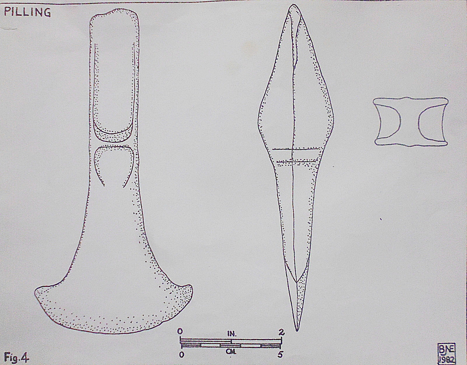
Pilling Moss Bronze Age Axe Head (Illustration).

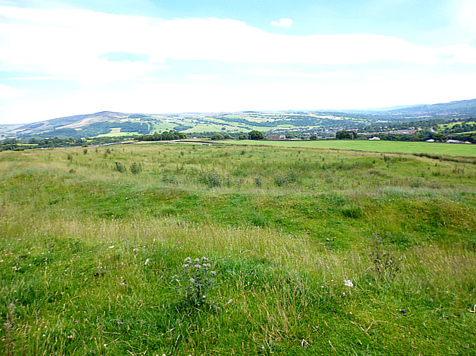
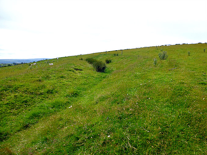
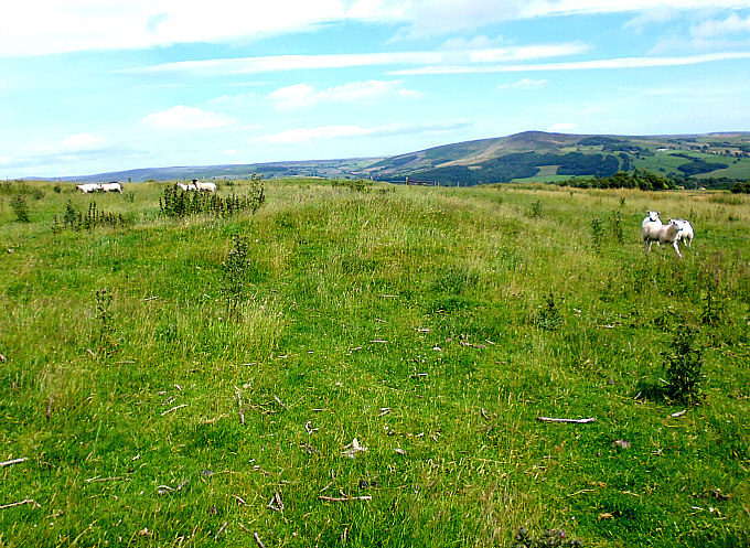
NGR: SD 463 447. The village of Nateby, Over Wyre, is 2 miles west of the A6 road near Gar-stang, while Pilling Moss is a couple of miles further west from there. Archaeologists consider the low-lying, level area around the Moss as very interesting – after recent excavations found late Mesolithic to early Neolithic settlements and trackways in that area. In the late 1970s a prehistoric settlement was found at Bonds Farm, just east of Stackpool; also a scattering of artefacts was excavated here (animal bones etc) and, at Friars Hill, another settlement, just to the north by (LUAC) – radiocarbon dating gave a date of about 2,345 BC and for Bonds Farm a date of 1,445-1,397 BC. At Manor Farm, Nateby, a few polished axes were excavated and were of a similar date. The area around Bone Hill House near Nateby was perhaps another ancient British settlement? but this place was more recently, in the 18th century, reputedly infamous as a “baby farm”. It was here that a number of babies’ skeletons were dug up from beneath trees in what looked like suspicious circumstances.

At Friars Hill (possibly associated with Cockersand Abbey) further to the north, was another prehistoric settlement; it was discovered that this site had been connected to Pilling Moss by trackways called by Archaeologists ‘Kate’s Pad’; these timber walkways, made from oak trees, were probably built to cope with the constant flooding of the moss and thus better access. These timber structures apparently went several feet down into the moss. In the Roman period it is thought the wooden walkways were strengthened and added to – at this period they were referred to as ‘the Danes Pad’. About a 1½ miles of these ancient timbered structures have been excavated across Pilling Moss.

And at Nateby recent excavations in and around the village have shown that a trackway going through the centre of the village dates from prehistoric times, and, a hill in the village showed signs of settlement. The trackway almost certainly connected with the one mentioned above running from Pilling Moss to Nateby – and then on to the River Wyre at Hambleton.

In 1824 a human head was dug up from Pilling Moss; the skull was of a young girl from the Bronze-Age period that still retained its auburn hair as well as a necklace of jet containing a single amber bead, according to B. J. N. Edwards in (Lancashire Archaeological notes Prehistoric and Roman, Trans. Hist. Soc. Lancashire Cheshire, 121, 99-106, 1969). Archaeologists now consider the skull to have been a ritual bog burial. Also, a dug-out canoe was excavated from Pilling Moss, close to Pressall. This, though, may have dated from the so-called Dark Ages, rather than from prehistoric times.

In the vicinity of Eagland Hill, near Scronkey, on Pilling Moss, Lancashire (NGR: SD 433454), a Bronze Age palstave was discovered during drainage work being carried out there in the early 1980s. Two other Bronze axe blades were found during excavations in the same area in the late 1970s. Pilling Moss was apparently, so we learn, not drained until the 1830s.

B. J. N. Edwards writing in 1982 says: “Readers will recall that the original stimulus for the excavations at Pilling in 1978 and 1979 was the finding of a Bronze Age haft-flanged axe blade. Subsequently, another was found in the same area. These two blades took their places in a line of five similar discoveries running NW-SE through the excavation site. These were then the only Bronze Age axe blades recorded from the Moss apart from a single flat axe. It is a palstave and was found during drainage work in the winter of 1980-81 near Eagland Hill.

“With an overall length of 6.06 inches (16.6cm) and a width across the blade of 3.02 inches (8 cm) it is noticeably larger and heavier than either of the 1977 and 1978 finds referred to above. Its closest parallel in Davey & Foster (Bronze Age Metalwork from Lancashire and Cheshire), Liverpool, 1975) is No 32 from Cartmell, for which the text says “incipient stop-ridge”, though the drawing seems to show a well-developed one.

“The implement has been returned to its finders, to whom the writer is grateful for permission to draw the implement and to search the field in which it was found. The latter activity was unsuccessful as was to be expected since the field concerned still has a considerable depth of peat”, says the writer B. J. N. Edwards.

Somewhere near Pilling Moss, or more likely off the coast at Fleetwood and Knott End, lay the legendary Roman port known as Portus Sentantiorum, but its actual whereabouts remain unknown, and whether the legendary port even existed at all is something that is still open to conjecture, and will be for a long time to come. The legendary or mythical port is mentioned in antiquarian books discussing the lost lands and villages located somewhere off the Lancashire Coast. In the 2nd century AD the Roman cartographer, Ptolemy, set about charting the wild coast of Lancashire; he apparently named what was assumed to be the Ribble Estuary as Belisama, but at that time the river was further to the south, close to what is now Southport, says Kenneth Fields. It has even been thought by some historians that Portus Sentantiorum was located out in the Dee Estuary between Chester and northeastern Wales.

Clifford Oakes (1953) says: “The formation of mosslands is almost certainly due to the impermeable nature of underlying clays at Chat Moss, Pilling Moss, Cockerham Moss and the original Tarleton Moss. The latter has now been largely reclaimed, and heavy root crops, mostly potatoes, are raised where heather, bilberry and sphagnum once flourished.”

Sources & References & Associated Websites:-

Davey & Foster, Bronze Age Metalwork from Lancashire and Cheshire, Liverpool, 1975.

Edwards, B. J. N., Lancashire Archaeological Notes Prehistoric and Roman, Trans. Hist. Soc. Lancashire and Cheshire, 121, 99-106, 1969.

Edwards, B. J. N., Lancashire Archaeological Bulletin, Vol. 8 No. 2,  (Page 30), May 1982.

Fields, Kenneth, Lancashire Magic & Mystery, Sigma Press, Wilmslow, Cheshire, 1998.

Oakes, Clifford, The Birds Of Lancashire, pg 12 (Agriculture), Oliver And Boyd, London, 1953.

Copyright © Ray Spencer, The Journal of Antiquities, 2023.


Clegyr Boia Hillfort, Near St David’s, Pembrokeshire (Sir Benfro), Wales

Plan of Clegyr Boia Hillfort, Pembrokeshire.

OS Grid Reference: SM 73719 25062. About 1 mile to the west of St David’s, at Nant-Y-Felin, in Pembrokeshire (Sir Benfro), Wales, is the prehistoric hill-top settlement site and hillfort of Clegyr Boia, which derives its name from a 6th Century pirate; however, the place was settled long before that in the Neolithic Age, and continued to be settled, in one way or another, up until the Dark Ages. The rectangular-shaped hillfort and earlier Neolithic settlement occupy the summit of this small rocky hill (named after an Irish pirate leader called Boia) and are enclosed by ramparts that join up with the existing rock outcrops – forming a secure, defensive site. Legend tells that the fort was destroyed by fire. Archaeological excavations took place on Clegyr Boia in the early 1900s and, more recently in the 1970s. There are two holy wells: one being Ffynnon Dunawd and, at the southwest side, there is Ffynnon Llygaid. From the western side of St David’s: take Pit Street and then Feidr Treginnis road until you see the hillfort in front of you. At least two footpaths lead up to the hillfort from the lane.

Timothy Darvill (1988) tells us that: “The rocky summit of this steep-sided hill on the coastal plain of south-west Dyfed was first occupied in early Neolithic times, and is one of the largest settlements of the period in Wales.

“About 3800BC, at least two rectangular houses stood on the hilltop. Their occupants were probably cattle farmers, and in addition to the large quantity of pottery recovered there were flint tools and polished stone axeheads made from locally outcropping rocks. Whether this settlement was defended is not known, but in Iron Age times a substantial rampart, which still stands 1m high, encircled most of the hilltop. The entrance, fortified with a long entrance tunnel, lay at the south-west corner of the site.”

Darvill adds that: “Legend attributes the site to Boia, an Irish pirate of the 6th century AD. Boia’s wife apparently sacrificed her stepdaughter Dunawd to heathen gods but on the same night Boia himself was slain by a second pirate, named Lisci, and his castle was consumed by fire from heaven.”  

Chris Barber (1987) says that: “This small fort is situated on the summit of a large mass of igneous rock which rises about 45 feet above the surrounding farmland and is roughly 320 feet long by 100 feet wide. ……the summit has been fortified by a bank of stones mingled with earth. Originally, the bank would have been faced on both sides with large slabs set on end, in a similar fashion to the camp of Bwrdd Arthur on Anglesey. Most of the facing stones at Clegyr Boia have been removed for building purposes, but some still remain in place.

“The camp is roughly a rectangular parallelogram with an outpost on the north-eastern extremity. The interior of the main camp and the annexe have been hollowed out, and these excavations have, of course, provided the stone and earth to build the ramparts. In the sixth century the site was occupied by Boia, a Gwyddel chief who gave St David considerable problems, although the latter eventually dealt with him by causing fire to fall from heaven and consume the fortress. There is reputed to be a well here that is a small hollow in the rock, just large enough for a fist to be inserted. It is claimed that the water is good for soothing sore eyes.” 

Children & Nash (2002) tell us more, saying that: “Clegyr Boia is set within rectangular ramparts, measuring 100m by 25m, that may be of Iron Age date. The settlement, excavated in 1943, consists of two Neolithic house structures, a fire pit and a midden (Williams, 1953, 24-9). An earlier excavation revealed a possible third hut, located centrally within the rampart area (Baring-Gould, 1903). Outside the settlement area, a large number of Mesolithic flint scatters suggest continuous occupation of the peninsula for well over 4,000 years.

“One of the houses is oval, the other rectangular. The rectangular structure (7m by 3m) comprised two rows of posts, which may have supported a timber roof. An “unused pit” investigated inside this structure by Audrey Williams was compared by the excavator to similar pits discovered under the Pentre Ifan monument. She also suggested a link between the two sites on the basis of pottery evidence.

* Drawing of a typical Neolithic hill settlement.

Children & Nash go on to tell that: “The oval hut yielded evidence of extensive burning. Barker (1992) has suggested that the burning, plus the deposition of pottery in each of the contexts, indicates possible ritual abandonment. We would argue that the settlement and the two nearby monuments are contemporary, and that the former may have suffered natural abandonment towards the end of the Neolithic, only being re-occupied in the Iron Age. Pottery from the oval hut appears to be identical to examples found in the rectangular structure and in the midden to the west. Three different Neolithic pottery styles have been identified in all, and are similar to wares found in Cornwall, Southern Ireland and the Wessex region. The evidence suggests that a possible exchange network linked these areas. Barker (1992) proposes a Middle Neolithic (4,300 to 3,300 BC) date for the pottery from Clegyr Boia. Recovered from the floors of two huts were shouldered bowls, a number of animal bones, mainly of wild cattle, and limpet shells. 

“A series of hearths to the west of the oval hut yielded a flint arrow-head and a partly-polished stone axe of gritty volcanic tuff (Houlder, 1988). Limpet shells, pottery, and oak and birch charcoal were recovered from the midden. Cattle bone was found in both huts. The bone, together with the shells, suggest that the people of Clegyr Boia existed on a mixed economy of hunting/gathering/fishing with an element of domesticated herding. The settlement may have supported only two or three small family units at any one time.”  

Christopher Houlder (1978) adds to the above saying that: “The rocky summit of a small hill has been enclosed by ramparts joining outcrops to form a secure Iron Age dwelling site, for which precise dating evidence was lacking in excavation. Important Neolithic remains included the substantial rectangular house of a group of cattle farmers, whose pottery indicates an Irish connection in the third millennium B.C.”

Sources / References & Related websites:-

*Airne, C. W, M.A. (Cantab.), The Story of Prehistoric & Roman Britain — Told in Pictures, Sankey, Hudson & Co. Ltd., Manchester.

Barber, Chris, More Mysterious Wales, Paladin, London, 1987. 

Children, George & Nash, George, Monuments In The Landscape . Volume 5 — Neolithic Sites of Cardiganshire Carmarthenshire & Pembrokeshire, Logaston Press, Little Logaston Woonton Almeley, Herefordshire, 2002.

Darvill, Timothy, AA Glovebox Guide — Ancient Britain, Publishing Division of the Automobile Association, Basingstoke, Hampshire, 1988.

Houlder, Christopher, Wales: An Archaeological Guide, Faber & Faber, London, 1978. 

https://en.wikipedia.org/wiki/Clegyr_Boia

https://ancientmonuments.uk/128978-clegyr-boia-camp-st-davids-and-the-cathedral-close#.XT4mhlLsZjo

https://www.megalithic.co.uk/article.php?sid=5988

https://getoutside.ordnancesurvey.co.uk/local/clegyr-boia-pembrokeshire-sir-benfro

https://coflein.gov.uk/en/site/305389/details/clegyr-boia

© Ray Spencer, The Journal of Antiquities, 2019.


1 Comment

Round Dikes Earthwork, Addingham Low Moor, West Yorkshire

Round Dikes on Addingham Low Moor (from above).

Round Dikes on Addingham Low Moor (from above).

    OS grid reference: SE 0551 5012. Quite a substantial Iron Age earth-work situated below Counter Hill on Addingham Low Moor, West Yorkshire, that is locally called ‘Round Dikes’, ‘Round Dikes Camp’ and ‘Round Dikes Settlement’. This enclosed and almost oval-shaped earthwork on the moors to the east of Crossbank Road also supports a Bronze Age burial mound, but unfortunately this is now badly muti-lated. There are traces of an associated linear earthwork to the south-east of the site, and another burial mound, although this is now hardly recognizable at ground level. Round Dikes Earthwork can be reached from Crossbank Road, where a footpath runs north-east towards Counter Hill, through a couple of fields and over a couple of wall stiles for 400m. Just before the earthwork there are some gates and a short muddy path. The grassy earthwork is now in front of you!

Round Dikes Earthwork, Addingham Low Moor (the north side).

Round Dikes Earthwork,  (the north side).

    Round Dikes Earthwork roughly measures 87m x 79m and is oval shaped. It has a well-defined ditch with banks running around an inner area which would have been the camp or settlement’s inner sanctum; the banking at the north-side is very prominent and is 4-5 feet high in parts, whereas the banking further around the site is slightly less at 3-4 feet high. However it is thought this was a non-defensive camp or “entrenchment” probably of the Iron Age, and not of the Roman period. The inner part of the site probably contained maybe nine hut circles and some hearths, according to John Dixon in his work ‘Journeys Through Brigantia’ – Volume One. At the south-east side there is what looks to be an entrance, and close to that and just inside the camp’s enclosure, a spring which is now almost lost in reed beds! The ditch and banking at the S side is almost lost in dense foliage and reed beds, and the spring makes for very boggy conditions here.

    It would seem that the people of the Iron Age kept their stock: cattle, sheep, goats, pigs and maybe horses close to them and always within the bounds of their settlements or enclosures.

    The author J. C. Barringer in his work ‘The Yorkshire Dales’, says of these Iron Age people and their enclosures: These complexes of small enclosures were bounded by stone banks and contained round huts of about fifteen feet in diameter. The inference to be drawn from the archaeological evidence is that Iron Age peoples occupied many of the limestone plateau above the main valley floors and that they were agriculturalists to the extent of growing crops of oats and perhaps rye in their small enclosures.”

    He goes on to say: ‘Their small enclosures near their huts may have been crop growing areas, but most of their territory must have been used for grazing stock. The grazing of hillsides, would of course, hold back tree growth and in the case of goats severely inhibit it, so maintaining the clearance of the woodlands and perhaps increasing it in some areas.”

Round Dikes Earthwork. Bronze Age Bowl Barrow (between the sheep!)

Round Dikes Earthwork. Bronze Age Bowl Barrow (between the sheep!)

    Near the south side of the site there is a small but very mutilated mound or bowl barrow which must be ascribed to the Bronze Age. This grassy mound is about 4 feet high but it is very damaged with a hollowed-out part at one side – due perhaps to robbery, or maybe from some illegal archaeological diggings in the past. So the site was obviously in use as a settlement long before the round dikes were built. And 200m further down hill to the south-east there are traces of a linear earthwork which was probably an extended part of the Round Dikes Camp. There is also another tumulus (bowl barrow) just below this earthwork at (grid ref: SE 0584 4993), although this has been largely lost due to plough-ing of the field.

    About ¾ of a mile to the west, at Woofa Bank, there is another large oval-shaped Iron Age enclosure with associated earthworks over to the north and east, and there is an interest-ing tumulus (bowl barrow) on the trackway (Millennium Way) to the south.

Sources and related websites:-

Barringer, J. C., The Yorkshire Dales, The Dalesman Publishing Company Ltd., Clapham, 1982.

Dixon, John & Phillip, Journeys Through Brigantia – Volume One – Walks in Craven, Airedale and Wharfedale, Aussteiger Publications, Barnoldswick, 1990.

https://en.wikipedia.org/wiki/Addingham

http://www.pastscape.org.uk/hob.aspx?hob_id=48311

http://www.ancientmonuments.info/en31498-late-prehistoric-enclosed-settlement-known

http://www.armadale.org.uk/rounddykes.htm


Portfield Hillfort, Whalley, Lancashire

Portfield Hillfort, Whalley, Lancashire.

Portfield Hillfort, Whalley, Lancashire.

OS grid reference SD 7460 3553. About three-quarters of a mile east of Whalley in the Ribble Valley, Lancashire, beside Portfield Lane stands the prehistoric site known as Portfield hillfort or Planes Wood Settlement, a promontory-type fort. Just half a mile to the west is the busy A680 Accrington Road and Spring Woods, with carparks and a number of woodland paths for the visitor to explore at leisure – all far removed from the Iron-Age hillfort-cum-settlement that lies  just beyond. The hillfort with it’s man-made defensive ramparts can be found just behind Portfield farm and the splendid 14th century tithe barn, a timber construction that was associated with Whalley Abbey. Close by is Leck beck and down in the valley at Whalley the river Calder winds it’s way southwards beneath Whalley Nab towards Great Harwood. In 1966 a hoard of Bronze-Age artefacts was dug up in the middle of the hillfort.

Portfield Hillfort (south-east rampart).

Portfield Hillfort (south-east rampart).

The fort covers an area of about three-and-a-half acres (roughly 152,460 square feet) and, although it is accepted that it dates from the Iron-Age, there was almost certainly a much earlier settlement or enclosure on this site that was inhabited in the Mesolithic, Neolithic and Bronze-Age periods of prehistory, which would be 4,000 years BC or more. There were two main phases of construction in the case of the Iron-Age fort’s defensive ramparts, as is now known from the archaeological excavations that took place in the late 1950s.

The first phase sometime between 1,000-750 BC? was a stone rampart (with no ditch) about 13 feet across with stone kerbs on their sides at the back of the inside defense, while the second phase involved the levelling of the first rampart to construct bigger but ‘unusually’ low defensive bivallate ramparts, which were stone-revetted and upto 20 feet in width surrounding the enclosure area of the fort – being especially well-defined at the north-west side but, less so at the south-eastern and east sides. Beyond this there was a 20 foot wide berm and a ditch measuring 15-18 feet across. The excavations of 1958 and 1959 revealed a cobbled pavement at the main entrance to the fort, and over this another layer of stones. It was here that a fragment of Romano-British Roman pottery was discovered dating from the 5th century AD. A couple of the back gardens of the houses on Portfield lane have rather intruded onto what’s left of the eastern rampart, although this does not ‘in any way’ spoil the situation of the prehistoric site.

Portfield Hillfort (Eastern Rampart).

Portfield Hillfort (eastern rampart).

In 1966 while workmen were laying new pipes near the centre of the fort a hoard of Bronze-Age artefacts was uncovered – among the items found were two axes, a tanged knife and blade, a tanged stud, a gauge, part of a hilt, but much more of interest was the discovery of a gold penannular bracelet (possibly of Irish craftsmanship) and a gold tress-ring dating from the mid to late Bronze-Age. Then, in excavations during 1970-71, post holes were found as well as body sherds, flints and pottery sherds from a biconical vessel. There have also recently been a few finds dating back to the Mesolithic and the Neolithic ages, including flints and pottery. Many replicas of these artefacts can be viewed in The Blackburn museum and also The Ribchester Roman museum.

Joan Allen (1977) tells us that: “In September 1966, two Manchester Corporation workmen, digging a ditch in a meadow at Portfield Farm, Whalley, Lancs., located a gold armlet, gold hair-ornament (called a tress ring), a carpenter’s gauge and a number of bronze axe-heads and other tools. Museum experts believed that Bronze Age craftsmen had hoarded them underground between 700 and 800 B.C.”

Sources:-

Allen, Joan, Glittering Prospects—All You Need To Know About ‘Treasure Hunting’, Elm Tree Books Ltd., London, 1977.

Dixon, John & Dixon, Phillip., Journeys Through Brigantia (Vol 9) The Ribble Valley, Aussteiger Publications, Barnoldswick, 1993.

http://www.pastscape.org.uk/hob.aspx?hob_id=44511

http://www.webbaviation.co.uk/gallery/v/lancashire/whalley/PortfieldHillfort-fb34133.jpg.html


Werneth Low and Hangingbank, Greater Manchester

SJ9709 9315. Werneth Low is a hill 279 metres high located just west of Uplands farm near Hyde in Tameside, Greater Manchester. It was the site of an Iron-Age settlement or enclosure on the south-west facing side of the hill, dating from the 1st century BC. A flint knife and a stone mace were excavated here. The Brigantes tribe who held the territory just before the Roman army arrived would have come here to the hill to celebrate both the winter and summer soltices. And what a wonderful sight that must have been!

Werneth Low near Hyde, Greater Manchester, on ...

Werneth Low near Hyde, Greater Manchester (Photo credit: Wikipedia)

SJ9647 9352. Some 2 miles to the north-east of Werneth Low is another ancient settlement or farmstead called ‘Hangingbank’ just south of the A660. It is a low hill covering 3 acres that was inhabited from the middle to late Bronze-Age through to the Iron-Age. A number of Bronze-Age artefacts were found at the site. The earthworks at Hangingbank consist of a double-ditched enclosure with numerous crop-marks indicating where ancient field boundaries were. There may have been a Roman camp here in the 1st-2nd century AD as a shard of pottery was dug up from one of the ditches and a post hole was excavated. The course of the Roman road from Melandra Castle to Astbury supposedly crossed the site. Today a modern-day war memorial stands in the centre of the earthworks of the prehistoric settlement.