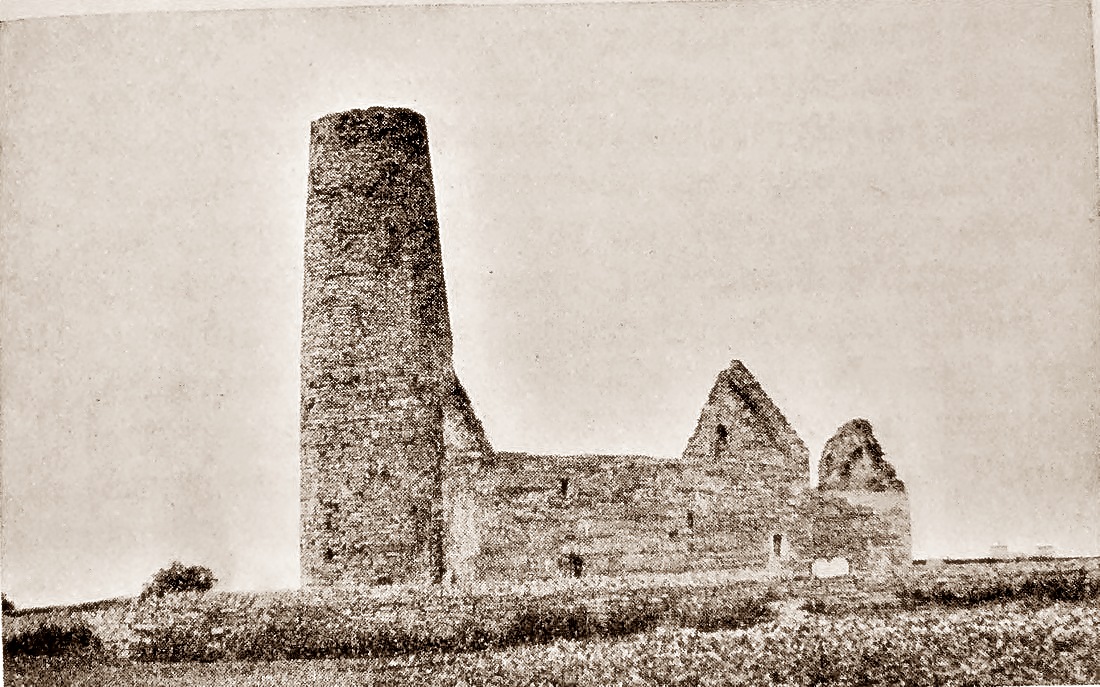
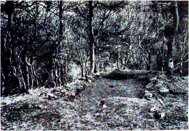
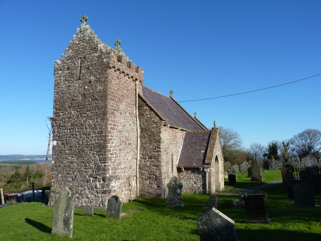
St Magnus’ Church on Egilsay Island, Orkney.
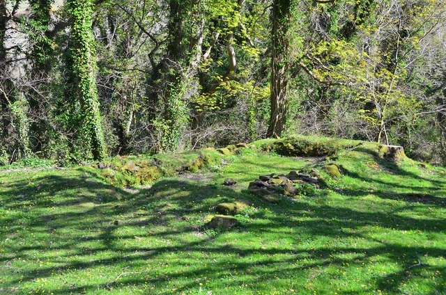
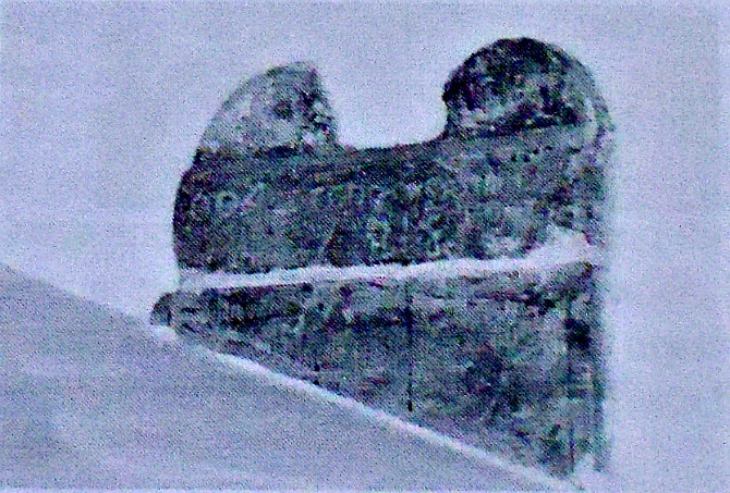
NGR: HY 4660 3039. At the north-western side of the long narrow island of Egilsay (Church Island or in Norse Egil’s Island) to the east of Rousay, in the Orkney Isles, is the ruined and roofless 12th-century Norman church of St Magnus (built in the Romanesque style) with its small graveyard/cemetery. Sometime between 1115 and 1117 St Magnus Erlendsson, Earl of Orkney, was treacherously murdered on the orders of his cousin, Earl Haakon; Lifolf, who was Haakon’s cook carrying out the dastardly deed, at this site. The church is architecturally well-known because of its round tower, which is similar to those at Celtic churches (though often detached) that are to be found in Ireland and elsewhere. The present-day roofless church on Egilsay Island, near Pier Road at North Tofts, dates from just before the mid-12th century – probably being founded by the Bishop of Birsay, but there was almost certainly a church on this site back in the 11th century or earlier. Structurally the walls of the church are very sound and the two gable ends still stand intact as do the Norman arches and Nave. However, the splendid round tower at the western end has lost some of its height – it was originally over 60 feet high and had a conical roof. There is a relatively recent monument located close by the church called St Magnus Cenotaph. Magnus was canonised in 1135 and his feast day is April 16th.
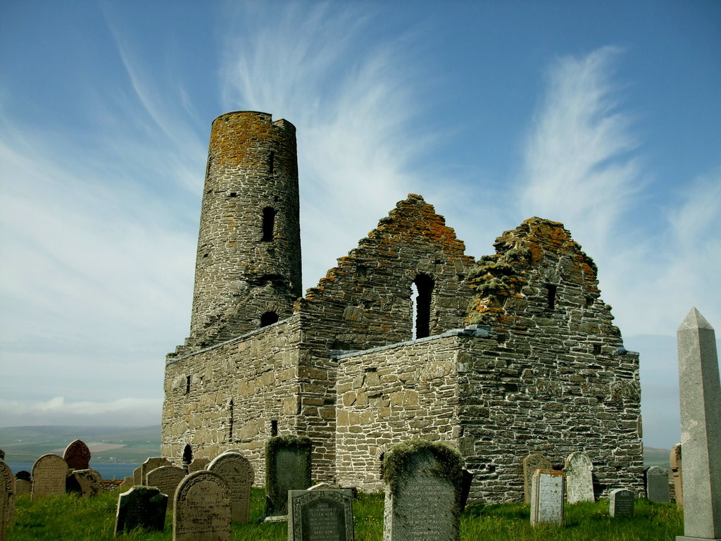
St Magnus Church, Egilsay Island, Orkney. Photo by Robert Beharie (Creative Commons).
Reader’s Digest (1977) tells us that: “The 12th-century church on Egilsay, Orkney, is dedicated to St Magnus, a Norse earl of Orkney who was noted for his piety. He was enticed to Egilsay c. 1117 by his cousin Haakon, and executed by Haakon’s cook.” The AA (1982) says of St Magnus’ Cathedral, Orkney: “The Cathedral was founded in 1137 by Earl Rognvald, the Norse ruler of Orkney, in memory of his uncle and predecessor, Magnus, who was murdered by a rival earl in 1115. The canonised remains of both rulers are sealed in pillars in the Cathedral. St Magnus’s skull was discovered during renovations in 1919. It was split across as though by an axe—just as the murder of Magnus is described in a Norse saga. Colin Waters (2003) adds to the above and says of St Magnus that he is: “An 11th-century Earl of Orkney who became Orkney’s patron saint. He was a pirate who was captured by Vikings. He joined them but refused to attack Britain. He returned to Orkney where he was killed in 1116 in a plot organised by his cousin, Haakon, the joint ruler of the island.”
Charles Tait wrote in 1999 about Egilsay Island and said: “The arrowhead-shaped island is dominated by the fine St Magnus Church. Although only 5km (3 miles) long by 2km (1.25) miles wide the island figures prominently in Orkney history. The present church is thought to be a replacement for a much earlier church and the island was important as the other residence of the Bishop, after Birsay. There are several saga references to people going to Egilsay to see the Bishop. The island’s main claim to fame is of course the martyrdom of St Magnus at Easter, 1115. A cenotaph was erected in 1937, on the traditional spot where he was killed. The St Magnus Church was probably erected sometime after the death of the Saint, most likely at the instigation of Bishop William on the site of an earlier church. Built on a prominent rise in the middle of the island, the Romanesque church dates from the second quarter of the 12th century. The unique tower is now 14.9m but may have reached 20m and had a conical roof, while the main flagstone roof was still in place in 1822. Windows in different levels on the tower face north, south, east and west, and the sanctuary over the barrel-vaulted chancel could only be reached from inside the church. The tower may derive from Irish influence, but more probably Northern European ideas, and, though unique in Orkney now, there were churches with towers at Skaill in Deerness and in Stenness.
Lloyd Laing writing in 1974 tells us more about St Magnus, Egilsay. He says: “A building in many ways closely related to Birsay is the church of St Magnus on Egilsay. It was on this island that the saint was murdered, and the church may possibly be connected with the event. Bishop William probably lived on Egilsay prior to his establishment of the bishopric at Birsay, and established the church around 1135, using it as his seat until the new church was built on the brough. It consists of a nave and chancel, opening directly onto the nave without a chancel arch. The chancel was surmounted by a barrel vault, now missing, above which was a chamber under the roof. Attached to the west end of the nave is a round tower, some 10ft in diameter. From the first stage of the tower a doorway gave access to the west end of the nave, and another door led from the chamber above the chancel vault, demonstrating that originally there were timber galleries and presumably staircases at first-floor level, The only entrance to the tower was through a door in the west wall of the nave. The doorways have round-headed ‘Norman’ arches. At the west end of the chancel the tusking of a stone screen is still traceable.
“The most intriguing feature of Egilsay church is its similarity to Irish churches of the eleventh century. The round tower, for instance, is a feature fairly rare in medieval architecture. Apart from the series of later Anglo-Saxon examples in East Anglia, which are unlikely to have inspired Egilsay, there is another series in Ireland (with two surviving outliers at Brechin in Angus and Abernethy in Perthshire). Others may have existed in Scotland. Egilsay is the only surviving example attached to a church, but there was at least one other in Orkney. The parish church of Deerness for example, demolished in the eighteenth century, had two round towers flanking the west front, while the church at Stenness, also demolished in the eighteenth century, had a remarkable half-round tower at the west end. Both are known from eighteenth-century drawings, and Stenness was partly excavated in the earlier part of this century. There is reason to suppose that both Deerness and Stenness were twelfth-century buildings. The Irish round towers are for the most part detached from churches, as indeed were the two surviving Scottish examples. Originally built as belfries, as part of monastic complexes, they also served as watch towers and refuges for monks and their treasures at the time of the Viking raids. Access was far up the tower by means of a removable ladder; they had no staircases. It is probable that they were originally attached to churches, later examples being free-standing. The earliest surviving examples date from the tenth century, most are later, the best being mainly twelfth. About eighty survive in whole or in part.
“Another Irish feature in St Magnus’ is the chamber built above the vault. In Ireland such chambers arose when a relieving void was constructed beneath the stone roof, and were sometimes inhabited. The building as a whole is very similar to the church at Glendalough, County Wicklow, which dates from c 1100, where a round tower is attached to the west end, though here rising from a square annexe.”
Sources & References & Related Websites:-
Gunn, J., Orkney — The Magnetic North, Thomas Nelson And Sons Ltd., London, 1941.
Laing, Lloyd, Orkney And Shetland — An Archaeological Guide, David & Charles, London, 1974.
Reader’s Digest, Folklore Myths and Legends of Britain, Reader’s Digest Association Limited, London, 1977.
Tait, Charles, The Orkney Guide Book (Edi 2.1), Charles Tait photographic, Kelton, St. Ola, Orkney, 1999.
The AA., Illustrated Guide to Britain, Drive Publications Limited, Basingstoke, Hants., 1981.
Waters, Colin, A Dictionary Of Saints Days, Fasts, Feasts And Festivals, Countryside Books, Newbury, Berkshire, 2003.
Colour photo (2nd down) of St Magnus Church, Egilsay Island, Orkney by Robert Beharie (2013): https://www.geograph.org.uk/photo/3491116
https://en.wikipedia.org/wiki/St_Magnus_Church,_Egilsay
https://www.undiscoveredscotland.co.uk/usbiography/m/stmagnus.html
https://www.orkney.com/things/leisure/walking/egilsay
Copyright © Ray Spencer, The Journal of Antiquities, 2024.

