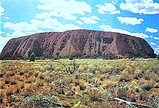
Ayres Rock, Australia
Latitude: 25.344683. Longitude: 130.037370. Ayres Rock is a ‘world famous’ natural rock formation (which includes Kata Tjuta) in the Australian outback – the southern part of the Northern Territory, central Australia, some 208 miles (in a straight line) south of Alice Springs; by road it is more like 280 miles! This sacred sandstone rock is located close to State Route Highway 4 (Lesseter Highway) but more often called Uluru Road, a few miles south-east of Yulara.
The Aboriginal people of Australia regard Ayres Rock, also called Uluru, as a sacred place. There are many deep springs and watering holes (billabongs) located on and around the rock that are known to have sacred healing qualities, and there are caves with rock art. Ayres Rock Campground and Uluru-Kata Tjuta Cultural Centre at Yulara are in a rocky area to the north, spread out over several miles, just east of State Route 4 in The Kata Tjuta National Park. Ayres Rock is now a World Heritage Site. The 19th-century explorer Sir William Gosse named the Great Rock after Sir Henry Ayres, Premier of South Australia.
At an elevation of 2,830 feet, 860 metres above sea level, a height of 1,142 feet (348 metres) and a length of 3.6 km (2.2 miles) Ayres Rock monolith is a massive natural rock formation that can be seen a very long way away, sixty miles or more due to the terrain of the Northern Territory. It is ‘said’ to be up to 450 million years old, with a circumference of 9.4km (over 5 miles) and estimated to be 6kms below ground level.
The make-up of the rock, geologically speaking, is very interesting in that it is made of reddish ‘arkose’ sandstone, although seperately Kata (the Olgas) is a conglomerate mix of small stones and boulders fused together with mud etc. Uluru is distinctly reddish at certain times of the day due to the high iron, red oxide content of the rock, but at other times it is grey. The rock also has a rich feldspar content, which adds to the rock’s distinctly reddish hue, although the colours change at different times of the day. Over millions of years, there has been much erosion due to weathering and it is ‘this’ that has caused the strange formations of gulleys, ridges and furrows that we see today. The rock is virtually bare with no vegitation whatsoever.
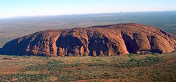
Uluru (Helicopter View) Photo Copyright: Wikipedia
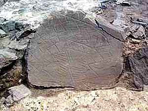
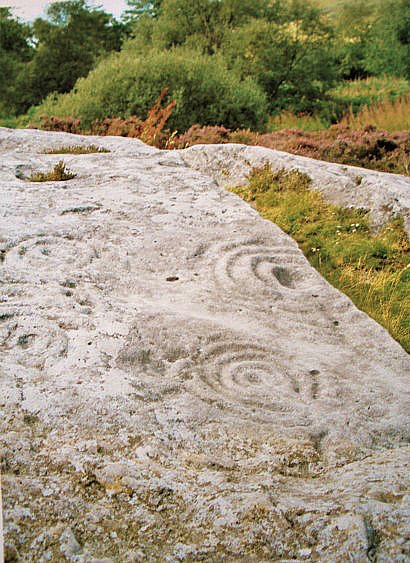
There are many deep honeycomb hollows and, also a number of deep caves in Ayres Rock which have been made over millions of years, especially near the base where some contain fantastic rock paintings made by the ancestors of today’s Aboriginal people, namely the Yankunytjatjara (carpet-snake people) and the Pitjantjatjara (hair-wallaby people) who lived in what was at that time called the ‘Dreamtime’ (Tjukurpa); their paintings depicting scenes from life. These pictographs and paintings are “…..Mute testimony to primitive man’s reverence to Ayres Rock, these archaeological relics add to the majestic beauty of the colossus of the Australian outback” according to the ‘Book of Natural Wonders,’ 1980. And there are, apparently, many sacred springs that seep out from deep in the rock’s surface; these are sacred springs to which the powers of healing have been attributed, and around the great rock there are watering holes (billabongs) for the thirsty – man or beast – for this place is a very hot, unrelenting desert. Water is a matter of ‘life and death.’
The book ‘Strange Worlds Amazing Places,’ 1994, informs us that: ….“As the sun spreads its dawn rays across the sky, Uluru begins to lighten. Shifting from black to deep mauve, the giant monolith gradually becomes more distinct. When the first rays of the sun strike, the stone bursts into a riot of reds and pinks that chase each other across the surface with startling speed. Shadows flee the hollows until the whole rock is bathed in desert daylight. The colour changes continue throughout the day, and by evening have run the spectrum from golden and pinky reds through ruby to crimson red and purples.”
Sources:
Book of Natural Wonders, The Reader’s Digest Association, Inc, New York & Montreal, 1980.
Strange Worlds Amazing Places, The Reader’s Digest Association Limited, London W1, 1994.
Wikipedia: http://en.wikipedia.org/wiki/Uluru
The Megalithic Portal: http://www.megalithic.co.uk/article.php?sid=11621
Wikipedia: http://en.wikipedia.org/wiki/Billabong
Copyright © Ray Spencer, The Journal of Antiquities, 2014.