The Journal Of Antiquities

Ancient Sites In Great Britain & Southern Ireland


St Kenelm’s Well, Winchcombe, Gloucestershire

St Kenelm's Well near Winchcombe BY Michael Dibb (Geograph).

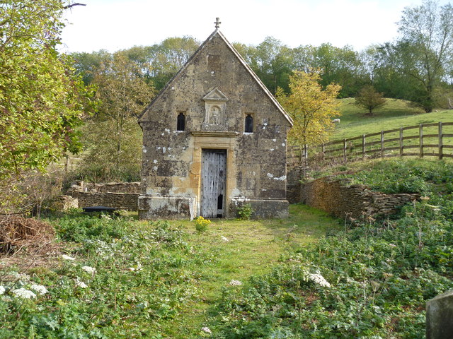
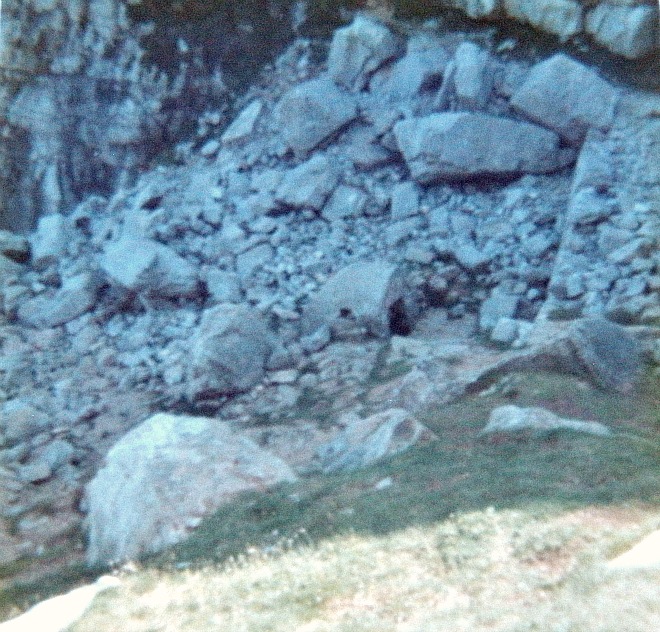
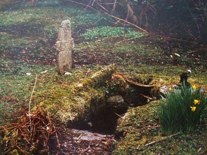
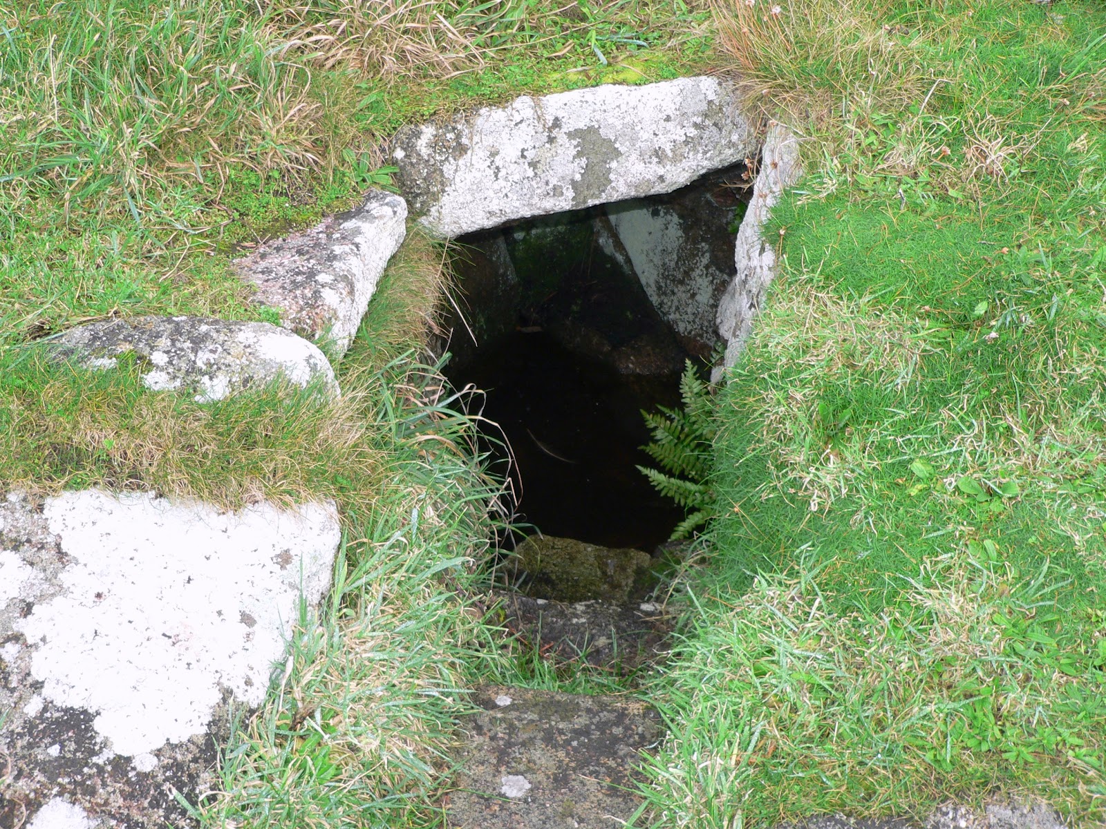
St Kenelm’s Well near Winchcombe by Michael Dibb (Geograph).

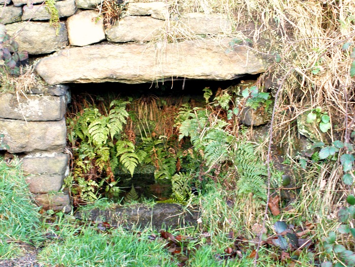
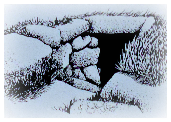
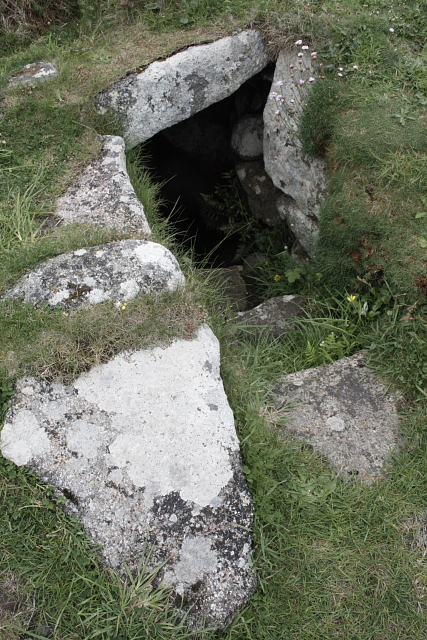
    OS grid reference: SP 0435 2779. About 1 mile east of Winchcombe village, Gloucestershire, on the side of a hill stands St Kenelm’s holy well. The wellhouse-cum-baptistry which houses the holy well is a mid-16th century building. The well takes its name from St Kenelm, a Mercian boy-king and martyr, who was the grandson of King Offa. He was ‘most treacherously’ murdered at the instignation of his scheming elder sister, Quendrida, sometime between 819-821 AD. It is located on the side of a hill which is surrounded by trees on its lower sides, and is easily reached along a country lane that runs in an easterly direction out of Winchcombe village, passing close by Sudeley Castle. A footpath runs just to the west of the well-house. The holy well was a place of pilgrimage in the Middle Ages and in more recent times too, as was Winchcombe Abbey, where the martyr’s coffin had lain for many hundreds of years. It is now housed in St Peter’s parish church.

    Francis Duckworth recalls the “Legend of St Kenelm” in his beautiful book ‘The Cotswolds’, and says: “Kenulf, King of Mercia, founded Winchcombe Abbey in the 9th century. He had a daughter, Quenride, and a son, much younger, Kenelm. The latter, while still a child, succeeded his father, and  the jealous Quenride at once began to hatch plots to put him out of the way. One fine morning he went out hunting with his tutor, and never returned. So Quenride reigned in his stead.

    “Some years afterwards, while the Pope was celebrating mass in St Peter’s, a pure white dove flew in through an open window, and let fall a piece of parchment from her bill. On the parchment was written: “In Clent, in Cowbach, Kenelm, Kinges bermn (bairn) lieth under a thorn heuade birevede (bereft of his head).” An Englishman who happened to be present interpreted this, and the Pope set on foot an investigation of the whole matter. In the end a party of monks from Winchcombe succeeded in finding the headless of Kenelm. At this  point the monks of Worcester interfered, and claimed the body as having been found within their boundaries. Divine arbitration was implored. Both claimants should sleep one night by the body’s side: the first to wake should possess the relic. This good fortune fell to the Winchcombe monks. On their way they stopped to rest, and the spot is marked by St Kenelm’s Well.”

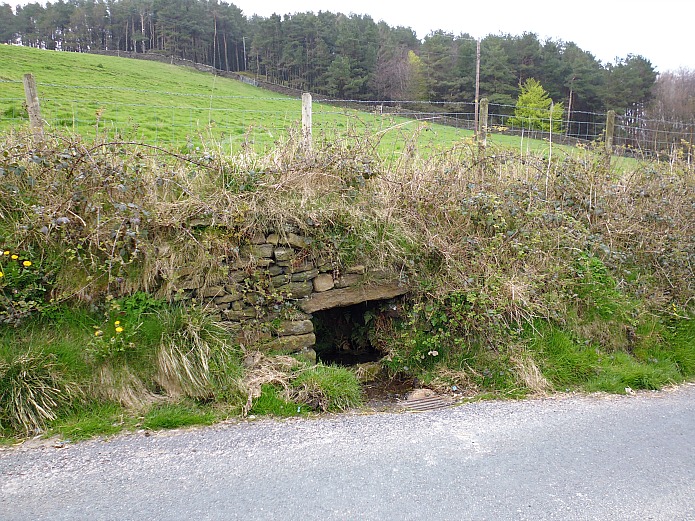
    St Kenelm’s murder took place at Romsley in the Clent Hills, Worcestershire, where another holy well sprang forth where the saint’s body had lain. This well is located in the valley behind St Kenelm’s church, which is about½ a mile north-west of the village, according to authors Janet & Colin Board ‘Sacred Waters’. On its long journey from Romsley in Worcestershire the martyr’s body had been rested, only a mile from Winchcombe Abbey, Gloucestershire, but this simple action caused a second spring of water to burst forth and soon miracles of healing were attributed to its water. The well water was said to be most effective as a cure for eye troubles. Above the door of the stone-built wellhouse is a statue of St Kenelm, who today surveys what would have been his kingdom, but sadly ‘that’ wasn’t to be. The present-day building dates from 1549 and it was restored in 1887.

    Author Francis Duckworth goes on to say that after Kenelm’s murder: “Quenride sat at her window to watch the procession pass, and, to cast an evil spell upon it, read aloud the 100th Psalm backwards. When the procession reached her window her eyes dropped out of her head into her lap, and stained the psalter with blood. This psalter was preserved and shown for many years in proof of the story. Kenelm was buried in the abbey precincts, and one of the two very early stone coffins in the west end of the parish church is called Kenelm’s coffin.” The other coffin was thought to be that of King Kenulf (Coenwulf), father of St Kenelm (Cynehelm). Winchcombe abbey was founded by King Kenulf in 789 or 798 AD, but it was dissolved in 1539. Nothing survives of the abbey above ground. The evil Quenride, also known as Cwenthryth lived out the rest of her ‘sad’ days in a monastery, where she was ‘perhaps’ made abbess? She died in 827 AD. St Kenelm, the boy-king, is still much venereated at Winchcombe – where is feast-day is held on 17th July.

    Over the years there has been much speculative debate on the age of Kenelm when he succeeded his father to the throne of Mercia. We can assume that he came to the throne in either 819 or 821 AD at the age of 7 or 9, if he was born in 812 AD which is the date usually given, although some historians think he was a few years older than that, maybe as old as 12? Not that it really matters now!

Sources:

Bord, Janet & Colin, Sacred Waters, Paladin, London W1, 1986.

Bottomley, Frank., The Abbey Explorer’s Guide, Kaye & Ward, Tadworth, Surrey, 1981.  

Duckworth, Francis., Beautiful Britain – The Cotswolds, A. & C. Black Ltd., Soho Square, London W1, 1914.

http://www.geograph.org.uk/photo/2767417     © Copyright Michael Dibb and licensed for reuse under this Creative Commons Licence.

https://insearchofholywellsandhealingsprings.wordpress.com/2012/03/19/st-kenelms-well-at-winchcombe/


Jinny Well, Newchurch-in-Pendle, Lancashire

Jinny Well, Newchurch-in-Pendle.

Jinny Well, Newchurch-in-Pendle.

OS grid reference: SD 8238 3946. A few hundred yards down the hill from the Pendleside village of Newchurch-in-Pendle along Jinny lane, and set into the grassy bank is Jinny Well or Jennet’s Well, a sacred spring that has been here for some considerable time from when the land was first formed in geological terms. Not a great deal is known about it today, perhaps because in our modern times with clean drinking water on tap, it has been largerly forgotten, sadly. At the time of my visit the well was looking a bit overgrown. From the top of the village Pendle Hill can be seen 2 or 3 miles to the north-west, while the village of Sabden is 4 miles further to the west and Barrowford is roughly 3 miles to the east.

The well is built into the grassy bank at the side of Jinny Lane – it’s roof is formed from a thick stone-slab and a large stone basin collects the water, which is nowadays a dirty-brown colour and “certainly not” suitable for drinking, while at the other side and also above, the structure is made out of drystone walling; the spring comes out of a small grassy hillock in the field above the well. At the front there is a horrid iron grid to collect any overflowing, cascading water. Undoubtedly, at one time long-ago the well water was used by local people because of it’s purity and, maybe it had some health-giving qualities of which we know little about today.

Jinny Well, Newchurch-In-Pendle

Jinny Well, Newchurch-In-Pendle

According to local legend, the lane is haunted by the headless ghost of a woman called Jinny, Jinnet or Jennet; and she has given her name to the well and the lane, but as to when she lived around here, again, we do not know, only the legend and name remains. Maybe Jennet still uses the well for her needs in the realm where ghosts and spirits (water spirits) preside. Jennet does not appear to have been accorded the title of ‘saint’ in this case, even though she lost her head! There are a few other wells and springs in the pretty village of Newchurch-in-Pendle, in particular there is said to be a well in the garden of St Mary’s vicarage/parsonage.

Source:

Bennett, Paul., The Northern Antiquarian, 2009. http://megalithix.wordpress.com/2009/11/08/jinny-well-pendle/


2 Comments

St Govan’s Chapel, Bosherston, Pembrokeshire, Wales

St Govan's Chapel in Pembokeshire c.1972

St Govan’s Chapel in Pembokeshire 1970s

OS grid reference SR 9669 9296. At the church of St Michael & All Angels in Bosherston village take the road opposite (Buckspool lane) out of the village for about 1 mile. If there is an MOD sign displayed you may not be able to proceed any further for a few hours due to military training on the firing range. There is a car-parking area on Travallen Downs by The Pembrokeshire Coast Path – just above the medieval chapel of St Govan which nestles down on the rocky shoreline below the precipitous cliffs of St Govan’s Head. A flight of stone steps leads down between a large ravine in the cliffs into the ancient little building; the number of steps varies between 50-70 but there are said to be 52 steps all told. However, it is difficult to count the exact same number coming back up again! Near the chapel there is a dried up holy well called Ffynnon Govan (St Govan’s Well). The place has been regarded as a sacred and holy pilgrimage site since the Middle Ages, a place where miracles of healing were wrought in past times; even the soil is said to be curative. The county town of Pembroke is roughly 7 miles to the north on the B4319.

The little chapel solidly built of limestone is said to date from the 13th century – being restored at that time, so I think we can assume that there was an earlier chapel on this site, possibly one founded by the saint himself. Inside the building measures 18 feet by 12 feet and it’s roof is vaulted. At the eastern side an entrance leads to a hermit’s cell in the cleft of a huge limestone boulder. According to the often-told legend: the saint was pursued here by marauding sea pirates; he hid in the cleft of the great boulder which then closed up, hiding him from view, or his hermit’s attire matched the rock thus he became invisible. You can still make out some marks in the boulder that were made by the saint’s fingers when he hid here back in the 6th century AD. If you make a wish while standing in the cleft of the rock, facing the wall, your wish will be granted, hopefully!

At the side of the hermit’s cell is a stone altar beneath which, according to legend, St Govan is buried. A holy water stoup (piscina) is built onto the wall and, beneath this a spring of water runs out of the ground but is never said to run across the chapel floor, though it has been known to happen! The spring is said to have miraculous healing properties. There is a recess in the wall (aumbrey) that may have been used for sacred vessels or perhaps relics, and there are some solid looking stone seats up against the wall. The little bellcote on the roof did once possess a bell but this was long ago lost to the sea; it can apparently still be heard ringing on stormy nights from beneath the turbulent waves off shore, foretelling an impending disaster at sea. Another tale put forward says the bell was stolen by pirates, but later rescued by sea nymphs who placed it inside a rock near the chapel. It was said that if you struck the rock the bell would ring out.

Ffynnon Govan (St Govan's Well)

Ffynnon Govan (St Govan’s Well)

Some steps lead down below the chapel to a rock strewn area and St Govan’s holy well (Ffynnon Govan) covered over by a stone hood. However, this well has been dry for a long time now, but up until the mid 19th century it was the site of many healings with crutches being left by previously crippled pilgrims as a votive offering. Red soil that is found around the chapel site was used in a poltice form to cure sore, itchy eyes, and it is still said to be effective today! Francis Jones in his well-known work ‘The Holy Wells of Wales’ says about this well: “On the cliff side by St. Govan’s Chapel, Bosherston parish : especially famous in the cure of failing eyesight, lameness, and rheumatism.” “Near the well is a deposit of red clay formed by rock decomposition, and great virtue was attached to it : a poultice of this was applied to limbs and eyes, and the patients then lay there for several hours in the sun.”

So who was St Govan? It is strongly believed that he was St Gobhan who founded the monastery of Dairinis-Insula near Wexford, Ireland, about the year 530 AD and was a follower of St Ailbhe, bishop of Emlech (Emily) in County Tipperary. Gobhan (Govan) came as a missionary to south-west Wales in old age and became a friend of St David. He may have been present when St David died in 589 AD? Gobhan became a hermit in south-west Pembrokeshire and lived out the rest of his life in a cell beside the rocky cliffs, now known as St Govan’s Head. His feast-day is celebrated on 26th March. He died towards the end of the 6th century, and is patron saint of builders. However, some individuals have tried to link the name Govan with Gawain, King Arthur’s knight who supposedly retired to this hermitage after the death of Arthur, or to a St Cofen, daughter of King Brychan. This is unlikely. And St Ailbhe, mentioned earlier, also came to Wales and baptised Wales’ future patron St, David, at Porthclais. He is called Aelbyw or Elvis and was said to have dwelt in the area to the east of Solva at St Elvis farm, now named after him.

At Bosherston in the medieval church of St Michael, a stained-glass window shows St Govan as a bearded old man holding a model of his chapel; another window shows St David, patron St of Wales. The churchyard has a 14th century preaching cross with a tiny carved head near the top, which is thought to represent Christ. It stands on two-tiered steps that enabled it to be used as a sort of stone crucifix. The cross was found in the 16th century having survived the Reformation; the head was placed on top a standing stone that may date back to pre-Christian times or the Dark Ages?

Sources:

Spencer, Ray., Historic Places In Wales – An Exploration of the Fascinating and Mysterious, (Unpublished manuscript), Nelson, Lancashire, 1991.

Spencer, Ray., A Guide to the Saints Of Wales and the West Country, Llanerch Enterprises, Felinfach, Lampeter, Dyfed, 1991.

Jones, Francis., The Holy Wells of Wales, University of Wales Press, Cardiff, 1992.

Barber, Chris., Mysterious Wales, Paladin (Grafton Books), London, 1987.

.


St Warna’s Well, St Agnes, Scilly Isles

OS grid reference SV 8804 0077. Above the rock-strewn shoreline of St Warna’s Cove at the south-western side of St Agnes, Scilly Isles, and tucked away beside a coastal trail and field enclosure at the far north-eastern edge of Wingletang Down, is St Warna’s Well. It is almost certainly a natural spring that was Christianized by the presence of St Warna back in the so-called Dark Ages – the 5th or 6th century AD, although nothing much is known about him or her, I’m sorry to say.

St Warna’s Well, Scilly Isles (by F. Gibson).

The well is situated under a little grassy mound and a few steps go down into the dark, stone-lined chamber, while its roof is a slab of stone and its outer sides, especially at one side, are constructed of larger lumps of flat stones. In days gone by pins were thrown into the well and a wish made in order that a ship would be steered away from treacherous rocks, or on the other hand, a bent pin (or several bent pins) thrown into the water and wishes made ‘for a ship to be guided onto the rocks and wrecked so that the booty could be plundered by the locals’. Once washed ashore the booty was regarded as ‘belonging to the islanders’. St Warna is patron saint of shipwrecks, oddly enough! But despite that, the well was visited by pilgrims hoping to obtain some miraculous cure for certain ailments – for its waters were long regarded as being curative.

According to legend, St Warna, a female saint sailed from the south coast of Ireland to the Scilly Isles in a coracle made of wicker and covered in hides; another legend has it that she sailed across the sea in a wicker basket! However she, or he, sailed here, St Warna lived beside the well and imparted her/his holiness to the place. I don’t know whether there was ever a chapel on this site, but it’s possible there once was long ago. We know next to nothing with regard to St Warna – could she have been one of the many followers of St Bridget of Kildare in Ireland, or if a “he” maybe a follower of St Patrick? We just don’t know, unfortunately. There have also been very “tentative” efforts to link the saint with a Celtic goddess of the sea. Anything’s possible, I suppose. One suggestion being that St Warna was a female saint of the 2nd-3rd century AD.

F. Gibson says that: “This bay is steeped in legend. Tradition tells us that Santa Warna came from Ireland in a wicker boat covered with hides and landed in this bay. A holy well marks the spot. The inhabitants used to show their devotion and gratitude to the saint by visiting the well on the day following the twelth day, performing superstitious ceremonies, which of course were followed by the customary feastings and rejoicing. By the glory of nature Santa Warna herself is carved in rock. She is best seen from the southern side of Little Porth Askin cove.”

Sources:-

Gibson, F, Visitors companion to the Isles Of Scilly, (no publisher and no date).

Saint Warna's Well

https://en.wikipedia.org/wiki/Wingletang_Down_(St_Agnes)

Colquhoun, I., The Myth of Santa Warna (The Glass) No 1 , Summer, Unpaginated.

Guide to the Natural History of Scilly – Nature Trails and their habitat, St Ives, Cornwall, England.

https://thejournalofantiquities.files.wordpress.com/2013/07/6ea91-115_115.jpg

© Ray Spencer, The Journal of Antiquities, 2013 (up-dated 2019).

.


The Gloonan Stone, Cushendun, Co. Antrim, Northern Ireland

The Gloonan Stone, Co.Antrim

The Gloonan Stone (Rosemary Garrett)

Irish grid ref: D2336 3218. A couple of miles to the west of Cushendun village, Co. Antrim, along the Glendun road and opposite Craigagh church can be found The Gloonan Stone, or St Patrick’s Knee-Stone, which is actually one of literally hundreds of balluan stones that are to be found in Ireland, and is said to date back to the time of the Irish patron saint, though it’s more likely to pre-date him. The Church of St Patrick and St Brigid across the road is worth looking at and, in Craigagh Woods to the west, there is an ancient, carved altar stone (Altar In The Woods) that has been frequented by the local Catholic community for hundreds of years. The village of Knocknacarry is roughly ½ a mile to the south-east on the opposite side of the Dun river, while the coastal village/townland of Cushendall is 8 miles to the south-west on the A2 road.

At the opposite side of the Roman Catholic church of St Patrick and St Brigid on Glendun Road at the side of the entrance to the farm stands the famous Gloonan Stone with a large hollowed out, circular hole and a smaller circular depression that is considered to be one of the more famous of all the balluan stones in Ireland. The name Gloonan (gluin) means knee-stone, this one in particular being associated with the great St Patrick. Of the two holes the deeper one often has water inside it that is locally considered to be miraculous – in fact it is, perhaps, sometimes erroneously called St Patrick’s Well, the water having the ability to cure warts and other skin problems. Legend says that when St Patrick was travelling this way in the 5th century AD he stopped here, knelt down on the stone and drank the water, thus making the water from that time onwards, miraculously curative; his knee apparently caused the smaller, circular depression, at least that’s the ‘legend’. Other possibilities being that the stone was used by Celtic missionaries as a sort of baptismal font, another that it was used for the grinding of corn?

In St Patrick and St Brigid’s Catholic church, dating from 1917, across the road there is a lovely Rose window and also some other interesting stained-glass. Inside the entrance stands a replica of the medieval Ardclinis crozier, the original one being in the National Museum, Dublin. This bishop’s crozier came from the monastic site at Ardclinis near Waterford and could well be associated with St Patrick?

In Craigagh Woods to the west stands the famous ‘Altar In The Woods’, an oval-shaped stone set into a rock with the crucified Christ and a winged cherub carved onto it; there used to be an inscription but this has worn away. The stone was brought here by boat from the island of Iona, western Scotland, in the 1500s by local people in the days of Penal Law. The Local Roman Catholic community came to worship at this rocky site long before the carving of Christ as it was well hidden by the oak trees, and every June crowds of people with ‘great faith’ still come to worship here at the altar and at the little chapel that stands on the site of an earlier religious building, probably of a medieval date.

Source:-

Garrett, Rosemary., Cushendun, and the Glens of Antrim, J.S. Scarlett & Sons, Ballycastle, Northern Ireland, 1956.

Links:-

http://www.cushendunweb.co.uk/St%20Patricks/stpatshome.htm

http://www.heartofthecausewaycoastandglens.com/Portals/0/downloads/HeartOfAntrimGlensVisitorGuide.pdf

.


Rebecca’s Well, Wargrave, Berkshire

OS grid reference SU 7993 8048. One mile north of Wargrave village in woodland on the side of Crazies Hill and a few hundred metres north-east of Gibstroude farm, stands a Victorian wellhouse covering a more ancient spring now called Rebecca’s Well, but before that time it had always been called Rebra’s Well. The curious name ‘Crazies Hill’ is locally said to mean Cray-wy-seath Hill or ‘the hill of the fresh clean water of the waterless place’, which obviously refers to the old well there. Rebra’s Well is apparently ‘the healthy water place on the hill’, being pronounced in the local dialect form ‘Reb bar yagh wylle’, and “perhaps” being named for Rebecca (Rebekah) the prophetess from the Old Testament. The well is located in the woods just a little to the south of Crazies Hill Lane on the way to Cockpole Green. The town of Reading is 8 miles to the south-west.

The ancient well of Rebra had become, over the years, a muddy pool in the woodland at Crazies Hill, but it had been a source of water for the folk of Crazies Hill for some considerable time, indeed they had apparently frequented it for its health-giving, healing properties. In 1870 the local parson Reverend Greville Phillimore ordained that his flock “should not be revering the water alone,” so he decided to build a proper wellhouse and honour a Biblical personage in the form of Rebecca, believing the original name Rebra to be a shortened form of her name? The good reverend designed the interior well-basin himself, but he commissioned Gertrude Jekyll (1843-1932) the celebrated English garden designer to design the wellhouse, and what a delightful job she did too.

The folly-like building made of plastered-over brickwork is 10 foot high and has a conical tiled roof with gabled frontage; the design plan is a semi-circular one. There is a circular arch at the front with an inscription ‘REBECCA AND THE SERVANTS OF ABRAHAM AT THE WELL OF NAHOR’. The colourful painting on the front depicts Rebecca and a servant, or Isaac her husband, standing beside the well of Nahor. Inside the wellhouse there is a large round-shaped stone basin where the water now collects, sometimes though not always in a good quantity, and at the rear of this a carved stone with another inscription and a cross all in segmented panels. The well usually has an iron gate in front of the water basin that can be opened for access.

According to the O.T. (The Book of Genesis) the servants of the Prophet Abraham ran to meet Rebekah and said “let I pray thee drink a little water of thy pitcher” at the well of Nahor. The actual Biblical well was at a place called Haran or Horan just outside the city gates of Nahor in Mesopotamia, which is today the land between the rivers Tigris and Euphrates, including parts of Iraq, Iran, Syria and Turkey. Rebecca was the wife of the Patriarch Isaac and granddaughter of Nahor, brother of Abraham. She was the mother of Jacob and Esau and great-niece of Abraham. Legend says the died at Haran (Horan) and was buried in the Cave of the Patriarchs at Machpelah, near Memre. But Rebecca is remembered for her great hospitality to travellers (guests) traversing the hot Mesopotamian desert with their camels and, for providing water for them at the well of Nahor, which she always did with much humility, kindness and graciousness, thinking only for the well-being of her guests at all times.

Sources:-

http://www.imagesofengland.org.uk/Details/Default.aspx?id=395246&mode=adv

http://www.britishlistedbuildings.co.uk/en-395246-rebecca-s-well-wargrave

http://people.bath.ac.uk/liskmj/living-spring/sourcearchive/ns2/ns2mb1.htm


2 Comments

Ilam Churchyard Crosses, Staffordshire

Ilam Churchyard Cross, Staffordshire

Ilam Churchyard Cross, Staffordshire

Os grid reference: SK 1325 5069. The very pretty little village of Ilam in north-east Staffordshire stands beside the River Manifold, 4 miles north-west of Ashbourne and 2 miles north of the A52. It is situated just a few miles from the border with Derbyshire. Beside Ilam Hall, an early 19th century Gothic building, stands Holy Cross church, originally a Saxon foundation and, in the churchyard near the porch and at either side of a more modern churchyard cross, are two Anglo-Saxon preaching crosses; one being a typical Mercian-style cross, although both are now without their cross-heads. In the church there is the medieval shrine and tomb of the local hermit saint, Bertelin, and close by are two holy wells associated with the saint – which were credited with miraculous healing powers.

The smaller of the two crosses is decribed as traditionally Mercian in style. It stands at 4 feet 3 inches high and is a cyllindrically-shaped pillar with very little of it’s round cross-head surviving, having suffered from vandalism, although a small boss can still be seen. A raised collar runs around the middle with some raised links running downwards forming a square. The rest is now well-worn and difficult to identify. When it was examined just below ground in 1890 by Rev G.F.Browne it was found to be standing in a rude-stone socket. The second cross over 5 foot high is the more normal Anglo-Saxon thin pillar-shaped cross that has been restored in two places – again due to vandalism. The cross-head has long since gone. However, this cross still displays some interesting carvings including a scroll or circle, knotwork interlacing and, at the bottom, what could be the top part of a human figure is portrayed in a rounded panel. Both crosses date from between the 8th-11th centuries AD.

A third rather battered cross shaft stands on Paradise Walk beside the River Manifold in Hinkley Woods half a mile to the south-west of the church. This one was rescued in 1840 from the foundations of a cottage close by and was said to have originally marked the site of a battle between the Saxons and Danes. It is referred to as ‘The Battle Stone’. The well-worn carvings are similar to those on the two Ilam churchyard crosses, and of a similar date.

Ilam Churchyard Crosses, Staffordshire.

Ilam Churchyard Crosses, Staffordshire.

In Holy Cross church is the medieval shrine tomb of the local Saxon saint, Bertram, Bertelin or Bettelin, an 8th century prince of Mercia who lived here as a hermit. According to the Legend, St. Bertram visited Ireland where he married an Irish princess, but soon returned to his father’s kingdom of Stafford (his father may have been King Ethelbald?) along with his pregnant wife, but on  the way both his wife and new-born baby son were killed by wolves. Later, he became a Christian and studied under St. Guthlac at Crowland, Lincolnshire, but as a penence for what had happened to his family he decided to withdraw from the world and became a hermit beside a well (St. Bertram’s Well) at Ilam. The well is still there today beneath an ash tree, locally called St. Bertram’s Ash, which can be found on Bunster Hill near Townend farm to the north of the village. This healing well is located on a strong ley-line that links the prehistoric sites of Foolow and Arbor Low in Derbyshire, a distance of over 16 miles.

But there is another well associated with the saint just a little south of the church beside Paradise Walk. This is a rectangular walled construction with a holy water basin (baptismal pool) in the middle. St. Bertram supposedly died here at Ilam in the early 8th century AD and his tomb and medieval shrine were built over his resting place within Holy Cross church to which pilgrims came, and still do, in the hope of a miraculous cure. However, some historians are of the opinion, whether right or wrong, that the saint died at Stafford, of which he is now the patron saint with his feast-day on 10th of August.

Sources:-

Sharpe, Neville T., Crosses Of The Peak District, Landmark Publishing Ltd., Ashbourne, Derbyshire, 2002.

Pickford, Doug., Staffordshire – Its Magic & Mystery, Sigma Press, Wilmslow, Cheshire, 1994.

Browne, G.F. Rev., On The Pre-Norman Sculptured Stones Of Derbyshire, [thesis], 1890.


Grotto De Massabielle, Lourdes, Hautes-Pyrenees, Southern France

la grotto de Massabielle Lourdes (photo credit: Brunner Emmanuel Manu25 Wikipedia)

la grotto de Massabielle Lourdes (photo credit: Brunner Emmanuel Manu25 Wikipedia)

Latitude 43.097606. Longitude 0.058322. The famous 19th century healing shrine of the Grotto de Massabielle at Lourdes, in the Hautes-Pyrenees region, of south-western France is a cave and grotto located on the bank of the river Gave, just beneath the Basilica of The Immaculate Conception (The Upper Basilica). Lourdes is a town in the foothills of the Pyrenees that became famous the world-over when on 18th February 1858 a young French peasant girl called Bernadette Soubirous experienced 18 apparitions or visions of the Blessed Virgin Mary, which continued until 16th July that year. The town of Tarbes is 5 miles to the north-east on the N21 highway.

The name Massabiele means ‘the old rock’ or ‘the ancient mass’. In the grotto is the famous miraculous healing spring that has cured many, many people of illnesses since the very day when it started to flow again after being dry for some considerable time. A simple altar stands in the middle of the grotto and in a niche upon a rocky ledge a very beautiful statue of Our Lady of Lourdes. Bernadette became a nun in 1866 at the convent of St Gildard in Nevers, France, where she died of ill health in 1879 aged 35. She was canonised as a saint in 1933 and her body lies preserved (incorrupt) in a crystal-glass reliquary in St Gildard convent church. Today the shrine at Lourdes is the most famous Roman Catholic pilgrimage centre in the world.

The Basilica and Grotto.

The small cave entrance forms the grotto of Massabielle close to the bank of the Gave de Pau river where Bernadette, her sister and a friend, came to collect wood for her family’s fire in 1858 – the site was at that time surrounded by a pig-sty and festering rubbish dump. It measures 27 metres (88 feet) in height, nearly 10 metres wide and 9.5 metres deep – the niche or crevice to the right-hand side where the statue of Our Lady of Lourdes stands is just under 4 metres high. Our Lady’s statue carved out of marble is 1.88 metres (6ft 2 inches) high and was sculptured by Joseph Fabisch of Lyons. The statue was placed in the grotto in 1864. She wears white with a blue girdle and rosary beads hang from her left arm, while yellow roses adorn her feet. Our lady looks serene with her hands raised together in prayer. Beneath the statue are the Latins words:- Que Soy Era Immaculada Concepciou – ‘I am the Immaculate Conception’.

From what is known with regard to the miraculous healing spring which now flows into a large pool in the grotto it appears it had dried-up long before Bernadette came on to the scene, but during one of the visions (on 25th February 1858) Our Lady told the young peasant girl to scratch at the soil where water would then flow, and on the following day the spring was flowing very strongly, forming a pool. From that day on miracles of healing began to occur and, indeed, have continued to occur with many sick and disabled people being miraculously cured after partaking of, or, bathing in the holy water – something that many doctors have been unable to give any medical or scientific reasons for the many astounding cures. There are taps provided for pilgrims to collect the water in bottles, or simply to have a drink and, bathing facilities are provided for sick and disabled pilgrims.

Today Lourdes is visited by thousands, if not millions of pilgrims, coming from all corners of the world, not just looking for a miraculous cure, but to join in with the many religious services (there is the Underground Basilica of St Pius X) and processions that take place along The Esplanade. All go away feeling greatly uplifted and spiritually renewed, and some realise that they have received a miraculous cure. The water in the grotto has a very high mineral content and has frequently been examined by scientists – indeed carbonate of magnesia, carbonate of iron, chloride of sodium, chloride of potash, silicate of soda, iodine and ammonia have all been found in the water of the holy spring, along with other minerals too; the surrounding soil being rich in limestone. It can be drunk without any danger. But at the end of the day it is “perhaps” faith that is the true miracle here at the grotto in Lourdes.

Sources:-

Shields, J.A Rev., The Spirit of Lourdes, M.H.Gill and Son Ltd, Dublin, 1958.

Bordes, Joseph Father, Lourdes In Bernadette’s footsteps, MSM, Vic-en-Bigorre Cedex, France, 2005.

https://fr.wikipedia.org/wiki/Grotte_de_Massabielle

Ravier, Andre, Bernadette, Collins, London and Glasgo, 1979.

Click on the link  http://whoyoucallingaskeptic.wordpress.com/2008/11/13/lourdes-healing-waters/

Copyright © Ray Spencer, The Journal of Antiquities, 2012 (up-dated 2022).


Finn’s Well, Haggate, Lancashire

Finn’s Well, Haggate, Lancashire

OS grid reference: SD 8671 3582. Finn’s Well or Finsley Well is now rather forgotten, but it is still flowing. It can be found 1 mile to the southeast of Nelson town centre on Higher Causeway (at Marsden Heights) just before the village of Haggate. Walk along a track that goes along the eastern edge of Nelson Golf Course. The well is just at the edge of the golf links close by a wall. A farmhouse called Finsley used to stand where the rough trackway is, but this was demolished in the 1980s. The golf course was opened back in 1921 and is a privately run course. The well or spring, because that’s what it originally was, now mingles in quite well with the green links and bunkers of the golf course, having been recently restored to look like it is part of the place, or rather a delightful little pond at the edge of the fairway, perhaps!

The well is roughly oval in shape and edged all around with stonework. It measures about 70 feet in circumference and 20 feet across. There are two inlets, one, the main inlet issues with a steady, constant flow of water, while another inlet is largerly dry. At the opposite side there is an outlet which keeps the water level the same all the time, even during very wet spells of weather and dry spells of weather. The depth of the water is not more than 6 inches at any time. Obviously the spring was used by the inhabitants of Finsley farm and other farms close by, but that no longer applies today because many of these buildings have gone. But I have no doubt the spring has been here for many hundreds, if not, thousands of years. It was probably the abode of a Norse chieftain or landowner by the name of Finn – the place-name Finsley probably means ‘Finns Hill’ or ‘the hill where Finn dwelt’. Many villages around here have Scandinavian names: Harle Syke means ‘Defensive ditch of Jarl’. Jarl being a Norse earl. Scholefield just north-east of the well is yet another Scandinavian name: Skali-feld meaning ‘Summer pasture or dwelling’. Haggate is thought not to be a Scandinavian place-name; it simply means: ‘hawthorne trees by the gateway’ (Hack Gaeta).

Finn’s Well, Haggate, Lancashire

The well has on more than one occasion been referred to as St Helena’s Well due to the fact that a farm or house called ‘St Helena’ stood close by a stone trig point that is in a somewhat sorry state. The trig point is number 54621. However, that building stood about a quarter of a mile to the west and was probably not connected with “this” well, despite the saint’s name often being associated with holy wells, and the building originally called St Helena was demolished in recent times. There is no Roman site in this area, although there have been some Roman coin finds at nearby Catlow and Castercliff Hillfort.

Copyright © Ray Spencer, The Journal of Antiquities, 2012 (updated 2024).


1 Comment

St Doolagh’s Holy Well, Balgriffin, Co Dublin, Southern Ireland

Irish grid reference: O2112 4208. The holy well is located behind the church of St Doolagh to the north of Dublin and just off the R107 Malahide road at Balgriffin. The area known as Balgriffin is a small part of Malahide, one and half miles to the north – Malhaide itself being a suburb of Dublin city. St Doolagh’s parish church dates in part from the 12th century when it was an Augustinian abbey, but there was a church on the site back in the early 7th century AD – at which time it is thought that St Doolagh or Doulagh lived as a hermit here. He is, however, a largerly forgotten saint and nothing much is known about him. He may have been a disciple of St Finian and, in later life became a bishop. His feast day 17th November is still celebrated here at Balgriffin where his holy well can be found in a sunken area behind the church surrounded by trees; and a rather nice well it is too. In fact there are two holy wells here.

St. Doulagh's Church, Malahide

St. Doulagh’s Church, (Photo credit: Wikipedia)

The main holy well, St Doulagh’s, is located inside a small hexagonal-shaped well-house that has a pointed roof and two narrow windows at the back, one shaped like a cross, while at the front above the entrance door another narrow window. The building actually taking on the look of a small chapel or baptistry. Here the spring of water issues from what may originally have been a font, and then outside into a square-shaped baptismal pool or bath that has some steps ascending downwards. The well-house stands in a sunken area that is surrounded by low walls and, at the pool-side end, there are stone seats running around these walls for the benefit of pilgrims. On the saint’s feast-day 17th November pilgrims still come here hoping for a miraculous cure through the healing waters. At certain times the sunken area around the well-house is submerged in water forming a much larger bathing pool.

A short distance from the main well-house down some steps is yet another well. Yes there are two wells here. This building is octagonal-shaped and has an arched doorway with a narrow window above that. The spring called St Catherine’s well (St Catherine’s Pond) is located inside the little building. This well-house, like St Doulagh’s, is similar in design, and has also been a place of pilgrimage since at least the middle-ages, if not before that.

Inside the small, partly restored church there is a hermit’s cell where the low window is located and, also a penitents’ cell (not sure what the difference is). Also what is considered by some authorities to be the actual tomb of St Doulagh. Just down the lane stands a small cross on a modern, stepped base. This is shaped like a letter “T” and is probably one of only a very few tau crosses in Southern Ireland, dating from the early medieval period.

Click on the following link for a photo pf St Doolagh’s Holy Well http://www.google.com/imgres?num=10&hl=en&biw=1093&bih=503&tbm=isch&tbnid=u35Uk414Ln1N6M:&imgrefurl=http://www.flickriver.com/places/Ireland/Dublin/Balgriffin/&docid=pQNZORmhxt4iRM&imgurl=http://farm8.static.flickr.com/7186/6848457907_cefb0f6d2a.jpg&w=500&h=394&ei=76lYUMD3F-fI0AXEk4GoDQ&zoom=1&iact=hc&vpx=608&vpy=81&dur=911&hovh=199&hovw=253&tx=134&ty=120&sig=114173254659168981823&page=1&tbnh=149&tbnw=193&start=0&ndsp=10&ved=1t:429,r:8,s:0,i:101


1 Comment

Wulfruna’s Well, Wolverhampton, West Midlands

English: Lady Wulfruna's Well This memorial da...

Lady Wulfruna’s Well, Wolverhampton, by John M. Geograph & Wikimedia Commons

OS grid ref: SJ 9111 0050. The well called Wulfruna’s fountain stands near the top end of Gorsebrook road, just after the railway bridge and beside what used to be the race-course (it is now a trading estate). A little further along and you come to the A449 flyover roundabout. Also called Lady Wulfruna’s Well, today it is more of a fountain; it used to have a tap and drinking cup, but these are now gone and no water flows here. The fountain, which was set up in 1901, was restored back in 1980 by the local Civic society after falling into disrepair at the hands of “mother nature”.

Originally the well stood close by St Peter’s collegiate church where, in 994 AD St Wulfruna as she was later known, founded a convent dedicated to St Mary and endowed the first church. This place was later called Wulfrun’s Heanton (High Town) from which is derived the name of Wulfrun Hanton or, as we know it today, Wolverhampton. According to legend, Wulfruna was a noblewoman of the house of Mercia, possibly the grand-daughter of King Aethelred I. In 943 AD she was imprisoned by the Viking chieftain, Olaf, at Tamworth, but eventually she was released and in 985 King Aethelred II granted her land at a place then called Peoleshale (Pelsall). Her two sons Aelhelm and Wulfric became key-players in the royal houses of Northumbria and Mercia. Wulfric went on to found the abbey of Burton-on-Trent. A statue of Lady Wulfruna can be seen in the square close to St Peter’s Church in the town. A Roman column carved in the 9th century with Anglo-Saxon decoration stands by the south porch of St Peter’s. Lady Wulfruna (St Wulfruna) died at Tamworth in 995 or 996 and was buried there.

The well water originally had healing qualities that were said to be very therapeutic with strong medicinal values. In the Middle Ages and, indeed, upto the Victorian age, faithful pilgrims came here in the hope of a miraculous cure. And no doubt they did receive a miraculous cure because the well continued to be in use for many centuries after.

Photo of Lady Wulfruna’s Well is by John M.  https://commons.wikimedia.org/wiki/File:Lady_Wulfruna%27s_Well_-_geograph.org.uk_-_407931.jpg

*******************************


St Anne’s Well, Kilmesantan, Co.Dublin

Irish grid reference: O1020 2161. The holy well is located to the east of the Upper Bohernabreen Lake (reservoir) along a path which winds through fields that are often muddy and rough some 250 yards to the north of Kilmesantan, in the Glenasmole Valley, 4 miles south of Tallaght. Originally dedicated to a Celtic bishop called St Santan or Sentan, but later re-dedicated to St Anne. Today the well is still a place of pilgrimage to many local people; it has a rough-walled granite surround and an arched roof with a large ash tree leaning over it, making it hard to find at the best of times. There also is a figurine of St Anne standing inside what looks like a caged structure, probably so that she doesn’t get nicked!

The well was always visited on St Anne’s feast-day 26th July for its curative properties; the water was known to be clear and cold coming from deep in the ground. It was regarded as a cure for soreness of the eyes and stomach aches etc – bottles of the water being taken away by pilgrims to be handed out amongst their families no doubt. The water from the well is said to run into the Upper Bohernabreen reservoir a short distance to the west.

250 yards to the south at Glassamucky is the old graveyard of Kilmesantan (O1015 2142) with a ruined church inside the square-shaped low walls. Originally the 13th century church which stands on the site of an earlier Celtic church, was dedicated to a St Santan, Sanctan or Sentan, a 5th century Celtic bishop and son of the king of Britain (Coel of Strathclyde?), according to the Book of Leinster, but who was also a missionary at Kirksantan, Isle of Man, and in north Wales at Llansannan, near Llangernyw, where he has a church dedication, and also at Llantrisant, Anglesey.

Only the south-east wall still stands, the rest of the building consists of foundation stones in a rectangular pattern among the gravestones. In more recent times the church was re-dedicated to St Anne. We know that the nave measured 16 by 36 feet, the chancel was 12 feet long and the walls a staggering 3 foot thick. Beside the gate there is a stone font, now broken at the back, that is over 2 foot high and 3 foot square, with a depth of nearly 1 foot. This was probably the font from the church and could be quite old. A crude Celtic stone cross was found in the graveyard some while back; it now resides in the National Museum of Ireland at Dublin.


St Oran’s Well, Colonsay, Western Highlands

St Oran's Well, Colonsay, Western Highlands

St Oran’s Well, Colonsay, Western Highlands

NR3922 9669. Near the north-western coast of Colonsay Island in the Western Highlands, in some pretty gardens belonging to Colonsay House, is the holy well of St Oran, known also as Tobar Oran. The well is on private land. Apparently the Irish saint, Oran or Odhran, who was the brother of St Columba and a follower of that great saint had a cell here at some point in the mid-6th century AD. He died on the Island of Iona where a chapel is still dedicated to him. Today the well is little more than a rectangular-shaped hole in the ground with some foundation stones around the edges, but it still has water flowing into it which, long ago, was regarded as miraculous with pilgrims coming here for curative purposes. And even today the well of Tobar Oran is still visited by pilgrims from far and wide.

Close by the well is a curious-shaped little cross that may date from the 7th-8th century AD. It measures 17 inches (0.37 metres) in height by 13 inches (0.33 metres) across and is made out of locally quarried stone with various carvings including what could be the face of Christ at the top; the bottom of the stone tapers away forming the shape of a fish’s tale. The cross has very small arms three-quarters of the way up with spiral patterns. This type of decoration is quite prevalent in Ireland – so could this little stone have been carved by St Oran himself in the true Irish tradition.

Originally the stone stood at the nearby ancient Chapel of Ruisg Buidhe but it was moved to its present site in recent times – this is why the little cross is often called ‘The Ruisg Stone’ or sometimes ‘The Buidhe Stone’. The ancient chapel at Ruisg Buidhe perhaps taking its name from another saint from Ireland, St Buithe?

Copyright © Ray Spencer, The Journal of Antiquities, 2012 (updated 2023).


St Edith’s Well, Kemsing, Kent

Os grid ref: TQ5547 5868. St Edith’s Well can be found close to the High Street in Kemsing, Kent, 3 miles from Sevenoaks. Built into a wall at the side of the street there is a plaque with an inscription, and in the garden behind is the famous holy well of St Edith of Kemsing, a 10th century Saxon nun. She was, according to legend, the illegitimate daughter of King Edgar and Queen Wulfthryth. The restored and nicely-kept well has a rather odd-shaped walled structure surrounding it and a metal grill covering the water. Some steps descend down into the well which, it was claimed, had miraculous healing powers; indeed soreness and irritation of the eyes has been cured here and the well has been a place of pilgrimage since medieval times.

St Edith's Well, Kemsing On junction of St Edi...

St Edith’s Well, Kemsing, Kent (Photo credit: David Anstiss (Geograph)

On the wall plaque at the front of the well the inscription reads:- “St Edith of Kemsing AD 961-984. This well lay within the precincts of the convent where St Edith, daughter of King Edgar passed her childhood, and hallowed by her presence its waters became a source of healing”. The town’s signboard shows Edith as a young girl leaning over her well.

There is, however, some uncertainty about St Edith’s life. It seems she spent her childhood in a convent in Kemsing, but when she was older she was sent to a convent at Wilton where she remained until her death in 984 AD. She always refused to become the abbess of Wilton, or any other religious house, leaving the position at Wilton (c978) to her mother, Wulfthryth, instead. Edith would not even consider becoming queen upon her mother’s death, even though she was put under great pressure.

We know that a number of miracles were wrought by her great holiness, but austerity and devotion to God was always at the forefront of her time as a nun. She was also known for her charities to the poor and for her love of wild animals. After her death at the fairly young age of 23 miracles occured at her tomb and a shrine was set up in Kemsing to which pilgrimages were established, with her well a focus of healing. Her feast-day is held on 16th September and a procession still takes place in the town on that day.

References:

Photo by David Anstiss:  https://commons.wikimedia.org/wiki/File:St_Edith%27s_Well,_Kemsing_-_geograph.org.uk_-_1256275.jpg

https://en.wikipedia.org/wiki/Edith_of_Wilton

© Ray Spencer, The Journal of Antiquities, 2012 (up-dated 2019).


St Non’s Well, Caerfai, Pembrokeshire, Wales.

NGR: SM 7510 2437. On the windswept headland at Caerfai, 1 mile south of St David’s overlooking St Non’s Bay, is St Non’s holy well, a place of great sanctity to the Welsh people. Here, according to the Legend, in about 500 AD St Non, daughter of Cynyr, prince of Pembrokeshire, gave birth to her son St David, patron St of Wales, in somewhat miraculous circumstances during a thunderstorm when she was pursued here by Sant of Ceredigion, the probable father of her child. At the moment of the birth Non leaned upon a stone into which she pressed her fingers (these marks can still be seen in one of the stones close by the well). The stone apparently split in two when it was hit by lightning. At the very moment of the child’s birth a spring of water gushed forth from the ground (St Non’s Well). But, in fact, we know that the well predates Christianity – it is a naturally formed spring that was here when the land was geologically formed. The remains of a Bronze-Age stone circle or cromlech can still be seen around the well – strong evidence that this was once a pagan site.

St Non’s Holy Well, Pembrokeshire

The well has an 18th century plain-vaulted stone hood above it which replaced an earlier medieval well-housing. Today the well is used mainly as a wishing well but pilgrims still come here, as they have for hundreds of years, in the hope of a miraculous cure for many diseases and ailments were apparently cured here by the water – such diverse things like child-bearing and eye complaints. Reputedly the water in the well ebbs and flows with the tides. Behind the well is a shrine with a statue of St Non inside a stone niche. The well-kept shrine is often adorned with flowers put here by Catholics who visit the nearby retreat centre and modern chapel dedicated to St Non.

A short distance to the south-west stands a ruined medieval chapel. Leaning up against the southwest facing wall is a 7th-century stone with an incised Latin ring cross. Originally this stone was embedded into the eastern wall. The chapel went out of use following the Reformation and may have been in use as a house at some point. An archaeological dig inside the ruin found roofing tiles, pottery, stone coffins and a medieval brass with the figure of a priest engraved onto it.

Copyright © Ray Spencer, The Journal of Antiquities, 2012 (updated 2023).