The Journal Of Antiquities

Ancient Sites In Great Britain & Southern Ireland


5 Comments

William Walker’s Stone, Far Slippery Ford, Newsholm Dean, Near Oakworth, West Yorkshire

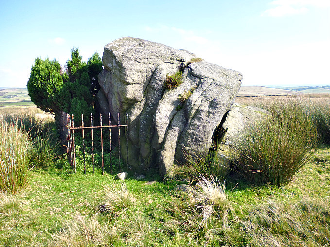
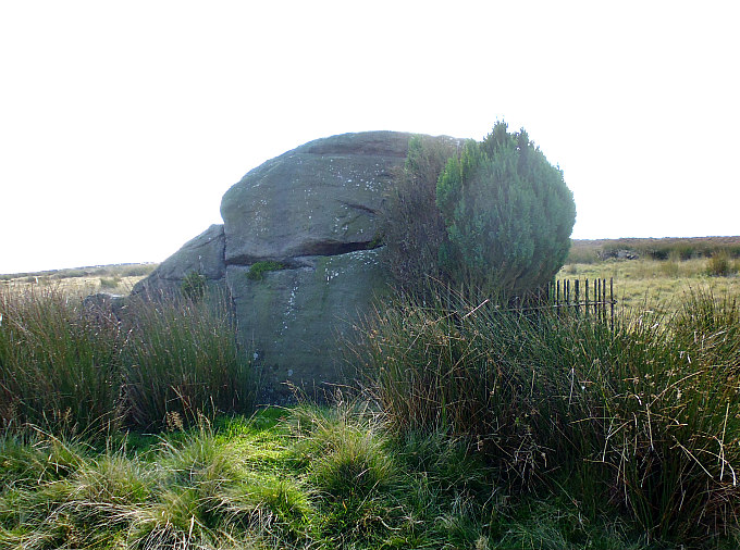
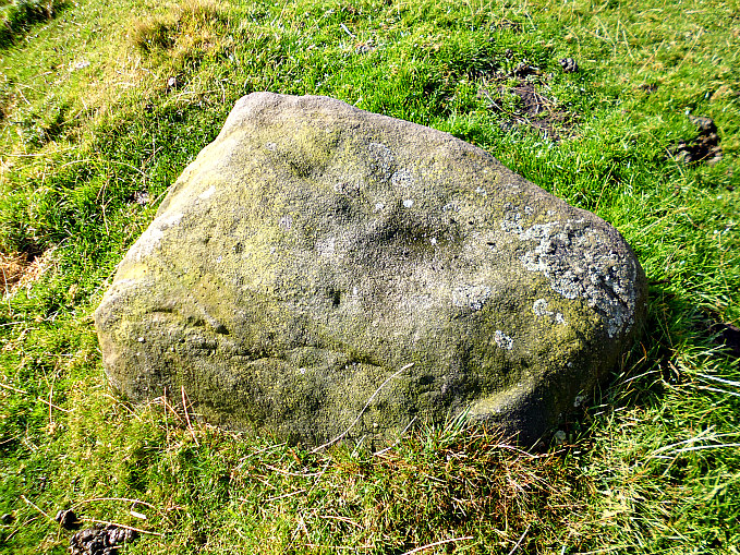
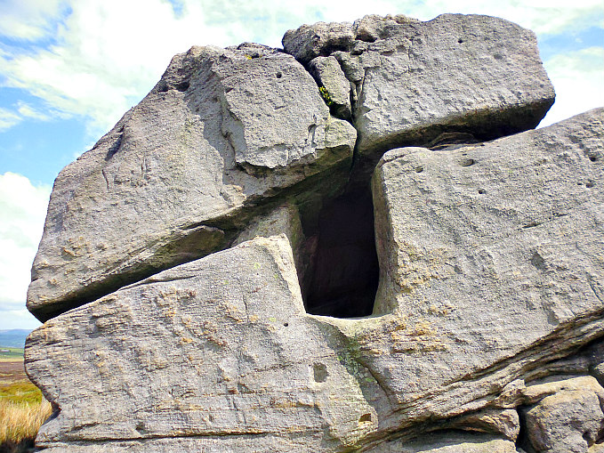
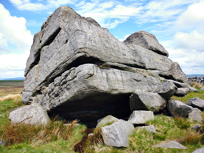
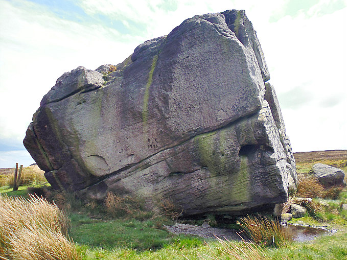
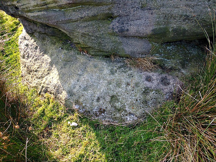
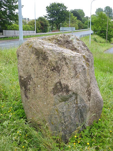
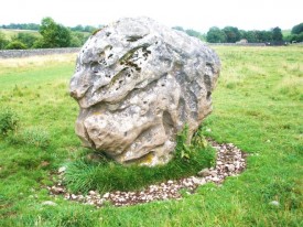
William Walker’s Stone at Far Slippery Ford, Newsholm Dean, near Oakworth, West Yorks.

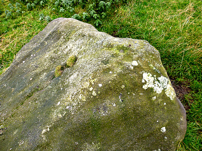
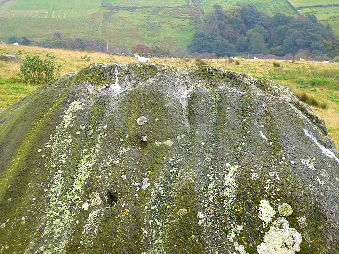
Close-up of William Walker’s Stone at Far Slippery Ford, near Oakworth.

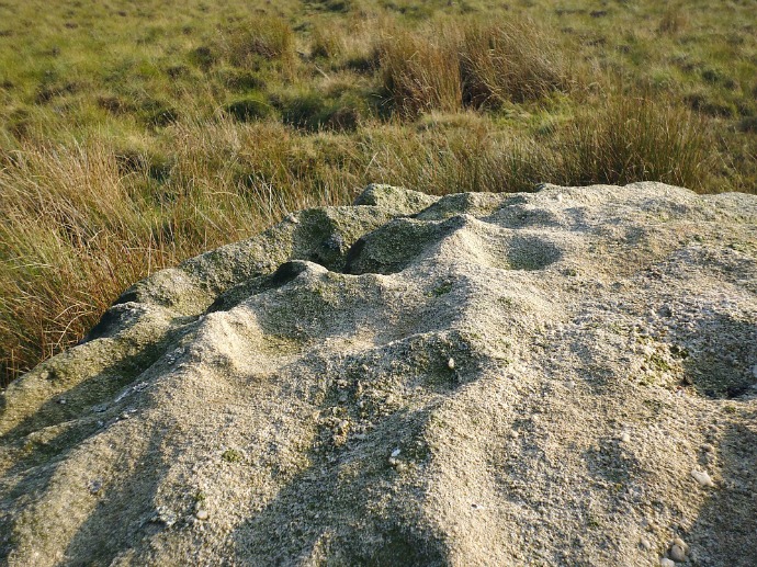
NGR: SD 99905 40664.  In the middle of a farmer’s field next to a drystone wall at Far Slippery Ford, Newsholme Dean, near Oak-worth, in west Yorkshire, there is a large glacial rock which is locally called William Walker’s Stone. The rock takes its name from a local farmer who had farmed the fields around here. After his passing in 2002 an inscription to his memory was carved onto the bottom of the rockface; there are a few more recently carved inscriptions on the rock. Also of interest: there are several faint cup-marks on the top surface of the rock and a partial ring with cup-markings inside it, but these are now very faint and difficult to make out when the light is not good, although when its raining these carvings are more visible to the eye. There are other cup-marked rocks and boulders 730 metres to the east at Greystones Farm. These erratic rocks and boulders, known as earth-fast, were deposited by the retreating glacier moving southwards 13,000-15,000 years ago; then coming forward in the late Neolithic and early Bronze Ages our distant ancestors carved these cup marks onto the smooth rock faces. From the A6068 at Cowling take Oakworth Old Lane (past the graveyard), Piper Lane, Buckstone Lane, Dick Lane, Long Gate, then Far Slippery Ford Lane to Walker’s Farm (on your left); here take the gated trackway (opposite) for a while until you see the boulder up against the wall in the field over to the SW.

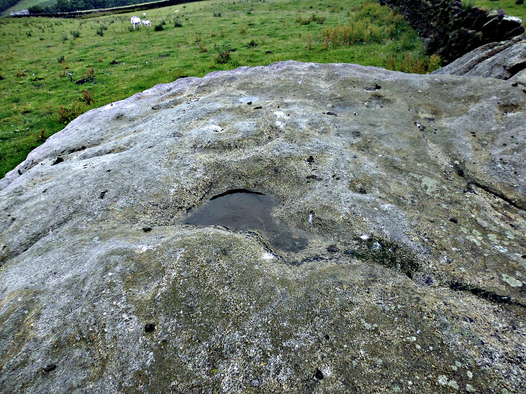
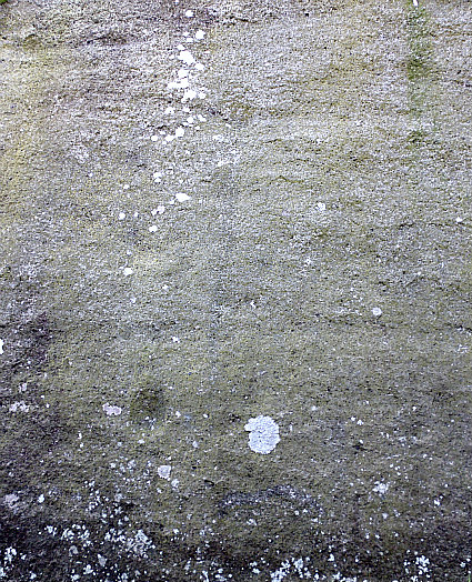
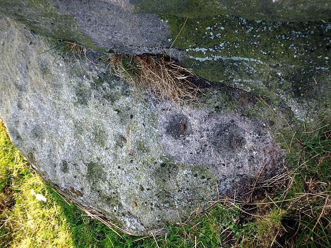
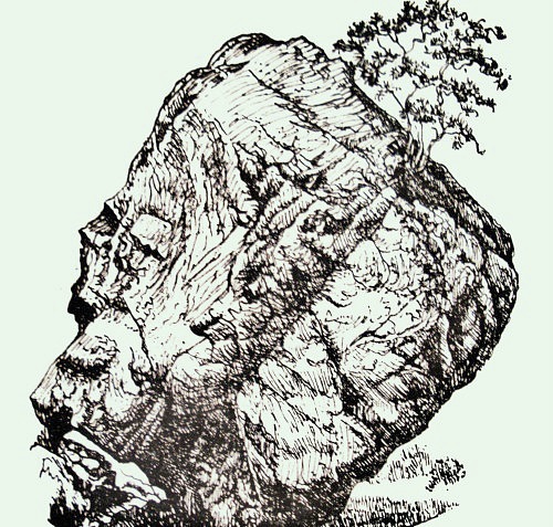
Close-up of the partial ring carving on William Walker’s Stone.

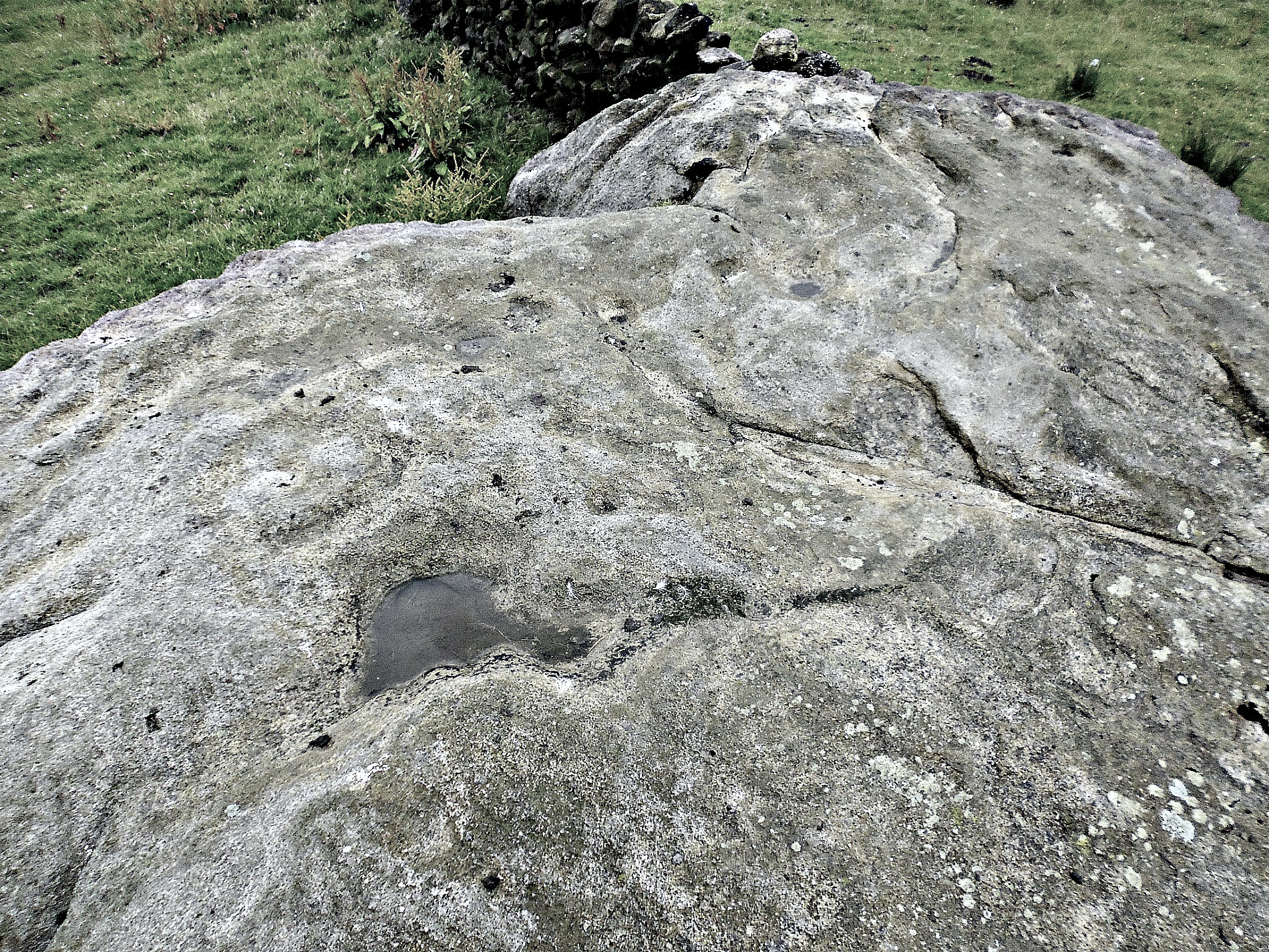
Cup-marks and a ring carving on William Walker’s Stone.

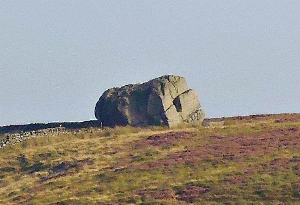
William Walker’s Stone is around 6 feet high and lies on its own here against a drystone wall. There are, though, other similar earth-fast rocks and boulders over to the east at Greystones and, further to the north on Sutton Moor, there are the Buck Stone, Hitching Stone, Kid Stone and Quicken Stone. But William Walker’s Stone is the only stone of those to have definite prehistoric cup-and-ring markings, which are also known as petroglyphs. There are said to be perhaps up to twenty cup-markings (circular depressions) on the top of the stone and a very worn ring can just be made out next to a small and shallow rock basin. The partial ring has several cup-markings around its edge and within it, which almost make it look like a face. There are maybe a few other cups with rings in a line on the upper side of the rock, though these might be more recent. There are also some curious grooves on the top of the stone but these might be naturally-formed features caused by weather-related erosion. The Northern Antiquarian discovered the rock carvings on William Walker’s Stone back in 2006, and, they also noted what might be a boundary mark with the letters “I W”, although the stone does not appear to have ever marked any such boundary!

Near the bottom of the eastern face of the stone can be found an inscription or epitaph to the memory of a local farmer, William Walker. The inscription is difficult to read now due to moss growing in the lettering, but it looks to say: William Walker Farmed here 1963 to 2002. The Walker family still farm here and their farmhouse is on the opposite side of the lane from the gated trackway. And another inscription, possibly to another farmer, reads: F. Allen 1958-63.

On your way back to the track/footpath you will notice a nice little well in the grassy field. I don’t know anything about how old it is but obviously the spring is very ancient. Water issues out of a plastic pipe and into a rectangular stone basin, which is flat to the ground. There is a channel allowing the water to overflow out of the basin and into a stony area at the front and then downwards into the field. The water looks very clear coming out of the pipe.

Sources / References & Related Websites:-

William Walker Stone, Keighley Moor, West Yorkshire | The Northern Antiquarian (wordpress.com)

William Walker Stone (Keighley Moor) [IAG0b] Rock Art : The Megalithic Portal and Megalith Map:

Greystones Farm Cup-Marked Rocks, Near Newsholme Dean, West Yorkshire | The Journal Of Antiquities

Slippery Ford :: Survey of English Place-Names (nottingham.ac.uk)

Copyright © Ray Spencer, The Journal of Antiquities, 2021.


2 Comments

Haystack Rock, Ilkley Moor, West Yorkshire

Haystack Rock on Ilkley Moor, west Yorkshire.

Haystack Rock from a different angle.

   OS Grid Reference: SE 13027 46313. A large and squat-shaped gritstone rock known as Haystack or Haystacks Rock on Ilkley Moor, west Yorkshire, has many cup-and-ring carvings, but also some more recent graffiti. The rock is thought to resemble a haystack and so the name has stuck. It is just one of many rocks and boulders upon Ilkley Moor, also known as Rombald’s Moor, many of these often strange-shaped rocks having ancient cup-and-ring carvings that date from the Neolithic and Bronze Age periods of prehistory. However, these carvings are often almost ‘lost to the heather’ and not that easy to find – though there are said to be 400 of them on the moor. Best to park at Cow & Calf Rock Café on Hangingstone Lane, then walk up to Cow & Calf rocks and walk along the moorland footpath going southwest for a while, then head south and up onto the footpath along the ridge to Haystack Rock; while on the horizon further in front of you you will see the strange-shaped Pancake Stone perched on the edge of the ridge.

Haystack Rock, Ilkley Moor, with cup-and-ring carvings.

Haystack Rock. Close-up of the cup-and-rings

   Haystack Rock, also known as Rombald’s Moor 141, is a glacial erratic boulder that was deposited here thousands of years ago and then, during the Bronze Age the curious if strange rock-art known as cup-and-rings were carved onto the sloping face of the rock by ancient people who lived in hut circles and settlements on the moor, or they were simply traversing it from one side to the other, building their stone circles and erecting standing stones as they moved around.  The climate at this time would have been much milder in the Winter than what it is today. The millstone grit boulder is 2m high and over 5m in length, and resembles a haystack depending on what angle you are viewing it from. There are said to be 70 cup-and-ring carvings on the rock, some having channels linking and running away from them, as well as a few other curious carvings; but there is more recent graffiti too, some of which is obviously from the Victorian age. It is briefly mentioned by Paul Bennett on page 56 in ‘The Old Stones of Elmet’ (2001), and there is much more information on ‘The Northern Antiquarian’ website (see below).

   Author Brian Spencer writing in 1986 says that: “Visitors to Ilkley can hardly avoid seeing the distinctive mass of the Cow and Calf rocks. Behind them the moor is rich in the carved stones of our prehistoric ancestors who have left not only their cairns and circles but enigmatically carved ‘cup-and-ring’ and ‘swastika’ stones. A walk from the Cow and Calf along the edge of the moor will take in all these features.” 

Sources and related websites:-

Bennett, Paul, The Old Stones of Elmet, Capall Bann Publishing, Milverton, Somerset, 2001.

Spencer, Brian, The Visitor’s Guide To The Yorkshire Dales, Teesdale & Weardale, Hunter Publishing Inc., Edison, NJ USA, 1986.

Haystack Rock, Ilkley Moor, West Yorkshire

http://www.stone-circles.org.uk/stone/haystack.htm

                                                                                          © Ray Spencer, The Journal of Antiquities, 2017


1 Comment

Kid Stone, Sutton Moor, West Yorkshire

Kid Stone on Sutton Moor, West Yorkshire.

Kid Stone on Sutton Moor, West Yorkshire.

   OS grid reference: SD 99631 41759. A glacial erratic rock at the east-side of Kid Stone Hill, above Long Gate, on Sutton Moor, west Yorkshire. It has been a parish boundary stone and way-marker for a long, long time although the actual boundary is ‘now’ some distance away to the south. There are “possible” faint cup-markings on the flat side of the rock, and at the other side there is a curious granite memorial stone to a local sheep farmer and a yew tree within some iron railings. The ‘Kid Stone’ might get its name from ‘a young goat’, or maybe some other localized name – similar perhaps to ‘Buck Stone’, ‘Cat Stone’ and ‘Wolf Stones’ to name but a few on the moor. To reach the stone: follow the footpath from Buckstone Lane towards Hitchin Stone, then south-east towards Quicken Stone, and then via off east across the moor onto Kid Stone Hill – the stone is in front of you. Or take the footpaths going north-west from Long Gate just above Far Slippery Ford.

Kid Stone on Sutton Moor (with yew tree).

Kid Stone on Sutton Moor (with yew tree).

Kid Stone on Sutton Moor (possible faint cup-marks)

Kid Stone on Sutton Moor (possible faint cup-marks)

   The weather-beaten glacial erratic boulder known as ‘Kid Stone’ stands on the eastern-side of Kid Stone Hill, on Sutton Moor. It stands upon the windswept moor at around 352 feet and is over 1,100 feet above sea-level. Originally this large gritstone rock marked the parish boundaries of Sutton and Newsholme, but today this boundary is a hundred yards or so further to the south. Geologically speaking the boulder was deposited here by a retreating glacier moving in south-ward direction some 12,000 years ago; this glacier is sometimes re-ferred to locally as ‘the Giant of Rombald’s Moor’ – to the north-east – as it came from there, although the boulder might have been scooped up from somewhere else along the way! The boulder is heavily worn, cracked, and has large grooves and channels running down its sides due to weather-related erosion (lots of rain). On its flat face there are a few “possible” faint cup-marks, or are these perhaps just more signs of erosion? 

   At one side of the boulder, inside some iron railings, there is a small yew tree growing and down at the base an odd/curious granite memorial stone to a local sheep farmer, Walter Rochester Airey, who died in 1994, but in what circumstances is not known. He lived at the farm back up the lane: New Bridge Farm on Buckstone Lane, Sutton-in-Craven. The memorial message on the stone says:- “In Loving Memory of Walter Rochester Airey, d 1994.”

Sources of information and related websites:-

https://www.sutton-in-craven.org.uk/historyDR.asp

https://en.wikipedia.org/wiki/Sutton-in-Craven


Cob Stone, Near Far Slippery Ford, Newsholme Dean, West Yorkshire

Cob Stone near Grey Stones Lane, Far Slippery Ford.

Cob Stone near Grey Stones Lane, Far Slippery Ford, west Yorkshire.

    OS grid reference: SE 00549 40890. In a field beside Grey Stones Lane and below an outcrop of rocks called Grey Stones Hill, near Far Slippery Ford, west Yorkshire, is a gritstone rock that is locally called Cob Stone. Whether it takes its name from a small round loaf of bread, or something else, I don’t know with any certainty, but I am also told that the word “Cob” means ‘Devil’ in this part of the country, so it could mean “Devil’s Stone”. The rock has a cluster of quite well-defined cup-marks on top and maybe a few fainter cups-marks lower down. To reach the stone you can take the footpath going east from Long Gate Lane at Far Slippery Ford. This will bring you to the bottom of the field. Other than that, you could see if the wooden gate opens on Grey Stones Lane next to the track going down to Grey Stones Farm. If it opens, then please make sure it is secured after entering, and on going back out again!

Cob Stone, beside Grey Stones Lane (cluster of cup-markings).

Cob Stone, beside Grey Stones Lane (cluster of cup-markings).

Large boulder near Cob Stone (with pos- sible cup-markings)

Large boulder near Cob Stone (with “possible” cup-markings).

    Cob Stone or Devil’s Stone is a glacial erratic gritstone rock that was deposited by a retreating glacier many thousands of years ago at the end of the last Ice Age. On top of the stone there is a cluster of 7 or 8 small cup-marks and further down a few fainter cups can just be made out. However, these faint cup-marks might have been caused by erosion – it’s often difficult to tell one way or the other, and the rock itself is now very smooth on its side due to thousands of years of weathering. Some 68m to the south-west there is an even larger boulder; maybe it’s another Cob Stone?, and this is indeed roughly shaped like a loaf of bread! This large boulder looks to have a few cup-marks on top and on its side, or are these due to erosion? And there are a few other rocks in the same field that have “possible” cup-markings; it’s just a case of walking around and looking closely at the many small and large rocks, and there are indeed “many” to look at. Cob Stone is recorded in Boughey & Vickerman’s  2003 survey.

    And of further interest to the lover of rock-art is another large rock some 80 metres to the south-east. This can be found at the north side of the large barn belonging to Greystones Farm. See the link below:-

Cup-Marked rock in the field near Cob Stone.

Cup-Marked rock in the field near Cob Stone, Grey Stones Lane near Far Slippery Ford.

Stone near Cob Stone (possible faint cup-marks)

Stone near Cob Stone at Grey Stones Lane, Far Slippery Ford (possible faint cup-marks)


Sources and related websites:-

Cob Stone Field, Keighley, West Yorkshire

Greystones Farm Cup-Marked Rocks, Near Newsholme Dean, West Yorkshire

                                                                            © Ray Spencer, The Journal Of Antiquities, 2016.


Hitching Stone, Near Cowling, West Yorkshire

Hitching Stone on Keighley Moor.

Hitching Stone on Keighley Moor.

    OS grid reference: SD 9866 4170.  At the western side of Keighley Moor, between Cowling and Keighley, stands a huge gritstone boulder called ‘Hitching Stone’. The stone stands on the Lancashire—Yorkshire border and also parish boundaries. Hitching Stone is in fact an erratic boulder which was deposited here many thousands of years ago by a retreating glacier at the end of the last Ice Age. There are some in-teresting myths and legends associated with this huge boulder, not all of them being plausible. The stone can be reached from Buckstone Lane to the east of Cowling. There is a small carpark for Wainman’s Pinnacle. Take either of the two footpaths opposite this carpark and head south onto the moor for around 880m; the footpaths cross some quite boggy land and a couple of streams, but keep close to the wall all the way to Hitching Stone. You can’t really miss it as the huge boulder stands out on the landscape for several miles!

Hitching Stone (closer up) north and west faces.

Hitching Stone (closer up) the north and west faces.

    Hitching Stone is a huge, almost square-shaped block of gritstone that is probably as large as a small house, well it is 21 feet high, and is almost 30 feet long and 25 feet wide, and is said to weigh well over 1,000 tonnes. It probably originally came from Earl Crag up above Cowling, which is just over a mile to the north. At the last Ice Age 12,000-14,000 years ago the great boulder was scooped up by a retreating glacier, and as it moved southwards the ‘object’ was deposited in its current location – rather like it was ‘hitching a lift’, and that might be where the name “Hitching” comes from, or a giant carried the stone from Rombald’s Moor – though that giant could have been the retreating glacier! Another legend says a witch from Ilkley pushed or threw the stone across the moor to its current position! It is reputed to be Yorkshire’s largest boulder.

Hitching Stone (west face showing fissure and hole).

Hitching Stone (west face showing fissure and rectangular hole).

    About half-way up the west face of the stone is a large rectangular-shaped dark hole (recess)which seems to go quite along way into the stone, similar perhaps to a tiny cave, but it would seem that a large stone of a ‘different type’ was originally embedded into it; this eventually eroded away leaving the large, natural hole. This has sometimes been called ‘The Druid’s Chair’- harking back to more ancient, magical times, perhaps. Just above that is a long fissure (tube) that runs through the whole of the N and W faces. This fissure was originally filled by a fossilized tree which eroded away leaving the massive crack across the stone, almost cutting the top half in two. On the top of the stone there is a hollowed-out basin that is 3 foot deep and usually filled with rainwater; indeed this natural pool of water is never said to dry-up even in hot, dry conditions.

Hitching Stone (the south-east side).

Hitching Stone (the south-east side).

     Paul Bennett in his highly acclaimed work ‘The Old Stones of Elmet’, says of Hitching Stone: “It is a likely contender as a British omphalos, or ‘culture of the universe’ stone. Our other omphalos contender, the Ashlar Chair ten miles to the east, is just visible on the distant horizon. Its geomantic virtues represent the forces of life, death, rebirth and Illumination.” Bennett goes on to say that: “As a centre-point to the many regions it is little surprise the Hitching Stone was used as the meeting place of ancient councils and local parliaments. This tradition only stopped in the eighteenth century. Prior to this, folklore tells us it was used as a council moot by the pre-christian priests (druids). In similar tradi-tion this giant boulder was also the site of markets and Lammas fairs held in early August—the last of which was held in 1870. Such gatherings originated in pre-Christian times and it is likely that the gatherings here were part of a tradition which went back several thousand years.”

Hitching Stone (north face).

Hitching Stone (north face).

    In the book “The Pendle Zodiac’ by Thomas Sharpe, we are told more about the solstice alignment and sighting point with regard to ‘Hitching Stone’. The authors says: “The Hitching Stone is a glacial erratic, which seems to have been guided through this recursive field to its present position at the centre of the innermost polygon (vortex effect). This may have happened because even up until the end of the last glaciation, the Earth would have been relatively ethereal and less physically dense than it is today. It partly explains why the calibration curves of radiometric dating, using the half-lives of radioactive isotopes, are generally inconsistent. Then of course, the subtle fields may likewise guide migratory birds  shown to have a magnetic sense. For instance, over the West Sussex migratory wetlands of Pulborough Brooks is centred a replica polygon. The Hitching Stone, then, as well as marking an old county boundary, has become an entelechy in itself, and nesting within its attractor field it really exists between two worlds.”

    Sharpe goes on to say that: “Local tradition claims that the Winter Solstice sunrise is from behind the Hitching Stone, when viewed from the cup-marked and aptly named ‘Winter Hill Stone’. In the same fashion…..the Vernal Equinox sunrise (from) behind the Hitching Stone is in alignment with Pendle Hill.” The Winter Hill Stone is roughly 500 yards to the north-west of Hitching Stone.

Sources and related web-sites:-

Bennett, Paul, The Old Stones of Elmet, Capall Bann Publishing, Milverton, Somerset, 2001.

https://thejournalofantiquities.com/tag/hitching-stone-on-keighley-moor-in-west-yorkshire/

http://www.megalithic.co.uk/article.php?sid=10059

http://philipcoppens.com/hitchingstone.html

http://www.bradfordhistorical.org.uk/boundary.html

Sharpe, Thomas, The Pendle Zodiac, Spirit Of Pendle Publishing, 2012.


Winter Hill Stone, Keighley Moor, West Yorkshire

Winter Hill Stone, Keighley Moor.

Winter Hill Stone, Keighley Moor.

OS grid reference: SD 9828 4197. Upon Keighley moor (western side) and overlooking Cowling stands the Winter Hill Stone, a large weather-beaten boulder that has many faint cup marks at its base and others on top. The stone lies some 630 yards to the northwest of Hitching Stone, on the Yorkshire-Lancashire border, which is a huge block of gritstone. It is from Winter Hill Stone that the winter solstice sunrise can be seen, so obviously a place

Cup-Marks on Winter Hill Stone.

Cup-Marks on Winter Hill Stone.

of great reverence in prehistoric times; the cup marks being carved in the Bronze Age. To get to this stone it is “best” to follow the footpath opposite the small carpark, on Buck Stone lane, close to Wainman’s Pinnacle, then head in the general direction of the Hitching Stone, but after some 460 yards (at the little wooden gate) veer off to the south-west and, a further 380 yards brings you to Winter Hill Stone, close to the western edge of the moor overlooking the hamlet of Over Dean. The village of Cowling is 2 miles to the west and Cross Hills a further 4 miles north along the A6068 road.

Winter Hill Stone (Top).

Winter Hill Stone (Top).

This large rounded, weather-worn stone is quite prominent upon the flat-shaped Winter Hill, but sadly the cup markings around the stone’s base are now much less prominent – indeed some of them are barely legible to the eye. There are at least 17 tiny cup marks that are eligible, the rest are very faint, but on the top of the stone more cup marks are quite well-defined, indeed over time they have become deeper and wider due to the constant weathering; the strange grooves and ruts are also the result of erosion to the soft gritstone. The hill on which the boulder stands is ‘so named’ because the winter sun can be seen to rise from [here] behind the Hitching Stone over to the northwest. There are many, many other boulders and stones littering the moor, one or two also look as if they “might” have very faint cup marks on them. In particular, a boulder some 380 yards to the south-west of Winter Hill, looks a likely candidate. It is highly likely that there were ancient settlements somewhere on the moor, but obviously these are now hidden beneath the thick, dense carpet of ferns and heather which seem so relentlessly to have taken over.

The author Paul Bennett in his epic work ‘The Old Stones of Elmet’ says: “Although there are some cups higher up the rock, oddly the majority are just above ground level. This makes little sense until one realises, thanks to its name, that the winter solstice sunrise was observed from here rising up behind the gigantic Hitching Stone on the near skyline.”

Hitching Stone.

Hitching Stone.

The Hitching Stone (OS grid ref: SD 9866 4170) is a huge glacial erratic block of gritstone the size of a small house that was deposited here at the last Ice Age. It reputedly weighs over 1,000 tonnes. Large fissures run vertically through the rock, one of which was caused by a fossilised tree that has worn away; while one side of the rock bears a large oblong-shaped hole that people climb into. There are some Victorian inscriptions on the stone while at the top a deep natural basin containing rainwater that is never known to dry up, even in long dry spells of weather. Long ago local folk visited the stone in order to participate in various games, and the site was also a meeting place for local councils and parliaments – Bennett ‘The Old Stones of Elmet.’ The Hitching Stone stands on the Yorkshire-Lancashire boundary.

And in the interesting little book ‘The Pendle Zodiac’ by Thomas Sharpe we are told that the Vernal Equinox sunrise behind the Hitching Stone is in alignment with Pendle Hill. Sharp goes on to say: “Where natural markers (and even some of these have pecked ‘cup and ring’ markings) are absent, the ancestors would have incorporated standing stone monoliths to time the alignments and to receive into the landscape, etheric vitality from the luminaries.” Pendle Hill beacon is roughly 14 miles, as the crow flies, to the southwest of Winter Hill Stone and  Hitching Stone.

These large gritstone boulders on Keighley Moor were laid down thousands of years ago at the last Ice Age by a massive glacier moving southwards, and retreating as it did so. Over time the boulders (erratics) themselves are slowly weathering-away due to the often wet, windy climate upon the moor. Nowadays, however, these strange, often round-shaped boulders and stones have become waymarkers and sentinels that seem to loom up on the barren, unforgiving landscape, taking one by sudden surprise!

Sources:

Bennett, Paul., The Old Stones of Elmet, Capall Bann Publishing, Milverton, Somerset, 2001.

Sharpe, Thomas., The Pendle Zodiac, Spirit Of Pendle Publishing, 2012.

http://davidraven-uk.blogspot

Copyright © Ray Spencer, The Journal of Antiquities, 2014 (updated 2023).


3 Comments

The Crossgates Stone, Seamer, North Yorkshire

The Crossgates Stone near Seamer railway station.

The Crossgates Stone near Seamer railway station.

Os grid Reference: TA 1268 8163. In a grassy area at the top of Station road, Crossgates, Seamer, some 3 miles south-west of Scarborough, stands a solitary glacial erratic boulder that is known to have been deposited by a glacier many thousands of years ago. Local legend says the boulder originated from the Lake District, or did it? The large stone has been a landmark here for many years, but originally it stood a little further down the road, and there may have been other glacial boulders in this area. The village of Seamer is about 1 mile up the road, while Scarborough is 3 miles to the north-east on the B1261 and A165 roads.

The Crossgates Stone at Seamer near Scarborough.

The Crossgates Stone at Seamer near Scarborough.

This large, solitary granite boulder is around 6 feet in height and double that in girth, and is set well into the grassy ground at the top of Station road (at the junction of the B1261 Scarborough road and Station road), but it had originally stood in the yard of Seamer railway station at the bottom of the road where it had resided for some considerable time. In 1947 permission was granted for the boulder to be moved up the road from the old railway station. The information plaque alludes to the fact that the stone was carried here by a glacier moving south-eastwards from Shap in Cumbria at the end of the Ice-Age thousands of years ago, but could it in fact have been carried south from Scotland or maybe Northumbria instead? On the way south it apparently got dislodged in a natural gap in the higher land at either side – the B1261 and A165 roads to Scarborough now run through this naturally-formed gap. So it’s ‘highly probable’ that there were other boulders in this area, though where they are remains something of a mystery.

The Crossgates Stone close-up.

The Crossgates Stone close-up.

The iron information plaque at the front of the stone does not say a great deal about the stone’s history, but in brief it says that:- “A boulder of Shap granite moved to Seamer by a glacier in the Ice Age. It was moved to this site on 3rd December 1947 from Seamer station grounds with the co-operation of The British Railways Board and Dowsett Ltd.”


The Bowder Stone, Rosthwaite, Cumbria

The Bowder Stone, Cumbria

The Bowder Stone, Cumbria

OS grid reference: NY 2540 1641. In the valley of the river Derwent, in Borrowdale, just north of Rosthwaite in a woodland clearing on the opposite side of the road from the river, stands a huge glacial boulder shaped like a human head that is one of several Cumbrian curiosities and, which has locally been called The Bowder Stone or Balder’s Stone, after the son of the Norse god, Odin (Woden). This ice-borne rock was carried down the valley by a glacier many thousands of years ago and deposited having been trapped and then dislodged between the two side-slopes of the river valley. Today, the massive rock has become a tourist attraction and a photographer’s delight! And many antiquarian writers have travelled here to see the stone and maybe “try”and measure its height and girth, and to be amazed at this wonderous geological curiosity. The village of Rosthwaite is 1 mile south on the B5289 road and Grange is roughly one and half miles north-west, while the town of Keswick is 5 miles in the same direction from here.

The Bowder Stone (Geograph)

The Bowder Stone (Geograph)

The Bowder Stone is 36 feet high (10.9 metres), 62 feet long (18.8 metres) and 90 feet (27.4 metres) in circumference though ‘a few’ might, perhaps, argue with these approximate measurements! It is said to weigh somewhere between 1,970 to 2,000 tons, give or take a few! Geologically speaking the huge rock was brought to its present position by a ‘retreating glacier’ moving south from Scotland during one of a number of Ice Ages 12,00-15,000 years ago; this being a well-known fact because the rock is not from the local area, which is largerly volcanic in its geological make-up. It is a free-standing erratic in that it does not touch the surrounding rocks, but simply balances and pivots deep in the ground beneath it. The rock is shaped like a human head, or several heads with faces – you can easily see a nose, eyes and mouth on at least three different parts of the stone if you look closely at it, indeed you might see more than three! A step-ladder allows access to the top of the stone where a good panoramic view can be had of the Derwent Valley and Upper Borrowdale; the various marks and holes in the stone have been made by climbers. There are other glacial erratic rocks close by, but none of them quite as big as The Bowder Stone.

The Ward Lock Red Guide (Lake District) 1975 sums up the rock quite nicely: “A mile from Grange Bridge and immediately beyond a large slate quarry is the famous Bowder Stone, a remarkable rock of prodigous bulk, which lies like a ship upon its keel.” And author Maxwell Fraser in his book ‘Companion Into Lakeland’, 1939, says: “The chief tourist site of Borrowdale is the curious geological feature, the Bowder Stone, a poised block of stone 36 feet high which is reckoned to weigh 1,970 tons.” In the great Arthur Mee’s book ‘Lakeland Counties’ we are told about one ancient curiosity of Borrowdale, Castle Crag, a nearby Iron-Age hillfort, and then the author goes on to say: “Another is the curious Bowder Stone, an immense boulder of about 2,000 tons……, which after rolling down the fell-side, has remained balanced on an edge so narrow that through a hole in it two people can shake hands”. According to tradition, two people holding hands through the opening at the bottom of the rock and then making a wish, shall have that wish come true.

Sources:-

Fraser, Maxwell., Companion Into Lakeland (Second Edition), Methuen & Co. Ltd., London, 1939. 

Mee, Arthur., Lake Counties, (Seventh Impression), Hodder And Stoughton Ltd., London, 1961.

‘Lake District’  Ward Lock Red Guide, (edt by Reginald J.W. Hammond), Ward Lock Limited, London, 1975.

The Illustrated Road Map Of England & Wales, The Automobile Association (AA), London, 1962.

Geograph  © Copyright Graham Hogg and licensed for reuse under this Creative Commons Licence.


2 Comments

Samson’s Toe, Langcliffe, North Yorkshire.

Samson's Toe Glacial Erratic Boulder, Langcliffe, North Yorks.

Samson’s Toe Glacial Erratic Boulder, Langcliffe, North Yorks.

Os grid reference SD 83176 66229. About 1 mile to the east of Langcliffe village, near Langcliffe High Mill, in the Yorkshire Dales National Park, stands a huge glacial erratic boulder that is locally called Samson’s Toe. It is located in an area of limestone ridges and scars known as ‘Whinskill’, which is probably a Scandinavian name. Here, in this barren, rocky land, there are a number of large boulders known as “rocking stones”. To the north the great bulk of Pen-y-Ghent can be seen as can the flat-topped Ingleborough further to the north-west – when the weather is fine and sunny that is! The town of Settle is 2 miles to the southwest.

The great boulder can be found in a limestone-strewn area called ‘Whinskill Rocks’, just west of Henside Lane and close by a wooded area. Lower Whinskill Farm can be seen a bit further to the west. The glacial boulder called Samson’s Toe is approx 8 foot high and it stands (or pivots) upon little limestone stilts that, because they have been protected have not eroded away, at the edge of a ridge of limestone. It is said to be possible to “rock the stone” but you would need many strong men to do this! The boulder has, however, suffered from graffiti some of which could date from the Victorian age.

The boulder is apparently shaped like a giant’s toe – the giant in question being Samson. According to legend, he lost his footing when jumping across from Langcliffe Scar or Ribblesdale, breaking off his toe whilst attempting this. But, in fact, the boulder was deposited here at the last Ice-Age 12,000-13,000 years ago or more by retreating glacial flows moving from north to south – the boulder being picked up by the glacier somewhere to the north, perhaps the Lake District, or a bit closer to home. The great boulder is made from something called “greywacke”, a grey-black hard sandstone made up of fine pebbles, quartz, feldspar and other rock fragments. There are two other boulders nearby, just to the east over on the opposite side of Henside Lane, which make up the Whinskill Rocks –  these are also referred to as “rocking stones” on ordnance survery maps of this area.

Sources:-

Thanks to David Gledhill for the up-dated grid reference.

Cook, David & Kirk, Wendy., Pocket Guide Rocks & Minerals, Larousse, London, 1995.

Click on the following link  http://flickrhivemind.net/Tags/winskillstones/Interesting


The Linton Stone, Linton-in-Craven, North Yorkshire

The Linton Stone, North Yorkshire

The Linton Stone, North Yorkshire

SE0042 6317. Standing in a field just opposite St Michael & All Angels church at Linton, near Grassington, is a 6 foot high boulder. The limestone boulder is round-shaped and covered in large holes or pockmarks along with grooves caused by erosion over thousands of years. In the same field there are other recumbant stones, though these are much smaller in size. And built into a wall not far from the banks of the River Wharfe there are three smaller limestone boulders. The largest of these is obviously a glacial erratic that was deposited here by the retreating ice flows some 11,000-13,000 years ago at the last Ice-Age.

It could be that the boulder and whats left of these other stones originally formed a pagan stone circle; these stones being moved in to position in prehistoric times by a tribe of ancient people living beside the river. The boulder and the other scattered stones form an alignment, but many have been robbed away by local farmers. Near the entrance to St Michael’s church on church road stands the stump of an Anglo-Saxon cross which means the site was Christianised at some point between the 7th-9th century AD.


The Great Stone Of Stretford, Gorse Hill, Manchester.

The Great Stone of Stretford

The Great Stone of Stretford

SJ8041 9553. At the lodge entrance to Gorse Hill Park on the Chester road (A56), in Stretford, stands the curious ‘Great Stone’. The rectangular-shaped stone, made of millstone grit, is 3 feet high, 5 feet wide and 2 feet deep and the two large holes (slots) in the top are roughly 7 inches deep. Locally called the plague stone it is, in fact, a glacial erratic boulder that was originally deposited at Great Stone Road close by at the last Ice Age – perhaps up to 13,000 years ago.

According to legend and local folklore the holes in the top of the stone were filled with vinegar or holy water, perhaps vinegar in one hole and holy water in the other. Coins given by plague victims were placed in the vinegar to steralise them; the holy water  hopefully cured the victim of the disease. Legend says that the stone was thrown by a Saxon giant called Tarquin who lived in the castle at ‘Castlefield’ in Manchester – the holes being for his finger and thumb. He was apparently killed in a local battle by Sir Lancelot. But other theories suggest that the stone is the base of a Saxon cross or a mile stone for the Roman road leading to their fort at Northwich (Condate).