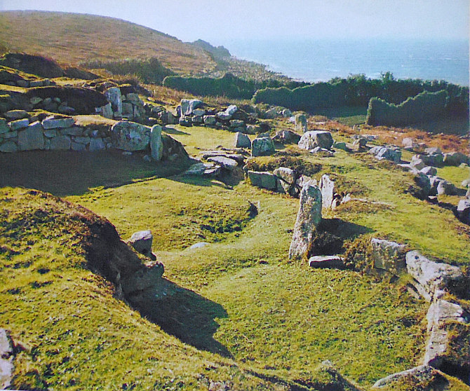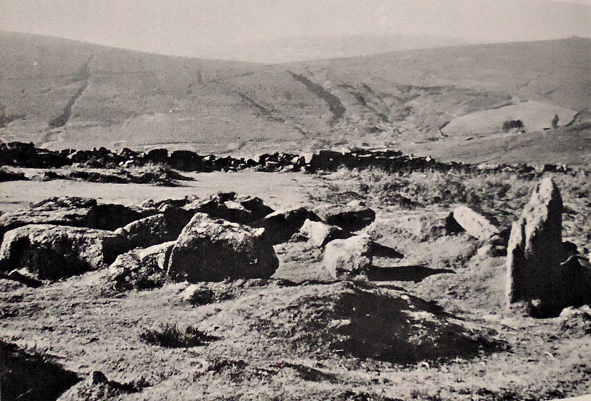
Grimspound Ancient Settlement, Near Manaton, Devon
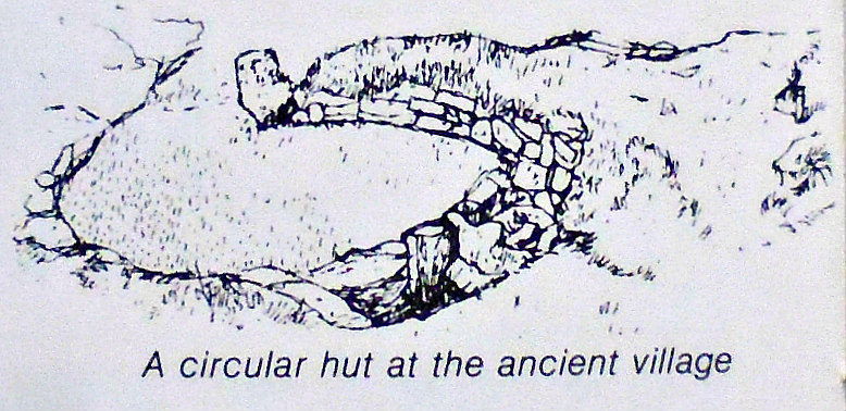
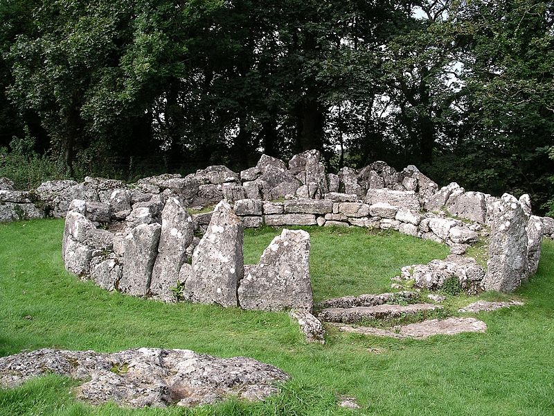
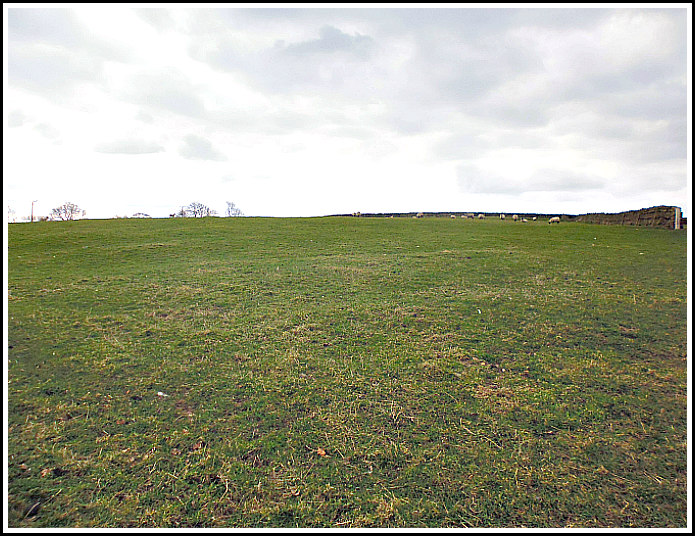
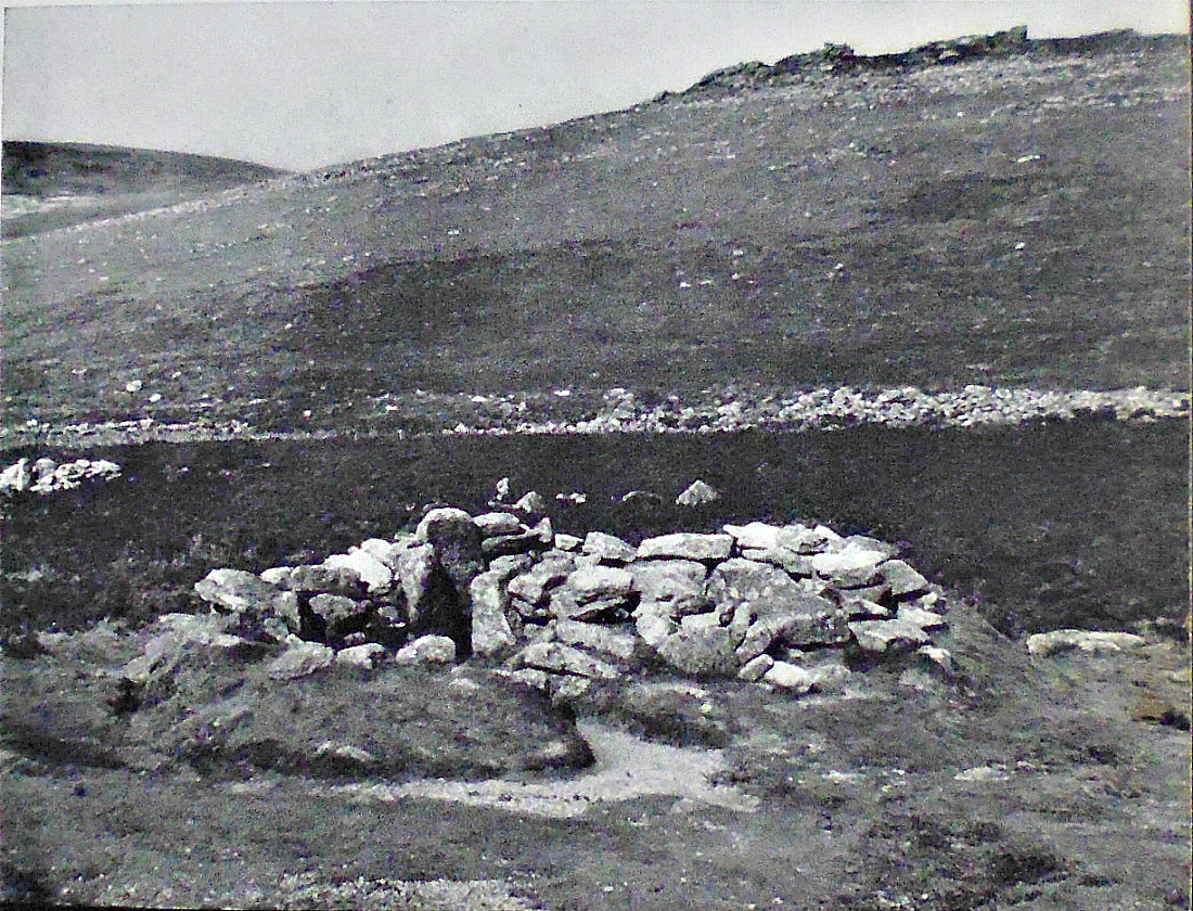
Grimspound Ancient Settlement in Devon. One of the hut circles.
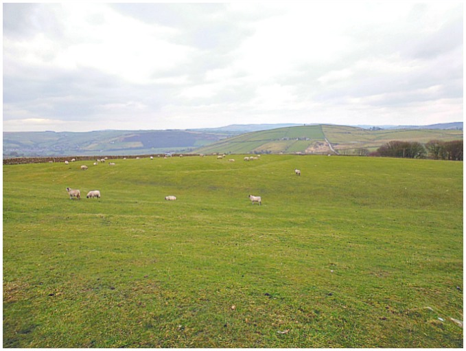
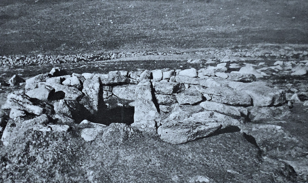
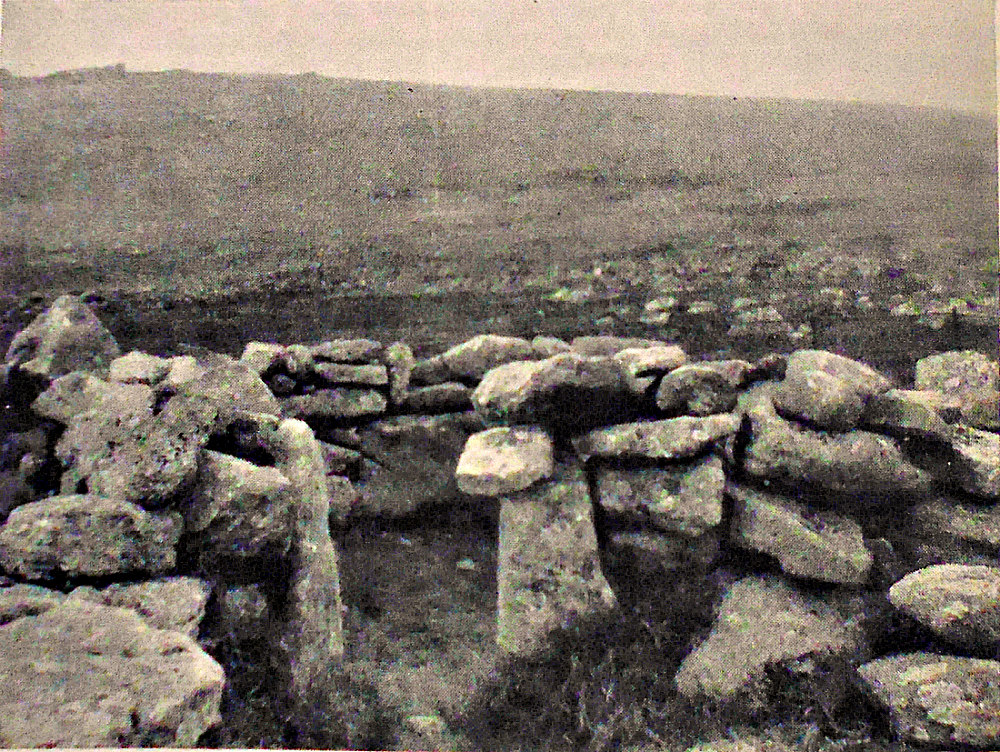
NGR: SX 7006 8089. At the northern side of the Dartmoor National Park half-way between Hameldown Tor and Hookney Tor and 3 miles to the west of Manaton, Devon, is the Grimspound Ancient settlement, an almost circular four-acre site dating from the mid to late Bronze Age period of pre-history. The whole site is enclosed by an almost complete 500 foot diameter ancient boundary wall and within this there are 24 hut circles or roundhouses, some of which are in an excellent state of preservation, although a few have had to be rebuilt. The hut circles were built with loose stones, indeed some very large, shaped stones were used, and they had narrow entrances; most of the huts were used as dwellings with hearths but a few were used for storage or maybe as animals shelters, and they would have been roofed-over. Nearby there is an ancient field system. To reach the site head W on the country lane from Manaton; then W again for 1 mile to Heatree and Heather-combe Forest. Now walk W for 2 miles on the footpath over the hilly, windswept moorland to Grimspound Ancient Settlement.
Timothy Darvill (1988) tells us that: “This site is probably the best-known middle Bronze Age enclosed settlement on Dartmoor. It lies in a shallow valley sheltered from the wind by hills to the north and south in an area of wild open moorland. When the site was occupied between about 1600BC and 1200BC, the climate was warmer than today, and this part of Dartmoor was probably open grassland occasionally punctuated by small fields. The Grimspound enclosure covers an area of about 1.6ha, and is bounded by a stout wall of granite boulders. The ancient entrance lies on the south side; the other gaps are modern. Inside are the foundations of over 20 buildings, all round in plan with walls up to 1m thick. Sixteen of them were probably dwellings and another eight possible storage buildings, barns or byres. The stone foundations visible today originally supported a wooden superstructure and a thatched roof.
Roland Smith (1990) says: “In his first report back to Sherlock Holmes from Baskerville Hall, in Conan Doyle’s novel The Hound of the Baskervilles, the famous detective’s loyal lieutenant, Dr Watson, painted an accurate picture of Dartmoor’s brooding sense of prehistory:
On all sides of you as you walk in the houses of these forgotten folk, with their graves and the large monoliths which are supposed to have marked their temples. As you look at their grey stone huts against the scarred hillsides you leave your own age behind you, and if you were to see a skin-clad, hairy man crawl out from the low door, you would feel that his presence there was more natural than your own.
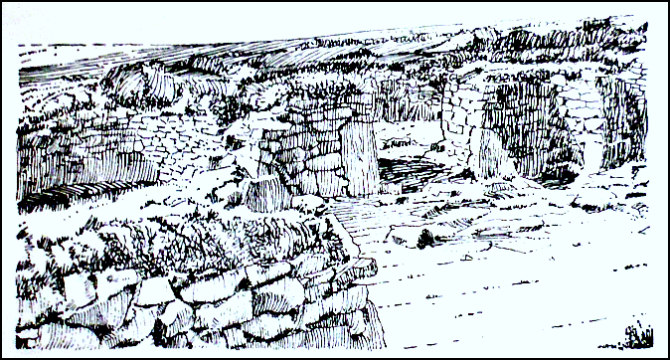
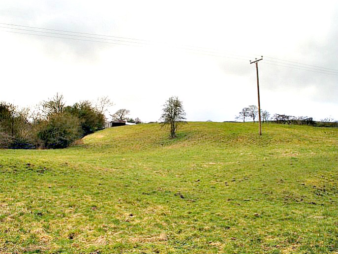
Grimspound Ancient Settlement. One of the B/A hut circles.
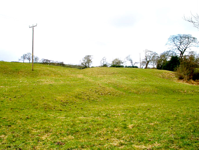
Grimspound Ancient Settlement. Entrance to one of the huts.
Watson’s keenly observant eye led him to the conclusion that the occupants of Dart-moor’s many pre-historic hut circles must have been an ‘unwarlike and harried race’, forced out on to this inhospitable moor where no one else would settle. Of course, in Watson’s day, pollen analysis of Dartmoor’s peat had not yet revealed that the climate of Bronze Age Britain was several degrees warmer and much drier than it is today. But as you pick your way through the foundations of a settlement like Grims-pound , near Manaton, it is not difficult to share the good doctor’s uncanny feeling about the close proximity of the past and those pioneering first farmers. Grims-pound, on the wild and windswept combe between Hameldown and Hookney tors, is the most complete and accessible of Dartmoor’s Bronze Age village settlements. The wall surrounding the four-acre site is almost complete and still 6 ft (1.8 m) high in places, and the remains of two dozen hut sites can be clearly seen. It is the nearest thing England has to Orkney’s Skara Brae settlement, and a place where the past seems very close.”
Janet & Colin Bord (1991) say that: “Dartmoor today does not look the most inviting of locations for a cattle farm, but in the late Bronze Age conditions may have been better. Grimspound survives as evidence for such settlements, and a ruined wall encloses a large area in which can be seen the remains of about twenty-four huts and some cattle-pens. The name ‘Grimspound’ was given to this place when it was already ruinous and its occupants forgotten — ‘Grim’ means the Devil, or Woden, or some evil spirit.”
Crispin Gill (1976) tells us more, saying: “Of all the Bronze Age villages on the Moor none has a more striking wall around it, heavily built and 6ft high in places. A stream runs in and out, there are clearcut gateways and 24 huts inside, all free-standing, and some small courts against enclosure walls. It covers nearly 4 acres. The general belief is that the wall was to keep animals in, protected from natural predators, rather than to keep out human enemies.”
Sources / References & Related Websites:-
Bord, Janet & Colin, Ancient Mysteries of Britain, Diamond Books, 1991.
Clamp, Arthur L., A Pictorial Guide to Eastern Dartmoor, Westway Publications, Plympton, Plymouth, Devon, 1969 or 70.
Darvill, Timothy, Glovebox Guide — Ancient Britain, Publishing Division of The Automobile Association, Basingstoke, Hampshire, 1988.
Gill, Crispin, David & Charles Leisure & Travel Series — Dartmoor, David & Charles (Publishers) Limited, Newton Abbot, Devon, 1976.
Smith, Roland, Britain’s National Parks — A Visitor’s Guide, Dolphin Publications, Salford, Manchester, 1990.
https://www.english-heritage.org.uk/visit/places/grimspound/history/
https://en.wikipedia.org/wiki/Grimspound
More here: https://www.legendarydartmoor.co.uk/grim_pound.htm
Copyright © Ray Spencer, The Journal of Antiquities, 2021.