The Journal Of Antiquities

Ancient Sites In Great Britain & Southern Ireland


Dun Aengus Fort, Inishmore, Aran Islands, Co. Galway, Southern Ireland (The Republic of Ireland).

Dun Aengus Fort near Kilmurvey in County Galway, Southern Ireland.

Irish Grid Reference: L 8180 0976. The ancient semi-circular shaped fort of Dún Aengus (Fort of Aonghasa), near Kilmurvey, is situated at the edge of a 330-foot high cliff overlooking Galway Bay on Inishmore (Inis More), which is one of the three Aran Islands, in west County Galway, Southern Ireland (The Republic of Ireland), and, is thought to date from the late Bronze Age to the early Iron Age – around 1,000 BCE, or maybe earlier. This spectacular cliff-top hill fortification or Cashel is the best known of all the prehistoric forts on the Aran Islands and is now an archaeological site of great interest. It was an ancient stronghold with some very serious defences: stone ramparts and dry-stone walling made of jagged, tooth-like upright slabs and blocks of Limestone – with the innermost ramparts enclosing an area of around 150 feet in diameter, but the whole site is said to cover 11 acres (6 hectares). Its strategic location on the cliff edge added to the security of the fort and would have allowed its defenders to ‘keep a look out’ for any would-be invaders from all directions, especially landward, but, also seaward too – the sheer cliff face making the hill-fort above unassailable and unattackable to anyone wanting to even attempt it. Dún Aengus ancient hill-fort is located nearly ½ a mile southeast of the village of Kilmurvey (Kilmurvy). The site is in the care of Heritage Ireland.

Treasures Of Britain (1968) tells us that: “The most spectacular of the Aran Islands’ many prehistoric monuments, this dra-matically sited drystone fort encloses nearly 11 acres. It has three rings of defense, the central one reinforced with a line of jagged limestone uprights. The innermost rampart encloses an area about 150 ft in diameter. There are three principal islands: Inishmore to the north-west, Inishmaan in the middle, and Inisheer to the south-east. On all three islands there are numerous early drystone forts…… The exact date of the great forts is unknown, but they are presumed to be of the Iron Age. INISHMORE, Kilronan, the principal town, is in Killeany Bay on the north-east coast. The major monument is the world-famous Dun Aengus, a huge drystone semicircular fort standing on the edge of a 300 ft cliff dropping sheer into the sea. To the north-west is Dun Onaght, a large ring-fort, also restored…… In the centre of the island, near the highest point, is Dun Oghil, a large stone ring-fort…… A mile and a half to the west is the promontory fort of Doocaher, also with a defensive line of spikes, and also restored, with clochans.”

Historic Britain (1956) says: “Research by archaeologists is discovering more and more information about prehistoric civili-zation in Scotland and Ireland. Dun Aengus in the Aran Islands, one of the many prehistoric forts of Ireland, encloses an area of eleven acres on the edge of the cliffs. The outer defences of this vast encampment are shown below (see photo, left). They consist of well-built dry-stone walls in the same tradition as the walls, for instance, of the dwelling places…… in the Orkney Islands.

Close-up of the ramparts of Dun Aengus hill-fort.

The Rough Guide (1999) gives us some very useful information here, saying: “DÚN AENGUS AND THE FORTS: The most spectacular of Aran’s prehistoric sites is Inishmore’s fort of Dún Aengus (signposted from Kilmurvey, three-quarters of a mile), a massive semicircular ring fort of three concentric enclosures lodged on the edge of cliffs that plunge 300ft into the Atlantic. The inner citadel is a 20ft-high, 18ft-wide solid construction of precise blocks of grey stone, their symmetry echoing the almost geometric regularity of the land’s limestone pavementing and the bands of rock that form the cliffs. Standing on the ramparts you can see clearly the chevaux-de-frise outside the middle wall, a field bristling with lurching rocks like jagged teeth, designed to slow down any attack.

“The place is tremendously evocative, and it’s easy to understand how superstitions have survived on the islands long after their disappearance on the mainland. Visible west of the cliffs of Inishmore under certain meteorological conditions is the outline of what looks like a mountainous island. This is a mirage, a mythical island called Hy Brasil that features in ancient Aran stories as the island of the blessed, visited by saints and heroes. Until the sixteenth century Hy Brasil was actually marked on maps”.

Other hill-forts of interest in the area include: Dún Eoghanachta, 1 mile to the northwest, Dún Dúcathair (the Black Fort), 2 miles to the east, near Killeany, and Dún Eochla, 2 miles to the northeast, near Eochaill.

Reader’s Digest (1992) describes the site as: “Dun Aengus is a huge prehistoric cliff fort defended on the landward side by three semicircular rings of massive dry-stone battlements, and a broad band of vicious looking chevaux-de-frise, sharp, upended rocks placed in the ground to impede any enemy. The innermost enclosure is some 50 yards across.”

Sources / References & Related Websites:-

Odhams, Historic Britain – Britain’s Heritage Of Famous Places And People Through The Ages, Odhams Books (Hamlyn), Feltham, Middlesex, 1956.

Reader’s Digest, Illustrated Guide To Ireland, Reader’s Digest Association Limited, London, 1992.

The Rough Guide, Ireland, (Fifth Edition), Rough Guides Ltd., London, 1999.

The AA, Treasures Of Britain And Treasures Of Ireland, Drive Publications Limited, London, 1968.

https://en.wikipedia.org/wiki/D%C3%BAn_Aonghasa

https://www.megalithic.co.uk/article.php?sid=6333395

https://heritageireland.ie/places-to-visit/dun-aonghasa/

https://www.hillforts.co.uk/dunaengus

And more info here: https://www.doolin2aranferries.com/blog/dun-aengus-fort-icon-aran-islands/

Copyright © Ray Spencer, The Journal of Antiquities, 2022.


Clegyr Boia Hillfort, Near St David’s, Pembrokeshire (Sir Benfro), Wales

Plan of Clegyr Boia Hillfort, Pembrokeshire.

OS Grid Reference: SM 73719 25062. About 1 mile to the west of St David’s, at Nant-Y-Felin, in Pembrokeshire (Sir Benfro), Wales, is the prehistoric hill-top settlement site and hillfort of Clegyr Boia, which derives its name from a 6th Century pirate; however, the place was settled long before that in the Neolithic Age, and continued to be settled, in one way or another, up until the Dark Ages. The rectangular-shaped hillfort and earlier Neolithic settlement occupy the summit of this small rocky hill (named after an Irish pirate leader called Boia) and are enclosed by ramparts that join up with the existing rock outcrops – forming a secure, defensive site. Legend tells that the fort was destroyed by fire. Archaeological excavations took place on Clegyr Boia in the early 1900s and, more recently in the 1970s. There are two holy wells: one being Ffynnon Dunawd and, at the southwest side, there is Ffynnon Llygaid. From the western side of St David’s: take Pit Street and then Feidr Treginnis road until you see the hillfort in front of you. At least two footpaths lead up to the hillfort from the lane.

Timothy Darvill (1988) tells us that: “The rocky summit of this steep-sided hill on the coastal plain of south-west Dyfed was first occupied in early Neolithic times, and is one of the largest settlements of the period in Wales.

“About 3800BC, at least two rectangular houses stood on the hilltop. Their occupants were probably cattle farmers, and in addition to the large quantity of pottery recovered there were flint tools and polished stone axeheads made from locally outcropping rocks. Whether this settlement was defended is not known, but in Iron Age times a substantial rampart, which still stands 1m high, encircled most of the hilltop. The entrance, fortified with a long entrance tunnel, lay at the south-west corner of the site.”

Darvill adds that: “Legend attributes the site to Boia, an Irish pirate of the 6th century AD. Boia’s wife apparently sacrificed her stepdaughter Dunawd to heathen gods but on the same night Boia himself was slain by a second pirate, named Lisci, and his castle was consumed by fire from heaven.”  

Chris Barber (1987) says that: “This small fort is situated on the summit of a large mass of igneous rock which rises about 45 feet above the surrounding farmland and is roughly 320 feet long by 100 feet wide. ……the summit has been fortified by a bank of stones mingled with earth. Originally, the bank would have been faced on both sides with large slabs set on end, in a similar fashion to the camp of Bwrdd Arthur on Anglesey. Most of the facing stones at Clegyr Boia have been removed for building purposes, but some still remain in place.

“The camp is roughly a rectangular parallelogram with an outpost on the north-eastern extremity. The interior of the main camp and the annexe have been hollowed out, and these excavations have, of course, provided the stone and earth to build the ramparts. In the sixth century the site was occupied by Boia, a Gwyddel chief who gave St David considerable problems, although the latter eventually dealt with him by causing fire to fall from heaven and consume the fortress. There is reputed to be a well here that is a small hollow in the rock, just large enough for a fist to be inserted. It is claimed that the water is good for soothing sore eyes.” 

Children & Nash (2002) tell us more, saying that: “Clegyr Boia is set within rectangular ramparts, measuring 100m by 25m, that may be of Iron Age date. The settlement, excavated in 1943, consists of two Neolithic house structures, a fire pit and a midden (Williams, 1953, 24-9). An earlier excavation revealed a possible third hut, located centrally within the rampart area (Baring-Gould, 1903). Outside the settlement area, a large number of Mesolithic flint scatters suggest continuous occupation of the peninsula for well over 4,000 years.

“One of the houses is oval, the other rectangular. The rectangular structure (7m by 3m) comprised two rows of posts, which may have supported a timber roof. An “unused pit” investigated inside this structure by Audrey Williams was compared by the excavator to similar pits discovered under the Pentre Ifan monument. She also suggested a link between the two sites on the basis of pottery evidence.

* Drawing of a typical Neolithic hill settlement.

Children & Nash go on to tell that: “The oval hut yielded evidence of extensive burning. Barker (1992) has suggested that the burning, plus the deposition of pottery in each of the contexts, indicates possible ritual abandonment. We would argue that the settlement and the two nearby monuments are contemporary, and that the former may have suffered natural abandonment towards the end of the Neolithic, only being re-occupied in the Iron Age. Pottery from the oval hut appears to be identical to examples found in the rectangular structure and in the midden to the west. Three different Neolithic pottery styles have been identified in all, and are similar to wares found in Cornwall, Southern Ireland and the Wessex region. The evidence suggests that a possible exchange network linked these areas. Barker (1992) proposes a Middle Neolithic (4,300 to 3,300 BC) date for the pottery from Clegyr Boia. Recovered from the floors of two huts were shouldered bowls, a number of animal bones, mainly of wild cattle, and limpet shells. 

“A series of hearths to the west of the oval hut yielded a flint arrow-head and a partly-polished stone axe of gritty volcanic tuff (Houlder, 1988). Limpet shells, pottery, and oak and birch charcoal were recovered from the midden. Cattle bone was found in both huts. The bone, together with the shells, suggest that the people of Clegyr Boia existed on a mixed economy of hunting/gathering/fishing with an element of domesticated herding. The settlement may have supported only two or three small family units at any one time.”  

Christopher Houlder (1978) adds to the above saying that: “The rocky summit of a small hill has been enclosed by ramparts joining outcrops to form a secure Iron Age dwelling site, for which precise dating evidence was lacking in excavation. Important Neolithic remains included the substantial rectangular house of a group of cattle farmers, whose pottery indicates an Irish connection in the third millennium B.C.”

Sources / References & Related websites:-

*Airne, C. W, M.A. (Cantab.), The Story of Prehistoric & Roman Britain — Told in Pictures, Sankey, Hudson & Co. Ltd., Manchester.

Barber, Chris, More Mysterious Wales, Paladin, London, 1987. 

Children, George & Nash, George, Monuments In The Landscape . Volume 5 — Neolithic Sites of Cardiganshire Carmarthenshire & Pembrokeshire, Logaston Press, Little Logaston Woonton Almeley, Herefordshire, 2002.

Darvill, Timothy, AA Glovebox Guide — Ancient Britain, Publishing Division of the Automobile Association, Basingstoke, Hampshire, 1988.

Houlder, Christopher, Wales: An Archaeological Guide, Faber & Faber, London, 1978. 

https://en.wikipedia.org/wiki/Clegyr_Boia

https://ancientmonuments.uk/128978-clegyr-boia-camp-st-davids-and-the-cathedral-close#.XT4mhlLsZjo

https://www.megalithic.co.uk/article.php?sid=5988

https://getoutside.ordnancesurvey.co.uk/local/clegyr-boia-pembrokeshire-sir-benfro

https://coflein.gov.uk/en/site/305389/details/clegyr-boia

© Ray Spencer, The Journal of Antiquities, 2019.


Stanwick Iron Age Hillfort, North Yorkshire

Plan of Stanwick Fortifications (after Wheeler)

Plan of the Stanwick Fortifications (after Wheeler)

   OS Grid Reference: NZ 1820 1161. The Stanwick “late” Iron Age hillfort, also known as Stanwick Camp, lies some 8 miles to the north of Richmond, north Yorkshire, covering a large area of more than 700 acres and up to 5 miles in length, north of the village of Stanwick St John, with the earthworks spreading out from the hillfort itself. The hillfort or oppidum was built by the Brigantes tribe of northern England in three different phases roughly between 47-72 AD, with the first phase of the fort being at Toft Hill. The Brigantian leader Venutius, husband of Queen Cartimandua, was “thought” to have been defeated and killed by Roman troops from York at Stanwick in 74 AD – at about the same time that parts of the fort were destroyed by fire, but the fire was ‘probably not started by the Romans’ – although Quintus Petillius Cerialis, who was Roman Governor of Britain (71–74 AD), might have had a hand in that destruction at some point. Cartimandua maybe settling in at her base of Castle Hill (Almondbury) after 69 AD? 

Mary Wild Beck and Stanwick Church by

Mary Wild Beck and Stanwick Church by Mick Garratt (Geograph).

   Stanwick hillfort and its associated earthworks officially start at the village of Forcett from where there are some well-defined footpaths taking in the ancient monument, traversing its impressive and quite formidable ramparts and ditches. But the medieval church of St John the Baptist at Stanwick St John is the place to head to, and just to the south-west lies the hillfort known as Toft Hill (the Tofts), although there are grassy earthworks all around here running for several miles. Locally these earthworks are called Jack-Dike Arches. And there are ancient burial mounds which perhaps date back the late Bronze Age and the late Iron Age. Stanwick hillfort and its associated earthworks were excavated by Sir Mortimer Wheeler in 1951-52. In more recent times 1981-86 excavations were carried out by Durham University. St John’s Church at Stanwick houses a number of antiquities including a 9th century Anglo Saxon cross-shaft.

   Harold Priestley in ‘The Observer’s Book of Ancient & Roman Britain’, says of the Stanwick site: “If not the most impressive to view, this fortified area is the largest and greatest engineering feat of the Iron Age tribes. It started as a 17-acre (6.9-ha) fort in the early 1st century AD, and was twice extended until the fortification enclosed no less than 747 acres (302 ha). It is believed to have been the rallying-point of the Brigantes under their king Venutius who revolted against the Emperor Vespasian in AD 69. His queen, Cartimandua, had taken the side of the Romans and may have set up her headquarters at the fort at Almondbury near Huddersfield.

   “In about AD 50-60 (after the Roman conquest of the S of Britain) another 130 acres (53 ha) to the N of the fort were enclosed by a bank and ditch except on the SE where a stream, the Mary Wild Beck, acted as a barrier. The fortifications between the old and new sections were demolished. Part of this bank and ditch have now been restored.

Horse's-head plaque, Stanwick, north Yorks.

Horse’s-head plaque, Stanwick

   “The final huge extension covering some 600 acres (243 ha) was made to the S of the Beck and brought into the fortified area a rough quadrilateral of land capable of accommodating an army and pasturing horses and cattle. It was enclosed within a bank and ditch with an in-turned entrance on the S. There are signs that the fortifications were attacked by the Roman commander Cerialis before this section was completed. Part of the ramparts then appear to have been deliberately destroyed. No account of this campaign has ever been found, but the fall of Stanwick opened the way to the N for the Roman armies.”

   Author Ian Longworth in his work ‘Regional Archaeologies – Yorkshire,’ says of the Stanwick fortifications: “The fortifications lie on a rolling piece of land between the modern villages of Aldburgh St John and Caldwell. The site was hardly chosen for its commanding position, for the ground here does not rise above 100 feet. Rather it was chosen as being near a good supply of water, the Mary Wild Beck. In their final form, discounting a later addition on the south side, the earthworks enclosed an area of over 700 acres, but the first fortification was a more modest affair enclosing 17. This more or less coincides with a rough field known  as ‘the Tofts’ south-west of Stanwick church. The defences were impressive, for a man standing on the bottom single ditch would look up to a rampart rising to a height of 24 feet. Naturally access had to be provided across the rampart and a gateway left at the western angle. To strengthen this point the flanks of the gateway were revetted with dry-stone walling.

Stanwick Iron Age Fortifications by Mick Garatt (Geograph).

Stanwick Iron Age Fortifications by Mick Garratt (for Geograph).

   “Although only a small portion of the area was examined, a series of drainage ditches were found inside the enclosure together with the remains of a round timber hut with an entrance facing east. This was set within a circular drainage ditch, which would have taken the water dripping from the conical roof. An interesting feature which emerged from the excavations at Stanwick was that only a quarter of the pottery recovered was home-made and these were mainly rough cooking-pots. The remainder of the pottery had all been imported. These imported wares included Butt Beakers from south-east England and fine red Samian Ware made towards the end of the first century A.D. in Gaul. The builders of the fortifications then had wide trading contacts with other tribes living farther south. This first fortification was probably built as a centre for anti-Roman resistance in northern Brigantia, shortly after the Roman invasion of A.D. 43.

   “At a later date the fortifications were greatly enlarged. An enclosure of 130 acres was built to the north to supplement the first fortifications. This new enclosure cut off the northern end of the earlier work and, where this lay within the new  enclosure, the old ramparts were flattened. The new enclosure was deliberately built to include some 300 yards of the Mary Wild Beck and, along this stretch, the brook and its marshy borders formed the only defence. Towards the western angle the new rampart was side-stepped to provide an entrance. This new rampart, which had originally been marked out with a small bank and ditch, was revetted in front by vertical dry-stone walling to a height of about 15 feet. Between the rampart and the ditch lay a berm—a flat space about 1 foot wide. The vertical height from the bottom of the ditch to the top of the rampart when first erected must have been something like 28 feet.

   “Near the entrance a pool of muddy water had collected in the bottom of the ditch. This had helped to preserve the organic objects that had either fallen or been thrown in. An oak dish was found and fragments of basketry, as well as an iron sword in a bronze-bound scabbard made of ash wood. Near the sword lay a skull showing very definite signs that its owner had met with a violent death. The skull had been slashed twice across the eye and a third blow had sliced of a piece of frontal bone which lay nearby. The head had been severed from the body between the fourth and fifth vertebrae. The victim was perhaps a criminal or prisoner and may well have suffered the fate of having  his head stuck on a pole at the gate.

   “The final stage of the construction was marked by a huge extension to the enclosure with a bank-berm-and-ditch defensive system to the previous fortification. The new fortifications  enclosed some 600 acres and provided ample pasturage for horses and cattle. The entrance lay in the middle of the south rampart in the form of a Z-shaped breach, but no gates were found. This final reconstruction was never completed. The causeway across the ditch opposite the gate had been roughly hacked through and blocks lay where they had been hurriedly levered up. The occupants had clearly had no time to finish their work before being called upon to defend themselves.

   “It was probably Venutius who extended the fortifications at Stanwick and then extended them again in and after A.D. 69 when he was gathering his allies for a final stand against the Romans. The unfinished state of the last phase of the defences shows that the final battle came before the Brigantes were completely ready, and the deliberate destruction of part of the ramparts shows only too clearly the ultimate result of the conflict. The actual struggle is not documented by the historians, but the Roma victory must have been complete, for by A.D. 80 Agricola was campaigning in Scotland. A Scottish campaign would have been out of the question if the Brigantes were still menacing the supply routes to the south.”

   The great Mr Arthur Raistrick in his work ‘The Pennine Dales’, tells us more about Stanwick. He tells us that: “At Stanwick, a prominent point, Toft Hill, had been converted into a defensive hill-fort, and one of the leaders of the fort builders was buried there, his body accompanied by his chariot. Many ornaments of bronze, some with stylized horse-head motifs, buried with him, were from the harness and chariot trappings.” Could this burial mound have contained the remains of Venutius, leader of the Brigantes, whom it was believed was killed by the Romans in 74 AD?

Butt beaker and Samian bowl from Stanwick (After Wheeler).

Butt beaker & Samian bowl, Stan-wick (After Wheeler).

   Author Jaquetta Hawkes writing in 1975 says that: ‘The history of the Stanwick earthworks are revealed by Sir Mortimer Wheeler’s digging leads into the Roman conquest of Britain at a point where the pro-tagonists are known by name, thanks largely to the writings of Tacitus. Having conquered the lowlands, the Roman army was now thrusting into the highland zone. At this point the [Brigantes], probably the largest of all the British tribes and occupying much of northern England, were ruled over by Venutius and his queen, Cartimandua. Friendly policy towards the Romans had brought them the status of a client kingdom. In 51 AD Caractacus, the heroic leader of British resistance, asked for asylum at the court of Queen Cartimandua. She then handed him to the Romans in chains. The Brigantes were now in turmoil, with the pro-Roman policy still maintained by the queen, but now opposed by her husband and the elite of his warriors. Venutius and Cartimandua separated in violent hostility. Venutius then succeeded Caractacus as leader of the resistance, while the queen took his squire Vellocatus as her consort for bed and throne.

   Hawkes goes on to say that: ‘With Roman support Cartimandua was able to hold out in the old Brigantian capital (possibly Almondbury), but the Brigantes and others rallied to Venutius. He later attacked Cartimandua with great success and she had to be rescued by Rome. As Tacitus put it on behalf of Rome ‘The Throne was left to Venutius, the war to us.’ But he was not allowed long to enjoy his victory. The Ninth legion came from York and ended the great Brigantian resistance for good.” 

I would like to thank the late John Dixon, and family, for their bringing about of this site page through books and literature greatly received.

Sources of information and related websites:-

Barringer, J. C., The Yorkshire Dales, The Dalesman Publishing Company Ltd., Clapham, 1982.

BBC Publication, Roman Britain, The British Broadcasting Corporation, London, 1966.

Hawkes, Jacquetta, A Guide To The Prehistoric And Roman Monuments In England And Wales, Cardinal (Sphere Books Ltd), London, 1975.

Longworth, Ian H.,  Regional Archaeologies: Yorkshire, Heinemann Educational Books  Ltd., London, 1969. 

Priestley, Harold, The Observer’s Book of Ancient & Roman Britain, Frederick Warne & Co Ltd., London, 1976.

Raistrick, Arthur, The Pennine Dales, Arrow Books Ltd., London, 1972.

Ramm, Herman, Roman York – From A.D. 71, Yorkshire Architectural and York Archaeological Society, York, 1979.
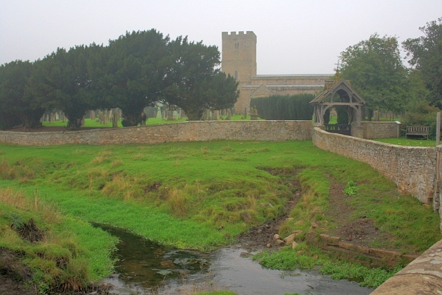
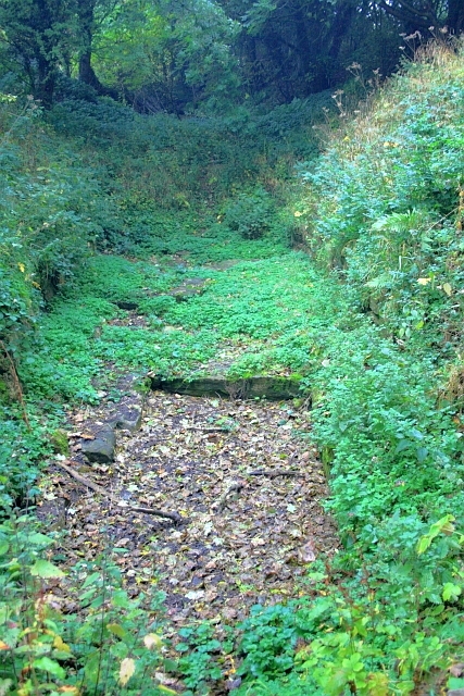
Mary Wild Beck and Stanwick Church

Stanwick Iron Age Fortifications

Stanwick Hill Fort, Forcett, North Yorkshire

https://en.wikipedia.org/wiki/Stanwick_Iron_Age_Fortifications

Stanwick Fortifications, North Yorkshire

http://www.academia.edu/4032642/New_Geophysics_Results_at_Stanwick_Oppidum_North_Yorkshire

http://www.english-heritage.org.uk/visit/places/stanwick-iron-age-fortifications/

                                                                           © Ray Spencer, The Journal Of Antiquities, 2017.


1 Comment

Castercliff Hillfort, Colne And Nelson, Lancashire

Castercliff Hillfort near Colne and Nelson, Lancashire.

Castercliff Hillfort near Colne and Nelson, Lancashire.

    OS grid reference:- SD 8849 3839. On Southfield Lane above the Lancashire towns of Colne and Nelson, is Castercliff hillfort, an Iron-Age contour and multivallate fort that dominates the landscape and is 900 feet above sea-level. The fort and its defensive ramparts cover a large area of the high ground above the two Lancashire towns and is a well-known landmark in these parts. The fort can be reached from Nelson by going up Barkerhouse Road, turning left at the top, then going along Southfield Lane to Gib Clough Head Farm, where just opposite on Back Lane there is a parking area – the hillfort is then reached by a stile and footpath at its eastern side.

Eastern Rampart.

Eastern Rampart.

    It was considered by some local historians to have been a ‘temporary’ Roman camp because a number of Roman coins had been found in the vicinity; it could in all probability have been a Romano-British camp or settlement. The sunken lane that traverses the eastern side of the fort was long thought to date from Roman times, but it is nowadays considered to be a Medieval trackway that leads from the high-ground down to the valley of the river Calder. But walking along this grassy, now overgrown track affords some good views of the ramparts at the south-eastern side of the fort.

NW rampart and Entrance.

NW rampart and Entrance.

    Castercliff hillfort is said to date from approx. 750-500 BC, though some archaeologists now think it is much older. It covers an area of 1.7 hectares – just over 4 acres in total. The fort is described as being oval shaped and originally having three ramparts. It is largerly made of stone with timber lacing. The inner (revetted) rampart shows signs of vitrification due to burning at some stage in its early history – its lifespan being short lived. But whether this was because it was attacked, burned by its own occupants, or just simply abandoned, is not known with any certainty. The oval-shaped plateau is 115m x 76m, while the defensive ramparts are approx. 1.5m high and the inner ditches about the same; the ramparts at the N side are unfinished and only one single rampart and ditch is evident here, but with shorter sections of three ramparts. At the W side there is what appears to be ‘a quite prominent’ entrance into the hillfort.

Bell Pit & Pond on Castercliff hillfort.

Bell Pit & Pond on Castercliff hillfort.

    Author W. Bennett in his renowned work ‘The History Of Marsden And Nelson’, says of the hillfort: “The earthwork known as Castercliffe is popularly connected with the Roman occupation. It is situated at the top of a hill some 920 feet above sea-level, is roughly oval in shape, 300 feet long and 240 feet broad, and has a small earth rampart; two ditches across the face of the hill are supposed to be trench defences. The place is first mentioned in 1515 when it was known as Castelcliffe or Castycliffe, both of which means a small fort on a hill; in the early 16th century there was a great deal of coal digging there and the ditches may have been made by men in search of a coal outcrop.”

    The author John Dixon in his local book ‘Historic Walks Around The Pendle Way’, adds more information on the hillfort and says that: “The inner rampart…..upon excavation, was seen to be partly vitified. Originally it consisted of upright timbers set in two tiers about 6 ft apart and perhaps transverse timbers within the framework. The main bulk of the rampart was constructed of stone and earth and may have had a stone facing. At some time the timbers had been fired and this resulted in the shattering of some of the stones and the vitified masses.

    “The outer rampart was seen to be a narrow timber frame box type rampart, and there was also evidence of a free-standing palisade outside the ditch. C14 dating of the charcoal remains of the timbers produced dates of 510-70 BC. The hill fort belongs to a group of stone and timber defences built around the sixth and fifth centuries defined by an arc spreading from the Cotswolds through the Welsh borderland and Cheshire into Yorkshire.”

    Castercliff hillfort is different from its near neighbour Portfield, 9 miles to the south-west near Whalley, in that it is a contour fort, whereas Portfield is a promontory fort; and yet Castercliff’s ramparts seem to be of a wholly different construction. But it is obvious that it had a higher hierarchical status to Portfield. It was, no-doubt, the residence of a chieftain of some high standing. Portfield hillfort has only one, low rampart and is today considered to be more an enclosure and earthwork.

Castercliff Hillfort Plan (After D.G. Coombs).

Castercliff Hillfort Plan (After D.G. Coombs).

    The plateau of Castercliff is pock-marked by numerous bell pits – these circular depressions are evidence to the fact that coal was being extracted from the ground here from as far back as the 16th-17th centuries; some of these pits have become ponds with an array of insect and amphibian life during the Summer months. The late John Dixon told me that there were traces of hut circles in the field just to the north of the fort, but ‘as yet’ I have not been able to find any evidence of them. In 1958-60 and again in 1970-71 Archaeological excavations were carried out on the hillfort. Over the years a number of flints have been dug-up from the site, and a number of Roman coins have been found at the foot of the hill and along the sunken lane.

On the top of the hillfort looking towards Pendle.

On the top of the hillfort looking towards Pendle.

    Author Thomas Sharpe in his work ‘The Pendle Zodiac’, tells of his moment standing upon the hillfort and looking out west towards Pendle Hill and realizing there was a ‘Ley Alignment’. He says: “Over the years, I had often suspected such an energy ley to be traversing the Pendle landscape, until finally discovering a section at New-church-in-Pendle….I sensed it one afternoon while standing upon the Iron Age (Brigantine) fort of Castercliffe and looking westwards towards Pendle Hill. To clairvoyant sight, a flow of white light appeared to cross through the landscape beneath the television transmitter at Newchurch.”

Sources:

Bennett, W., The History Of Marsden And Nelson, Nelson Corporation, Nelson, Lancashire, 1957.

Clayton, John A., The Valley Of The Drawn Sword, Barrowford Press, 2006.

Dixon, John & Mann, Bob., Historic Walks Around The Pendle Way, Aussteiger Publications, Barnoldswick, 1990.

Castercliff, Nelson, Lancashire

Sharpe, Thomas., The Pendle Zodiac, Spirit of Pendle Publishing, 2012.


Sudbrook Camp, Portskewett, Monmouthshire

Iron Age hillfort, Sudbrook. (Photo Credit: Wikipedia)

Iron Age hillfort, Sudbrook. (Photo Credit: Wikipedia)

Os grid reference: ST 5053 8732. About half a mile south of Portskewett, Monmouthshire, on the cliffs overlooking the Severn Estuary, is the Iron-Age Sudbrook Camp, a promontory fort with its well-defined earthworks still largerly intact, although suffering somewhat at its south-side due to coastal erosion. It is known to have been inhabited from roughly the mid-2nd century BC up to at least the 1st or perhaps mid-2nd century AD – at which time it may well have been in use as a Roman trading post. The earthworks are located by going along Sudbrook road and, at the end of Camp road, they are some 50 metres to the south-west, close by the ruins of a 13th century church, some railway buildings, and the Severn Railway Tunnel (Gwent Levels). A coastal path traverses the camp. Caldicot village is 1 mile to the west, while the M4 motorway and the Severn Bridge, are half a mile to the east; the town of Chepstow is roughly 4 miles to the north.

Plan of Sudbrook Camp (After V.E.Nash-Williams) 1936.

Plan of Sudbrook Camp (After V.E.Nash-Williams) 1936.

Sudbrook Camp is made up of triangular-shaped earthworks. The whole site is 1.4 hectares: the inner section is approx 78 metres between the cliff and the first ditch, 109 metres across south to north and 280 metres in width west to east, but a section at the south-side has eroded away due to cliff falls, and so the camp would have been larger. A section at the north-side ‘may’ have been destroyed due the houses and also Sudbrook and Camp lanes . However, the rest is still resonably well-preserved, in particular the fairly deep ditches, three ramparts at the west and two ramparts at the east – indeed the defensive ramparts still stand up to 5.2 metres high, according to the work ‘Prehistoric Sites of Monmouthshire’ by Children & Nash. At the far south-western side of the camp stands a World War II concrete lookout post. Rather oddly the interior of the camp is sometimes used as a football pitch!

Camp road to the north-west cuts-off the earthworks, as do the ruins of Holy Trinity Church at the far south-eastern side. The entrance to the camp can clearly be made out at the north-side between the ditches and ramparts; this connected up to an ancient trackway which was used by the Silures tribe, and later by the Romans, linking the site to their newly established town at Caerwent ( Venta Silurum) ‘market town of the Silures’, which later became Caer Guent (Fortress Venta), some 5 miles to the west.

Sudbrook Camp would have been inhabited by an ancient Celtic tribe in the Iron Age (150 BC) and, later in 30 or 31 AD, by the Silures, a fierce tribe who worshipped a cat-like diety. The Silures ruled the south-eastern part of Wales. But at this time they were being put under pressure by the Roman legions making their way up the Severn estuary – led by one Julius Frontinus – who set out to invade Siluria, and at which time the Celtic chieftain Caradoc (Caractacus) had fled from north Wales to Sudbrook Camp, or maybe Llanmelin hill-fort, one-and-a-half miles north-west of Caerwent. Caractacus eventually ended up in Rome where he was pardoned by the emperor Claudius (after 51 AD). The Silures were ‘allowed’ to remain at Llanmelin hill-fort until about 70 AD. However, Frontinus did not make much of an inpact, and it was not until 51 AD that the Silures tribe had their so-called ‘last stand’ when attacked and routed by Ostorius Scapula and the XX legion, according to Roy Palmer in his book ‘The Folklore of (Old) Monmouthshire’.

There is evidence to think that after the routing of the Silures tribe from the camp the Romans used the place as a trading-post and, 17 metres below the cliffs in the estuary, there was a natural harbour facility that was used by the newly conquering Roman legions as ‘a possible docking facility’ and naval base (beach-head) for their sailing vessels – up until at least the late 1st century AD, or even the mid-2nd century AD – Bryan Walker’s work ‘The Archaeology And History Of Ancient Dean And The Wye Valley’.

Archaeological excavations were carried out at Sudbrook Camp between 1934-36 at which time many artefacts were found including: bones of oxen, pigs, sheep and goats and, also fragments of iron, glass, Roman bricks and coins. During the excavations the remains of two V-shaped ditches were discovered between the ramparts (north-west side) of the main bank which, would have been done in four stages. Two steep-sloping revetments of uncoursed drystone walling were uncovered on the inner scarp – ‘Prehistoric Sites of Monmouthshire’ by Children & Nash.

The sad-looking grey ruins of the 12th or 13th century Holy Trinity Church stand at the far south-eastern side of the earthworks, now alas almost hidden by ivy, bushes and trees, with only the front bell-tower gable-wall and a few ruined rear walls still standing; its graveyard has nearly gone over the cliffs. But the main part of the ruin dates from the 17th century, other earlier parts being from the 13th-14th centuries, notably the chancel, while the nave walls may be 12th century. Sadly the church was abandoned and left to the elements in the 1790s, due probably to the erosion of the nearby cliffs – Fred Hando ‘Hando’s Gwent – A Centenary Tribute’.

Fred Hando says of the ruin: “There is no great charm in the grey ruins of Holy Trinity, Sudbrook. It is difficult to account for its erection here, unless it was a private chapel for John Southbrook, who is mentioned in the Wentwood Survey of 1276”. He goes on to say that: “Holy Trinity at Sudbrook was in use, it seems, to the end of the Eighteenth Century. Bradney tells us that one of the last to be buried there was Captain Blethin Smith of Sudbrook, who left instructions that his corpse was to be borne to the grave by six seafaring men”. Captain Smith’s will was dated 1755.

Sources:

Barber, Chris., Exploring Gwent,  Regional Publications (Bristol) Limited, Clifton, Bristol, 1984.

Children, George & Nash, George., Prehistoric Sites of Monmouthshire, Logaston Press, Little Logaston Woonton Almeley, Herefordshire, 1996.

Hando, Fred., Hando’s Gwent – A Centenary Tribute, (Ed by Chris Barber), Blorenge Books, Abergavenny, 1987.

Houlder, Christopher., Wales: An Archaeological Guide, Faber And Faber, London, 1978.

http://www.sudbrook.info/

http://en.wikipedia.org/wiki/Sudbrook,_Monmouthshire

Palmer, Roy., The Folklore of (old) Monmouthshire, Logaston Press, Little Logaston Woonton Almeley, Herefordshire, 1998.

Walters, Bryan., The Archaeology And History Of Ancient Dean And The Wye Valley, Thornhill Press, Cheltenham, Gloucestershire, 1992.


Castleberg Hillfort, Addingham, West Yorkshire

Castleberg Hillfort (Photo Credit) Geolocations David Spencer.

Castleberg Hillfort (Photo Credit: Geolocations David Spencer)

OS grid reference: SE 0912 4943. Just half a mile to the north-east of Addingham at Nesfield, West Yorkshire, is Castleberg Hillfort, said to date from the Iron Age although the site has never been properly excavated by archaeologists and therefore it could be earlier, maybe late Bronze Age, which would then make it an enclosure or settlement, and quite probably the Roman legions came this way on their way to the fort at Ilkley (Olenacum or Olicana?) and maybe ‘made camp’ here on the hill at some point; the name Castleberg is distinctly a Roman one. The hillfort stands at the top of a naturally-formed hill that has a Limestone scar at its southern side. Much of the western side of the site is covered in woodland which stretches down to the river Wharfe, while a little further to the south, opposite Low Mill village, and hidden in trees beside the river lies the famous Castleberg scar, which is actually a Limestone crag. The town of Ilkley is 3 miles to the east on the A65 and Bolton Abbey is 9 miles north-west along Bolton Road and then the A59.

The shape of the hillfort is quite odd, really, mainly because it follows the contours and curve of the hill. It measures, roughly, 140 metres in width, 130 metres lengthwise and 130 metres in diameter; the earthworks being more visible at the eastern side and at the western and north-western sides where earthworks run off from the fort itself; the south-side of the hillfort follows the natural curve of the hill above the river Wharfe. A few well-known Victorian antiquarians and historians have visited this site and more or less they all agree with each other with regard to Castleberg, though there is still much uncertainty about its true age – the Stone Age through to the more recent, Roman period? There have been a couple of finds dating from the Bronze-Age, but nothing particularly substantial. This man-made defensive hillfort would have provided its occupants with a panoramic view of the surrounding area for miles around and would ‘certainly’ have given them prior warning of any signs of hostility advancing up the Wharfe valley.

On Addingham Low Moor just east of the village, near Woofa Bank, there are several more ancient sites including: tumuli, enclosures and round dikes, making this a very rich area of prehistory, while to the south-east there is Ilkley Moor with many, many more ancient antiquities. St Peter’s Church at Addingham (SE0851 4969) is said to have been built on a pagan site though the present building is 15th century; it houses a a very nice carved section of an Anglo-Saxon cross, dating from the 10th century.

Sources:

The Northern Antiquarian  http://megalithix.wordpress.com/2008/09/28/castleberg-nesfield/

Photo Credit  http://www.geolocation.ws/v/W/File:Castleberg%20Fort,%20Nesfield%20-%20geograph.org.uk%20-%2060792.jpg/-/en

Bell, Richard., Village Walks in West Yorkshire, Countryside Books, Newbury, Berkshire, 1998.


Portfield Hillfort, Whalley, Lancashire

Portfield Hillfort, Whalley, Lancashire.

Portfield Hillfort, Whalley, Lancashire.

OS grid reference SD 7460 3553. About three-quarters of a mile east of Whalley in the Ribble Valley, Lancashire, beside Portfield Lane stands the prehistoric site known as Portfield hillfort or Planes Wood Settlement, a promontory-type fort. Just half a mile to the west is the busy A680 Accrington Road and Spring Woods, with carparks and a number of woodland paths for the visitor to explore at leisure – all far removed from the Iron-Age hillfort-cum-settlement that lies  just beyond. The hillfort with it’s man-made defensive ramparts can be found just behind Portfield farm and the splendid 14th century tithe barn, a timber construction that was associated with Whalley Abbey. Close by is Leck beck and down in the valley at Whalley the river Calder winds it’s way southwards beneath Whalley Nab towards Great Harwood. In 1966 a hoard of Bronze-Age artefacts was dug up in the middle of the hillfort.

Portfield Hillfort (south-east rampart).

Portfield Hillfort (south-east rampart).

The fort covers an area of about three-and-a-half acres (roughly 152,460 square feet) and, although it is accepted that it dates from the Iron-Age, there was almost certainly a much earlier settlement or enclosure on this site that was inhabited in the Mesolithic, Neolithic and Bronze-Age periods of prehistory, which would be 4,000 years BC or more. There were two main phases of construction in the case of the Iron-Age fort’s defensive ramparts, as is now known from the archaeological excavations that took place in the late 1950s.

The first phase sometime between 1,000-750 BC? was a stone rampart (with no ditch) about 13 feet across with stone kerbs on their sides at the back of the inside defense, while the second phase involved the levelling of the first rampart to construct bigger but ‘unusually’ low defensive bivallate ramparts, which were stone-revetted and upto 20 feet in width surrounding the enclosure area of the fort – being especially well-defined at the north-west side but, less so at the south-eastern and east sides. Beyond this there was a 20 foot wide berm and a ditch measuring 15-18 feet across. The excavations of 1958 and 1959 revealed a cobbled pavement at the main entrance to the fort, and over this another layer of stones. It was here that a fragment of Romano-British Roman pottery was discovered dating from the 5th century AD. A couple of the back gardens of the houses on Portfield lane have rather intruded onto what’s left of the eastern rampart, although this does not ‘in any way’ spoil the situation of the prehistoric site.

Portfield Hillfort (Eastern Rampart).

Portfield Hillfort (eastern rampart).

In 1966 while workmen were laying new pipes near the centre of the fort a hoard of Bronze-Age artefacts was uncovered – among the items found were two axes, a tanged knife and blade, a tanged stud, a gauge, part of a hilt, but much more of interest was the discovery of a gold penannular bracelet (possibly of Irish craftsmanship) and a gold tress-ring dating from the mid to late Bronze-Age. Then, in excavations during 1970-71, post holes were found as well as body sherds, flints and pottery sherds from a biconical vessel. There have also recently been a few finds dating back to the Mesolithic and the Neolithic ages, including flints and pottery. Many replicas of these artefacts can be viewed in The Blackburn museum and also The Ribchester Roman museum.

Joan Allen (1977) tells us that: “In September 1966, two Manchester Corporation workmen, digging a ditch in a meadow at Portfield Farm, Whalley, Lancs., located a gold armlet, gold hair-ornament (called a tress ring), a carpenter’s gauge and a number of bronze axe-heads and other tools. Museum experts believed that Bronze Age craftsmen had hoarded them underground between 700 and 800 B.C.”

Sources:-

Allen, Joan, Glittering Prospects—All You Need To Know About ‘Treasure Hunting’, Elm Tree Books Ltd., London, 1977.

Dixon, John & Dixon, Phillip., Journeys Through Brigantia (Vol 9) The Ribble Valley, Aussteiger Publications, Barnoldswick, 1993.

http://www.pastscape.org.uk/hob.aspx?hob_id=44511

http://www.webbaviation.co.uk/gallery/v/lancashire/whalley/PortfieldHillfort-fb34133.jpg.html


1 Comment

Ingleborough Hillfort, North Yorkshire

Ingleborough ascent

Ingleborough (Photo credit: Immanuel Giel – Wikipedia)

OS grid reference SD 740 745. The massive bulk of the Yorkshire peak Ingleborough mountain called ‘The Mountain of Fire’ is 2,372 feet high (a few maps call it a hill!). It is some 4 miles to the north-east of the town of Ingleton, and is best reached from the B6255 Ingleton to Hawes Road and then via the various footpaths running east up to the summit on which there is an Iron-Age hillfort and, also the remains of what may be a Roman encamp-ment? Down on the lower slopes of the mountain are the famous White Scar Caves and to the east lies the equally famous pot-hole of Gaping Ghyll.

.
Ingleborough’s flat summit is topped by a hillfort that dates back to the Iron-Age when the Brigantes tribe first settled there. The fort or settlement covers 15 acres (61,000 metres) and its defensive walls, now much robbed away, can still be seen around the edges of the windswept summit. These millstone grit ramparts cover 3,000 feet in circumference, some of which are made up of the natural rock edge which would have been quite helpful at the time as a defense. There are openings at the north, east and South-western sides of the ramparts. The inner part of the fort has 19 or perhaps 20 hut circles placed at intervals; the hut circles measure between 5 metres and 8 metres in circumference, though some historians call them ring structures without hearths and roofs, which were built by the Brigantes, a tribe that covered most of northern England from the west to east coast; they later supported the Roman invasion of the northern Pennines even though they were, at that time themselves under attack from the Roman legions who were spreading out and moving north, west and east. It seems likely that the Iron-Age hillfort was in general use all year round – the climate at that time being much more temperate than it is now, otherwise it would have been virtually impossible to live on the summit during the winter months.
.
Simon Fell, North Yorkshire, with Ingleborough...

Ingleborough (Photo credit: Mick Melvin -Wikipedia)

The Brigantean queen, Cartimandua, handed the Romans Caractacus, a British chieftain, who had led a guerrila-style revolt against the invading army in AD 51; Cartimandua then married Venutius, a Brigantean chieftain, but the marriage did not last long because in AD 52 they divorced and the queen married Vellocatus (who was then king from AD 52-69); he was Venutius’ own armour-bearer – causing him much displeasure. Civil war then broke out in the northern Pennines and to quell this disorder the Roman governor Quintus Petillius Cerealis (AD 71-74) ordered the IX legion to the area to put down the revolt. The Brigantes were crushed, while Venutius travelled north-east to Richmond where he was eventually defeated by elite Roman troops – it is not known what happened to him after that – more than likely he was killed at Stanwick near Richmond. The date of his death is not known.

.
On the northern and eastern edge of Ingleborough summit are the remains of some walling which some historians considered to have been a Roman military encampment – though there is still much uncertainty about this. The nearest Roman fort is at Bainbridge to the north which was connected by a Roman road from Ingleton to Lancaster via Cam Fell. Ingleton church is built on top of a mound that could have been used to protect the river crossing, but it is not thought to have been inhabited by the Romans and no evidence of any occupation by them exists in the town itself. Later the Anglo Saxons further to the west moved inland and settled in Ingleton and the surrounding settlements.
.
Sources:-
.
Bentley, John., – A Unique Yorkshire Village – The History of Ingleton, Ingleton Publications,2008.
Raistrick, Arthur., – The Pennine Dales, Arrow Books, 1972.
.
Johnson, David., – Ingleborough: Landscape and History, Carnegie Publishing Ltd., Lancaster, 2008
.
With thanks also to ‘The Northern Antiquarian’ (General Archaeology Section).
© Ray Spencer, The Journal of Antiquities, 2013.
.