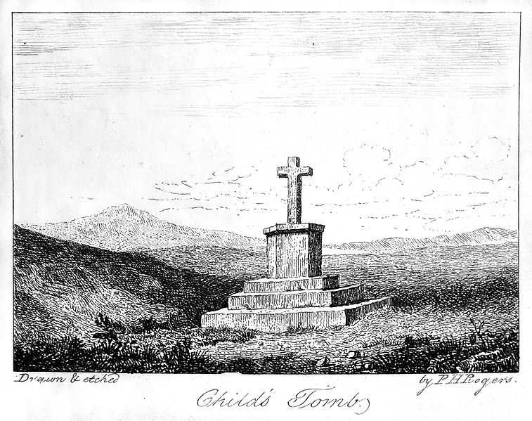
The Journal Of Antiquities

Ancient Sites In Great Britain & Southern Ireland


1 Comment

Childe the Hunter’s Tomb, Dartmoor, Devon

Childe’s Tomb on Dartmoor by P. H. Rogers (1826) – Dartmoor – A Descriptive Poem by N. T. Carrington

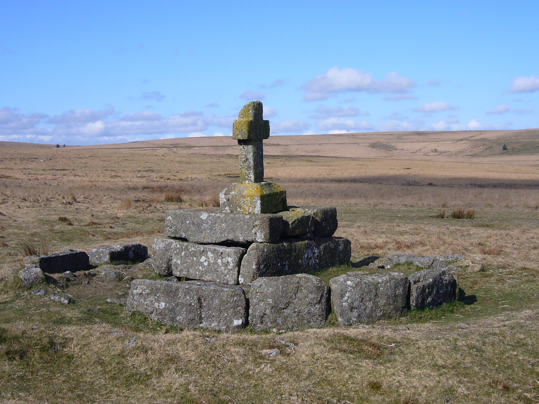
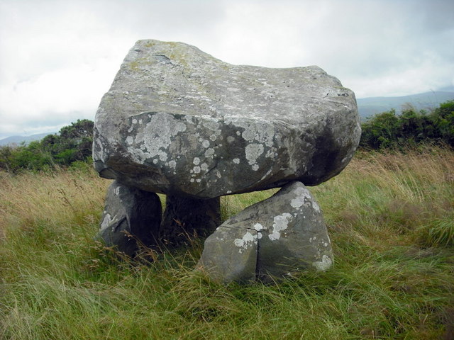
Childe’s Tomb on Dartmoor. (Photo by Herbythyme (talk | contribs). Creative Commons.

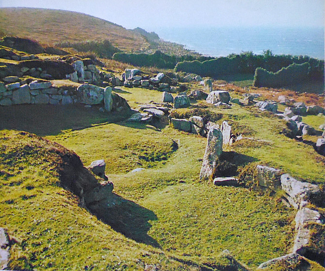
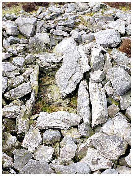
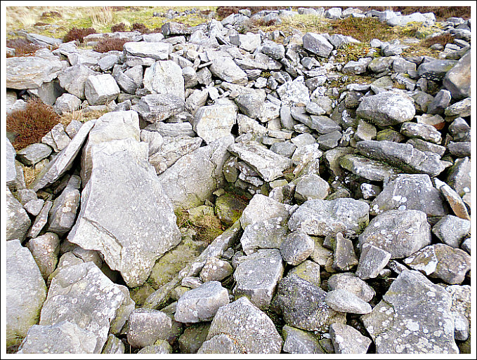
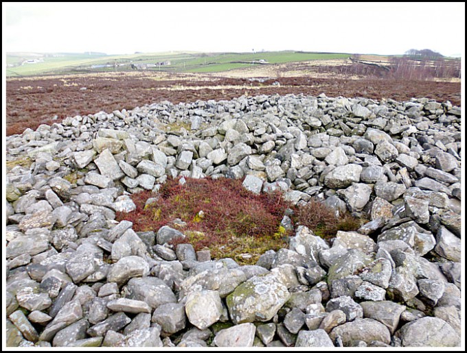
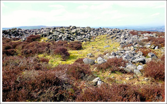
NGR:- SX 62579 70302.  On the south-eastern side of Fox Tor Mires, 500 metres to the north of Fox Tor, on Dartmoor, in Devon, is a solitary late 19th century stone cross known as ‘Childe the Hunter’s Tomb’ or ‘Childe the Hunter’s Cross’. There are some local legends attached to this cross and what lay beneath it – because we know there was an ancient burial tomb or Kistvaen with an outer kerb. In the 11th century a Saxon nobleman or thane called Ordulph was out hunting on his horse upon the moor but he became lost in a snowstorm and eventually died in the freezing conditions; his body was buried by the monks of Tavistock with a cross erected on that very spot, although the burial tomb beneath the cross predated Childe the Hunter and was of prehistoric origins. There are many other ancient burial cairns in this area. Originally the cross stood on blocks of granite which formed the tiered steps, but, these are now in a rather sorry, jumbled state and a lot of the stones were, sadly, robbed-away to build a nearby farmhouse in the early 19th century.  In the west at Blowing House near Burrator Reservoir, Southern Dartmoor: take the trackway heading E onto the moor for 4 miles to reach Whiteworks, then, take the path SE across Fox Tor Mires for a few miles towards Fox Tor – the 1.3 metre high cross can be seen over to the NE, but there’s no proper footpath leading to it.

Crispin Gill (1976) tells us: “Legend has it that Childe the Hunter was buried here. Overtaken when hunting on the Moor by a snowstorm he slew his horse, disemboweled the animal and used it as a shelter from the storm. But he froze to death, leaving a message that whoever gave his body Christian burial would have his lands of Plymstock. The monks of Tavistock found the body and were carrying it across the Moor when the people of Plymstock sought to bar their way by blocking the bridge over the Tavy. So the monks threw a bridge across the river further up, and gave his body burial. It must be said that Tavistock Abbey, and the Dukes of Bedford who acquired the land after the dissolution of the monasteries, did own Plymstock, and a bridge east of Abbey Bridge at Tavistock is still called Guile Bridge. 

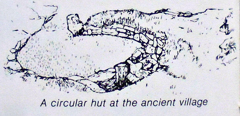
“But when Childe’s Tomb is examined it is found to be a kistvaen, a prehistoric grave, overlaid with slabs of stone and surmoun-ted by a clearly-modern cross. There was an earlier cross surmounting a monument, mentioned early in the seventeenth century, which was thrown down and the stones used to build Fox Tor Farm in 1812. The ruins of the farm can be seen north-east across the River Swincombe. Childe’s Tomb was restored as we know it in 1885, with a new cross, but why the kistvaen was chosen is a mystery. The story is confused, but the late H. P. R. Finberg in Devonshire Studies pieces together the story of a giant Devon landowner buried at Tavistock Abbey, to which he left much land, and who was in his day a great hunter. ‘Childe’ he points out was a title of honour (like Childe Roland) in the eleventh century, the time of this giant. The story that has come down to us in Finberg sees as ‘an almost perfect specimen of folk-lore based on facts'”.

“On Fox Tor there is a 10th-century Saxon noble’s memorial called Childe’s Tomb. Lost in a blizzard, the nobleman cut open his horse and crawled inside for warmth. Before he died, he wrote his will in the horse’s blood on a nearby rock”, according to Folklore Myths and Legends of Britain (1977).

Sources / References & Related Websites:-

Gill, Crispin, David & Charles Leisure & Travel Series — Dartmoor, David & Charles  (Publishers) Limited, Newton Abbot, Devon, 1976.

Reader’s Digest, Folklore Myths and Legends of Britain, (Second Edition), Reader’s Digest Association Limited, London, 1977.

Childe’s Tomb – Wikipedia

Childe the Hunter / Childe of Plimstock (Roud 23155) (mainlynorfolk.info)

Wayside cross 1120m ENE of Childe’s Tomb, Dartmoor Forest, Devon (ancientmonuments.uk)

Childe’s Tomb Cross | Legendary Dartmoor

Childe’s Tomb (dartmoor-crosses.org.uk)

Childe’s Tomb – Academic Kids

Copyright © Ray Spencer, The Journal of Antiquities, 2021.


Spinster’s Rock, Near Drewsteignton, Devon

Spinster’s Rock Burial Chamber, near Drewsteignton, Devon.

NGR:- SX 70093 90782. At the northern edge of Dartmoor National Park about ½ a mile west of Drewsteignton, in Devon, is Spinster’s Rock, a Megalithic burial chamber from the mid Neolithic age of Prehistory. The monument stands in a field beside a country lane close to Shilstone farm. It has been described variously as a Portal Dolmen, a Cromlech and Burial Chamber. Three large stones (uprights) tentatively support the massive capstone, and a few other stones or outliers lie on the ground in the close vicinity of the burial chamber. In 1862 the monument collapsed but within the year it had been re-erected again. One or two local legends have been ascribed to the site with regard to the name ‘Spinster’s Rock’ though these seem to have their founding in more recent times, rather than back in prehistory, and are very far-fetched, but each legend is associ-ated with three local spinster ladies who apparently built the monument! To reach the site head W out of Drewsteignton for 1 mile, then turn S onto lane towards Chagford. Look-out for the track to Shilstone farm and a wooden signpost. The monument is in the field 130m to the W of the farm.

llustration of Spinster’s Rock, in Devon.

Spinster’s Rock, also known as ‘Shilstone Cromlech’, dates from between 3,500 to 2,500 BC and stands 11 feet high. The three Granite uprights supporting the huge slab or capstone are between 6-7 feet high, while the capstone itself is roughly 16 feet X 10 feet, and is said to weigh upto 16 tonnes. It almost looks as if the capstone is floating in mid-air. Originally there would have been a mound of soil and stones covering the burial chamber but this is long gone. This is apparently the only Neolithic burial chamber in the County of Devon, though there are many Bronze and Iron Age sites on Dartmoor – Grey Wethers and Grimspound being two. In 1862 the monument collapsed due to subsidence but was re-erected within 10 months, although it wasn’t put back in its original form, and some of the supporting stones have had to be fixed in position with iron straps, and a notch had to be made in one of the uprights so that the capstone rested more easily onto it. When it was excavated in the 19th century no burials were found.

Roland Smith (1983) tells us that: “Most famous of Dartmoor’s cromlechs is Spinster’s Rock tomb, its massive four stones standing over 6 ft (1.8 m) tall in pleasant farmland at Shilstone, near Drewsteignton. The cromlech gets its name from a local legend that it was erected by three spinster’s of that parish one morning before breakfast — a labour of truly Amazonian proportions. The cromlech is probably the denuded remains of a Neolithic  (New Stone Age) burial mound, with a great capstone perched delicately on three uprights, but it is known that the monument was re-erected after collapse in 1862, so its original form is uncertain.”

The legends that are associated with this burial chamber are far-fetched and not plausable. Apparently three (or maybe four) spinster ladies (they may have been wool spinners) of the parish were on their way to market early one morning. They decided to build the dolmen before eating their breakfast. It seems they accomplished this great fete because of a trist, each wanting to out do the other, so they could marry the same man. The ladies were turned to stone and Spinster’s Rock took on their form, according to another legend.

The HE (Historic England) list entry number is: 1003177. See below.

Sources & References & Related Websites:-

Clamp, Arthur L., A Pictorial Guide to Eastern Dartmoor, Westway Publications, Plympton, Plymouth, Devon. 1969/70.

Smith, Roland, Britain’s National Parks — A Visitor’s Guide, Dolphin Publications, Salford, Manchester, 1983.

The AA,  The Illustrated Road Book Of England & Wales, The Automobile Association, London, 1962.

https://historicengland.org.uk/listing/the-list/list-entry/1003177

https://www.megalithic.co.uk/article.php?sid=149

https://en.wikipedia.org/wiki/Spinsters%27_Rock

http://www.stone-circles.org.uk/stone/spinstersrock.htm

http://www.saintsandstones.net/stones-spinstersrock-journey.htm

Copyright © Ray Spencer, The Journal of Antiquities, 2021.


1 Comment

Halangy Down Ancient Village, St Mary’s, Scilly Isles

Halangy Down Ancient Village, St Mary’s, Scilly Isles (photo: F. Gibson).

NGR: SV 90983 12379. The ancient village/settlement of Halangy Down is situated about 1 mile north of Hugh Town on St Mary’s Island, in the Scilly Isles, and is close to the sea-shore between Toll’s Porth and Halangy Point; it is just a little down the slope from Bant’s Carn Burial Chamber, while a bit further to the south is the golf course at Carn Morval from which there are quite exceptional panoramic views of all the Scilly Islands. This ancient site was probably occupied originally in the Bronze Age, but the village itself was established in the late Iron Age and, continued to be occupied through the Roman period, and on into the Romano-British period. There are some well-preserved remains of a complex of buildings including circular huts, inter-connected structures, courtyards and stone drains, all of which seem to be well looked after. To get to St Mary’s take the ferry-boat from Penzance, Cornwall. It’s then a case of walking the footpaths and road (northwards) at the western side of the island from Hugh Town, keeping to the coastline, and passing Porthmellon, Porthloo, Seaways, the golf course, and Toll’s Porth, to reach Halangy Ancient Village.

Circular hut at Halangy Down Ancient Village, St Mary’s. (F. Gibson).

F. Gibson tells us quite a bit about this site, saying: “There is an extensive complex of stone built huts here, developed and modified during the course of some half-millennium. A courtyard house is the uppermost, with buildings lower down which were all inter-connected. A system of stone drains led under the main entrance of the house and beneath the courtyard. It is probable that both the house and the courtyard were roofed; roofing spars supported in the middle by posts would have supported a thatch of reeds or straw, held in position by straw ropes weighted down by boulders. During excavation a number of quartz implements were found; they were crude choppers, rounded blocks, rough scrapers and axe-like points. There were also a wide range of heavy tools and equipment made from the local granite, as well as numerous querns of the saddle, bowl and rotary types.

“The earliest inhabitants are considered to have arrived about 2000 B.C. and they sought sustenance from the sea. Shellfish were collected, and fish, birds and mammals were caught; whilst at the same time the land was not neglected, cereals being brought to the islands, where clearances were made to grow them. It would seem from the middens however that limpets were the main source of protein in their diet.” 

Gibson also adds that: “Evidence of the Roman period can be found in the islands. Ancient villages of this period are at Halangy Down on St Mary’s and on Nornour. The site at Halangy is on the higher slopes of a much larger settlement which reaches down to the Porth. The lower slopes were probably abandoned on encroachment of the sea. The people who lived there were growing grain, keeping cattle, pigs and sheep; and eating fishand limpets in vast quantities. From evidence of finds the economy appeared well adjusted to island life.”

Timothy Darvill (1988) with regard to Bant’s Cairn on St Mary’s, tells us that: “Nearby are the foundations of round and oval houses of a small Iron Age and Romano-British village.” Lord Harlech (1970) tells us much the same as Timothy Darvill (1988) apart from saying it……“was occupied in the middle of the Roman period.”

Nearby, just up the slope, at NGR: SV 90994 12302 is ‘Bant’s Carn Burial Chamber’, a Bronze Age tomb dating from around 2000 BC. There are four large capstones resting above a rectangular chamber with an entrance leading into it, and there is an inner and an outer wall of large slab-stones; the whole structure with its grassy mound being quite well-preserved. Close-by is a small section of ancient field terraces which were begun in the Bronze Age but, later, in the Iron Age and Romano-British periods – these field systems were obviously re-used by the occupiers of the Halangy Down Ancient Village.

Sources / References & Related Websites:-

Darvill, Timothy, AA Glove Box Guide — Ancient Britain, Publishing Division of the Automobile Association, Basingstoke, Hampshire, 1988.

Gibson, F., Visitors companion to the Isles Of Scilly, (publisher unknown, and date unknown).

Harlech, Lord (the late), Southern England — Illustrated Regional Guide to Ancient Monuments No. 2, Her Majesty’s Stationery Office, London, 1970.

https://en.wikipedia.org/wiki/Halangy_Down

https://www.english-heritage.org.uk/visit/places/bants-carn-burial-chamber-and-halangy-down-ancient-village/history/

https://www.megalithic.co.uk/article.php?sid=6333313

https://www.citizan.org.uk/interactive-coastal-map/#zoom=10&lat=6435646.73888&lon=-700072.42535&layers=B00000TF

https://www.cambridge.org/core/journals/antiquaries-journal/article/excavation-of-a-homestead-of-the-roman-era-at-halangy-down-st-marys-isles-of-scilly-1950/4676994F35C2F26A377B817179CFED2F

© Ray Spencer, The Journal of Antiquities, 2019.


1 Comment

Dolmen of Fontanaccia, Plain of Cauria, Corsica, (France)

Dolmen of Fontanaccia, Corsica, by Cardioceras (Commons Wikimedia)

Latitude: 41.529559N. Longitude: 8.918266E. On the Plain of Cauria (Plateau de Cauria), 15 kms to the southwest of  Sartè (Sartène) on the Island of Corsica, (France), stands the most famous Corsican Megalithic structure: the Dolmen of Fontanaccia, Funtanaccia Dolmen, or ‘Stazzona  del Diavolu’ (the Devil’s Forge), which dates from the late Neolithic/early Bronze Age. This very important prehistoric burial chamber (table tomb) is located in the Dept: Corse-du-Sud, near the end of the D48A road, southwest of Sartène, and near Tizzano on the southwestern coast. From Sartène follow the D21, D48 and D48A roads going southwest to the megalithic monument. The Dolmen of Fontanaccia with its huge, flat capstone-table and six massive stone supports, is thought to be up to 4,000 years old (the 2nd -1st millennia BC). About ½ km to the northeast of the domen is ‘The Alignment de Stantari’, a group of fifteen menhir statues, while 1 km to the south of those another prehistoric site composed of forty-six standing stones known as ‘The Rinaghju Alignment’.

Olivier Jehasse (1992) says of this prehistoric site that: “Between Sartè and the sea, left of the valley which arrives as far as the port of Tizza (Tizzano), extends the high plain of Cauria, an old place of the prehistoric period. This place overhung by a granite mass is above all famous for the Dolmen of Fontanaccia, that the popular tradition transmitted in the last century by P. Merimee, calls ‘”A Stazzona d’U Diavulu”‘ (the forge of the devil). This beautiful monument, well conserved, is composed of 6 slabs which support a table 3.40 meters long and 2.60 meters wide. The room sitting approximately 40 centimeters deep in the earth measures 2.60 meters long, 1.60 meters wide and 1.8 meters high. These funereal buildings, of which a dozen examples are known in Corsica and scattered in all of the western world, are slightly older than the Casteddi which are characteristic of the island’s prehistoric era.  If their roles in the rural communities of the 2nd and 1st millennia B.C. are difficult to understand, the presence of such monuments, in the middle of the plains, or in the hills or at a peak’s edge, bear witness to the presence of social structures on the island, magnified by these collective tombs, dating to late antiquity.”

Jehasse (1992) adds more with regard to the Bronze Age in Corsica, saying that: “Starting from 2200 B.C., the Bronze Age makes a turning point for architectural invention. This island is covered with castles, fortified complexes, and huts grouped around circular or rectangular buildings having various functions. Very well preserved in the south and in the regions of Porti Vecchju, Livia, and Taravu, these complexes are also to be found in Balagne, in the Golu Valley near Ponte Leccia, in the Niolu region and in the hills overlooking the Aleria hinterland. The appearance of these complexes, moreover, is a sign of the transformation of this island society, where human groups differentiate themselves one from another. This evolution is still more clear cut in the area of religion. Collective funerary monuments Stazzoni or dolmens were built. Southern Corsica is once again the region richest in vestiges of these monuments: Stazzona of Funtanaccia and Cardiccia near Sartè, the Stazzona at Taravu and Stazzona of Appiettu near Alacciu. They are also to be found in the northwest in the Agriate region near the village of Santu Pietru of Tenda and in the Niolu region near the village of Albertaccia. This presence of death in monumental form on the peaks and in the highlands is one of the hallmarks of this epoch.”  

About 1 kilometer to the northeast of the dolmen, at the center of the Caurian plain, is another prehistoric site called: ‘The Alignment de Stantari’, a group of fifteen granite menhir statues. These strange carved stones were probably erected some-where between the 13th and 7th centuries BC? Stantari meaning “man on his feet” in the island’s language. The stones measure between 2.78 and 2.91 in height. And another 1 kilometer to the south of these statues is yet another prehistoric site: ‘The Rinaghju Alignment’, which is composed of forty-six granite standing stones in two parallel rows. The tallest stone being 1.50 meters high, according to Olivier Jehasse in her work of 1992.

Sources and related websites:

Jehasse, Olivier, Corsica – Island of beauty, (English Translation: Ilene Steingut), Edition: Plurigraf, Narni – Terni, Italy, 1992.

Photo of Dolmen of Fontanaccia by Cardioceras at:-  https://commons.wikimedia.org/wiki/

https://www.google.co.uk/search?q=The+Dolmen+of+Fontanaccia+in+Corsica+(Wikimedia)&dcr=1&tbm=isch&source=iu&ictx=1&fir=ASbisxkJrL1XIM%253A%252CpTPng18DJJg4KM%252C_&usg=__vaeUDHgVv13_Xpkjoa7G0YoN3Co%3D&sa=X&ved=0ahUKEwiig_T_qq7aAhVIPBQKHb9kCckQ9QEIQzAE#imgrc=ASbisxkJrL1XIM:

https://translate.google.co.uk/translate?hl=en&sl=fr&u=https://fr.wikipedia.org/wiki/Dolmen_de_Fontanaccia&prev=search

http://www2.culture.gouv.fr/public/mistral/merimee_fr?ACTION=CHERCHER&FIELD_1=REF&VALUE_1=PA00099114

http://www.megalithic.co.uk/article.php?sid=9501

http://www.megalithic.co.uk/article.php?sid=9519

© Ray Spencer, The Journal Of Antiquities, 2018.


Brownshill Dolmen, County Carlow, Southern Ireland

Brownshill Dolmen in Co Carlow, Southern Ireland

   Irish Grid Reference: S 75440 76846. In a field a little to the east of the village of Browneshill in County Carlow, Southern Ireland, is the Neolithic monument known as ‘Brownshill Dolmen’ or ‘Brownshill Portal Tomb’ and sometimes as Browne’s Hill Dolmen. But it also goes under the name of Kernanstown Cromlech. The monument has a huge capstone weighing over 100 tonnes, But sadly, however, it has lost its covering mound of earth and a few of its upright supports have collapsed under the enormous weight of the top-stone, although three uprights at the front are still supporting it – two of which form the portal (entrance) to the tomb. The dolmen is located almost 2 miles east of Carlow town near the R726 road. It is best reached to the east of Browneshill village: from the R726 (Hacketstown road) at Ballinakillbeg take the footpath for 550m that heads south from the road, then heads west for quite a distance, and then north to the ancient monument – which stands in the corner of the field.

Brownshill Dolmen. Photo by Sarah777 (Creative Commons).

   The Brownshill Dolmen is really much like a ‘stone table’ or ‘tombstone on legs’ resting horizontally (vertically) on up-right stones’; but it is also called a cromlech and portal tomb (a tomb with an entrance). In the Nicholson ‘Guide To Ireland’, we are told that the: “Browne’s Hill Dolmen……with largest capstone in Ireland, if not Europe, 5 feet thick, 20 feet square and weighing over 100 ton. Two up-right portal stones (orthostats) support the huge granite capstone at the front, while the third supporting stone is a ‘gate-stone’ or ‘blocking stone’; these three entrance stones are between 5-6 feet high. There is a fourth stone at the front which may have been part of the forecourt, although this points at an angle away from the tomb. At the back of the monument two recumbent stones support the capstone near ground-level, but whether these two stones collapsed under the weight or were originally placed like this, is not known. I would think they were placed as such. Originally the tomb was covered by a mound of earth. The megalithic monument is said to be almost 4,000 years old and was the burial place of a Stone Age chieftain, according to Reader’s Digest ‘Illustrated Guide To Ireland’.

Sources of Information and related websites:-

Nicholson, Guide To Ireland, Robert Nicholson Publications Limited, London, 1983.

Reader’s Digest, Illustrated Guide To Ireland, The Reader’s Digest Association Limited, London, 1992. 

https://en.wikipedia.org/wiki/Brownshill_Dolmen                                                                                                                         https://en.wikipedia.org/wiki/Brownshill_Dolmen#/media/File:IMG_BrownshillDolmen.jpg

https://irisharchaeology.ie/2016/04/brownshill-portal-tomb-co-carlow/

http://www.megalithic.co.uk/article.php?sid=6333452

                                                                                       © Ray Spencer, The Journal Of Antiquities, 2017.


1 Comment

Bradley Long Cairn, Farnhill, North Yorkshire

Bradley Long Cairn, near Farnhill, north Yorkshire

Bradley Long Cairn, near Farnhill, north Yorkshire.

    OS grid reference: SE 0092 4756. At the north-eastern side of Bradley Low Moor, near Farnhill, in north Yorkshire, is the Bradley Long Cairn, which is also known as ‘Bradley Long Barrow’ and sometimes ‘Black Hill Long Cairn’. Now, sadly, it is a large pile of stones and an uncovered oblong-shaped cist grave that has suffered from much disturbance over the years, and maybe robbery in some shape or form. Some 40m to the south-west is a much destroyed ring cairn, and yet a third cairn lies 50m to the north-west but this is hardly visible beneath the thick heather. The site can easily be reached from the hamlet of Farnhill, and then along Crag Lane which skirts the western-side of the moor. Just opposite the house go through the gate and follow the footpath up onto the moor in an easterly direction for 290m, then via off to the right in the direction of the wall for 360m. You will soon see the long barrow and ring cairn as piles of grey stones in the heather. The village of Kildwick is about a mile to the south.

Bradley Long Cairn.

Bradley Long Cairn, near Farnhill, North Yorks.

    The Bradley long cairn measures roughly 76m (249 ft) in length by 30m (98 ft) in width at its widest part and on its eastern flank it is up to 2.4m (8 feet) high, although it is difficult to make out due to the long heather which grows in abundance on the higher parts of the moor. Sadly the cairn has suffered greatly from disturbance over the years and maybe from robbery, especially at the E side; today its oblong-shaped cist grave is 1.5m deep and is open to the elements and its large flat covering stone broken up and partially missing, but its side stones are largerly still intact. In 1930 this Neolithic barrow was excavated by archaeologists and its funery contents (one single human burial) taken away to safety. The thinking is that during the Bronze Age a round cairn was built onto it at the S side. There is no sign of the earthern mound that would have formed the covering to this megalithic structure, only the piles of stones survives; some of the outer stones in the large pile are nicely shaped, while many others are very smooth – very typical of this grey gritstone.

    Author John Dixon in his work ‘Journeys Through Brigantia’, volume one, tells us that: “The excavation revealed a stone cist, 6½ feet long and 3 feet wide, some 60 feet from the eastern end of the barrow. The cist was formed by four stone slabs set on end with a fifth forming a ‘capstone’. A sixth slab lay  on the floor and this covered a deposit of unburnt but smashed human bones. Cremated were also found in the cist. The mound contained a number of standing stones, but none of these were formed a second cist. The barrow may represents a degenerate example of a megalithic chambered tomb.”

    John Dixon goes on to tell us about the probable construction of Bradley Long Cairn. He says that: “The building of such a large monument would have consumed an appreciable share of the community’s time, energy and effort. Its construc-tion and use would to some extent have performed a community function, although it was probably directed by and for a small elite.

“The building of the tomb would take twenty or so able-bodied persons over thirty days. Such an investment of labour would have to be made over a period of time, and at times when there was little farming activity. It is reasonable to sup-pose that they used the labour potential availability of neighbouring groups to join in the construction work. Given a suitable incentive — a great feast with amusement and exchanges providing a forum for social intercourse, co-operative effort can work to build impressive monuments.

    “The Bradley cairn reflects the importance of the social occasion and the passionate concern for the group status in Neolithic society. The long cairn would become the principal feature of the territory, which may itself have been known by the name of the monument. Its construction would be one of the steps such a group would have to take in order to estab-lish its identity with the regional clan.”

Black Hill Ring Cairn.

Black Hill Ring Cairn.

Black Hill Ring Cairn.

Black Hill Ring Cairn.

    Some 40m to the south-west of the long cairn at (OS grid ref: SE 0087 4753) is a much destroyed round cairn. It is often referred to as the ‘Black Hill Cairn’. This round cairn from the Neolithic age is sadly now just a large pile of stones – with four slight depressions at intervals in the inner part of the monument – where they are no stones. These are perhaps the result of stone robbery, and not burials. This cairn measures approx. 30m x 24m.

    And yet a third cairn which is also known as the ‘Black Hill Ring Cairn’ is only just visible 50m to the north-west at (OS grid ref: SE 0081 4756) but is now ‘virtually’ lost in the thick heather. This is a ring cairn or maybe a cairn circle, and it has a diameter of 20m. There is just a scattering of stones on its heather-clad mound.

Sources:

Dixon, John & Phillip, Journeys Through Brigantia, (Volume One), Walks in Craven, Airedale and Wharfedale, Aussteiger Publications, Barnoldswick, 1990.

https://historicengland.org.uk/listing/the-list/list-entry/1010440

http://www.megalithic.co.uk/article.php?sid=11624

http://www.megalithic.co.uk/article.php?sid=11625


Llech-y-Dribedd, Moylgrove, Pembrokeshire, Wales

Llech-y-tribedd, looking east (photo credit: Bob Helms for Geograph)

Llech-y-tribedd, looking east. Photo credit: Bob Helms (Geograph).

OS Grid Reference: SN 10063 43195. The Neolithic burial chamber Llech-y-Dribbed, or Llech-y-Trypedd, stands on private land 25 metres to the west of a farm track at the south-west side of Penlan Farm, and ¾ of a mile from the village of Moylgrove, in Pembrokeshire. It has been variously described as a cromlech, a quoit and a dolmen. And from some distance away this ancient megalithic monument looks quite eerie – and it has the appearance of an alien spacecraft that has just landed, but close-up it becomes a tripod or triangular-shaped lump of stone on three smaller upright stones, hence its occasional name ‘The Tripod Stone’. Local legend says that the large capstone was hurled from the top of Carn Ingli, near Nevern, by a local giant called Samson, although we don’t know whether this was St Samson, who is associated with other megalithic tombs in this part of Wales.

The name Llech-y-Dribedd means ‘Stone of the Three Graves’ (Sykes, Homer, 1998) so as this was originally a long barrow we might assume that there were three burials here, but all that now remains of the chamber(s) are several large stones partly buried in the ground beneath the monument. It stands on three ‘sturdy’ upright stones at a height of 8 feet, while its huge, “triangular-shaped capstone” measures 9 feet 8 inches long by 9 feet broad, according to the authors Chris Barber & John Godfrey Williams ‘The Ancient Stones of Wales’. The earthen mound that once covered the tomb has long since eroded away, although one of the recumbent stones beneath the capstone was said to be ‘still standing’ in the early 18th century; and I would hope that it will “still” be here in many years to come ‘as a testament to the ancient people who built it.’

Sources:

Barber, Chris & Williams, John Godfrey., The Ancient Stones of Wales, Blorenge Books, Abergavenny, Gwent, 1989.

http://www.geograph.org.uk/photo/1426936      © Copyright Bob Helms and licensed for reuse under this Creative Commons Licence.

http://www.megalithic.co.uk/article.php?sid=4353

Sykes, Homer., Celtic Britain, Pheonix Illustrated Orion Publishing Group, London WC2. 1998.

Copyright © Ray Spencer, The Journal of Antiquities, 2016 (updated 2023).


Le Creux Es Faies, St Peter Du Bois, Guernsey, Channel Islands

Le Creux Es Faies, Guernsey, Channel Islands (J.Dixon-Scott)

Le Creux Es Faies, Guernsey, Channel Islands (J.Dixon-Scott)

Latitude: 49.456047. Longitude: -2.653499. At the south-western side of the island of Guernsey and just to the north of L’Eree Bay, stands the well-preserved prehistoric monument of Le Creux Es Faies, a huge grassed-over mound which covers an ancient burial tomb, said to date back to between 3,500-2,500 BC. The burial chamber or dolmen is located on the Houmet Nicolle headland a little to the north of L’Eree Bay opposite the island of Lihou, in the parish of St Peter Du Bois, on Les Sablons road. Close by there is a concrete watchtower that was used by German troops during the occupation of the channel islands (1940-45). St Peter Port lies on the east coast about 7 miles from here. On Lihou Island there are some ruins belonging to a Benedictine priory.

Le Crueux Es Faies (Mound of the Fairies) is very similar to the La Varde Dolman, also in Guernsey, and to Gavrinis Tumulus, Brittany. The bottle-shaped passageway is said to be between 8-9 metres long and unusually has a chamber that leads off from the main burial chamber (which is round-shaped), while the long gradually narrowing passage has hefty-looking supporting stones along it sides running the whole length into the tomb and, on top of these at one end, two large capstones. The mound at the north-eastern side has been damaged, possibly during the 2nd world war, the sides of the mound are strenghtened by flat upright slabs placed at intervals with a stonework course between each of the slabs, much like at Gavrinis Tumulus. Originally the mound here at Le Creux would have been much higher, erosion having decreased its overall size. The entrance has a huge slab jutting out over it and the approach has large, almost recumbant stones at either side as you descend down into the darkness of the tomb. Le Creux was probably used for burial purposes from the Neolithic through to the late Bronze-Age.

In local myth and folklore we are told that the (portal) entrance to the mound is the ‘gateway to the fairy kingdom,’ the inner part of the monument being referred to as a ‘fairy grotto.’ Here the little people would go about their daily duties, making bread and keeping house in their own fairy realm, being largerly undisturbed by the world outside! They would only venture out to play when darkness had descended and be back inside by sun rise.

During archaeological excavations in 1840 a number of flint arrowheads were discovered, but little else of interest was found, due quite probably to the tomb being robbed-away by locals or antiquity hunters wanting to make easy money.

Sources:

Newnes Pictorial Knowledge, Volume Seven, George Newnes Limited, London WC2.

The Megalithic Portal:  http://www.megalithic.co.uk/article.php?sid=2076070978

http://www.topicguernsey.com/history


The Devil’s Den, Marlborough, Wiltshire

The Devil's Den, Wiltshire (Dixon-Scott)

The Devil’s Den, Wiltshire (Dixon-Scott)

OS grid reference: SU 1521 6965. In a field on Fyfield Down, 1 mile east of Marlborough, Wiltshire, stands the prehistoric burial chamber known as The Devil’s Den or Clatford Bottom Stone, a Neolithic monument from 5,000 years ago that is also known as a Dolmen (stone table). To reach the site head north on the footpath from the A4 (Bath Road) opposite Clatford village and near the “private” entrance to Manton House Estate, then after about 950 metres head west to the monument on Fyfield Hill, which is in a little valley. They own much of the land on this side of the road, so keep to the footpath if possible. The town of Marlborough is 1 mile east on the A4, while Avebury is 2 miles to the west. Nearby, to the east stands an ancient mound which has given its name to the town of Marlborough. You may well come across some crop circles in the fields around The Devil’s Den! Don’t be surprised!

The Devil’s Den, near Marlborough (drawing)

The Devil’s Den burial chamber stands upon a low mound that was originally part of a long barrow – which is still visible near the south-east edge of the field in the form of a recumbant “outlier” stone; the barrow would have been 230 feet in length. So what we see here today is almost certainly a reconstruction from the early 1920s – the stones having fallen down. The large capstone now only stands on two supporting stones, the other upright lies recumbant, though there might have been another two or three stones here long ago. Originally this burial chamber would have been covered over by an earthen mound but, over time this has been either ploughed away, or eroded away by the weather. Recent evidence ‘suggests’ it might never have had an earthen covering? The large, chunky capstone is said to weigh 17 tons or more and to have at least two cup markings on it. And there is a legend concerning these cup-marks. A number of well-respected antiquarians have visited the site including the great William Stukeley in the early 1740s; he called this ancient monument a kist-vaen (cist).

According to local tradition “if water is poured into the hollows on the capstone, a demon will come along in the night and drink it.” But there are many legends and myths associated with the devil around these ancient sites, most of them should be taken with a pinch of salt over the left shoulder! It might be that the devil was considered the only one who could build such a monument, but we know different. In the grounds of Marlborough College (SU1836 6867) at the north-east side of the town – a stepped grassy mound is thought to be where Merlin the Magician lies buried, but infact, it is Maerl’s Mound and the town’s name is derived from this. One or two places in Wales migh also claim to have Merlin buried in their neck of the woods! It was probably, originally, a prehistoric burial mound or barrow pre-dating Merlin which in the Middle Ages had a small castle built over it. Though Maerl or Maerla could well be ‘one and the same’ as Merlin?

Sources:

Romantic Britain, ed. by Tom Stephenson, Odhams Press Limited, Long Acre, London WC2, 1939.

AA Illustrated Guide To Britain, Drive Publications (Reprint), London WC1, 1982.

The Northern Antiquarian:  http://megalithix.wordpress.com/2010/06/30/devils-den-clatford/

http://en.wikipedia.org/wiki/The_Devil’s_Den

http://www.francisfrith.com/fyfield,marlborough,wiltshire/photos/the-devils-den-1901_47674/

Copyright © Ray Spencer, The Journal of Antiquities, 2014 (Up-dated 2021).


Gavrinis Tumulus, Gulf of Morbihan, Brittany, France

Entrance to Gavrinus Cairn (Photo Copyright: Wikipedia)

Entrance to Gavrinus Cairn (Photo Credit: Myrabella, Wikipedia)

Latitude 47, 571835 Longitude -2,898588. In the Gulf of Morbihan 1 mile south of Larmor-Baden in the Bretagne-Morbihan region of Brittany is Gavrinus Island (Ile de Gavrinis) with, what is considered, a world-famous prehistoric burial mound called Gavrinis Tumulus. The burial chamber at the south-side of the island is ‘variously’ referred to as a tumulis or cairn, dating back to the Neolithic 5,000 to 6,000 years. It is said by those historians that are proficient in this type of ancient monument to be the best preserved passage-grave in Brittany, and maybe Europe, if not the world, though there are other “equally good” burial mounds in Europe, one in particular being Newgrange in Southern Ireland. Gavrinis means Isle of Goats. To reach the island of Gavrinis you need to get a boat from the embarking point in the port of Larmor-Baden, but it’s only a short trip of 10 minutes! The town of Vannes is some 12 miles to the north-east on the D136 and D101 roads.

Gavrinis Decorated Stones (Photo Credit: Wikipedia)

Gavrinis Decorated Stones (Photo Credit: Wikipedia)

The great mound of Gavrinis measures 23 feet in height (7 metres) and is 328 feet in circumference (100 metres). The diameter of the mound is between 50 and 60 metres (164 feet to 196 feet). It was built around 3,500 BC and was made of earth and large stones that are piled on to the top of the burial mound. Deep inside the mound a gallery (passage) 43 feet long is covered over by stones – with 50 slabs, 23 of these are supporting slabs on top of which there are 9 capstones or tables, leading to a square-shaped burial chamber. The stone supports are richly adorned with beautiful carvings, including pattern-work, symbolism, animals and what could be a human figure – also zigzag decoration, lozenge shapes, abstract circles, axes, arcs, and snake-lines. Undoutedly, this was a funery tomb for some high-ranking person, maybe a chieftain or a king; the ceiling above is made of a large (single) stone-slab measuring 12 feet (4 metres) long by 9 feet (3 metres) wide and weighing upto 17 tons, which rests upon 8 more stone supports standing in a rectangle. The entrance (portal) is built with large slabs, two at the sides and one at the top, while the sides (faces) of the mound are stepped or tiered with thousands of large lumps of stone, not to disimilar perhaps to the pyramids at Giza in Egypt! There are some ‘spectacular’ panoramic views to be had from the tumulus of Gavrinis of the Gulf of Morbihan and the surrounding areas for many miles around, in every direction!

Gavrinis was discovered back in 1832 and excavations began in 1835. In more recent years, the 1960s through to the 1980s there have been further excavations and, in recent years (2011) the decorated stone slabs from inside the chamber have been ‘thoroughly’ researched. A few miles to the south is the tiny island of Er Lanic and two stone circles (together) in the form of a figure-eight – half of the circle now being submerged in the sea. To the north of Gavrinis Island, near Auray, stands the burial chamber or tumulus of Er Grah and, near that close to Locmariquer is Les Table des Marchand. The renowned archaeologist and writer, Aubrey Burl, visited Gavrinis and ‘seems’ to have been “very enthusiastic” about what he had seen of the cairn. Burl was later to describe this and other ancient monuments in his book ‘Megalithic Brittany,’ 1988. Burl said of Gavrinis “It is for its art that Gavrinis is famous.”

Sources:

Michelin Tourist Guide ‘Brittany’, Michelin Tyres Plc, London, 1983.

Insight Guides ‘Brittany’, Ed: Brian Bell, (First Edition) APA Publications (HK) Limited, 1994.

Burl, Aubrey., Megaliths of Brittany, Thames & Hudson, London, 1985.

http://en.wikipedia.org/wiki/Gavrinis

http://www.knowth.com/gavrinis.htm

http://www.academia.edu/5015454/Gavrinis._The_raising_of_digital_stones


Pentre Ifan, Pembrokeshire, Wales

NGR: SN 0990 3690. The famous ancient monument Pentre Ifan or Coetan Arthur (Arthur’s Quoit) is located in a field beside a country lane between Penwern and Llwynihirion. The nearest village, Brynberian, is 2 miles to the south, while the nearest town is Newport on the Pembrokeshire coast, 3 miles to the west. Carn Ingli and the Preseli Mountains form a backdrop on either side of the ancient monument which is a Neolithic burial chamber, cromlech or dolmen, whatever you want to call it – they all mean the same thing at the end of the day – a place where some ancient chieftain was buried.

Pentre Ifan Burial Chamber, Wales

Pentre Ifan is a Neolithic burial chamber, dating from between 3,000 to 4,000 BC, which was probably built in two phases. It stands on a slightly raised mound and is 8 feet high with a huge capstone that rests on the very tips of three upright stones. The entrance is H-shaped and is amost closed by a large blocking stone; at the south side (front) a semi-circular forcecourt and at the sides some of the kerbstones still lie flat. Originally the momument would have been covered over by a huge mound of earth over 36 metres (18 feet) long and 17 metres (9 feet) wide. Some of the stones have been robbed-away to the locality, but at least seven are in situ. The massive capstone is 5 metres in length and some 2 metres off the ground and, the whole monument is 5.5 metres in length. It’s wedge-shaped capstone weighs an “estimated” 16 tonnes. Looking at the capstone you could almost expect it to move at any moment, the balancing of this stone on it’s three supporting uprights is quite remarkable. There is a saying, locally, that a man could sit on horseback underneath the capstone, but I don’t know whether this theory has ever been tried out? The ancient monument stands on a slightly raised mound. Over the years there has been damage to the monument and so it has had to be partially restored when the huge capstone fell down, but you wouldn’t know it had.

Pentre Ifan Neolithic Burial Chamber.

Archaeological excavations took place here in 1936-37 and 1958-59 but nothing significant was found, certainly no burials were discovered. But the excavations firmly placed the ancient monument to around 3,500 years BC, in the Neolithic age. This is almost certainly the best preserved of all the burial chambers in Wales. King Arthur is also associated with the site. It is said he placed the capstone into position or threw the stone to where it came to rest. Arthur is also said to have built the monument. These are just legends, but ones that have stuck. The famous king probably had no connection with it at all. The little people (fairies) are said to inhabit the area around Pentre Ifan, sometimes dancing around the stones!

Copyright © Ray Spencer, The Journal of Antiquities, 2012 (Updated 2022).