The Journal Of Antiquities

Ancient Sites In Great Britain & Southern Ireland


4 Comments

Tooter Hill, Sharneyford, Near Bacup, Rossendale, Lancashire

Possible Bronze Age Ring Cairn on Tooter Hill, Sharneyford. Photo Credit: Stephen Oldfield

NGR:  SD 8903 2387. Tooter Hill  at Sharneyford, near Bacup, in Rossendale, Lancashire, was probably first settled in the Neolithic period of prehistory, but also, too, in the Bronze Age. There is evidence of an ancient field system at the western side of the hill and also a “possible” ring cairn type of burial on the summit. There must have been an ancient settlement or enclosure upon the hill because there have been many interesting finds over the past century or so, some of these archaeological finds being found by local people traversing the windswept hill, and quite a few deposited and displayed in the N.A.T.S. museum in the nearby town of Bacup. However, there are many quarry mounds and quarry holes upon the hill’s summit so it is not always easy to say just what-is-what; and there was mining up there in the 19th century, but there are a few other earthwork-type features, too, and these could have ancient origins? There are at least three footpaths running off Limers Gate Lane and one from the A681 (Todmorden Road) at Holden Gate; these foot paths all tend to skirt the periphery of the hill from around the N. E. and S. sides.

Tooter Hill (I have heard it called Toot Hill) is 430 feet (131.64m) in height, and is about 1 mile southeast of Sharneyford village on the A681, near Bacup. There may have been a Neolithic settlement on the summit, but more likely it was inhabited during the Bronze Age. There is a “possible” ring cairn at the northern side of the hill – if that’s what it is because there are many more recent mounds and depressions up there due to quarrying and mining, which took place in the Victorian period.  Many in-teresting ancient artefacts have been dug up from beneath the peat on Tooter Hill over the past century or so. A tanged and barbed arrowhead with serrated edges (probably an archery weapon) dating from the Neolithic period (4,500BC-2,500BC) was excavated along with an arrowhead from the Bronze-Age (2,500BC-700BC), and also a tranchet-shaped arrowhead (its date unknown). These are housed in the N.A.T.S. museum on Yorkshire Street, in Bacup, 1½ miles to the southwest. There is also a collection of small flint implements from the hill including a flint scraper, flint adze and a flint borer; but more recently flints have been found on the hill by local people.

Sources / References & Related Websites:-

(Many thanks to Stephen Oldfield for the use of his photo).

https://www.megalithic.co.uk/article.php?sid=29213

Tooter Hill, Bacup, Lancashire

http://www.bacupnaturalhistorysociety.co.uk/

https://www.megalithic.co.uk/article.php?sid=30846

Copyright © Ray Spencer, The Journal of Antiquities, 2020.


2 Comments

Gilbeber Hill Earthwork, Near Greenberfield, Lancashire

Gilbeber Hill, near Greenberfield, viewed from the south.

Gilbeber Hill Earthwork near Greenberfield, Lancashire.

OS Grid Reference: SD 87627 48284. About halfway between Greenberfield and Bracewell, in Lancashire, is Gilbeber Hill (sometimes spelt as Gilleber), and an almost square-shaped earthwork consisting of a raised outer bank and, near the centre,   a small raised platform with a little stone. The rough, grassy earth-work has been considered to be a Roman camp, a Medieval enclo-sure, or perhaps a Civil War encampment from the 17th century! Bracewell was originally part of the West Riding of Yorkshire. The Roman road linking Ilkley in the east with Ribchester in the west runs close to Gilbeber Hill, the course of which is still to be found at Brogden Lane to the southwest. From the footpath (at east-side of Sewarage works) on Greenberfield Lane: head across the field to a second wooden gate, then continue on this footpath to the foot-bridge over Stocks Beck. Gilbeber Hill is the low, grassy hill on your left; the footpath runs around the base of the hill towards a third gate and then onto Gisburn Road. A similar earthwork is to be found on Hawber Hill ½ a mile to the northwest.

Gilbeber Hill Earthwork near Greenberfield. The Western side.

Gilbeber Hill Earthwork. The small raised feature at the SW side.

The rectangular-shaped earthwork atop Gilbeber Hill (drumlin) is a raised, grassy area with a visible bank around its edges which measures between 1-2 feet in height, and there are slight traces of an outer ditch. Nearer the centre at the W side is a small, raised square feature (platform) with a little stone standing upon it, but whether this ‘white stone’ was part of the earthwork structure is not known; it may have come from somewhere close by. At the E side is what might be an entrance? The earthwork is roughly 24m x 26m and 632-756 square yards with a parameter length of 101m covering 0.156 acres of the flat hilltop site. But was this a temporary camp from the late Roman period, or perhaps a Romano-British farmstead (similar to Bomber Camp near Coal Pit Lane)? or was it a medieval settlement/enclosure? or could it have been a Civil War encampment from the 1640s? – this we don’t know with any certainty. There don’t appear, however, to have been any Civil War camps in this part of west Craven, and so that theory must be dismissed.

John & Phillip Dixon (1990) say of the earthworks: “Near the settlement of Stock are two hill-top earthworks; one is sited above Stock upon Hawber Hill, the other is sited upon Gilbeber Hill, roughly 30 yards square and 27 yards square respectively. The Gilbeber earthwork displays signs of an outer ditch, and…….commands a view of the surrounding area that is bisected by the Roman road. There are over a dozen such hill enclosure sites in the western central Pennine area and none, other than the Bomber Camp/Primrose Hill sites, have been subject to archaeological study. At this stage it may be reasonable to view the Hawber and Gilbeber site as having their possible origins in the late Roman period. And, in the case of Hawber, may be related to some of the earthwork features around Stock Green that we consider may be a Romano-British settlement similar to that of Bomber Camp.”

John Dixon goes on to add: “Whitaker in his “History of Craven”, states that “tradition holds that they (the Hawber and Gilbeber earthworks) were constructed by the Royalist forces of Prince Rupert during their march through Craven in 1644. They consist of small square encampments and are strengthened by long rectilinear fosses, which descend along the slope of the hills on each side to the plane beneath.”

The PastScape / Historic England Monument No. is: 45403.

Sources / References and related websites:-

Dixon, John & Phillip, Journeys Through Brigantia Volume One: Walks in Craven Airedale and Wharfedale, Aussteiger Publications, Barnoldswick, 1990.

https://www.pastscape.org.uk/hob.aspx?hob_id=45403

https://www.pastscape.org.uk/hob.aspx?a=0&hob_id=45398

© Ray Spencer, The Journal of Antiquities, 2019


1 Comment

Castle Haugh, Paythorne Bridge, Newsholme, Lancashire

11th century Castle Haugh, Lancashire, (from the north).

   OS Grid Reference: SD 82997 50775. High above a bend in the river Ribble, ¼ of a mile south of Paythorne Bridge, Newsholme, Lancashire, is a large tree covered mound with a deep ditch running part-way around it, which is known as Castle Haugh or Cromwell’s Basin. The site is 1 mile north of Gisburn and close to the A682 Hellifield road. It is about ¼ of a mile further along from Little Painley burial mound. Castle Haugh is actually a late 11th century Norman motte that is quite well preserved, although the ditch on the river-bank side has slid downwards. Often described as a medieval ringwork or earthwork. It was quite obviously a hastily constructed fortification built by a Norman baron; maybe William de Percy? There might have been a wooden structure on top of the mound in the early years, but that this was soon destroyed by Scottish raiders. The bailey, if it ever existed, has long since disappeared. It is best reached by way of a footpath heading south through the woods from Paythorne Bridge. Follow this path for about a ¼ of a mile until you see the mound of trees in the field just up ahead of you. As the mound is on private land it is best to ask the farmer for permission to view it more closely.

Castle Haugh Motte.

Castle Haugh Motte.

   Authors John & Phillip Dixon (1990) say of the site that: “Castle Haugh is sited on the edge of a high scar one hundred feet above the River Ribble south of Paythorne Bridge. It comprises a large mound and surrounding ditch. The central motte is small, twenty-five feet high, and it is evidently defensive, as it still retains the hearthen breast work round the top, silted down so as to convert the inner area into a shallow cup. The dry ditch round it, seven feet deep, is nearly perfect, except for a portion that has slipped down the scar. The situation is a commanding one, high above the Ribble, where Ribblesdale meets Craven and Blackburnshire.

   The authors go on to say that: “Some historians have suggested that Castle Haugh earthwork is what remains of an early castle of the Norman Baron, Roger the Poitevin, mentioned in the Domesday entry for Barnoldswick: “”In Bernulfeswic (including Ellenthorpe), Gamel (the English predecessor of Berenger de Todeni) had 12 carucates for geld. Berenger de Todeni held it, but now it is in the castellate of Roger the Poitevin.” This may be a reference to Castle Haugh, or to Clitheroe Castle, or to some other now lost castle in the West Craven District. 

   “Others suggest that the reference to a ‘castellate’ is not to an actual structure but a term used to indicate that a manor was in the honor of a lord. Many other words were used vaguely in the 10th and 11th centuries, before the establishment of an accepted terminology. The word ‘castelli’ is proven to have been used to refer to the whole of the lord’s estates, before the word ‘honor’ became the norm. This could well be the case with the Barnoldswick Domesday reference. However, the debate goes on.”

Castle Haugh. The deep  grassy ditch.

Castle Haugh. The ditch and motte.

   W. R. Mitchell (2004) says that: “When Norman rule began the valleys of Ribble and Hodder were already well settled, with evidence for the nuclei of many villages. William de Percy, who had arrived on the scene in 1067, was awarded a hundred Yorkshire manors, including Gisburn and Bolton-by-Bowland. Yorkshire territory was subsequently known as Great Bowland. Chipping — the Chipenden of Domesday Book — was not counted with Bowland until early in the 12th century, becoming part of the Lancashire share, otherwise called Little Bowland. The Bleasdale area, although not mentioned in the Domesday survey, was held by Tostig and included in the Forest of Lancaster. As such it was royal property.

   Jane Sterling (1974) says: “In the wholesale share-out of lands after the victory, William the Conqueror gave lands to Roger of Poitou, the third son of Roger de Montgomery, Earl of Arundel and Shrewsbury, a cousin of the Conqueror and who had fought with distinction at Hastings. Roger’s estates included the lands between the Ribble and the Mersey, Lonsdale and Furness. Amounderness (the Fylde) was added to these possessions in 1072. To this gift of land to Roger de Poitou we can trace the rather odd geographical distribution of the later county of Lancashire to include the southern part of the Lake District which would have more geographical affinity with Cumberland and Westmorland — an anomaly rectified by the new county boundaries. But military considerations took precedence over others and Roger de Poitou who became involved in a military campaign against the Scots was presumably given the land in the Cartmel and Furness areas so that he could defend the main route of the Scottish invasion — across the sands of the Leven and Kent estuaries.

   Sterling goes on to say that: “The Domesday Survey is a unique document. It was compiled mainly for the purpose of aquainting William I with the extent and tax potential of his new realm. Though by no means a comprehensive survey of the country it is an invaluable record of England in the early years of Norman domination. Lancashire at this time had still not emerged as an administrative county and the entries which cover the present day Lancashire are included partly in the survey of Cheshire and partly in “”the King’s lands in Eurvicshire (Yorkshire)””.

Castle Haugh. On the summit of the motte.

Castle Haugh. On the summit of the motte.

   I am informed by Nick Livsey that the large mound of Castle Haugh was built on top of a Bronze Age burial mound. This occurred because a site was quickly needed for a defensive castle (motte) to be situated close to the river Ribble. Nick says that: “Its a bronze age burial mound that was re-used as a motte and bailey castle (timber construction) around 1080; but its a shame that the river Ribble has eaten 1/3 of it away, and that a motte and bailey was constructed upon it and, as far as I know, it hasn’t been archeologically excavated, well not by professional archeaologists anyway.” Nick also adds that “the new Norman lord used the easiest available mound that offered good views down and up the Ribble and also the road system; the fact that there are so many burial mounds near here is because of the River Ribble was a watery liminal place between the living and the dead. You often find burial mounds on parish boundaries or next to lakes or rivers.”

Sources and related websites:-

Dixon, John & Phillip, Journeys Through Brigantia, (Volume One), Walks in Craven, Airedale and Wharfedale, Aussteiger Publications, Barnoldswick, 1990. 

Mitchell, W. R., Bowland And Pendle Hill, Phillimore & Co. Ltd., Chichester, West Sussex, England, 2004.

Sterling, Jane, Dark Age and Norman Lancashire, Dalesman Publishing Company Ltd., Clapham, North Yorkshire, 1974.

Thanks also to Nick Livsey for his input.

Little Painley Burial Mound, Gisburn, Lancashire

https://historicengland.org.uk/listing/the-list/list-entry/1012521

http://www.matthewpemmott.co.uk/2007/08/castle-haugh-gisburn.html

http://www.castleuk.net/castle_lists_north/103/gisburn.html

http://historicalbritain.yolasite.com/mottes.php

                                                                                          © Ray Spencer, The Journal Of Antiquities, 2017.


Stanwick Iron Age Hillfort, North Yorkshire

Plan of Stanwick Fortifications (after Wheeler)

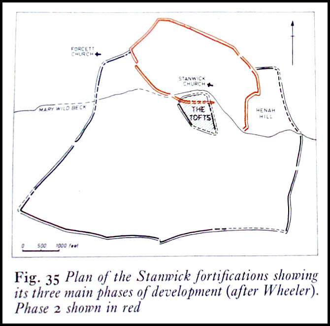
Plan of the Stanwick Fortifications (after Wheeler)

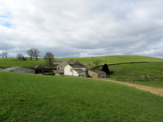
   OS Grid Reference: NZ 1820 1161. The Stanwick “late” Iron Age hillfort, also known as Stanwick Camp, lies some 8 miles to the north of Richmond, north Yorkshire, covering a large area of more than 700 acres and up to 5 miles in length, north of the village of Stanwick St John, with the earthworks spreading out from the hillfort itself. The hillfort or oppidum was built by the Brigantes tribe of northern England in three different phases roughly between 47-72 AD, with the first phase of the fort being at Toft Hill. The Brigantian leader Venutius, husband of Queen Cartimandua, was “thought” to have been defeated and killed by Roman troops from York at Stanwick in 74 AD – at about the same time that parts of the fort were destroyed by fire, but the fire was ‘probably not started by the Romans’ – although Quintus Petillius Cerialis, who was Roman Governor of Britain (71–74 AD), might have had a hand in that destruction at some point. Cartimandua maybe settling in at her base of Castle Hill (Almondbury) after 69 AD? 

Mary Wild Beck and Stanwick Church by

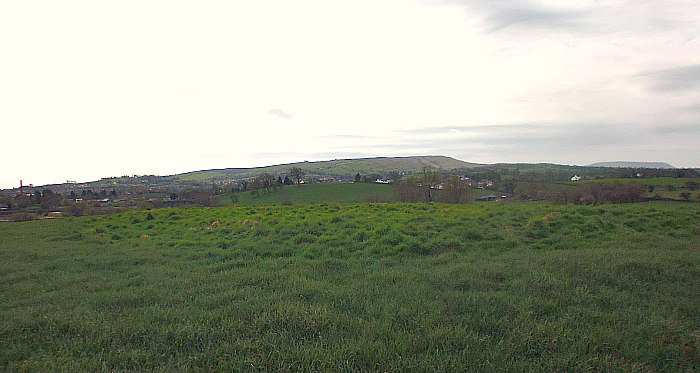
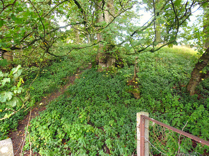
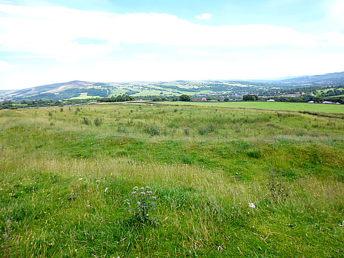
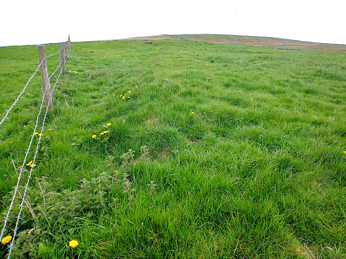
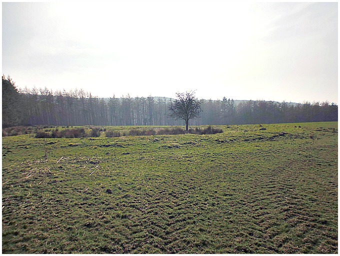
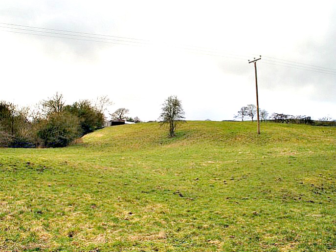
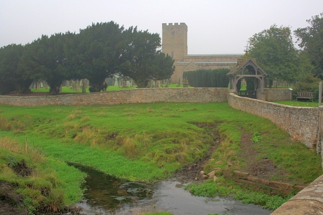
Mary Wild Beck and Stanwick Church by Mick Garratt (Geograph).

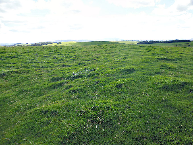
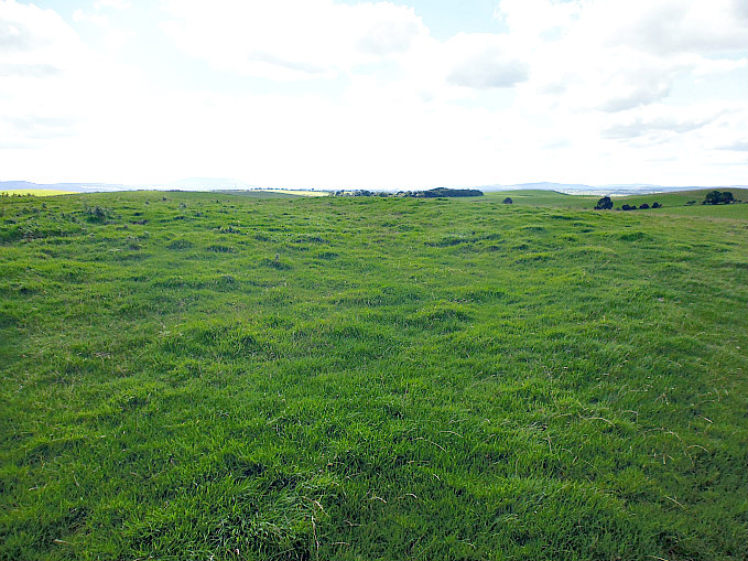
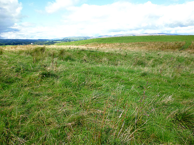
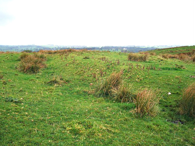
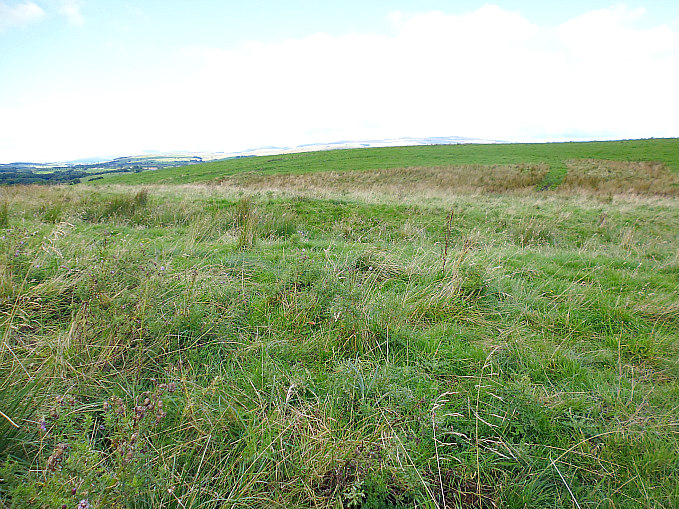
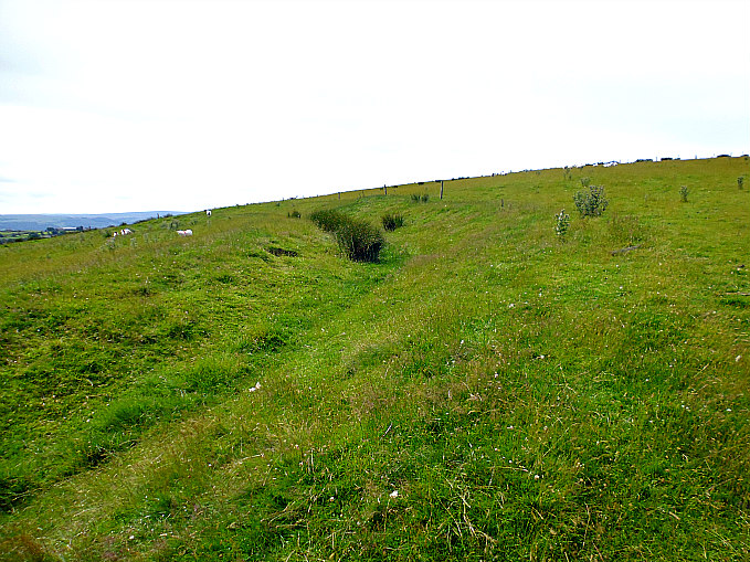
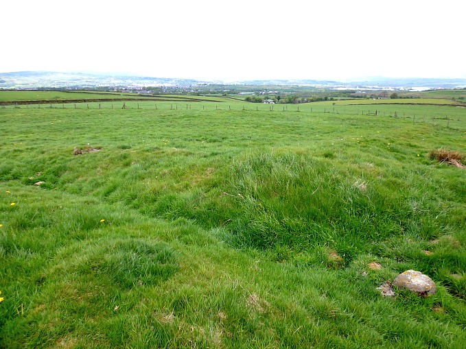
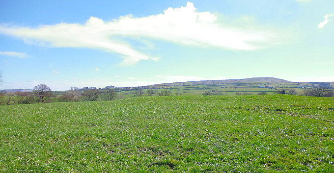
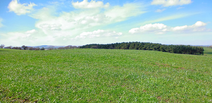
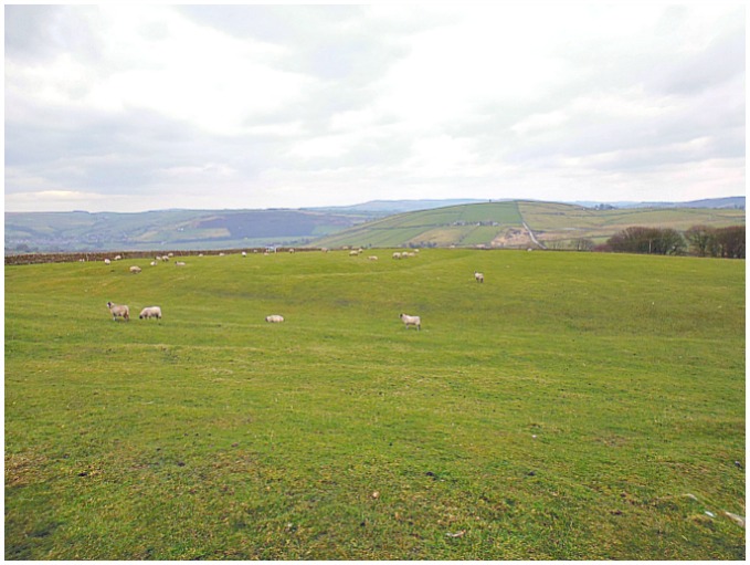
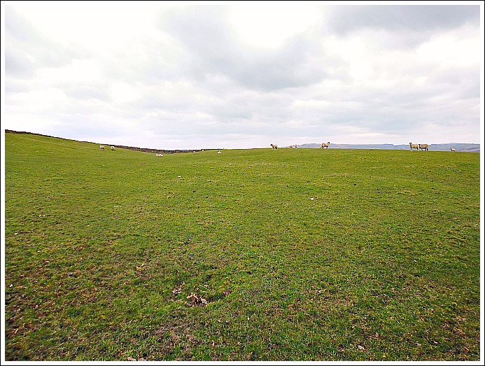
   Stanwick hillfort and its associated earthworks officially start at the village of Forcett from where there are some well-defined footpaths taking in the ancient monument, traversing its impressive and quite formidable ramparts and ditches. But the medieval church of St John the Baptist at Stanwick St John is the place to head to, and just to the south-west lies the hillfort known as Toft Hill (the Tofts), although there are grassy earthworks all around here running for several miles. Locally these earthworks are called Jack-Dike Arches. And there are ancient burial mounds which perhaps date back the late Bronze Age and the late Iron Age. Stanwick hillfort and its associated earthworks were excavated by Sir Mortimer Wheeler in 1951-52. In more recent times 1981-86 excavations were carried out by Durham University. St John’s Church at Stanwick houses a number of antiquities including a 9th century Anglo Saxon cross-shaft.

   Harold Priestley in ‘The Observer’s Book of Ancient & Roman Britain’, says of the Stanwick site: “If not the most impressive to view, this fortified area is the largest and greatest engineering feat of the Iron Age tribes. It started as a 17-acre (6.9-ha) fort in the early 1st century AD, and was twice extended until the fortification enclosed no less than 747 acres (302 ha). It is believed to have been the rallying-point of the Brigantes under their king Venutius who revolted against the Emperor Vespasian in AD 69. His queen, Cartimandua, had taken the side of the Romans and may have set up her headquarters at the fort at Almondbury near Huddersfield.

   “In about AD 50-60 (after the Roman conquest of the S of Britain) another 130 acres (53 ha) to the N of the fort were enclosed by a bank and ditch except on the SE where a stream, the Mary Wild Beck, acted as a barrier. The fortifications between the old and new sections were demolished. Part of this bank and ditch have now been restored.

Horse's-head plaque, Stanwick, north Yorks.

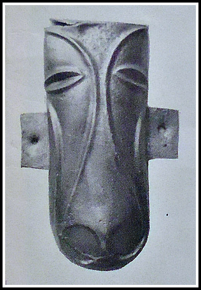
Horse’s-head plaque, Stanwick

   “The final huge extension covering some 600 acres (243 ha) was made to the S of the Beck and brought into the fortified area a rough quadrilateral of land capable of accommodating an army and pasturing horses and cattle. It was enclosed within a bank and ditch with an in-turned entrance on the S. There are signs that the fortifications were attacked by the Roman commander Cerialis before this section was completed. Part of the ramparts then appear to have been deliberately destroyed. No account of this campaign has ever been found, but the fall of Stanwick opened the way to the N for the Roman armies.”

   Author Ian Longworth in his work ‘Regional Archaeologies – Yorkshire,’ says of the Stanwick fortifications: “The fortifications lie on a rolling piece of land between the modern villages of Aldburgh St John and Caldwell. The site was hardly chosen for its commanding position, for the ground here does not rise above 100 feet. Rather it was chosen as being near a good supply of water, the Mary Wild Beck. In their final form, discounting a later addition on the south side, the earthworks enclosed an area of over 700 acres, but the first fortification was a more modest affair enclosing 17. This more or less coincides with a rough field known  as ‘the Tofts’ south-west of Stanwick church. The defences were impressive, for a man standing on the bottom single ditch would look up to a rampart rising to a height of 24 feet. Naturally access had to be provided across the rampart and a gateway left at the western angle. To strengthen this point the flanks of the gateway were revetted with dry-stone walling.

Stanwick Iron Age Fortifications by Mick Garatt (Geograph).

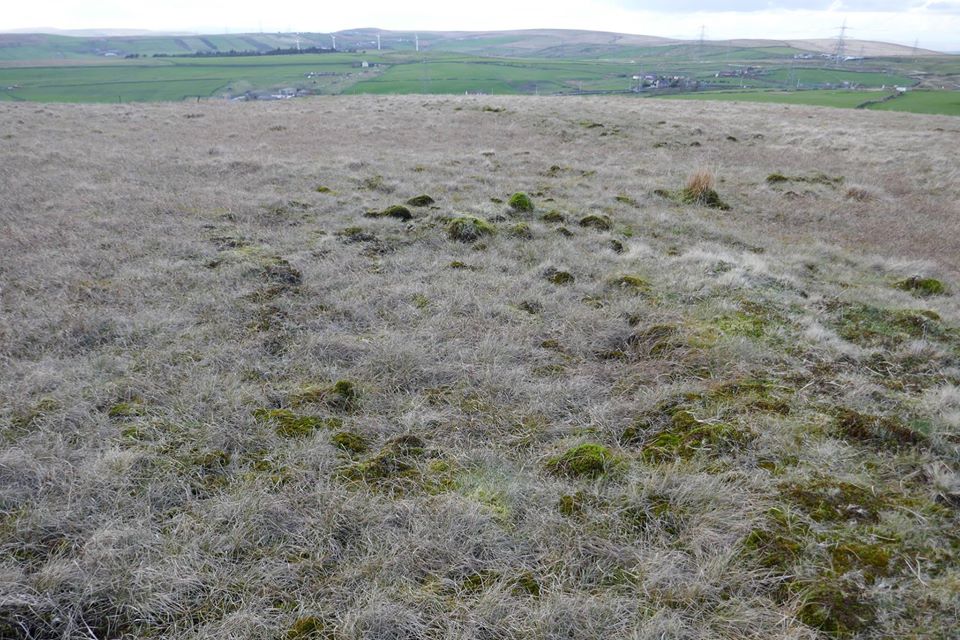
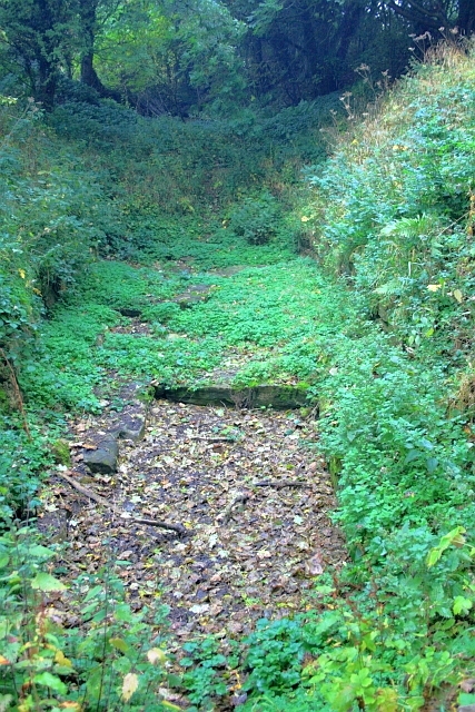
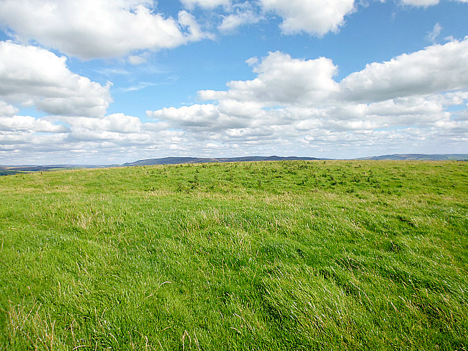
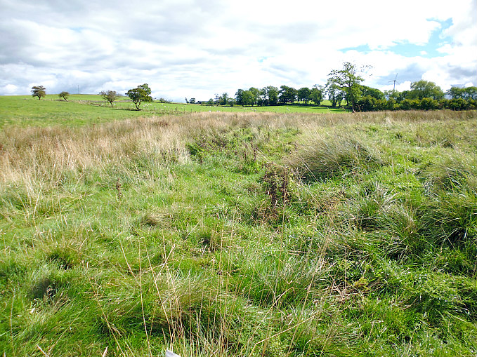
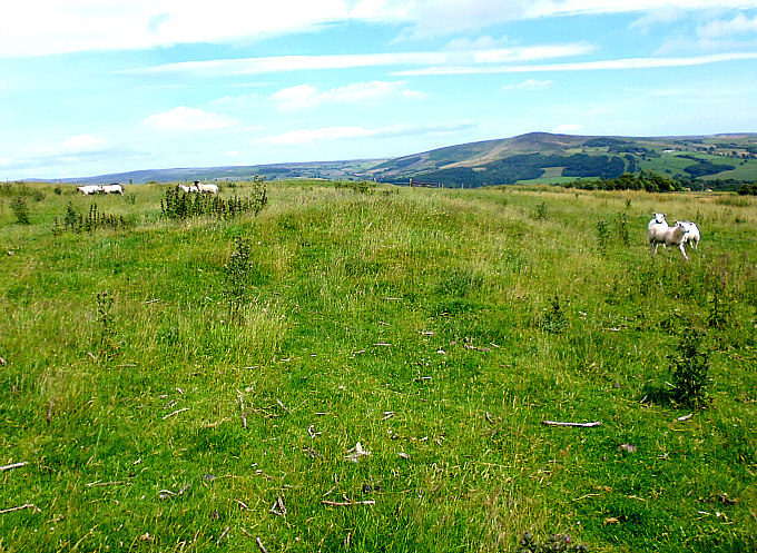
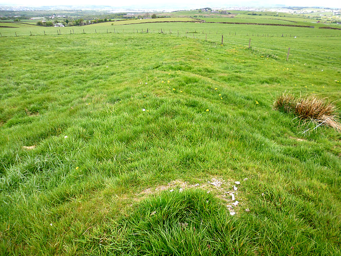
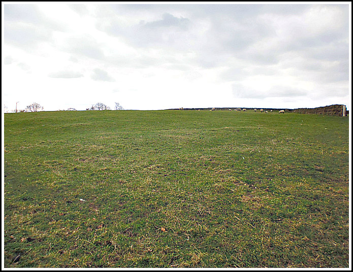
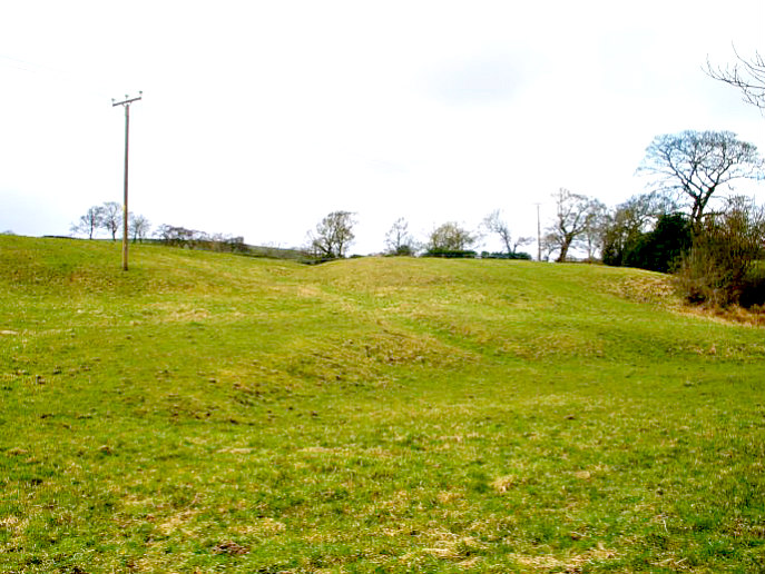
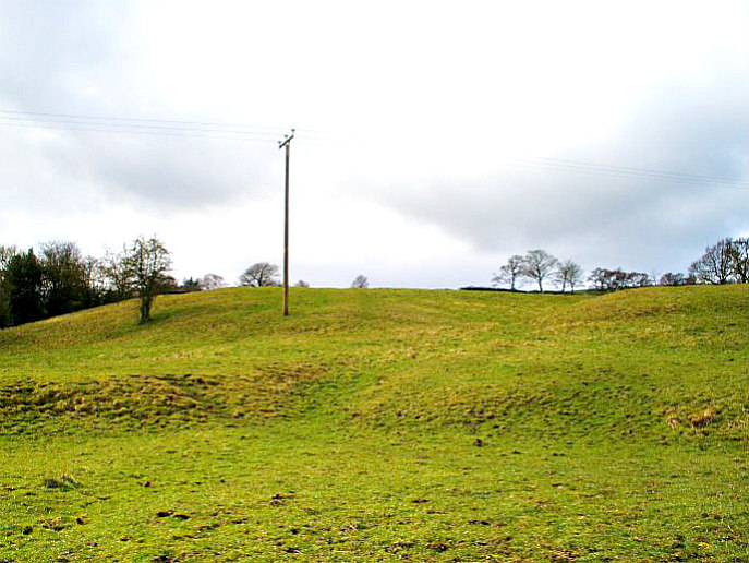
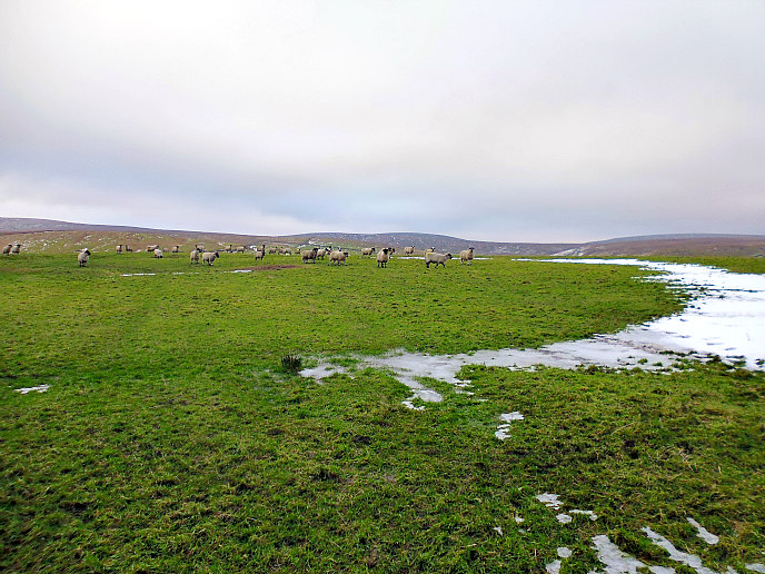
Stanwick Iron Age Fortifications by Mick Garratt (for Geograph).

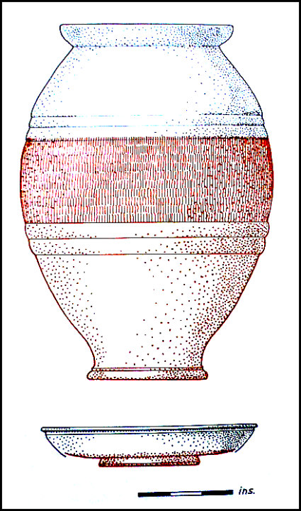
   “Although only a small portion of the area was examined, a series of drainage ditches were found inside the enclosure together with the remains of a round timber hut with an entrance facing east. This was set within a circular drainage ditch, which would have taken the water dripping from the conical roof. An interesting feature which emerged from the excavations at Stanwick was that only a quarter of the pottery recovered was home-made and these were mainly rough cooking-pots. The remainder of the pottery had all been imported. These imported wares included Butt Beakers from south-east England and fine red Samian Ware made towards the end of the first century A.D. in Gaul. The builders of the fortifications then had wide trading contacts with other tribes living farther south. This first fortification was probably built as a centre for anti-Roman resistance in northern Brigantia, shortly after the Roman invasion of A.D. 43.

   “At a later date the fortifications were greatly enlarged. An enclosure of 130 acres was built to the north to supplement the first fortifications. This new enclosure cut off the northern end of the earlier work and, where this lay within the new  enclosure, the old ramparts were flattened. The new enclosure was deliberately built to include some 300 yards of the Mary Wild Beck and, along this stretch, the brook and its marshy borders formed the only defence. Towards the western angle the new rampart was side-stepped to provide an entrance. This new rampart, which had originally been marked out with a small bank and ditch, was revetted in front by vertical dry-stone walling to a height of about 15 feet. Between the rampart and the ditch lay a berm—a flat space about 1 foot wide. The vertical height from the bottom of the ditch to the top of the rampart when first erected must have been something like 28 feet.

   “Near the entrance a pool of muddy water had collected in the bottom of the ditch. This had helped to preserve the organic objects that had either fallen or been thrown in. An oak dish was found and fragments of basketry, as well as an iron sword in a bronze-bound scabbard made of ash wood. Near the sword lay a skull showing very definite signs that its owner had met with a violent death. The skull had been slashed twice across the eye and a third blow had sliced of a piece of frontal bone which lay nearby. The head had been severed from the body between the fourth and fifth vertebrae. The victim was perhaps a criminal or prisoner and may well have suffered the fate of having  his head stuck on a pole at the gate.

   “The final stage of the construction was marked by a huge extension to the enclosure with a bank-berm-and-ditch defensive system to the previous fortification. The new fortifications  enclosed some 600 acres and provided ample pasturage for horses and cattle. The entrance lay in the middle of the south rampart in the form of a Z-shaped breach, but no gates were found. This final reconstruction was never completed. The causeway across the ditch opposite the gate had been roughly hacked through and blocks lay where they had been hurriedly levered up. The occupants had clearly had no time to finish their work before being called upon to defend themselves.

   “It was probably Venutius who extended the fortifications at Stanwick and then extended them again in and after A.D. 69 when he was gathering his allies for a final stand against the Romans. The unfinished state of the last phase of the defences shows that the final battle came before the Brigantes were completely ready, and the deliberate destruction of part of the ramparts shows only too clearly the ultimate result of the conflict. The actual struggle is not documented by the historians, but the Roma victory must have been complete, for by A.D. 80 Agricola was campaigning in Scotland. A Scottish campaign would have been out of the question if the Brigantes were still menacing the supply routes to the south.”

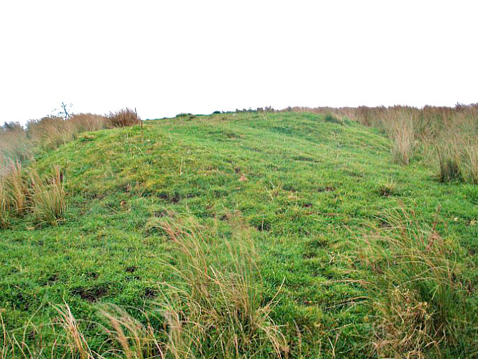
   The great Mr Arthur Raistrick in his work ‘The Pennine Dales’, tells us more about Stanwick. He tells us that: “At Stanwick, a prominent point, Toft Hill, had been converted into a defensive hill-fort, and one of the leaders of the fort builders was buried there, his body accompanied by his chariot. Many ornaments of bronze, some with stylized horse-head motifs, buried with him, were from the harness and chariot trappings.” Could this burial mound have contained the remains of Venutius, leader of the Brigantes, whom it was believed was killed by the Romans in 74 AD?

Butt beaker and Samian bowl from Stanwick (After Wheeler).

Butt beaker & Samian bowl, Stan-wick (After Wheeler).

   Author Jaquetta Hawkes writing in 1975 says that: ‘The history of the Stanwick earthworks are revealed by Sir Mortimer Wheeler’s digging leads into the Roman conquest of Britain at a point where the pro-tagonists are known by name, thanks largely to the writings of Tacitus. Having conquered the lowlands, the Roman army was now thrusting into the highland zone. At this point the [Brigantes], probably the largest of all the British tribes and occupying much of northern England, were ruled over by Venutius and his queen, Cartimandua. Friendly policy towards the Romans had brought them the status of a client kingdom. In 51 AD Caractacus, the heroic leader of British resistance, asked for asylum at the court of Queen Cartimandua. She then handed him to the Romans in chains. The Brigantes were now in turmoil, with the pro-Roman policy still maintained by the queen, but now opposed by her husband and the elite of his warriors. Venutius and Cartimandua separated in violent hostility. Venutius then succeeded Caractacus as leader of the resistance, while the queen took his squire Vellocatus as her consort for bed and throne.

   Hawkes goes on to say that: ‘With Roman support Cartimandua was able to hold out in the old Brigantian capital (possibly Almondbury), but the Brigantes and others rallied to Venutius. He later attacked Cartimandua with great success and she had to be rescued by Rome. As Tacitus put it on behalf of Rome ‘The Throne was left to Venutius, the war to us.’ But he was not allowed long to enjoy his victory. The Ninth legion came from York and ended the great Brigantian resistance for good.” 

I would like to thank the late John Dixon, and family, for their bringing about of this site page through books and literature greatly received.

Sources of information and related websites:-

Barringer, J. C., The Yorkshire Dales, The Dalesman Publishing Company Ltd., Clapham, 1982.

BBC Publication, Roman Britain, The British Broadcasting Corporation, London, 1966.

Hawkes, Jacquetta, A Guide To The Prehistoric And Roman Monuments In England And Wales, Cardinal (Sphere Books Ltd), London, 1975.

Longworth, Ian H.,  Regional Archaeologies: Yorkshire, Heinemann Educational Books  Ltd., London, 1969. 

Priestley, Harold, The Observer’s Book of Ancient & Roman Britain, Frederick Warne & Co Ltd., London, 1976.

Raistrick, Arthur, The Pennine Dales, Arrow Books Ltd., London, 1972.

Ramm, Herman, Roman York – From A.D. 71, Yorkshire Architectural and York Archaeological Society, York, 1979.

Mary Wild Beck and Stanwick Church

Stanwick Iron Age Fortifications

Stanwick Hill Fort, Forcett, North Yorkshire

https://en.wikipedia.org/wiki/Stanwick_Iron_Age_Fortifications

Stanwick Fortifications, North Yorkshire

http://www.academia.edu/4032642/New_Geophysics_Results_at_Stanwick_Oppidum_North_Yorkshire

http://www.english-heritage.org.uk/visit/places/stanwick-iron-age-fortifications/

                                                                           © Ray Spencer, The Journal Of Antiquities, 2017.


1 Comment

Steeling Hill Earthwork, Near Coniston Cold, North Yorkshire

Steeling Hill Enclosure, near Coniston Cold, North Yorks.

Steeling Hill Enclosure, near Coniston Cold (north-side).

    OS grid reference: SD 8859 5515. A large earthwork or enclosure located on the crest of Steeling Hill above the A65 near Coniston Cold, North Yorkshire. This flat-topped hill on the opposite side of the lane from Kelber Farm was once the enclosure, settlement or camp of an ancient tribe, but unfortunately nothing much is known of its history. It was almost certainly a strategically placed encampment overlooking the valley below and in this sense it may have been a defensive site, although its low, almost non existent outer ditch, is barely visible today at ground level. At its centre there is a round-shaped feature but what this was is uncertain. It might actually be a more modern feature.

    To reach the earthwork from the A65 just to the south of Coniston Cold: go along the farm track/footpath nearly opposite The Coniston Hotel towards Kelber farm for 240m, then on the right-hand side go through the gate and head up the grassy hill-side for 220m to a second gate. You can reach the site from here. There is, however, no proper designated footpath up to the hill; and so please remember to ‘fasten the gates’ behind you.

Steeling Hill Earthwork (viewed from the south)

Steeling Hill Earthwork (viewed from the south)

Steeling Hill Earthwork (from the south-west).

Steeling Hill Earthwork (from the south-west).

    This very large rectangular earthwork on the top of Steeling Hill covers a large area of the summit and measures roughly 280m x 138m (918 ft x 452 ft), whilst the smaller, circular feature in the middle measures 74m x 60m (242 ft x 196 ft). The inner part of the earthwork/enclosure is raised by a few feet above the outer ditch, if it was ‘ever’ meant to be a ditch, but at the S and E sides this is much less noticeable. And as to the circular, slightly raised feature at the centre, and its distinct ditch – could this have been an inner enclosure, or maybe a living area with a hearth? Or could this be a more recent feature?

    So was this an Iron Age enclosure, or was it a Brigantian settlement?, or maybe something else; it looks to be an unlikely candidate for a Roman camp. Perhaps it was ‘a plain and simple animal enclosure’. But as ever there is a lack of any information regarding this earthwork, only the words ‘earthwork’ or ‘enclosure’ are mentioned on Ordnance Survey maps. There are though one or two other, similar, earthworks in this area, one in particular being near Cobers Laithe at Swinden, near Nappa.

Other related websites:-

http://www.kirkbymalham.info/KMI/malhamdale/speight.html

http://www.skiptoncastle.co.uk/history-of-craven.asp?page=17

https://en.wikipedia.org/wiki/Coniston_Cold

Kelber Farm

                                                             © Ray Spencer, The Journal Of Antiquities.


1 Comment

Cobers Laithe Earthwork, Swinden, Near Nappa, North Yorkshire

Cobers Laithe Earthwork, near Nappa (looking north-west).

Cobers Laithe Earthwork, south-side (looking north-west).

Cobers Laithe Earthwork, near Nappa (looking north-east).

Cobers Laithe Earthwork, south-side (looking north-east).

    OS grid reference: SD 8669 5340. Sadly next-to-nothing is known about the oval-shaped earth-work or enclosure near to Cobers Laithe farm on  Swinden Moor, which is also known as Swinden Earthwork and Swinden Roman Camp, just 1 mile east of Nappa, North Yorkshire. Was it a Roman camp, as a few have suggested, or was it perhaps a Brigantian settlement – at the time of the Roman invasion? Or was it a more typical Iron Age settlement or enclosure? We don’t know with any certainty. And also it is a bit of an odd sort of earthwork-enclosure as it is intersected through the middle by a stream, and there are a numble of circular pits (bell pits), especially at the N side. The earthwork lies on private land. It is located in a field close to Mill Lane at Swinden – between Bank Newton and Nappa, just 380m to the west of Swinden Moor Head farm. On the earthwork side of the lane Ash Tree Farm is about 530m up the fields to the east.

Cobers Laithe Earthwork, south-side (looking north-west).

Cobers Laithe Earthwork, south-side (looking north-west).

Cobers Laithe Earthwork, south-side (looking east)

Cobers Laithe Earthwork, south-side (looking east)

    It is quite a large earthwork measuring roughly 107m x 87m and it used to have a smaller inner earthwork with a circular bank but this seems to have disappeared altogether, maybe due to farming and the stream. At the time of my visit the outer bank and ditch of the earthwork were deep in grass and reeds in several places, but despite that they are quite pronounced at the SE and SW sides. And at the N, NW and NE sides the bank and its associated ditch are still quite well-defined, and there is a possible entrance at the NW. But as to whether they were ramparts designed for warfare or security, we don’t know, but in my opinion I would think they were non-defensive.

Cobers Laithe Earthwork (the enclosure south-side). (the inner enclosure).

(The enclosure at the  southern-side).

Cobers Laithe Earthwork (grassy bank and ditch)

Cobers Laithe Earthwork (grassy bank and ditch)

    The oval-shaped layout of the earthwork or camp does ‘not’ look particularly Roman to me. We know the Romans always built square-shaped fortifications. Although it could have been a ‘temporary’ Romano-British camp. However, there does not appear to have been much, if any, Roman activity in the area; and the theory that there was a temporary Roman fort or camp at Long Preston, in the field near St Mary’s church, seems to have all but died a death. In all probability the earthwork here at Swinden was a Brigantian camp, settlement, or enclosure. But another distinct possibility being that this was a more typical Romano-British farmstead.

Cobers Laithe Earthwork (southern-side grassy earthworks.

Cobers Laithe Earthwork (southern-side grassy earthworks.

    The relatively flat part of the earthwork, nearest the lane and fence, is on the south-side of the little stream while the northern and, by far the largest part of the earthwork, lies just beyond the stream and up the slight slope of the field beyond. But unfortunately the stream in between the two sections has made for some very muddy and boggy conditions, and so it is not easy to reach that ‘northern’ section unless you have wellies! Its quite obvious that the steam is a ‘more recent’ feature, having gouged out the channel through the centre of the ancient earthwork. To put it another way: the stream was not here when the earthwork was constructed. It was formed from a spring further up the field over hundreds of years, but certainly ‘not’ thousands of years.

    The northern part of the earthwork is pock-marked by holes or depressions (bell pits) in the ground, which are probably the result of quarrying for coal a few hundred years or so back. This poor or cheap coal substitute being used by local farms. Some of the holes have now become ponds.

    The Pastscape website has the site of an alleged Roman camp (monument no. 45530) about a ¼ of a mile to the north-west at Swinden (OS grid ref: SD 8617 5440), though this is perhaps an error? See the website link below.

Sources and related websites:-

Click on this Geograph link for a good photo of the enclosure on Swinden Moor:-     http://www.geograph.org.uk/photo/2837370

http://www.pastscape.org.uk/hob.aspx?hob_id=45530

http://www.pastscape.org.uk/hob.aspx?hob_id=45517

http://www.megalithic.co.uk/article.php?sid=28080

https://en.wikipedia.org/wiki/Swinden

http://www.gisburn.org.uk/nappa/

http://www.longpreston.info/history/history.html

http://mapio.net/o/1975548/

                                                        © Ray Spencer, The Journal Of Antiquities.


1 Comment

Round Dikes Earthwork, Addingham Low Moor, West Yorkshire

Round Dikes on Addingham Low Moor (from above).

Round Dikes on Addingham Low Moor (from above).

    OS grid reference: SE 0551 5012. Quite a substantial Iron Age earth-work situated below Counter Hill on Addingham Low Moor, West Yorkshire, that is locally called ‘Round Dikes’, ‘Round Dikes Camp’ and ‘Round Dikes Settlement’. This enclosed and almost oval-shaped earthwork on the moors to the east of Crossbank Road also supports a Bronze Age burial mound, but unfortunately this is now badly muti-lated. There are traces of an associated linear earthwork to the south-east of the site, and another burial mound, although this is now hardly recognizable at ground level. Round Dikes Earthwork can be reached from Crossbank Road, where a footpath runs north-east towards Counter Hill, through a couple of fields and over a couple of wall stiles for 400m. Just before the earthwork there are some gates and a short muddy path. The grassy earthwork is now in front of you!

Round Dikes Earthwork, Addingham Low Moor (the north side).

Round Dikes Earthwork,  (the north side).

    Round Dikes Earthwork roughly measures 87m x 79m and is oval shaped. It has a well-defined ditch with banks running around an inner area which would have been the camp or settlement’s inner sanctum; the banking at the north-side is very prominent and is 4-5 feet high in parts, whereas the banking further around the site is slightly less at 3-4 feet high. However it is thought this was a non-defensive camp or “entrenchment” probably of the Iron Age, and not of the Roman period. The inner part of the site probably contained maybe nine hut circles and some hearths, according to John Dixon in his work ‘Journeys Through Brigantia’ – Volume One. At the south-east side there is what looks to be an entrance, and close to that and just inside the camp’s enclosure, a spring which is now almost lost in reed beds! The ditch and banking at the S side is almost lost in dense foliage and reed beds, and the spring makes for very boggy conditions here.

    It would seem that the people of the Iron Age kept their stock: cattle, sheep, goats, pigs and maybe horses close to them and always within the bounds of their settlements or enclosures.

    The author J. C. Barringer in his work ‘The Yorkshire Dales’, says of these Iron Age people and their enclosures: These complexes of small enclosures were bounded by stone banks and contained round huts of about fifteen feet in diameter. The inference to be drawn from the archaeological evidence is that Iron Age peoples occupied many of the limestone plateau above the main valley floors and that they were agriculturalists to the extent of growing crops of oats and perhaps rye in their small enclosures.”

    He goes on to say: ‘Their small enclosures near their huts may have been crop growing areas, but most of their territory must have been used for grazing stock. The grazing of hillsides, would of course, hold back tree growth and in the case of goats severely inhibit it, so maintaining the clearance of the woodlands and perhaps increasing it in some areas.”

Round Dikes Earthwork. Bronze Age Bowl Barrow (between the sheep!)

Round Dikes Earthwork. Bronze Age Bowl Barrow (between the sheep!)

    Near the south side of the site there is a small but very mutilated mound or bowl barrow which must be ascribed to the Bronze Age. This grassy mound is about 4 feet high but it is very damaged with a hollowed-out part at one side – due perhaps to robbery, or maybe from some illegal archaeological diggings in the past. So the site was obviously in use as a settlement long before the round dikes were built. And 200m further down hill to the south-east there are traces of a linear earthwork which was probably an extended part of the Round Dikes Camp. There is also another tumulus (bowl barrow) just below this earthwork at (grid ref: SE 0584 4993), although this has been largely lost due to plough-ing of the field.

    About ¾ of a mile to the west, at Woofa Bank, there is another large oval-shaped Iron Age enclosure with associated earthworks over to the north and east, and there is an interest-ing tumulus (bowl barrow) on the trackway (Millennium Way) to the south.

Sources and related websites:-

Barringer, J. C., The Yorkshire Dales, The Dalesman Publishing Company Ltd., Clapham, 1982.

Dixon, John & Phillip, Journeys Through Brigantia – Volume One – Walks in Craven, Airedale and Wharfedale, Aussteiger Publications, Barnoldswick, 1990.

https://en.wikipedia.org/wiki/Addingham

http://www.pastscape.org.uk/hob.aspx?hob_id=48311

http://www.ancientmonuments.info/en31498-late-prehistoric-enclosed-settlement-known

http://www.armadale.org.uk/rounddykes.htm


Ring Stones Earthwork, Worsthorne, Burnley, Lancashire

Ringstones Earthwork near Worsthorne, Lancashire.

Ring Stones Earthwork Worsthorne, Lancashire. South-eastern side.

    OS grid reference: SD 8863 3301. On Worsthorne Hill above the two Swinden reservoirs at the east side of Burnley, Lancashire, there is a rectangular-shaped earthwork which has often been considered to be Iron Age in date, but it appears to be Romano-British, and most probably mid to late 4th century AD. It is similar in design to the Bomber Camp Earthwork, near Gisburn, Lancashire. This quite large site is also called ‘Slipper Hill Earthwork’ and ‘Hameldon Pasture Earthwork’. It is conjectured to have been a Romano-British farmstead, or maybe a temporary camp, although without any “real” concrete information that is still ‘open to question’. The site can be reached from St John’s Church in Worsthorne. From here take the Gorple road going eastwards on what becomes a rough track for about ¾ of a mile. Take the track on the left just after Brown Edge Farm, climb over two stiles and continue along here for 600m, eventually climbing a 3rd and 4th wall stile. The site is in the field to the right. There is a stile but it’s on the wrong-side of the earthwork; so the two gates are in the way and the site seems to be on ‘private land’. You can probably reach the earthwork from a path at the the north-western side of the field.

Ring Stones Earthwork (western side)

Ring Stones Earthwork (western rampart looking south).

    This quite large rectangular earthwork measures 56m x 41m and has very well-defined outer banks (ramparts) that are curved at the corners, and there are also prominent ditches. The outer banks (ramparts) are 3 feet high in places, especially at the S, W and N sides – the bank at the E side is not quite as high. At the E and W sides the ditches are quite well-defined. The NE side has what could be an entrance with extended banks at either side running out from the earthwork for 15m – and a trackway or path traversing from east to north-west across the inside of the site, although these could be a more recent features? The NW side has a circular (banked) feature with large stones inside, which could perhaps have been a 17th century lime kiln? At the W and NW sides, in particular, the outer banks (ramparts) have large and small stones embedded into them at intervals – an indication of how these were built. At the NW side a second, smaller earthwork measuring 18 yards square can just be made out – although this is now very faint in the ground and only just visible.

Ring Stones Earthwork. The western rampart.

Ring Stones Earthwork. (Western rampart looking north).

    The author Walter Bennett in his acclaimed work ‘History of Burnley’ did a survey of the earthworks in 1946. In this he called the site: “an enclosure that is 50 yards square with ramparts 2 yards wide and 1 yard high with an outer ditch 2 yards wide.” He says of the smaller enclosure: “It is 18 yards square.” He goes on to say: “the site was excavated in 1925 at which time a gateway 7 yards wide at the SW side was paved with boulders laid in a gravel foundation. At the S side there was a drain. A regular course of large stones flanked the gateway entrance at either side, and a floor of gravel and flat stones or cobbles. The rampart was built of earth and stones. There was a well-constructed road 7 feet wide which ran towards Bottin Farm on the Worsthorne to Roggerham road.” This is ½ a mile to the west. Could this have been the ancient straight trackway which runs back down to Gorple Road, or another track that heads north-west from the site to Swinden?

Ring Stones Earthwork (from the south-east).

Ring Stones Earthwork (from the south-east).

    But what makes this site interesting is the fact that a smaller, square-shaped earthwork feature joins onto the larger one at the north-western side, although this is fainter and more difficult to make out at ground level. So was this also a Romano-British farmstead, or was it something else? Almost certainly it was linked to, or was part of, the larger farmstead. It may be that this structure, and the larger one, only lasted for a short period of time because at that ‘time’ in Late Roman Britain, especially in the northern parts of the empire, daily life was becoming difficult with warring factions and tribal infighting on the increase – the Roman army now almost incapable of holding these rebellious northern, British tribes back. And soon the Roman army would retreat back to Gaul. Britanniae would then be left to its own devices! But the question must be asked: what was this Late Roman farmstead or camp doing here at the east side of Burnley?

Sources and related web-sites:-

Bennett, Walter, History Of Burnley – Vol I, Burnley Corporation, 1946.

Hall, Brian, Burnley (A Short History), Burnley and District Historical Society, 1977.

http://www.pastscape.org.uk/hob.aspx?hob_id=45317

https://historicengland.org.uk/listing/the-list/list-entry/1009488

Ring Stones, Worsthorne, Lancashire


1 Comment

Primrose Hill Earthwork, Gisburn, Lancashire

Primrose Hill Earthwork, near Gisburn, Lancashire

Primrose Hill Earthwork, near Gisburn, Lancashire

    OS grid reference: SD 8476 4725. Near Coal Pit Lane – about 1 mile to the south-east of Gisburn, Lancashire, there is a small, square-shaped earthwork that sits upon the north-side of Primrose Hill. But unfor-tunately hardly anything is known about this solitary earthwork apart from the probability that it dates from the Roman period. This earth-work is located beside a footpath close to Hesketh Farm. There are other Roman features in this area: 600m to the north-west is the well-defined earthwork known as Bomber Camp, and 500m to the south-east there are faint traces of the Roman road that runs from Elslack to Ribchester. The Primrose Hill earthwork can be reached from the A682 out of Gisburn, turning onto Coal Pit Lane for maybe ½ a mile, then walk along the footpath/track towards Hesketh House Farm. Via off to the north before the farm, then north-east along footpath (following tree line) for 160m to reach the low hill (Primrose Hill) on the right.

Primrose Hill Earthwork near Gisburn, Lancashire,

Primrose Hill Earthwork (in the foreground) near Gisburn, Lancashire,

    This roughly square-shaped earthwork or earthen platform on Primrose Hill is about 1m (3 feet) high and 10m (nearly 33 foot) square. It is quite prominent when viewed close-up from just below the hill itself, but from further afield it is not particularly visible and would be easily walked passed. There is a dearth of information with regard to this site – although it is conjectured to have been a Roman watchtower or signal station – the later being more unlikely due to the smallness of the earthwork. A watchtower seems more plausible due to the feature being situated on a hill with lower ground on the N side and its nearness to a Roman road on the S. If this “were” a watchtower of the late Roman period, it would have been garrisoned by only ten soldiers at any one time. The thinking being that this particular watchtower never even saw the light of day, it was quickly abandoned and never begun, leaving just an earthen platform. The nearby Roman earthwork ‘Bomber Camp’ ended its days in a similar vane – only surviving for a short period of time towards the end of the 4th century AD.

Primrose Hill Earthwork, near Gisburn, Lancs.

Primrose Hill Earthwork, near Gisburn, Lancashire.

    The author John Dixon in his work ‘Journeys Through Brigantia’, (Volume One), says of this earthwork that: “During June 1971 the site was excavated by Alan King and the Chorley College of Education. No post-holes or masonry were found, nor any finds. There was no ditch around the earthwork, but the boulder clay of the mound contained sand-stone while the drift below was more calcareous, and so it was given to be man-made.” And so with the lack of any ‘good’ credible information this Roman earthwork, if that’s what it was, shall have to remain just a miscella-neous earthwork of uncertain date – at least until further information arises.

Sources:

Dixon, John & Phillip, Journeys Through Brigantia (Volume One), Walks in Craven, Airedale and Wharfedale, Aussteiger Publications, Barnoldswick, 1990.

Bomber Camp, Gisburn, Lancashire


1 Comment

Babyhouse Lane Ancient Settlement, Cononley, North Yorkshire

Babyhouse Lane Settlement from the south-west.

Babyhouse Lane Settlement from the south-west.

    OS grid reference: SD 9719 4628. On the hills a mile or so to the south-west of Cononley, north Yorkshire, near the top end of Babyhouse Lane there is an Iron Age settlement or camp. This is thought to have been a Brigantian outpost that was still in use in the late 1st century AD when Roman soldiers marched along the Roman road to the south-west and set up their fort at Elslack. For a time the Brigantes got on to some extent with the Romans, but that was not to last for long and their settlements were soon to be abandoned, forever. Babyhouse Lane can be reached from Colne Road (A6068) near the Dog & Gun public house at Glusburn. Take the lane up onto Leys Lane, turning left at the top onto Babyhouse Lane, and then just after the junction of four lanes and the wooded area on the right, go through the second farm-gate and into the large walled field – here before you are the faint and grassy earthworks of the ancient settlement.

Babyhouse Lane Settle-ment viewed from SE.

Babyhouse Lane Settle-ment viewed from SE.

    At ground level there isn’t a great deal to see apart from a few raised areas (low ramparts) in the middle of the field and, what are probably ditches around the edges; and the earthworks continue just beyond the wall at the N side. This pentagonal-shaped settlement measures approx. 91m x 85m and covers an area of just over 1 acre. At the W and S sides the ditch is more prominent – just before the land rises forming the bank (which seems not to be part of the earthwork), while over at the E side there is what could be an entrance. The settlement appears to be strategically placed to overlook the Aire Gap to the north-west. And the modern-day walls surrounding the earthworks give this former Brigantian, possible Romano-British settle-ment, the look of “still” being an enclosed site, even if today it is only to keep the sheep in! Sadly nothing much else is known about this site.

Babyhouse Lane Settlement viewed from the East.

Babyhouse Lane Settlement viewed from the East.

    The late John Dixon in his work ‘Journeys Through Brigantia’ , Volume One, says of the settlement here: “Just down Babyhouse Lane, over on the left, are the earthwork remains of an Iron Age/Romano-British settlement site, the earliest home of man in the area, being a pentagonal dtched earthwork with an entrance on the east and covering just over one acre.” While the author and antiquarian Harry Speight considered the ancient settlement on Babyhouse Lane to be of Danish origins. There are indeed some Scandinavian place-names around this area. Cononley is named after King Canute, according to Mr Speight. But it would seem that this is a late Iron Age-Romano-British site; and there are similar earthworks at Higher Scarcliff and Catlow Gill near Carleton Lane Head, a couple of miles to the north.

Sources:

Dixon, John & Philip., Journeys Through Brigantia, Volume One, Walks in Craven, Airedale and Wharfedale, Aussteiger Publications, Barnoldswick, 1990.

Check out this web blog by Jim Jarratt:  http://www.jimjarratt.co.uk/walks/beaconsway/section2.html


1 Comment

Standrise Earth Circle, Carleton-in-Craven, North Yorkshire

Standrise Earth Circle/Enclosure, near Carlton-in-Craven.

Standrise Earth Circle/Enclosure, near Carleton-in-Craven.

    OS grid reference: SD 9418 4846. Standrise Earth Circle is located above Elslack Reservoir at the north-west side of Standrise Plantation, some 2 miles south-west of Carleton-in-Craven, north Yorkshire, there is a large Iron-Age earth circle or enclosure. This quite well-defined earthwork stands upon Elslack Moor. And 160m to the north-west another, smaller enclosure is visible. The site can be reached from the country lane between Colne and Carleton-in-Craven, turning left just after the plantation onto Moor Lane, and just after the track to Mitton House go through the gate on the opposite side of the lane, then via left up the steep hill following the edge of the plantation until you reach a flat area of land, where directly in front of you is the ancient earth circle/enclosure. You can also reach it by heading east out of Elslack and coming up by way of Mill Fold.

Standrise Earth Circle / Enclosure, near Moor Lane.

Standrise Earth Circle / Enclosure, near Moor Lane.

    The earthwork is almost a perfect circle – but how did our ancient ancestors do that? It measures 34m across and 35m vertically (38 yards x 39 yards) and has an outer bank made of soil and stones, many of these stones being small boulders; the circular, raised bank is over 1 foot high in places and is quite a substantial construction. The stones that are scattered about the circle are the remnants of a wall that once traversed the eastern side of the earthwork. Near the centre of the circle are traces of a raised area, which could well have been a hearth. And there is a solitary tree near the middle of the circle! Could this ancient enclosure have been a Brigantian settlement that was in use prior to the Roman Conquest? Maybe it was the residence of a chieftain? A couple of miles to the west we have the earthworks of ‘Burwen Castle’ Roman fort at Elslack, which was built in 80 AD, at a time when the Brigantes tribe held sway over the area, though this would soon turn in favour of Rome. This perhaps also saw the final abandonment or destruction of these Iron Age settlements.

Standrise Earth Circle (outer bank).

Standrise Earth Circle (outer bank).

    160m to the north-west near the crest of the hill at (OS grid ref: SD 9406 4861) there is a smaller circular enclosure, but very similar in construction to the other. This small circle measures approx. 14m x 15m. There is another earthwork or enclosure about 1 mile to the north-east at Higher Scarcliff, near Carleton Lane Head, and there is a possible cairn circle on the moor, above Rushbank farm, ½ a mile to the south-west of that. There are many other ancient enclosures and earthworks scattered around the Carleton, Lothersdale and Skipton areas, but too many to mention here.

    The late John Dixon in his excellent book ‘Journeys Through Brigantia’, Vol 1, says that: Moor Lane which runs along the north-east side of Standrise Plantation over to Street Head farm, near Lothersdale, was probably a “minor” Roman road linking Keighley to Burwen Castle Roman fort at Elslack, which he calls Margery 721 or the M721!

Sources:

Dixon, John & Philip., Journeys Through Brigantia, Volume 1, Walks in Craven, Airedale and Wharfedale, Aussteiger Publications, Barnoldswick, 1990.

http://www.archiuk.com

http://www.archiuk.com/cgi-bin/web-archi.pl?

http://www.megalithic.co.uk/article.php?sid=35748


1 Comment

Aedmar’s Mound And Earthworks, Blacko, Lancashire

Aedmer's Mound at Admergill, near Blacko, Lancashire.

Aedmar’s Mound at Admergill, near Blacko, Lancashire.

    OS grid reference: SD 84829 41718. For want of a better name I am calling this site ‘Aedmar’s Mound Earthworks’. These earthworks or ringworks are located down in a narrow valley, in a field above Blacko Water, near Wheathead Lane, just to the west of Blacko and Gisburn road, Lancashire, in the area called Admergill. A trackway heads off from Wheathead Lane at the bridge and then goes in a south-westerly direction for a short distance, and eventually through a wall stile – the earthworks are in the field (here) at the western-side of the beck – being noticeable by the grassy rectangular mound with its accompanying low ramparts, known as ringworks. These now rather forgotten earthworks may date back to the Iron-Age, or from the so-called Dark-Ages, or from the early Medieval period, but other than that we do not know when these earthworks were built or what they actually were; and they are not marked on any Ordnance Survey maps.

Aedmar's Mound / Earthworks viewed from the south-east.

Aedmar’s Mound / Earthworks viewed from the south-east.

    The earthworks cover an area of approx. 94m across N-S and 60m diagonally W-S though the S and N sides are cut-off and damaged by the farmer’s ‘modern’ field system, while at the NW side of the site there is a continuation of the low ringwork ramparts. The rectangular-shaped low mound ‘with the telegraph pole’ is quite a distinctive shape, but there are actually two mounds here – both being intersected in the middle by a deep ditch, or entrance. So what was it exactly? Was it a camp, a hillfort, or a defended site? Or was there a settlement here or maybe a royal residence of some kind? There appears to be at least three circular ramparts or ring-works and, possibly a fourth ring by the looks of it, surrounding the low, grassy elevated mound, and the same again at the far NW side but in a sort of square-shape, which has been cut off from the main site, possibly due to farming, or that it was meant to be like this?

    Local author, John Clayton, in his fascinating book ‘Valley of the Drawn Sword’, says that Admergill could possibly take its name from: “the Welsh prince A’dd Maur who controlled certain British lands sometime in the Early Medieval period, it is very possible that this name has been shortened over time to Mawr….but equally, it could apply to the nearby settlement of Admergill…..which eventually leads to A’dd Mawr’s Gill.”

Aedmar's Mound, Blacko, with ditch through the middle.

Aedmar’s Mound, Blacko, with ditch through the middle.

    But what of Aedmar and Eadmer two names that may be connected with this area, in which our ancient site lies.  St Aedmer or Eadmer was a bishop, ecclesiastic, and theologian who died in 1126, and was a friend of St Anselm. Was it “he” who gave his name to Admergill. And, there was a 7th century St Eadmer, a Northumbrian monk and disciple of St Cuthbert. But the truth is we don’t know, and probably never will – the name being lost in the mists of time. I think we should, therefore, say that the Welsh prince A’dd Mawr (Athmawr) is the more liklely contender here. He may have ruled over the Celtic (British) kingdom of Craven – Admergill being at the southern edge of this northern kingdom. And 2 miles to the north we have a farm called Craven Laithe!

    About 1 mile to the north on the southern side of Burn Moor a bowl-shaped quern stone was found, dating from 300-400 BCE (the middle Iron-Age). Grain would have been rubbed in the central depression with a small, rounded stone or pestle. In the vicinity of this discovery there were found to be a number of ancient boulders, some being built into walls (Clayton, John A, 2006).

Sources:

Clayton, John A., The Valley of the Drawn Sword – The Early History of Burnley, Pendle and West Craven, Barrowford Press, 2006.

Dixon, John & Mann, Bob, Historic Walks Around The Pendle Way, Aussteiger Publications, Barnoldswick, 1990.


2 Comments

Broadbank Earth Circle/Enclosure, Briercliffe, Lancashire

Broadbank Earth Circle / Enclosure looking through the centre N to S.

Broadbank Earth Circle / Enclosure looking through the centre N-S.

    OS grid reference: SD 90236 35225. A fairly large Iron-Age earth circle/enclosure and possible settlement, situated at 350m above sea-level, which is located at the northern end of Halifax road, overlooking Thursden Valley, near Briercliffe, in Lancashire. Sometimes called Burwains Camp. It is located at the northern end of Halifax road (High Ridehalgh), going out of Briercliffe, just before the World War II concrete pill-box. On the opposite side of the lane is a carparking area and picnic site, with beautiful panoramic views over Boulsworth Hill, but it is also easily reached coming over from Nelson past the Coldwell reservoir and Activity Centre, and turning right at the pill-box. There is not much to be seen of the earth circle/enclosure at ground-level – it is best seen from an aerial view and from that it is quite a well-defined earthwork. The site is on private farmland and is surrounded by a wall and barbed-wire. The town of Burnley is 3 miles to the south-west.

Broadbank Earth Circle / Enclosure viewed from S to E.

Broadbank Earth Circle / Enclosure viewed from  S-E.

    The large earth circle of Iron-Age date just beyond the wall measures approx. 45m vertically and 40m across, and around the perifery there is a narrow, possibly, defensive ditch-line and bank. At the NW and SE sides there has been some damage due ‘perhaps’ to farming methods, or something else. The ditch that runs through the centre of the circle and out from it may be quite recent; this was 3.5m deep when excavated, and 25cm across;  and there are still the ‘noticeable’ remains of a slight curved bank at the W, S and E sides. At the NW and N sides there are two small earth circles: 9m x 11m and 12m x 12m respectively, which could be hut circles? These connect with the large circle by way of short ditches or entrance ways, while at the E side there looks to be a “faint” outline of a medium-sized circle that is approx. 28m x 28m, but this has suffered some damage at its SE side possibly due to its closeness with the wall, past excavations, or something else.

    In 1950 the circle was excavated by The Archaeology Department of Liverpool University. A hearth was discovered at the E side, and there were numerous flint and chert flakes as well as a stone axe (4½ inches long) of Langdale origin which had a curved cutting edge and a thin rounded head and a smooth surface, but there was no evidence of polishing, according to John Dixon & Bob Mann in their book ‘Historic Walks Around The Pendle Way’.

World War II pill-box at Burwains Camp.

World War II pill-box at Burwains Camp.

    Further north along the lane at the side of a grassy mound (OS grid ref: SD 90454 35270) stands a World War II concrete pill-box, dating from about 1940. It would appear that here on this raised area of land there was some sort of camp or fort (Burwains Camp) of Iron-Age origins, and these low ramparts once formed part of that, although it is not marked as such on any OS map. The author, John Clayton, in his work ‘Valley of the Drawn Sword’, says that: “It is likely that this particular spot has been valued for its defensive nature by every culture to have graced our shores since the Neolithic period. Conflict and wars abide and over the wide span of history things do not change!”

Sources:

Clayton, John A., The Valley Of The Drawn Sword – The Early History of Burnley, Pendle and West Craven, Barrowford Press, Barrowford, Lancashire, 2006.

Dixon, John & Mann, Bob., Historic Walks Around The Pendle Way, Aussteiger Publications, Barnoldswick, 1990.

http://www.gridreferencefinder.com/

Broadbank Earth Circle, Thursden, Burnley, Lancashire.

Archaeology Department of Liverpool University, Report and Pamphlet, 1950.