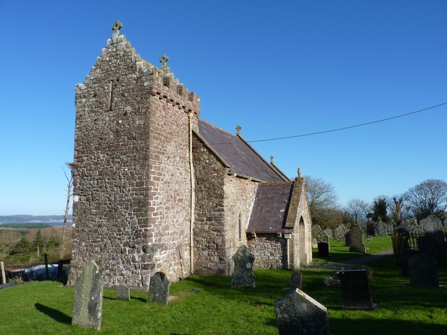
The Journal Of Antiquities

Ancient Sites In Great Britain & Southern Ireland


2 Comments

Ballintaggart Ogham Stones, Co. Kerry, Southern Ireland

Ballintaggart Ogham Stone (with an unusual incised cross).

Irish Grid Reference: V 4645 9966. On the top of Ballintaggart Hill, just to the southeast of the village of Ballintaggart (Baile an tSagairt) and 1½ miles southeast of Dingle, in County Kerry, Southern Ireland, there is a circular enclosure which was probably an ancient burial ground from the early Christian period; within this enclosure there are nine sandstone grave-markers – cigar-shaped recumbent stones in a circular pattern arrangement – the ninth stone laying in the middle, and all having incised carvings on them; these carvings either being Ogham-script notches or curious thin crosses, some having both. Some of the stones have Ogham inscriptions recalling the devotees of the pagan goddess, Dovinia (Duibhne) of the Corcu Duibne tribe of the Corcaguiny Peninsula. Three of the smooth recumbent stones have thin crosses carved on them. These carvings could well date back to the 5th Century AD. The site is also known as ‘Ballintaggart Nine Stones’. To reach the site: head W for ½ a mile or so along the lane from Doon-shean, then on the right-hand side, look out for the footpath up to the hill, just before the lane turns N to the racecourse and then Dingle town. 

Ogham Stone by R.R.Brash (1879).

The circular enclosure on Ballintaggart Hill, which is a low hillock or knoll, measures around 30m (98 ft) in diameter and approx. 17m W-E – 92° degs X 17m S-N – 1° deg. There is a raised bank around the edge of the enclosure and a shallow ditch. Three of the stones have thin incised crosses and most have Ogham inscriptions. One stone recalls AKEVRITTI another to TRIAM MAQA MAILAGNI or ‘the three sons of Malagnos’, while on its reverse side CURCITTA. And on this stone a triple-ended incised cross. Another stone in memory of INISSIONAS, while another recalls CUNUMACCQQI AVI CORBRI or ‘Conmac grandson of Coirpre’. Another recalls NETTA LAMINACCA KOI MAQQI MUCOI DOVINIAS or ‘the nephew of Laminacca, son of the people of Dovinia’. Dovinia, Dobhinia, or Duibne, being the pagan goddess of the tribe Corcu Duibne of the Corcaguiny Peninsula. This stone also has a cross with expaned ends. Another stone has a similar inscription in memory of MAQQI IARI KOI MAQQI MUCCOI DOVVINIAS recalling the same goddess. There is also a stone recalling someone called SAVL or SAUL, grandson of DOCHAR. Two other stones in memory of: SUVALLOS MAQI DUCOURROS and MAQI DECCEOA MAQI GLASICONAS. The burial ground was apparently the site of a church but nothing remains of that now.

James Mackillop (1998) tells us that Ogham is: “The earliest form of writing in Irish in which the Latin alphabet is adapted to a series of twenty ‘letters’ of straight lines and notches carved on the edge of a piece of stone or wood. Letters are divided into four categories of five sounds. A twenty- first symbol, an upturned arrow, was used for the letter p in British inscriptions. Notches and grooves appear on one or both sides of a foundation line (druim). Designations for the letters q, v, and z, which are not used in Irish, support the now widely accepted interpretation of ogham as an expression of Irish through the Latin alphabet. The current view displaces many colourful speculations on ogham’s origin: runic alphabet of Scandinavia, Chalcidic Greek, northern Etruscan, etc.

“Ogham inscriptions date primarily from the 4th to 8th centuries and are found mainly on standing stones; evidence for inscriptions in wood exists, but examples do not survive. The greatest concentration of surviving ogham inscriptions is in southern Ireland; a 1945 survey found 121 in Kerry and 81 in Co. Cork, while others are scattered throughout Ireland, Great Britain, and the Isle of Man, with five in Cornwall, about thirty in Scotland, mainly in ‘Pictish’ areas, and more than forty in Wales. In Wales, ogham inscriptions have both Irish and Brythonic-Latin adjacent inscriptions.

“Most ogham inscriptions are very short, usually consisting of a name and a patronymic in the genitive case. They are of linguistic rather than literary interest, because they show an older state of the Irish language than found in any other written sources. Many appear to be memorials to the dead, while others mark the border between two lands. Although the knowledge of ogham was never lost in scholars (at least one 19th-cent. grave-marker uses it), the notion that ogham was employed for occult or magical purposes dogs critical commentary. As late as the 1930s the eminent archaeologist R. A. S. Macalister proposed that ogham was part of the secret language of ‘druidic freemasonry’. Sean O’ Boyle suggested (1980) that the key to explaining ogham is harp notation. The god of rhetoric and eloquence, Ogma, is an attributed creator; his name and the word appear to be philologically related”.

Before setting out to visit Ballintaggart Ogham Stones, please check websites to see whether it is open or closed to the public in these times of Covid-19, and also check National rules.

Sources / References & Related Websites:-

Mackillop, James, Dictionary Of Celtic Mythology, Oxford University Press, 1998.

Matthews, John & Caitlin, The Aquarian Guide To British And Irish Mythology, The Aquarian Press, Wellingborough, Northamptonshire, 1988.

Image Ogham Stone by R.R.Brash (1879):  https://commons.wikimedia.org/wiki/File:CIIC_156_(Richard_Brash,_1879).png

https://en.wikipedia.org/wiki/Ballintaggart_Ogham_Stones

http://www.ancientireland.org/ballintaggart/

https://ogham.celt.dias.ie/stone.php?lang=en&site=Ballintaggart&stone=155._Ballintaggart_I&stoneinfo=description

https://www.megalithic.co.uk/article.php?sid=27329

https://www.google.com/maps/dir/53.8361757,-2.2012261/Ballintaggart+Ogham+Stones+IN+cO+kERRY+-+IS+IT+OPEN+OR+CLOSED+%3F/@52.8993587,-10.7110317,6z/data=!3m1!4b1!4m9!4m8!1m1!4e1!1m5!1m1!1s0x484ffa2aebcaa01d:0x6f921f297f781b5c!2m2!1d-10.2431562!2d52.1278522

Copyright © Ray Spencer, The Journal of Antiquities, 2021.


1 Comment

The Written Stone, Grimsargh Near Longridge, Lancashire

The Written Stone at Grimsargh, near Longridge, Lancashire.

OS Grid Reference: SD 62622 37892. At the northern end of Written Stone Lane at Grimsargh, near Longridge, Lancashire, is a very curious and mysterious stone slab, with an even stranger inscribed message carved onto it and the name Ralph Radcliffe (1655), although this very large lump of gritstone might be much older. This inscribed stone, known locally as ‘The Written Stone’, stands at the side of the lane close by the entrance to Written Stone Farm, originally called Cottam House. It became known as ‘the cursed stone’ after very strange and ghostly happenings took place when the farmer decided to try and move it, but he had to return the stone to its original position when ‘all hell let loose’, according to the legend. To reach this site from the east side of Longridge: head onto the B6243 for a couple of miles in the direction of Hurst Green. Passing the two Spade Mill reservoirs on your left continue for a short distance, then take the next (left) turning up Written Stone Lane; the stone is in the bank beside the entrance to Written Stone farm, on the left-hand side.

The Written Stone is a huge long lump of sandstone measuring 9 feet in length, 2 feet wide and 18 inches in depth, and is said to weigh several tonnes. There is a long inscription along the side of the stone in large letters dating back to the mid-17th Century. The message reads: RAVFFE: RADCLIFFE: LAID: THIS STONE TO LYE: FOR: EVER: A.D. 1655. It is, according to the legend, said that a terrible murder was committed here. The victim of this murder began to plague the conspirators – the Radcliffe family – who lived at Cottam House. Several members of Ralph Radcliffe’s family began to die in strange circumstances as if they were cursed in some way. In the hope of atoning for this terrible murder Mr Radcliffe had a large stone carved and an inscription written onto it; the hope being, perhaps, that the restless spirit would be calmed. But travelers going along the lane, which local people called Boggart Lane, began to report strange happenings – loud screeching sounds, bumps and bangs, ghostly appari-tions, people being pinched and their clothing being messed about with. All this was simply put down to a poltegiest trying to cause trouble.

The Written Stone is a long slab of gritstone with an inscription carved on its side.

Many years later when the Radcliffe family had moved away from Cottam House its new tenant decided to try and move the large stone so that he could put it into use as a “buttery stone” in his dairy. However moving the stone proved very difficult. It took six horses and many local people to actually move it. But during the removal a number of persons were injured and much noise seemed to eminate from the stone itself. When the said stone was finally moved to its new resting place the problems continued – anything placed upon it just fell off or was thrown off by unseen hands. During that first night “all hell let loose”, with loud bangs and clatterings, and other horrid noises. The next morning the farmer decided he’d had enough and the six horses and local folk were asked to move the stone back to its original site but, oddly enough this time only one horse was required – the stone almost moving of its own accord – seemingly the demonic spirit was eager to get back from whence it came and, from that day onwards the stone has not been moved or touched, according to the Legend. So peace and quiet returned to the country lane. Today, people walking past the stone seem unaware of its terrible history, but I wonder whether anyone dares to touch the stone or get too close to it. Let it be ‘a warning’ to anybody who might even consider trying to move, or take the stone away, from its “place of eternal rest” and, if you do, be ready for the consequences, or not.

Janet & Colin Bord (1980) tell about a doctor riding his horse along Written Stone Lane: “Late one night he was riding past the Written Stone…….when his horse became hysterical, and took off at a gallop, only stopping two miles further on. The doctor must have been feeling especially bold, for, despite this adventure, he decided to return to the Written Stone and face whatever had  frightened the horse. He rode up to the stone and issued a challenge, whereupon, in the words of Kathleen Eyre, describing the encounter in her Lancashire Legends, a shapeless mass materialized, seized him, plucked him from the saddle and almost squeezed the breath from his body. As soon as he was able, the doctor left the spot at a gallop.”

In recent times it has been suggested by a few people that the ‘Written Stone’ was brought down from the fell where it had perhaps been a standing stone, or that maybe it had once formed part of a stone circle, and as such it might have been a pagan altar-stone. Another theory is that it could possibly lay on the site of an earlier standing stone, according to Janet & Colin Bord (1980). I have heard it said that it might actually be an outlier. But from which stone circle did it come? as there are no such ancient monuments like that anywhere near here, so it must have travelled some distance. Written Stone Lane, also known as Boggart Lane, forms part of, or intersects with, a Roman road that links the forts of Ribchester and Lancaster.

The British Listed Buildings (BLB) Source ID number is:- 1147440. See Link below.

Sources/references and related websites:-

Bord, Janet & Colin, The Secret Country — More Mysterious Britain, Granada Publishing Limited, St Alban’s, Herts, 1980.

Dixon, John & Phillip, Journeys Through Brigantia, Volume Nine, The Ribble Valley, Aussteiger Publications, Barnoldswick, 1993.

Fields, Kenneth, Lancashire Magic & Mystery, Sigma Leisure, Wilmslow, Cheshire, 1998.

Howarth, Ken, Ghosts, Traditions & Legends of Old Lancashire, Sigma Leisure, Wilmslow, Cheshire, 1993.

http://northernantiquarian.forumotion.net/t307-the-written-stone-near-longridge

https://britishlistedbuildings.co.uk/101147440-the-written-stone-longridge#.XIBQ-VJCdjo

http://www.martintop.org.uk/blog/rauffe-radcliffe-written-stone-longridge

Written Stone Lane

© Ray Spencer, The Journal of Antiquities, 2019.


Roman Inscribed Stone in St John the Baptist’s Church, Tunstall, Lancashire

Roman Inscribed Stone by karl & Ali (Geograph).

OS Grid Reference: SD 61411 73931. In the 15th century parish church of St John the Baptist at Tunstall, near Kirkby Lonsdale, Lancashire, there is a fragment of an inscribed Roman stone, which was perhaps part of an altar but, according to the church guide, is actually a votive stone with a dedication in Latin to two Roman dieties – very roughly carved onto it; the stone was found in the 1800s at the Roman fort of Burrow (CALACVM), a couple of miles to the north. The stone was brought into the church from the churchyard in the early 20th century and was set (upside down) into a window jamb of the north aisle during restoration work. Also of interest within the church is the altar stone which is considered to be Anglian and to date from the 8th century? St John the Baptist’s church can be found along Church Lane about ¼ of a mile to the northeast of the village. The village of Tunstall itself is roughly 3½ miles to the south of Kirby Lonsdale on the A683 and 4 miles southwest of Cowan Bridge.

The Roman votive ‘altar’ stone with its Latin inscription reads: ‘DEOS ASCLEPIO ET HYGIAEAE P S SVA CVM SVIS IVL SATVRNINVS’ and when translated is something like: “To the dieties (gods) Asclepius and Hygiaea, Julius Saturninus placed This Here for himself and his family.” The word ‘SANCTO – Sacred’ can sometimes be placed at the beginning of an inscription like this as another variation.

Drawing of Roman Stone, John Cotton.

Sara Mason (1994) in her work concerning the church and parish of Tunstall tells us that “A stone in the present church is dedicated to Aesculepius, the pagan Roman god of medicine and Hygeia, goddess of healing. This was salvaged from the ruins of the Roman fort at Burrow in the eighteenth century by the Reverend Richard Rauthmell. And a fragment of another triangular Roman stone was built into a farmhouse wall in Burrow; a remaining piece was said to be in the    keeping of the vicar of Tunstall.”

Mason also adds regarding the: “Fragment of Roman votive stone: this, with a dedication to Aesculepius and Hygeia (god of medicine and goddess of healing) by one Julius Saturninus, was incorporated into the left jamb of the most eastern window of the north aisle during the 1907 restoration of the Church.”

Sara Mason (1994) adds that: “The stone of which the altar in the present church is made is considered to be Anglian (eighth century) and bears evidence of early Christian worship at Tunstall, possibly from when St Wilfred came westwards from Ripon. It was put into its present place in the 1950s. A medieval burial slab was reused and preserved, as a quoin in the old school house in the Church Lane.

The Roman road from Ribchester to Overburrow Fort runs near Tunstall Church and it is possible that an early church was built there because it was close to the road. However, churches, being on consecrated land, rarely change site. The field named Crosber — up the Church Lane, between the Cant beck and the Roman road — may refer as much to the crossing of the Roman Road by the road from Burton in Lonsdale towards the Lune, as to the possibility of a preaching cross there.”  

Lawrence E. Jones & Roy Tricker (1992) tell us a bit about the church, saying that: “Visiting a country church like this, in its delightful rural setting, stops people imagining that Lancashire is just industry and suburbia. This lovely church of St   John the Baptist was much rebuilt in 1415, but incorporates earlier work, and we enter beneath a fine two-storeyed porch, to admire 15th and 16th century glass from Flanders in the east window and much else in this atmospheric place. The medieval altar stone, cast out at the Reformation, has now been restored to its rightful use.” 

Nikolaus Pevsner (1979) describes St John Baptist Church in ‘His’ way, saying that: “The only church in North Lancashire which one can praise for never having given in to sweeping suggestions to restore windows and other features. How right Ruskin and Morris were ! It creates a human appeal which cannot otherwise be roused. The church was rebuilt by Sir Thomas Tunstal about 1415, but the W and E responds of the N arcade have early C13 capitals, and the W lancets of the aisles are probably also C13. On the N side is a two-light Dec window. The two-storeyed porch is the finest piece of the C15 work. The Perp tracery of the S aisle and the Perp arcades are coarse. — FONT. C18 stone baluster with an elliptical marble baluster. — ROMAN ALTAR to Asclepius and Hygieia (NE window sill). — STAINED GLASS. The E window has Nether-landish late C15 and C16 glass from two different sources. It was brought from Flanders by Richard T. North before 1833. — PLATE. Chalice and Paten by Richard Bayley, 1708; Paten by Henry Jay, 1709-10; Chalice inscribed 1713; Paten and Flagon by Thomas Mason, 1718-19. — MONUMENTS. Defaced early C16 stone effigy (S chapel), probably Sir Thomas Tunstal. — Many Tablets, eg. Lt. Miles North, 1837, with the relief of a shipwreck.”

Also of interest: there are several Medieval carved stones leaning against the outside wall of the church, one of which could be a cross-head, but its age is uncertain though it is possibly Anglo-Saxon?

Sources and related websites:-

Jones, Lawrence E. & Tricker, Roy, County Guide To English Churches, Countryside Books, Newbury, Berkshire, 1992. 

Mason, Sara, The Church And Parish Of Tunstall, (Drawings by John Cotton), December 1994.

Pevsner, Nikolaus, The Buildings of England — North Lancashire, Penguin Books Ltd., Harmondsworth, Middlesex, England, 1979.

Photo (top) by karl & Ali:  http://www.geograph.org.uk/photo/1992950

http://www.megalithic.co.uk/modules.php?op=modload&name=a312&file=index&do=showpic&pid=133149

https://en.wikipedia.org/wiki/St_John_the_Baptist%27s_Church,_Tunstall

https://britishlistedbuildings.co.uk/101071642-church-of-st-john-the-baptist-tunstall#.W4R9w1K0Vjo

http://cumbrianchurches.blogspot.com/2009/08/tunstall-st-john-baptist.html

https://www.tripadvisor.co.uk/Attraction_Review-g8536808-d8532119-Reviews-St_John_the_Baptist_s_Church-Tunstall_Lancaster_District_Lancashire_England.html

© Ray Spencer, The Journal Of Antiquities, 2018. 


The Advenctus Stone, St Madoc’s Church, Llanmadoc, Gower, West Glamorgan

Church of St Madoc at Llanmadoc by Richard Law (Geograph).

OS Grid Reference: SS 43889 93439. In the 12th century church of St Madoc at Llanmadoc –  at the far northwestern side of the Gower Peninsula, West Glamorgan, Wales, there is an early 6th century pillar-stone with a Latin inscription in memory of Advenctus. This was probably a grave-cover. There are two more ancient stones in the church – one with a carved cross. The font is Norman. The first church here at Llanmadoc was founded way back in the 6th century AD by St Madoc (Maedoc or Maodhoge), who had come from Ireland to Wales for his education – firstly under St David at Glyn Rhosyn and then under St Cenydd at Cor Llangennith; St Cenydd may have been his cousin? He is probably one and the same as St Aedan (Aidan), bishop of Fearns in Co. Wexford, Ireland, who died in 626. St Madoc was apparently co-founder, with St Cenydd, of the monastic college at Llangennith, a few miles to the southwest of Llanmadoc. To reach Llanmadoc it is best to come off the M4 motorway at Exit 47, then south onto the A483 and west on the A484 through the villages of Gowerton, Pen Clawdd, Crofty, Llanrhidian and Weobley Castle.

On a windowsill in the nave of Llanmadoc church there is a 27′ long graveslab with a crack at the top left-hand corner, and carved into this are Latin/Roman letters commemorating: Advenctus, Avectus or Vectus; the stone is said to date from 500 AD or thereabouts. In Latin the inscription reads: ADVECTI FILIUS GVAN HIC IACIT, which when translated is: ‘Advenctus, the son of Guanus, he lies here’. The inscribed stone was discovered built into the wall of the rectory in 1861, but was brought into the churchyard and then the church. But who was Advenctus? or Vectus? And who was Guanus? These questions ‘we’ don’t know with any certainty; they are names that are now lost in the mists of time. John Kinross (2007), speculates that Guanus was in fact St Govan, and he refers to Advenctus as Advestus! But could Advenctus have been the brother of St Padarn – as his mother was called Guean? It’s all purely speculation, but worth considering. And built into the west wall is a pillar-stone with two carved crosses that is thought to date from the 7th-9th century AD, and close to that a medieval stone pillar that may have been a boundary marker. Kinross also adds that a Celtic-style hand-bell was found in a field near the church; this is now at Penrice Castle! 

The Gower Society (1989), say with regard to the church, that: “The church of St Madoc is reputed to have been founded in the 6th century……and the present building is probably 13th century…..and is the smallest in Gower and the correspondingly small tower has the familiar combination of saddle-back roof and parapets. An extensive renovation in 1865, when the nave and chancel were considerably altered and the tower lowered, has left little of the original building. At that time the graveyard had risen as much as four feet above the floor of the nave, and even the chancel arch had to be reconstructed to level things up. The interior of the church is very dark, and must have been even darker when the east window was a single trefoil light; here are preserved a Norman font and a Roman-Celtic tombstone which was discovered in 1861 built into the wall of the Old Rectory. It is one of the few churches in Gower where traces of the paintings which originally decorated the walls were found when the church was restored. The Rev. J. D. Davies, the 19th century historian of West Gower, was Rector of Llanmadog and Cheriton for over fifty years.”

St Madoc (Maedoc) is a somewhat shadowy figure who was probably born in the North, the son of King Sawyl, in the early 6th century. Sawyl Benisel, father of St Asaph, was buried on Allt Cynadda, west Glamorgan, after he was killed in an attack on his camp, according to Chris Barber. St Madoc spent his early years in Connacht and Leinster in Ireland, but then came to Wales to study scripture under St David at Glyn Rhosyn in Menevia, and later under St Cenydd at the monastic college of Llangennith, which he may have co-founded. Some historians think he was related to St Gildas and St Cenydd (maybe a cousin), but that is questionable. Legend has it that St David died in the arms of St Madoc and, after St David’s passing, Madoc became abbot of Glyn Rhosyn, before returning to Ireland.

St Madoc, also known as Aedan, founded many churches in Wales including those at Bryngwyn, Clytha, Llanmadoc, Llanbadoc, Llanidan, Llawhaden and Great Rudbaxton (where there is holy well named after him). Many historians consider him to be one and the same as St Aidan (Aedan), who became bishop of Ferns, Co. Wexford. In Ireland [as St Aidan] he founded monasteries at Drumlane, Co. Cavan, Rossinver, Co. Leitrim, and Clonmore, Co. Carlow, as well as Ferns. He died aged over 100 at Ferns in 626 or 632 AD. His feast day is 31st January. He was apparently known for his kindness to the poor and was known to have given away his and others’ clothing to the needy, and lived on bread and water for many years, though it seems he was none the worse for this! Some of his relics lie in Armagh Cathedral and The National Museum, Dublin.

Sources and related websites:-

Barber, Chris, More Mysterious Wales, Paladin, London, 1987.

Kinross, John, Discovering The Smallest Churches In Wales, Tempus Publishing Limited, Brimscombe Port, Stroud, Gloucestershire, 2007.

Spencer, Ray, A Guide to the Saints Of Wales and the West Country, Llanerch Enterprises, Felinfach, Lampeter, Dyfed, 1991.

The Gower Society, A Guide To Gower, (Evan Evans, Bernard Morris, T. R. Owen & J. Mansel Thomas Edts), Gower Society, 1989.

Geograph photo no. 2684530 by Richard Law.  http://www.geograph.org.uk/photo/

http://www.ggat.org.uk/cadw/historic_landscape/gower/english/Gower_007.htm

http://www.explore-gower.co.uk/llanmadoc-church

http://www.waymarking.com/waymarks/WMKEK0_Pillar_Stone_Church_of_St_Madoc_Llanmadog_Gower_Wales

http://www.earlybritishkingdoms.com/bios/madocapn.html

http://stainedglass.llgc.org.uk/site/79

© Ray Spencer, The Journal Of Antiquities, 2018. 


1 Comment

The Sagranus Stone, St Dogmael’s, Pembrokeshire (Sir Benfro), Wales

The Sagranus Stone at St Dogmael’s.

OS Grid Reference: SN 16404 45914. In the mid-19th century parish church of St Thomas the Apostle in the village of St Dogmael’s (Llandudoch), Pembrokeshire, is The Sagranus Stone, a 5th century pillar-stone which is inscribed with both Ogham and Latin inscriptions to the memory of Sagranus, son of Cunotamus. There are some other Early Medieval stones in this church though these would be called cross-slabs rather than inscribed stones. Close by the church are the ruins of the 12th century St Mary’s abbey of the French Tironesian religious order but, a long time before that, there was a Celtic ‘clas-type’ monastery here in the 5th century which had been established by St Dogmael, a Welsh monk who was born in the local area. This early Christian monastery was, however, destroyed by the invading Danes in 987 AD. The village of St Dogmael’s, also called Llandudoch, lies 1 mile southwest of Cardigan (over the river Teifi) and 3 miles northwest of Cilgerran. St Thomas’ parish church is located on Church Street and the abbey ruins are next to the church. 

Sagranus Stone.

The Sagranus Stone stands in the west end of the nave of St Thomas’ parish church and it has for some time now been recognized by scholars of Early Christian inscribed stones as being of great importance. It is a 7 feet high dolerite pillar-stone and is thought to date from the late 5th or early 6th century AD, that being the immediate years following the Roman retreat from Wales. This ancient stone probably came from the original cell (llan) of the Celtic monastery. There are two holes in the slab which means that in the past it was used as a gate post, and it may even have been in use as a sort of stepping stone over a stream; maybe this caused the stone to be broken into two pieces. But as a bilingual inscribed stone with its Ogham cipher inscription of notches or strokes on its edges and the Latin (Roman) inscription on its face – it’s safety is now assured. Back in 1848 the strokes on the ancient pillar-stone enabled scholars and historians to de-cipher (interpret) the Ogham alphabet. Ogham was the early Goidelic/Gaelic) language of Ireland. Both inscriptions, once they are translated, read as the same. 

HMSO/DoE (1975) says that: “1 Rough pillar stone of the early sixth century……. On the face is an inscription in two lines of Roman capitals, running downwards: SAGRANI FILI CVNOTAMI. On the dexter edge is an inscription in Ogham characters, which reads:  SAGRAGNI MAQI CVNATAMI. Both indicate that the stone was set up to mark the grave of the local chieftain, Sagranus, the son of Cunotamus. Ogham is a cipher, in which strokes arranged in relation to a vertical stem—in this case the angle of the stone—are used to represent the letters of the Latin alphabet. The system, which was evolved in Ireland, is found on a number of early inscriptions in Wales where it is generally employed, as here, with a Latin transliteration.” 

HMSO/DoE also give details of the other pre-Romanesque stones in the church: “2 Part of headstone now in the parish church near the south door. On the face is slightly incised Maltese cross in a circle. Small headstones of this type were in common use from the ninth to the eleventh century; this example is early in the series. 3 Base of a tall stone pillar now standing reversed near the pulpit in the parish church. On the face is incised the lower arm of a cross with a swollen foot enclosing spirals and a basal knob; the out-turned lines at the broken upper edge of the pillar indicate the beginning of the cross. Pillars of this type with incised crosses were set up for commemorative purposes in the cemetery and in other parts of Celtic monasteries. The elaborate cross is probably not earlier than the ninth century. 4 Part of the cover slab of a grave, originally some 6ft by 14in by 11in thick. On the upper surface is a Maltese cross in a circle with a long shaft and swollen foot enclosing spirals and a basal knob. Rather later than number 3; probably eleventh century.” There are several other Medieval stones but they are located in the abbey precinct outside. 

Donald Gregory (1991) adds that: “Between the south door of the church and the north entrance to the abbey ruins should be noted a very old yew, which is so large that it has had a three feet high brick wall built to contain it.” 

The abbey of St Mary was founded in 1115 by Robert Fitz Martin, Lord of Cemais, as a daughter house of the Abbey of Tiron in France, on the site of a Celtic (clas) monastery. However, the Celtic monastery was destroyed by the invading Vikings in 987 AD. The monks of St Mary’s were members of the Tironesian Order, founded at Tiron between Chartres and Le Mans (1114) by St Bernard of Abbeville (1046-1117). The order of Tiron followed closely the Benedictine Rule and, in accordance with that, the monks at St Mary’s led a simple and austere life much influenced by the self-disciplined austerity of St Benedict. St Mary’s had dependencies at Caldey and Pill in Wales. In 1536 the abbey was dissolved but the church and conventual buildings remained intact with some reconstruction taking place; and then it was put into parochial (parish) use, while the rest of the monastic buildings were allowed to fall into a ruinous state. The 14th century doorway of the abbey church retains its carved flower ornamentation. In the north transept there are Medieval carvings on corbels which depict Christ’s apostles, the eagle of St John the Evangelist and St Michael. Later, in 1848 a new church, dedicated to St Thomas the Apostle, was built from the stone of the old abbey. 

Not that much is actually known about St Dogmael, Dogfael, Dogwell or Toel, who has given his name to this Pembrokeshire village, apart from that he was a native of Ceredigion (Cardigan) just across the river Teifi. He was the son of King Ithel ab Ceredig ab Cunedda Wledig. Apparently he gained his monastic training in Ireland, but came back to settle on the Isle of Anglesey – where Llandogwel church is dedicated to him. Then, later he sailed down the Cardigan coast and established a monastery inland at what became St Dogmael’s (Llandudoch) near the river Teifi. Another church is named after him at St Dogwells, Pembrokeshire, but it seems he died in Brittany about 505 AD, where he goes under the name of St Toel. He is titular saint of the church of Pommerit Jaudy in the diocese of Trequier, Brittany. David Hugh Farmer (1982) says that: “It is likely, but not certain, that he moved to Brittany where a St. Dogmeel or Toel has had a considerable cultus, and is invoked to help children to learn to walk.” His feast day is celebrated on 14th June.

Sources and related websites:-

Bottomley, Frank, The Abbey Explorer’s Guide, Kaye & Ward Ltd., London, 1981. 

Farmer, David Hugh, The Oxford Dictionary of Saints, Oxford University Press, 1982.

Gregory, Donald, Country Churchyards In Wales, Gwasg Carreg Gwalch, Capel Garmon, Llanrwst, Gwynedd, Wales, 1991.

H.M.S.O./DoE, St Dogmael’s Abbey, C. A. Ralegh Radford, Her Majesty’s Stationery Office, London, 1975.

Spencer, Ray, A Guide to the Saints Of Wales and the West Country, Llanerch Enterprises, Felinfach, Lampeter, Dyfed, 1991.

https://howardwilliamsblog.wordpress.com/2015/10/25/sagranus-commemorated-at-st-dogmaels/

http://coflein.gov.uk/en/site/401267/details/sagranus-stone-st-thomas-the-apostle-church-st-dogmaels

https://en.wikipedia.org/wiki/St_Dogmaels

http://grandterrier.net/wiki/index.php?title=Sant_Dogvael

http://www.catholic.org/saints/saint.php?saint_id=2919

© Ray Spencer, The Journal Of Antiquities, 2018.


1 Comment

Saxon Sundial at St Gregory’s Minster, Kirkdale, North Yorkshire

Anglo-Saxon Sundial at St Gregory’s Church, Kirkdale, north Yorks.

   OS Grid Reference: SE 67688 85776. Above the inner south door of the the ancient minster-church at Kirkdale near Kirkbymoorside, north Yorkshire, there is an Anglo-Saxon sundial of unique standing that is most beautifully carved and inscribed. It was reputedly carved in 1060 AD, just before the Norman Conquest of Britain. Also in the church which is dedicated to St Gregory are two carved Saxon grave-slabs and a number of fragments of Anglo Saxon cross-heads, and other antiquities most of which probably date from the late medieval period. The church of St Gregory is built on the site of an Anglo-Saxon church and monastery that was perhaps founded by St Cedd, or St Aiden, sometime after 650 AD. Though St Cedd was thought to have founded Lastingham church (659). This secluded church is 1½ miles to the west of Kirbymoorside village and just north of the A170 Helmsley to Kirkdale road. It can be reached on narrow country lanes – one of which is called Back Lane – the church being located at the northern end of ‘this’ country lane and in the opposite field above. 

   The church guide book compiled by Mr Arthur Penn in 1970 is very helpful here. It says  that: “The dial seems to be in its original position, and consists of a stone slab, seven feet long, divided into three portions. The centre one is the dial, while the outer ones contain an inscription recording the rebuilding of the church, and giving a fairly exact date.

   “The dial itself is divided into eight, which accords with the octaval system of time division, common among the Angles. The double cross on the first line denotes ‘daegmael’ or ‘day-time,’ and may be the time of the first service. The inscription above reads:- ‘This is day’s sun marker at every time.’

Kirkdale Sundial by:- Charles J. Wall (1912). Wikipedia.

   “The outer panels are curious in that the lettering on the first is even and well-spaced, while that on the third is compressed and yet it still was not able to hold the whole inscription, which was continued at the foot of the second panel. Clearly the work was never planned out. The inscription in modern language reads:- Orm Gamal’s son bought S. Gregory’s Minster when it was all broken down and fallen and he let it be made anew from the ground to Christ and to S. Gregory in the days of Edward the King and of Tosti the Earl. And Haward me wrought and Brand Priests. 

   “The inscription also tells us that  the work was carried out in the days of King Edward (the Confessor) and of Earl Tosti. Tosti or Tostig, who became  Earl of Northumberland in 1055, was banished for a variety of crimes, including the murder of Orm’s father, Gamal, in 1065, but returned with Harold Hardrada, King of Norway, in the following year. The Norwegian army fought against Tostig’s brother, Harold  Godwinson, King of England, at Stamford Bridge, and there both Tostig and his Norwegian ally were killed. After the battle Harold Godwinson carried out his forced march to Hastings, where he was killed in battle by the Norman army of William the Conqueror. The sundial thus dates the building between 1055 and 1065. Its inscription in Northumbrian English has traces of runic characters, but is not difficult to decipher.”

Kirkdale Saxon Sundial (a close-up of the dial).

   Nigel & Mary Kerr (1982) tell us more about the hours of the day shown on the sundial. They say that: “The lines with cross bars correspond with 6 a.m., noon , 3 pm., and 6 p.m., the uncrossed lines divide each tide into one-and-a-half-hour periods. The line with a cross on it on the left-hand side of the dial  denotes 7.30 a.m., which marked the beginning of ‘day time'”. They also say with regard to the panels at either side of the dial: “that Orm rebuilt the church in the reign of Edward the Confessor, and the central inscription reads, in translation: ‘This is the day’s sun-marking at every hour. And Hawaro made me, and Brand, priest [?].'” 

   St Gregory’s minster-church houses a number of antiquities from the Anglo Saxon period. There are two sculptured coffin lids in the north aisle one of which is called ‘The Ethelwald Stone’ which dates from the 10th century and recalls Aethelwald, King of Deira, while another called ‘The Cedd Stone’ has interlacing and is thought to date from the 10th century. This also has carvings on its side including V-shaped tassels with little ball-ends. This may be a representation of a pall, which was a cloth draped over a coffin. If it was, then the work was doubtless very fine, providing another outlet for the needleworking skills of Anglo-Saxon ladies, say Nigel & Mary Kerr (1982). In the north aisle there are a number of fragments of cross-heads from the 11th century  – one of which has been fashioned from pock-marks rather than the usual design of one continuous line. Also in the north aisle is ‘The Archer’s Stone’, while at the eastern end of the aisle a 14th century fragment with the Virgin and Child carved upon it. The octagonal font is Transitional and 13th century in date.

   Ella Pontefract, writing in 1937, says of the minster that:- “Kirkdale is a satisfying church in a most beautiful situation, and it should not be missed.” Malcolm Boyes & Hazel Chester (1996) also reflect on the beauty of the place and its location in the peaceful valley beside Hodge Beck.

 Sources of information and related websites:-

Boyes, Malcolm & Chester, Hazel, Discovering The North York Moors, Smith Settle Ltd., Otley, West Yorkshire, 1996.

Jones, Lawrence E. & Tricker, Roy, County Guide To English Churches, Countryside Books, Newbury, Berkshire, 1992.

Kerr, Nigel & Mary,  A Guide to Anglo Saxon Sites, Paladin (Granada Publishing Limited), London, 1982.

Penn, Arthur (Compiler), St Gregory’s Minster Kirkdale, Parochial Church Council, 1970.

Pontefract, Ella, The Charm of Yorkshire Churches, The Yorkshire Weekly Post, Leeds, 1936-7.

https://en.wikipedia.org/wiki/Kirkdale_sundial

https://en.wikipedia.org/wiki/St_Gregory%27s_Minster,_Kirkdale

http://greatenglishchurches.co.uk/html/kirkdale.html

http://www.ling.upenn.edu/~kroch/scand/kirkdale.html

http://www.megalithic.co.uk/article.php?sid=13357

                                                                                       © Ray Spencer, The Journal Of Antiquities, 2017.


Torphichen Sanctuary Stone, West Lothian, Scotland

Torphichen Sanctuary Stone

   OS Grid Reference: NS 96842 72506. An ancient standing stone known as the ‘Torphichen Sanctuary Stone’ is to be found at the west-side of the kirkyard and preceptory of Torphichen parish church, 2¼ miles to the north of Bathgate in west Lothian, Scotland. The stone has five small prehistoric cup-marks, but also a Celtic-style carving from the Dark Ages when St Ninian lived here, while on the top of the stone there is a medieval incised cross and a small hollow.  It is the central-most stone of three – the other two being within a 1 mile radius of the preceptory. The thinking is that the santuary stone came from the ancient site of Cairnpapple Hill, about 1½ miles to the east. Torphichen’s medieval church and preceptory are located at the east-side of the village on The Bowyett, which runs off from the B792 road. You will find the little standing stone set amongst the gravestones at the west-side of the grassy kirkyard.

   The little standing stone was set up here in the 12th century by the Knights Hospitallers (Knights of St John) to mark out a place of sanctuary or refuge for local people and pilgrims from further afield who wished to seek ‘a place of safety here’, or more likely the stone was already here when the Knights founded their preceptory/hospital and church in 1168; an incised cross was carved on the top of the stone and the little hollow carved to either hold a cross or maybe holy water? But the stone was used at an earlier date by St Ninian, who had settled here in the 4th century and, in the 7th century St Fechin, an Irish monk and missionary from the monastery of Fore, County Westmeath, apparently also made use of this standing stone – the Celtic-style carving on the stone would date from this time. The five small cup-marks on the side of the stone date from the early Bronze Age when it stood on Cairnpapple Hill where there is a Neolithic henge monument and Bronze Age cairn. The pre-ceptory which was the Knight’s Hospitallers Scottish base, is now in ruins although the central tower, west tower-arch and transepts remain; the nave was rebuilt in the 17th century and now forms part of the present parish church. Some of the domestic buildings and parts of the hospital also still stand.

   There are two other associated sanctuary (refuge) stones (West and East) both of which stand about 1 mile distant from the central stone here in the Torphichen kirkyard. The W stone, which had a Maltese cross carved upon it, is located at Westfield farm (OS grid ref: NS 9437 7211) while the E stone is at Easter Gormyre farm near the hamlet of Gormyre (OS grid ref: 9806 7311), according to the Canmore website entries.

Sources of information and related websites:-

Ancient Monuments — Scotland, Volume VI, H. M. Stationery Office, Edinburgh, 1959.

Bottomley, Frank, The Abbey Explorer’s Guide, Kaye & Ward, London, 1981.

The AA, The Illustrated Road Book Of Scotland, The Automobile Association, London, 1963.

http://www.megalithic.co.uk/article.php?sid=30653

https://en.wikipedia.org/wiki/Torphichen_Preceptory

http://www.armadale.org.uk/torphichen.htm

https://canmore.org.uk/site/47929/torphichen-churchyard-refuge-stone

https://canmore.org.uk/site/48010/westfield-farm-refuge-stone

https://canmore.org.uk/site/47915/gormyre-refuge-stone

                                                                                     © Ray Spencer, The Journal Of Antiquities, 2017. 


1 Comment

St Eithne’s Grave, Eileach An Naoimh, Argyll and Bute, Inner Hebrides

Aethne's Grave on Eileach an Naoimh (photo credit: Gordon Doughty Geograph)

Aethne’s Grave on Eileach an Naoimh by Gordon Doughty (Geograph)

    OS grid reference: NM 6302 0964. The little Scottish island of Eileach-an-Naoimh (Rock of the Saint) is one of the Garvellach Islands, in the Firth of Lorne, and is the reputed burial place of St Eithne, mother of St Columba, making it a ‘holy island’. On this very remote, windswept island are the scant remains of a Celtic monastery with beehive huts, two chapels and a graveyard with three crosses, and 80 metres to the south-west is the traditional site of St Eithne’s grave, which is marked by a grave-slab bearing an incised cross. In old texts the island was called Hinba. And to this little island St Columba and other ‘saintly’ figures came from time to time for a deeper solitude and contemplation – this fact being borne-out because the island was, and still is, largerly inaccessible. There are no ferries or steamers alighting in Port Cholumcille, but some pilgrims do visit the island and pay their respects at St Eithne’s grave, though they have to hire their own boats! The island of Mull is 6 miles to the north and Scarba 4 miles to the south-west, while the mainland of Argyll is 6 miles away.

    Author Reginald B. Hale in his work ‘The Magnificent Gael’, tells us that: “Eithne came of the royal line of Leinster kings. Her husband Felim macFergus was a chieftain of the dynastic family of Ui Neill, heirs of the mighty Niall-of-the-Nine Hostages, High king of Ireland. So their little son was born a prince of the Blood Royal and would inevitably live his life in the glare of the political limelight. His parents had every reason to hope that someday he might hold the scepter of the High King and reign at Tara.

    “But the child also had another heritage. His great-great-grandfather Niall had been a heathen and an unabashed slave raider. However several of his sons had been converted by St Patrick, the ex-slave who brought Christianity to the Irish. One of these sons was Conall Gulben, king of Donegal. St Patrick with his staff marked a cross on King Conall’s shield and from then on his descendants took as their symbol a Hand grasping a Cross. From the time of his conversion his clan had been staunch for the faith. So it was that Felim macFergus, grandson of Conall, was himself a deacon of the Church and his son was born into a devout Christian family.”

    Hale goes on to say that: “Felim and Eithne took their child six miles to Kilmacrenan to be baptized by the priest Cruithnechan which is pronounced “Crenan”. He was christened Colum, which in Latin is Columba. He also received the traditional family name of Crimthann that means a fox, an animal admired by the Gaels.”

    But we know that Columba was born beside Lough Gartan in Co Donegal (521 AD) where there are the Medieval ruins of what is locally called St Eithne’s Convent. And there is a St Eithne’s Well at Termon. The site of St Columba’s birth, near the southern shore of the lough, is marked by the so-called ‘Natal Stone’, and nearby are the saint’s holy well, the Stone of Lonliness, and the saint’s ruined church. His birth was miraculous we are told. St Eithne had a dream in which she was given a beautiful robe with colours similar to the wild flowers, but the wind blew the robe away. However, the wind-blown robe grew in size and spread out to cover the land, mountains and islands – this being a sort of divine portent regarding her son who would eventually take Christianity to the northern Pictish High King, Brude, and his people sometime after 565 AD – at a time that was “dark” in many respects, but for St Columba it was a time of ‘great joyfulness’.

    In 563 AD Columba set sail for Iona and was accompanied by members of his family including his mother and also disciples and servants. Later, he founded a great monastery on the island which became a college of learning; he took the message of Christ to the Picts and established many other monasteries and churches in Scotland. His mother retired to the Island of Hinba (Eileach-an-Naoimh) where she was cared for by Ernan, who was St Columba’s uncle and also prior of the monastery of Hinba, founded by St Brendan. Women were not allowed in the monastery. St Eithne died and was buried on the island in the mid to late 6th century. Her ‘reputed’ grave is located on the Peak of Hinba, 80 metres south-west of the monastery, where a circular enclosure (11 feet in diameter) with three standing stones marks the site, one of these being a grave-marker (2½ feet high) bearing a thin equal-armed Greek cross with terminals, beneath which is a thinner spike. And there are a number of recumbent stones and a kerb running around the site. The grave seems to be positioned so as to look out over the Firth of Lorne.

    But some historians question the grave-site. A few think that it may in fact date from the Iron-Age, or earlier, and others think it may be the burial site of more than one person? But I think it should be pointed out here that the type of burial that was around in prehistoric times was more than likely to have existed well into the early Christian period – the so-called Dark Ages of the 5th-7th centuries AD.

The Monastery Chapel, Eileach an Naoimh by Gordon Brown, Wikipedia.

Monastery Chapel, Eileach an Naoimh by Gordon Brown, Wikipedia.

    The monastery on Eileach-an-Naoimh often ascribed to St Brendan, rather than St Columba, is a ruin consisting of low drystone walls with a number of bee-hive huts (hermits cells) around it, one of which is a double construction. There are two small ruined chapels that are said to date from the 9th-12th centuries and a graveyard with three stones bearing incised crosses, and also a circular feature that is probably an early Christian grave, maybe that of Ernan the first prior? The monastery was probably burned c 800 AD and thereafter it suffered from a number of attacks by invaders from overseas, including the Vikings. The monastic site on Eileach an Naoimh is probably the oldest religious ruin in Scotland.

Sources:

Hale, Reginald B., The Magnificent Gael, R.B.Hale, Otawa, Canada, 1976.

http://www.geograph.org.uk/photo/2014435    © Copyright Gordon Doughty and licensed for reuse under this Creative Commons Licence

https://canmore.org.uk/site/22364/garvellachs-eileach-an-naoimh

https://en.wikipedia.org/wiki/Eileach_an_Naoimh   Photo by Gordon Brown Creative Commons Attribution Share-alike license 2.0

Newton, Norman., The Shell Guide To The Islands Of Britain, David & Charles, Newton Abbot, Devon, 1992. 

The AA, Illustrated Road Book Of Scotland, The Automobile Association, 1963.


Kilmalkedar Monastic Site, Dingle Peninsula, Co Kerry, Southern Ireland

Kilmalkedar Church, Co Kerry (Photo credit: Wikipedia)

Kilmalkedar Church, Co Kerry (Photo credit: Wikipedia)

Irish grid reference: Q 4030 0620. Just off the R559 Cois Farraige (or the Carrig) road to the east of Murreagh on the Dingle Peninsula, Co Kerry, stands the 7th century Kilmalkedar Monastic Site, also known as Cill Malcheadair. Here we find a small 12th century roofless Romanesque church, a rare Dark Age sundial, an Ogham and Latin inscribed stone and some cross-inscribed slabs, one of which is called ‘the Alphabet Stone’ and, there are some pre-Christian holed ‘balaun’ stones, holy wells and early medieval grave-markers – in what is a ‘very’ beautiful and holy setting in the far south-west of County Kerry, some 5 miles north-west of Dingle on the R559 road.

The first church and a monastery, were established here at Kilmalkedar in c 600 AD by St Maolcethair (Maolcedar), the son of an Irish king (of Ulster). A building called ‘St Brendan’s House’, actually an oratory, can also be found here and, close by the pilgrims’ road (Cosan na Naomh) leads on to Mount Brandon from where St Brendan departed for foreign lands in the mid 6th century. About 1 mile to the south-west of Kilmalkedar is the famous boat-shaped building known as ‘the Gallarus Oratory’, which dates maybe from the 8th century. The Celtic monastery of Kilmalkedar is known from history to have been a renowned school of learning during the early medieval period.

The ancient roofless Romanesque chapel dates from the mid-12th century, though there was obviously an earlier religious building on this site, maybe dating back to the Dark Ages when both St Brendan and, later St Maolcethair were in residence here. There are a number of very beautiful architectural features in the church. It consists of a chancel and nave – the chancel measures roughly 6 metres by 5 metres – while the nave is roughly 8 metres by 9 metres. The church is said to resemble the more famous Cormac’s Chapel at Cashel, County Tipperary.

In the excellent article ‘Marking The Passage Of Time’ by Patrick O’Sullivan for the Ireland’s Own magazine we are informed that the church was: “built in the Romanesque style of the twelfth century, typical features being the round headed doorway and the high pitched gables”. But there are a number of other features too including the barrel-vaulting and a lower section of the corbelled stone roof, and some carved window surrounds have survived. The chancel dates from 1200; and the west doorway has a ‘tympanum’ with carved stone head. O’Sullivan in his article goes on to say: “The original roof of the church has long since given way but the East Window, known locally as Cno na Snaithaide, the eye of the needle, still remains. It has long been the tradition for pilgrims to pass through the window nine times, especially at Eastertime, when it was believed that doing so would grant them the promise of eternal life”.

Standing in the chancel is the famous ‘Alphabet Stone’, dating probably from the 6th century AD, which is 4 feet high, but is broken at the top. On its west face the Latin alphabet and an earlier inscription DNI which is probably ‘domini’. The north face has a thin, damaged cross while the south face has an equally thin Latin cross with scrolled ends. And outside in the graveyard a 6 foot high slender Ogham stone with a little round hole at the top. The Latin inscription on this is: ANM MAILE INBIR MACI BROCANN which is translated as: ‘In the name of Mael Unbir, son of Brocan’, and on the opposite side (along the edge) is the Ogham notch inscription reading the same. This stone is thought to date from the 5th or 6th century AD.

Kilmalkedar Sundial Co Kerry (Photo credit: Wikipedia)

Kilmalkedar Sundial Co Kerry (Photo credit: Wikipedia)

Also in the churchyard is a 4 foot high rectangular shaped stone with sundial markings beautifully carved onto it. O’Sullivan says of this: “The beautiful sundial is marked with segments which correspond to the divisions of the monastic day”. He goes on to say: “The northwest face meanwhile is decorated with a cross of arcs, the later now thought to be a symbol of pilgrimage, as it appears on many stones associated with early pilgrimage routes”. And further he says: “While the lines on the Kilmalkedar sundial end in half moons, or semi circles, other examples have lines that end in three pronged forks. There are two decorative fret motifs at the top of the shaft of the Kilmalkedar sundial, everything about it evocative of an age when the pilgrims made their way to the holy mountain. It is the easiest thing in the world to picture some of them stopping by the sundial, telling the time of day from the way in which its face was shadowed by the sun”, he says.

There are a number of interesting early Medieval grave-markers set among the more modern gravestones, these may indicate where monks from the monastery were buried between the 8th-12th century. Also, there are two holy wells – one for St Maolcedir, founder of the monastery here, and the other belongs to St Brendan whose ruined, roofless oratory (St Brendan’s House) stands 50 metres to the north. St Brendan’s holy well is located at the south-east side of his two-roomed oratory.

Also in the churchyard, a hefty and tall slab-cross with a thin (unfinished) cross carved onto it, and a number of early medieval grave-markers in the form of crosses, including a small T-shaped tau cross. These probably mark the graves of the monks who lived at the monastery between the 8th-12th centuries AD.

Some 50 metres to the north, near St Brendans House, there are two pre-Christian balaun stones with several depressions or bowl-like holes in them – though what these were originally used for is uncertain, maybe milk, or some other substance was placed in the holes as a kind of fertility aid, or for healing purposes? During the early Christian period these holes may have been used by missionaries for holy water and, subsequently baptism of the local people. Close by is the pilgrims road (Saint’s Road) which leads from Kilmalkedar to Brandon Mountain from where legend says St Brendan the Navigator sailed across the Atlantic Ocean on his long journey to other lands back in the mid-6th century AD, according to Katharine Scherman in her delightful book ‘The Flowering of Ireland’.

Sources:

Bord, Janet & Colin., Mysterious Britain, Paladin Books, London, 1974.

http://www.irelandtravelkit.com/irish-romanesque-church-kilmalkedar-county-Kerry/

http://irishantiquities.bravehost.com/kerry/kilmalkedar/kilmalkedar.html

http://de.wikipedia.org/wiki/Kilmalkedar

O’Sullivan, Patrick., ‘Marking The Passage Of Time’, Ireland’s Own, (Various Dates), Wexford, Ireland.

Scherman, Katharine., The Flowering of Ireland, Victor Gollancz Ltd., London, 1981.


3 Comments

Grave of St Nicholas, Newtown Jerpoint, Co. Kilkenny, Southern Ireland

Tomb of St Nicholas (Santa Claus). Photo Credit: Wikipedia.

Tomb of St Nicholas (Santa Claus). Photo Credit: Wikipedia.

Irish grid reference: S 5679 4042. In the old churchyard at the west-side of the ruined medieval church of St Nicholas at Newtown Jerpoint, Co. Kilkenny, stands the medieval carved gravestone, reputed to be where the remains of St Nicholas of Myra (yes, the original Santy, St Nick, Santa Claus or Klaus), were laid to rest here back in the year 1300 and, a beautifully carved graveslab was placed over the saintly bishop’s remains. The legend says that St Nicholas’ remains were brought back to Ireland from Bari in Italy by two knight-crusaders of Irish/Norman birth, although [the] church dedicated to the saint was already established at Newtown Jerpoint at that time. There is also a holy well named after the saint. St Nicholas’ ruined church with its famous medieval gravestone is located (on private land) 2 miles south-west of Thomastown, just west of the Little Arrigle river and the N9 (R448) road, at Jerpoint Park. The monastic ruins of Jerpoint Abbey are about half a mile to the east; while sadly the village of Newtown Jerpoint was abandoned in the 1680s and the church left to fall in to ruin and decay. Kilkenny town is 13 miles to the north-east.

The story goes that in the 13th century two Irish knights (both known as De Fraine) on their ‘retreat’ back from the crusades in the Holy Land stopped off at Bari in Italy and managed to secure some of St Nicholas’ holy remains; these remains were brought back to Ireland (by way of Normandy) and then buried in the churchyard adjoining the church of St Nicholas of Myra in Newtown Jerpoint; the two knights thought this to be a safe place for which to bury such a saintly personage. The family of De Fraine had a beautifully carved gravestone placed over the grave of the saint – the date being either 1200 or more likely in 1300 as the church had been established for some time already (1172), being built by William Marshall, earl of Pembroke and ancestor of the De Fraines’ family. Marshall, the son-in-law of Strongbow (Richard Fitzgilbert de Clare) also established the “new town” of Nova Villa Juxta Jeripons situated opposite the mid-12th century Cistercian abbey of Jerpoint, in 1200, at which time he also built the little church dedicated to his favourite and esteemed patron saint, Nicholas of Myra.

The grave of St Nicholas and the adjoining church became a place of pilgrimage from the 13th/14th century onwards, as was the saint’s holy well close by the churchyard; however, in c1680 the village of Newtown was abandoned and   the little church with its famous grave left to fall in to steady decay and ruin – its ruined tower, walls and gallery now almost obliterated by trees and foliage – the gravestone of St Nicholas cracked across the middle. But its beautiful carvings survive. The bishop or cleric on the large, cracked gravestone wears a robe that is shaped like a crusader shield, while at the top two carved heads at either side of the saint’s head are thought to be the knights who brought the remains from Italy to Ireland. At the upper left-side a carving of a boat and at the opposite (upper right-side) a sun carving; there is also a carved cross with more intricate stuff around it and what may be a French fleur de lis. A Latin inscription can also be seen on the stone.

The age-old legend of St Nicholas (Santa Claus) is known to most people. He was bishop of Myra (Mugla) in Lycia, Turkey, during the 4th century AD, and was well-known for his charitableness to the poor and the under-privileged, especially towards children; so much so that he came to be regarded as a “miracle-worker”. He is said to have died in 320, 342 or 350 AD, and his relics later (1084) translated to Bari on the Italian coast. According to the legend, Nicholas “reputedly gave three bags of gold to three girls for their marriage dowries” (Farmer, 2004). These dowries were tossed through an open window, or maybe down a chimney! and that is, perhaps, where the idea of Santa Claus putting gifts down a chimney comes in to its own. Another legend says that he ‘raised to life’ three boys who had been drowned in a brine-tub by a butcher” (Farmer, 2004).

The author Colin Waters in his work ‘A Dictionary Of Saints Days, Fasts, Feasts And Festivals’ says of St Nicholas: “In early Europe it was traditional for people to leave gifts for others without saying who they were from on St Nicholas’ Eve (5th December). This was said to have been started by St Nicholas (also Klaus, Klass etc) when he was bishop of Myra in Lycia.” Waters goes on to say: “He is also patron saint of all prisoners and of all travellers, merchants and those overtaken by sudden distress or danger. His emblem is three balls, indicative of the gold he so freely gave away as a rich man. Panbrokers adopted his symbol. He is represented by three children in a tub.” St Nicholas is patron St of Russia and of Galway city. There are many churches dedicated to him in Ireland, including the medieval collegiate church of St Nicholas in Galway city which dates from c1320 – said to be the largest parish church in Ireland.

The grave of St Nicholas at Newtown Jerpoint, Co. Kilkenny, has been mentioned by many Irish antiquarians and historians, including Canon Carrigan and Owen O’Kelly in his esteemed work ‘A History of County Kilkenny’. And interestingly, this tale has appeared regularly in the ‘Ireland’s Own’ magazine, being authored by Gerry Moran.

Sources:

Farmer, David., Oxford Dictionary Of Saints, Oxford University Press, New York, USA, 2004 

Moran, Gerry., ‘Santa Claus is buried in Kilkenny’, Ireland’s Own, Wexford, Ireland, (various dates).

http://omniumsanctorumhiberniae.blogspot.co.uk/2012/12/saint-nicholas-irish-connection.html

http://en.wikipedia.org/wiki/Newtown_Jerpoint

O’Kelly, Owen., A History of County Kilkenny, Kilkenny Archaeological Society, Kilkenny, Ireland, 1969-70.

Waters, Colin.,  A Dictionary Of Saints Days, Fasts, Feasts And Festivals, Countryside Books, Newbury, Berks, 2003.


1 Comment

Ballycrovane Ogham Stone, Co. Cork, Southern Ireland

Ballycrovane Ogham Stone (Photo credit: Peter Ribbans - Geograph)

Ballycrovane Ogham Stone (Photo credit: Peter Ribbans – Geograph)

Irish grid ref: V 6569 5291. On the windswept headland to the south of Lough Fadda, at the far-western point of County Cork, Southern Ireland, stands the ancient monument which is known as Ballycrovane Ogham Stone, a very tall standing stone (menhir) which has an Ogham inscription carved on its edge. But this tall, thin pillar-stone pre-dates the Ogham inscription by over two-thousand years – back to the Bronze-Age, at least. The ancient standing stone is located in a field on the top of the hill overlooking the harbour at the south-side of Kenmare Bay – at Ballycrovane on the Beara Peninsula (Ring of Beara) – a few hundred-yards south-east of the ‘Faunkill and the Woods’ road and the little coastguard station, then with ‘possible’ access through the farmyard*. Ballycrovane is 2 miles to the south-west of Ardgroom village and the R571 road; the village of Eyeries being a further 2 miles to the south-east. [*The stone is on private farmland, so you “might” have to pay a small fee to visit the monument!]

Ballycrovane Ogham Stone is said to be ‘the tallest Ogham stone in Ireland’ and probably in Europe, for that matter. It stands at a very impressive 17 feet (5.3 metres) and is said to be several feet below ground, but it is only a very slender pillar-slab and it tapers slowly away to the top. At the eastern edge there is an Ogham inscription which is becoming difficult to see because of weathering. This stone was obviously erected here during the Bronze-Age, with the notches being carved onto it in more recent times, probably during the 3rd-5th centuries AD. The inscription is now thought to recall someone called Deich and Toranus – the full Latin translation being: MAQI DECCEDDAS AVI TURANIAS which would be ‘Of the son of Deich a descendant of Torainn’, but could the inscription in fact be a kind of dedication or memorial to the Deisi – the ancient tribe that inhabited Ireland – during the 3rd-4th centuries AD? We may never know that question.

Ogham was the ancient (Goidelic) language of the Celts who inhabited the western fringes of Britain in pre-Roman times, but it was still being used by the ancient Britons up until the 5th-7th centuries AD – the so-called Dark Ages, at which time many Ogham memorial stones were Christianized with a carved cross. The script consisted of a series of short notches or strokes, carved vertically and also slanting on the edges of grave-covers and some standing stones, similar in fact to the wording and epitaphs that we see on gravestones in churchyards today. Antiquarians and historians in this particular field have now been able to translate, in Latin form, these usually short inscriptions by following the Ogham script alphabet, the key to which was in the 14th century Book of Ballymote.

The author James MacKillop in his work ‘Dictionary of Celtic Mythology’ says of the Ogham language: “The earliest form of writing in Irish in which the Latin alphabet is adapted to a series of twenty ‘letters’ of straight lines and notches carved on the edge of a piece of stone or wood. Letters are divided into four categories of five sounds.” MacKillop goes on to say: “Ogham inscriptions date primarily from the 4th to 8th centuries and are found mainly on standing stones; evidence for inscriptions on wood exists, but examples do not survive. The greatest concentration of surviving Ogham inscriptions is in southern Ireland; a 1945 survey found 12 in Kerry and 80 in Co. Cork, while others are scattered throughout Ireland, Great Britain, and the Isle of Man, with five in Cornwall, about thirty in Scotland, mainly in ‘Pictish’ areas, and more than forty in Wales. South Wales was an area of extensive settlement from southern Ireland , including the migration of the Deisi.” 

Sources:

Dictionary of Celtic Mythology, Oxford University Press, New York, 1998.

Photo copyright:  http://www.geograph.org.uk/photo/507477

© Copyright Peter Ribbans and licensed for reuse under this Creative Commons Licence.

Reader’s Digest., Illustrated Guide to Ireland, The Reader’s Digest Association Limited, London, 1992.

Scherman, Katherine., The Flowering Of Ireland,  Victor Gollancz Ltd., London, 1981.

The Megalithic Portal:  http://www.megalithic.co.uk/article.php?sid=12


The God Stone, St Luke’s Churchyard, Formby, Merseyside

The God Stone, Formby, Merseyside.

The God Stone.

Os grid reference: SD 2800 0671. At the western side of the town of Formby, Merseyside, close to the seashore and just along St Luke’s Church Road, stands the parish church of St Luke and, almost hidden in the churchyard (west side) is The God Stone, a small oval-shaped stone that is inscribed with a thin cross standing upon some steps. It is also known as The Corpse Stone or The Cross Stone. The present 19th century church stands on a pagan site, but probably from about the early 10th century it was settled by Vikings from Ireland or perhaps the Isle of Man; the stone being placed there at that time, or maybe earlier? Also of interest in the churchyard is the wooden cross, and in the church porch the 15th century gravestone of a local giant! The seaside town of Southport is 6 miles to the north on the A565 while Crosby is 5 miles south on the same road. Liverpool city centre is 10 miles to the south.

The God Stone stands at the west-side of the churchyard beneath some trees. It is 1 foot 6 inches high and is oval in shape, but below ground it becomes a short stumpy shaft which tapers away. It was apparently moved to its present position in 1879. In the early 10th century Formby (Fornebei) was a Viking settlement and a pagan one, but by about 960 the site was Christianised and, later in the 12th century a chapel was established, which would become St Luke’s. There were at least two churches on this site previous to the present-day church, which was built in 1855. It would, therefore, seem that the God Stone became a sort of marker or “rebus” to which the newly converted could ‘congregate around’ and be baptised “at” by Christian missionaries. At some stage, maybe a few centuries later, a Calvary cross was carved onto the stone by missionaries (as a representation of Christ). The curious little stone with its steps below a thin incised cross which has a circle or orb at the top (perhaps a Norse runic symbol) that ‘might’ signify commitment to Christ and ‘the climb up the steps to the cross’, and the nearness to heaven and then ‘eternal life’ (the afterlife).

In the Middle Ages and more recent times, and also to some extent in pre-Christian times, corpses were ceremononially carried around the stone three times, or maybe more in order to contain the spirit of the departed and prevent it from coming back to haunt the relatives, according to Kathleen Eyre in her book ‘Lancashire Legends’. She goes on to say that: “The practise of carrying the corpse three times around the churchyard was witnessed by an English traveller to Holland a few years ago”.  Though the author does not say who that traveller was!

Also in the churchyard there used to be an old wooden cross of uncertain age (encased in zinc) and standing upon tiered stone steps (there is now a more modern wooden cross in its place), and also the 18th century village stocks. In the church porch there is the cracked 15th century gravestone of a local giant. Actually he was none other than Richard Formby, a local man and one of the ancient family of Formby’s, who was the armour-bearer of King Henry IV (1399-1413) and who died in 1407. His tombstone was brought to St Luke’s from York Minster where it received its crack when a wooden beam fell onto it during a fire at the minster in 1829. Apparently Richard was seven feet tall. An inscription on the gravestone reads: “Here lies Richard Formby formerly armour-bearer of our Lord and King, who died on the 22nd Day of the month of September in the year of our Lord 1407. Upon whose soul may God have mercy”- Kathleen Eyre ‘Lancashire Legends’. Housed inside the church is a crude 12th century font which came from the first building on this site. 

Sources:

Eyre, Kathleen., Lancashire Legends, The Dalesman Publishing Company Ltd., Clapham, North Yorks, 1979.

Fields, Kenneth., Lancashire Magic & Mystery, Sigma Leisure, Wilmslow, Cheshire, 1998.

http://stlukes.merseyside.org/history.html


2 Comments

St Tudclud’s Church, Penmachno, Conwy (Bwrdeistref Sirol), North Wales

The Carausius Stone, Penmachno, Gwynedd

The Carausius Stone, Penmachno, Gwynedd

Os grid reference: SH 7899 5059. In the village of Penmachno, Conwy, stands St Tudclud’s Church, a rather unassuming Victorian building which houses a collection of Romano-British memorial stones. But these stones are now known to be of great historical importance with regard to Wales at the end of Roman occupation (the early 5th century AD). One of these stones recalls Carausius, a young Irishman who migrated to Wales and proclaimed himself emperor of the Celtic west, the other stone is in memory of the cousin of a magistrate, perhaps the first-known person with the title of a court official. The church is located on Llewelyn street, and is dedicated to the little-known Celtic saint, Tudclud, also known as Tyddud. A Roman camp stood close to where the church is – now alas little more than a few grassy earthworks in a field. The village lies 3 miles to the south-west of the A5 road, 4 miles south of the Conwy Valley and Bettws-y-Coed, 8 miles east of Pentrefoelas, and 12 miles north-east of Ffestiniog.

In the church of St Tudclud there are five very interesting inscribed memorial stones which date from the late 5th to early 6th century. In particular two of these stones, one recalling Carausius, and the other in memory of Cantiorix are of very specific historic importance. The Carausius Stone is a flat-shaped grave-cover inscribed in Latin to the memory of CARAUSIUS HICIACIT INHOCCON GERIESLA PIDUM or ‘Here lies Carausius in this heap of stones.’ Also inscribed on this stone are the Greek letters “X” and “P” the first two letters of the word Christ (Christos), which here form a four-rayed cross known as a Chi-Rho monagram. Legend tells us that Carausius, also known as Crair or Caron, was the hero of the Britons during the 3rd century AD. He proclaimed ‘himself’ King and Emperor of the Celtic west, and stood up to the might of the Roman army who, in turn, regarded him as ‘something of an annoyance.’ A church was dedicated to him at Tregaron, Gwynedd, because he was regarded as a saint in this part of the Celtic fringe.

The Cantiorix Stone, Penmachno, Gwynedd

The Cantiorix Stone, Penmachno, Gwynedd

Another interesting stone has a Latin inscription (on both faces) recalling Cantiorix the cousin of Maglos. It reads: CANTIORI HIC IACIT VENEDOTTI CIVES FUIT CONSOBRENAS MAGLI MAGISTRATI or ‘Cantiorix lies here, a citizen of Gwynedd, and cousin of Maglos the magistrate,’ The Magistrate Stone was found at Beddau Gwyr Ardudwy near Ffestiniog. It is thought to be the only known example of a person being linked to that of a court official and almost certainly dates from the 5th century. A third stone has the inscription ORIA HIC IACIT which simply means: ‘Oria lies here,’ while a fourth stone reads: FILI AVITORI INTEMPORE IUSTINI CONSULIS or ‘The son of Avitorus in the time of Justinus the Consul,’ which perhaps relates to a consul of Constantinople in the year 540? A large, square-shaped stone has two letters “L” and “R” carved onto it. A couple of these stones were found in the fabric of the church when it was being rebuilt in 1856, but they may originally have come from the nearby Roman camp. The font is thought to be 12th century.

A sixth gravestone is of the 13th century and commemorates prince Iorwerth ab Owain Gwynedd (Iorwerth Drwyndwn), who died in 1174 and was the eldest son of Owain, King of Gwynedd. And another slightly more recent slab-stone, maybe from the 8th century, has only an inscribed cross upon it. The patron saint of this church is Tudclud, or Tyddud, a 6th century monk who was said to have been the son of Seithenyn, King of Cantref-y-Gwaelod (the Lowland Hundred), the drowned kingdom off the Cardigan coast. Not much is known about him other than he founded a monastery here at Penmachno and was the brother of St Arwystyl, who was a monk at Bangor Fawr, and St Collen of Llangollen. There is a legend that says King Seithenyn was so drunk one night that he forgot to close the sea-gates and, by the morning his kingdom had been completely ‘lost to the sea,’ according to Nigel Pennick in his very interesting book ‘Lost Cities And Sunken Lands’ 1997.

Sources:

Barber, Chris., More Mysterious Wales, Paladin Books, London, 1987.

Gregory, Donald., Country Churchyards In Wales, Gwasg Carreg Gwalch, Llanrwst, Wales, 1991.

Gregory, Donald., Wales – Land Of Mystery And Magic, Gwasg Carreg Gwalch, Llanrwst, Wales, 1999.

Holder, Christopher., Wales: An Archaeological Guide, Faber & Faber, London. 1978.

Pennick, Nigel., Lost Cities And Sunken Lands, (Revised & Updated 2nd Edition), Capall Bann Publishing, Chieveley, Berks, 1997.

The Quest for Arthur’s Britain, edited by Geoffrey Ash, Paladin Books, St Albans, Herts, 1976.

http://www.megalithic.co.uk/article.php?sid=16831


2 Comments

St Materiana’s Church, Tintagel, Cornwall

Roman Milestone, Tintagel, Cornwall

Roman Milestone, Tintagel, Cornwall

OS grid reference SX 0506 8845. On Vicarage Hill Lane at Glebe Cliffe close to the seashore and just to the west of the famous Arthurian village of Tintagel, north Cornwall, stands St Materiana’s church, also called Mertheriana’s, an ancient religious foundation that is now the parish church. At the west end of the south transept there is a Roman milestone commemorating the Emperor Licinius which dates from the 4th century AD. The inscription on the stone reads IMPCG VAL LICIN (the Emperor). This would be Caesar Galerius Valerius Licinianus (308-24 AD). This milepost was originally built into the church lychgate (Lower Church Stile) where it had been used as a coffin rest! but in 1888 it was brought inside the church for safety. Another Roman milestone was found at nearby Trethevy village. This has a Latin inscription: IMP C DOMIN GALLO ET VOLUSIANO honouring Gallus* and Volusianus (AD 251-253). *The Roman emperor Gallus ruled together with his son Volusianus.

Also housed inside the church at the west end of the nave is a very fine Norman font bowl which is said to have come from St Julitta’s Chapel in the grounds of Tintagel Castle. The church dates from about 1080 AD and was built on the site of a Saxon or Dark-Age settlement. Much of it’s wonderful carved stonework is from the Norman and medieval periods, especially the north doorway (1080) and the south doorway (1130). The building was restored in the 1870s by J.P.St Aubyn.

St Materiana (Madryn or Madrun) was a 5th century princess from the south-east of Wales who came to live in the area as a nun with some female companions. She founded the first church and, possibly a monastery, at Minster (Talkarn) near Boscastle (SX 1105 9046) some 5 miles to the east of Tintagel. She was eventually buried at Minster with her feast-day on 9th April. Her tomb existed in the ‘mother church’ of Boscastle (which is also dedicated to her) in Minster Woods about half a mile east of that village, in the Valency Valley, up until the Reformation.

According to the ‘Legend’, Materiana was the daughter of Vortimer the son of the British King Vortigern (of Wales), and later she married Ynyr, King of Gwent. However, she decided to lead a religious life and with her companions Marcelliana and Uliet (Juliot or Julitta) sailed to north Cornwall where they set about their mission to covert the local people to Christianity. St Uliet (Juliot) founded a small monastery on the eastern promontory of Tintagel Head, opposite Tintagel Castle, circa 500 AD, which was excavated by archaeologists in the 1930s. There is a church dedication to St Uliet at Llanilid in Mid Glamorgan, south Wales, where she is described as being one of the many daughters of King Brychan of Brecknock (Brecon) whose second wife was called Marcella – maybe St Marcelliana? St Materiana’s holy well can still be seen in Minster churchyard.

Aelnet's Cross, Tintagel, Cornwall

Aelnet’s Cross, Tintagel, Cornwall

Back in the village of Tintagel itself and in the grounds of the former Wharncliffe Arms Hotel (now new flats) on Fore Street stands a 5th-6th century Celtic cross. Although the cross dates from that time the carvings and an inscription are thought to have been carved in the 10th or 11th century? Originally the cross, which is just over 4 feet high, stood at nearby Trevillet where it had been used as a farm gatepost and has therefore suffered some damage.

It has wheel-head crosses on both faces and also Latin inscriptions. On the front face there is the inscription: AELNET FECIT HAN CRUCEM PRO ANIMA SUA or ‘Aelnet made this cross for the sake of his soul’. On the opposite face the names of the four Evangelists MATHEUS, MARCUS, LUCAS AND JOHANES with their beaded faces being carved into the angles of the expanded cross-arms.

Sources:-

Pevsner, N & Radcliffe, E., The Buildings Of England, Cornwall, Penguin Books, 2nd edition, 1970.

Spencer, Ray., A Guide to the Saints of Wales and the West Country, Llanerch Publishing, Felinfach, Lampeter, Dyfed, Wales, 1991.

Ashe, Geoffrey., The Quest for Arthur’s Britain, Paladin Books, St Albans, Herts, 1971.

.


St Patrick’s Chair, Marown, Isle Of Man

St Patrick's Chair, Marown.

St Patrick’s Chair, Marown.

OS grid reference SC 3050 7650. In a field called Magher-y-Chairn just west of the B35 road between Braaid and Crosby, in the parish of Marown, Isle of Man, and north of Garth farm are three standing stones stood together that are known locally as St Patrick’s Chair or Chairn-y-Pherick. Two of the slabs have early Christian crosses carved on them. In the same field is a holy well. Local legend has it that St Patrick came to preach here in the mid 5th century AD, but actually there is no hard evidence to support this. However, three Irish bishops – namely St Runius (Ronan), St Lonan and St Connachan (Onchan) are said to have lived and possibly died here. Indeed, they may lie in St Runius’ churchyard at Kirk Marown, about half a mile to the north-east. Also in that churchyard at the east end of the old church are the remains of a keeill, a primitive chapel dating from the early Christian period. The parish of Marown (Ma-Ronan) takes it’s name from the saint; and the town of Douglas is 4 miles to the east.

Originally there were five granite standing stones here but two have now fallen over and they lie amongst a jumble of other stones that may have once formed a burial site. Two of the slabs have simple but intricately carved thin crosses on their front faces from the early Christian period. It would appear that early missionaries have christianised these stones at some point between the 7th-9th centuries AD, as the standing stones themselves almost certainly pre-date Christianity by a few thousand years, making them prehistoric in age. Was this the meeting place for early Christians, or was it the burial place for an ancient chieftain? who knows! At the south-eastern side of the very same field is a holy well called Chibber y Chairn (Well of the Chair), also known as St Ronan’s Well.

Local legends say that St Patrick himself came here and used the stones as a seat to preach from in the 5th century AD; however this cannot be substantiated and is thought highly unlikely, but it is likely that Irish bishops preached in front of the stones – one bishop in particular could well have been St Ronan, known locally as St Runius or Runy (Ma-Ronan) who founded a tiny chapel (keeill) a short distance to the north-east in the 7th or 8th century? and has given his name to Marown parish. His feast-day is still celebrated in the Isle of Man on 7th February. He was apparently third bishop of Man following St Maughold (d 498) who “was” a convert of St Patrick. Whether this St Ronan is one and the same as St Ronan, bishop of Kilmaronen in Lennox, Innerleithen, Scotland, is uncertain, but ‘he’ is credited with attending the famous Synod of Whitby in 664 AD, according to the Venerable Bede.

The remains of the saint’s humble little chapel, built from wattle and daub with earthen walls stone-faced on the inside and roughly measuring 16 feet by 10 feet, can be seen at the east-side of St Runius’ old church. The little building dates from c1200 AD, but was enlarged and then rebuilt in the mid 18th century. It eventually fell in to decay only to be restored and re-opened again in 1959 by local people. Housed within are some crude Manx-style crosses, one of which was found beneath the porch. Could it be that these crosses once marked the resting places of the three Irish saints? This is certainly a very holy site.

Sources:-

The Manx Museum And National Trust, The Ancient And Historic Monuments of The Isle Of Man, Fourth (Revised) Edition, Douglas, 1973.

Farmer, David., Oxford Dictionary Of Saints, Oxford University Press, Oxford, 2004.

Click on the link http://www.iomguide.com/historical-sites/st-patricks-chair.php