The Journal Of Antiquities

Ancient Sites In Great Britain & Southern Ireland


St Columba’s House, Kells, Co. Meath, Southern Ireland

Irish Grid Reference:- N 73908 75963. At the side of Church Lane, opposite the monastic site, in the town of Kells (Ceanannas Mór), Co. Meath, Southern Ireland, there is a curious little ecclesiastical building that is called ‘St Columba’s House’ or ‘the House of Columcille’ (Teach Naomh Cholumba), which dates back to the 9th-11th Centuries AD, although its sloping roof was probably rebuilt in more recent times. The chapel/oratory was probably built by one of the abbots. Traditionally, it was here that the famous illuminated gospels known as ‘The Book of Kells’ was written by a monk from St Columba’s Abbey in 800 AD and, the body of the Irish saint, may have been housed in this very building (or one before it) after being brought from Iona in Western Scotland in the late 9th Century. The monastic enclosure and graveyard on the other side of Church Lane has a 100 foot-high round-tower, and three sculptured Celtic high crosses, of the early Medieval period; and the Market Cross in the market square. Legend attributes the founding of the abbey at Kells to St Columcille (550 AD), although there has always been some uncertainty about that. 

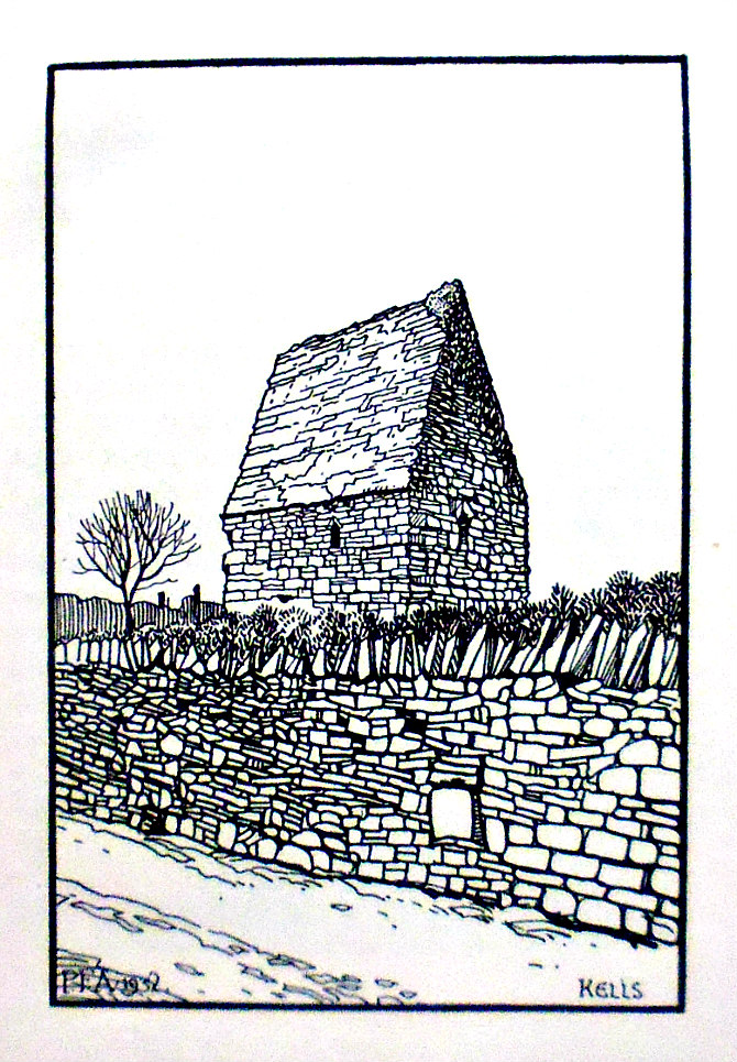
St. Columba’s House, Kells, in Co. Meath, by Peter F. Anson

Peter F. Anson (1952) tells us about St. Columba’s House, saying that: “It is quite possible that in this curious little building with an upper chamber hidden away above the barrel vaulting of its roof, was written the famous Book of Kells, the great treasure of the library of Trinity College, Dublin. Who wrote this and illuminated this most perfect expression of Christian art which has survived the centuries of war and strife in Ireland ? Tradition has it that the artist was an unknown monk of the abbey of Kells, in Meath. Anyhow, whoever he was he must have been one of the greatest book illustrators and masters of penmanship the world has ever known, and for this reason I had always wanted to make a pilgrimage to Kells. When this marvelous work of art was being produced in what is now no more than a sleepy little country town, ‘London was a haunted Roman ruin on a hill with the brambles over London Wall and the camp fires of the East Angles shining on the marsh beyond the city which they were afraid to enter,’ writes Mr. H. V. Morton, ‘Paris was a desolation and the sun was setting over Rome.’ But Ireland, thanks to her isolation, remained a stronghold of learning and culture. What is left to-day of the ancient glories of Kells? There is this little building, known as St. Columba’s House, a dreary neglected churchyard containing some magnificent Celtic crosses, and that is all.”

The Wikipedia website says: ‘St. Columb’s House is today thought to mostly date from the 10th century. It is named after Columba (Colm Cille), whose relics it may once have housed. The roof was modified at a later date. The house was used by monks to say the Liturgy of the Hours, or possibly as a shrine church or burial place of an abbot. It once contained a large flat stone called “St Columb’s Bed”, possibly a grave slab. His relics were brought to Kells in 878, and moved to Skryne Church later before finally going to Downpatrick, according to Wikipedia. See Link, below.

Katharine Scherman (1981) says regarding the Book of Kells that: “Argument, often stormy, surrounds the history of the Book of Kells, there being strong claimants for its generation in Ireland, Iona, Lindisfarne or other insular foundations of Irish origin and mixed personnel. The answer will probably never be known, though some experts reason that evidence favours its inception at Iona in the late eighth century and subsequent removal to Kells, where it was completed in the first quarter of the ninth century.

“In 795 Iona was pillaged by Norse raiders; in 801-802 they came again and burned the monastery to the ground; returning in 806 they murdered sixty-eight monks….. In 807 the abbot, Cellach, with the remaining monks, moved to Ireland taking with them the bones and other relics of St Columba and whatever valuables they had managed to hide from the ravag-ers—among them, presumably, the unfinished manuscript. They went to the site of one of Columba’s monasteries at Kells, County Meath, and built there a new monastery, to be the headquarters of the league of Columban houses.

“Kells, being inland, was considered safe from the marauders, who, in the early years, limited their invasions to hit-and-run assaults on the monasteries immediately accessible by sea. But Kells was struck the year after its founding and its church destroyed. A new church was completed in 814 and the monastic village, probably fortified, succeeded in fending   off subsequent attackers. Undoubtedly, also, successive abbots paid tribute for the privilege of being left alone. At any rate, the monastery of Kells had years of peace in the early ninth century — time enough for the production of the great book. For the creation of such a complex, profound and subtle work of art is a luxury that presupposes a number of conditions: security from outward disturbance; wealth to afford the years of dedicated specialization of a corps of scribes and painters; a scholarly intimacy with the Christian thought of the time; and a large library of books from abroad, which, being rare, would take years to accumulate. The scriptorium at Kells, fortunate in its relative tranquillity, could meet these conditions and finish — though it was never absolutely finished — the work that had begun at Iona. But the monastery was not permanently inviolate. The Norse sacked it in 919, 950 and 969, and in the following century it was raided repeatedly by the Irish themselves. In 1170 it was burned to the ground by the Anglo-Normans at the instigation of their Irish ally, Diarmait Mac Murrough.

“Despite the brutal history of Kells, the manuscript survived almost intact. In 1006 it was stolen, and turned up two and a half months later buried “under a sod” with the gold of its wood-and-metal cover wrenched off. The inside pages were unscathed, though some missing leaves at the beginning and the end may have been torn off at this time.

Andrew Jones (2002) tells us that: “The first probable record of the existence of the Book of Kells is an account of the theft of ‘the great Gospel of Columkille, the chief relic of the western world’ from the great stone church of Kells in the year 1007. The book was found buried in the ground almost three months later, and presumably remained at Kells until it was brought to Dublin and presented to Trinity College by Henry Jones, Bishop of Meath, some time after the year 1661. It has been in the College Library ever since as its greatest treasure.”

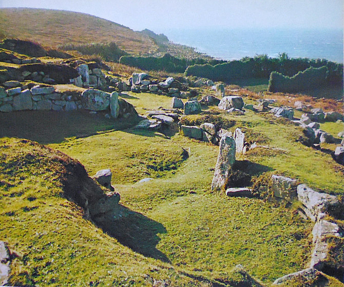
Greenwood, Connolly, Hawkins & Wallis (1999) tell us a lot about the Kells monastic site, saying that: “The Round Tower in the churchyard is known to have been here before 1076, for in that year Murchadh Mac Flainn. who was claiming the High Kingship, was murdered within the tower. It’s a little under 100ft high, with five windows near the top, and missing only its roof.

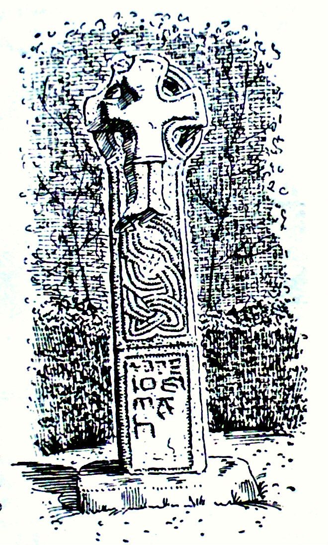
“Near the tower is the South High Cross, the best and probably the oldest of the crosses at Kells, carved as ever with scenes from the Bible. Here you’ll see, on the south face, Adam and Eve and Cain and Abel; then the three children in the fiery furnace; then Daniel in the lions’ den. On the left arm of the wheel Abraham is about to sacrifice Isaac, and on the right are SS. Paul and Anthony in the desert; at the top is David with his harp and the miracle of the loaves and fishes. There are two other complete crosses in the churchyard, and the stem of a fourth (behind the church back-entrance door) with the inscription Oroit do Artgal, A prayer for Artgal. This has several identifiable panels. The near side shows the baptism of Christ, the marriage feast at Cana, David with his harp again, the presentation in the Temple, and others to worn to make out. On the other side are a self-conscious Adam and Eve, Noah’s Ark, and others hard to identify accurately. There are sculptured stones embedded in the walls of the bell tower.

“In the central market square there’s another fine high cross, discoloured by traffic fumes, said to have been placed here by Jonathan Swift. In 1798 it served as the gallows from which local rebels were hanged. Yet again, it is liberally festooned with fine stone carving. The base shows horsemen and animals in a battle scene; on the west face are the adoration of the Magi, the marriage at Cana and the miracle of the loaves and fishes, all surrounding the Crucifixion in the centre of the wheel; on the east are Christ in the tomb, Goliath, Adam and Eve, and Cain and Abel, with Daniel in the lions’ den occupying centre stage.”

Sources and related websites:-

Anson F., The Pilgrim’s Sketch Books — No. 4 — An Irish Pilgrimage, Burns Oates & Washbourne Ltd., London, 1932.

Greenwood, Margaret, Connolly, Mark, Hawkins, Hilda & Wallis, Geoff, Ireland — The Rough Guide, Rough Guides Ltd., London, 1999.

https://en.wikipedia.org/wiki/St._Columb%27s_House

Jones, Andrew, Every Pilgrim’s Guide To Celtic Britain And Ireland, Canterbury Press, Norwich, 2002.

Scherman, Katharine, The Flowering of Ireland — Saints, Scholars & Kings, Victor Gollancz Ltd., London, 1981.

https://en.wikipedia.org/wiki/St._Columb%27s_House#/media/File:St._Columb’s_House,_Kells_2018-07-24_

http://www.megalithicireland.com/Kells%20Monastery,%20Meath.html

http://irelandsholywells.blogspot.com/2013/06/saint-columbas-well-kells-county-meath.html

http://www.heritagetowns.com/kellslarge1.shtml

http://www.archaeologicalconsultancyservices.com/index.php/archaeological-consultancy-services-blog/47-archaeologist-from-acs-ireland-at-st-colmcilles-house-kells-co-meath

© Ray Spencer, The Journal of Antiquities, 2019.


1 Comment

Halangy Down Ancient Village, St Mary’s, Scilly Isles

Halangy Down Ancient Village, St Mary’s, Scilly Isles (photo: F. Gibson).

NGR: SV 90983 12379. The ancient village/settlement of Halangy Down is situated about 1 mile north of Hugh Town on St Mary’s Island, in the Scilly Isles, and is close to the sea-shore between Toll’s Porth and Halangy Point; it is just a little down the slope from Bant’s Carn Burial Chamber, while a bit further to the south is the golf course at Carn Morval from which there are quite exceptional panoramic views of all the Scilly Islands. This ancient site was probably occupied originally in the Bronze Age, but the village itself was established in the late Iron Age and, continued to be occupied through the Roman period, and on into the Romano-British period. There are some well-preserved remains of a complex of buildings including circular huts, inter-connected structures, courtyards and stone drains, all of which seem to be well looked after. To get to St Mary’s take the ferry-boat from Penzance, Cornwall. It’s then a case of walking the footpaths and road (northwards) at the western side of the island from Hugh Town, keeping to the coastline, and passing Porthmellon, Porthloo, Seaways, the golf course, and Toll’s Porth, to reach Halangy Ancient Village.

Circular hut at Halangy Down Ancient Village, St Mary’s. (F. Gibson).

F. Gibson tells us quite a bit about this site, saying: “There is an extensive complex of stone built huts here, developed and modified during the course of some half-millennium. A courtyard house is the uppermost, with buildings lower down which were all inter-connected. A system of stone drains led under the main entrance of the house and beneath the courtyard. It is probable that both the house and the courtyard were roofed; roofing spars supported in the middle by posts would have supported a thatch of reeds or straw, held in position by straw ropes weighted down by boulders. During excavation a number of quartz implements were found; they were crude choppers, rounded blocks, rough scrapers and axe-like points. There were also a wide range of heavy tools and equipment made from the local granite, as well as numerous querns of the saddle, bowl and rotary types.

“The earliest inhabitants are considered to have arrived about 2000 B.C. and they sought sustenance from the sea. Shellfish were collected, and fish, birds and mammals were caught; whilst at the same time the land was not neglected, cereals being brought to the islands, where clearances were made to grow them. It would seem from the middens however that limpets were the main source of protein in their diet.” 

Gibson also adds that: “Evidence of the Roman period can be found in the islands. Ancient villages of this period are at Halangy Down on St Mary’s and on Nornour. The site at Halangy is on the higher slopes of a much larger settlement which reaches down to the Porth. The lower slopes were probably abandoned on encroachment of the sea. The people who lived there were growing grain, keeping cattle, pigs and sheep; and eating fishand limpets in vast quantities. From evidence of finds the economy appeared well adjusted to island life.”

Timothy Darvill (1988) with regard to Bant’s Cairn on St Mary’s, tells us that: “Nearby are the foundations of round and oval houses of a small Iron Age and Romano-British village.” Lord Harlech (1970) tells us much the same as Timothy Darvill (1988) apart from saying it……“was occupied in the middle of the Roman period.”

Nearby, just up the slope, at NGR: SV 90994 12302 is ‘Bant’s Carn Burial Chamber’, a Bronze Age tomb dating from around 2000 BC. There are four large capstones resting above a rectangular chamber with an entrance leading into it, and there is an inner and an outer wall of large slab-stones; the whole structure with its grassy mound being quite well-preserved. Close-by is a small section of ancient field terraces which were begun in the Bronze Age but, later, in the Iron Age and Romano-British periods – these field systems were obviously re-used by the occupiers of the Halangy Down Ancient Village.

Sources / References & Related Websites:-

Darvill, Timothy, AA Glove Box Guide — Ancient Britain, Publishing Division of the Automobile Association, Basingstoke, Hampshire, 1988.

Gibson, F., Visitors companion to the Isles Of Scilly, (publisher unknown, and date unknown).

Harlech, Lord (the late), Southern England — Illustrated Regional Guide to Ancient Monuments No. 2, Her Majesty’s Stationery Office, London, 1970.

https://en.wikipedia.org/wiki/Halangy_Down

https://www.english-heritage.org.uk/visit/places/bants-carn-burial-chamber-and-halangy-down-ancient-village/history/

https://www.megalithic.co.uk/article.php?sid=6333313

https://www.citizan.org.uk/interactive-coastal-map/#zoom=10&lat=6435646.73888&lon=-700072.42535&layers=B00000TF

https://www.cambridge.org/core/journals/antiquaries-journal/article/excavation-of-a-homestead-of-the-roman-era-at-halangy-down-st-marys-isles-of-scilly-1950/4676994F35C2F26A377B817179CFED2F

© Ray Spencer, The Journal of Antiquities, 2019.


The Old Man of Gugh Standing Stone, Isle of Gugh, Scilly Islands

The Old Man of Gugh Standing Stone (by F. Gibson).

NGR: SV 8904 0848. At the east side of the little Island of Gugh (below Kittern Hill, south-east side) which is connected by a sand bar (tombolo) to the larger St Agnes Island, in the Scilly Islands, is a tall granite standing stone (menhir) called ‘The Old Man of Gugh’, that is thought to date from the Bronze Age. This odd-shaped pillar stone is 9 foot high and is slender and jagged, and leans at an angle towards the east. It is aparently ‘the only’ standing stone in the Scilly Islands, but there are 17 other prehistoric monuments close by, on Kittern Hill, including ‘Obadiah’s Barrow’. The standing stone was first recorded in 1756, but it was not excavated until the beginning of the 1900s at which time nothing much was found. Coming over from Penzance, Cornwall, one is able to reach the Island of Gugh, firstly, by ferry-boat to St Mary’s, the main island of the Scillies, and then the local boat service must be availed of to get you to St Agnes Island, and then [“at low tide”] walk along the sand/shingle bar to the Isle of Gugh, following the main footpath across the island, to reach the standing stone, at the east side, close to the sea cliffs.

F. Gibson tell us that: “Gugh has many Megalithic remains. Unfortunately none are cared for by the Ministry of the Envi-ronment, as on St. Mary’s, but they can be seen amongst the bramble and bracken…….. In the centre of the island is a single stone monolith, considered to have been placed there in the Bronze Age. It is about nine feet high. This is the Old Man of Gugh. It is an interesting fact that this monument stands on the southernmost point of the British Isles, and that a similar stone stands on the most northern point in the Shetland Isles.”

Dixe Wills (2018) says with regard to the sea-birds nesting on the island’s cliffs and their angry calls, that ……“you can strike up an altogether less frenzied acquaintance with the Old Man of Gugh, a 9ft-high leaning menhir (or standing stone). Etched with long grooves and placed here sometime during the Bronze Age, he may have served as a memorial or merely as a territorial marker. Apparently, there are over a dozen ley lines radiating from the Old Man, but when the ground around the stone was excavated no further clues were found.” 

Wills goes on to say that: “A walk around the island is like a trip in a broken time machine, hunting its occupants backwards and forwards apparently at random. Head towards the heather-strewn hillock at the southern end of Gugh and you’ll come upon the Carn of Works Civil War Battery. Built by Cavalier troops to hold two guns that would defend the southern approaches to the Isles of Scilly, the battery’s designers appear to have pressed an ancient entrance grave within its walls into use as a magazine, which one would have thought was an act of sacrilege. Perhaps such matters matter less in times of war.” 

The Historic England monument list no. is: 1014791.

Sources / References & related websites:

Gibson, F., Visitors companion to the Isles Of Scilly, (publisher not known, and un-dated).

Wills, Dixe, Tiny Islands — 60 Remarkable Little Worlds Around Britain, AA Publishing, Basingstoke, Hampshire, 2018.

https://historicengland.org.uk/listing/the-list/list-entry/1014791

https://en.wikipedia.org/wiki/Gugh

https://www.megalithic.co.uk/article.php?sid=6333302

http://www.cornwallinfocus.co.uk/history/ancientsites.php?r=IO

http://scillypedia.co.uk/PhotoOldManGughl.htm

© Ray Spencer, The Journal of Antiquities, 2019.


Celtic Cross, Lanherne (St Mawgan-in-Pydar), Cornwall

NGR SW 87219 65926. Standing between the churchyard of St Mauganus & St Nicholas’ Church and the convent garden at Lan-herne or Lannhorne, in the village of St Mawgan-in-Pydar, near Newquay, Cornwall, is a Celtic wayside cross, which is thought to date from the 10th or 11th Century AD. It is a wheel-headed or four-holed cross with a tapering shaft, a carving of Christ, curious inscriptions in ancient lettering similar to the runic-type, and carved decoration. The carvings on the opposite side are very faint. There is a five-boss cross on the head and another inscription at the bottom. However, the cross is not in its original setting, as it used to be located at Roseworthy, 20 miles to the north. The convent of Lanherne, just opposite the church was a manor house built in Elizabethian times, but Carmelite nuns from Belgium moved in in 1794; today it is still home to the Fran-ciscan sisters. St Maugan’s Church stands on the site of a 5th-6th Century Celtic monastery, founded by an Irish saint who came here from south-west Wales! The saint’s holy well can be found near the lych-gate, and there is a 15th Century lantern cross in the churchyard.

The Lanherne Celtic cross.

The Cross of Lanherne is located in ‘a peaceful setting’ at the northeastern side of the convent garden, close by the churchyard. It is just under 5 foot high and is made from a single lump of stone from Pentewan in Cornwall. The SW face: (head) shows in high relief a delicately carved figure of Christ crucified with arms outstretched (forming the actual cross-head but leaving holes visible), his longish body and legs, and with his feet resting upon some outstandingly beautiful Celtic two-cord plaitwork (banding) and three-cord plaitwork – all intertwining (with flat cord-knots at intervals) in a sort of ‘zig-zag’ fashion. Below that a large panel of ancient-style lettering similar, perhaps, to Scandinavian runic letters, which might spell out a personal name? While the opposite side: NE face (head) has a simple rounded cross with five tiny bosses forming the actual head, with the holes left showing, and below that, but now very faint a longer in length area of cord-plaitwork intertwining and twisting in and out in a ‘zig-zag’ fashion with flat-cord knots and, at the bottom, a small panel of ancient lettering similar to that on the main face. The edges of the cross have more cord-plait banding, interlacing and knotwork.

The Historic England Monument List No is: 1020866. See the Link, below. 

Sources / references & related websites:

The AA, The Illustrated Road Book Of England & Wales, The Automobile Association, London, 1961.

https://historicengland.org.uk/listing/the-list/list-entry/1020866

https://www.megalithic.co.uk/modules.php?op=modload&name=a312&file=index&do=showpic&pid=100139

https://en.wikipedia.org/wiki/Lanherne

https://www.genuki.org.uk/big/eng/CON/MawganinPydar

http://www.friendsoflanherne.org/p/the-sisters-at-lanherne.html

© Ray Spencer, The Journal of Antiquities, 2019.