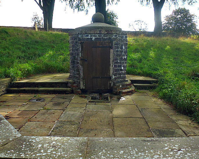
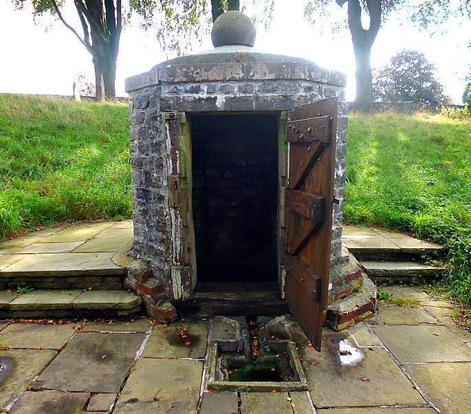
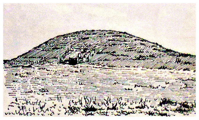
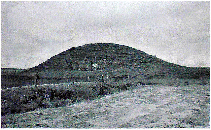
Maeshowe chambered cairn, in Orkney Island.
NGR: HY 31830 12762. At the southeastern edge of Loch Harray (north side of the A965 Strom-ness to Kirkwall road) on Orkney Island, Scotland, stands ‘Maeshowe’ or ‘Maes Howe’, a well-preserved Neolithic chambered cairn and passage-grave from 2800 BC, which is the largest megalithic tomb in Orkney and the finest of its kind in the British Isles; the masonry in this tomb being far better than any of the prehistoric burial monuments in the rest of Europe! This large and imposing grassy mound is around 24 feet high, over 100 feet in diameter, and is surrounded by a ditch that is more than 40 foot wide. At the southeast side of the mound there is a slab-built entrance with a long passage-way leading inside the monument to the inner chamber that is over 12 feet in height. Inside the chamber there are 30 runic inscriptions and other carvings. Mawshowe is located about 1 mile east of ‘Stones of Stenness’ and 4 miles west of Finstown. A footpath leads of the A965 road (opposite Tormiston Mill) in a northwesterly, then northeasterly direction, for 300m to the monument.

Maeshowe Chambered Cairn, Orkney Island. (Photo: T. Kent).
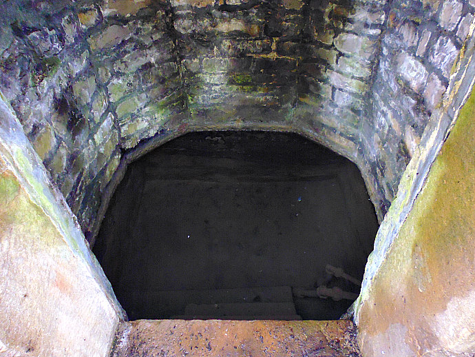
J. Gunn (1941) on his visit to Maeshowe tells us: “We enter the mound by a low and what seems a very long passage, at first barely2½ feet high, but for the second half over 4 feet, and are glad to reach the central chamber, where we can stand upright once more. The floor of this chamber is 15 feet square. The walls are vertical for the first 6 feet of their height, and then begin to curve inwards, not by an arch structure but by each course of the masonry over-lapping the previous one, and so producing the effect of a vault, until at the height of about 13 feet only a small opening is left to be covered by a single slab. The angles of the building are strengthened by heavy buttresses of stone. In the wall opposite the entrance, and on either side, are recesses some 3 feet above the ground, built as if for burial chambers.
“The mound was broken into, perhaps in search of treasure, by the followers of Earl Rognvald II., who wintered in Orkney in 1151 before setting forth on his famous pilgrimage to Jerusalem. In 1861 it was reopened and carefully examined, the passage was opened out, the interior cleared of rubbish, and the roof restored.”
Gunn goes on to say: “The mound which covers and protects the building is still some 35 feet in height, and 300 feet in cir-cumference. It stands on a level platform of nearly three times this diameter, surrounded by a trench about 40 feet wide, and from 4 to 8 feet deep. The entrance passage to the chamber is fully 50 feet long. Regarding the builders of the chamber, its purpose, and its date, nothing is known.” And Gunn goes on to say “There is thus no doubt that their original purpose was sepulchral, and this is true also of Maeshowe itself, as is shown by the fragments of human skulls which were found in it when it was examined in 1861.”

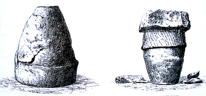
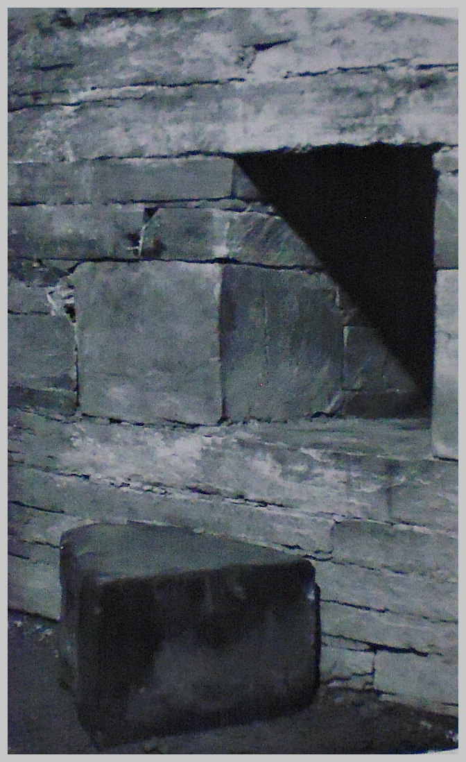
Burial recess & blocking stone
Childe & Simpson (1959) tell us that: “Maes Howe covers the finest “megalithic tomb” in the British Isles, the masonry of which is surpassed nowhere in Western Europe. The tumulus rises from a flan plain at the south-east end of the loch of Harray, and belongs to a great complex of monuments to which we shall return. The imposing mound is 115 feet in diameter and still 24 feet high. It is encircled, 50 feet to 70 feet from its base, by a great penannular ditch, 45 feet wide. From the south-east edge of the barrow a passage now over 36 feet long leads to a chamber 15 feet square and now 12 feet 6 inches high. (The original corbelled roof is preserved to that height only, the gap being covered by modern vaulting). In the middle of each side wall save the southern rectangular “window” some 3 feet above the floor gives access to a small rectangular cell, 3 feet 6 inches high, and roofed by a single lintel slab. These cells, the actual depositories of the deceased, could be plugged with stone blocks, still lying near them on the chamber floor.
“The masonry of the passage and chamber is of outstanding excellence. Most of the stones used have been dressed. The walls and roof of the inner part of the passage are formed of monoliths, on an average 18 feet 6 inches long, 4 feet 4 inches wide and 7 inches thick. The joints are so finely adjusted that it is impossible to insert a knife-blade between them. Projecting piers in the chamber’s four corners, ingeniously designed to support the corbels, are each faced on one side with upright monoliths that attain a height of 9 feet 8 inches.
“Maes Howe was presumably designed as the burial place of a potent chief and recalls in several details some famous tombs on the Boyne. It was opened by Farrer in 1861, who found he had been anticipated by Vikings in the 12th century. These had left nothing of the original burials nor their furniture, but a record of their violation in the form of Runic inscriptions and engravings of a lion, a walrus, and a serpent-knot. The inscriptions mention the removal of treasures and record various visits by Christian Vikings and crusaders about A.D. 1150.”
Bill Anderton (1991) says of the Maes Howe Tomb: “Near Stromness, on the island of Orkney can be found the remains of a magnificent chambered tomb. The tomb lies beneath a 7-metre-high mound of clay and stones, the entrance being through an 11-metre-long passage lined with huge slabs of stone. The chamber of the tomb measures 4½ metres square. The wall opposite the entrance and the two side walls each have a recess leading into the body of the earthern mound. Burials may have been placed within these recesses. The tomb was sealed in about 1500 BC, and remained thus until AD 1150 when it was broken into by some Norse pirates who were spending the winter on the island. Nothing was left in the tomb except for some runic inscriptions testifying to their presence. These inscriptions were carved by Vikings over 800 years ago, but the beautifully constructed cairn is dated to about 2750 BC. It is orientated so that the mid-winter sun shines down the 11-metre-long entrance passage to light up the inner beehive chamber. Among the carvings on one of the uprights is the famous Maes Howe Dragon.”
Further to that Charles Tait (1999) says: “Maeshowe has the distinction of having one of the largest groups of runic in-scriptions known in the world. Inscribed artefacts are common all over Scandinavia and the Norse colonies, with the earliest dating from about AD 200. The younger futhark was developed about AD 700 and was the form of runes used by the Vikings. Many inscriptions are on artefacts and tell who carved the runes while runic memorial stones are also common, often using existing boulders. These epitaphs often commemorate the exploits of the dead.
“The Vikings left much runic graffiti, but none have so far been as rich and interesting as in Orkahaugr – the Norse name for Maeshowe. These runes were carved in the 12th century and are a development of the characters used by the earlier Vikings. Runes developed as a simple way of carving letters into wood, bone or stone using a blade or similar implement. They represent most of the Latin alphabet as required by Old Norse. There are many variations in the runic alphabet, but most of the characters have Latin equivalents. Runes were used throughout the Germanic lands, but probably developed in Scandinavia.
“At Maeshowe there are about 30 inscriptions, many of which are of the style “Thorfinn wrote these runes”. Some gave their father’s name, or a nickname, some are by women and one intriguing inscription says “these runes were carved by the man most skilled in runes on the Western Ocean with the axe that killed Gaukr Trandkill’s son in the south of Iceland”. This rune carver may have been Thorhallr Asgrimassom, Captain of Earl Rognvald Kali’s ship when they returned in 1153 from the Crusades. Clearly the Vikings were interested in Maeshowe and left inscriptions on at least one other occasion, when stories about treasure were being told, as in “Haakon singlehanded bore treasures from this howe”. Women were also discussed, as in “Ingigerd is the most beautiful of women” and “Ingibiorg the fair widow”, or “Many a women has come stooping in here no matter how pompous a person she was”’.
Charles Tate adds that: “Some of the runes are cryptic tree runes which are easily deciphered by a numeric code based on the futhark – the runic alphabet. Little could the Viking graffiti writers of 1153 have realised how interesting their runes would be today! In the magnificent setting of the 5,000 year-old tomb, the Viking visitors seem not so distant.”
Sources / References & Related Websites:
Anderton, Bill, Guide To Ancient Britain, W. Foulsham & Co. Ltd., Slough, Berkshire, 1991.
Childe, Gordon & Simpson, Douglas, Ancient Monuments—Scotland—Illustrated Guide, H. M. Stationery Office, Edinburgh, 1959.
Gunn, J., Orkney—The Magnetic North, Thomas Nelson And Sons, Ltd., London, 1941.
Tait, Charles, the Orkney Guide Book (Edition 2.1), Charles Tait photographic, Kelton, St. Ola, Orkney, 1999.
The AA, Illustrated Guide Book Of Scotland, The Automobile Association, London, 1963.
https://en.wikipedia.org/wiki/Maeshowe
https://www.historicenvironment.scot/visit-a-place/places/maeshowe-chambered-cairn/
https://canmore.org.uk/site/2094/maes-howe
https://stonesofwonder.com/maeshowe.htm
http://www.orkneyjar.com/history/maeshowe/index.html
https://sites.google.com/a/umich.edu/from-tablet-to-tablet/final-projects/runic-graffiti-at-maeshowe-orkney-katie-rokakis-13
© Ray Spencer, The Journal of Antiquities, 2019.