The Journal Of Antiquities

Ancient Sites In Great Britain & Southern Ireland


1 Comment

Rooley Moor Burial Mound, Near Rochdale, Greater Manchester

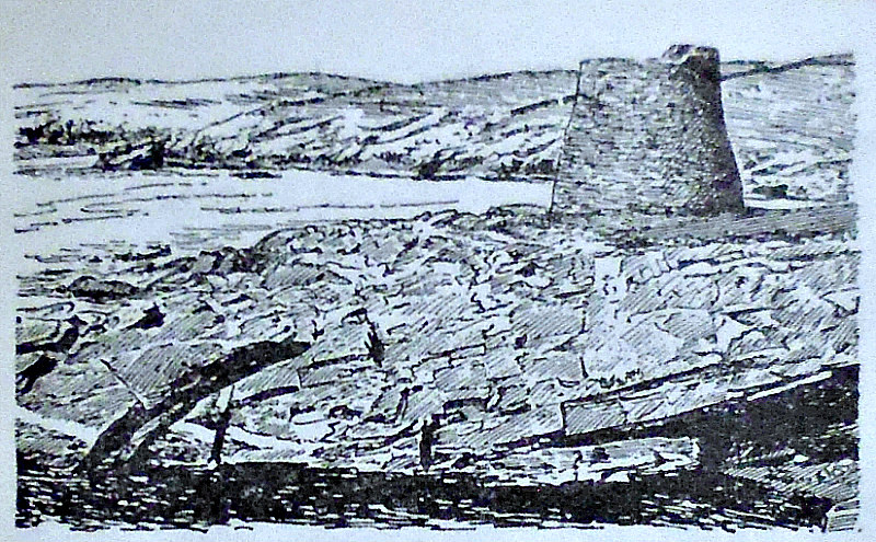
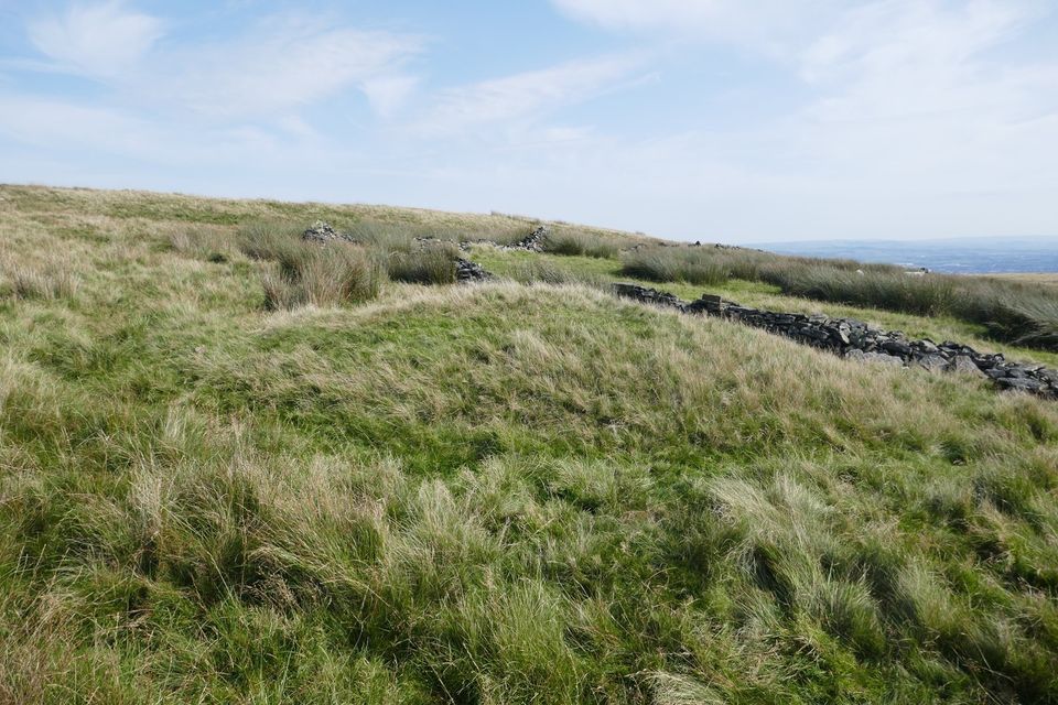
Burial mound on Rooley Moor. Photo copyright: Stephen Oldfield.

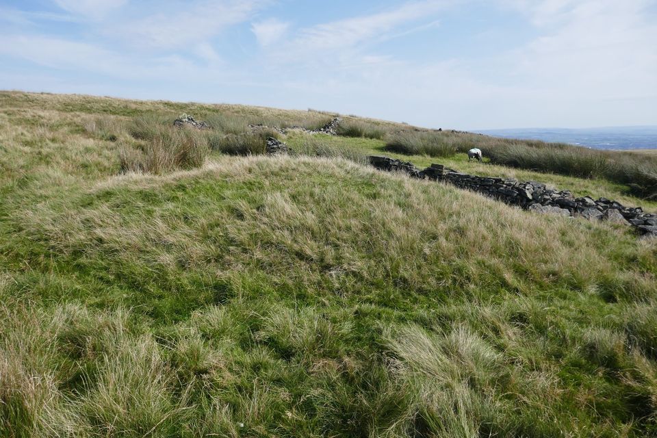
NGR: SD 8577 7952. On Rooley Moor to the north of Rochdale, Greater Manchester, and quite close to Rooley Moor Road, there is a Bronze Age burial mound (barrow), which actually looks more like a long barrow? However, this ancient mound has been missed by the archaeologists and the Ordnance Survey people, even though it is quite a prominent grassy mound with what looks to be a faint outer ditch. The barrow appears to have been damaged at one side, though whether it has been dug into, or robbed of what was contained inside it,  is not known.  The barrow is at the E. side of the moor some 50 metres to the west of Rooley Moor Road, and is not far from the scant remains of the Old Moorcock Inn, where two tall gateposts still stand like sentinels. Moorcock Inn was in its heyday in the 19th Century.  There are two footpaths going onto the moor from Rooley Moor Road: one running N.W. to Ding Quarry and Cowpe, another running S. to Reddyshore.

B/A barrow on Rooley Moor. Photo copyright: Stephen Oldfield.

There are other ancient features on the moors around here including an enclosure, a cup-marked rock, and a bit further away to the east at Bagden Hillocks, a cairn. Bagden Hillocks is just inside the boundary with Rossendale. Rooley Moor used to be called Shore Moor and Rooley Moor Road used to be Catley Lane; it is nowadays known as ’the Cotton Famine Road’ and, in Medieval times, it was the packhorse route between Rochdale, Whalley Abbey and Clitheroe. Hamer Hill has some recumbent stones which archaeologists had thought were part of a stone circle, while Hunger Hill has possible burial mounds at its northern side. The moor is scattered with mines, quarry pits and mounds dating from the time of the Industrial Revolution, and sometimes these can, perhaps, be mistaken for ancient burial mounds, but this particular mound does appear to be a prehistoric barrow of Bronze Age date. 

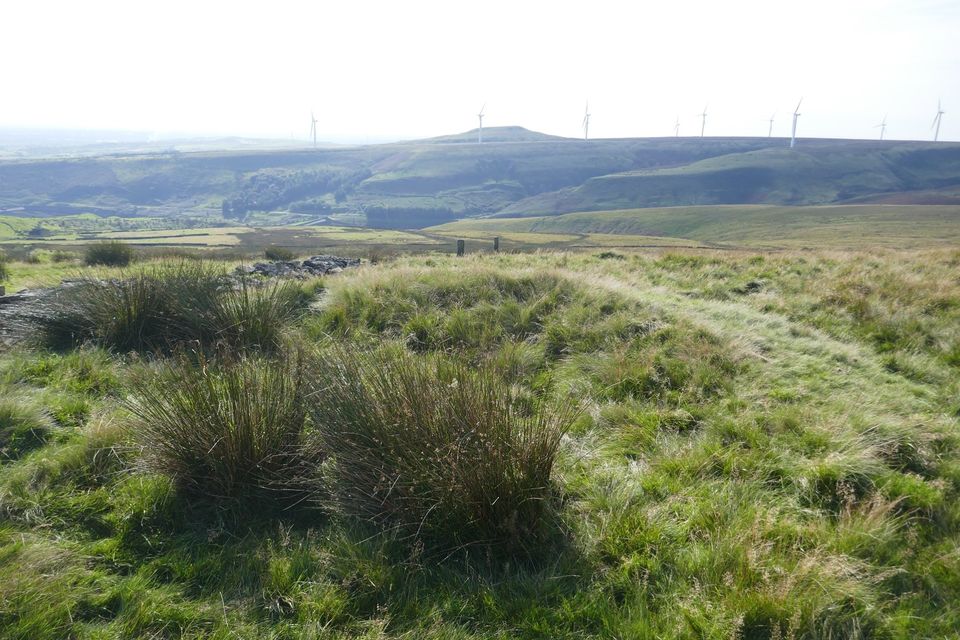
The Damaged barrow by Stephen Oldfield.

Stephen Oldfield, who told us of this site, gives directions to finding the burial mound, saying: “You will see a small rectangular wall which was the perimeter for the Old Moorcock pub. The cairn is at the north corner of this. Unmissable. Head about 100m due north-east and you hit the superb Bagden Hillocks cairn. Both are lined up with the north-east/south-west axis of Knowl Hill.” Stephen goes on to say that: “Just behind the ruins of the old Moorcock Inn on Rooley Moor Road is a Bronze Age burial mound lined-up exactly with the prehistoric site of Knowl Hill to the west.  It appears to have been dug into in the past.  The alignment cuts through a ’henge feature’ too and my guess is they are aligned with sunrise at the equinoxes but I’ll have to check this out,” he adds.

Sources / References & Related Websites:-

I would like to thank Stephen Oldfield for the use of his photos (above) and for his input with further information on the site and its surroundings. Thanks mate. All photos are Copyright © Stephen Oldfield 2020.

https://lancsarchaeology.wordpress.com/category/rooley-moor/

https://lancsarchaeology.wordpress.com/tag/rooley-moor/

https://www.megalithic.co.uk/article.php?sid=18858

https://www.megalithic.co.uk/article.php?sid=35513

Photo of the Old Moorcock Inn:   https://www.facebook.com/RochdaleLocalHistory/photos/the-moor-cock-rooley-moor-road/635869649903867/

Copyright © Ray Spencer, The Journal of Antiquities, 2020.


Broch of Mousa, Island of Mousa, Shetland Isles, Scotland

Broch of Mousa on the Island of Mousa in the Shetland Islands.

NGR: HU 45730 23660. At the far western side of the Island of Mousa (south island), in Shetland, and overlooking the Sound of Mousa, stands the well preserved ‘Broch of Mousa’, dating from the late Iron Age; but these brochs have often wrongly been called Pictish towers by some historians, though the building of brochs had almost certainly ended by the 2nd Century AD, so it would seem the Picts merely took them over and lived in them as they were very strongly built and fortified. This particularly fine example of a broch has thankfully not been robbed of its stone-work and still stands to a height of nearly 44 feet or 13 metres, and is the only broch to have survived to its original height. The broch is a bell-shaped fortress-like tower, or round-house, that is built with thick drystone blocks of stone and has a double inner wall with a stairway – while on the outside there is a stonework surrounding wall forming a courtyard. To reach the uninhabited Island of Mousa you will need to take the motor boat from Sandsayre pier at Sandwick, 2 miles to the west. [Check first to see whether the boat is operational at this time of Covid-19].

Broch of Mousa, Shetland (exterior).

Broch of Mousa, Shetland (Interior).

Gordon Childe & Douglas Simpson (1959) tell us that: “The Broch of Mousa stands on the shore of a small rocky island, yet was defended on the landward side by a wall, now much dilapidated. It has often been taken as the most typical broch, so only diver-gences  from  the ideal  norm  need  be  mentioned.  The solid  “ground-floor” wall  is  exceptionally  high,  12   feet 4  inches. Immediately  above  the  present entrance there was once an entrance passage, but its mouth was built up in 1919. Again the entrance to the stairhouse cells in approximately on a level with the floor of this upper passage and some 6 feet above the primary floor, but just below the second scarcement. Below it are three intramural cells entered by descending steps. At the bottom of the court is a rock-cut cistern that is doubtless original. On the other hand the present hearth, a radial wall, and a low wall, concentric with and inside the main wall, seem to be secondary additions to the original plan.

“According to Egil’s Saga an eloping couple from Norway took refuge in the broch about A.D. 900, and, a similar incident about 1153 is recorded in the Orkneyinga Saga.” 

Timothy Darvill (1988) says of Mousa Broch, that it is: “Set on the tiny island of Mousa to the east of mainland Shetland, this great stone toweris built straight on to the rock overlooking Mousa Sound. Undoubtedly the best-preserved broch in Scot-land, it still stands over 12m high and is constructed of dry-stone walling of the very highest standard. The broch tower has an external diameter of 15.2m at the base, but tapers inwards slightly towards the top. To withstand the gales and high winds that blow in from the North Sea the wall is over 6m thick.

“Opening off the central courtyard are three large corbelled cells with low doorways. There are three wall-cupboards in the side of the inner court. Two ledges representing supports for upper floors or galleries can be seen. The upper ledge may have supported the roof. The inner wall-face also contains sets of openings or voids which may have been to allow light into the galleries contained within the walls. A stair rises clockwise inside the wall allowing access to the galleries. It is unlikely that these galleries were ever lived in, although they could have been used for storage. Judging from its superior design and craftsmanship, this broch was probably constructed fairly late in the tradition of broch building.”

Janet & Colin Bord (1984) add similar information, saying: “This broch now stands over 40 feet high, taller than most other brochs, and has been restored at various times. The only opening in the thick external wall is the doorway, and inside a passage leads to a central chamber. All round the walls, right to the top of the broch, are small chambers, and a stairway winds gradually to the top of the building.”

The Rough Guide (2000) informs us that these Iron Age brochs were: “Concentrated along the Atlantic coast and in the northern and western isles, the brochs were drystone fortifications (that is, built without mortar or cement often over 40ft in height.  Some historians claim they provided protection for small coastal settlements from the attentions of Roman slave traders.  Much the best-preserved broch is on the Shetland island of Mousa; its double walls rise to about 40ft, only a little short of their original height.  The Celts continued to migrate north almost up until Julius Caesar’s first incursion into Britain in 56 BC. 

“At the end of the prehistoric period, immediately prior to the arrival of the Romans, Scotland was divided among a number of warring Iron Age tribes, who apart from the raiding, were preoccupied with wresting a living from the land, growing barley and oats, rearing sheep, hunting deer and fishing for salmon.  The Romans were to write these people into history under the collective name Picti, or Picts, meaning painted people, after their body tattoos.” 

There is a second broch over on the east coast of Sandwick, a couple of miles to the west of the Island of Mousa, overlooking the Sound of Mousa at (NG: HU 44687 23214). This is known as the ‘Broch of Burraland’, Leebitten.

Sources / References & Related Websites:-

Airne, C. W., The Story Of Prehistoric & Roman Britain — Told In Pictures, Sankey, Hudson & Co. Ltd., Manchester.

Bord, Janet & Colin, Mysterious Britain, Paladin Books, London, 1984.

Childe, Gordon & Simpson, Douglas, Ancient Monuments — Scotland — Illustrated Guide Volume VI,  H.M.S.O., Edinburgh, 1959.

Darvill, Timothy, AA Glovebox Guide — Ancient Britain, Publishing Division of the Automobile Association, Basingstoke, Hampshire, 1988.

The AA, Illustrated Road Book of Scotland, The Automobile Association, London, 1963.

The Rough Guide (Humphreys, Reid & Tarrant), Scotland, The Rough Guides Ltd., London, 2000.

https://en.wikipedia.org/wiki/Broch_of_Mousa

https://www.historicenvironment.scot/visit-a-place/places/mousa-broch/

https://canmore.org.uk/site/944/mousa-broch-of-mousa

https://www.shetland-heritage.co.uk/mousa

https://www.undiscoveredscotland.co.uk/mousa/mousabroch/index.html

https://www.mousa.co.uk/

https://www.mousa.co.uk/island-trip

Copyright © Ray Spencer, The Journal of Antiquities, 2020.