The Journal Of Antiquities

Ancient Sites In Great Britain & Southern Ireland


The Wolverhampton Cross, St Peter’s Church, Wolverhampton, West Midlands

The Wolverhampton Cross, St Peter’s Church, Wolverhampton.

Information board near the cross, St Peter’s Church, Wolverhampton.

OS Grid Reference: SO 91406 98769.  Near the south door of St Peter’s Parish Church, Wolverhampton, West Midlands, stands a 4m high blackened column which is called ‘The Wolverhampton Cross’, St Peter’s Garden Cross, or sometimes Saint Wulfruna’s Cross. This curious column may, in fact, have come from the Roman town of Wroxeter, but in the mid-9th century AD Saxon stone-masons added carvings to it and, from that time on, it became a preaching cross that ‘may’ have been associated with a Saxon monastery on the site, though there seems to be little evidence for that. A small, slender stone cross used to be affixed to the top of the column’s capital. The decorative Anglo-Saxon carvings on this cylindrical shaped monument are now very faint and indecipherable, but in certain light and shade they tend to be more visible. At the north-side of the church is a modern statue of Wulfruna, a 10th century Mercian saint. St Peter’s Collegiate Church stands between the Council Offices and Wolverhampton Gallery on Wulfruna Street and St Peter’s Walk, at the north-side of central Wolverhampton, opposite the University and Arena Theatre buildings.

The Wolverhampton Cross stands beside St Peter’s parish church.

The Wolverhampton Cross, Wroxeter Roman column, St Peter’s Garden Cross or, even Saint Wulfruna’s Cross, call it what you will, is a column/pillar made of sandstone that stands just over 4 metres (13½ feet) high on its large sturdy base of four rounded steps. It cylinder-shaped shaft gradually tapers away towards the top to be surmounted by a capital where originally a cross was built onto it – and what a spectacular monument it must have been. Thought to date from 850 AD although historians now tend to think that it was carved in the late 10th century at which time (994 AD) a monastery was founded here by St Wulfruna and the original church perhaps raised to ‘minster status’, although scholars think it unlikely that there ever was a Saxon monastery. The present church is 15th century. If the column did originally come from Roman Wroxeter (Viraconium), could it have been stolen by Saxon stone carvers? – so to speak, and then brought to Wolverhampton! There are carvings on the column, although faint, of foliage, acanthus leaves, scrolls, beasts, birds and other ornament, but you’ll need to look very closely and have the right light and shade.

Robert Harbison (1993) writes that: “Outside the S door is the mid 9c Wolverhampton cross. From afar it looks like a column suffering from comically exaggerated entasis. It is very black and hard to decipher, but at the right distance you see roundels separated by decorative bands, then a subliminal lattice and, depending from it, V-shaped feelers of decora-tion which trail off into the uncarved base. It is an inventive scheme without parallel elsewhere.”

Kendrick (1938) “considered the decoration to be unique; the only surviving example in England which demonstrated the southern continental Baroque style.. He also thought (1949) that it illustrated “a taste for a crowded display of finicky decoration”, which is also reflected in the later Stapleford Cross,” according to the Wikipedia website.

Robert Harbison (1993) tells of St Peter’s Church “St Peter’s chancel is long and prominent, made that way in the 1860s by Ewan Christian to balance the 16c tower. Old photos reveal that the E end is all Victorian. Here they were right, because the 17c chancel was undeniably mean. Inside, however, we deduce the addition was planned for external effect, because from within it feels much too long.

“The nave is an awesome space, towering up to the gloom of a good roof. In the N aisle interesting Whallish windows of local provenance. On the Perp stone pulpit there’s a wonderful lion guarding the stair.

“Behind one of the mellow screens in the S transept is a compelling monument to an admiral by Le Sueur, with a mannered lifesize portrait flanked by sprawling babies, a bronze trio of enigmatic force.” 

St Peter’s parish Church with modern statue of St Wulfruna.

As to St Wulfruna, mentioned earlier, not that much is known, though she seems to have been purely a local saint; and a noblewoman of the royal house of Mercia. She was the wife of Earl Athelme, mother of St Wulfric of Burton, and granddaughter of King Aethelred I. King Edgar was related to her. Legend tells that in 948 Wulfruna was kidnapped and imprisoned at Tam-worth by the Viking chieftain, Olaf, but she did manage to escape!  Some have suggested that she founded a convent at or near the present St Peter’s Church (at the place called Hēatūn, later known as Wolverhampton), but this might not be the case. It would seem she was granted some land at Pelsall (Peoleshale) in 985. St Wulfruna died and was buried at Tamworth in 996 or 1005. There is a holy well named after her in Goresbrook Road, Wolverhampton (see link below). A modern statue of Lady Wulfruna by Wheeler stands in the square at the north-side of St Peter’s church.

Sources & related websites:-

Harbison, Robert, The Shell Guide to English Parish Churches, André Deutsch Limited, London, 1993. 

Kendrick T. D., Anglo Saxon Art to AD 900, p 192-3, 1938.

Kendrick T. D., Late Saxon and Viking Art, p 71-2 (plate XLVI), 1949.

https://en.wikipedia.org/wiki/Wolverhampton_Pillar

http://blackcountryhistory.org/collections/getrecord/WOHER_MBL337/

Wulfruna’s Well, Wolverhampton, West Midlands

https://en.wikipedia.org/wiki/Wulfrun

http://www.historywebsite.co.uk/articles/wulfruna/wulfruna01.htm

https://historicengland.org.uk/listing/the-list/list-entry/1005886

http://www.historywebsite.co.uk/articles/Penn/history/AngloSaxons.htm

© Ray Spencer, The Journal of Antiquities, 2018.


Golgotha Lodge, Williamson Park, Lancaster, Lancashire

OS Grid Reference: Approx. SD 4866 6121. At the northwestern side of Lancaster’s Williamson Park at the place strangely known as Golgotha, in the County of Lancashire, there used to be ‘in olden times’ one or more Bronze Age burial mounds or barrows (tumuli). However, there is nothing to see there today as the barrow(s) were destroyed and the park was, sadly, later built over them in 1881. The barrow(s) were located close to Golgotha Lodge, near the western entrance to the park, which has ‘also’ long since disappeared. The biblical name of Golgotha is usually taken to mean ‘a place of skulls’ or ‘hill of skulls’, which is very apt for a place of death and burial – as we had hearabouts. There also used to be a few drumlins or hummocks (small round-shaped hills) around here which may, or may not, have sometimes been mistaken for burial mounds, although obviously not in the case of this particular (destroyed) barrow, or barrows, located near or in the vicinity of Golgotha Lodge.

The barrow(s) (tumuli) were excavated back in 1865 at which time six or more funery urns were found along with some other, smaller finds (grave goods). Mr. J. Harker (1865, 1872 & 1877) has left us with some good information on the site which was near Golgotha Lodge, Lancaster; the destroyed barrow(s) also sometimes going under the name of ‘Lancaster Moor’. The site had lay close to what is today Wyresdale Road (on a ridge of land ) at the edge of the now Williamson Park; and to the northeast of what were Bowerham Barracks (now St Martin’s College and part of the University of Cumbria). In the vicinity of the barracks there was, apparently, another prehistoric mound or barrow but, once again this suffered destruction, and not much is known about it and its location is now difficult to pin down.

The site entry (No. 6) in the ‘Lancashire Archaeological Bulletin’ (1984) for the parish of Lancaster. Site Name: Lancaster Moor. N.G.R. SD 489 611. Primary Reference: Harker 1865 (=Harker 1877b). Disposition of Finds: Siting “A group of urn was found on Lancaster Moor c.1865. Harker describes the site as being ‘a little to the south of the most elevated part of the people’s recreation group’. This cannot be Highfield Recreation Ground, as the Ordnance Survey record card suggests, since this was not in existence even as late as 1893 (First edition O.S. 25” map). Harker also suggests, in dealing with the Bowerham Barracks find of 1877 (Site 8), that there were only 300 yards between the two discoveries. This suggests the general area of Golgotha Lodge for the 1865 site. He also says ‘At the eastern extremity of the barrows the land inclines steeply towards the Asylum ground’. This must be a down slope, but this and the following sentence are the only places where he uses the word ‘barrows’. The sentence quoted, in conjunction with the siting evidence already quoted, suggests that find covered a considerable area.

Stratigraphy “Eight feet below the then current ground level. The top six feet broken stone recently brought from the quarry. Below this, six inches of ‘dark vegetable soil’. ‘Between this soil and the sandstone rock, ordinary drift deposit and marl’.

The six B/A urns found near Golgotha Lodge

Golgotha Lodge Barrow(s). Artefacts (Grave-Goods).

Nature of finds “Urns placed ‘in pairs, at intervals of a yard, in a long extended line extending east and west’. (Exactly what does this mean?) Harker describes and illustrates six urns and an accessory vessel. In one of the urns was an unburnt bone from the head of a fish and a tanged bronze spearhead (Not in Davey and Foster 1975). Another contained a bone pin and two perforated cheek pieces of antler. The riveted dagger blade illustrated by Harker (not in Davey and Foster 1975) came from an urn which was not preserved, which was one of a number nearer the Asylum, where, Harker suggested, the ‘free drainage’ resulted in the urns and their contents being ‘so much decayed…as scarcely to be recognisable’. This point about ‘the urns in this part of the barrows’, expressions such as “Some of them….; others….’ and the fact that ‘fragments of several other urns have been brought to me’ show that the total was many more than the six plus an A.V. [accessory vessel] described.

Ritual “It is frequently implied in the report that all pots contained cremated bone. Harker notes an absence of teeth. He describes a cist containing one pot, the remainder of the space with only a flag to cover the mouth. His description of the disposition of Nos. 1 and 2 is hard to follow. They were ‘placed side by side, a thick flag, nearly two feet square between them and another heavy flag resting on the uprights (?) so as to cover the mouth of both vessels’ All pots were apparently upright since the 1872 urn (site 7) was not, and the fact that the 1865 urns were is there mentioned. Illustration from Harker *1977b — Plate A.” [*Should probably read 1877b).

Sources & related websites:-

Edwards, Margaret & Ben, (Editors), Lancashire Archaeological Bulletin, Vol. 10, No. 2/3, May & July 1984.

https://www.lancaster.gov.uk/…/Lancaster%20District%20Housing%20Sites%20-%20I…

http://www.megalithic.co.uk/article.php?sid=6858&m_distance=1.3

http://www.lancaster.gov.uk/sites/williamson-park

Golgotha, England

https://getoutside.ordnancesurvey.co.uk/local/golgotha-lancaster

© Ray Spencer, The Journal of Antiquities, 2018.


Clerk’s Well, Farringdon Lane, Clerkenwell, London E.C.1

Clerk’s Well blue plaque photo by Spudgun67. (Wikimedia Commons)

OS Grid Reference: TQ 31452 82134. On Farringdon Lane in Clerkenwell, London EC1, there is an interesting old well. It may have originally been a “holy well” but was probably more a “sacred well” where, in the distant past miracle plays were performed by the parish clerks (clerics), and further back into history it was perhaps associated with St Mary’s nunnery, a 12th century house of Benedictine nuns and, later of Franciscan nuns, which stood beside the well; the sisters making good use of the water. Adjoining the nunnery was St John’s Priory, the headquarters of the medieval Knights Hospitallers. Clerkenwell, a north London suburb that is now part of Islington, gets its name from ‘this’ ancient water source. The well has sometimes been called ‘Clark’s Well’ though usually ‘Clerks’. It was re-discovered back in 1924 after having been lost for some time. A pump at the corner of Ray Street used to be connected to the Clerk’s Well, a chalybeate spring first recorded way back in 1174. Its stone-built circular well chamber is located down some steps in the basement of no. 16 Well Court, a modern office block in Farringdon Lane – between Ray Street and Vine Street – east of the A201 at the north side of the city.

Arthur Mee (1949), says that: “The Clerk’s Well, from which Clerkenwell takes its name, goes back to Norman times, when London’s parish clerks attracted crowds to the well every year to see their miracle plays. In mid-Victorian days the well was filled with rubbish, but was reopened a few years after the war during excavations in Farringdon Road. We can now go down to a basement and look into the clear water. The wall of the chamber is partly of stone and Tudor brick, and it seems that one side must have formed part of the boundary wall of a nunnery called St Mary’s Priory. Here is part of the pump which stood in the street when the 18th century ended.” 

Robert Charles Hope (1893 & 2012), said of Clark’s or Clerk’s Well that: “Stow, speaking of the wells near London, says that on the north side thereof is a well called Clark’s Well; and in assigning the reason for this appellation, he furnishes us with a curious fact relating to the parish clerks of London. His words are these: “‘Clark’s Well took its name from the parish clerks in London, who of old times were accustomed there yearly to assemble and to play some large history of Holy Scripture.”‘—Brand, Pop. Ant., ii 370, 371.

There are several other wells and springs in and around London, some having been built over by modern buildings and roads, while others have been lost to time. These include: Bride’s Well (Fleet Street), Black Mary Well (Church End), Black Well (Blackwall), Camber Well (Camberwell), Caesar’s Well (Wimbledon), Fagg’s Well, Moss Well (Muswell Hill), Rad Well, Sadler’s Well (Islington)), Shepherd Well (Hampstead), Skinner’s Well (Finsbury), St Clement’s Well (Strand), St Chad’s Well (Shadwell), St Eloy’s Well (Tottenham), St Govor’s Well (Kensington), St John’s Well (Shoreditch) and St Pancras’ Well, and no doubt others that are now no longer in existence, or difficult to find and locate, with only the name to remind us.

Please note:- The well is in the basement of a private office building. Anyone wishing to look at the well close-up should contact The Islington Local History Centre. There is a blue plaque saying: “Clerks’ Well” and an information board – inside the window of no. 16 Farringdon Lane.

Sources & related websites: 

Bottomley, Frank, The Abbey Explorers Guide, Kaye & Ward Ltd., Kingswood, Tadworth, Surrey, 1981.

Hope, Robert Charles, The Legendary Lore of the Holy Wells of England, (Classic Reprint Series), Forgotten Books, 2012. [Originally published 1893]. 

Mee, Arthur, The King’s EnglandLondonHeart of the Empire and Wonder of the World, Hodder & Stoughton Limited, London, 1949.

https://commons.wikimedia.org/wiki/File:Clerks%27_Well.

https://www.britishlistedbuildings.co.uk/101298055-clerks-well-and-chamberenclosure-in-basement-of-number-16-clerkenwell-ward#.W0aNC1K0Vjo

http://shadyoldlady.com/location.php?loc=1465

https://www.londonremembers.com/memorials/clerks-well

https://en.wikipedia.org/wiki/Clerkenwell

https://londonunveiled.com/2012/05/29/clerkswell/

© Ray Spencer, The Journal of Antiquities, 2018.


Cleopatra’s Needle, Victoria Embankment, London W.C.2

The Obelisk.

OS Grid Reference: TQ 30545 80518. Located at the edge of the Victoria Embankment, overlooking the River Thames, in London WC2, stands the famous landmark known as ‘Cleopatra’s Needle’, which is actually an Egyptian obelisk (column) that dates back nearly 3,500 years. At either side of this 21 metre-high column, two Bronze sphinxes guard the column, but ‘they’ are Victorian replicas. This curious carved obelisk made of Aswan granite was originally set-up at Heliopolis in Egypt by the Pharoah Thuthmose III (1450 B.C.) but, after much wrangling over the cost of having it transported to Britain, it was erected at its present location beside the Thames in 1878, though this was only after an arduous and eventful sea journey from Alexandria. There were originally two of these giant columns but its twin went to America to be erected in New York City. Apparently the obelisk has nothing to do with Queen Cleopatra! There are many panels with hieroglyphs on the obelisk, some dating back to Thuthmose III of the 18th Dynasty (1479-25 BC), but others to Rameses II (1250 B.C.). The monument’s location is just south of Waterloo Bridge and just east of Charing Cross underground Station. It can’t really be missed! 

From Heliopolis, Egypt, the obelisks were moved to Alexandria and set up in the Caesareum – a temple built by Cleopatra in honour of Mark Antony or Julius Caesar – by the Romans in 12 BC, during the reign of Augustus, but were toppled some time later. This had the fortuitous effect of burying their faces and so preserving most of the hieroglyphs from the effects of weathering, according to Wikipedia. 

Arthur Mee (1949), says of Cleopatra’s Needle that: “This great column is 35 centuries old. It stands 70 feet high and is 8 feet wide at the bottom and 5 at the top, then ending in a pyramid 7 feet high. It weighs 166 tons, being ten times as heavy as the biggest stone at Stonehenge.

“It was first set up about 1450 BC by Thothmes the Third, who introduced war chariots and horses into Egypt’s army, took Nineveh from the tribes of Syria, and laid waste to Mesopotamia. It was floated down the Nile to the sacred city of Heliopolis, the On of the Bible, where Moses was found in the bulrushes. It was taken down by Augustus and sent to Alexandria where it was set up outside Cleopatra’s palace after her death, standing there for 15 centuries. In 1867 the Khedive, wishing it out of the way, offered it to England, and in 1875 Sir Erasmus Wilson gave £10,000 to bring it home. After half a century it was on its way, cased in an iron cylinder 100 feet long and towed by a steam tug.

Arthur Mee goes on to say: “Alas for the plans of mice and men, it was wrecked in the Bay of Biscay, and on one side of it as it stands today are the names of six seamen who perished in a bold attempt to succor the crew of the obelisk ship Cleopatra during a storm. In the end it came home and all was well, and under its foundation as it stands by the Thames are buried a Bible and the coins and the papers of the day. The bronze sphinxes are by Vulliamy. The damaged patches at the base are the marks of a German bomb. The hundreds of hieroglyphics on its four sides make up two separate inscriptions, for Cleo-patra’s Needle is a witness to the habit of Rameses the Great of putting his name on other people’s monuments. Thothmes set up his inscriptions in the centre of the four sides, and in 200 years, when Rameses came that way, he set up eight columns of inscriptions of his own on each side of the existing ones. The inscription of Thothmes declares that he  has set up two obelisks (the other one stands in New York), capped with gold, as monuments to his divine father Horus the Rising Sun, and on the next two sides he continues to claim his divine origin with due homage to the gods. On the fourth side he makes offerings for a sound life of thirty years. The eight columns added by Rameses express similar homage to the gods, and glorify the rule of Rameses over his country, referring to his chastisement of foreign nations. It is here that we find for the first time known the phrase King of Kings. 

(Photo by: Donald M’Leish).

Mary Fox-Davies (1910 ) tells of the monument in her own friendly style, saying: “You will see this curious column on the Embankment, and wonder perhaps how it came here, and what its history is. It is said to have been one of a pair hewn in Egypt, and erected at Heliopolis near three thousand years ago. Many hundred years later the twin needles were removed to Alexandria, and here they stood until about three hundred years ago. Cleopatra’s Needle was presented to England early in the nineteenth century, but, as you can imagine, much difficulty arose over the question of bringing it the long journey by sea, and it was not removed for many years. Eventually, in 1876, it was enclosed in a huge iron cylinder, which, fitted with sails and rudder, and with a crew of twenty-six men, was taken in tow by a steamer. But in a storm in the Bay of Biscay this queer craft overturned, and was cut adrift from the steamer and abandoned. However, it was found by another vessel, and shortly afterwards brought safely to England and erected on the Embankment.

“An interesting fact about Cleopatra’s Needle is that inside the pedestal on which it stands are several great jars which contain a collection of coins, clothes, newspapers, and many other things typical of England in the nineteenth century. These were placed here when the monument was erected, in imitation of the old Egyptian custom.”

Mary Fox-Davies tells more, saying: “You will notice near the base of the monument some holes and scars in the stone. These were caused during the Great War by a German bomb which exploded near to it, and, had it fallen just a little nearer, would have destroyed for ever this wonderful relic.” 

At either side of Cleopatra’s Needle are two beautifully made cast-bronze sphinxes that were erected here in 1878 to guard and protect the obelisk, though they don’t look directly at it. They were designed by the English architect George John Vulliamy (1817-86). He also designed the iron benches and other Egyptian-style statuary, close by. The two ‘slightly smiling’ sphinxes are replicas of the Great Sphinx which stands beside Khufu’s Pyramid at Giza in Egypt; and they each have hieroglyphs saying: “The good god, Thuthmosis III, given Life”. 

Fox-Davies, Mary, London — Shown To The Children, T. C. & E. C. Jack, Ltd., London & Edinburgh, 1910.

Mee, Arthur, The King’s England — London — Heart of the Empire and Wonder of the World, Hodder & Stoughton Limited, London, 1949.

https://en.wikipedia.org/wiki/Cleopatra%27s_Needle,_London

https://www.historic-uk.com/HistoryUK/HistoryofBritain/Cleopatras-Needle/

http://projectbritain.com/calendar/September/CleopatrasNeedle.html

https://www.theengineer.co.uk/march-1878-cleopatras-needle-obelisk-comes-to-london/

http://looking-at-london.com/2015/09/27/who-is-that-sphinx/

© Ray Spencer, The Journal Of Antiquities, 2018.


Cockersand Abbey, Near Thurnham, Lancashire

Engraving of the chapter house at Cockersand Abbey. (Wikipedia).

OS Grid Reference: SD 42703 53764. The scant and windswept ruins of Cockersand Abbey, or priory, lie beside the Lancashire Coastal Way on the Moss about 2 miles west of Thurnham and 2½ miles northwest of Cockerham on the Lancaster Road (A588). It is 9 miles south of Lancaster, 3 miles northeast of Pilling, and overlooks Morecambe Bay. Today only the 13th century chapter-house remains intact, whereas the rest of the abbey is now all but a few low walls and earth-works next to the adjacent Abbey farm, which might have some of the stonework of the religious building? Cockersand Abbey started its life as ‘the hospital of St Mary’ for lepers – having been established by Hugh (Garth) the Hermit around 1180. It became a priory in 1190 and, in 1192 the Norman baron Theobald Walter, turned it into an abbey for Premonstratensian canons, whose mother-house was Croxton Abbey, Leicestershire. Cockersand was dissolved in 1539. To reach the site head west out of Thurnham for about 2 miles, passing Haresnape farm. At a junction of two lanes – head south along Moss Lane. After half a mile go west onto the coastal footpath to the abbey. You will see the chapter-house in front of you. You can also reach the site from Bank End Farm in the south, and from Glasson in the north on the coastal path southwards for 3 miles.

1954 1″ Ordnance Survey map of Preston (sheet 94) which shows Cockersand  Abbey.

The infirmary or ‘Hospital of St Mary of the Marsh’ for lepers at Cockersand grew in size under Hugh Garth and it received monies from Croxton Abbey, near Leicester. Hugh was very well-liked and respected by the local people and, because of this, many charitable gifts were given to the hospital, which for 10 years flourished. After the death of Hugh Garth in 1188 or 1189 white canons of the Premonstratensian Order from Croxton arrived in the area, and in a few years they built an abbey onto the hospital building as a cell of their mother-house. In 1230 they added a chapter-house. The abbey was said to have covered 1 acre of land, and to have become one of the three richest abbeys in Lancashire; the other two being Whalley and Furness. Then, in the 15th century the canons built what must have been the first lighthouse in the area to guide sea vessels away from dangerous mud and sand banks. The lighthouse would have been a stone tower with a beacon burning every night. We also know that the fishing rights on the River Lune between Glasson and Thurnham were owned by the canons of Cockersand Abbey, and they owned land at Pilling Hall, a few miles to the southwest, where there are the remains of Pilling’s first church, a medieval foundation served by the canons.

Ruins at Cockersand Abbey by Bob Jenkins (Wikimedia Commons/ Geograph).

However, the abbey’s good fortunes were not to last for in 1539 this religious building was destroyed by King Henry VIII’s soldiers, although the chapter-house was left intact as it was being used as a family mausoleum by the Dalton family of nearby Thurnham Hall. They had the building crenellated in the 19th century. The last Dalton to be buried there was Elizabeth in 1861. Following the dissolution the land was sold off to a local gentleman, John Kitchen (Kechyn) of Hatfield. The abbey’s 14th century choir stalls and Renassance chest were thought to have been taken to Lancaster Priory – though this would seem not to be the case. However the stonework from the abbey was used in the building of Crook farm and there may be some in the walls of the adjacent Abbey farm. There is, apparently, robbed-away stonework in the sea-wall defenses and some pieces of stonework have been found on the shoreline. The canons’ cemetery has long since gone, having been partly Lost to the sea due to the constant erosion; there is archaeological evidence that human bones from the abbey’s cemetery have been found in the sea-wall and also on the seashore. The chapter house is a Grade I listed building.

Richard Peace (1997), says of the place, that it is: “A bleak and forbidding spot on the Lancashire coast marks where a 12th century hermit founded a leper hospital. Originally the building stood on a island, surrounded by treacherous salt marshes. In 1190 Cockersand Abbey was founded on the same spot, its monks battling with high tides which washed away much of their work. By the 15th century it was one of the three richest abbeys in Lancashire. The surrounding marshland had been drained, a quay built, and the first lighthouse on this part of the coast may well have been in operation.

“Today the only part remaining virtually intact is the Chapter House, where the monks once gathered daily to discuss a chapter from “The Rule”, the strict code which governed their lives. After the Reformation a local aristocratic family, the Daltons, destroyed most of the Abbey but turned the Chapter House into a family mausoleum. If the door is open you may enter to discover a beautiful octagonal room with intricate carving.” 

A. J. Noble (2009), tells us more about the Dalton family. He says that: “The earliest recorded burial at the abbey is that of William Hoghton on December 10th 1712. William was brother to John Dalton who had taken the name of Dalton. The last burial was of Miss Elizabeth Dalton on March 21st 1861. He also tells us that: “the abbey remains were acquired by the Catholic Dalton family of Thurnham Hall in 1556.”

Ian & Krysia Brodie (1993) add some interesting bits of information. They say that: “Crook Farm and its shippon incorporate stone fragments from Cockersand Abbey, some of which are recognizable as former door frames and two-light window heads. The authors also add that: “the ruins are the result of dissolution and time. The chapter house remains because it became the burial vault of the Dalton family from nearby Thurnham Hall who had the building crenellated. The last of the line to be buried here was Miss Elizabeth Dalton in 1861, who built some of the houses……. in Glasson Dock.” They also add that: “Just south of [Pilling Hall Farm] lies a small moated site and some rubble — the remains of Pilling’s first church. This dates at least from the early thirteenth century, possibly earlier, and was served by the monks of Cockersand Abbey, who farmed some land at Pilling. It was probably built on a previously pagan site.”

Nikolaus Pevsner (1979), says of the abbey: “Of the Premonstratensian abbey, founded in 1190, there remains only the chapter house and some inarticulate fragments of walls. Excavations in 1923 have shown that the church had an aisleless nave and aisleless choir and transepts with the pairs of straight-ended chapels which were standard Cistercian and Premon-stratensian custom The cloister was S of the church. Walls indicate the E, S, and W ranges. In the E range is the chapter house. This, if it were better looked after, could be a very beautiful room. It is small (27 ft 6 ins.) and octagonal, with a compound mid-pier of four major and four minor shafts and a rib-vault with one pair of tiercerons for each two cells. The pier has one luscious stiff-leaf capital. The doorway is still round-headed.”

Jacqueline Senior writes that: “The Chapter House and Abbey grounds are open on the Saturday and Sunday of the second weekend in September between noon and 5pm for the Heritage Open Weekend.; these are a festival which is coordinated by The National Trust. My husband and I help out by providing visitors with info, show them all various displays, and point out places of interest there (plus sell my booklet for £5). We help to mark out the Abbey site with various posts and signs so people can see how large an area the Abbey encompassed. Our local historian, Robert Parkinson, is a fount of knowledge of this area and it’s well worth having a chat with him. His mother used to tend the lighthouse which used to be in the grounds of Lighthouse Cottage, but has now gone. This cottage still exists on the shore on the left-hand side at the top of Slack Lane. I have copied the Link to a film that was made of her tending the lighthouse.” http://www.britishpathe.com/video/lighthouse-1/query/lighthouse

Sources & related websites:

Bottomley, Frank, The Abbey Explorer’s Guide, Kaye & Ward Ltd., (The Windmill Press), Kingswood, Tadworth, Surrey, 1981.

Brodie, Ian & Krysia, The Lancashire Coastal Way And The Wyre Way, Lancashire County Books, Preston, 1993.

Noble, A. J., (Contributed Article 19 ‘Cockersands Abbey Chapter House’), The North West Catholic History, (Ed: J. A. Hilton), Volume XXXVI (2009).

Peace, Richard, Lancashire Curiosities, The Dovecot Press Ltd., Stanbridge, Wimborne, Dorset, 1997.

Pevsner, Nikolaus, The Buildings of England — North Lancashire, (Reprint) Penguin Books Ltd., Harmondsworth, Middlesex, England, 1979.

Thanks also to Jacqueline Senior for her input. 

The engraving of the chapter house (top) is from ‘Cockersand Abbey’, A History of the County of Lancaster: Volume 8 (1914), pp. 105-06. URL: http://www.british-history.ac.uk/report.asp?compid=53276.

http://www.british-history.ac.uk/vch/lancs/vol8/pp105-106

https://en.wikipedia.org/wiki/Cockersand_Abbey

https://www.britishlistedbuildings.co.uk/101362525-the-chapter-house-cockersand-abbey-thurnham#.WzQKLFK0Vjo

http://wyrearchaeology.blogspot.com/2010/02/whatever-happened-to-cockersand-abbey.html

http://news.bbc.co.uk/1/hi/england/lancashire/6226466.stm

http://www.daltondatabank.org/Chronicles/RDaltonBook/Chapter_1a_History.html

https://historicengland.org.uk/services-skills/grants/visit/the-chapter-house-cockersand-abbey-la2-0az/

© Ray Spencer, The Journal Of Antiquities, 2018.


3 Comments

The Pre-History Of Catlow, Near Nelson, Lancashire

Looking down Southfield Lane to the hamlet of Catlow.

The hamlet of Catlow, near Nelson, Lancashire.

OS Grid Reference: SD 885 368. The hamlet of Catlow lies 1 mile to the east of Nelson town-centre in Pendle, Lancashire. It is a place of historical importance locally but, further back into pre-history, it became archaeologically more important for its Middle Bronze-Age burial sites, which were very sadly destroyed in the mid 19th century. However, if you would care to look more closely from an aerial perspective down onto the hamlet of Catlow, you might just about make out a few “possible” circular features, which could be ploughed-out barrows (tumuli), or could they be just filled-in quarry holes? Back in 1854 quarry-workers at Catlow dug-up two or three pottery urns containing cremations, but on closer examination the urns (or food vessels) fell to pieces, and with time “were lost”. Thankfully these artefacts were recorded. To reach Catlow: from Nelson centre, go past the bus station on railway street, then turn left onto Netherfield Road and then all the way up Barkerhouse Road, passing the Golf Course on the left. At the very top turn right onto Southfield Lane, with the Shooters Inn on the left. Continue down the slope on this lane until you reach a junction of four lanes – this is the hamlet of Catlow and, a bit further down the sunken lane, is Catlow Bottoms! 

The meaning of the place-name Catlow with its two combined words “Cat” and “Low” is probably ‘battle site beside a place of burial’. “Catt” or “Catu” being the Celtic/British word for battle, which in the Welsh form is “Cadd”, while Low or Lowe is a Saxon or Early English name for a burial mound or tumulus. However, some recent historians think “Cat” might refer to feral cats, and so Catlow could have also meant there were cats living by or near a burial mound! Bennett (1957), says with regard to the local place-name of Catlow: (Cattehow 1311) seems to be ‘”wild cat hill”‘ though a later spelling Cattelow suggests ‘”cattle hill”‘.

W. Bennett (1957), says of the Bronze Age period that: “After a period of approximately 400 years, a fresh arrival of settlers initiated another period about 2,000 B.C., known as the Bronze Age, since the newcomers had a knowledge of that metal. It must be remembered, however, that the new metal was very scarce for many centuries and that flint continued to be used for arrow heads, dart points and scrapers right through the whole of the Bronze Age , which lasted until about 500 B.C.

“The people of the early Bronze Age are known as Beaker Folk, so-called from the beaker-shaped pottery vessel which they buried with their dead. They occupied Yorkshire but apparently did not penetrate very far over the boundary into Lancashire, so that the only flint daggers associated with this period that have ever been found in this county were discovered near Hurstwood. These flint daggers may be seen in the Towneley Museum together with tanged and barbed arrow heads, hammer heads, and other flint implements found in the distrct. Two bronze weapons, which have been found locally, date from the Early Bronze Age period; one, found near Blacko Tower, is a plain, flat axe head some 6¼” long, while the other, found near the Old Laund, is a flat spear head of beaten bronze, 4″ in length. The beaker Folk usually buried their dead with one or two beaker vessels in an oblong cist of stones over which a circular mound of earth was raised; such a burial has been found at Lawhouse near Mereclough.”
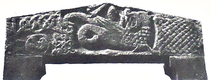
Catlow Spear.

Bennett (1957), goes on to say that: “The Middle Bronze Age saw a remarkable development in the technique of making bronze articles. Previously, the efficiency of a flat bronze axe head was much impaired because the cleft wooden handle to which the head was tied tended to break when a blow was struck; similarly, a flat spear head tended to break the wooden shaft. In the Middle Bronze period, the axe head was fashioned with flanges on the lateral edges and with a stop ridge on each of its faces so that the cleft wooden handle could be bound more securely to grip the head. In the case of the spear head, the smith made the head with a fairly long tang which was driven into the wooden shaft and secured by a bronze nail through a hole in the tang and a collar that fitted the shaft. Several axe heads with flanges and stop ridge have been found in this area but the most interesting is a spear head with holed tang, 9” long, that was found at Catlow in 1854; unfortunately, the bronze collar was not discovered. 

The general location of the destroyed tumulus at Catlow, near Nelson.

Probable location of the destroyed tumulus at Catlow, near Nelson.

“The custom of cremating the dead was introduced during the Middle Bronze period and quite a number of such burials have been excavated in this area. The excavations have shown that after the body had been burnt the calcined bone fragments were wrapped in a cloth and placed in an earthenware vessel, called an urn, which was then buried, often in an inverted position,   just below the surface of the ground. An area round the burial was then marked off by a circle of boulder stones and into this enclosure were thrown flint implements of all kinds, such as knives, scrapers, grain rubbing stones, arrow heads and broken querns. Such burial circles are almost invariably situated at the top of a hill. A burial of this kind was accidentally destroyed by workmen in 1854 at Catlow and the only important details we know about it are that it contained three urns of which one was a Middle Bronze type and the two others, both broken by a workman’s pick, were food vessels. An earth circle, fifty yards in diameter, which is situated at Broad Bank, overlooking Thursden Valley was excavated in 1951 but the only find was a stone axe head of the Middle Bronze period; a report on the excavation described the earthwork as possibly ‘”a religious enclosure.”‘

Bennett goes on to discuss the Late Bronze Age, saying that: “During the Late Bronze Age, the technique of bronze making was further developed so that both axe heads and spear heads were made with sockets into which the handle or shaft could be fitted. Only on example, a socketed spear head 2½ inches in length, has been found locally. It is said to have been found “‘near Pendle.”‘

“Judging from the many burials and the various types of implements, both bronze and flint, which have been discovered, it would appear that the Marsden and Burnley areas were relatively important in the Bronze Age. It is uncertain what could have attracted people to this area at that period since life in a hut on our moors could not have been very alluring to men and women who knew the arts of farming, weaving and pottery making, even though the climate was drier and more temperate than it had been in the Neolithic Age. That they did live in this district is evident from the finds of jet beads and jet rings (used as ornaments), spindle whorls, loom weights, saddle querns, grain rubbing stones, and implements of all descriptions that would be used in a settled community. The only probable reason for their long existence here seems to be that through this district passed one or two tracks which served as trade routes between the Lancashire coast and the Yorkshire coast. It is believed that the route from the west through northern England proceeded by the Ribble and Calder to Whalley and thence Old Read where a number of Early Bronze Age axes have been found, to Barrowford and Barnolds-wick, where a bronze sword has been found, and so continuing by the Aire Gap to Leeds and thence by river to the coast. Most probably, the flat axe  head discovered near Blacko Tower, is connected with this route. An alternative route from Old Read lay through Higham, Gannow, Towneley, Mereclough and thence by the Long Causeway to the Yorkshire Calder. Near this track several burial mounds and many flint implements of Bronze Age origin have been found. The existence of Bronze Age burials on Bleara Moor on the Colne to Skipton road, at Catlow, at Shelfield (possibly) and at Ell Clough above Thursden Valley may point to a pre-historic track connecting the Whalley-Barnoldswick-Leeds route with that between Whalley-Mereclough-Heptonstall.”

Catlow Row.

H. Hindle, writing a local magazine article called ‘Pre-History – Colne & Surrounding Areas’ in the 1980s, says that: “A Bronze Age dagger or spearhead was found in 1845 about 2½ ft from the surface in a field about halfway between Burnley and Colne in the Catlow district. The dagger had a narrowed  tange with a rivet hole and was just over 9′ in length; the tange was 3′ long and at its greatest width the dagger measured 1½’.The spear’s collar was not found. It seems this spear was, in fact, found underneath the forecourt of Catlow Row as those cottages were built in that very same year. Tanged daggers are extremely rare, being known chiefly from the Arreton Down deposit, Isle of Wight.”, says Mr Hindle.

Catlow artefacts. Top left/bottom (Wilkinson, 1857), top right (Bennett, 1946 & 57).

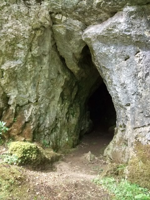
Hindle goes on to say, that: “The most interesting discovery, a burial site, was made at Catlow stone quarry in March 1854 by Captain Sagar’s workmen. Two or three earthenware urns were met with a little below the surface when clearing earth for the flagstone rock. The urns, probably Pennine collared type, were perfect and measured 14 inches in depth and 9 inches in diameter at the mouth, with considerable swelling at the centres. They are formed from very course earthenware unglazed and very slightly baked. The urns contained calcined bones, pieces of charcoal, and soft dark earth. Most of the bones, supposedly human, are mixed with others belonging to a horse and some lesser animals. Only one of the urns survived due to rough handling by the quarry workers at Catlow who damaged them with their picks; one of the urns was Middle Bronze Age in date, the other two were considered to be food vessels. A rude piece of flint was found amongst the bones, but from its decayed state, it is not easy to determine whether it had been an arrowhead. Two ivory bodkins were found at the same time; they were exceedingly friable, either from age or having been subjected to the action of a fire before being deposited in the urns.

I understand that in 1954 a Bronze Age urn was dug-up from beneath the stone forecourt at the front of Catlow Row. This urn was considered to be very similar to those ones found at Catlow quarry, close by. The urn remains ‘buried where it was found’ (in situ). 

The site entry (No. 19) for the parish of Nelson (Catlow Quarry) in the‘Lancashire Archaeological Bulletin’ (1984), says:- N.G.R. SD 885 368. Primary Reference: Wilkinson 1857; 428 P1. II. Waddington & Wilkinson 1887; 92. Disposition of Finds: Lost. 1854. apparently found by workmen. Two or three urns, cremations, flint, allegedly animal bones, two bone pins perforated at top.

John Dixon & Bob Mann (1990), says that: “In around 1854, workmen hewing stone from the Catlow Quarries came across the remains of three burial urns containing cremations. Two ivory bodkins were also found with the urns. Unfortunately these finds are now lost, but are mentioned and recorded in old texts. A Middle to Late Bronze Age date is ascribed to these finds.” 

John A. Clayton (2014) tells us that there was possibly a hill-fort or settlement of some kind (with a mound in the middle) at Catlow Bottoms, though this would no doubt date to the Iron Age? 

Location of circular features (beside a footpath), just north of Catlow Row.

Although the burial mound (tumulus) at or about SD 885 368 (north-side of Crawshaw Lane, just to the east of the World War II pillbox) was destroyed, there are some other “possible” faint circular features, which might or might not be of interest here. In the fields at either side of Catlow Row. North-side (above the trackway) two very faint circular features at NGR SD 88218 36635 and SD 88185 36542, while at the south-side of the cottages – three small circular features close by a house at NGR 88238 36434. At the northeastern end of Crawshaw Lane, just before you reach Delves Lane, two more “possible” faint circular features: NGR SD 88682 37091 and SD 88894 36867, while on the other side of the lane at the top of the field beside Delves Lane, near the wall stile there’s a faint mound at: NGR SD 89260 36930 and another close to that at: SD 89457 36834; these might be something or nothing, but worth considering. There might be others that I haven’t spotted! And we mustn’t forget there used to be a stone circle hearabouts on Ring Stones Hill (see link, below).

Bennett, Walter, The History of Marsden And Nelson, Nelson Corporation, 1957.

Clayton, John A., Burnley And Pendle Archaeology (Part One) Ice Age to Early Bronze Age, Barrowford Press, 2014.

Dixon, John & Mann, Bob, Historic Walks Around The Pendle Way, Aussteiger Publications, Barnoldswick, 1990.

Edwards, Margaret & Ben (Editors), Lancashire Archaeological Bulletin, Vol. 10, No. 2/3, May & July 1984.

Hindle, Herbert, Pre-History – Colne & Surrounding Areas (Magazine Article in Pendle & Burnley Magazine, Ramsbottom, Bury, Lancs, 1980s,

Ring Stones Hill, Catlow, Nelson, Lancashire

http://www.barrowford.org/page117.html

http://www.disused-stations.org.uk/features/catlow_quarries/index.shtml

© Ray Spencer, The Jourmal Of Antiquities, 2018.


The Advenctus Stone, St Madoc’s Church, Llanmadoc, Gower, West Glamorgan

Church of St Madoc at Llanmadoc by Richard Law (Geograph).

OS Grid Reference: SS 43889 93439. In the 12th century church of St Madoc at Llanmadoc –  at the far northwestern side of the Gower Peninsula, West Glamorgan, Wales, there is an early 6th century pillar-stone with a Latin inscription in memory of Advenctus. This was probably a grave-cover. There are two more ancient stones in the church – one with a carved cross. The font is Norman. The first church here at Llanmadoc was founded way back in the 6th century AD by St Madoc (Maedoc or Maodhoge), who had come from Ireland to Wales for his education – firstly under St David at Glyn Rhosyn and then under St Cenydd at Cor Llangennith; St Cenydd may have been his cousin? He is probably one and the same as St Aedan (Aidan), bishop of Fearns in Co. Wexford, Ireland, who died in 626. St Madoc was apparently co-founder, with St Cenydd, of the monastic college at Llangennith, a few miles to the southwest of Llanmadoc. To reach Llanmadoc it is best to come off the M4 motorway at Exit 47, then south onto the A483 and west on the A484 through the villages of Gowerton, Pen Clawdd, Crofty, Llanrhidian and Weobley Castle.

On a windowsill in the nave of Llanmadoc church there is a 27′ long graveslab with a crack at the top left-hand corner, and carved into this are Latin/Roman letters commemorating: Advenctus, Avectus or Vectus; the stone is said to date from 500 AD or thereabouts. In Latin the inscription reads: ADVECTI FILIUS GVAN HIC IACIT, which when translated is: ‘Advenctus, the son of Guanus, he lies here’. The inscribed stone was discovered built into the wall of the rectory in 1861, but was brought into the churchyard and then the church. But who was Advenctus? or Vectus? And who was Guanus? These questions ‘we’ don’t know with any certainty; they are names that are now lost in the mists of time. John Kinross (2007), speculates that Guanus was in fact St Govan, and he refers to Advenctus as Advestus! But could Advenctus have been the brother of St Padarn – as his mother was called Guean? It’s all purely speculation, but worth considering. And built into the west wall is a pillar-stone with two carved crosses that is thought to date from the 7th-9th century AD, and close to that a medieval stone pillar that may have been a boundary marker. Kinross also adds that a Celtic-style hand-bell was found in a field near the church; this is now at Penrice Castle! 

The Gower Society (1989), say with regard to the church, that: “The church of St Madoc is reputed to have been founded in the 6th century……and the present building is probably 13th century…..and is the smallest in Gower and the correspondingly small tower has the familiar combination of saddle-back roof and parapets. An extensive renovation in 1865, when the nave and chancel were considerably altered and the tower lowered, has left little of the original building. At that time the graveyard had risen as much as four feet above the floor of the nave, and even the chancel arch had to be reconstructed to level things up. The interior of the church is very dark, and must have been even darker when the east window was a single trefoil light; here are preserved a Norman font and a Roman-Celtic tombstone which was discovered in 1861 built into the wall of the Old Rectory. It is one of the few churches in Gower where traces of the paintings which originally decorated the walls were found when the church was restored. The Rev. J. D. Davies, the 19th century historian of West Gower, was Rector of Llanmadog and Cheriton for over fifty years.”

St Madoc (Maedoc) is a somewhat shadowy figure who was probably born in the North, the son of King Sawyl, in the early 6th century. Sawyl Benisel, father of St Asaph, was buried on Allt Cynadda, west Glamorgan, after he was killed in an attack on his camp, according to Chris Barber. St Madoc spent his early years in Connacht and Leinster in Ireland, but then came to Wales to study scripture under St David at Glyn Rhosyn in Menevia, and later under St Cenydd at the monastic college of Llangennith, which he may have co-founded. Some historians think he was related to St Gildas and St Cenydd (maybe a cousin), but that is questionable. Legend has it that St David died in the arms of St Madoc and, after St David’s passing, Madoc became abbot of Glyn Rhosyn, before returning to Ireland.

St Madoc, also known as Aedan, founded many churches in Wales including those at Bryngwyn, Clytha, Llanmadoc, Llanbadoc, Llanidan, Llawhaden and Great Rudbaxton (where there is holy well named after him). Many historians consider him to be one and the same as St Aidan (Aedan), who became bishop of Ferns, Co. Wexford. In Ireland [as St Aidan] he founded monasteries at Drumlane, Co. Cavan, Rossinver, Co. Leitrim, and Clonmore, Co. Carlow, as well as Ferns. He died aged over 100 at Ferns in 626 or 632 AD. His feast day is 31st January. He was apparently known for his kindness to the poor and was known to have given away his and others’ clothing to the needy, and lived on bread and water for many years, though it seems he was none the worse for this! Some of his relics lie in Armagh Cathedral and The National Museum, Dublin.

Sources and related websites:-

Barber, Chris, More Mysterious Wales, Paladin, London, 1987.

Kinross, John, Discovering The Smallest Churches In Wales, Tempus Publishing Limited, Brimscombe Port, Stroud, Gloucestershire, 2007.

Spencer, Ray, A Guide to the Saints Of Wales and the West Country, Llanerch Enterprises, Felinfach, Lampeter, Dyfed, 1991.

The Gower Society, A Guide To Gower, (Evan Evans, Bernard Morris, T. R. Owen & J. Mansel Thomas Edts), Gower Society, 1989.

Geograph photo no. 2684530 by Richard Law.  http://www.geograph.org.uk/photo/

http://www.ggat.org.uk/cadw/historic_landscape/gower/english/Gower_007.htm

http://www.explore-gower.co.uk/llanmadoc-church

http://www.waymarking.com/waymarks/WMKEK0_Pillar_Stone_Church_of_St_Madoc_Llanmadog_Gower_Wales

http://www.earlybritishkingdoms.com/bios/madocapn.html

http://stainedglass.llgc.org.uk/site/79

© Ray Spencer, The Journal Of Antiquities, 2018. 


1 Comment

The Dragon Stone, St Mary And St Bega’s Church, St Bees, Cumbria

View of St Bees priory church, Cumbria, by Samuel & Nathaniel Buck (1739) Wikipedia.

OS Grid Reference: NX 9685 1210. In an alcove of the churchyard wall of St Mary & St Bega’s church at St Bees, Cumbria, is a huge carved stone lintel, which was thought to date back to the 8th century AD? The stone has a very beautiful, but also quite curious, Anglo Saxon carving of a dragon being killed by St Michael the Archangel, and not St George – as was usually the case! Below this lintel stone is a carved Medieval cross. The stone, which is called ‘The Dragon Stone’ for obvious reasons, is also known as ‘The Beowulf Stone’. Inside the parish church, which has grown out of the ruins of the near-complete priory nave, are more interesting carved gravestones and crosses. The Benedictine priory was dissolved in 1538. St Bega (Bee) was a Legendary 7th century Irish princess who came here in order to avoid an unwanted marriage; she founded a nunnery in AD 650 at or close to where the present parish church now stands. The priory church can be found beside the B5345 (over the railway line) at the northwestern side of the village – in the direction of Rottington. The village of St Bees lies 3 miles west of Egremont.

The Dragon Stone at St Mary & St Bega’s Church, in Cumbria.

The Dragon Stone or Beowulf Stone is in an alcove of the churchyard (courtyard) wall, opposite the beautifully carved west door of c.1160. It is a huge, long lump of carved stone bearing carvings that were thought to date from the 8th century, but they are now considered to be from the Norman period – the early 12th century AD, and probably came from a much earlier church that stood here. These carvings are very well-preserved, despite their age. A ferocious looking dragon with its long curled tail is depicted about to be killed by St Micheal, who is cowering behind it with his sword raised in readiness. There looks to be another strange beast, perhaps a dragon, with a long curled tail behind the main dragon, but also a dove of peace inside a circle, which sort of balances things out between good and evil. The strap-work design at the right-hand side seems more like Celtic or Saxon, and certainly not Norman; and at the left-side are two small circles with knotted (connecting) cords running through that look like crosses and, below them another section of knotwork with loops and links. Beneath the lintel stone a round-headed medieval cross with shaped depressions forming the arms. Also out in the churchyard part of a 10th century cross-shaft with Late Saxon carvings and a serpent.

Arthur Mee (1961), tells of more about the village, St Bega, and its church, saying that: “Deep in a valley near the sea it lies, a grey village of much antiquity and charm. Its church is the oldest and finest in West Cumberland; its school is ancient, and so is its bridge; but the oldest of all is its delightful story of St Bega (or Bee) and how she got her nunnery. “

The church has grown from the church of a rich priory which began about 1125 as an offshoot of St Mary’s great abbey in York. The priory was built where the nunnery has stood (from the 7th century until the Danes destroyed it in the 10th), and this church is carrying on its ancient tradition. But the most interesting possession of St Bees is a relic of the nunnery itself, a remarkable stone believed to date from the eighth century.

The Dragon Stone.

“We see it in the wall between the churchyard and the vicarage, where it forms the lintel of an alcove. It is carved with an ugly dragon turning to snarl at a tiny armed figure attacking it from behind. One end of the stone is decorated with plaitwork, and with the knotwork at the other end is a very curious carving which looks like a boar’s head. Standing in the alcove is another relic, a stout stone cross on which the bearers of a coffin would rest their load.

“The cross-shaped church with its fine central tower has been altered in modern times, but the greater part was built only a few decades after the priory. It has a magnificent Norman doorway without equal for many miles. The arch has four rich chevron mouldings, beak-heads of men and serpents, and a ram; and carved on one of the capitals is a figure swinging like a monkey from the branches. Three trefoils on stalks make an unusual decoration at the top of the dripstone, and are perhaps meant to represent the Trinity. The oak door is modern, and has decorated hinges. “

Among the stones kept here as relics are a stoup, a piscine, and a mortar, all of the 12th century. Others are probably parts of still older cross-shafts with primitive carving, and one is the upper part of a 10th century shaft decorated on each side with chain and scroll. There are coffin stones 800 years old, carved with crosses and swords and shears: a very fine one engraved with an archer drawing his bow, an elaborate 13th century stone, and another charmingly engraved with the portrait of 14th century Johanna Lucy in a graceful gown her hair in plaited coils.”

Arthur Mee (1961), goes on to tell of St Bega, patron saint of St Bees, saying that: “She was an Irish princess who lived in the 7th century. As a child she made up her mind to serve God and not to marry, and as a pledge of her determination she kept a bracelet said to have been given to her by an angel. But she was the most beautiful woman in the country, and her father betrothed her to a Norwegian prince. Bega (as she was often called) was guarded so that she should not run away, but on the eve of the wedding everyone joined in the merrymaking and she was able to escape, crossing the sea to Northumbria.

“Legend tells us that she was well received by a great lady there, who asked her husband to give her land for a nunnery. He jokingly said he would give as much land as was covered by snow on Midsummer day, and on that morning there was snow for three miles round. Snow has been known on Cumberland mountains on Midsummer day, and possibly the story grew up as an explanation of the irregular shape of the parish. Bega built her nunnery, serving food to the workers with her own hands. As abbess she cared for the sick and poor of the district and became greatly loved.

“Those who declare that there was no Saint Bega assert that the origin of her story is to be found in a ring keep at St Bees until the 13th century, venerated as the bracelet given to Bega by the angel. Actually this was a Norse ring from a pagan temple, taken into the Christian church and referred to as Sancta Bega, Latin for Holy and Anglo-Saxon for Ring; a misunderstanding of these words would account for belief in a saint named Bega. But it is likely that Bega was a real abbess, for the people of north-east England long looked upon her as the protector of the oppressed and the poor.”

Maxwell Fraser (1939), says that: “It has since been demonstrated that no St Bega had any connection with the site, although there was undoubtedly a pre-Norman church there.” W. T. Palmer (1939), adds to the legend of St Bega, saying that: “The place was Christianised by St. Bega, who had been promised all the land that snow lay on, on Midsummer morning. A space of 16 m. by 10 m. was clad in white, and had to be handed to her. In time monks took the place of nuns, and the Prior became one of the most powerful men in the North, though his church and estate were constantly being raided by Scots and by pirates.”

In recent times scholars and historians have considered Bega to be identical with Begu, a 7th century Northumbrian nun and friend of St Hilda. It was Begu who, looking out of her nunnery window at Hackness, had a vision of the soul of St Hilda floating (ascending) up into the night sky and heaven at the very same moment that the saintly abbess had died at Whitby mona-stery, on 17th of November, 680 AD, according to The Venerable Bede’s History. Her death also being recorded in ‘The Anglo Saxon Chronicle’. A passage concerning a bell being tolled for her passing is the first written mention of a bell in recorded history, according to Colin Waters (2003). David Farmer (1982), with regard to St Bee & St Begu being one and the same person, gives the feast-day of St Begu as 31st October. He also says that a sarcophagus containing the bones of St Begu was found at Hackness (c.1125) by the monks of Whitby – after it had been miraculously revealed to them. It was inscribed: Hoc est sepulchrum Begu. These relics were translated to Whitby Abbey where miracles were reported, but another set of relics was claimed by St Bees, says Farmer.

Sources & Related Websites:-

Bottomley, Frank, The Abbey Explorer’s Guide, Kaye & Ward, London, 1981.

Farmer, David, The Oxford Dictionary of Saints, Oxford University Press, 1982.

Frazer, Maxwell, Companion Into Lakeland, Methuen & Co. Ltd., London, 1939.

Jennett, Seán (Editor), The Travellers Guides — The Lake District, Darton, Longman & Todd, London, 1965.

Mee, Arthur, The King’s England — Lake Counties — Cumberland And Westmoreland, Hodder & Stoughton, London, 1961.

Palmer, W. T., The Penguin Guides (Edt. by L. Russell Muirhead), Lake District, Penguin Books, Harmondsworth, Middlesex, 1939.

https://en.wikipedia.org/wiki/St_Bees_Priory

https://www.britishlistedbuildings.co.uk/101336027-church-of-st-mary-and-st-bega-st-bees#.WwSbT7uG9jo

http://www.stbees.org.uk/churches/priory/index.html

https://www.stbeghschurch.co.uk/Articles/249205/St_Beghs_Priory/About_us/History/Father_Gregory_Holden/BENEDICTINES_IN_WHITEHAVEN.aspx

St. Bees Priory

© Ray Spencer, The Journal Of Antiquities, 2018.


1 Comment

Chapel And Fountain: Saint-Anne-La-Palud, Finistere, (Bretagne) Brittany

Chapelle-de-Sainte-Anne-la-Palud by GO69 (Wikimedia Commons).

Latitude: 48.135994. Longitude: -4.262185. At the western side of the little Breton village of Saint-Anne-la-Palud in Plonevez Porzay, Finistere, Bretagne (Brittany), 4 miles northwest of Locronan, is the large 19th century Gothic Catholic chapel and pilgrimage centre dedicated to St Anne, mother of the Virgin Mary. The chapel (Kerk) is actually a basilica, and is located on Sainte-Anne la Palud road. There have been several chapels on this site – the first founded by St Guenole in the 6th century may have been nearer the shoreline, in the marshes. To the south of the chapel on Sainte-Anne la Palud road, is St Anne’s Fountain (Fontaine de Sainte-Anne), which has been visited for its miraculous properties for hundreds of years by the faithful from the local area and further afield. A few hundred meters to the west is the coast and beyond that the Atlantic Ocean.

Legend tells us that St Anne or Ana was an Armorican (Breton) woman of noble birth who journeyed to Judea where she gave birth to her daughter, Mary. She is said to have been transported there by angels. Later, she returned to Brittany (after Jesus’ birth) and died there? But this Legend seems to be purely a Mythical one, or it was adapted from the Life of another Breton saint Anna (Ana). In Ireland the Celtic goddess Annu (Danu) of the Tuatha De Danann, seems to have metamorphosed into St Anne. Annu was celebrated in May, according to Colin Waters (2003).

The first pilgrimages to Sainte-Anne la Palud may have began way back in the 5th or 6th century at the behest of the two local saints: Corentin and Guenole. Land for the building of the first chapel dedicated to St Anne was given to St Guenole by King Gradlon. The present-day chapel dates from 1864. In more recent times: from the 17th century onwards pilgrimages have become more prevalent as have the ‘pardons’ in honour of the saint which take place in the sanctuary of the chapel in late July (small pardon), culminating in the ‘Great Pardon’ on the last weekend of August, each year. Then the procession through the village begins and is always well-attended by the local community. During the ‘Great Pardon’ a painted statue of the patron saint, made of granite and dating from 1548, which is much venerated here, is held aloft and carried on its processional journey through the village from the Chapelle Ste-Anne to the 17th century Calvary and, eventually to the Fontaine de Sainte-Anne. 

Michelin (1983), says with regard to the pardons: “The Breton pardons are above all a manifestation of religious fervor. They take place in the churches and chapels, sometimes consecrated by the tradition of a thousand years. There the faithful come to seek forgiveness for their sins, to fulfill a vow or to beg for grace. The great pardons are most impressive, while the smaller, though less spectacular, are often more fervent. It is well worth the tourist’s while to arrange his trip so that he may be present at one of them. It is also one of the rare occasions when he will see the old customs, perhaps slightly modernized. The procession, which begins in the afternoon, is the most curious ceremony: candles, banners and statues of saints are carried by men and girls; with pilgrims singing hymns, priests, the Blessed Sacrament, and sometimes even several bishops. After the procession, the lay festival is given free rain. As a rule this is a rather ordinary fair. Modern dancers are taking the place of the gavotte but bagpipes and bombards still hold their own against accordions and jazz. Sometimes there are wrestling matches, for wrestling is a traditional sport of the Breton peasants.”  

Virgin & child with St Anne by Otto Bitschnau (1883).

Michelin Guide (1983), says with regard to St Anne, the patron of Saint-Anne la Palud that: “The Cult of Saint Anne was brought to western Europe by those returning from the Crusades. Her eager adoption by the Bretons was in part due to the popularity of the Duchess, Anne of Brittany and her later renown. Patroness of Brittany and mother of the Virgin Mary, Saint Anne was originally invoked for a good harvest. The most famous pardon in Brittany, that of Ste-Anne-d’Auray, is dedicated to her, so is the very important one of Ste-Anne-la-Palud and hence the local saying, “‘Whether dead or alive, every Breton goes at least once to Saint-Anne.”‘ A doubtful legend makes St Anne a Cornouaille woman of royal birth who was taken to Nazareth by angels to save her from her husband’s brutality. After having given birth to the Virgin Mary she returned to Brittany to die. It was Jesus who, when visiting his grandmother, called forth the sacred spring of Ste-Anne-la-Palud. The statues usually portray her alone or teaching Mary to read, very often wearing a green cloak symbolizing hope for the world.”  

C. P. S. Clarke (1919), says: “St. Anne was the mother of the Blessed Virgin Mary. The only authorities for her life are the references in three of the Apocryphal Gospels. Her name does not occur in Christian literature until the fourth century. She is said to have been the wife of a rich man named Joachim, but was childless for many years. One year when they came to the Temple for the dedication festival Joachim was upbraided by the high priest for his childless condition. Cut to the heart, and not daring to face the taunts of his neighbours, he disappeared into the wilderness for forty days, and gave himself up to prayer and mourning. Meantime St. Anne remained in Jerusalem. Each had a vision of angels promising a daughter, who was to be called Mary, and was to be dedicated to God from her birth. Many miracles were attributed to her in the Middle Ages, but the observance of her festival was not imposed by authority until 1584. Feast-day July 26th.” 

Rev. Alban Butler (1936), says under the entry for July 26 that: “The Hebrew word Anne signifies gracious. St Joachim and St Anne, the parents of the Blessed Virgin Mary, are justly honoured in the church, and their virtue is highly extolled by St John Damascen. The Emperor Justinian I built a church at Constantinople in honour of St Anne about the year 550. Codinus mentions another built by Justinian II in 705. Her body was brought from Palestine to Constantinople in 710, whence some portions of her relics have been dispersed in the West. F. Cuper the Bollandist has collected a great number of miracles wrought through her intercession.” 

David Hugh Farmer (1982), says of St Anne: “Relics of her were claimed by Duren (Rhineland) and Apt-en-Provence, by Canterbury, Reading, and Durham. The most famous shrine in her honour in England was at Buxton. The Cult has left literary record in three Middle English Lives. It was, and still is, especially popular in Brittany and Canada. Feast 26th July (with S. Joachim); in the East, 25th July.” Henri Queffelec (1972), says regarding Anne Le Berre: “Anne is a name which is given to both men and women in Brittany. St Anne, the mother of the Blessed Virgin Mary, is the Patron Saint of Brittany and the object of special veneration, called pardons in villages like Sainte-Anne-d’Auray and Sainte-Anne-la-Palud.” 

Fontaine de Saint-Anne-la-Palud by Leon Gaucherel 1844.

Fontaine-de-Sainte-Anne or St Anne’s Fountain is about one-hundred metres to the south of Chapelle-Ste-Anne – at the south-side of the road, beside a wooded area. This originated as a spring of water which flowed at the bidding of Jesus, according to the Legend, when he apparently visited, with St John, his grandmother’s place of birth, or maybe she was still living when he came to visit her? The spring or well has been the site of miraculous cures down through the centuries and a place of pilgrimage for the faithful since very early times. It has been claimed that many, or all diseases, were able to be cured by the waters of the holy fountain, but rheumatism being one in particular. Madness and evil were also healed and warded off by the water. A statue of St Anne, on a plinth, with a young Mary at her side stands looking down over the well basin, the present structure of which dates from  1871. The local church pardons process here to the Fontaine-de-Sainte-Anne every year in Late July (small pardon) and the last weekend in August (the Great Pardon).


Sources and related websites:-

Butler, Alban (Rev), The Lives of The Fathers , Martyrs And Other Principal Saints, Volume III, pages 839-40, Virtue & Company Limited, London, 1936.

Clark, C. P. S., Everyman’s Book Of Saints, A. R. Mowbray & Co Ltd., London, 1919.

Farmer, David Hugh, The Oxford Dictionary of Saints, Oxford University Press, 1982.

Michelin, Tourist Guide – Brittany, London & Clermont Ferrand, France, 1983

Queffelec, Henri, Un Recteur De L’ile De Sein, George G. Harrap & Co. Ltd., London, 1972. Originally pub. in French Language (1945) by Éditions Stock.

Waters, Colin, A Dictionary Of Saints Days, Fasts, Feasts And Festivals, Countryside Books, Newbury, Berkshire, 2003.

Photo by GO69    https://commons.wikimedia.org/wiki/Category:Chapelle_de_Sainte-Anne-la-Palud

https://fr.wikipedia.org/wiki/Chapelle_Sainte-Anne-la-Palud

https://en.wikipedia.org/wiki/Saint_Anne

http://www.infobretagne.com/sainte-anne-la-palud.htm

http://fontaines.bretagne.free.fr/presentation2.php?id=95

© Ray Spencer, The Journal of Antiquities, 2018.


9 Comments

St Corentin’s Chapel, I’le de Sein, Finistere, (Bretagne) Brittany

St Corentin’s Chapel on I’le de Sein, by Ji-Elle (Wikimedia Commons)

Latitude: 48.041993. Longitude: -4.867500. At the far northwestern side of the I’le de Sein at the sacred place called Goulénez, just 8 kms off the Finistere Coast at Pointe de Raz, (Bretagne) Brittany, stands the restored chapel dedicated to St Corentin (Cury), a 5th century Celtic saint who became bishop of Quimper; he was apparently also the adviser and confessor of King Gradlon le Grand – whose Breton kindom of Caer Ys (or Is) was both legendary and almost certainly, mythical. Quimper eventually being the location of his new royal palace. The lonely little chapel, of ancient origins but restored in the early 1970s, is a short distance from the rocky seashore of the island’s northwest coast. There is also a holy well/spring and close to that is the ‘Hermit’s Garden’. St Corentin’s Chapel and holy well have long been a place of pilgrimage and veneration for the islanders themselves, but further back into the mists of time the island was home to the druidic priestess, Velleda, and then the Romans probably camped on the island, which ‘they’ were to call: Insula Sena. To reach the site: follow the Route du Phare coastal path around the north and northwest side of the island.

The Insight Guide (1994), says of the island: “Bretons call Ile de Sein Enez Sun, and it is suggested that this helps to identify it as the Isle of the Dead, a burial place of the druids. It is also said to be the Romans’ Insula Sena, a mysterious island where sailors used to consult an oracle tended by nine priestesses.”

The Insight Guide (1994) adds: “The home of King Gradlon, Is, was protected by a dyke and the key to its gates was always carried by the king. His daughter, named variously as Dahut or Ahés, had become attracted by the Devil in the shape of a handsome young man. The Devil requested that she steal the key to the gates that protected a dyke surrounding the king’s palace at Is. At the Devil’s request she stole the key and opened the gates allowing the sea to pour into the city. King Gradlon managed to escape on his horse with his daughter clinging onto him for dear life, but a voice from heaven informed him that he could only be saved if he ditch this evil spirit. He did this, and the sea withdrew, but his kingdom of Is was completely submerged and destroyed.

“The king then chose Quimper as his new capital for the kingdom of Cornouaille, and his statue stands between the two towers of the cathedral. For the rest of his days, he lived a life of holiness and piety, helped by the first bishop of Cornouaille, St Corentin. As for his daughter, Dahut, she became a mermaid (siren) known as Marie-Morgane, and today still lures sailors to watery graves,” according to the Legend.

The Insight Guide (1994) goes on to say that “As for St Corentin, he is remembered for his diet, which consisted purely of the flesh of one miraculous fish. Each day he would eat half of the fish and throw the rest back into the river, only to find it restored to full size the following day. Corentin was one of the first Celtic religious leaders to move to Brittany in the 5th century and, like the others, he became a saint.”

David Hugh Farmer (1982), says of St Corentin that he was: “Cornish founder and patron of Cury in the Lizard. He was a Celtic hermit who later became a Bishop in Brittany. An ancient cross stands near his church; in 1890 a fresco was discovered in Breage (the mother-church of the Lizard), which depicts him in cope and mitre with a pastoral staff. Beside him is a fish, from which he was reputed to have cut and eaten one slice each day, without any diminution in the size of the fish. An ancient Breton cult in his honour was revived by a private revelation in the 17th century, when several old shrines there were restored. His feast (translation?) at Quimper is the occasion for presents of blessed cakes. Ancient feast: 1st May.”

Map of I’le de Sein (North)

St Corentin or Corentinus, was a native of Armorica (Brittany), but he may have visited the southwest of England and maybe Wales at some point. At least one church is dedicated to him at Cury in Cornwall, where he is called St Cury. However, he was more likely a hermit living on the I’le de Sein (440 AD), a small island in the Atlantic, just off the Finistere coast, and later at Plomodiérn near Ménéz-Hom in Crozon. St Guenole (Winwaloe) was his disciple. Indeed, St Guenole also has a church dedication on the island. Corentin established a hermitage and church on the island and imparted his holiness into the waters of a well there. The site being of pre-historic importance. A modern wood statue of the saint stands inside the tiny chapel along with one of the Virgin Mary, and other Breton saints. Eventually, King Gradlon installed Corentin as first bishop of Quimper, in Cornouaille; the Cathedral of St Corentin now stands on the site of his church. He died at Quimper in 460, 490 or 495 AD. His feast-days are 1st May (translation) and 12th December.

Henry Queffélec (1945 & 1972), says of St Corentin’s hermitage on I’le de Sein: “the Chardin an Iarmit, or “‘Hermit’s Garden”‘, was situated on the western end of the ile de Sein next to a small chapel dedicated to St Corentin. Although the chapel has now fallen into ruins the site is still regarded by the people of Sein as a place of pilgrimage and special veneration. Cambray in his Voyage dans le Finistère of 1794 described the chapel and garden.”

Queffélec adds that: “There is no evidence whatsoever that the chapel dedicated to St Corentin was ever destroyed by fire or that its stones were used to build another church on the island. This chapel, unfortunately, has simply been allowed to fall into ruins and very little remains of it today.”  [The chapel was, however, rebuilt in 1971 by the people of the island and the priest.] 

He also adds more information with regard to the History of the island, saying that: “In early times, the ile de Sein was thought to be the haunt of supernatural beings. In the first recorded mention of the island in 43 A.D, in the work of the Roman geographer, Pomponius Mela, we are told that the Insula Sena possessed an oracle which was served by nine vestal virgins who had the capacity to control the elements and cure the apparently incurable. This tradition is later exploited by Chateaubriand in Book IX of Les Martyrs (1809) in his description of the sacrificial activities of the Celtic druidess Velleda some of which take place on the “‘ile de Sayne, ile venerable et sacrée”‘. In the Middle Ages , the ile de Sein is caught up in the Arthurian legends and according to some  storytellers, is the birthplace of two of the most accomplished magicians, the wizard Merlin, and Morgan La Fée.” 

Sources and related websites:

Insight Guide, Brittany, (Ed. by Brian Bell), APA Publications (HK) Ltd., 1994.

Farmer, David Hugh, The Oxford Dictionary of Saints, Oxford University Press, 1982.

Queffélec, Henri, Un Recteur De L’ile De Sein, George G. Harrap & Co. Ltd., London, 1972. Originally pub. in French Language (1945) by Éditions Stock.

https://commons.wikimedia.org/wiki/Ile_de_Sein

https://en.wikipedia.org/wiki/Corentin_of_Quimper

https://en.wikipedia.org/wiki/%C3%8Ele_de_Sein

La chapelle St Corentin

https://www.breizh-poellrezh.eu/bretagne/%C3%AEle-de-sein/

http://www.earlybritishkingdoms.com/bios/gradlmby.html

© Ray Spencer, The Journal Of Antiquities, 2018.


1 Comment

Dolmen of Fontanaccia, Plain of Cauria, Corsica, (France)

Dolmen of Fontanaccia, Corsica, by Cardioceras (Commons Wikimedia)

Latitude: 41.529559N. Longitude: 8.918266E. On the Plain of Cauria (Plateau de Cauria) 15 kms southwest of  Sartè (Sartène) on the Island of Corsica, (France), stands the most famous Corsican Megalithic structure: the Dolmen of Fontanaccia, Funtanaccia Dolmen, or ‘Stazzona  del Diavolu’ (the Devil’s Forge), which dates from the late Neolithic/early Bronze Age. This very important prehistoric burial chamber (table tomb) is located in the Dept: Corse-du-Sud, near the end of the D48A road, southwest of Sartène, and near to Tizzano on the southwestern coast. From Sartène follow the D21, D48 and D48A roads going southwest to the megalithic monument. The Dolmen of Fontanaccia with its huge, flat capstone-table and six massive stone supports, is thought to be up to 4,000 years old (the 2nd -1st millennia BC). About ½ a km to the northeast of the dolmen is ‘The Alignment de Stantari’, a group of fifteen menhir statues, while 1 km to the south of those another prehistoric site composed of forty-six standing stones known as ‘The Rinaghju Alignment’.

Olivier Jehasse (1992) says of this prehistoric site that: “Between Sartè and the sea, left of the valley which arrives as far as the port of Tizza (Tizzano), extends the high plain of Cauria, an old place of the prehistoric period. This place overhung by a granite mass is above all famous for the Dolmen of Fontanaccia, that the popular tradition transmitted in the last century by P. Merimee, calls ‘”A Stazzona d’U Diavulu”‘ (the forge of the devil). This beautiful monument, well conserved, is composed of 6 slabs which support a table 3.40 meters long and 2.60 meters wide. The room sitting approximately 40 centimeters deep in the earth measures 2.60 meters long, 1.60 meters wide and 1.8 meters high. These funereal buildings, of which a dozen examples are known in Corsica and scattered in all of the western world, are slightly older than the Casteddi which are characteristic of the island’s prehistoric era.  If their roles in the rural communities of the 2nd and 1st millennia B.C. are difficult to understand, the presence of such monuments, in the middle of the plains, or in the hills or at a peak’s edge, bear witness to the presence of social structures on the island, magnified by these collective tombs, dating to late antiquity.”

Jehasse (1992) adds more with regard to the Bronze Age in Corsica, saying that: “Starting from 2200 B.C., the Bronze Age makes a turning point for architectural invention. This island is covered with castles, fortified complexes, and huts grouped around circular or rectangular buildings having various functions. Very well preserved in the south and in the regions of Porti Vecchju, Livia, and Taravu, these complexes are also to be found in Balagne, in the Golu Valley near Ponte Leccia, in the Niolu region and in the hills overlooking the Aleria hinterland. The appearance of these complexes, moreover, is a sign of the transformation of this island society, where human groups differentiate themselves one from another. This evolution is still more clear cut in the area of religion. Collective funerary monuments Stazzoni or dolmens were built. Southern Corsica is once again the region richest in vestiges of these monuments: Stazzona of Funtanaccia and Cardiccia near Sartè, the Stazzona at Taravu and Stazzona of Appiettu near Alacciu. They are also to be found in the northwest in the Agriate region near the village of Santu Pietru of Tenda and in the Niolu region near the village of Albertaccia. This presence of death in monumental form on the peaks and in the highlands is one of the hallmarks of this epoch.”  

About 1 kilometer to the northeast of the dolmen, at the center of the Caurian plain, is another prehistoric site called: ‘The Alignment de Stantari’, a group of fifteen granite menhir statues. These strange carved stones were probably erected some-where between the 13th and 7th centuries BC? Stantari meaning “man on his feet” in the island’s language. The stones measure between 2.78 and 2.91 in height. And another 1 kilometer to the south of these statues is yet another prehistoric site: ‘The Rinaghju Alignment’, which is composed of forty-six granite standing stones in two parallel rows. The tallest stone being 1.50 meters high, according to Olivier Jehasse in her work of 1992.

Sources and related websites:

Jehasse, Olivier, Corsica – Island of beauty, (English Translation: Ilene Steingut), Edition: Plurigraf, Narni – Terni, Italy, 1992.

Photo of Dolmen of Fontanaccia by Cardioceras at:-  https://commons.wikimedia.org/wiki/

https://www.google.co.uk/search?q=The+Dolmen+of+Fontanaccia+in+Corsica+(Wikimedia)&dcr=1&tbm=isch&source=iu&ictx=1&fir=ASbisxkJrL1XIM%253A%252CpTPng18DJJg4KM%252C_&usg=__vaeUDHgVv13_Xpkjoa7G0YoN3Co%3D&sa=X&ved=0ahUKEwiig_T_qq7aAhVIPBQKHb9kCckQ9QEIQzAE#imgrc=ASbisxkJrL1XIM:

https://translate.google.co.uk/translate?hl=en&sl=fr&u=https://fr.wikipedia.org/wiki/Dolmen_de_Fontanaccia&prev=search

http://www2.culture.gouv.fr/public/mistral/merimee_fr?ACTION=CHERCHER&FIELD_1=REF&VALUE_1=PA00099114

http://www.megalithic.co.uk/article.php?sid=9501

http://www.megalithic.co.uk/article.php?sid=9519

© Ray Spencer, The Journal Of Antiquities, 2018.


Pompey’s Pillar And Sphinxes, The Serapeum, Alexandria, Egypt

Pompey’s Pillar and Sphinx at Alexandria in Egypt.

Latitude:31.182515  Longitude:29.896394. On the rocky hill called ‘The Serapeum’ near the center of Alexandria, Egypt, are three monuments dating from the Roman period. The ornate granite ‘triumphal pillar’ or monolithic column (over 20m high) has wrongly been called ‘Pompey’s Pillar’ (it was probably erected to honour the Emperor Diocletion (297-300 AD) when he saved the city from famine. The pillar is also known as Awud as-Sawari (The Horseman’s Pillar). The two monuments (at either side) are Roman copies of the Sphinx, although much smaller than the more well-known Great Sphinx at Giza. Both are made from pink granite and of an earlier date than the pillar; they show the body of a lion and the head of a man. The Serapeum, at the south-west side of the city, on Shari Amûd al Sawari, northeast of the Catacombs of Kom al Shuqqafa, was the site of the Temple of Serapis and the Sanctuary and Library buildings, which were built either by Ptolemy I or III, the ruins of which are now the Acropolis Archaeological site. The  city of Alexandria was conquered by Rome in 30 BC. Pompey the Great was murdered in Egypt (48 BC).

Old Postcard showing Pompey’s Pillar at Alexandria, Egypt.

The Insight Guide – Egypt (1988) says of the site that: “Long before Alexander arrived on the scene, this hill was the citadel of Rhakotis, dedicated to the worship of Osiris. The Ptolemies in their turn built a temple of Serapis on its summit. Here, with a collection of 200,000 manuscripts given to her by Mark Antony, Cleopatra endowed the second great Alexandrian library, which was to remain attached to the Serapeum until the temple itself was destroyed by a Christian mob; and thus here, for 400 years, was the most learned spot on earth. Today not much of the Serapeum remains: some tunnels in the rocks with crypts and niches and a few marble pillars. What the Christians wiped out in 391 A.D. later vicissitudes have put paid to. But the principal attraction, a solitary 72-foot (22 meter) high pillar of pink Aswan granite, seems to touch the sky defiantly and when European travelers arrived in the 15th century it caught their attention. No scholars they, but since they had heard of Pompey, they named the pillar after him and said his head was enclosed in a ball at the top. It actually has nothing to do with Pompey: according to an inscription on its base, it was dedicated to the Emperor Diocletian in 297 A.D. and it may once have had an equestrian statue on top, which would explain its Arabic name. Even less is left of the temple to Isis that once stood on the hill than of the Serapeum. You can see a statue of Isis Pharia, found near the site of the Pharos, as well as two granite sphinxes.”  

Alice Taylor (1964) adds to that that: “Among the best-preserved remains of the Roman period in Alexandria are Pompey’s Pillar and the sphinx. The red granite pillar, eighty-five feet high, was erected by Diocletian in 297 A.D. Excavations here have unearthed dozens of fragments of other Roman objects and buildings, but they are only fragments.”

And Taylor (1964) also says that: “In the last years of the Ptolemaic era a succession of rival rulers, constantly at war with each other, fell under the rising power of Rome. Cleopatra VI, the last of them, a woman of remarkable ability, tried her best to save the dynasty.”

And further to that Alice Taylor adds with regard to Egypt that: “Most of the Roman rulers, like the Greek, considered Egypt a “”cow to be milked””, although at times the people appear to have been fairly prosperous. Gradually, despite persecutions, Christianity gained converts. Many sought refuge in the harsh lonely desert, where they created the world’s first Christian monasteries. Later, Christianity became the official religion, known as the Egyptian (Coptic) Church, and the non-Christians in turn were persecuted.”

View of Pompey’s Pillar c 1850. (Wikimedia).

Edith Flamarion (1997) writes regarding Pompey the Great that: “One man especially became the champion of Egyptian independence: the roman imperator (commander) Pompey the Great, wreathed in glory after suppressing a revolt in Rome, clearing the Mediterranean of pirates, and crushing the powerful Asian king Mithradates. In 64 BCE he over-threw the Seleucid kingdom; the following year, he reduced Syria to the status of a Roman province—thereby creating a Roman stronghold in the Middle East, at the gates of Egypt—and took Jerusalem. Auletes made an alliance with Pompey, sending him 8,000 cavalry for his wars and many gifts, among them a heavy gold crown. 

In 60 BCE, though, the pharaoh had reason to tremble, for Pompey allied himself with Julius Caesar, who became consul the following year. The Egyptian king sent to Rome the huge sum of 8,000 talents, which brought him official acknowledge-ment of his authority. Julian law declared Ptolemy XII Auletes “”an ally and friend of the Roman people,””  which made him, in reality, a vassal.

“The looming military presence of Rome may have alarmed the Alexandrians, who rebelled against the ruler. Driven out by his subjects, Auletes fled Egypt for Rome. There, beginning in 57 BCE he launched a campaign of politicking and corruption, seeking to regain the throne of Egypt and to rally to his cause every powerful citizen of the Roman capital. Auletes bribed senators, spending so much that he was obliged to borrow from Rabirius, a wealthy Roman financier. 

“In the meantime, the Alexandrians put his eldest daughter, Berenice IV, on the throne, and sent a delegation to Rome to request the Senate to arbitrate the conflict between father and daughter. While Rome hesitated, equivocated, and consulted sacred texts, Auletes simply arranged to have a number of the delegates assassinated. But Rome was reluctant to commit a large armed force to returning Auletes to power. In despair, the deposed pharaoh left Rome for Ephesus, in Asia Minor. Cleopatra, then about ten years old, remained in Alexandria, where her half-sister now reigned.

“It was then that Rome decided upon a military intervention. One of Pompey’s lieutenants, Gabinius, governor of Syria, marched on Egypt at the head of a mighty army—an expedition in which the ten thousand talents promised by Auletes undoubtedly played a part. Leading the cavalry was a fiery twenty-four-year-old officer named Mark Antony. Gabinius took Pelusium, then Alexandria; Archilaus, Berenice’s husband, died in combat. Auletes entered the Egyptian capital as its conqueror, and immediately had his daughter executed.

“With the pharaoh back on the throne, Gabinius quit Egypt, leaving behind a military guard composed in the main of German and Gallic mercenaries. The Roman Rabirius, Auletes’ creditor became his prime-minister in Egypt.”” And the rest ‘they’ say is History! 

Sources & Related Websites:

Flamarion, Edith, Cleopatra – From History to Legend, (New Horizons), English Translation – Harry N. Abrams, Inc., New York, 1997.

Ingram, David, (Insight Compact Guide), Egypt,  APA Publications GmbH & Co. Verlag KG Singapore, (Reprint 2008).

Taylor, Alice, United Arab Republic, (Around The World Program), Nelson Doubleday, Inc And Odhams Books Ltd., 1964. 

Youssef, Hisham & Rodenbeck, John, (Insight Guides – First Edition Reprint), Egypt, Hans Johannes Hoefer, APA Publications (HK) Ltd., 1988.

https://commons.wikimedia.org/wiki/File:

https://en.wikipedia.org/wiki/Pompey%27s_Pillar_(column)

https://www.ask-aladdin.com/Alex-Travel-Information/PompeyPillar.html

Serapea of Ancient Egypt

Alexandria: City of Lost Glory

© Ray Spencer, The Journal Of Antiquities, 2018.


The Coronation Stone, Kingston Upon Thames, Greater London

The Coronation Stone at Kingston-Upon-Thames.

OS Grid Reference: TQ 17867 69069. On High Street, just opposite the Guild Hall, in the town centre of the south London suburb of Kingston-Upon-Thames, Greater London, is the 10th century stone monument known as ‘The Coronation Stone’ or ‘The King Stone’. Traditionally seven, or maybe eight, Anglo-Saxons kings (AD 900-1016) were crowned whilst seated upon the stone. This 3½ foot high block of grey-black sarsen stone ‘now’ stands on a grassy area of land close to the Hogsmill River, and is surrounded by ornate blue Victorian railings. The Greater London suburb of Kingston-Upon-Thames, once part of Surrey, obviously taking its name from the stone that has, from an early date, also been called the King Stone or King’s Stone. Originally it stood in the ancient Chapel of St Mary (which had fallen into ruin by 1730) and, in 1850 the Market Place, but in 1936 it was moved to its present position on the High Street; though it could be moved again in the near future to All Saints Church, a building which also has ancient origins.

Coronation Stone, Kingston-Upon-Thames (photo by Philip Halling – Geograph).

According to tradition seven Anglo Saxon kings of Wessex and Mercia were crowned on the Coronation Stone in the ancient Saxon Chapel of St Mary Magdalene which stood in the grounds of All Saints Church, Kingston-Upon-Thames, in the 10th century: Edward the Elder (8th June, 900), Aethelstan (4th Sept, 925), Edmund I (29th Nov, 939), Eadred (16th Aug, 946), Edwy also known as Eadwig (26th Jan, 956), Edward the Martyr (975), Ethelred the Unready (April 978) and, possibly Edmund Ironside (14th Apr, 1016)? However, it is known from History that a couple of these kings were ‘not’ crowned at Kingston-Upon-Thames, as was often thought. King Edgar, who is not in the list above, was crowned at Bath (959), and King Edmund II (Ironside) often thought to have been crowned at Kingston was, in fact, crowned in the ancient 7th century Saxon St Paul’s Church, London, the forerunner of the present-day St Paul’s Cathedral. The first St Paul’s church to be styled as a Cathedral was not built until 1087 AD.

The Coronation Stone, which is probably a lump of prehistoric sarsen stone, sits upon a large, modern granite base-stone which has the names running round it (in large lead letters) of the seven kings whom its thought were crowned whilst seated upon the stone – at various dates between AD 900 and 978, but in more recent times it was used as a mounting block for horses! The badge or coat of arms representing the Royal Borough of Kingston-Upon-Thames displays three salmon symbols, and can be seen at many strategic points in and around the town. 

Janet & Colin Bord (1991) say with regard to The King Stone or Coronation Stone that: “It is claimed that seven kings were crowned at this stone during the tenth century, but this is disputed in some quarters. The stone was originally located in the Saxon Chapel of St Mary, but since 1730 it has had several outdoor locations, moving in 1936 to its present site. Whatever its true history, it has now assumed a role as the relic from which the town took its name.”

And also Reader’s Digest (1977) say: “In Kingston market can be seen the stone which gave the royal borough its name. From Edward the Elder (AD 900) to Edmund Ironside (1016), English kings were crowned seated upon the stone.”

Sources & related websites:

Bord, Janet & Colin, Ancient Mysteries of Britain, Diamond Books, 1991.

Reader’s Digest, Folklore Myths and Legends of Britain, Reader’s Digest Association Limited, London, 1977.

The AA, The Illustrated Road Book Of England & Wales, The Automobile Association, London, 1961.

http//www.geograph.org.uk/photo/2591257   Photo (above) of Coronation Stone is © Copyright Philip Halling and licensed for reuse under their Creative Commons Licence

https://en.wikipedia.org/wiki/Coronation_Stone,_Kingston_upon_Thames

https://historicengland.org.uk/listing/the-list/list-entry/1080066

The King’s Stone of Kingston

http://sussexhistoryforum.co.uk/index.php?topic=7208.0;wap2

© Ray Spencer, The Journal Of Antiquities, 2018.


1 Comment

Waugh’s Well, Scout Moor, Near Edenfield, Lancashire

Waugh’s Well (photo by P Smith). (Wikipedia).

OS Grid Reference: SD 8287 1957. On windswept Scout Moor between Edenfield and Cowpe in the Rossendale Valley, Lancashire, stands the Victorian memorial known as Waugh’s Well, named after the famous Rochdale-born dialect poet Edwin Waugh (1817-1890), who was the son of a shoemaker. The poet often came to stay at a farm on the moors and, very often would visit and sit beside a spring of water, at Foe Edge. In 1866 a wellhead with a carved stone-head of the poet and a gritstone wall at either side, was built to honour the man who would come to be known as the Lancashire Poet Laureate and also Lancashire’s very own “Burns”. Following his death at New Brighton the well became a place of pilgrimage for devotees of the poet, but it was here on the moor at Foe Edge that Waugh composed some of his famous dialect poems, all having a strong Lancashire feel about them. The well lies about ¼ of a mile to the east of Scout Moor High Level Reservoir on the Rossendale Way footpath. The site is probably best reached from the A680 road and the footpath going past Edenfield Cricket Club, and then eastwards onto the moor itself for a few miles towards Cowpe.

Nick Howorth writing in a magazine article (1996) says of Waugh’s Well that: “The well, originally a spring, was converted into a memorial to Waugh in 1866. This was an extraordinary tribute to a man who was not only still in mid-career at the time, but who had only been famous as a writer of Lancashire dialect songs and poems for 10 years. His fame grew to the extent that by the time he died in 1890 he was variously called “”The Laureate of Lancashire”” or “”The Burns of Lanca-shire””, although he never achieved an international reputation. The well was rebuilt in 1966 and shows a bronze figurehead of Waugh  with his dates, 1817-1890. His connection with the spring on Scout Moor was that he often stayed with friends living at Fo Edge Farm near the well, finding the solitude good for composing songs and poems.

The name ‘Waugh’ is variously pronounced in Lancashire to rhyme with ‘draw’, ‘laugh’ or cough,…..but today ‘Waw’ is more usual. Edwin was born in 1817 in a cottage at the foot of Toad Lane, Rochdale, the second son of a prosperous clog-maker. All was well until his father died of a fever aged 37 when Edwin was nine years old. Years of penury followed but Edwin’s mother, Mary, held the family together. She was a devout Methodist, intelligent, and a good singer. By being careful, she kept Edwin at school until he was 12. She then educated him at home herself, fostering in him the seeds of artistic talent.”

Howorth goes on to say that: “His early career was a struggle against poverty. He was apprenticed to a Rochdale printer, Thomas Holden, when aged 14. This gave him opportunities to read widely although he was often ‘ticked off’ for reading during the shop hours. He also met local literary figures and politicians. Waugh held strong Liberal views but his boss was a Tory; they did not get on well. Between the ages of 20 and 30, Waugh worked in London and the south of England as a printer, but in 1844 he returned to Rochdale to work at Holden’s. They fell out over politics and Waugh left in 1847. In that year he abruptly married Mary Ann Hill, but although he loved her deeply, their natures were so far apart that the marriage was a disaster.

Edwin Waugh.

“For the next five years Waugh worked for the Lancashire Public School Association whose aim was to make a good quality primary education available to poor children. Waugh worked in Manchester, which he hated, but he met many of the city’s literary and intellectual leaders and talked literature, education and politics with other struggling writers. He was beginning to get articles and poems published in Manchester. He worked partime as a journeyman printer, earning money by printing copies of  “Tim Bobbin” (John Collier’s masterpiece of 1746). In 1855 he borrowed £120 and published his first volume of essays, “”Sketches of Lancashire Life and Localities””. Then in June 1856 came the big breakthrough when “”Come Whoam to thi Childer an’ Me,”” was published in the Manchester Examiner, bringing him national prominence. The poem was republished as a penny card, earning him £5 for 5,000 cards.

“His reputation was made and he never looked back. His first collection of poems and Lancashire songs followed in 1859. A few of the titles give the flavor: “”God bless these poor folk!””, “”while takin’ a wift o’ my pipe”” and “”Aw’ve worn my bits o’ shoon away.””

“Apart from courtship and family life, his great love was nature. Many of his essays described excursions far beyond the Lancashire moors, such as Scotland and Ireland. Essays were often published as pamphlets selling for 6d or 1s, eg ‘Over Sands to the Lakes’, ‘Seaside Lakes and Mountains of Cumberland’, ‘Norbreck: A Sketch of the Lancashire Coast’ cost 1d.

“Waugh’s third area of composition was poetry in standard English. A few titles are: ‘The Moorland Flowers’, ‘Keen Blows the North Wind’, ‘God Bless Thee, Old England’ and ‘The Wanderer’s Hymn’. Subjects like these no doubt reflected the tastes of Victorian England.”

Nick Howorth (1996) also adds that: “Another important Waugh activity for many years was giving public readings of his works, rather like his contemporary, Charles Dickens. Although these did not pay very well, they kept his name in the public eye. His big, open, friendly face and soft Lancashire accent made him a popular performer. He did not dress up for these public performances, was always an unkempt figure with big boots, thick tweeds and a heavy walking stick. This emphasized his humble origins to his audiences. In 1869, he read in public almost fortnightly in town halls all over the midlands and the north.

Waugh was an important figure in Lancashire’s literary history because he popularized dialect poetry and made it a valid part of English literature. Before Waugh, Lancashire dialect was difficult to follow, because it contained so many obscure words and spellings. Tim Bobbin, dating from 1746, is the best example of the “”old dialect”’. Readers have to refer con-stantly to the author’s glossary. Waugh simplified and standardized how Lancashire dialect should be written down, and  it has hardly changed since then.

“George Milner (1889) in an essay setting out his views “”on dialect as a vehicle for poetry”” in his collection of Waugh’s poems and songs showed that dialect can express feelings with a simplicity and directness not so easily achieved in Standard English.”

Poets Memorial

At the western edge of Broadfield Park, Rochdale, overlooking the Esplanade there is a very fine four-sided monument commemorating Edwin Waugh and three other local poets. This monument is called ‘The Lancashire Dialect Writers Memorial’. It was designed by Edward Sykes and erected on the land above the Esplanade in 1900. The pedestal is made of red granite and is topped by an obelisk. The four local poets are: Edwin Waugh (d. 1890), Oliver Ormerod (d. 1879), Margaret Lahee (d. 1895) and John Clegg (d. 1895). This fine memorial is inscribed with various poems and information regarding each writer, with their carved heads. A bit further along the path is a statue of John Bright (1811-1889 the Liberal MP for Manchester. Bright was a reformer and campaigner for the repeal of The Corn Laws (1839). In St Chad’s churchyard, Sparrow Hill, is the grave of Tim Bobbin alias John Collier (1708-1786), the satirical dialect poet who frequented the inns of Rochdale. His grave, with its now worn epitaph, is behind iron railings; but ‘the’ grave has become a place of pilgrimage for devotees of his life and works.

Sources/References and related websites:-

Nick Howorth, ‘Edwin Waugh – a man of ink, and his well’, Really Lancashire – A Magazine for the Red Rose County, Landy Publishing, Staining, Blackpool, Issue No. 2, August 1996.

https://en.wikipedia.org/wiki/Edwin_Waugh

http://www.edwinwaughdialectsociety.com/waugh.html

http://holcombevillagelancs.org.uk/?page_id=370

© Ray Spencer, The Journal Of Antiquities, 2018.


Winckley Lowes II, Near Hurst Green, Lancashire

Map of Winckley Lowes, Bronze Age barrows, Lancashire.

Winkley Lowes II (Photo credit: Stephen Oldfield).

OS Grid Reference: SD 70843 37313. In a farmer’s field 1 mile to the south-east of Hurst Green, Lancashire, is a large tree-clad mound (bowl barrow) which is called Winckley Lowes II or Loe Hill. This particular mound has only recently been identified as a Bronze Age burial site. It lies some 200m to the southeast of a smaller burial mound (tumulus) called Winckley Lowes I. Both sites are located in fields opposite the River Ribble. In the Summertime and Autumn the local farmer grows tall maze crops here  and so the two burial mounds are difficult to see and, as they are on private land, they can not really be reached. The Winckley Lowes II mound was examined by local antiquarians in the early and late 19th century, but no University-based excavations have, as yet, taken place here. At least two footpaths heading south-eastwards from the B6242 road between Hurst Green and Great Mitton, near the bridges, are the best bet to reach the site; then follow The Ribble Way running east beside the river to the former boathouse (now a private house). The tree-clad mound of Winckley Lowes II lies across the fields 140m to the northeast of this building. 

It’s not a good idea, however, to visit the mounds when the maze crops are growing tall. When the crops have been cut back in the Autumn it is possible to see both mounds from the footpath beside the river Ribble, or from either of the two metal gates at either side of the boathouse; and if you do go further into the fields to get a closer view it is probably best to walk along the edges of the fields when ‘they’ have been ploughed. 

The grassy mound, bowl barrow or round barrow, has trees growing from its sides and summit. It is about 6m (20 feet) high and has dimensions of approx. 42 x 38 metres (137 ft x 124 ft). It has the look of being a naturally-formed hillock or knoll that was formed many thousands of years ago. 

The late John Dixon (1993) says of this site that: “The second, larger, mound is known as Loe Hill and has only recently been declared man-made. No major excavation work has been carried out on the mound and its purpose remains uncertain. Some suppose that it was built after the Battle of Billington in A.D. 798; towards the close of the 8th century the Anglo-British kingdom of Northumbria was fraught with internal conflict.”

Mr Dixon adds that: “It is also possible to see the mound as a Bronze Age earthen bowl-barrow; consequently, one could put the barrow into the wider pattern of Bronze Age settlement in the area. Its close proximity to Winckley Lowe might indicate that the site had some ritual significance. Given the lack of dateable remains the site must remain the subject of speculation.”

Author Ron Freethy (1988) further adds to that uncertainty and says that: “Billington has its roots way back in Saxon times; the important battle of Billangahoh was fought there in 798 AD. The tumuli found close to the spot are said to be the burial mounds but no bones or artefacts have yet come to light. The name of Billington was mentioned in Domesday as was nearby Langho with its ancient church, repaired in 1684 using stones from the ruins of Whalley Abbey.”

The site entry for Winkley Lowes II mound (in the parish of Aighton, Bailey and Chaigley) in ‘Lancashire Archaeological Bulletin’ (1984) says:- “(b) Excavated by Whitaker in 1815. The whole, as far the investigation proceeded, was made up of large water gravel, mixed with exceedingly tough marle, of which there is a bed by the river side. The labour and expense of removing such materials was found so great, that we were compelled to desist before we had arrived at the centre, so that unfortunately nothing was found. Also excavated by Fr. Luck (from Stoneyhurst College. See link, below), September, 1894. Trench 10 feet wide from south-east to centre in four steps. Found earlier excavators’ trench with mussel shells, potsherds, clay pipes and two coins of 1806 (? Whitaker, but why not coins of 1815?). Combination of slate-coloured clay and ice-striated limestone convinced excavator that mound is natural.”  

John Dixon (1993) adds further to the above sites saying that: “A third mound once stood across the river at Brockhall Eases. During the summer of 1836 Thomas Hubbersty, the farmer at Brockhall, was removing a large mound of earth when he discovered a stone-lined cist. This was said to contain human bones and the rusty remains of some spearheads of iron. The whole crumbled to dust on exposure to air. Given that the spearheads were made of iron, one is tempted to describe it as a 1st millennium B.C. burial.”

Sources/references and related websites:-

Dixon, John & Phillip, Journeys Through Brigantia (Volume Nine) The Ribble Valley, Aussteiger Publications, Barnoldswick, 1993.

Freethy, Ron, The River Ribble, Terence Dalton Limited, Lavenham, Suffolk, 1988.

Lancashire Archeological Bulletin, Vol. 10 No. 2/3, May & July 1984.

http://www.megalithic.co.uk/modules.php?op=modload&name=a312&file=index&do=showpic&pid=12695

http://www.themodernantiquarian.com/site/3015/loe_hill.html#images

http://www.jesuit.org.uk/pause-for-prayer/3753/prayer/nojs

Winckley Lowes I, Near Hurst Green, Lancashire

© Ray Spencer, The Journal Of Antiquities, 2018.