The Journal Of Antiquities

Ancient Sites In Great Britain & Southern Ireland


The Fairies Rock, La-Roche, Illet-et-Vilaine, Brittany

Longitude 47.936515 Latiude 1.404866. The Fairies Rock or ‘Rock of the Fairies’ (Roche-aux-Fees) prehistoric monument is located in a wooded area with oak trees and a small lake about half a mile northeast of La Roche village, Illet-et-Vilaine Dept, central Brittany, near the D341 La Motte road. There is a small car park. The site is two-and-a-half miles south of Esse and some 3 miles northwest of Retiers. This famous passage grave is said to be the largest dolmen in France, and it is quite probably the best preserved of any of the dolmens in Europe. In the Breton language the word “dolmen” means table of stones or simply ‘a stone table’.
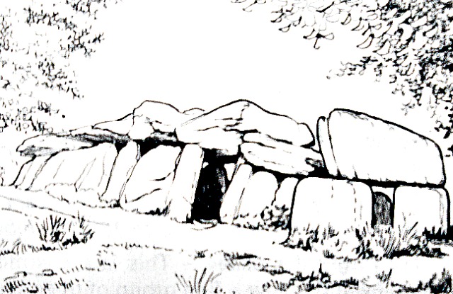
Fairies Rocks, Brittany (After P.Mesney).

There are 40 huge stone slabs here, some reckon on there being 42, but it is difficult to reach a proper total. The dolmen or passage-grave dates from the late Neolithic period sometime between 3,000-5,000 years BC, and was said to have been built by fairies, but in reality this sacred long tomb was constructed by ancient tribesmen for the burial of chieftains, but because it forms an alignment it was probably also used by them to view the Winter solstice on 21st December. The huge slabs of stone have a slight purple colour, but in fact, the stones are made of a reddish basaltic schist that was quarried some 3 miles from here.

The passage grave or corridor tomb is 20 metres (65 feet) long, 4 metres (13 feet) wide and 2 metres (6-7 feet) high. Some of the larger slabs and boulders weight up to 40 tonnes, while the smaller ones weigh several tonnes, rather to heavy for the fairies to attempt to lift but hundreds of tribesmen would no doubt have ways of dealing with them. The entrance to the dolmen or passage grave is 3 metres long and is in the form of a porchway (portico) with two uprights and a huge top lintel stone that fits exactly into position. This capstone has some markings at its edges, possibly caused by ropes or something ritualistic. Further inside the monument there is a low roofed passageway or corridor and then a large chamber divided into four compartments with uprights around the sides supporting the rest of the monument and more huge top stones forming the roof. In the central chamber a lump of stone has fallen to the ground. Originally this wonderful grave (tumulus) aligned south to east would have been covered over with earth to a length of 20 metres, but the earth has gone leaving the massive supporting stones.

According to legend, young couples would come here to consult with the fairy folk. They were then informed by the little people to do as instructed. The man would have to walk around the stones in a clockwise direction, while the woman went in an anti-clockwise direction, and by the time that both had returned to their starting position each would have to have counted the same number of stones – all would then go well for them in their marriage, but if one had counted a couple of extra or lesser stones they might not find things went their way; and if they each counted by more than two stones then the marriage would not go ahead and they must go their own separate ways. Well its a good story, and if you believe in the fairy folk, and many people do, then you will almost certainly be captivated by the little tale.

Please click on the following link to see a photo of the site  http://www.flickr.com/photos/cris_gmp/498506060/

Copyright © Ray Spencer, The Journal of Antiquities, 2012 (updated 2024).

1 Comment

Kit’s Coty, Walderslade, Kent

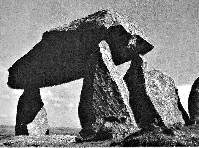
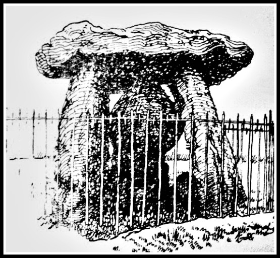
OS grid reference: TQ 7451 6083. The prehistoric burial chamber called Kit’s Coty or Kit’s Coty House stands in a field to the west of the Chatham road in the Medway Valley and the A229, 1 mile south-west of Walderslade. The famous Pilgrims Way is just to the south as is the Rochester road. The nearest town, Chatham, is 2 miles to the north. The ancient monument can be reached by a trackway running alongside the site from the south at Blue Bell Hill. At first glance, the monument looks like a large stone shelter or a tiny house, but it soon takes on the form of a burial chamber, which is also referred to in other terms as being a cromlech, dolmen or quoit. Although it dates back to the Neolithic age, it apparently takes its name from a 5th-century Welsh prince called Catigern – hence we get “the house of Cati”.

Kit’s Coty Burial Chamber, Kent.

Originally, the burial chamber was at the eastern end of a long barrow that was completely covered over by a mound that has now gone, while at the western end there used to be a large standing stone and another stone (a peristalith) that was known locally as “the General’s Tombstone”. Sadly, this large stone was blown up in 1867 because it got in the way of ploughing the field. The burial chamber consists of three huge upright slabs or sarsens 2.5 metres high with an equally large, overlapping capstone 4 metres long standing upon a small mound 1 metre high; originally this mound was 15 metres wide. The whole site of the burial chamber and long barrow is roughly 70 metres in length. Today, the monument is surrounded by ugly railings for security reasons.

Although the monument dates back more than 4,000 years to the Neolithic age, the name is derived from a Dark Age prince called Catigern, son of Vortigern, who, according to legend, died in a battle against the Saxons under Hengest and Horsa at or near Aylesford in 455 AD. 400 metres to the south, beside the Aylesford road, can be found another ancient monument called Little Kit’s Coty or “the Countless Stones” where there are a number of recumbent stones which once formed a second burial chamber. No burials have been found at either of these sites.

Copyright © Ray Spencer, The Journal of Antiquities, 2012 (updated 2025).


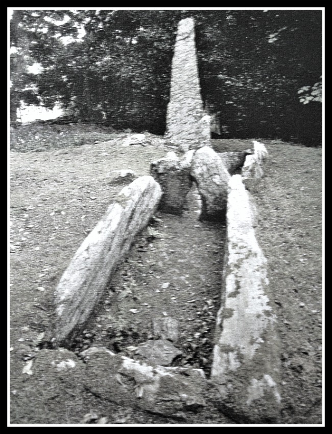
King Orry’s Grave, Laxey, Isle of Man

Grid Reference: SC 4389 8439. At the north side of Laxey village, about 70 yards to the north of the junction of the A2 road and Ballaragh road, stands the largest prehistoric monument on the island known as King Orry’s Grave, a section of which is in a garden. The original name for the monument was apparently ‘Gretech Veg Cairn’. It is actually a chambered long barrow from 4,000 years ago in the Neolithic age. There is uncertainty as to just who King Orry was, and why this monument should be associated with him, but probably he was the legendary King Gorse or Gorred of Crevan, a Viking who died here in the 11th century AD. However, as we already know, the long barrow pre-dates King Orry by thousands of years.

King Orry’s Grave, Laxey, Isle of Man

The chambered long barrow with its single chamber at the top end is formed by two standing stones with a lintel slab that has now fallen. Here at the west end the cist burial would have been located beneath a cairn, but whether this long barrow ever had a mound over it we do not know for certain, so perhaps it would be safe to say that it did. There is a well preserved U-shaped forecourt that is 12 metres long and 4 feet wide, and is formed by 6 stone slabs, two of which are quite long. The eastern section of the monument has a second barrow with possibly two chambers, a forecourt and entrance, and a line of cists running roughly north-east to south-west.

But, unfortunately this section has a road running through it and has largely destroyed this part of the monument, its cairn of stones having been robbed away to be used in the building of the two cottages close by in 1868. The western section of the long barrow was originally in a private garden and had never been excavated but, in the 1990s, the cottage and garden were purchased by MNH (Manx National Heritage), allowing access for visitors to the main part of the site, which is some 30 feet in diameter; the whole site being over 170 feet in length.

The site was first excavated back in 1830 when the cist was uncovered and, more recently in 1953-4 when only one burial of unburnt bones was found along with a few grave goods, including a pottery bowl and some flints.

Source:-

The Manx Museum And National Trust: Fourth (Revised) Edition, The Ancient Monuments And Historic Monuments Of The Isle Of Man (A General Guide), Douglas, 1973.

Copyright © Ray Spencer, The Journal of Antiquities, 2012 (updated 2023).


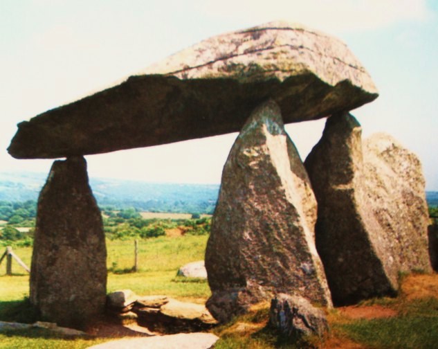
Pentre Ifan, Pembrokeshire, Wales

NGR: SN 0990 3690. The famous ancient monument Pentre Ifan or Coetan Arthur (Arthur’s Quoit) is located in a field beside a country lane between Penwern and Llwynihirion. The nearest village, Brynberian, is 2 miles to the south, while the nearest town is Newport on the Pembrokeshire coast, 3 miles to the west. Carn Ingli and the Preseli Mountains form a backdrop on either side of the ancient monument which is a Neolithic burial chamber, cromlech or dolmen, whatever you want to call it – they all mean the same thing at the end of the day – a place where some ancient chieftain was buried.

Pentre Ifan Burial Chamber, Wales

Pentre Ifan is a Neolithic burial chamber, dating from between 3,000 to 4,000 BC, which was probably built in two phases. It stands on a slightly raised mound and is 8 feet high with a huge capstone that rests on the very tips of three upright stones. The entrance is H-shaped and is amost closed by a large blocking stone; at the south side (front) a semi-circular forecourt and at the sides some of the kerbstones still lie flat. Originally the monument would have been covered over by a huge mound of earth over 36 metres (18 feet) long and 17 metres (9 feet) wide. Some of the stones have been robbed away to the locality, but at least seven are in situ. The massive capstone is 5 metres in length and some 2 metres off the ground and, the whole monument is 5.5 metres in length. Its wedge-shaped capstone weighs an “estimated” 16 tonnes. Looking at the capstone you could almost expect it to move at any moment, the balancing of this stone on its three supporting uprights is quite remarkable. There is a saying, locally, that a man could sit on horseback underneath the capstone, but I don’t know whether this theory has ever been tried out? The ancient monument stands on a slightly raised mound. Over the years there has been damage to the monument and so it has had to be partially restored when the huge capstone fell down, but you wouldn’t know it had.

Pentre Ifan Neolithic Burial Chamber.

Archaeological excavations took place here in 1936-37 and 1958-59 but nothing significant was found, certainly no burials were discovered. But the excavations firmly placed the ancient monument to around 3,500 years BC, in the Neolithic age. This is almost certainly the best preserved of all the burial chambers in Wales. King Arthur is also associated with the site. It is said he placed the capstone into position or threw the stone to where it came to rest. Arthur is also said to have built the monument. These are just legends, but ones that have stuck. The famous king probably had no connection with it at all. The little people (fairies) are said to inhabit the area around Pentre Ifan, sometimes dancing around the stones!

Copyright © Ray Spencer, The Journal of Antiquities, 2012 (Updated 2022).