
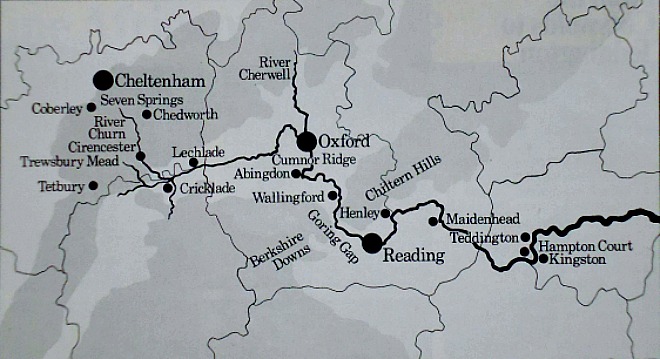
Map of the River Thames (Cotswolds to Teddington).
Here quoted “in full” is the brilliant and very comprehensive article from ‘The Illustrated LONDON NEWS’ magazine of July 1971, written by J.R.L.Anderson. In the forward to the article we are told that: “The Upper Thames no longer carries commercial traffic, though it remains a fine inland waterway for pleasure cruising. In the first of a two-part article the author, who lives in the Thames, describes the non-tidal stretch of the river and recalls some of its history and two of its enigmas – the continuing controversy over its source and the origin of its name.”
“The Thames is London’s river, but it would be more exact to say that London owes its existence to a geological freak, a little ridge of hard Corallian limestone near Oxford left by the Jurassic seas that covered most of southern England about 140 million years ago. This little ridge, noticeable enough in the days when people walked from Oxford to Cumnor, is taken by the motor car in its stride. You may, perhaps, have to change gear if you are held up by a lorry, but otherwise there is nothing to tell you that you are climbing a hill that changed the course of the Thames, and with it the course of English history.”
“The Thames rises in the Cotswolds and flows easterly towards the North Sea. But for the Cumnor ridge it would have gone on flowing eastwards, trending a little north to skirt the Chilterns, and forming its estuary somewhere between Aldeburgh and Clacton. But for the Cumnor ridge, Ipswich or Colchester would have been the capital of England.”
“The ridge checks the easterly flow of the Thames. To get round the ridge the river makes a great bend to the north and then turns south again, gathering the Cherwell at Oxford. Instead of flowing on east, it runs more nearly south – a little east of south – towards Reading. Just before its gets to Reading the Thames meets another barrier, the ridge of chalk forming the Berkshire Downs and the Chilterns. The river deals with this decisively, cutting a path for itself through what is called the Goring Gap. From here it returns to a generally easterly course to London and the sea.”
“London came into being as a settlement at about the sea-tide coming into the river up the estuary, a good place for crossing the river. There were shallows where, at low tide and when the Thames itself was low, the river might be fordable, though the crossing on foot or on horseback would always have been risky. But it would have been easy enough by boat, a good place for a ferrypoint before the river widens into its estuary. A good place, too, for beaching larger craft bringing cargoes from the Continent, a snug haven after those vicious, short, steep seas of the passage from Norway, Denmark or the Low Countries. So London came into being as the pulsing heart of England, with the Thames its artery.”
“For a river with so much history so long studied, the Thames still presents a surprising number of enigmas. No one has yet satisfactorily determined what its name means, or where it comes from. The Romans found it called (phonetically) “Tems”, and latinised this into “Tamesis”. The “h” in the modern spelling is a ludicrous intrusion. It occurs in no very early charters, although it is occasionally to be found in late medieval documents as “Thamisa”. The silly “h” became fashionable in the seventeenth century when it was considered the thing to go in for “antiquities” – it is a fake. It has remained with us ever since.”
“But what does “Tems” (or “Thames”) mean? It has no obvious root in the Celtic or Gallic tongues spoken in England before the Romans came. Dr Eilert Ekwall, author of the great Oxford Dictionary of English Place-Names, suggests that it may derive ultimately from the Sanskrit “Tamasa”, meaning “dark”, perhaps through the Old Irish “Temen”, also meaning “dark”. Some early people speaking in Indo-European language certainly came to Britain and they may have called the Thames “dark water” in their tongue. It is a singularly inappropriate name for the Thames as it has been these past 2,000 years, for it is a silver stream rather than a dark, brooding one. But when our remote ancestors came, the Thames valley was thickly wooded, and the river under the trees may have seemed strikingly dark. No one knows. “Thames” may be a link with our first Indo-European forebears, or it may mean something completely different in some completely unknown tongue.”
“I should like here to denounce another affectation in the name “Isis” occasionally presented as an alternative name for the Thames above Oxford, and regrettably sanctioned as such by the Ordnance Survey. The “Isis” is a non-existent river, and the name was unheard of before the fourteenth century. Some unknown scribe seems to have conceived the idea that “Tamesis” was a compound of the names “Thame”, a tributary which joins the Thames just below Oxford, and an imaginary “Isis”. This is absurd. No one living by the Upper Thames has ever called the river anything but “Tems”, of which “Tamesis” is simply the Latin form. “Isis” has gratified some uncritical literary fancies, but it is as bogus as the “h” in “Thames”. That “h”, I fear, is too long established in orthodox spelling to be shifted now, but the map-makers ought surely to abandon “Isis”.”

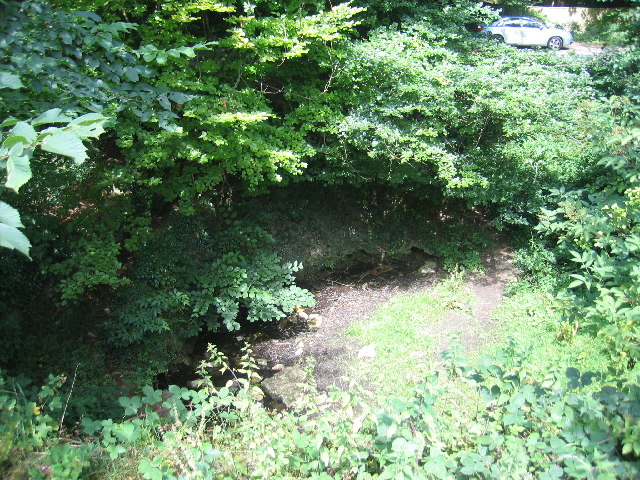
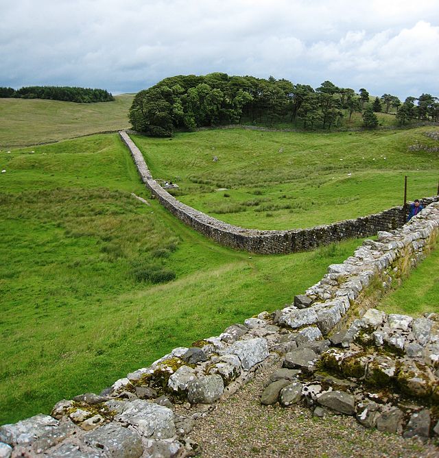
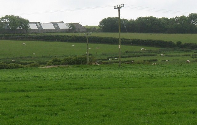
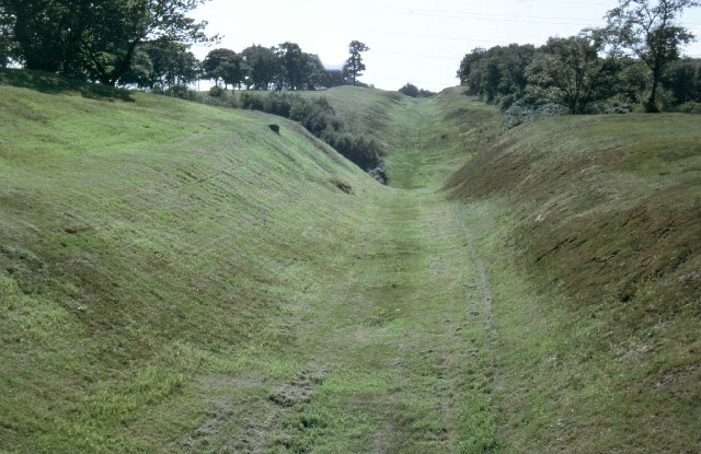
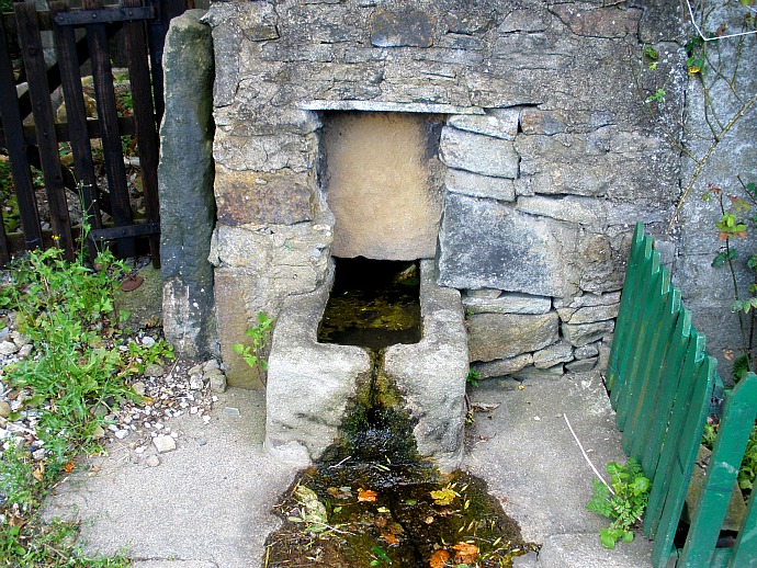
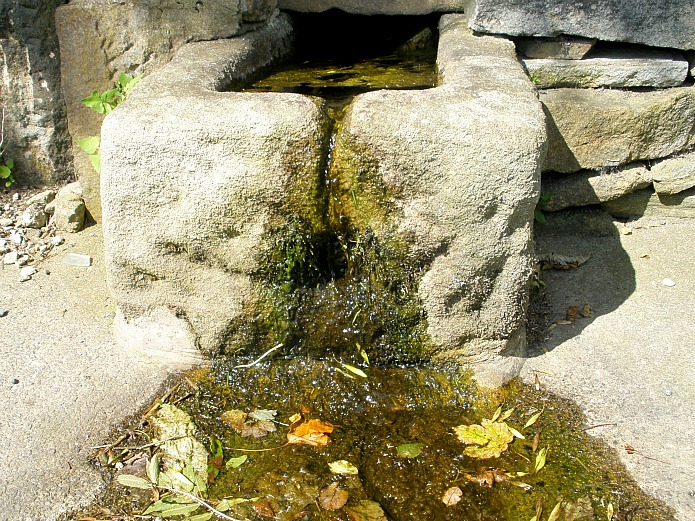
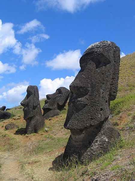
Seven Springs on the River Churn (photo by David Stowell – for Geograph)
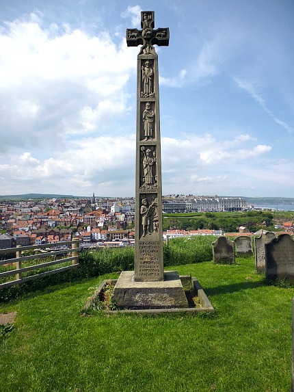
“Another enigma of the Thames is that its source – in well-surveyed, civilised England! – remains in dispute. The Ordnance Survey accepts the source as a spring (commonly dry in summer) at Trewsbury Mead, about 3½ miles SW of Cirencester and just to the N of the old Roman road (Fosse Way) between Cirencester and Tetbury. This is accepted, too, by the Thames Conservators, the official body responsible for the river, and the site has been adorned by them with a statue of a river god (Old Father Thames?) that once lived in the old Crystal Palace. But there is a rival source, about 11 miles farther north at Seven Springs, near Coberley, on the outskirts of Cheltenham. Here, there is a better spring, in a dell with water in it, and a Latin inscription on a stone, recording:
Hic Tuus, O Tamesine Pater, Septemgeminus Fons, (Here, O Father Thames, is thy sevenfold source).
“The matter was even discussed in Parliament (in 1937), when the supporters of Seven Springs tried to get a ruling giving official recognition to their source. Mr Chamberlain’s Government was unmoved, sticking to Trewsbury Mead, and arguing that the river which rises at Seven Springs is not the Thames, but the Churn. The Churn, however, is a tributary of the Thames, which it joins at Cricklade. Its source is farther from the sea than Trewsbury Mead: should it be regarded as the main river down to Cricklade, and the stream from Trewsbury Mead as a tributary? This is like the arguments that go on about the Mississippi and the Missouri; it will never be settled.”
“The Thames has always been navigable, though not always easily, from the sea to Lechlade, and at times, when barge-traffic was important, as far as Cricklade. Until the coming of railways, the Thames was the main route for merchandise from London to Windsor, Maidenhead, Reading, Wallingford, Abingdon, Oxford, Lechlade and Cricklade, and for the products, mostly agricultural, of Oxfordshire and Berkshire sent to market in London. Cheeses from the Vale of the White Horse, shipped by river, helped to feed London before the Conquest. Until the Angevin kings stopped the trade (because they wanted revenue from the vineyards in France) there was a considerable river trade in wine from Abingdon and Reading. It was not the climate but politics that put an end to grape-growing in the Thames valley – an end, that is, commercially, for grapes can still be grown well by the Thames and I have drunk an excellent light wine from grapes grown near Pangbourne. Cotswold stone for building the first St Paul’s Cathedral was brought by the Thames to London, and Sir Christopher Wren turned again to Burford for stone and to the Thames for transport when he built the present St Paul’s. By Wren’s day, however, Portland stone by sea was cheaper than Burford stone brought to London by river, so he used Burford stone only for parts of his cathedral, where he wanted its special qualities.”
“Had railways been invented a few decades later a splendid system of canals, based on the Thames, would have linked London to Bristol and the Midlands : there might even have been a ship canal from the Bristol Avon to the Thames. The canals exist but the railways killed them before they could be developed for modern traffic. It is no use crying over spilt canal water, but one can still be angry that so much of it remains spilt. Many people hold that these canals could – and should – be restored and modernised, to the great relief of overcrowded roads.”
“If commercial traffic has gone from the Upper Thames it remains one of the finest inland waterways in Europe for pleasure cruising. The Conservancy maintains a dredged channel for 124 miles of non-tidal river from Teddington to Lechlade, and the channel is being extended to take small cruisers well above Lechlade. All locks on the Thames are manned, and most of them now are power-operated. There are fleets of cruising craft for hire or charter, and good facilities for privately-owned boats. From the Thames, too, you can get on to the Oxford Canal, a beautiful eighteenth-century waterway, and thence to the canal network of the Midlands – wonderful territory for inland cruising. Many of the old canals are still navigable by small boats, though you may have to work the locks yourself. But this is good exercise for a crew of strong sons and daughters, while the skipper goes off to replenish stores. If you time your arrival rightly at the right places, stores replenishment can be indeed a congenial task.”

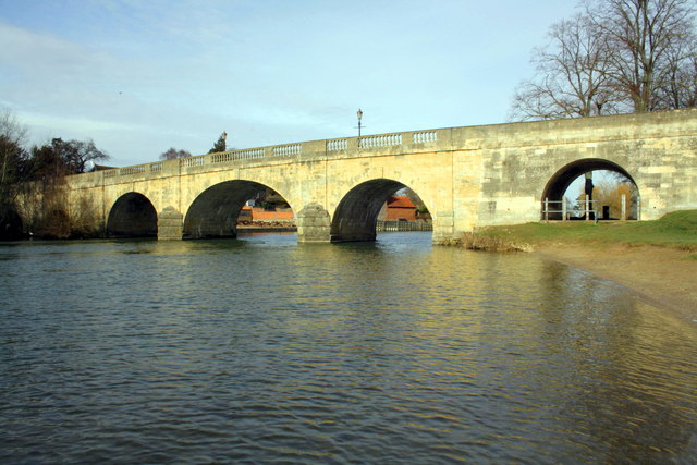
The Thames at Wallingford Bridge (photo credit: Roger Templeman – for Geograph).
“But you need a lifetime to properly explore the Thames itself, and its magic hinterland. It is good to travel by boat, but you need not, for all the Thames-side towns and villages can be reached by car, though you will want a good map, and will have to make considerable detours as the river winds. The centuries unfold with particular vividness as you make your way along the river, if you go with a map to a library beforehand and work out the meanings of the place-names on your route. The Thames is a boundary as well as a highway. It brought prehistoric man to the good upland country where he could flourish, and protected his little settlements. Later, it brought the early Saxons to the heart of their kingdom of Wessex – Hinksey, now part of modern Oxford and once an island in the river marshes, means “Hengist’s Island”, commemorating a very early Saxon name. The Thames bounded the ancient kingdom of Wessex, and when it was beset by enemies the river line held. King Alfred and his sons took particular care to guard the crossings at Cricklade, Oxford and Wallingford, and the invading Danes were checked by the Thames. Later, it was the dividing line in the south of England between the area where the old Saxon laws prevailed and the Danelaw, where Viking traditions were recognised.”
“William the Conqueror secured his hold on England by holding the Thames. His great castles at London, Windsor, Wallingford and Oxford not only controlled the river but dominated the routes leading to and from places where it could be crossed. The wars between Stephen and Matilda were fundamentally struggles to control these castles, and it was Stephen’s final failure to take Wallingford Castle, which held out for Matilda, that ended the war in the treaty securing the succession of the throne of England to Matilda’s son, afterwards Henry II. It was through Henry II that the blood of the old Saxon Royal House was restored to the English throne, a link that has never since been wholly severed, save in the interregnum of the Cromwellian Commonwealth (1649-60). Thus it can be held with truth that it was the defense of the Thames at Wallingford in the twelfth century that not only gave England one of her greatest monarchs in Henry II but ensured that a descendant of Egbert, king of Wessex in the ninth century and the first ruler to style himself “King of the English”, occupies the throne of England still, in our present sovereign Queen Elizabeth II.”

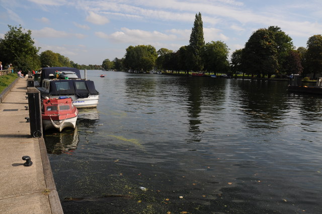
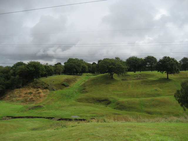
River Thames above Teddington (photo credit: Philip Halling – for Geograph).
“At Teddington, the Thames meets the tide from its estuary and begins to mingle with the sea. Above Teddington the Thames is an inland waterway; below, it starts to have an ocean feel about it. One of the lost hopes of the first post-war Labour government was a plan to establish a Thames-side Walk, all the way from London to the source. That went the way of many dreams of a brave new world. It would be nice to revive it, but such a riverside walk would be expensive to construct, for what was once the towpath has often vanished in the encroachments of houses and gardens, particularly near London. On the upper river there is still a good deal of towpath, but there are awkward gaps that would require long detours or expensive bridging to restore a walk along the river’s length. One day, perhaps……..”
“Meanwhile, there is enough access to the Thames to give infinite pleasure in return for very little trouble. Below Henley the towns become more and more suburban, but the river remains beautiful, with magic reaches by Kingston and Hampton Court. The best sailing reach on the whole river is the stretch from Marlow to Bourne End. From Reading to Oxford towns and built-up areas are fewer. Abingdon is the most considerable town and still retains patches of medieval beauty in spite of some horrible commercial development. Wallingford is a gracious little place – its size does not match its history. Above Oxford there is next to nothing but water-meadows and peace. A week on a boat proceeding gently from Oxford to Lechlade is to be transported in time as well as space, to a world remote from motor roads, where the landscape has changed little since Parliament men and the Royalist troops fought over bridges in the Civil War, when Charles I made his capital at Oxford.”
“The centuries sit lightly on the Upper Thames. Yet it is always London’s river, feeling the force of social and technological change pulsing out of London in many subtle ways, some hurtful, some making for its betterment. I shall discuss these in the August issue of the ILN, and describe what I call the ocean-Thames, whose ships go out to the farthest seas of the world by that nursery of seamen the Thames Estuary,” so says the author of this magazine article J. R. L. Anderson back in 1971.
Sources:
Anderson, J. R. L., ‘London’s River 1 – From The Costwolds To Teddington,’ The Illustrated LONDON NEWS, Vol 259, No 6876, Holborn Hall, 100 Grays Inn Road, London WC1. July 1971.
http://www.geograph.org.uk/photo/2929575 © Copyright David Stowell and licensed for reuse under this Creative Commons Licence.
http://www.geograph.org.uk/photo/2813784 © Copyright Roger Templeman and licensed for reuse under this Creative Commons Licence.
http://www.geograph.org.uk/photo/2592231 © Copyright Philip Halling and licensed for reuse under this Creative Commons Licence.
© Copyright, Ray Spencer, 2015 (updated 2025).


