Map of Winckley Lowes, Bronze Age barrows, Lancashire.
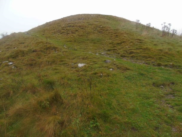
Winkley Lowes II (Photo credit: Stephen Oldfield).
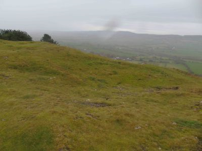
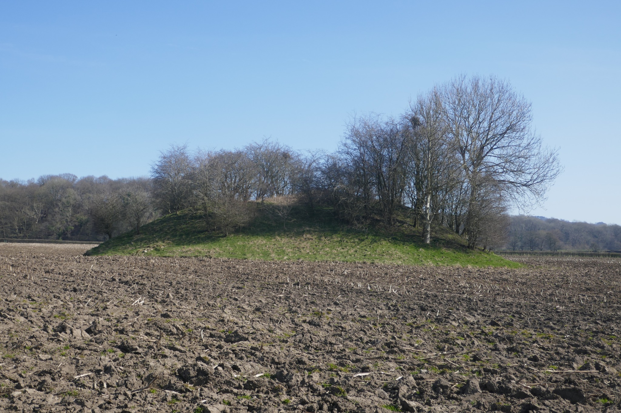
OS Grid Reference: SD 70843 37313. In a farmer’s field 1 mile to the south-east of Hurst Green, Lancashire, is a large tree-clad mound (bowl barrow) which is called Winckley Lowes II or Loe Hill. This particular mound has only recently been identified as a Bronze Age burial site. It lies some 200m to the southeast of a smaller burial mound (tumulus) called Winckley Lowes I. Both sites are located in fields opposite the River Ribble. In the Summertime and Autumn the local farmer grows tall maze crops here and so the two burial mounds are difficult to see and, as they are on private land, they can not really be reached. The Winckley Lowes II mound was examined by local antiquarians in the early and late 19th century, but no University-based excavations have, as yet, taken place here. At least two footpaths heading south-eastwards from the B6242 road between Hurst Green and Great Mitton, near the bridges, are the best bet to reach the site; then follow The Ribble Way running east beside the river to the former boathouse (now a private house). The tree-clad mound of Winckley Lowes II lies across the fields 140m to the northeast of this building.
It’s not a good idea, however, to visit the mounds when the maze crops are growing tall. When the crops have been cut back in the Autumn it is possible to see both mounds from the footpath beside the river Ribble, or from either of the two metal gates at either side of the boathouse; and if you do go further into the fields to get a closer view it is probably best to walk along the edges of the fields when ‘they’ have been ploughed.
The grassy mound, bowl barrow or round barrow, has trees growing from its sides and summit. It is about 6m (20 feet) high and has dimensions of approx. 42 x 38 metres (137 ft x 124 ft). It has the look of being a naturally-formed hillock or knoll that was formed many thousands of years ago.
The late John Dixon (1993) says of this site that: “The second, larger, mound is known as Loe Hill and has only recently been declared man-made. No major excavation work has been carried out on the mound and its purpose remains uncertain. Some suppose that it was built after the Battle of Billington in A.D. 798; towards the close of the 8th century the Anglo-British kingdom of Northumbria was fraught with internal conflict.”
Mr Dixon adds that: “It is also possible to see the mound as a Bronze Age earthen bowl-barrow; consequently, one could put the barrow into the wider pattern of Bronze Age settlement in the area. Its close proximity to Winckley Lowe might indicate that the site had some ritual significance. Given the lack of dateable remains the site must remain the subject of speculation.”
Author Ron Freethy (1988) further adds to that uncertainty and says that: “Billington has its roots way back in Saxon times; the important battle of Billangahoh was fought there in 798 AD. The tumuli found close to the spot are said to be the burial mounds but no bones or artefacts have yet come to light. The name of Billington was mentioned in Domesday as was nearby Langho with its ancient church, repaired in 1684 using stones from the ruins of Whalley Abbey.”
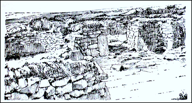
The site entry for Winkley Lowes II mound (in the parish of Aighton, Bailey and Chaigley) in ‘Lancashire Archaeological Bulletin’ (1984) says:- “(b) Excavated by Whitaker in 1815. The whole, as far the investigation proceeded, was made up of large water gravel, mixed with exceedingly tough marle, of which there is a bed by the river side. The labour and expense of removing such materials was found so great, that we were compelled to desist before we had arrived at the centre, so that unfortunately nothing was found. Also excavated by Fr. Luck (from Stoneyhurst College. See link, below), September, 1894. Trench 10 feet wide from south-east to centre in four steps. Found earlier excavators’ trench with mussel shells, potsherds, clay pipes and two coins of 1806 (? Whitaker, but why not coins of 1815?). Combination of slate-coloured clay and ice-striated limestone convinced excavator that mound is natural.”
John Dixon (1993) adds further to the above sites saying that: “A third mound once stood across the river at Brockhall Eases. During the summer of 1836 Thomas Hubbersty, the farmer at Brockhall, was removing a large mound of earth when he discovered a stone-lined cist. This was said to contain human bones and the rusty remains of some spearheads of iron. The whole crumbled to dust on exposure to air. Given that the spearheads were made of iron, one is tempted to describe it as a 1st millennium B.C. burial.”
Sources/references and related websites:-
Dixon, John & Phillip, Journeys Through Brigantia (Volume Nine) The Ribble Valley, Aussteiger Publications, Barnoldswick, 1993.
Freethy, Ron, The River Ribble, Terence Dalton Limited, Lavenham, Suffolk, 1988.
Lancashire Archeological Bulletin, Vol. 10 No. 2/3, May & July 1984.
http://www.megalithic.co.uk/modules.php?op=modload&name=a312&file=index&do=showpic&pid=12695
http://www.themodernantiquarian.com/site/3015/loe_hill.html#images
http://www.jesuit.org.uk/pause-for-prayer/3753/prayer/nojs
© Ray Spencer, The Journal Of Antiquities, 2018.