
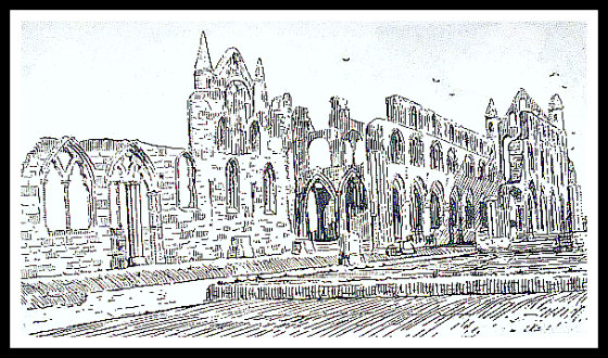
Whitby Abbey B/W.
OS grid reference: NZ 9030 1122. On the headland of the east-cliff (up the famous 199 steps) and above the seaside town of Whitby, north Yorkshire, stand the formidable ruins of Whitby Abbey, which was initially founded as a priory sometime after 1078 by Reinfrith, then in c 1105 it became a Benedictine abbey. It was finally dissolved on 14th December, 1539. On the same site back in 657-58 AD an Anglo-Saxon monastery was founded by Oswy, the King of Northumbria. This ‘then’ became a double monastery for both men and women and was headed by St Hilda (614-680 AD), a Saxon princess who had travelled ‘here’ from Hartlepool at the request of the king; Hilda being the daughter of a prince by the name of Hereic, who was apparently poisoned in 616 AD.
In 663 AD the famous ‘Synod (Council) of Whitby’ took place at the monastery itself and, was significant in that it brought together both the Celtic and Roman churches! In 867 AD the Saxon monastery of Whitby was destroyed by Viking raiders. The majestic ruins of Whitby Abbey that we see today date, for the most part, from the mid 13th century. St Hilda (Hild) died on the 17th November (her feast-day) in 680 AD – her passing being mentioned by the Venerable Bede and ‘The Anglo Saxon Chronicle’. In the Dark Ages Whitby was called ‘Streonshall’ and continued to be called that until at least the Viking Invasion in the 9th century, but probably the old name continued to be used long after that.
The following ‘Whitby Abbey’, which I will “quote” in full is taken from ‘Stories & Tales Of Old Yorkshire’, 1993, an excellent compilation of work by Edward White – that was first edited by him whilst residing in London (1883) – and then published in the antiquarian work ‘Old Yorkshire’, in 5 volumes. White says:-
“This famous Abbey was founded by Lady Hilda, whose death took place twelve-hundred years ago, and an enquiry into the special circum-stances which induced her to build the Abbey opens up an interesting chapter in ancient local and general history. This will be seen when we consider what England was when Hilda’s Abbey and College first arose, a lighthouse above the ocean — waters in the seventh century — when it first shone like a Pharos over the old kingdom of Deira, which was one of the chief provinces of the kingdom of darkness.”
“England was, from North to South, along its whole eastern side, and far up in the Midland Counties, a thoroughly heathen country, and had been heathen for 200 years preceding, ever since the departure of the Romans. What makes this fact so striking and terrible is that during the 400 years of the Roman Dominion, nearly the whole country had been evangelized. St Ninian, after whom one of Whitby’s churches is named, was a Scottish nobleman educated in Rome, who became one of the chief evangelists of the ancient races during the Roman times. The British tribes, and their neighbours, the Irish people, had thus early received the Gospel. When the Saxons came and saw, and conquered Britain, they restored heathenism over the whole area of their conquests. It was almost as if any army of Hindoos should now land in England, vanquish the inhabitants, drive the remnant towards the West, and establish Indian idolatry on the ruins of our Christianity. We are the descendants of those Saxon heathens, and we still call our week-days after the names of their impure gods and goddesses, Sun-day, Moon-day, Tuisca’s day, Woden’s, Thor’s day, Freyga’s day—a fearful memorial of the overflow of the ancient British Christianity.”

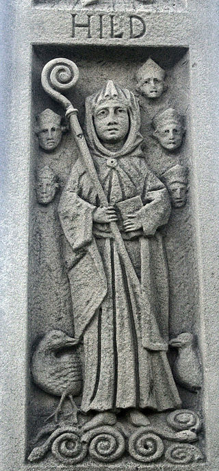
St Hilda’s Statue (photo Wilson 44691 for Wikipedia)
“The conquered Britons retired westward, fighting all the way, into Cornwall, into Devonshire, into Wales, into Cumberland, and Westmoreland, and Lancashire; and they took their Christianity and civilization with them, leaving behind a vast and awful night of barbarous Saxon paganism—of paganism with its ignorance, ferocity, blood-thirstiness, drunkenness, and lust. Eastern and Midland England for 200 years, from the time of Hengist to the time of Hilda, was full of ferocious tribes, battling all along the west with the remnant of the British aborigines, and battling just as fiercely with each other. When St Hilda was a young woman all central England, or Mercia, was held by a savage Pagan Sovereign named Penda, 80 years of age, a sort of Saxon Cetewayo, master of a powerful army, who for fifty years had made a war upon his neighbours. And it was in consequence of the destruction of this terrible old Pagan warrior by King Oswy at Winwidfield, near Leeds, in 655, that Hilda was enabled in 658 to found her abbey. Penda had previously slain King Oswald in the west, and hanged his mangled body aloft at Oswald’s tree, now Oswestry.”
“A monastery of the ancient ages is often thought of as necessarily an abode of idleness, and even of licentiousness. Such no doubt many of the religious houses at last became, and even this great Benedictine house at Whitby among the number in its latter days. Its present ruin is, according to Dr. Young, the visible punishment of the sins of its lates inmates. But in the earlier centuries a great monastery was often a stronghold of the good cause against the powers of darkness—and this mighty foundation of Hilda’s was among the noblest in England. Its purpose can hardly be understood, unless we remember that in the first half of the seventh century, there was in all Europe no more awful Aceldama and “abomination of desolation” than this northern part of England. The Saxon Heathen and Pictish Highlanders, had repeatedly laid the land waste in their wars, and made its rivers flow with blood. The country was scarred with the black marks of conflagrations of farms and homesteads. Deira invaded Mercia, and old Mercian Penda invaded Deira again and again. Bernicia invaded Lancashire and North Wales, and North Wales invaded Bernicia and Deira, or Northumberland and Yorkshire. All the history of these parts that remains is the history of cruelty, wrong, and bloodshed. No power but one could save and civilize Saxon heathenism, and turn this hell of the angles into a paradise. That power was Christianity.”

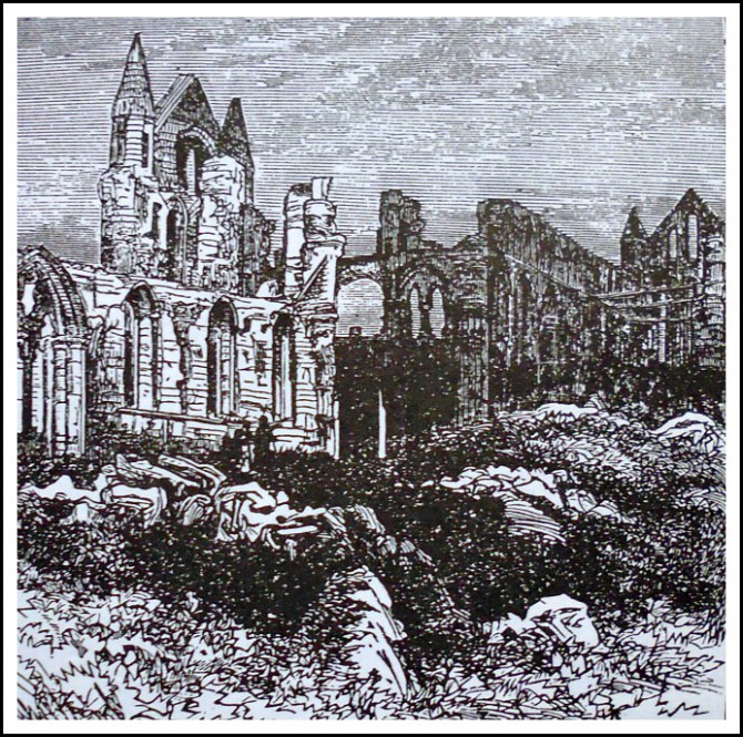
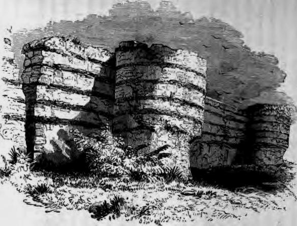
Whitby Abbey (Line Drawing 1960’s)
“The kings had begun to hear of what Christianity had done for other states and nations in Europe, and they were growing weary of their own wars and miseries. The monasteries which arose in that age, in the midst of the forests and open countries, were, then, strongholds of Christianity and civilization. A great monastery well placed aloft, like Cassino or Streonshall, and wisely and holily governed, was a Bethesda or Pool of Mercy with many porches. It was (1) a Temple for the worship of the living and eternal God, amidst the grotesque and degrading horrors of paganism, where the light of truth shone on high over the pagan pande-monium. (2) It was a place of education for both sexes. The Princess Hilda, grand-niece of King Edwin of Northumbria, founded here (after the modern American fashion) a college and school for both sexes, for both monks and nuns. Many of these were persons, like Hilda, well on in life and weary of the world; some of these were young, some even almost boys and girls. Her first charge was the little Princess Elfreda, well-born on her mother’s side; for there had been a succession of Christian Queens. First, Bertha, a French Princess, married Ethelbert, the King of Kent, and brought Christianity with her. Their daughter was Ethelburga, who married King Edwin in the great well-built Roman city of York, the capital of his kingdom of Deira. There daughter was Eanfleda, who married King Oswy, still a heathen; and their child was Elfreda, who was educated as a Christian at Whitby. In three cases Christianity came with the wife to a pagan husband. Who could say how great a blessing, or how great a curse, every young woman carries with her in her marriage, according as she is a loving wife and worshipper of God, or a heathen-ish worldling. Thus a monastery was a College and a School, and often had a learned Library. We still possess the catalogue of good books in manuscript, which this Abbey treasured up in the 12th century, beginning with the Bible. Part of the work of the place always was to copy good books, the priceless legacies of elder times, as it is now a good work to give or to lend them. A monastery inspired by such persons as Hilda and her fellow-workers was next a great mission centre, whence educated men went forth on foot to evangelise the neighbouring villages and towns; and many were the cells and village churches which were set up by the godly monks from Whitby College.”
“The noble St Chad, or Ceadda, of Lindisfarne, was often here; and so holy and laborious a worker and walker was he, that the people in after-times fancied that a healing virtue remained in the springs and pools where he baptized the heathen Saxons whom he converted; so that the name of “St. Chad’swell,” or Shadwell, is found over half of England, and has reached as far as London. For long Ceadda’s central abode was at Lastringham, beyond Pickering; and afterwards, in his last days when full of years and honours, he was made the Bishop of Litchfield, the first of a series of eighty, ending with Bishop Maclagan.”
“3. A monastery was also a great school of medicine, and place of healing. There were stored up all manner of receipts, wise and unwise, for the medical use of plants and treatment of wounds. And thence went forth elder Sisters of Mercy, to nurse the poor people of Whitby 1200 years ago”
“4. A great monastery was a fountain of civilization in all the useful arts, such as agriculture and gardening. The best intelligence of the time was frequently brought to bear on the culture of a great abbey’s possessions. It was also a school of the fine arts—of music, singing, painting, and preeminently of architecture. It was likewise a school of poetry, for here Caedmon sang his inspired song of the creation, and commended to the semi-barbarous Saxons divine ideas in strains that echoed far and wide over Saxon England, and gave prophetic hints of Miltons of the future yet to come.”
“And (5) lastly, a great monastery was a visible monument of all the Past Divine History of the world, as well as a written prophecy of a better kingdom to come.”
“All this was in the design of the Princess Hilda, when she planted her great Abbey upon these heights; and since she was, beyond all reasonable doubt, a devoted Christian, her object was in a great measure realized. For the great church and college of Whitby became to Yorkshire, and far beyond it, a fountain of salvation. Her religion was clothed in the idiom, the ceremonial, the con-ceptions of her own day; and much of that external investure was no doubt the growth of ages of gradual departure from the apostolic model. But what a grand and noble woman was this, who kindled so great a light on that sublime eminence, the memory of whose noble works was powerful enough 400 years after her death, to create another race of men to rebuild the fallen in new splendor on the very site of her earlier enterprise.”
“Now arose the early monasteries of Canterbury, of Glastonbury, of Streonshall—to this last king Oswy assisting by the gift to Hilda of twelve manors, prompted thereto by the remorseful desires of a heart that repented itself of its previous blood-stained and violent career. Now hence-forth the figure of the Princess Hilda rises on her sacred hill, towering aloft above the desolated villages of Saxon Deira, a true messenger of peace to the troubled people. Her monastery continued for 200 years to be the central light amongst this darkness; and the gleam that shone through the rounded windows of her humble early church was truly a light of life to the Saxons. Then, as you know, followed in the 9th century the complete destruction of the first modest and mostly wooden fabric by the Danish pirates, and an utter desolation of Streonshall for 200 years, indeed until after the Norman conquest. Then the Norman Percys, moved by the horrors of William the Conqueror’s desolation of Yorkshire—as Hilda had been moved 400 years before by the similar horrors of the Saxon war Desolations—began the re-building of the Abbey and Monastery, of which, and its subsequent additions, we can see the noble ruins to day.”

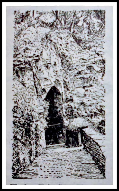
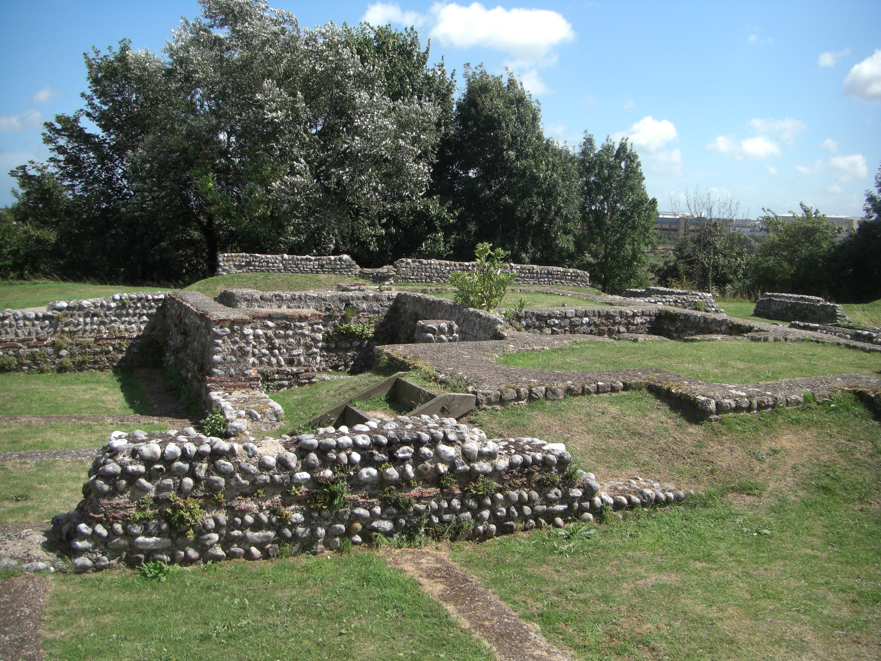
Whitby Abbey Ruins (old illustration).
“Now again 400 years followed of growing magnificence, of cease-less worship, of holy song, devout study, of strenuous labour by twenty-five generations of the black-robed Benedictine monks among the surrounding towns and villages; and alas, of increasing superstition, increasing depravation of manners, increasing sloth and forgetfulness of God, until the crisis was reached of the Tudor reigns; when the voice of England, thundering indignantly like a northern tempest against the apostate church, supported Henry VIII in the dissolution and plunder of the Abbeys, then possessed of at least one-third of the cultivated land of the kingdom, and ruin fell upon Streonshall, with its precincts full of the dust of saints and kings, in the just judgment of God.”
Sources:-
https://es.wikipedia.org/wiki/Hilda_de_Whitby
Smith, William., Stories & Tales Of Old Yorkshire, (orig. edt. by William Smith, 1882-3. Selected & Edt. by Dawn Robinson-Walsh, 1993), Printwise Publications, Tottington, Bury, Lancs., 1993. [Stories & Tales of Old Yorkshire selected from the work ‘Old Yorkshire’ 5 vols, 1882-3.]
Copyright © Ray Spencer, The Journal of Antiquities, 2015 (updated 2025).


.JPG)