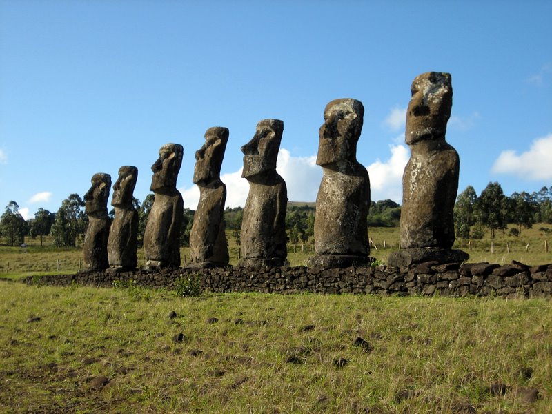
Easter Island (Ahu-Akivi) Photo Credit: Wikipedia.
Latitude: -27.1211919. Longitude: -109.3664237. A small Polynesian island in the south Pacific Ocean far away from any major landmass is Easter Island, only discovered in the early 18th century, but it is a very extraordinary and mysterious island of giant stone statues and rock carvings, some perhaps dating back well-over 1,000 years. Also known as Rapa Nui, the “sacred” island of the mysterious tribe that are also called by the same name and who lived here, roughly, between 400-1700 AD.
There are said to be upto 1,000 small and large stone statues on the island, many are said to represent the gods or chiefs of the Rapa Nui tribes; and there are many superb petroglyphs or rock-carvings scattered about the island. The island is 10 miles across north to south and about 16 miles length-wise at the south side; also at the south side a line of three dormant volcanoes: Rano Kao, Punapau and Rano Raruku, while at the north another volcano called Rano Aroi; the island is made of sandstone and volcanic rock. Easter Island, sometimes called ‘the Navel of the World’ is 1,200 miles from any other island and roughly 2,360 miles from any major landmass – in this case the west coast of Peru. It is 1,290 miles east of Pitcairn Island.
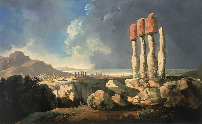
Easter Island by William Hodges 1775. Photo Credit: Wikipedia.
On Easter Sunday in 1722 Dutch sailors, lead by the enthusiastic seafaring admiral Jacob Roggeveen, discovered the barren, treeless island quite by chance and named it Easter Island; they were almost certainly very surprised to see huge stone heads lying on the ground. After that, in 1772 Spaniards re-discovered the island and, other interested parties (and some not so interested) came to the island in the late 19th century when archaeological excavations began. In more recent times (1956) the famous Norwegian explorer Thor Heyerdahl (1914-2002) sailed to the island on his balsa-log raft, Kon Tiki. Francis Hitching in his book ‘The World Atlas of Mysteries’ 1979, says of Heyerdahl’s expedition: “In 1956 the writer Thor Heyerdahl arranged an archaeological experiment with the mayor of Easter Island and six islanders. Using traditional methods, they carved out the contours of a new statue in three days using stone tools and gourds of water to soften the volcanic rock.”
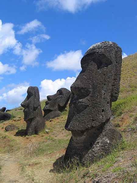
Easter Island (Rano Raraku). Photo Credit: Wikipedia.
The huge (colossal) statues carved from hardened volcanic ash are called ‘moai’ and they look stern-faced inwards away from the sea, seemingly to gaze towards the horizon for eternity, some stand on ceremonial rock platforms (ahu), especially those at Akivi on the island’s west coast and Nau Nau in Anakena Bay with between 7-15 figures, many having strange top-knots (pukao) on their heads, made from red tuff rock, their eye-sockets are made from coral and the irises from red scoria rock. In all there are nearly 900 statues (most having subtle differences in their appearances), including half-size ones and some that are unfinished, and some kneeling statues. They are said to represent the gods of the Rapa Nui. One of the statues, the ‘paro’ is 33 feet high (10 metres) and weighs in at 76 tonnes; another, an unfinished statue, is 69 feet high (21 metres), but there are some that are as tall as 24 metres, a staggering 78 feet! Many statues have fallen or been pushed over, maybe by the Rapa Nui tribes themselves as they knew that the end of their island culture was coming – due to a number of factors including abduction for the slave trade, war and disease – indeed by the 1870s only a hundred or so tribes-people remained, and in 1888 the island was finally annexed to Chile.
Author Justin Pollard in his excellent book ‘The Story of Archaeology In 50 Great Discoveries’ 2007, says that “By the 18th century Easter Island was almost devoid of trees and the destruction of the forest to provide wood for building and boats (and perhaps rollers for the moai) and to clear areas for agriculture led to a progressive impoverishment and erosion of the soil. These factors, together with the pressures caused by a growing population, meant that Easter Island society began to change rapidly.”
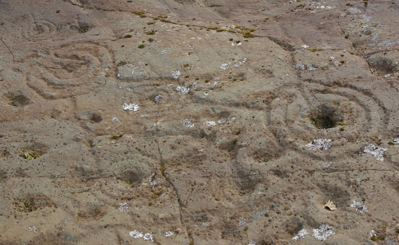
There are some amazing rock carvings on the island, in particular those in the Ana Kai Tangata cave at the south-west side of the island where there are depictions of the so-called ‘birdman’ (Tangata Manu) the supreme chief. The ‘birdman’ also features on a carved rock located above the Motu Nui islet; the cultus of the birdman was centred on the island village of Oronga where there are some well-preserved houses that were lived in by the Rapa Nui, from 1500 onwards. Thankfully, the famous statues of Easter Island have been re-erected and now stare, perhaps rather less stern-faced towards ‘a new horizon.’ Today tourists and archaeologists visit Easter Island to stare and to study the huge statues and rock carvings and, at the island that is slowly ‘being lived on’ once again!
Sources:
Hitching, Francis., The World Atlas Of Mysteries, Pan Books Ltd, London SW10, 1979.
Pollard, Justin., The Story Of Archaeology In 50 Great Discoveries, Quercus, London W1A, 2007.
Strange Worlds Amazing Places, The Reader’s Digest Association Limited, London W1X, 1994.
Photos Wikipedia: http://en.wikipedia.org/wiki/Easter_Island
http://www.southamerica.cl/Chile/Easter_Island.htm
Copyright © Ray Spencer, The Journal of Antiquities, 2014.


