The Journal Of Antiquities

Ancient Sites In Great Britain & Southern Ireland


Mosley Height, Mereclough, Lancashire

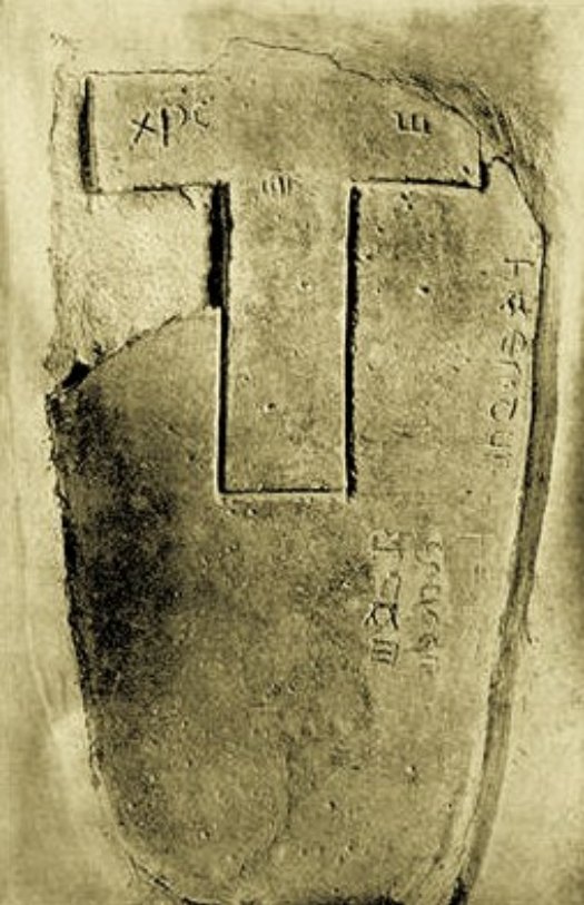
OS grid reference: SD 8809 3014. Also called Holme Stone Circle. On the moors, just to the east of Mereclough, and close to the Long Causeway is the 290 foot hill known as Mosley Height. At the northern edge of the hill, close to Causeway-side Farm, stood a Bronze-Age burial mound, ring cairn or cairn circle. Some historians and archaeologists have gone as far as saying this was a stone circle, but many of the 18 stones that were found here have now gone, though some were still here in the 1970s. A disused open-cast coal pit/quarry occupied most of the Mosley Height site, with just a few traces of the cairn at the edge of the former workings, but the quarry itself is now grassed over. The ancient site was thoroughly excavated in 1950 and, more recently in 2009-10, at which time the site yielded many grave-goods and interesting artefacts from 3,000 B.C. And, at the south-western side of Mosley Height, beside the Long Causeway, there’s a Bronze-Age standing stone which is, perhaps, rather misleadingly called ‘Stump Cross’. Could this stone have come from Mosley Height Cairn Circle?

Mosley Height Bronze-Age Urn, Mereclough. (Photo: Burnley Central Library).

The site at Mosley Height, near Mereclough, is nearly 1,000 ft above sea-level. There was a circular embankment 42 feet in diameter with 4 burial cists. It was excavated in 1950 by a local archaeologist, Mr W Bennett, at which time a number of grave-goods and other artefacts were found. The reason for the archaeological dig was because the coal board were about to build an open-cast mine at the site. Among the artefacts discovered were many bone fragments, flints, a stone with markings or patterns, arrow-heads, stone hammer heads and deposits of galena (lead), but probably best of all, 2 collared and inverted cremation urns of the Pennine type and 1 fragmentary collared urn. Some coins were also found here though these were more recent in date. Four circular pits were excavated where the burials had lain, one of which was unurned. These artefacts, dating to 3,000 BC, were taken to Towneley Hall Museum at Burnley, and put on display there. It seems likely that a Bronze-Age settlement had once stood here, or close by. The nearby Long Causeway was probably being used by ancient tribes as a trackway between their settlements. In 2009-2010 another exca-vation was carried out by UClan but very little of any antiquity was found apart from a barbed and tanged arrowhead.

Sources:-

Barrowclough, D., Prehistoric Lancashire, History Press, Stroud, 2008.

Bennett, W., Report on Excavations near Burnley. Transactions of The Lancashire and Cheshire Antiquarian Society, 62: 202-208, 1951.

Hall, Brian., Burnley (A Short History), Burnley and District Historical Society, 1977.

Lancashire Archaeological Bulletin, Vol. 10, No. 2/3 (May & June, 1984).

Marsden, Barry M, Discovering Regional Archaeology – North Western England, Shire Publications, Tring, Herts, 1971.

© Ray Spencer, The Journal of Antiquities, 2012 (up-dated 2019).


The Burnley Cross, Burnley, Lancashire

OS grid reference: SD 8424 3307. Just along from St Peter’s parish church at the north-side of the old Burnley grammar school at the junction of two roads, Bank Parade and Church Street, there is a small secluded, hidden garden surrounded by a wall and railings. Here stands the so-called Burnley Cross or Paulinus Cross and, also there is a 19th century cross-base and the old stone well-head of ‘The Shorey Well’, which used to stand beside the River Brun opposite.

The Burnley Cross, Lancashire

The blackened gritstone cross is about 3 metres in height, it’s thin shaft tapering away towards the top where there is a very mutilated wheel-head. In the centre a small round boss can be seen, but sadly the arms of the cross-head are almost gone. There are some faint traces of carving on the head and also on the shaft, but these are very faint now. The base of the cross is a rectangular, chamfered stone into which the monument is well-socketed. It is thought the cross was originally erected in 1295 for the price of “9 shillings and one penny” opposite St Peter’s parish church, in the area known as ‘top o’th’ town, but in 1617 a new market cross was set-up in Godley Lane, close by Ormerod Road, while the old one was placed in it’s present position in 1880. It’s appearance is said to be similar in design to the Anglian crosses in Whalley churchyard, so this could be why it has been referred to as one of the Paulinus crosses, which would date it, perhaps, to the 11th century. And this, then, is where the confusion arises between that and the old market cross. The octagonal base of the old market cross stands in the grammar school garden. This has one step and a three-course plinth along with a large round, moulded pedestal, rather like a very, very large flower pot! But, clearly the original cross shaft would not have been the right shape for this. So, is this what was referred to as the Paulinus Cross or the Market Cross?

The old stone well-head is all that remains of ‘The Shorey Well’. This was originally located on the bank of the River Brun opposite the old grammar school, and was the main source of clean drinking water for the northern side of Burnley. It could be reached along Shorey Bank, or by crossing over some stepping stones placed in the bed of the river by way of Dawson Square. But, when water pipes were brought in to use in the late 19th century there was no need for the old well; it’s stone surround was taken away and placed here in the little garden beside the grammar school.

The Shorey Well (remains of), Burnley.


Clach-a-Charra, Onich, Inverness-shire, Scotland

OS grid reference: NN 0262 6135. Onich is a small village in Kilmallie parish overlooking the north-eastern side of Loch Linnhe, a few miles west of Ballachulish, on the main A82 road to Fort William, in the Western Highlands region. Clach-a-Charra (Stone of Charra) is an odd-shaped prehistoric standing stone (menhir) standing in a farmer’s field a short distance to the north-west of Onich pier. It stands on private land just a little to the south of oak cottage and the A82 road, so permission to view the stone will have to obtained at the cottage.

This strange looking stone which seems to change it’s shape when viewed from different angles, from being thin to rather stocky, stands at 7 feet tall and is said to date from the Bronze-Age, more than 2,000BC. It has two naturally-formed round holes, but how these were made in the first place is open to question? They may have been made by the weather wearing away vulnerable parts of the stone or, are they, perhaps, connected with some local fertility rituals that took place here long-ago. The stone has suffered some damage over time due to it being used as an animal scratching post!

One well-told legend says that stone is associated with the two sons of Cummin (Commyn), clan chief of Inverlochy, who were murdered here back in the middle ages. So could the two holes in the stone be a sort of reminder about the deaths of these two young men, who knows. Probably just a coincidence.

Clach-n-Charra, Onich, Western Highlands


Caldey Island, Pembrokeshire, Wales

OS grid reference: SS 1417 9664. The holy island of Caldey (Ynys Pyr) lies about 2 miles south of Giltar Point, Tenby, across the strait known as Caldey Sound. The island has been called ‘A Cradle of Celtic Christianity’ since it’s foundation in c540 AD. Caldey is thought to be named after a Viking chieftain called Caldeye. The island is one and a half miles long and one mile wide. A celtic monastery was in existance here from the early 6th century, then in 1113 Cistercian monks founded a priory here but they were dependant on the abbey of St Dogmaels and this foundation, in it’s inhospitable position along with funding problems, meant that it was always in a poor state of repair and existance. But it did survive, in one way or another, until the dissolution in 1536. More recently, in 1923 Cistercian (Trappist) monks from Chimay in Belgium settled on the island and today they remain a major part of a thriving monastic community. There are three churches on the island, one of which, the old priory church (St Illtud’s) houses a 6th century stone ‘The Caldey Stone’ which has an Ogham inscription along with a Latin inscription and crosses.

The first abbot of Caldey was St Pyr (Piro), but was he the founder? According to legend, Pyr got drunk one night and fell into the monastery well through drinking to much homemade wine, or beer! He was succeeded as abbot by St Samson (c550) who had travelled here from Llanilltud Fawr, south Glamorgan, the monastic college of St Illtud. However, it seems Samson did not stay long on Caldey because he failed to improve the bad habits of the monks. St Samson travelled to Ireland. The thinking is that it was St Illtud who then succeeded St Samson as abbot, but there is uncertainty because St Dubricius may have been here at about the same time. There are three churches on Caldey Island: St David’s, the old priory church (St Illtud’s) and the Abbey Church. St Illtud’s is a 13th century foundation that is famous for it’s leaning tower and 50 foot high spire and, inside, it’s floor and walls are made of black pebbles from the shoreline, and a stained-glass window shows St Illtud as a knight of King Arthur’s court.

The Caldey Stone, Pembrokeshire. (After Macalister)

In the sanctuary of the old priory church, also called St Illtud’s, there is a 1.7 metre high 6th century Ogham inscribed stone known as The Caldey Stone. At the top right and left edges are incomplete notched inscriptions in memory of MAGLIA DUBRACUNAS – the servant of Dubricius or Dubracunas, the son of. The Latin inscription, carved in the 9th century, is on the front face and is taken to be ET SINGNOCR CRUSIN ILLAM FINGSI ROGO OMNIBU AMMULANTIBUS IBI EXORENT PRO ANIMAE CATUOCONI – ‘And by the sign of the cross which I have provided upon that stone, I ask all who walk there that they pray for the soul of Catuocunus’. Cutuocunus is probably to be identified with Cadwgan. Also, the stone has four Latin-style crosses on all four sides. St David’s is a small church close to the lily pond and seashore. The walls are 3 foot thick, a fact which could mean the building is of Celtic origins, but more likely it is a medieval foundation. There are wood carvings depicting the Oberammergau passion plays in Bavaria. Finally, the Abbey Church was built in the Romanesque style with local, Caldey limestone. There are some nice statues in here of St Bernard of Clairvaux, Our Lady, St Illtyd and St Aelred, abbot of Rievaulx in Yorkshire. The choir-stalls date from the 15th century and are made of oak. Clearly, this church is still in use as a monastery church with a cloister-like surround and refectory and kitchen to the west, while on the opposite sides, dormitories and abbey office buildings.

On the cliffs to the south of the abbey is a 12th century watchtower that is now used as a chapel by the monks. At the north-eastern side of the island near Den Point are Nanna’s Cave, Potters Cave, Ogof-yr-Ychen and Ogof-yr-Benlog caves where prehistoric artefacts have been excavated. Human and animal bones have been found from as far back as the Palaeolithic and Mesolithic ages right up to more recent, post Roman times.


Holy Cross Church, Ramsbury, Wiltshire

OS grid reference: SU 2738 7159. Holy Cross Church is located near the high street in the centre of the village of Ramsbury – off the A419 Hungerford to Swinden road, halfway between Marlborough and Hungerford – on the north bank of the river Kennet. Hungerford is 4 miles to the south-east, while Marlborough is 4 miles to the south-west. The 13th-14th century limestone church stands on the site of an Anglo-Saxon settlement from around 900 AD at which time, or later, the first church was given “minster” status and a bishopric created in 909 AD. Housed in the church are parts of two Saxon preaching crosses, two Saxon coffin lids and some other, later, medieval stones.

Lower face of the Ramsbury cross

At the western end of the north aisle there are several Anglo-Saxon and medieval artefacts. Three large stone fragments make up part of a 9th-11th century cross-shaft that is locally referred to as ‘the great cross of Ramsbury’. These ancient fragments have now been reconstructed as best as can be. On the front face is a rather “friendly” looking serpent that is coiled-up in a lengthwise position and, strangely enough, it appears to be biting its own body, whilst in between and around it there is some very nice interlacing in the form of long, interweaving plant stems or tendrils. This is said to be of Anglo/Danish origins and of the Ringerike-style of carving, something that was popular in Wessex at this particular time in history. The sides and the top section of the cross have knot-work and circles or wheels. On the opposite side there is more interlacing and another creature. And there are some fragments of a second Anglo-Saxon cross-shaft. These artefacts were discovered built into the south wall during restoration to the church back in 1891.

There are also two rather fine “coped” coffin lids from the 9th-10th century AD, one of which has a carving of a bishop, the other shows foliation in the form of scrolls and pointed stems or barbs. This style of workmanship is thought to be similar to that often seen on hog-back tombs from the north of England, and again of Danish/Viking origins. Also, part of a medieval stone-slab with a stepped cross (in relief) and other cross fragment from the 13th century.


Kilnaboy, Co Clare, Southern Ireland

Irish grid reference: R 2713 9158. The monastic site of Kilnaboy is situated right beside the R476 Kilfenora road, some 2 miles to the north of Corofin. Lake Inchiquin (Lough Inchiquin) is 1 mile to the south. Kilnaboy churchyard is a famous monastic site that dates back to 540 AD, when St Inghine Baoith founded a convent here. In the 12th century a church was built on that site. Part of a round tower can still be seen as well as a Tau cross. But, most interesting of all the artefacts here is what, I myself, would call vulgar though others might disagree? It is the sheela-na-gig figure over the door of the church. And what a sight it is too, but nice all the same. The place-name Kilnaboy means ‘Cell of Baoith’ or ‘Church of the daughter of Baoith’.

The roofless church dates from the 12th century but in the 16th century another church was built over that, but it is probable that a much earlier foundation stood on the site. On the gable end wall, at the western end, is the so-called ‘Lorraine Cross’, a double-armed or double-branched medieval cross. Over the doorway, the famous sheela-na-gig stares down at you in all its vulgarity. This is probably a pagan diety of the old religion. She displays her over-sized genitalia as a sign of fertility. The sheela is thought to be the cow goddess, Boand, who was also goddess of the river Boyne. St Inghine Baoith, the founding abbess of Kilnaboy monastery in the 6th century, takes her name from this old fertility goddess but, as was usually the case, the early Celtic (British) church very quickly turned her into a Christian saint. A similar thing happened to St Bridget of Kildare.

A tau-cross shaped like a letter “T” used to stand on nearby Roughan Hill but for the sake of safety it was taken to The Clare Heritage Centre at Corofin. This strange-shaped cross is 4 foot high and, on each arm two human heads are carved. Maybe they were ecclesiastics or biblical characters? The cross probably marked the local boundaries. The ruined, roofless church is fairly plain in structure. There are a number of niches in the walls that may have once contained religious statues or other relics. Not much of the round tower survives today, just the bottom section of its foundations.

On the north-eastern shore of nearby Lough Inchiquin there is a holy well, Toberinneenboy, which is one of two wells dedicated to St Inghine Baoith of Kilnaboy, also known as St Innywee. Her feast-day is still celebrated (locally) on 6th May.


Tocca’s Stone, Tockholes, Lancashire

OS grid reference: SD 6584 2302. A couple of miles north-west of Darwen is the village of Tockholes. Winter Hill and it’s famous transmitter is a few more miles east of here. Down Chapels Lane is the church of St Stephen, and in the churchyard can be found a curious-shaped stone on a large base. This is Tocca’s Stone or ‘The Toches Stone’. The monument is not more than 4 foot high now because the top section, which could have been a cross-head, was lost to the local area. It is said to have been erected in the late 7th century AD as a preaching cross by Tocca, a Saxon chieftain – Tockholes ‘Tocca’s hollow’ takes it’s name from him. Most probably the area was ruled by some post-Roman, pagan tribe who were Christianized by wandering missionaries like St Paulinus and St Wilfred. The church of St Stephen is a modern building that replaced an earlier Victorian church. Almost certainly there was a medieval church on this site, perhaps even a much earlier Saxon building. The churchyard has a rare outdoor pulpit, dating from the early 1900s, and some old stone arches from an earlier church.

The Toches Stone, Lancashire

The stone, now alas minus its cross-head stands forgotten in many senses, but long ago it was used by local people because of it’s magical healing powers. People came here to touch the round-shaped stone at the side of the old cross shaft. They believed that if they did this some sort of cure, be it magical or divine, would be bestowed upon them. This is probably why the rounded stone is now so smooth. On the large square stone below the cross stump there is a Victorian inscription that states that the cross was set-up on the parish boundary in AD 684 along with some other details of the history. Two local gentleman apparently donated the oblong shaped-stone and re-erected the cross, but they were said to have quarrelled about the cost of the stone and where it should stand, etc.

About 3 miles south of Tockholes is a 17th century wellhouse in the grounds of Hollinshead Hall. The well, however, is much older in date. On the carved arch inside the building there is an old inscription and a carved lion’s heads over a large basin. The water that once issued from the lion’s mouth was said to have had healing properties. However, today the wellhouse is abandoned and rather forgotten. It is a long time since Catholic pilgrims visited this place of sanctity; one can only peer through the windows into the dark, crumbling building.

Tocca’s Stone, Tockholes, Lancashire


Pentre Ifan, Pembrokeshire, Wales

NGR: SN 0990 3690. The famous ancient monument Pentre Ifan or Coetan Arthur (Arthur’s Quoit) is located in a field beside a country lane between Penwern and Llwynihirion. The nearest village, Brynberian, is 2 miles to the south, while the nearest town is Newport on the Pembrokeshire coast, 3 miles to the west. Carn Ingli and the Preseli Mountains form a backdrop on either side of the ancient monument which is a Neolithic burial chamber, cromlech or dolmen, whatever you want to call it – they all mean the same thing at the end of the day – a place where some ancient chieftain was buried.

Pentre Ifan Burial Chamber, Wales

Pentre Ifan is a Neolithic burial chamber, dating from between 3,000 to 4,000 BC, which was probably built in two phases. It stands on a slightly raised mound and is 8 feet high with a huge capstone that rests on the very tips of three upright stones. The entrance is H-shaped and is amost closed by a large blocking stone; at the south side (front) a semi-circular forcecourt and at the sides some of the kerbstones still lie flat. Originally the momument would have been covered over by a huge mound of earth over 36 metres (18 feet) long and 17 metres (9 feet) wide. Some of the stones have been robbed-away to the locality, but at least seven are in situ. The massive capstone is 5 metres in length and some 2 metres off the ground and, the whole monument is 5.5 metres in length. It’s wedge-shaped capstone weighs an “estimated” 16 tonnes. Looking at the capstone you could almost expect it to move at any moment, the balancing of this stone on it’s three supporting uprights is quite remarkable. There is a saying, locally, that a man could sit on horseback underneath the capstone, but I don’t know whether this theory has ever been tried out? The ancient monument stands on a slightly raised mound. Over the years there has been damage to the monument and so it has had to be partially restored when the huge capstone fell down, but you wouldn’t know it had.

Pentre Ifan Neolithic Burial Chamber.

Archaeological excavations took place here in 1936-37 and 1958-59 but nothing significant was found, certainly no burials were discovered. But the excavations firmly placed the ancient monument to around 3,500 years BC, in the Neolithic age. This is almost certainly the best preserved of all the burial chambers in Wales. King Arthur is also associated with the site. It is said he placed the capstone into position or threw the stone to where it came to rest. Arthur is also said to have built the monument. These are just legends, but ones that have stuck. The famous king probably had no connection with it at all. The little people (fairies) are said to inhabit the area around Pentre Ifan, sometimes dancing around the stones!

Copyright © Ray Spencer, The Journal of Antiquities, 2012 (Updated 2022).


St Beuno’s Church, Llanveynoe, Herefordshire

OS grid reference: SO 3030 3136. The medieval church of St Beuno and St Peter at Llanveynoe (Llanfeuno) stands in a remote hamlet along a narrow country lane 2 miles north of Longtown above the Olchon Valley, close to the Herefordshire/Monmouthshire border, at the edge of the Black Mountains. The town of Hay on Wye is 8 miles to the north. The little church houses two ancient stones with incised crosses and an inscription, while in the churchyard a curious thin cross can be seen.

Cemented into the south wall of the church are two stones. One of these shows Christ crucified. He wears a tunic and his arms are out-stretched with his feet in a standing position, head leaning slightly to one side. Tiny holes or pock marks can be seen in the stone, suggesting that it could be part of a pre-Christian, pagan altar? Next to it, another stone shows signs of damage. This has only half an incised cross, an incription, and alpha and omega symbols. Both stones are thought to date from between the 7th-10th centuries. The inscription is difficult to read because it is damaged and, also quite tiny Latin lettering. It reads:- HAES: DUR FECIT CRUCEM STAM and when translated is something like ‘Haestar made this cross’. At the top of the stone XPC the Greek Chi Rho and the letters IHC the Greek word for ‘Christ Jesus’. A fourth stone with a carved cross was found in the wall of a barn half a mile further along the Olchon Valley; this is now built into the church’s north wall, while a fifth stone with an inscription was discovered in the valley back in the 1870s but was badly broken during the construction of a road. This stone, or what’s left of it, is now in the south wall.

Outside in the churchyard among the more recent gravestones stands a 5 foot high thin, short-armed Celtic-style cross. This has a channel running down it’s shaft. It seems to have been used in recent times for a water channel. This was found in the 1870s and brought to the churchyard for safety. The date is probably 10th century?

St Beuno came to Llanveynoe in 600 AD and founded a small monastery on what was a pagan site. This was either situated where the church now stands, or on the site of Olchon Court, close by. Indeed, recent archaeological excavations in the grounds of the court have found what could be the foundations of a monastic building. Beuno was born in 560 AD at Berriew in mid-Wales, but his education was at Caerwent in south Wales under St Tangus (Tatheus). He was the nephew of that great Welsh saint, Cadoc, and his grandfather was non other than King Brychan of Brecknock (Brecon). After a few years stay at Llanveyno, Beuno headed north back to Berriew where he attended and ministered at his father’s funeral. From there he travelled north to the district of Tegengle and what is now Holywell, Flintshire, where his neice St Winifred was living. His most famous monastery was at Clynnog Fawr on the Lleyn Peninsula, but he established another 10 churches in north Wales. St Beuno died at Clynnog Fawr in 640 or 642 AD.

Llanveynoe Stone, Herefordshire

Llanveynoe Stone, Herefordshire


Gallarus Oratory, Co.Kerry, Southern Ireland

Q3930 0490. This rather strange-shaped 16 foot-high building stands in countryside to the west of the village of Gallarus on the Dingle Peninsula, west of the R559 road. The site overlooks the beautiful Ard Na Caithe harbour. The building is referred to as ‘the church of the foreigners’; these so-called foreigners being early Christian pilgrims. Local people call it ‘the upturned boat’ because that’s exactly what it looks like but, in fact, it is a small Dark Age oratory-style church, and according to some historians, a temple.

Gallarus Oratory, Southern Ireland.

The oratory is thought to date from the early 8th century AD but it could be a 12th century building. It is built of shaped stones placed tightly together without any mortar with walls that are over 3 feet thick. Inside, the building measures 10 feet by 15 feet and has a corbel-style, vaulted roof. There is a tiny round-headed window and a narrow door measuring 5 foot 6 inches high. Over hundreds of years the oratory has been well protected from the elements due to it’s curved, slanting shape, allowing rain to run off leaving the building in a resonably dry condition.

Gallarus oratory has been called the best example of it’s kind in Ireland, perhaps even the oldest. In some respects it reminds us of the pyramids at Giza in Egypt and, there is quite obviously some association with cosmic energy and spiritual significance attributed to the strange, curved almost pointed little building that it is. It certainly stands out. There is a visitor centre near the oratory. Close by there is a slab-stone standing in the middle of a group of rocks. This 3 foot-high stone has a circle with a cross inside it and an inscription recalling ‘Colum Mac Dine’. The stone may date from the 6th-8th century AD.


Please Visit The Aussteiger Publications Website

For all your local walking guide books in the north of England please visit the Aussteiger publications website:-http://www.aussteigerpublications.com/

or visit the Lancashire Diary at http://www.lancashirediary.com


The Sproxton Cross, Leicestershire

SK 8566 2490. The cross stands in St Bartholomew’s churchyard on Saltby road at the far north side of Sproxton village. The A607 road runs along the south-side of the village. Grantham is 5 miles to the north. The 12th century Norman parish church can be found on a hill, just north of Manor farm.

In the churchyard, near the south porch, stands a limestone cross dating from the 10th or 11th century that is referred to as being Anglo-Norse in origin. It stands at 7 foot 9 inches on a 19th century base-stone that is over 2 foot square. Sometimes described as a “weeping cross” because of the way it leans! The monument is said to be the only complete cross in Leicestershire. It’s wheel-head is rather odd-shaped and small in size but very nice all the same; the rectangular shaft has what is called a “raised collar” halfway up.

Of the three faces, the east side is heavily worn, due to it being used as a footbridge over a stream near Saltby; the west face has two creatures, one of which is the eagle of St John the Evangelist. Lower down a standing beast with raised feet that may be a wolf with a broad, curving tail that ends with interlacing. The north face of the cross has interlocking circles. On the side of the cross winding stems forming circles, while the wheel-head also has stems and foliage within the curves.

The Sproxton Cross (After Nichols).

The church of St Bartholomew is a Norman foundation of the 12th century and does not appear to have any earlier, Saxon work. In the south-west wall there is an interesting stone with zig-zag moulding. This is thought to date from the 11th-12th century.


Sources:-

Nichols, John., History and Antiquities of The County of Leicestershire, 1794.

Routh, T.E., Transactions of The Leicestershire Archaeological Society, Vol XX, 1937.