The Journal Of Antiquities

Ancient Sites In Great Britain & Southern Ireland


Kirk Sink, Gargrave, North Yorkshire

SD9395 5356. The faint earthworks of the Roman villa known as Kirk Sink are located on a flat area of fertile farmland close to the river Aire, half a mile south-east of Gargrave. At the southern edge of the Roman site is the railway line to Gargrave station and, just a little beyond that, a lane leads to the eastern side of Gargrave village.  The earthworks are on private land and in that respect access is difficult. A private house takes part of the far south-eastern part of the field in which the earthworks lie, though this does not appear to have caused any underlying problems with regard to the ancient site. Thank goodness for that! Surrounding the Roman site are traces of a ditched field-system covering upto 100 acres.

Today the earthworks consist of two faint enclosures set slightly apart. These are probably different phases of construction. The site measures 300 feet by 180 feet. But the actual site was late Iron-Age in date, and there was some sort of settlement belonging to the Brigantes with timber and turf circular huts, one of which was still in existance during the Roman period but, then in the 2nd century AD the villa was built.  This building had a corridor with central entrance, a mosaic floor and under-floor heating system. The bathhouse with it’s pillared hypocaust was detached from the villa. There was also a temple. At some point in the 3rd century the villa was abandoned; however, in the late 3rd or early 4th century AD, two new buildings were added along with a single square-shaped building, an administrative block, that may have been linked by a covered walkway to the other buildings/houses. These buildings appear to have been added to from time to time. In the late 4th century the place was finally abandoned altogether, or was it?

Plan of Kirk Sink Roman Villa, Gargrave.

Archaeological excavations took place here in the 18th and 19th centuries, but a major dig took place between 1968-75 conducted by the Yorkshire Archaeological Society in conjunction with Leeds University. Many of the finds were deposited at the Craven museum, Skipton, and at Cliffe Castle museum, Keighley. These include Samian ware, glass, bronze artefacts, cheese presses and many large and small pieces of tessera.

Garlick (1988) tells us that: “The site, in flat fields at Kirk Sink between the railway and the factory, has been examined by Mr. B. R. Hartley for the Yorkshire Archaeological Society. Finds in 1969 included coins, pottery, a large key, bill hook and an iron stylus or pen used for writing on wax tablets. The pottery and structural evidence shows the farmstead occupied down into the late 4th century. Gargrave is one of the few villas identified in the military zone and its total excavation will throw interesting light on Roman farming in an area of predominantly native farmsteads. Perhaps at one period it was the farm of a retired veteran from a nearby fort? Finds from the Kirk Sink excavations can be seen in the Craven Museum, Skipton. No villa sites are yet known further west.”

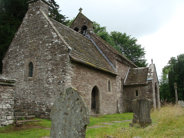
The original St Andrew’s church in the nearby village of Gargrave was built with robbed stone from the Kirk Sink site in the 10th-11th century, on what was a pre-Christian, pagan site. The present-day 16th century church houses a number of carved fragments of 9th century Anglo-Saxon/Norse cross(s). But was St Andrew’s the first church here? There is “some” evidence suggesting that an early British church was built on the site of Kirk Sink Roman villa – hence the name “Kirk”. This would perhaps have been a building something similar to a Celtic-style church. But there is a big question mark with regard to this. There was almost certainly a Roman temple here. So was the site occupied in the 5th or 6th century AD by a Celtic chieftain, quite possibly.

Sources / References:

Garlick, Tom, A Dalesman White Rose Guide — Roman Yorkshire, The Dalesman Publishing Company Ltd., Clapham, 1978.

© Ray Spencer, The Journal of Antiquities, 2012 (up-dated 2020).


Bomber Camp, Gisburn, Lancashire

OS grid reference: SD 8424 4768. The rectangular-shaped earthworks known as Bomber Camp are to be found in a field just off Coal Pit Lane, about 1 mile north of Gisburn and half a mile east of the A682. You can quite easily make out the earthwork ditch and low banks at ground level, but they are best seen from high above with an aerial view of the area. These earthworks are all that remain of a Romano-British camp, villa or settlement, dating from the mid to late 4th century AD, that is situated on a low hillside.

Roughly the earthworks measure 200 feet by 220 feet – about 1 acre. There is a ditch running around the edges of the site with an entrance at the south-eastern side. Some post holes were found during excavations here in 1940. The excavations also discovered cobbled and paved surfaces inside the camp’s enclosure. A number of artifacts were found including a sword, a quern stone, mortaria and some Samian-ware that was typically 4th century in date; and other pottery called grey-ware. Some of the pottery fragments had traces of burning – although no hearth was found. In the 1970s another archaeological dig was carried out here, but no report was compiled.

Bomber Camp, Gisburn (An Aerial View).

It seems that Bomber Camp may have been a mid-4th century Romano-British settlement or farmstead, but there is evidence to say that it was, in actual fact, a villa belonging to a chieftain because of the post-holes that were discovered here. In about 365-370 the camp or settlement was burnt to the ground as civil unrest began to spread across the north of England, perhaps even outright and violent warfare between retreating Roman forces and local tribes. Another smaller earthwork at Primrose Hill, just to the south-east, close by Hesketh farm most probably dates from the same period as Bomber Camp.

[I am indebted to John Dixon & Philip Dixon whose brilliant book ‘Journeys Through Brigantia Vol 1 Walks in Craven, Airedale and Wharfedale’ by Aussteiger Press, Barnoldswick, 1990, which I have sourced here for some of the information. Thank you].

Bomber Camp, Gisburn, Lancashire (looking west).

Bomber Camp, Gisburn, Lancashire (looking south)

Bomber Camp, Gisburn, Lancs (looking east)


Partrishow Church, Forest Coal Pit, Powys

SO2788 2243. The secluded little church of Partrishow, Patrishow or Patricio, can be reached along winding, narrow country lanes about 1 mile north of Forest Coal Pit, overlooking the Afon Grwyne Fawr Valley, at the foot of the Gader Fawr. The town of Abergavenny lies 5 miles to the south, while Crickhowell is about the same distance to the south-west. The hamlet of Partrishow consist of just a few farmhouses along with the little medieval church of St Ishow (Issui) and its graveyard and, just down the lane in the cwm, the holy well Ffynnon Ishow, a site of pilgrimage down the centuries.

English: St. Ishow church, Partrishow Taken fr...

St. Ishow’s church. (Photo credit: Wikipedia)

Parts of the church dates back to the 11th century although much of it is from the 13th-14th century with some restoration taking place in 1908-9. When you enter the 14th century porch with it’s old holy water stoup you are immediately taken right back into the middle ages, the building is just a sheer delight, it’s whitewashed walls, pre-Reformation paintings, gorgeous decorated oak rood-screen and other antiquities are a pleasure to see. The closed-off room at the west side is a hermit’s cell and chapel that dates from the 11th-14th centuries and is called ‘Eglwys-y-Bedd’ or grave of St Ishow, indeed the saint is said to lie under the altar that has six consecration crosses, rather than the customary five. In 1908 human bones were discovered under the wall. Also at the west end a painted skeleton is a “figure of doom” holding a scythe, hourglass and spade. The painting has been whitewashed over many times but it always mysteriously re-appears again.

The carved font dates from 1055 AD, making it the oldest in Wales. It has a Latin inscription to Genillin or Genyllin Voel the son of prince Rhys Goch, Lord of Ystradyw, and prince of Powys. When translated the inscription reads:- Menhir made me in the time of Genillin. In front of the rood-screen there are two stone altars each having five consecration crosses carved onto them, these representing the five wounds of Christ’s passion. The beautiful Irish oak rood-screen and loft is renowned throughout Wales, said to be of Flemish design, but more probably made by Welsh craftsmen in 1500. The screen is carved with figures representing St Mary the Virgin, St John the Apostle and a fearsome fire-breathing Welsh dragon.

In the churchyard stands a 12th-13th century preaching cross standing on three steps, its octagonal shaft leading up to the lantern that is more recent in date but, which has a number of figures carved upon it including St Issui. Giraldus Cambrensis (Gerald of Wales) is said to have preached his sermon on the 3rd crusade at the cross in 1188 during his famous tour of Wales. The small square building at the front of the church was used as the parson’s stable.

Back down the lane in the cwm on the left-hand side stands Ffynnon Issui (St Ishow’s well). Some steps lead down to the well situated close to the Nant Mair brook (St Mary’s stream). One of the steps has a Maltese cross. The well is inside a 1 metre high drystone-wall well-chamber with a slab for it’s roof. There are some niches to allow pilgrims to place offerings or flowers; the water runs into a small square basin at the bottom. According to legend, St Issui a 6th century hermit lived beside the well, so the well is of a pre-Christian date, the holy man using the water to baptise local people. But the saint was murdered by a man who sought shelter with him but had refused to be converted to Christianity; the site of this martyrdom became known as Merthyr Issui. In the middle-ages pilgrims began to come to the holy well to be healed of various diseases and this  continued up until the 19th century. But even today people come here and leave crosses made out of twigs and partake of the water in the hope that they, too, will receive a miraculous cure. Coins are also occasionally thrown into the well for good luck!

St Ishow’s Holy Well (Ffynnon Ishow), Partrishow, Powys.


Lonan Church Crosses, Isle Of Man.

SC4273 7937. Lonan old church (Kirk Lonan or Keeil-ny-Traie) is located just 1 mile south of the A2 east-coast road at Ballakilley, 1 mile south of Baldrine and 1 mile east of Onchan. Douglas is 4 miles to the south. The church is partially ruined now but it is still a very interesting site with it’s ancient churchyard and nine Celtic-style crosses and slabs.

The little church, dedicated to St Adamnan or Eunan, dates from the 12th-14th century but there was an earlier 7th century building on this site that stood on a pre-Christian, pagan site; it’s eastern wall is probably the earliest part of the church. St Adamnan, an irish monk, was abbot of Iona in western Scotland between 679-704 AD, though St Patrick’s nephew St Lonan was the first to settle here back in the late 5th century AD. He was apparently third bishop of Mann after St Maughold. St Lonan’s holy well (Chibbyr Onan) can be found just to the south of the church. Thanks to the Rev John Quine, a local antiquarian, the church was saved from complete destruction in 1895.

The most spectacular of the nine crosses (no 73) is in it’s original position at the south side of the kirk-yard. It stands at 8 feet high and has a large equal-limbed Celtic wheel-head cross that is almost completely covered in interlacing, knot-work and plait-work designs. This dates from the 5th century AD. All the other cross-slabs stand against the north wall in the roofed area at the east side of the church. The other eight cross-slabs and fragments, numbered 23, 27, 71, 75, 76, 77, 160 and 177, are heavily worn and only faint carvings can be seen; one has been repaired and shows part of a small wheel-cross, and there are two fragments of ‘The Glenroy Cross’. These show Celtic and Norse workmanship and are more recent in date, probably 8th to 10th century AD. You can see the casts of these cross-slabs at the Manx museum in Douglas.


Harold’s Stones, Trellech, Monmouthshire.

SO4992 0514. Standing in a field just off the B4293 Chepstow road just south of Trellech village are three Bronze-Age standing stones, dating from 3,500 years ago, all that is now left of a probable stone row or stone circle. Monmouth is 5 miles to the south and Tintern 3 miles to the north-west. Trellech means ‘the place of the three stones’. The three stones or monoliths lean at different angles to each other and vary in height from 8 feet, 10 feet and almost 13 feet, the tallest stone having sunk into the ground and slipped leaving it at a crazy angle. A fourth standing stone apparently once stood close by but was robbed-away or destroyed in the late 18th century. The stones are made of conglomerate rock that is known as ‘Pudding Stone’.

According to legend, the stones were hurled by the giant, Jack o’Kent, from either the Skirrid Fawr (Holy Mountain) 12 miles away to the north-west or, from Beacon Hill, 1 mile to the east, while he was having a fight or playing a game with another giant or, perhaps the devil? King Harold of the English, known as Harold Godwinson, fought a ferocious battle hereabouts with a Welsh army in the 11th century; Harold was victorious although he lost many of his men in the onslaught. He had the stones erected here to commemorate that battle. However, there is no connection whatsoever with King Harold, the stones pre-date him by thousands of years. It is thought likely that religious ceremonies took place here – the stones being phallic symbols, with some magical significance to the ancient druids maybe another line of thinking – though they are not generally thought to be part of a druids’ circle.

Harold’s Stones, Trellech, Monmouthshire.

In the village church of St Nicholas, a 13th century building on a 7th century Saxon site, there is an interesting 17th-century four-sided sundial. Three of the faces show the historic features in the village each with it’s own Latin inscription; the three standing stones are depicted along with the inscription MAIOR SAXIS or ‘greater because of the stones’ and HIC FUIT VICTOR HARALDUS or ‘here Harold was victorious’. On the other faces of the sundial are St Anne’s well or The Virtuous Well, 300 yards along the Llandogo road, was where medieval pilgrims came to receive a miraculous cure, and Tump Terret a 20 foot-high mound in the grounds of Court farm behind the church, that was probably a 12th century motte and bailey castle or a keep that was built by the Norman de Clare family, although local legend says that the mound contains the bodies of King Harold’s men who were killed in the battle. But no excavations have taken place so we shall probably never know it’s real meaning only what can be learned from the locals who know a good tale or two!

Copyright © Ray Spencer, The Journal of Antiquities, 2012. Updated 2023.


Elslack Roman Fort, North Yorkshire.

SD9259 4955. The solitary, rather forgotten earthworks of Elslack Roman fort or Burwen Castle lie just west of Elslack lane beside the disused railway line that linked Skipton with Colne, the course of which is now a pathway. The A56 Skipton road runs close by. A gate gives access to the site which is often quite boggy. There is not a great deal to see today, but if you look closely you can make out the earthworks that define the outer banks of this rectangular-shaped fort. The fort here at Elslack is probably Olenacum? rather than what some experts claimed it to be, Olicana. The fort at Ilkley is known as Olicana or Verbeia?

The first fort was 345 feet (3 acres) within its ramparts, today’s site measures 608 feet by 406 feet, just over 5 acres, with the Thornton beck running close to the north-west edge of the site. It was built during the Flavian period about 80 AD when the area was ruled by the Brigantes. At first it was manned by an infantry garrison then later, in the 2nd century, by an auxiliary cavalry unit of upto 500 men. It was probably originally a small fortlet that was constructed with clay ramparts on top of stone foundations with a double ditch 24 feet in width. In the 2nd century AD the fort was levelled and replaced by a much larger stone-built fort and, then in c340 AD, another stone fortification was built on top of that and this is more or less what we see here today. But in 370 AD the site was abandoned and not long after that the Romans withdrew their legions from Britain for good.

The defensive ramparts were upto 9 feet high and, at the western section upto 12 feet high but erosion of the site has now altered that somewhat. As usual there were four gateways, those at the western and eastern sides quite large, the two at the north and south sides were small. The south-east side of the fort has been almost destroyed by the course of the disused railway line, although a small section of the rampart is just visible at the opposite side of the path that now follows the bed of the railway line. The flat plateau between the earthworks is the interior of the fort. A low bank with small trees growing out of it running through the centre of the site is probably more recent in date, perhaps a field boundary, and does not appear to be part of the Roman fort?

In the early 1900s two excavations were carried out at the site. Finds included many animal bones, leather boots, a Samian bowl, coins of the Emperors Domitian and Constantine, part of a rotary quern and an artillery projectile from a Roman carroballista machine. These finds were deposited in the Craven museum at Skipton. Then in the late 1980s a geophysical survery was undertaken here which identified a possible building just outside of the eastern rampart, although the interior of the fort did not reveal any buildings, indicating perhaps that they were completely destroyed in 370 AD. The Roman road from Ribchester (Bremetenacum) to Ilkley (Verbeia) and York (Eboracum) intersects here. It is only really visible to the south-west of the site and to the north-east, beyond The Tempest Arms public house.

Gate and signboard at Elslack Roman fort.

Elslack Roman Fort, North Yorkshire

Elslack Roman fort defenses at western side.


1 Comment

Kemple End Cross, Bashall Eaves, Lancashire

SD6865 4045. The Kemple End Cross, also known as the Paulinus Cross, stands in the corner of a field beside a wooded area close to Birdy Brow Lane, just up from the Hodder bridge at Bashall Eaves, on the side of Longridge Fell. The town of Clitheroe is 3 miles to the west. A footpath at the northern side of the wooded area heads south-east at Fell Side farm. At first glance the cross looks like a pile of stones but, it is in fact, a pre-Conquest cross dating back to the 7th century AD.

It is an odd-shaped cross with a crude and stubby cross-head on a short shaft that is set into a large, natural socketed base-stone that is not the original, that having vanished long ago to where no one knows. All in all the cross and base are 5 foot high. The cross has weathered over the centuries to what it looks like today. Legend records that St Paulinus, bishop of York, preached here in the 7th century AD during his long mission in the north of England between 619-633 AD when he apparently converted thousands to the Christian faith from Cumbria right across  Lancashire, Yorkshire and to Lincolnshire. But nowadays sheep and cattle use it as a rubbing post! He is famous for baptising King Edwin of Northumbria into the Christian faith at York in 627 AD. St Paulinus died at Rochester, Kent, in 644 AD.

At short distance to the east along a path that leads to a gate there is a standing stone that is pointed at the top and has a large hole near the middle. Could this have been a marker stone for pilgrims visiting the ancient cross, or could it have been used as a gate-post? The stone is much more recent in date.

Kemple End Cross, Lancashire


Taeppa’s Low, Taplow, Buckinghamshire

SU9061 8216. Taeppa’s Low, a man-made burial mound or tumulus stands in the grounds of Taplow Court to the west of the village of Taplow, 1 mile east of Maidenhead, and to the north of the A4 and just east of the A4094 road. The site is close to the east bank of the River Thames. The Anglo-Saxon burial mound stands inside an old churchyard where there stood, upto 100 years ago, a Saxon church dating from c700 AD. The whole site is surrounded by the earthworks of an Iron-Age fortification which are now barely noticeable to visitors.

The grass-covered mound is 15 feet (4.5 metres) high and 80 feet (24 metres) in diameter at its base with a flatish top to it. In 1883 an archaeological excavation was carried out by the parish clerk who just so happened to be an antiquarian. He dug down into the mound for a few feet but  nothing much was found; however, when a 6 foot hole was dug into the mound just below ground level, a burial was found. The funery finds consisted of a thigh bone and vertebrae inside a planked coffin in a pit with a gravel floor. The grave pit or chamber was 12 foot by 8 foot and was made out of timber. Along with the bones of Taeppa were his many grave goods, some quite rich and decorated, indicating that he was a person of noble lineage – probably a chieftain or prince. He may have been a relative of King Redwald of East Anglia who died in 617 or 625 AD and was buried at Sutton Hoo. The finds at Taeppa Low were dated to 620 AD.

Among the artefacts found during the excavation was a sword, spear, shields, gold buckle, bronze clasps, drinking horns with gilt ends, glass beakers, an Egyptian bronze bowl, drinking cups, fragments of a harp, some well-decayed cloth found on the bones and golden thread from his tunic – everything that he would need in the afterlife! These finds are now in the British Museum, London. We do not, however, know whether or not Taeppa was a Christian, certainly his relation King Redwald was an “on off Christian”, and this was before the area was Christianised by St Birinus twenty years later.

200 yards to the north-west of the mound is Bapsey Pond which is actually a holy well associated with St Birinus, bishop of Dorchester, who died in 650 AD. He baptised many converts at the well in 642 AD. The source of the pond comes from the old churchyard where the mound is located. So, maybe there were originally two holy wells here?

Taplow Mound, Buckinghamshire. Image copyright Bob Trubshaw / bobtrubs@indigogroup.co.uk. From At the Edge / Bob Trubshaw 1996.


2 Comments

Caerhun Roman Fort, Caernarvonshire.

SH7760 7040. The square-shaped earthworks of Caerhun (Canovium) Roman fort are located about a quarter of a mile east of the hamlet of Caerhun and along a lane that leads off the B5106 Conwy road east of Tyn-y-Groes, about 5 miles south of Conwy. The lane is signposted to St Mary’s church and actually goes through the south-west corner of the fort in order to reach the church.

The Romans built their temporary wooden fort with an earthen rampart and two ditches close to the west bank of the Afon Conwy (River Conwy) in 75 AD and, later in about 150 AD, they rebuilt  it with stone. The 13th century church and churchyard of St Mary now occupies the north-east corner of the fort’s earthwork rampart. In 200 AD the fort was destroyed but it seems some form of occupation occured in the 4th century, only to be completely destroyed in c400 AD. After that there may well have been Romano-British occupation when a 5th or 6th century prince or king of Gwynedd called Rhun set up a camp or settlement here. Did Rhun found the first church on this site? Caerhun (Caer Rhun) takes it name from him.

Canovium’s earthwork ramparts are visible, especially at the south-side and at the south-east side of the churchyard, but can be better seen on aerial photographs of the area. The fort measured 140 metres by 80 metres . Crop marks within the defenses mark where the buildings were situated, but the bath house stood outside the fort just to the west of the church – the earthworks from this are still visible. In 1926-9 archaeologists excavated the site and discovered a docking facility down by the river with signs of a jetty there. They also found Roman pottery, coins, a small stone with an inscription recalling the 10th legion (Leg.X), and possible remains of a villa. Obviously the fort occupied a strategic position with the Roman road heading west to Segontium (Caernarvon), a major military fort, and Deva (Chester) to the east; the river just to the east of Canovium would have been a bridgehead which was well defended by the local garrison.

English: St Mary's Church, Caerhun Located wit...

St Mary’s Church, Caerhun  (Photo credit: Wikipedia)

St Mary’s church dates in part from the 13th century, especially the side walls of the nave, but mostly it is a 16th century building.  Monks from Maenan abbey are thought to have built the church. The east window is thought to be from the original church. In 1972 fifteen bones, three skulls and a child’s pelvis were discovered by the north wall where an ancient water stoup is now built into the wall close by the west door. Outside, a small square-shaped medieval stone showing Christ crucified is built into  the wall. Some of the stones from the Roman fort are incorporated into the walls of the church. All in all a very nice little church, in fact, the whole site is well worth a visit, even though not much of the Roman fort survives today.


3 Comments

Kilpeck Church, Herefordshire

SO4449 3051. The little Herefordshire village of Kilpeck is 2 miles east of the A465 Hereford to Abergavenny road at Wormbridge and 7 miles south-west of Hereford. It is noted for its outstandingly beautiful 12th century Norman church with many carvings that are greatly influenced by the Celtic, Norse and also medieval (Romanesque) periods in history. It is now dedicated to St Mary and St David, its original dedication was to St Pedic or Pedoric, hence the name Kilpeck. This 6th century Celtic saint, a follower of St David or St Dubricius (Dyfrig), had a cell here and later a Saxon church sprang from that in the 7th or 8th century. At the back of the church there is a round-shaped churchyard indicating that this was a sacred site before the coming of the Celtic, Christian church.

In 1140-1150 the building that we see now was built over the Saxon building  – although as is always the case some restoration has taken place in more recent times. By 1143 the church of Kilpeck was placed under the care of the Benedictine abbey of Gloucester giving it a monastic status; the monks came and built a small cell here soon afterwards. All the carvings that we see here are from the late 12th century and were probably all done by the Hereford school of stonemasons. The church survived being abandoned in the 14th century, the Reformation of the 16th century and the puritans of the 17th century, in fact, the place looks as if it has only just been built, especially as it is always kept well whitewashed and in a most excellent state of repair.

English: Kilpeck church The church is dedicate...

Kilpeck church (Photo credit: Wikipedia)

Kilpeck church is renowned for its very beautifully carved Norman south door, carved chancel-arch, nave and vaulted apse. Part of the nave (NE corner) may date from the 11th century. The font is Norman but the holy water stoup could be pre-Conquest; this is carved with animal heads and a pair of hands holding two heads. But it is the many carvings on the outside of the church that do it justice for there are so many to see. The exterior of the south door has double columns and a richly carved tympanum over the top. A vast array of carvings can be seen on the doorway including snakes, human heads, foliage, birds, dragons, warriors, medallions and a green man. The tympanum shows what is almost certainly the Tree of Life.

On the exterior walls running along the corbel table below the roof there are many strange, comical and often quite ugly carvings. These include two men fighting, a dog and rabbit, the lamb of God and cross of Jesus, a vulgar sheela-na-gig displaying genitalia, two dragons fighting, green men, a warrior entwined, human heads, a cat and dog and, a pig. But there are others too. A walk around the church is well worth it. Close to the church are the earthworks of a 11th-13th century Norman motte and bailey castle.

Kilpeck Church (South Door)

Kilpeck Church, sheela-na-gig


The Giant’s Grave, Penrith, Cumbria

OS grid reference: NY 5165 3016. A short walk in an easterly direction from market Square and king street (A6) in the centre of Penrith is the ancient church of St Andrew, a Saxon foundation. At the north-side of the church stands a slight mound on top of which are two pillar-crosses and four hogback gravestones – collectively known as the Giants Grave. These stones are said to have been placed over the burial site of Owain Caesarius, legendary and heroic king of Cumbria during the early 10th century, who was said to have been a giant of a man. Also in the churchyard is the Giant’s Thumb, a damaged Anglo-Norse wheel-headed cross dating from 920 AD.

The Giant’s Grave, Penrith.

The two tall and slender pillar-crosses standing 15 feet apart are now heavily worn and it is difficult to make out the carvings on them, but they have been dated to around 1000 AD and are Anglo-Norse in origin. Both crosses have sustained some damage – the taller cross with a badly damaged head is between 11 and 12 foot high, while the smaller cross, also without its head is between 10 and 11 foot high. Set between them, spaced 2 feet apart, and embedded into two long slabs are four hogback gravestones with curved upper edges and some rather nice carvings, including spiralling and circles with crosses or interlacing inside them. These graves represent Viking houses with carved sections depicting the life of the person(s) buried beneath them, often  with intricate symbols and patterns; the stones here may represent four wild boars killed by king Owain in Inglewood Forest.

Hogback Gravestone, Penrith.

Close by stands the Giant’s Thumb which also commemorates Owain Caesarius who was a legendary, perhaps mythical, king of Cumbria from 920-937 AD. This 6 foot high monument is another pre-Conquest cross with part of its wheel-head now missing. It stands upon a 19th century Victorian base with an inscription. According to local legend, the cross was set-up at the time of Owen’s accession to the throne of Cumbria. However, some historians have argued that Owain or Ewan was, actually, Owain ap Urien the son of king Urien of Rheged in the 6th century AD, who was probably of Welsh/Irish descent. Rheged was a part of the old north country, known to the bards as Hen Ogledd, which covered a large part of northern England and southern Scotland, in particular Rheged was centred on Cumberland and Westmorland, its people speaking the old Brythonic language. King Urien of Rheged ruled from 550-590 AD.


2 Comments

Y Gaer Roman Fort, Brecon, Powys

SO0033 2966. The “almost” perfectly square-shaped earthworks of the Roman fort of Y Gaer (Brecon Gaer) or Bannium Cicucium are located on a low ridge in a farmer’s field about a quarter of a mile north of the A40, just to the west of Llanspyddid. The town of Brecon lies 1 mile to the east. Y Gaer farm is partly built over the northern defenses and the site is on private land. It was built between 75-80 AD in the area held by the Silures tribe and manned by a garrison of 500 cavalrymen (Ala) from Vettones in Spain, along with some captured prisoners who were put to work on building the fort. The confluences of the rivers Usk and Ysgir straddle the valley close to the fort, something which the Romans were obviously aware of and would have considered to be an excellent place to build a fort.

The fort held a strategic position close to a major Roman road linking other camps and forts at Gobannium and Isca to the east, while  to  the  west  two  temporary marching camps at Y Pigwn and other nearby forts at Alabum, Coelbren and Moridunum. But the first fort here was made of timber with earthen ramparts and two ditches, then in c140 AD this was replaced by a stronger, stone fortification that was built by the 2nd Spanish Augusta legion. However, the occupation here may have come to an end in 200 AD although, evidently, there were two more occupations during the 3rd and 4th centuries AD.

The walls stood to a height of 10 feet and there were guard towers at each rounded corner of the fort and three gatehouses – although four entrances were built in the centre of the N, W, S and E walls, that at the N side now built over by a farm building; altogether the fort measured 615 feet by 460 feet. The headquarters buildings, barrack block and granary were, as always, inside the walled defenses as was the bath-house which was attached to the barracks for ease of use – normally this would have been outside the walls, and outside the N gate was the cival settlement (vicus) for the labourers, many of whom were captured prisoners.

In 1924-5 the site of Y Gaer was excavated by Sir Mortimer Wheeler and most of the buildings uncovered for the period of the dig. A number of antiquities were discovered but, the most impressive artefact was the tombstone of a young cavalryman called Candidus, which is now housed in the Brecon museum. Today some of the walls are still visible, but with more recent stonework being built onto them, and the S and W gates remain as they were found. The earthen defenses are visible along the sides of the fort at the W. S and E sides, that at the N side less so due to the “unfortunate” building of Y Gaer farm.

English: Cicvcivm - Brecon Gaer, near to Abery...

Y Gaer (Brecon Gaer). (Photo credit: Wikipedia)


Castlerigg Stone Circle, Keswick, Cumbria

NY2913 2362. Castlerigg stone circle or the Druid’s Circle stands on a flat hilltop close to Castle lane just south of Goosewell farm, 1 mile north of the A591 at Castlerigg village and 2 miles east of Keswick. Although referred to as a circle, it is actually oval in shape and probably dates from the late Neolithic to the early Bronze-Age periods 3,370-2,670 years BC. There are some excellent panoramic views to be had from the circle of the distant mountains of the lake district.

All of the stones and boulders ranging from small and large ones that make up the circle are glacial erratics made of metamorphic slate; these would have been moved into a suitable circular position. There are between 38-40 standing stones (also called carles) the correct number being difficult to count, 33 of the stones are standing while the rest are recumbant. Inside the circle 10 stones form a rectangular cove or sanctuary, the eastern section of which connects with the outer circle (perimeter), and is regarded as quite an unusual feature. At its most widest point the circle measures 32 metres (107 feet) in diameter and at its narrowest point it is 29 metres or roughly 100 feet.

Castlerigg Stone Circle, Cumbria

The height of the stones varies from around 1 metre to 2.3 metres, with 8 of the tallest stones being at the northern and southern sides and weighing between 15-20 tonnes. At the north-east side of the circle there is an entrance or portal between the stones which is 3.3 metres wide. Some 90 metres to the south-west near to a wall there is another boulder, or outlier, that may or may not be connected to the circle itself.

We can never really be certain what the circle was used for. It may have been a place where ritualistic ceremonies took place, or it was used it as a sort of astrological observatory for watching the skyline and calculating the movement or alignments of the sun, moon and stars, especially at the soltices. Shamanism – the spirit world was something the ancient peoples were interested in, coming to the circle to say prayers to their dead ancestors. One of the stones at the eastern side is said to be magnetic in nature, the whole site acting, perhaps, as a kind of powerpoint. A number of leylines are said to pass through the circle.


The Priapus Stone, Great Urswick, Cumbria

SD2704 7377. The ancient Priapus Stone is embedded into a wall beside a country lane half a mile south of Great Urswick village, near Holme Bank farm, and 4 miles south of Ulverston. There is much uncertainty about it’s age but it is probably prehistoric in origins and almost certainly pre-dates Christianity. This block of un-hewn limestone which measures 7 foot long by 2 foot 7 inches wide and 1 foot thick used to stand upright in the field on the other side of the wall till 1920. It is said to weigh upto one and quarter tons and was brought from a nearby quarry. There are six small holes at the head of the stone, five of which are in a cluster. These little holes apparently allowed women to place their fingers in as a kind of ancient fertility rite, but the stone itself is very crudely phallic in shape, supposedly fashioned to look like male genitalia, representing the ancient Greek and Roman god Priapus.

The Priapus Stone, Cumbria.

Back in the mists of time the women of Great Urswick would perform a fertility rites ceremony and decorate the stone to look like the god Priapus, son of Aphrodite. On midsummer’s day, in particular, coloured pieces of rag were smeared with sheep’s saliva or butter and placed over the stone; the head part was decorated with flowers – all this in the hope of a fruitful procreation being helped on. The ancient Greeks and, later the Romans, honoured Priapus with painted pictures on temple and villa walls, and often tiny statuettes were kept by ladies with the god himself usually depicted as a young, well-endowed man with “over-sized genitalia”. Today the stone in the wall at Great Urswick is slowly becoming forgotten, no such rituals and rites take place now, or do they?