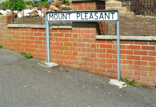
Mount Pleasant Sign at Chesterton.
OS grid reference SJ 8302 4900. This Roman site in north Staffordshire is a difficult one to examine in any real detail as there are no tangible signs of earthworks showing up from the late 1st century fort, or what’s left of it, which is partly buried under Chesterton High School (now known as Chesterton Community Sports College) between Mount Pleasant and Castle Street and the recreation fields at the back where there are some very faint, linear crop-marks. Was Chesterton the Roman town (vicus) of Mediolanum – about which some Roman historians have alluded to? Quite possibly, but still some uncerainty.
From what is known the auxiliary fort was built in the early Flavian period circa 70 AD after an earlier temporary fort at Trent Vale (Stoke on Trent) – a few miles to the south had been abandoned. The fort was apparently linked to a temporary Roman marching camp at Loomer Road, 400 yards to the south, where the Roman Catholic church of St John now stands, and it’s earthworks are still said to be visible at the south-east side of the church. And at Holditch, some 800 metres to the south-east, there was a Romano-British settlement of the late 1st to early 2nd century AD. Here a number of Roman artefacts were excavated. The town of Newcastle under Lyme is one and half miles to the south of Chesterton on the A34, at the north-western edge of The Potteries.
The northern section of the fort lies under the high school buildings and the southern section under the fields and recreation areas at the back, and roughly following the field boundarie there – where some very faint linear crop marks can be made out in the large field. Apparently the mainly timber-built fort was parallegram-shaped (rectangular) and measured 365 yards by 300 yards, according to Pastscape, which would be around 4 acres all told, so a medium to large-sized auxiliary fort on the Roman road called RYKNELD STREET, which ran from Derventio (Derby) in the east to the fort at Rocester and, in the west to Salinae (Middlewich), Condate (Northwich) or, according to some, Kindeston, and then on to Deva (Chester). The fort at Chesterton would have held a cohort of 500 to 600 soldiers quite comfortably, I would imagine.
After the demolition of a house called ‘Mount Pleasant’ in 1969 excavations were carried out on the site of the fort for a period of 2 years. A defensive bank running alongside the lane, at the north-west side, was found and also the defenses of the south-eastern side, but sadly no antiquities of any note, apart from a stray silver coin found by a pupil during a school dig [June 2013], and some early Flavian pottery from the ditch. From what is known, however, its timber rampart was 20 feet wide and at the front of this two ditches made from clay and turf were some 20 yards wide; the rampart apparently was shortened or cut back and then the inner-most ditch (15 feet wide and 6 feet deep) with a square-shaped drainage channel, was filled in.
The fort appears to have been built in “one” construction phase rather unusually, perhaps, whereas many Roman forts had two or even three phases of construction. A clay oven and the remains of the cook house were discovered – the latter had been built onto the timber rampart. Between 1593 and 1603 the antiquarian, Sampson Erdeswick, recalled in his work ‘A Survey of Staffordshire’ that the surviving walls were of “marvellous thickness”. So if we take that at face value the ramparts were made of stone-worked walling of some kind – probably sandstone fragments in hard clay, although sadly all that was either robbed away or bulldozed as there are no visible signs of any stonework today. The north-west corner of the fort abutted up against a sandstone outcrop which helped form the defenses there. There was a bath-house on the site though it is uncertain whether this was situated inside or, on the outside of the fort – they were usually outside.
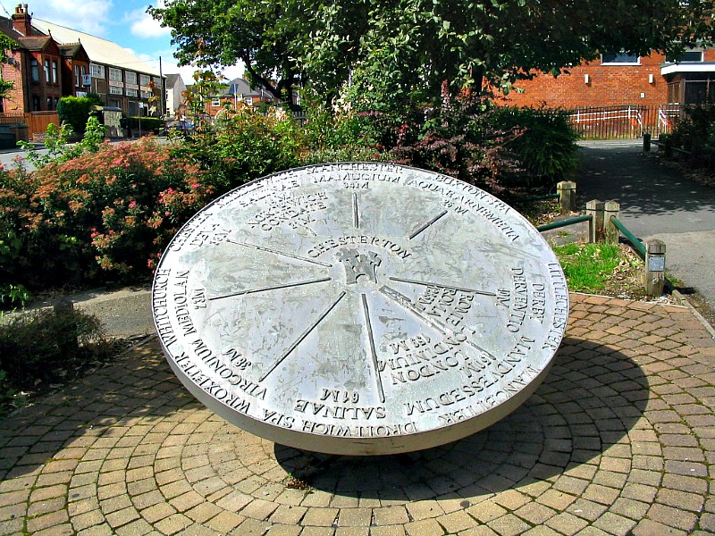
Chesterton Mileage Disc 2000
The nearby Roman marching camp at Loomer Road, Chesterton, measured 325 feet by 315 feet around 2 acres and was square-shaped; its earthworks are still visible at the south-east side of the Roman Catholic church of St John the Evangelist, while the Romano-British settlement at Holditch further to the south-east has all but vanished. However, quite a lot of pottery has been found on the site, as well as a pottery figure of Venus, glass beads and a bronze bell. At Trent Vale a pottery kiln from the Roman period was excavated, and at Lightwood near Longton, a hoard of Roman coins was unearthed. Many of these artefacts can be seen in the Newcastle Under Lyme museum in Brampton Park. There are some Roman antiquities from the Trent Vale site on display in The Potteries Museum at Hanley, Stoke-on-Trent. And the Chesterton mileage disc set up at the Millennium in 2000 can be found at the corner of London road (B5500) and Wolstanton road (B5369) in Chesterton and is part of the ‘Midlands Heritage Forum’. The disc displays the mileage in ‘Roman miles’ between various Roman forts and towns in England with Chesterton at the centre. Also, at ‘The Apedale Heritage Centre’ on Loomer Road, Chesterton, Newcastle-under-Lyme, there is part of the wall from a Romano-British building, information on the site at Holditch and the invasion of Britain in AD 43.
Sources:-
Erdeswick, Sampson, A Survey Of Staffordshire, J.B.Nichols & Son, London, 1844, 22.
Pastscape website http://www.pastscape.org/hob.aspx?hob_id=75834
www.roman-britain.org http://www.roman-britain.org/places/chesterton.htm
www.webbaviation.co.uk http://www.webbaviation.co.uk/gallery/v/staffordshire/Newcastle-under-Lyme/ChestertonRomanFort-fb31891.jpg.html
http://www.apedale.co.uk/index.php/museum
Thanks also to Barrie Collinson for the info on The Apedale Heritage Centre.
Copyright © Ray Spencer, The Journal of Antiquities, 2013 (updated 2024).
.

August 10, 2013 at 8:42 am
Yes Chesterton seems to a very ‘busy’ area for Roman Activity perhaps because of its links with Chester and other Roman Centres. I also found much of the information on line confusing so it did need someone to try and sort it out. You have done a very good job in bringing it all together. The information here is very detailed as we have come to expect.
Newcastle’s Millennium Project the Chesterton Mileage Disc was a good idea to highlight the area’s Roman past in an area where the is actually very little to see except in the Museum, but where there was a lot of activity at the time.
BarryS
LikeLike
August 10, 2013 at 8:46 pm
Thank you BarryS that’s a much appreciated comment and has cheered me up. Like me, you also enjoy Roman sites. Thanks.
LikeLike