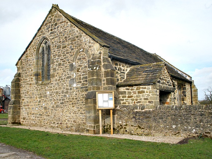
St Saviour’s Chapel at Stydd, Ribchester.
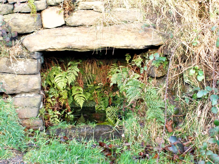
OS grid reference: SD 6538 3597. About ½ a mile to the east of Ribchester village, just after the Ribchester Arms Inn, turn off the B6245 (Blackburn road) and head up Stydd Lane (past the 18th century Stydd Almshouses) which eventually becomes a dirt track, and where soon you reach the isolated and ancient little Stydd Chapel, a simple rectangular-shaped building looking a bit like a barn, dating back to the mid 12th century and dedicated to St Saviour. And how pleasant the building is, surrounded on one side by a tiny grassy enclosure which was in use as a graveyard until 1879; and some old and new farm buildings scattered around it at the back. There are a number of interesting architectural features in the building and, equally some interesting old grave-slabs. The river Ribble runs close by and Dutton is bit further along the Blackburn road, while Longridge is 2 miles to the north-west and Whalley is 4 miles due east on the A59 road via Copster Green and Billington.
In her book Lancashire Countrygoer, 1964, authoress Jessica Lofthouse says of Stydd Chapel: “Six centuries ago the Knights Hospitallers of St. John of Jerusalem owned an estate at The Stede, a small “monastery” complete with chapel, dormitory, refectory and cloisters. They were crusading monks, rarely at home until the last fighting men had returned from the Holy Places. In 1338 — when it was considered it no longer served any useful purpose — it was dissolved.” The earliest documented evidence is probably the deeds (undated) of the mid 12th century, then later in 1292 another, clearer more acceptable document saying that “the Knights Hospitallers of St John aquired the land from one Adam of St Saviour at Dutton”. Author Ron Freethy in his book Exploring Villages, 1985, refers to St Saviours as a “Crusader church” and goes on to say that these Hospitallers whom took a major part in the crusades over in the Holy Land also brought back ‘healing’ herbal plants and says: “for the Knights of St John were not only good fighters but skilful healers and herbalists. Many of the plants they cultivated still grow well near Styd, and a careful look around the church yard will reveal plants such as toothwort, used to cure toothache, and willow trees from which they stripped the bark to cure headache”.
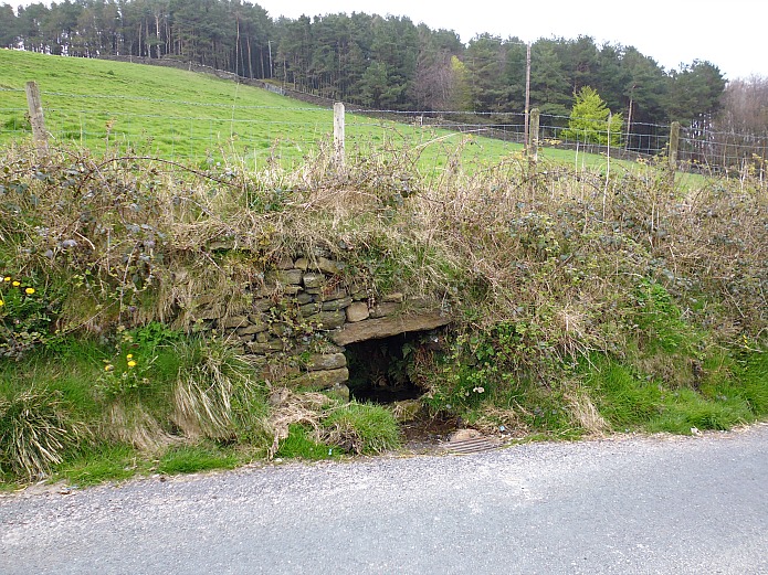
It was either in 1136 or 1150 when the Knights Hospitallers arrived at Ribchester to establish their chapel and monastic hospice for pilgrims, though it seems there had already been some kind of religious building on the site at the back where Stydd Manor farm now stands, perhaps an early Christian church or, more likely a Roman temple dedicated to the god Mithras, because Archaeological excavations here in 1912 came upon another building that ‘appeared’ to pre-date the present chapel, and could well be of a 4th century date, according to local authors John & Phillip Dixon in their book Journeys Through Brigantia (Volume 9) The Ribble Valley, 1993. A stone dedicated to Mithras was discovered inside the Roman fort at Ribchester – being used as a floor tile in a Romano-British building there. Stydd Manor farm still has some stones from the hospice or monastic farm incorporated into its walls.
The Early English porch (south door) was added to the chapel in the 13th century and has an oak door studded with nails and covered in old graffiti, while inside the building is rather “primitive” or bare to say the least with its stone-flagged floor, but there are also some interesting antiquities to be seen, despite that. Inside, the south door is quite beautiful with some exceptional carvings including concave keel mouldings and capitals with Corinthian floriated designs, dating from around 1200. But best of all are the north doorway and windows. On the exterior of the late Norman north doorway (now blocked up) there is what is called dog-toothed zig-zag carving (from between 1160-1190) and two round-headed windows. The octagonal font is made of gritstone and dates from the early 1500s and is interesting because it has carvings of sheilds and sacred heraldic symbols on all it’s sides, while the oak screen is of the late 17th century; and the piscina or water stoup built into the south wall of the chancel is medieval – maybe even late Norman, and has a trefoil stone head but it’s water bowl has gone. High up in the west wall there is another blocked-up doorway – this probably once lead to a wooden gallery and linked up with another building, now long gone.

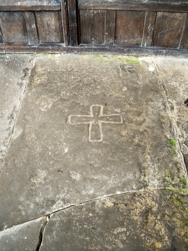
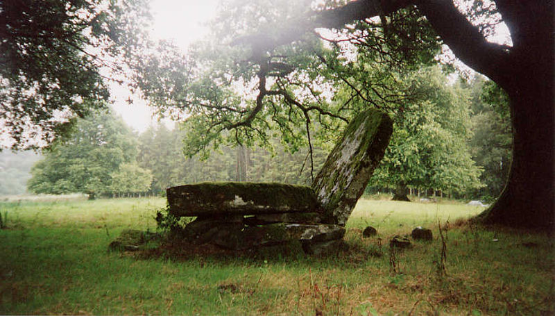
Gravestone of St Margaret Clitheroe at Stydd Chapel.
In the sanctuary at the back of the chapel we have some large recumbant grave-slabs. The one that is badly broken at the bottom with the plain incised cross is “said” to be that of the Roman Catholic martyr St Margaret Clitheroe (1556-86) who suffered for her faith at York and was canonised as one of the English Martyrs in 1970. She could, perhaps, have been related to the Clitheroe family who lived in these parts during the 14th century, though we don’t know this with any “real” certainty, but why would the gravestone of a Yorkshire martyr be here at Stydd? At the side of this stands a coffin tomb of unknown date. The other interesting gravestone which is now broken across the middle has a lovely floriated design. Buried here beneath this stone are the Knight Sir Adam de Cliderow and his wife Lady Alice Cliderow (1350). Outside in the old graveyard there is a medieval cross-base – its stump having disappeared. This is said to have come from Duddel Hill on the moors a few miles to the north of Stydd. Church services are still held ‘occassionaly’ at the Stydd Chapel and visitors, rather than pilgrims, come here now to look at the building.
Sources:
Lofthouse, Jessica., Lancashire Countrygoer, Robert Hale Limited, London, 1964.
Dixon, John & Phillip., Journeys Through Brigantia (Volume Nine) The Ribble Valley, Aussteiger Publications, Barnoldswick, 1993.
Freethy, Ron., Exploring Villages with Ron Freethy, Countryside Publications, Brinscall, Chorley, Lancashire, 1985.
Church Guide (Booklet), The Church of St. Saviour, Stydd. 2004. (In conjunction with St Wilfrid’s Church, Ribchester).
© Copyright, Ray Spencer, 2013.
53.818902
-2.527151