The Journal Of Antiquities

Ancient Sites In Great Britain & Southern Ireland


2 Comments

Gokewell Priory, Broughton, North Lincolnshire

Gokewell Priory Farm (

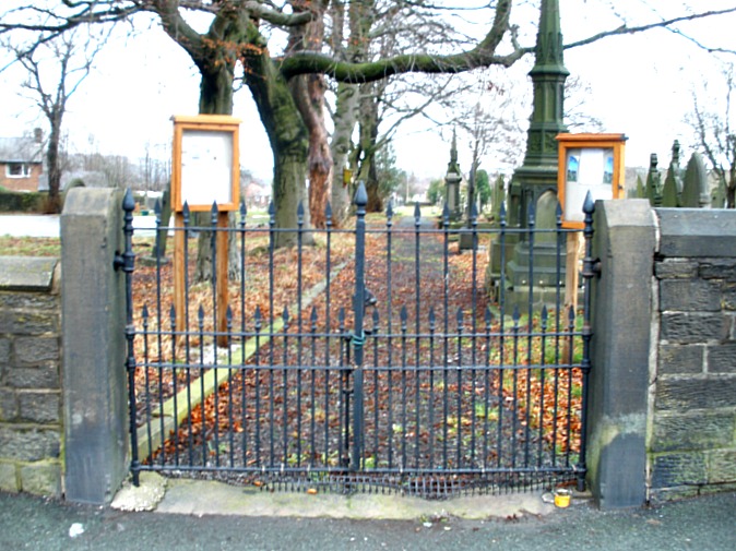
Gokewell Priory Farm (*Copyright, see below)

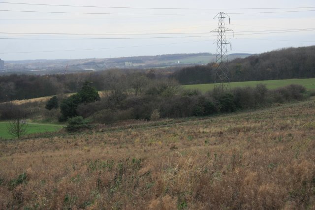
OS grid reference: SE 9402 1028. Roughly ½ a mile east of the Appleby Frodingham steelworks (Scunthorpe) and about halfway between Broughton and Santon, in north Lincolnshire, is the ‘lost’ hamlet of Gokewell with the scant remains and earthworks that are all that is left of the small religious house of Gokewell Priory, covering up to 1 acre of land. Standing just a little to the north “was” Gokewell Priory Farm (now demolished*) around which there are some very scant stone foundations, earthworks, ditches and ponds, all that is left of the medieval priory that housed Cistercian nuns between the late 12th and the early 16th centuries. The site now lies in the parish of Broughton, and an area of bushes marks the site where the farm used to stand.

The hamlet of Gokewell is virtually gone. Of the site itself there is little remaining today, while all around it there are ploughed fields that are usually covered in crops during the summer months but, there are footpaths around the periphery of the earthworks and, Santon Wood is just a short distance to the north – otherwise the priory earthworks are for the ‘most part’ on private land. The village of Broughton is 1 mile to the south-east on the B1207 (Appleby Lane) which is, in fact, the course of the Roman road Ermine Street; the roman road itself runs straight through the village centre. There was a holy well at Gokewell called Nun’s Well, but the site could date back to the Dark Ages or to pre-Christian times?

The small priory with a school-room for poor children was ‘probably’ founded in 1185 by William de Alta Ripa but, it’s possible that it was founded a little earlier in 1148; there were three other local benefactors who also gave ‘money’ for the establishment of the religious house, which was run by Cistercian nuns, with the first recorded prioress being a noblewoman called Avice (1234). From what we know, and its not very much, the priory never had much money (for its up-keep) and at any one time there was never more than ten or eleven religious sisters here and, even less on some occassions; at the Dissolution in 1536, only seven sisters remained! The sisters would have lived a “very” spartan life, with a life of prayer and penence, and besides that very little in the way of food, apart from fish from their ponds (still to be seen today), and food stuffs given to them by local people, their clothes were bought by their own families. However, they did take in ‘poor’ children, mainly boys under the age of eight and girls under ten years. The rector of Flixborough was their steward but they were always much in debt to him; however a number of northern bishops found the house to be ‘in good order’ and offered their protection against local thieves and troublemakers. We know that the yearly revenue of Gokewell priory never exceeded £10!

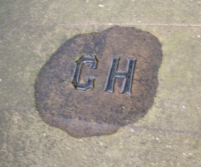
In 1536 the priory of Gokewell was abandoned, seemingly without any fuss, and the sisters dispersed to the locality, while the last prioress Anne (of) Castleford was given an annual pension of £4 and was still living in 1553. But it seems the prioress was not highly thought of by the younger nuns, in deed they took no notice of her and even apparently referrred to her as ‘a simpleton’; she also failed in her ability to discipline the nuns. Eventually the stonework from the priory was re-used in the building of the nearby Priory Farm; much of this carved and dressed stonework ‘could’ still be seen in the farm’s walls and its out-buildings (*the farm has long since been demolished). The land where the priory stood was flattened for farming purposes; however one large round-shaped fish-pond remains and a few smaller ponds can be made out, along with ditches, earthworks and ‘lumps and bumps’ beneath which, scant stone foundations remain.

The place-name ‘Gokewell’ is derived from “Gawk” or the Anglo-Saxon name gawkr meaning cuckoo or fool! which referrs to a holy well Gawkr’s Well (Cuckoo Well), probably a pre-Christian spring that was eventually renamed ‘Nun’s Well’ after the religious sisters who came to live here at the end of the 12th century, but whether it ever had any curative properties, we don’t really know, though I suspect it did. A bit of searching around and you may still be able to find the well, though it could now be dried-up? Abraham de la Pryme (1671-1704) the Yorkshire antiquarian writing in the 17th century calls it Nun’s Well and remarks: “And this day I went to Gokewell, formerly called Goykewell, which was a nunnery. It seems to have been a most stately place. The walls has compassed in betwixt twenty and thirty akers of ground. They shew’d me a little well, which by tradition, was once very great and famous; this they called Num’s Well. It has run straight through the midst of this ground, being a great spring, and it fed the all house with water, and several statues or water fountains in the courts and gardens.”

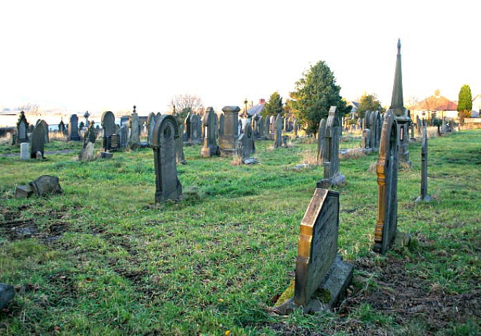
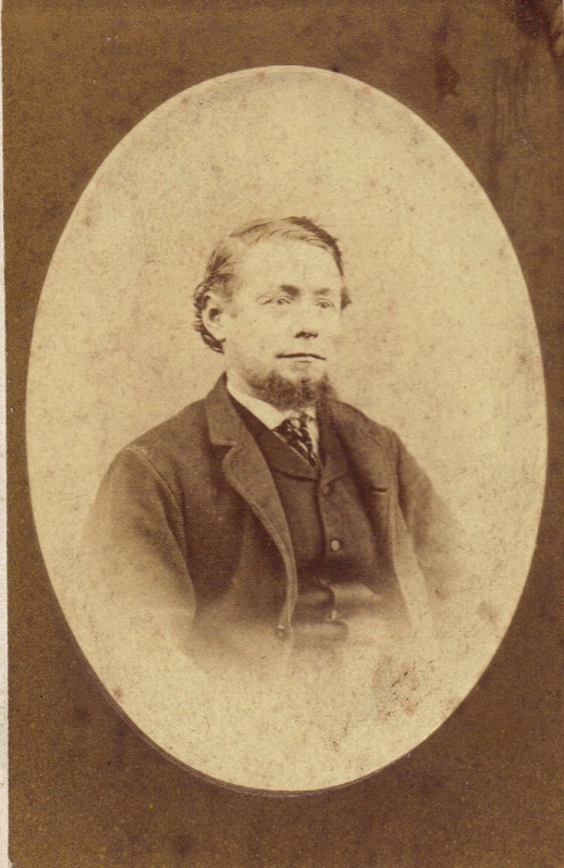
Footnote:- My Great-Great-Great-Great Grandparents Thomas and Rebecca Spencer lived at Gokewell Priory Farm from 1815-25, afterwhich they moved to Messingham. Thomas died in 1863 and is buried in the cemetary there.

Sources:

British History Online  http://www.british-history.ac.uk/report.aspx?compid=38014

Page, William., A History Of The County Of Lincoln, Volume 2, pages 156-7, 1906.

Pryme, Abraham de la., Ephemeris Vitae: A Diary of My Own Life, Vol 54, Surtees Society, 1870.

*Photo: © Copyright Robert Reynolds and licensed for reuse under this Creative Commons Licence.

My sincere thanks go to Ross Parish for his very valuable information on Gokewell, the place-name, and the holy well. Please take a look at his web blog for more holy wells in Lincolnshire  http://insearchofholywellsandhealingsprings.wordpress.com/tag/lincolnshire/


Carew Cross, Pembrokeshire, Wales

Carew Cross (After J. Romilly Allen)

(After J. Romilly Allen)

Os grid reference: SN0467 0370. At the east side of Carew’s ‘mighty’ medieval castle, close to Bird’s Lane, in the little village of Carew, near Sageston, stands the 4 metre-high Carew Cross, a truly magnificent Celtic ‘high’ cross that dates from the 11th century, which is carved with some quite stunning patterns and designs that are similar to those found on crosses in southern Ireland and the Isle of Man and, there is a memorial inscription in memory of a Welsh prince. The Carew cross is very similar in many respects to the churchyard cross at Nevern, also in Pembrokeshire. Carew is 6 miles west of Tenby on the A4075, not far from the Milford Haven estuary and Pembroke Dock. The nearest parish church to the cross is, St Mary’s, 1 mile south at Carew Cheriton.

The wheel-headed cross stands at about 4 metres (13 feet 2 inches) in height and is made, for the most part, out of local sandstone, and is in two sections, which is rather odd although this was presumably done due to the sheer height of the monument. It is probably the tallest cross in Wales. There are panels on it’s two sides with elaborate decoration and pattern-work. We also see a Latin inscription to the memory of an 11th century Welsh prince on the front face; in fact there could have been two inscriptions if the empty panel next to it had been used! And, it is thought the Carew Cross is ‘not’ in it’s original position because it has been moved around at least a couple of times, once in the Middle Ages, and again in more recent times; and today it is surrounded by iron railings. It dates from AD 1035 when the inscription was carved onto the cross, making it a memorial stone as well; so the actual stone-carved cross could be earlier in date, perhaps the 6th-9th centuries?

There is the usual Celtic-style decoration such as: plaitwork patterning, knot-work (varying in types) but, we also have intricate key-patterning, cord-plaiting (four and fourteen cord) to be precise; patterns with circular and oval rings – plain and looped, and also Greek-style key-patterning, fretwork, and square key-patterns that look similar to “swastikas; and diagonal key-patterning – again looking like the swastika symbol. The edges of the cross have the interlinking knotwork design. The Latin inscription reads: MARGIT EUT REX ETG FILIUS or King Mariteut, Margiteut (Maredudd) son of Etguin (Edwin) lies here. According to legend, Mariteut was king of Dheubarth (south-west Wales) but he was murdered in battle by Cynan ap Seisyllt in AD 1035 after only a two year reign. The Edwin mentioned in the inscription could be Edwyn ap Einion, father of Hywel? We know Hywel as Prince of Wales and the famous law-giver from Welsh history ‘who introduced and gave us’ the so-called codiefied ‘Laws of Dyfed’ after he held a famous parliament at Whitland (Hendy-gwyn-ar-Daf), in Carmarthenshire (AD 930). Prince Hywel Dda (Hywel ap Catell) died in AD 950. The cross-head is quite ordinary, and could be a bit more recent in date, but the cross-base is thick and stocky, being some 4 feet in width, though this part is undecorated.

Carew’s medieval, moated castle looks out from it’s rocky outcrop over an inlet of the river Carew, one of the tidal rivers flowing out from the Milford Haven estuary. Now ruined but still very attractive, it was built in c 1270 by Nicholas de Carew on the site of an earthen and timber fortification from the 1100s, and enlarged in the 15th century, but destroyed in the Civil War (1640s). There are two churches nearby, one St John the Baptist’s, is the local church, whereas the parish church of St Mary is 1 mile south of the castle, at Carew Cheriton. This cruciform-shaped building dates from the 14th century – being built for Bishop Gower of St David’s. The tower is 15th century Perpendicular. Inside there are some interesting tombs and effigies, while out in the churchyard there’s a 16th century charnel house/chantry chapel.

Sources:

Allen, Romilly J., Early Christian Art In Wales, Archaeologia Cambrensis, 5th series, vol xvi, 1899.

Barber, Chris., Mysterious Wales, Paladin (Grafton Books), London, 1987.

Barber, Chris., More Mysterious Wales, Paladin (Grafton Books), London, 1987.

Gregory, Donald., Country Churchyards In Wales, Gwasg Carreg Gwalch, Capel Garmon, Llanrwst, Gwynedd, 1991.

Bryce, Derek., Symbolism Of The Celtic Cross, Llanerch Enterprises, Felinfach, Lampeter, Wales, 1989.

Spencer, Ray., Historic Places In Wales – An Exploration of the Fascinating and Mysterious, (unpublished manuscript), Nelson, Lancashire, 1991.


St John’s Church And Churchyard, Great Marsden, Nelson, Lancashire

St John's churchyard entrance.

St John’s churchyard entrance.

OS grid reference: SD 8700 3780. St John’s Church And Church-yard, Great Marsden, stands about ½ a mile to the north of Nelson town centre – up Barkerhouse road. Today, the modern church which is dedicated to St. John the Evangelist, has been amalgamated with that of the old St. Philip’s church on Leeds road, Nelson, and is much in use as a church centre for many local functions and social gatherings. The churchyard has many splendid old Victorian tombs and monuments, some quite tall and ornate ones, recalling the names of the many eminent local people that are of great interest to the area; and there are also many newer graves as well as a collection of interesting graveslabs from the 1st and 2nd world wars.

View inside St John's churchtard.

View inside St John’s churchtard.

In 1846 a Mrs Maw and a Miss Walton heirs to the Marsden Hall Estate gave land and money for the establishment of a church and burial ground at Great Marsden, adjoining Barkerhouse Road. The church was finished and consecrated in 1848. It was built in the ‘standard’ Victorian-Gothic style with nave, side and middle aisles; the stone used in it’s construction apparently coming from the local quarries at nearby Catlow. William Messenger was first vicar. The church was restored and extended in 1896 but problems with dry rot meant it had to be demolished in 1995. A new church was consecrated in 2000, but the graveyard had by then become much neglected. The site covers 6.5 acres, and some 17,000 burials have taken place over the past century and a half.

In 1848 the Town of Nelson did not exist. The area included two townships or villages – Great and Little Marsden. Little Marsden had it’s own church but most people in Great Marsden attended and were buried at St Bartholomew’s in Colne. The Townships only became Nelson after the East Lancashire Railway Company named it’s new station ‘Nelson’ after the Nelson Inn, which stood nearby. The Nelson Inn had been built in 1805 by my ancestors and given the name after the victory and death of Admiral Lord Nelson at Trafalgar that same year.

The population of the area had grown rapidly throughout the 19th century as handloom weaving in peoples’ houses was replaced by power loom weaving in local factories – the economics of scale allowing more cloth to be produced more rapidly to meet a growing demand for cotton garments and bedding. By the 1840’s there was clearly a need to have a new church in Great Marsden itself, and a mission was established to facilitate this.

Anchor on tombstone at St John's churchyard.

Anchor on grave, St John’s churchyard.

In 1895 a new municipal burial site was established on Walton Lane as part of the new borough’s plans to emulate other boroughs with big projects like municipal buildings and parks high on the agendas of those who sought public office. Although people continued to be buried at St John’s the numbers declined in the 20th century, descendants themselves began to die off and the original occupants forgotten. The second half of the 20th century was a period of neglect. The burial ground was also affected by vandalism, subsidence and the encroachment of Japanese Knotweed, so that parts of the burial ground became inaccessible. My mother recalls successive vicars trying “desperately” to battle nature’s encroachment with little more than hedge trimmers and a garden lawn-mower!

Cow on gravestone at St John's churchyard.

Cow on gravestone at St John’s churchyard.

In 2005 a group of concerned individuals many of whom had ancestors buried in the graveyard came together to establish a new group ‘The Friends of St Johns Churchyard’ and to establish a project to restore the churchyard and to make it accessible again. Over the past 8 years the churchyard has been transformed, the Japanese Knotweed eradicated, the subsidence dealt with, vandalism stopped and the grass regularly mown, seating established and, finally a memorial garden for quiet contemplation, set up. The many “often” spectacular monuments which can now be viewed – can be seen to reflect the new wealth of the area in the late 19th and 20th centuries with the more humble monuments often reflecting the interests, beliefs, and lives of the people buried there, with for example nautical (see photo above, left) and agricultural (see photo, right) carvings on some tombstones, and doves of peace etc on others.

Letters GH on gravestone, St John's churchyard.

‘GH’ on grave, St John’s churchyard.

One of the more humble graves is that of my Great-Great-Grandfather, George Hillary 1837-69 (see photo below, right). The grave is marked with a simple inscription the letters ‘GH’ perhaps reflecting his view that there should be a lack of fuss over his funeral or that the family thought he would always be remembered by the local townsfolk. George was something of a local personality. People called him ‘George the Dandy’ on account of his liking for the most up-to-date fashions and his collection of waistcoats, a popular garment at the time with even children wearing them. As a youth George had travelled to the West Indies to work for a sugar company based in Liverpool, then as an adult he had worked for his father in law who had inherited the Nelson Inn as book-keeper and, later to learn the trade of Licensed Victualler. It was clear Matthew Manley had wanted him to take over on his retirement but fate was to intervene. George died aged 31 or perhaps 32 just one year before Matthew, of Tuberculosis, then called ‘consumption’ because of the way it appears to consume the body with feverish symptoms. It is said half the townsfolk turned out for the funeral. George’s prediction that the undertakers would fail to turn up came true when they got the date wrong! and men had to be found to carry the coffin from the Nelson Inn to the churchyard up the hill in Barkerhouse Road.

George Hillary.

George Hillary.

Also buried here are George’s wife, her second husband, George’s mother, and her parents, George’s brother and sister, his sister in law and brother in law, grandson and many cousins, too numerous to mention here.

By 2014 there has been a further renewal of interest in the graveyard, and for people seeking information about their ancestors as part of the ‘trend’ in Family History. The Friends now have requests for information from across the World. Some years ago the Pendle and Burnley Branch of ‘The Lancashire Family History and Heraldry Society’ recorded the information from ‘The Grave Books and Memorial Inscriptions’ and this is now available on CD (Details on The Friends of St John’s Churchyard Website).

There is a World War I Memorial Garden at the far side of the churchyard up against the north wall, and also two information boards.

Acknowledgements/Sources:-

Lancashire Family History and Heraldry Society: ‘Great Marsden (Nelson), St John the Evangelist Memorial Inscriptions and Grave Books’ CD.

Wilson, G.V., ‘Tales of the Nelson Inn’, Nelson and Colne Historical Society, 1966.

Bennett, W., ‘The History of Marsden and Nelson’, Nelson Corporation, 1957.

http://www.friendsofstjohns.co.uk/

© Ray Spencer, The Journal of Antiquities, 2014 (up-dated 2019).