
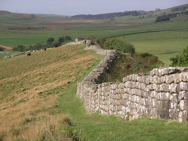
A section of Hadrian’s Wall (photo by Moldovian1 for Wikipedia)
In the Autumn 2008 edition of the magazine ‘Beautiful Britain’, there is an excellent article by the author Jock McKinnon called ‘The Old Frontier’. In this article, the author tours Hadrian’s Wall, the ancient Roman frontier that stretches from the Tyne in the east to the Solway Firth in the west, a distance of 80 Roman miles (73 normal British miles!), and he uncovers the history behind the Roman wall and its stones. Here I have “quoted” in full the article which appears in the magazine. Hadrian’s Wall (Latin: Vallum Aelium), also called the Roman Wall, Picts’ Wall, or Vallum Hadriani, was a defensive fortification in the Roman province of Britannia, according to Wikipedia.
“Standing on the stretch of Hadrian’s Wall west of the remains of Housesteads Roman fort, it is still possible to imagine a Roman sentry shivering in the cold. Squinting into the distant landscape, he must have wondered what on earth he was doing in such a ‘gods-forsaken’ place, so far from the centre of his ‘civilised’ world. It is an image that has been handed down to British schoolchildren for generations. But who really were the people who built and guarded the Wall? And why was it built? The answers, if they exist at all, lie buried in ancient records as well as in the stones and soil around the Wall.”
“The story begins with just one line of Hadrian’s biography, which describes the Emperor as ‘the first to build a wall, 80 [Roman] miles long, to separate the Romans from the barbarians’. In 117 AD, Hadrian succeeded Emperor Trajan, whose conquests had stretched the Roman Empire to its furthest reaches, from Mesopotamia (modern Iraq) in the south-east to Scotland in the north-west. It was clear to Hadrian, however, that the empire had just reached its limits. With military resources and communications stretched to their maximum, Hadrian decided to consolidate Roman hegemony by withdrawing wherever necessary to manageable borders. He knew it was more important to be able to control what the empire had conquered rather than attempt to stretch its frontiers further. And so he began a tour of the empire, including Britain, to see the problems for himself.”
McKinnon goes on to say: “Although much of Britain had been subjugated, and revolts by local tribes – such as Boudicca’s – had been brutally put down, it was clear that there was still trouble ‘up north’ caused by ‘insurgents’, to use a modern term, from the northern tribes. Although we do not know the nature of such warfare – no detailed accounts of the fighting exist – we do know that the building of the Wall began immediately after, or even during, Hadrian’s visit to the province, from 122 AD onwards.”
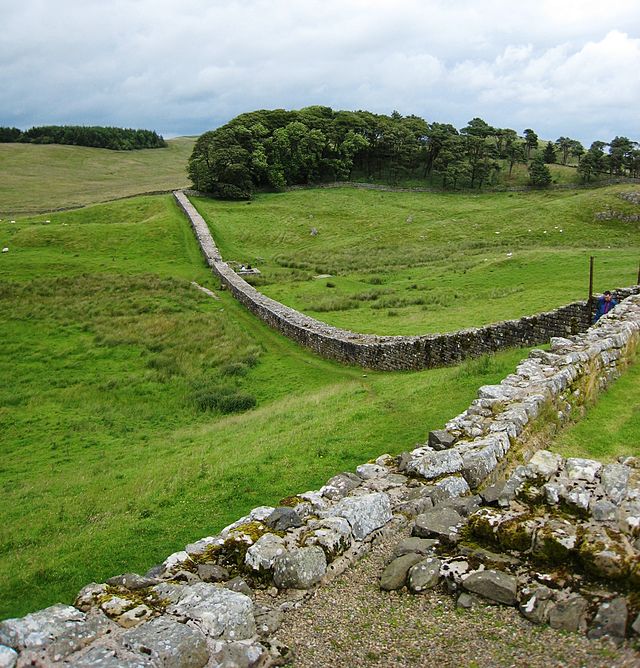
Section of Hadrian’s Wall (photo by Velela – for Wikipedia)
“Stretching 73 miles from Wallsend on the Tyne in the east to Bowness-on-Solway in the west, the Wall and its forts were built from locally quarried stone and made good use of natural features such as Whin Sill, a lengthy rocky outcrop forming a north-facing cliff. A long line of forts also stretched west, down the coast of Cumbria. Wall inscriptions show that construction was mostly undertaken by troops from three legions, one of which – the Six Victrix – had come to Britain with Hadrian himself. The construction project may well have served the additional purposes of keeping the troops occupied and boosting competition and morale, as well as indicating to the locals that the Romans were deadly serious about imposing their will on the region.”
“Conceived as a wall up to 15 ft high and 10ft thick, with a forward ditch to make an attack more difficult, the design was changed before completion, with later sections adopting a much thinner width, in places only 7ft thick. It is not known why there was this change of plan; perhaps it was to make more efficient use of the materials, or simply to speed up construction. Either way, it suggests that the need for the barrier was pressing. Indeed, it is believed that territory to the south of the Wall was just as troublesome at the time.”
“The Wall was, therefore, more than a defensive barrier to keep out northern raiders. In certain spots along the route of the Wall, such as at Heddon alongside the B6318, you can still make out large earthworks. Known as the ‘vallum’, these works consisted of a flat-bottomed ditch south of the Wall, about 20ft wide and deep, flanked on either side by mounds 20ft wide and 10ft high. The vallum often diverts around the forts, showing that it was built around the same time. Crossings were built opposite the forts, through the ramparts and across the ditch, with a gate. This indicates that the system of earthworks was used to control the flow of traffic through the Wall. So it seems that another purpose of the Wall was quite literally to divide and rule, and to control the cross-country movement of people and goods.”
The author asks: “So what do we know about the soldiers who manned the Wall? From inscriptions on the Wall and at nearby forts, it is clear that, although the legions – which consisted of men with Roman citizenship, helped with the construction of the Wall, and fought in the area, often manning forts to the north and south of the Wall, they did not form its main garrison. This was the job of auxiliaries – infantry and cavalry units of non-citizens recruited from all around the Roman Empire. Amongst the remains of the fort at Chesters is a stone reused as a step on which in inscribed the name of the First Cohort of Dalmations, infantrymen originally from the region which is now Croatia. Other inscriptions record the presence of troop units from France and Germany.”
“Chesters is a good place to begin to take in the skill of the military engineers. Because of the layout of the site, the fort is difficult to imagine, but the bath-house, with walls still reaching up to 10ft high, and the monumental foundations of the bridge that carried the Wall and traffic across the Tyne, are impressive. Also worth a visit is the small museum, which contains many of the most important inscriptions found along the Wall.”
“Chesters was one of a series of large forts that were constructed every six to eight miles along the Wall, sometimes after its construction, to house troops. These were in addition to the much smaller milecastles, which were built into the south side of the Wall once every Roman mile, and turrets. The purpose of the turrets and milecastles was to provide look-outs and to aid communication from fort to fort.”
“Housesteads was another large fort and its remains are imposing even today. It occupies a commanding position, on a south-facing slope, with its north side abutting the Wall and overlooking Whin Sill. Here it is possible to see the remains of gates, granaries, a headquarters building and the commanding officer’s house.”
Hadrian’s Wall from Housesteads Fort (photo by Jamesflomonosoff – for Wikipedia)
“There are still also visible remains of cultivation terraces outside the walls of Housesteads, and excavations have revealed the streets, workshops and shops that clustered around the forts of Chesters and Vindolanda. Local tradesmen would have supplied the armed forces and the expanding local civilian economy that would have gravitated towards the troops and military to serve their various needs.”
“Amongst the most remarkable finds from Hadrian’s Wall are the famous tablets of Vindolanda. Painstaking archaeology has pieced together fragments of military records and personal letters which were inscribed on the wooden tablets at the fort and then discarded, left to decay in wet, clay soil. Fortunately for us, they were miraculously preserved by the anaerobic conditions, and the retrieved texts now provide tantalising glimpses of everyday life.”
The author, Jock McKinnon, in his article makes mention of the other Roman frontier, the Antonine Wall, about 100 miles to the north. He says of this: “Another frontier, this time of earth banks, ditches and wooden palisades, was built about 100 miles further north 20 years later, during the reign of the Emperor Antoninus. The purpose of this second barrier may have been to create a controllable ‘neutral zone’ to Hadrian’s Wall further south, indicating that there was still a threat from unrest, but it would have doubled the military forces needed to patrol both frontiers and the region and it was abandoned by about 170 AD.”
“Hadrian’s Wall itself was finally abandoned much later, not until the late fourth century, although finds at Birdoswald fort show that it continued to be used by a community, probably as a defensive enclosure, into the fifth or six centuries, long after the Romans and Hadrian had become a distant memory. Subsequently, much of the stonework was dismantled and reused for building work, and it’s only the remote stretches of the Wall and forts that can be seen today.”
“It is sobering today to stand on the Wall, where that imagined soldier once stood, knowing that although it was obviously important at the time to emperors, their troops and local people – whether they supported it, hated it, or earned money as a result of it – it really matters little now whether the Wall was successful or not. All the time, money and manpower spent to quell a distant province proved fruitless. Except, that is, for what the Wall can still tell us about our distant past.”
Sources:
McKinnon, Jock., The Old Frontier, Beautiful Britain, Vol 3 Number 3 Autumn 2008, Cheltenham, Gloucestershire, 2008.
http://en.wikipedia.org/wiki/Hadrian’s_Wall
Copyright © Ray Spencer. The Journal of Antiquities, 2015.
