The Journal Of Antiquities

Ancient Sites In Great Britain & Southern Ireland


4 Comments

St Helen’s Holy Well, Caernarfon, Gwynedd, Wales

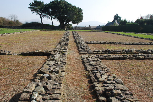
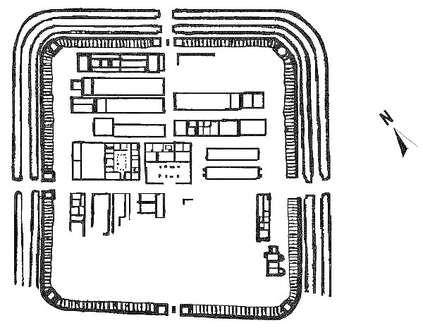
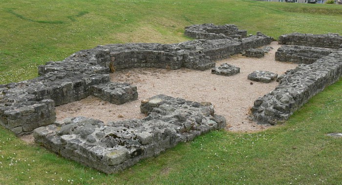
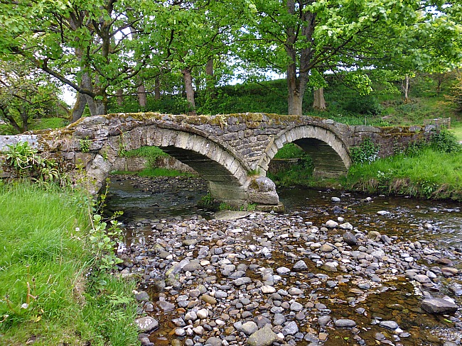
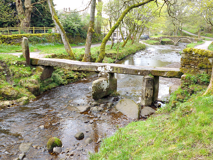
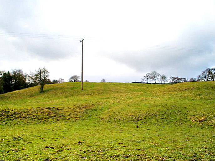
    OS grid reference: SH 48238 62224. St Helen’s Well, also known as Ffynnon Helen, is or was “possibly” located close to South Road at Coed Helen, in the area called Hen Waliau (a Roman walled enclosure), which is about ½ a mile west of Llanbeblig parish church, Caernarfon. Sadly, the well has become ‘overlooked’ and ‘forgotten’ beneath a canopy of trees almost next to the main railway line that runs through a secluded cutting. Long ago a Medieval chapel called Capel Helen stood close to the well, but today all signs of that are virtually gone. The well is located on private land close to a large house. Further along the lane there is an iron gate and, from here a path runs along a raised bank beside the railway line and passes by the well. Permission “may” be needed to visit the holy well.

     The well and its associated ancient chapel were dedicated to the 4th century St Elen of Caernarfon, a Welsh princess who was the daughter of Eudaf Octavius of Ewyas in western Herefordshire, and Aurelia Carausia. She was to figure strongly in the celebrated 14th century Mabinogion Tales. In these “tales” she marries the Roman general Magnus Clemens Maximus (Macsen Wledig) after he dreams about her while stationed in Rome. He then sets out (c 383 AD) to find this beautiful young woman and, after crossing the mountains of Snowdonia, he finally finds the woman of his dream. And so begins the well-known story of Helen and Maximus. But much confusion has arisen over time because Helen and Maximus had a son called Constantine (Custennin Fendigaid), and because of that confusion has arisen with Helen of Caernarvon being mistaken for St Helena of Constantinople (d 330 AD) and her son Constantine the Great – the first Christian Roman emperor. With this in mind, I should add that this Welsh Helen was the granddaughter of Constantine the Great.

    According to legend, Elen (often referred to as Elen Luyddog – Helen of the Hosts), had earlier led an army into north Wales where her father owned large areas of land, one of these being Caernarvon. Another legend states that Maximus, now made emperor in the west (including Spain where he was born), gives his wife Helen the Roman fortifications of Caerleon, Caernarvon and Carmarthen, as a wedding gift. Later, Helen and her sons Constantine and Publicius accompany Maximus to Gaul, but shortly after his return to Rome Maximus is “defeated and killed by the Emperor of the East, Theodosius” (Ashe, Geoffrey, 1976). His death probably took place at Aquileia, northern Italy (388 AD). The family later visit St Martin at Trier, according to St Gregory and St Sulpicius Severus, before travelling back to Wales – St Helen is then credited with introducing a new form of Celtic (Gaulish) monasticism into southeast Wales.

    Ffynnon St Helen was still in use up until the 1920s when local people visited it in order to be healed and they would take away bottles of its curative water, which was described as being plentiful (Hughes & North, 1924). The well stood on a raised area of land and its water was contained in a slate cistern with a flight of modern steps leading to it. Today, not a great deal survives of the well’s original structure. But the water is still flowing somewhere beneath the well, and certainly the sound of running water can still be heard alongside, though no structural remains are visible (Berks, Davidson & Roberts, 2005). The well site was often said to be ‘overgrown and generally abandoned’. There are apparently another five holy wells named after St Elen in Caernarfonshire! Unfortunately, we don’t know what ailments, conditions and diseases were cured by the water from Ffynnon St Helen, and we will probably never know. Over the years Roman coins have been dug up in the vicinity of the well.

    The author Francis Jones in his respected publication ‘The Holy Wells of Wales’, says of Ffynnon Helen that it is: “On the outskirts of Llanbeblig village, near the river Seiont. The ground has been raised round the well, which is now approached by a flight of modern steps: the water is still taken away in bottles for use as medicine: there is said to have been a chapel called Capel Helen near the well. St Helen is listed in ‘Lives of the British Saints’ by S. Baring Gould & J. Fisher, 1913.”

    There are at least three churches dedicated to St Elen in Caernarfon, and there are a few others named for her in Monmouthshire and west Glamorgan, while her sons have church dedications at Llanbeblig near Caernarfon and Welsh Bicknor (Llangystenin), in Hereford-shire; and the Roman road system called ‘the Sarn Helen’ is often attributed to her, although she probably had ‘no’ real connection with it,  but this might be why she is sometimes called ‘Helen of the Legions’. We learn that Helen and Maximus had other sons and daughters who are not quite so well-known: Annun (Eunan), Antonius, Dimit, St Ednyfed, Gratianna (Graciana), Severa and Victor (Gwythr). St Elen is thought to have died sometime between 390-400 AD, and she is venerated by the Church In Wales and the Roman Catholic and Orthodox Churches in Wales. Her feast-day is observed on 22nd May.

However, we learn that there were three or four other possible sites for St Helen’s Wells in Caernarfon, but there is some uncertainty as to those other wells. And there may have been a more recent well named for St Helen at the north side of the former gardens in Coed Helen, although that has now been lost. Thanks to Andy Norfolk on the Facebook group (Holy Wells of Wales, Inc Wellsprings and Cymdeithas Ffynhonnau Cymru. Andy tells us more, and says:-

“Here’s another little oddity
SH 48238 62224 is the grid ref given for St Helen’s Well in Caernarfon on the Journal of Antiquities website. In Cadw Scheduling Enhancement, Holy Wells, Report and Scheduling Recommendations, GAT Project No. 2156, Report No. 931, March, 2011 there’s an approximate grid ref of SH48206230. Neither is right. It’s shown at SH 48212 62164 on the old OS 1:500 town plan. This is where Archwilio shows it. I think a well at the north end of the garden has been mistaken for St Helen’s Well recently.”

Sources:

Ashe, Geoffrey., The Quest for Arthur’s Britain, Paladin, St Albans, Herts, 1976.

Thanks to Andy Norfolk on Facebook.

http://www.cofiadurcahcymru.org.uk/arch/gat/english/gat_interface.html

http://orthodoxwiki.org/Helen_of_Caernarfon

http://www.geni.com/people/St-Elen-Lwyddog-of-the-Host-of-Britain/377649183480004232

http://www.traditionalharp.co.uk/Caer_Feddwyd/articles/Elen.htm

Jones, Francis., The Holy Wells of Wales, University of Wales Press, Cardiff, 1992.

Spencer, Ray., A Guide to the Saints of Wales and the West Country, Llanerch Enterprises, Lampeter, Dyfed, 1990.

Copyright © Ray Spencer, The Journal of Antiquities, 2016 (updated 2023).


Segontium Roman Fort, Caernarfon, Gwynedd, Wales

Segontium (Barrack Blocks) by Alan Fryer (Wikipedia)

Segontium Roman Fort(Barrack Blocks) by Alan Fryer (Wikipedia)

    OS grid reference: SH 4854 6243. The fort of Segontium lies in a well-defended position at the tip of a ridge between the rivers Seiont and Cadnant, some 150 feet above sea-level, commanding wide views of the surrounding area. Today the remains of the Roman fort look down over Caernarfon Castle.  The fort lies on the A4085 road to Beddgelert on the outskirts of Caernarfon.  The name ‘Sego’ is Celtic for ‘strong’, while the Roman name Segontium means ‘forceful river’; the name may, therefore, have links with the names of the two rivers, Seiont and Cadnant. Segontium Roman fort was built in AD 77-78.

    The fort has had an interesting 20th Century history. The site was saved from builders in 1913, excavated by (Sir) Mortimer Wheeler from 1920-23, purchased by a John Robert’s of Caernarfon who was responsible for erecting the museum, and in 1937 willed by him to the National Trust who in 1958 placed it in the guardianship of Ministry of Public Buildings and Works, who also bought the vicarage area of the site to the south – with a view to further excavation. The SE section was subsequently excavated during the year’s 1975 to 1979. Responsibility for the site now lies with CADW the Historic Environment Service of the Welsh Government. The Museum seems to be managed by a local trust Segontium Cyf. There are references on-line to visitors finding it closed. A Guidebook can be bought at other CADW sites including Caernarfon Castle.

Plan of Segontium Roman Fort (after Collingwood, 1930)

Plan of Segontium Roman Fort (after Collingwood, 1930)

    Segontium fort faces south-east. In shape it is an imperfect rectangle with rounded corners 550 ft by 470 ft with four gateways. The buildings within are of a standard pattern with some exceptions and closely packed though a clear space (intervallum) which runs around the foot of the rampart separating the buildings from the wall. The buildings are arranged in three lateral blocks with the administrative buildings in the centre. Like other forts of its date the defences were originally of earth and timber as would have been the buildings. Coins relating to the reign of Edward I show the fort was used as a quarry for the building of Caernarfon Castle. A Roman Road connected Segontium with the legionary fortress at Chester (Deva).

    There are several elements to the visible remains: A wall with backing mound (the original rampart), counterforts on the interior face of the wall, corner turrets, and three gateways – the fourth at the SE having been lost during the laying of the A4085 which crosses the site. The wall dates from about AD 150 and is about 4’ thick at the base. The wall would originally have had a parapet standing in total about 18 feet high. Evidence of the original holes for scaffolding is still visible. The so-called ‘counter forts’ in base of the wall probably allowed access to the parapet via steps or ladders. Some of the turrets are, or would have been solid to carry the weight of a heavy ballista, a spring mechanism to discharge stone balls. The gateways would have been arched to carry the weight of the gatehouse. The gatehouses structure changed over the centuries as threats and needs varied.

    The internal buildings are of various dates though none earlier than 150 AD. Most show a rebuilding phase in the 4th century AD.

Segontium Roman Fort (The Principia) by JThomas (Wikipedia)

Segontium Roman Fort (The Principia) by JThomas (Wikipedia)

    Taking the middle section the Headquarters Building (Principia) succeeded an earlier timber structure. It includes an enclosed courtyard with porticoes and flagging, a roofed assembly hall later subdivided to provide additional office space, and a row of five rooms at the rear – the central room being the regimental chapel where the standard was kept. In the 3rd century an underground strong room was built into the chapel. Also in the 3rd century an apsidal room was added at the back of the building possibly to store fort records as it is the only part of the fort to have a hypocaust. The building seems to have suffered from damp much as some buildings do today. There is evidence that the builders tried to find ways of dealing with this!

    Next to this and to the NW is the Commandants House (Praetorium). Again part of the standard plan. At Segontium the house consisted of rows of rooms opening off porticoes arranged around a small internal courtyard or garden. A room at the rear, which contains a plinth, may have been the base of a shrine. Again traces of the original timber building have been found. Adjoining this building was a large yard and workshop (Fabrica) with a long subdivided shed at the far side.

    On the other side of the Headquarters Building lay two large granaries (Horrea) measuring 90ft by 19ft built to an unusual design without buttresses and the floor beams taking the entire weight of the grain above. The aim was to store a years worth of grain at each fort. The Roman Soldiers staple diet was bread and biscuits.

    There were eight long buildings to the rear at either side of the street leading to the northwest gate. Of these buildings most seem to have been barrack blocks (Centurie). The buildings were much altered over the centuries. A similar building in the NE corner may have been an additional granary or store. It was rebuilt in the 4th century as living accommodation. The barrack blocks are of a common design (an L shape) with the officer accommodation at the end and the long section for the men. Wooden particians would have further divided the walled areas. The intention was to house a century of men (actually 80 men) in each block or two troops of 30 horsemen with their equipment.

Segontium Roman Fort (Bath-House) by Wolfgang Sauber (Wikimedia)

Segontium (the Bath-House) by Wolfgang Sauber (Wikimedia)

    Excavation of the SE corner revealed a surprise. The largest structure was revealed to be a large building with a courtyard, built about AD 140, with en-suite bathhouse. It has been speculated that this was the residence of the Procurator Metallorum who would have been responsible for the extraction of metal ore in the area. The building and bath-house were demolished in the 4th century and replaced by another bath-house complex. Internal bathhouses are a feature of 4th century rebuilding so this in itself was not a surpise. However, it does not seem to have been ever finished in that a hypocaust system was never installed.

    Archaeological investigations have found a flourishing civil settlement (Vicus) outside the camp. An external bath-house has also been found. A walled enclosure built around 200 AD (230 foot by 165 foot) known as Hen Wallen (‘Old Walls’) may have had something to do with Segontium’s role as a port. The remains of this structure can be viewed 300 yards west of the fort along the A4085, turning left at Segontium Road South, then right at Hendre Street. 150 yards east of the fort near the church of St Peblig, a temple of Mithras was excavated in 1959. The building measured 48 foot by 21 foot, was partly dug into a slope, and had a slate roof. Again it dates from about AD 200. Mithras an Eastern Religion was popular amongst soldiers. It promoted the fight for good over evil and assured a life beyond the grave. There are no visible remains of the external bath-house, Temple of Mithras, or the Vicus.

    Taking the historical context Governor Agricola finally defeated the Welsh tribes in Anglesey in an unexpected lightning strike using Auxiliarie Troops, who swam across the Menai Straights with equipment and horses in AD 78. Segontium housed auxiliary troops from about AD 78. The auxiliary troops complimented the legionary troops who were stationed at Chester and Caerleon. Auxiliary troops often retained the traditional fighting skills and arms of their homelands and were not normally Roman citizens – an honour given to them after 25 years service. Auxiliary troops could be infantry usually 500 to 1000 strong or cavalry up to 500 strong.

The Segontium Museum Building by Eric Jones (Wikipedia)

Segontium Museum Building by Eric Jones (Wikipedia)

    The archaeological evidence suggests that at the very least Segontium was intended as a part mounted military cohort, both by its size, and the existence of what appears for some of the time to be an additional granary. In the early period of the occupation the auxiliaries at Segontium would have been detailed to keep the peace and to ensure continued mineral extraction. An inscription from the time of the Emperor Sepitimus Severus AD 193-211 indicates that, by the beginning of the 3rd century, Segontium was garrisoned by 500 men from the Cohors I Sunicorum, which would have originally been levied among the Sunici, who lived in the Rhine-Musse area, now Belguim. The size of the fort continued to reduce through the 3rd and 4th centuries. In the 4th century Segontium’s main role was probably the defence of the north Wales coast against Irish raiders. Coins found at Segontium show the fort was still occupied until at least 394 AD.

    Finally we enter the world of legend covering the late 4th century. Segontium is generally considered to have been listed among the 28 cities of Britain in the History of the Britains traditionally ascribed to Nennius, a 9th century writer, either as Cair Segeint or Custoient – and who stated that an emperor’s inscribed tomb was still present in his day. This monument such as it existed is now ascribed to Constantine, a son of a St Elen, the patron of the Sarn Helen – a series of road networks across Wales. The story of Elen also features in the 12th century Mabinogion Tales featuring one Maximus – in Welsh Macsen Wledig (possibly a reference to the late 4th century Gallic Roman Emperor Magnus Maximus 383-388). According to legend, Macsen saw Elen or Helen in a dream while he slept in Rome or in Wales, then sent out messengers to find her. Some of them eventually reached Snowdonia. Recognising the mountains and valleys Macsen had seen in the dream, they or “he” found Helen.

    Elen his future wife was the daughter of a Welsh chieftain called Eudaf Octavius. The tomb of her son Constantine (Cystennin) is said to have been moved by Edward I. The legend such as it is probably relates to whatever defences were available to the Romano-British peoples’ after the withdrawal of troops in 410 AD – under pressure from Saxon settlers from the east and Irish invaders from the west. A Celtic saint – St Peblig (Publicius) is said to have established a monastery and church at Llanbeblig – in the late 4th century? And St Peblig is recorded as being another son of Elen and Maximus. St Peblig’s remains the parish church for Llanbeblig. The building we see today is essentialy a 14th-century update of an earlier church built close to the Pagan Temple of Mithras and on a Roman graveyard. The tower was added in the 15th and 16th centuries. Other alterations were made in later centuries, including a major restoration in 1894.

Sources:

Segontium Roman Fort, G.C. Boon, Ministry of Public Buidings and Works, 1963

A Guide To The Roman Remains In Britain, Roger J. A. Wilson, Constable, 2002

https://de.wikipedia.org/wiki/Kastell_Segontium

Click on:   https://commons.wikimedia.org/wiki/File:Segontium_-_Therme_1.jpg

Video Link   http://www.dailypost.co.uk/whats-on/whats-on-news/watch-caernarfon-segontium-roman-fort-7570310


2 Comments

The Three Ancient Bridges, Wycoller, Lancashire

Pack-horse bridge at Wycoller, Lancashire.

Pack-horse bridge at Wycoller, Lancashire.

    OS grid reference: SD 932383 39247. The secluded little village of Wycoller nestles in a narrow valley 1½ miles to the east of Trawden, Lancashire, but it is well-known for its three ancient bridges which have stood over the beck for hundreds, if not thousands of years. They have even outlived Wycoller Hall which stands ruined and desolate. But each of the bridges has its very own tale to tell. There are actually seven bridges in the village but the pack-horse, clapper and clam bridges are of historic interest because of “their” great ages. Wycoller is easily reached on country lanes from Trawden. Park up at the large carpark ½ a mile to the west and walk into the village along the footpath at the side of the lane. There is a small carpark for disabled people close to the café.

The pack-horse bridge, Wycoller, Lancashire.

The pack-horse bridge, Wycoller, Lancashire.

    The famous pack-horse bridge is a two-arched structure spanning Wycoller beck. It is sometimes called Sally’s Bridge after one of the Cunliffe family who lived in the hall opposite the bridge in the 18th century. Historians have argued about its age, but none of them are certain, but it is thought to either date from the 13th century or the 15th. Its construction is a bit of an oddity, in that the arches are not equal to each other and the structure’s base-stone boulders are not level, giving the bridge a somewhat precarious appearance because of that – author John Bentley in his fascinating book ‘Portrait of Wycoller’, alludes to this. The coping stones along the sides of the bridge are significant in that some of them have faint cup-marks in them, indicating that they were brought down from a prehistoric site on the moors above Wycoller and used in the bridge’s construction. When walking over the bridge ‘you need’ to take care owing to the smoothness of the paving slabs which have endured hundreds of years of use.

The Clapper Bridge at Wycoller, Lancashire.

The Clapper Bridge at Wycoller, Lancashire.

    Clapper bridge, sometimes called the Druids’ Bridge, Weavers’ Bridge or the Hall Bridge, is just a short distance along the beck. This is a primitive structure but of massive proportions consisting of three flat gritstone slabs resting on two stone piers, one being a round-shaped boulder, the other a thinner pillar-shaped stone that looks quite fragile, but it is in fact very strong. It was originally a two-slab bridge sup-ported on one central pier. However the bridge has succumbed to floods over the years and has had to be reconstructed a few times. Its three slabs are heavily worn by hundreds of years of use. There is a legend that says this bridge led to a grove where druids practiced their strange rituals; there is no sign of this mystical grove or amphitheatre today, and the handloom weavers of Wycoller have long-since hung up their clogs! The clapper bridge is thought to date from the 16th-17th century, though a few historians ‘think’ it might date from before the Norman conquest (Bentley, John, 1993).

The Clam bridge, Wycoller, Lancashire.

The Clam bridge, Wycoller, Lancashire.

    And the third bridge, the clam bridge, is located ¼ of a mile along the track that runs beside the beck in Wycoller Dene. This ancient bridge is formed by one single gritstone slab which is some 12 feet long. It rests at one end on the bank, while on the other side it is propped up on some large stones, but it is very secure even though it might look like it is about to fall into the beck. At one time there was a wooden safety rail at one side and the holes for this can still be seen. The clam bridge is ‘often’ said to date from the Bronze or Iron Age and to have originally stoop up-right on the moors to the north east (as a standing stone – menhir), but there again it probably only dates from the 15th or 16th century. The long slender slab is well-worn and great care should be taken when crossing it. In the floods of 1989-90 the clam bridge was brought crashing down. It has sometimes been mistaken for a tree trunk lying across the beck and at a distance it does indeed look like that.

    The author John Dixon in his work ‘Historic Walks Around The Pendle Way’, came to the conclusion that the three Wycoller bridges were of ‘a mid-16th century’ date. He adds that: “The majority of bridge building was undertaken after the Dissolution of the monasteries when a moderate number of masons became unemployed and were wandering the countryside finding work on many of the new bridges which were required as roads became busier and wooden bridges and fords became inadequate.”

Sources:

Bentley, John., Portrait of Wycoller, Wycoller Country Park Project, Nelson, 1993.

Dixon, John & Mann, Bob., Historic Walks Around The Pendle Way, Aussteiger Publications, Barnoldswick, 1990.

http://www.megalithic.co.uk/article.php?sid=26761

http://www.megalithic.co.uk/article.php?sid=26767


1 Comment

Aedmar’s Mound And Earthworks, Blacko, Lancashire

Aedmer's Mound at Admergill, near Blacko, Lancashire.

Aedmar’s Mound at Admergill, near Blacko, Lancashire.

    OS grid reference: SD 84829 41718. For want of a better name I am calling this site ‘Aedmar’s Mound Earthworks’. These earthworks or ringworks are located down in a narrow valley, in a field above Blacko Water, near Wheathead Lane, just to the west of Blacko and Gisburn road, Lancashire, in the area called Admergill. A trackway heads off from Wheathead Lane at the bridge and then goes in a south-westerly direction for a short distance, and eventually through a wall stile – the earthworks are in the field (here) at the western-side of the beck – being noticeable by the grassy rectangular mound with its accompanying low ramparts, known as ringworks. These now rather forgotten earthworks may date back to the Iron-Age, or from the so-called Dark-Ages, or from the early Medieval period, but other than that we do not know when these earthworks were built or what they actually were; and they are not marked on any Ordnance Survey maps.

Aedmar's Mound / Earthworks viewed from the south-east.

Aedmar’s Mound / Earthworks viewed from the south-east.

    The earthworks cover an area of approx. 94m across N-S and 60m diagonally W-S though the S and N sides are cut-off and damaged by the farmer’s ‘modern’ field system, while at the NW side of the site there is a continuation of the low ringwork ramparts. The rectangular-shaped low mound ‘with the telegraph pole’ is quite a distinctive shape, but there are actually two mounds here – both being intersected in the middle by a deep ditch, or entrance. So what was it exactly? Was it a camp, a hillfort, or a defended site? Or was there a settlement here or maybe a royal residence of some kind? There appears to be at least three circular ramparts or ring-works and, possibly a fourth ring by the looks of it, surrounding the low, grassy elevated mound, and the same again at the far NW side but in a sort of square-shape, which has been cut off from the main site, possibly due to farming, or that it was meant to be like this?

    Local author, John Clayton, in his fascinating book ‘Valley of the Drawn Sword’, says that Admergill could possibly take its name from: “the Welsh prince A’dd Maur who controlled certain British lands sometime in the Early Medieval period, it is very possible that this name has been shortened over time to Mawr….but equally, it could apply to the nearby settlement of Admergill…..which eventually leads to A’dd Mawr’s Gill.”

Aedmar's Mound, Blacko, with ditch through the middle.

Aedmar’s Mound, Blacko, with ditch through the middle.

    But what of Aedmar and Eadmer two names that may be connected with this area, in which our ancient site lies.  St Aedmer or Eadmer was a bishop, ecclesiastic, and theologian who died in 1126, and was a friend of St Anselm. Was it “he” who gave his name to Admergill. And, there was a 7th century St Eadmer, a Northumbrian monk and disciple of St Cuthbert. But the truth is we don’t know, and probably never will – the name being lost in the mists of time. I think we should, therefore, say that the Welsh prince A’dd Mawr (Athmawr) is the more liklely contender here. He may have ruled over the Celtic (British) kingdom of Craven – Admergill being at the southern edge of this northern kingdom. And 2 miles to the north we have a farm called Craven Laithe!

    About 1 mile to the north on the southern side of Burn Moor a bowl-shaped quern stone was found, dating from 300-400 BCE (the middle Iron-Age). Grain would have been rubbed in the central depression with a small, rounded stone or pestle. In the vicinity of this discovery there were found to be a number of ancient boulders, some being built into walls (Clayton, John A, 2006).

Sources:

Clayton, John A., The Valley of the Drawn Sword – The Early History of Burnley, Pendle and West Craven, Barrowford Press, 2006.

Dixon, John & Mann, Bob, Historic Walks Around The Pendle Way, Aussteiger Publications, Barnoldswick, 1990.


2 Comments

Broadbank Earth Circle/Enclosure, Briercliffe, Lancashire

Broadbank Earth Circle / Enclosure looking through the centre N to S.

Broadbank Earth Circle / Enclosure looking through the centre N-S.

    OS grid reference: SD 90236 35225. A fairly large Iron-Age earth circle/enclosure and possible settlement, situated at 350m above sea-level, which is located at the northern end of Halifax road, overlooking Thursden Valley, near Briercliffe, in Lancashire. Sometimes called Burwains Camp. It is located at the northern end of Halifax road (High Ridehalgh), going out of Briercliffe, just before the World War II concrete pill-box. On the opposite side of the lane is a carparking area and picnic site, with beautiful panoramic views over Boulsworth Hill, but it is also easily reached coming over from Nelson past the Coldwell reservoir and Activity Centre, and turning right at the pill-box. There is not much to be seen of the earth circle/enclosure at ground-level – it is best seen from an aerial view and from that it is quite a well-defined earthwork. The site is on private farmland and is surrounded by a wall and barbed-wire. The town of Burnley is 3 miles to the south-west.

Broadbank Earth Circle / Enclosure viewed from S to E.

Broadbank Earth Circle / Enclosure viewed from  S-E.

    The large earth circle of Iron-Age date just beyond the wall measures approx. 45m vertically and 40m across, and around the perifery there is a narrow, possibly, defensive ditch-line and bank. At the NW and SE sides there has been some damage due ‘perhaps’ to farming methods, or something else. The ditch that runs through the centre of the circle and out from it may be quite recent; this was 3.5m deep when excavated, and 25cm across;  and there are still the ‘noticeable’ remains of a slight curved bank at the W, S and E sides. At the NW and N sides there are two small earth circles: 9m x 11m and 12m x 12m respectively, which could be hut circles? These connect with the large circle by way of short ditches or entrance ways, while at the E side there looks to be a “faint” outline of a medium-sized circle that is approx. 28m x 28m, but this has suffered some damage at its SE side possibly due to its closeness with the wall, past excavations, or something else.

    In 1950 the circle was excavated by The Archaeology Department of Liverpool University. A hearth was discovered at the E side, and there were numerous flint and chert flakes as well as a stone axe (4½ inches long) of Langdale origin which had a curved cutting edge and a thin rounded head and a smooth surface, but there was no evidence of polishing, according to John Dixon & Bob Mann in their book ‘Historic Walks Around The Pendle Way’.

World War II pill-box at Burwains Camp.

World War II pill-box at Burwains Camp.

    Further north along the lane at the side of a grassy mound (OS grid ref: SD 90454 35270) stands a World War II concrete pill-box, dating from about 1940. It would appear that here on this raised area of land there was some sort of camp or fort (Burwains Camp) of Iron-Age origins, and these low ramparts once formed part of that, although it is not marked as such on any OS map. The author, John Clayton, in his work ‘Valley of the Drawn Sword’, says that: “It is likely that this particular spot has been valued for its defensive nature by every culture to have graced our shores since the Neolithic period. Conflict and wars abide and over the wide span of history things do not change!”

Sources:

Clayton, John A., The Valley Of The Drawn Sword – The Early History of Burnley, Pendle and West Craven, Barrowford Press, Barrowford, Lancashire, 2006.

Dixon, John & Mann, Bob., Historic Walks Around The Pendle Way, Aussteiger Publications, Barnoldswick, 1990.

http://www.gridreferencefinder.com/

Broadbank Earth Circle, Thursden, Burnley, Lancashire.

Archaeology Department of Liverpool University, Report and Pamphlet, 1950.


The Pole Stoop Stone, Green Sykes, Cowling, West Yorkshire

The Pole Stoop Stone, near Cowling, west Yorkshire.

The Pole Stoop Stone, near Cowling, west Yorkshire.

    OS Grid Reference: SE 0153 4169. Halfway between Cowling and Keighley, west Yorkshire, is the boundary stone known as ‘The Pole Stoop’. It is an interesting stone in that it has a decorative, florated cross carved onto it, which is different to many other similar stones that tend to have just Latin letters on them, although this stone does have a Latin letter carved onto it. The Pole Stoop juts out of a field wall close to Pole Road, between High Pole Farm and Green Syke Farm. A footpath goes through the wall at the side of the lane, then to the right, and at the drystone wall you have the leaning stoop stone, located on what was the old bound-ary of Lancashire and west Yorkshire, some 4 miles east of Cowling and 2 miles south-west of Sutton-in-Craven.

The Pole Stoop Stone (close-up of the carvings)

The Pole Stoop Stone (close-up of the carvings)

    The Pole Stoop Stone is a 7 foot-long slender block of gritstone that leans out from the wall at a precarious 45 degree angle, but originally it was a free-standing stone and probably up-right – the wall being built up to it in the last 100 years or so. Or was the stone meant to lean (stoop) and point in the direction that it does? We do not know when the stone was erected here – some think it was the 15th century, others think it was the 17th century. In the middle of the west face there is carved a very nice florated cross and just below that a letter “T” is carved. This Latin-style letter and the cross were probably carved by the person who set up the stone,  or maybe by the landowner wanting everyone to know that “here” lies the county boundary. But the stone would obviously be useful as a ‘waymarker’ stone to travellers traversing the moor, but being different to a milestone in that it had no hands pointing to the nearest village and no mileage numbers.

    There are other odd looking stones in the vicinity, and ¼ of a mile to the north, beside a farm gate along Green Sykes road, is ‘The Sutton Stoop’, a 4½ foot-high stone pillar with a cross and the place-name “SUTTON” carved onto it.

Sources:

http://www.bradfordhistorical.org.uk/boundary.html

http://northernantiquarian.forumotion.net/t280-pole-stoop-standing-stone-or-hanging-stone


Llech-y-Dribedd, Moylgrove, Pembrokeshire, Wales

Llech-y-tribedd, looking east (photo credit: Bob Helms for Geograph)

Llech-y-tribedd, looking east. Photo credit: Bob Helms (Geograph).

OS Grid Reference: SN 10063 43195. The Neolithic burial chamber Llech-y-Dribbed, or Llech-y-Trypedd, stands on private land 25 metres to the west of a farm track at the south-west side of Penlan Farm, and ¾ of a mile from the village of Moylgrove, in Pembrokeshire. It has been variously described as a cromlech, a quoit and a dolmen. And from some distance away this ancient megalithic monument looks quite eerie – and it has the appearance of an alien spacecraft that has just landed, but close-up it becomes a tripod or triangular-shaped lump of stone on three smaller upright stones, hence its occasional name ‘The Tripod Stone’. Local legend says that the large capstone was hurled from the top of Carn Ingli, near Nevern, by a local giant called Samson, although we don’t know whether this was St Samson, who is associated with other megalithic tombs in this part of Wales.

The name Llech-y-Dribedd means ‘Stone of the Three Graves’ (Sykes, Homer, 1998) so as this was originally a long barrow we might assume that there were three burials here, but all that now remains of the chamber(s) are several large stones partly buried in the ground beneath the monument. It stands on three ‘sturdy’ upright stones at a height of 8 feet, while its huge, “triangular-shaped capstone” measures 9 feet 8 inches long by 9 feet broad, according to the authors Chris Barber & John Godfrey Williams ‘The Ancient Stones of Wales’. The earthen mound that once covered the tomb has long since eroded away, although one of the recumbent stones beneath the capstone was said to be ‘still standing’ in the early 18th century; and I would hope that it will “still” be here in many years to come ‘as a testament to the ancient people who built it.’

Sources:

Barber, Chris & Williams, John Godfrey., The Ancient Stones of Wales, Blorenge Books, Abergavenny, Gwent, 1989.

http://www.geograph.org.uk/photo/1426936      © Copyright Bob Helms and licensed for reuse under this Creative Commons Licence.

http://www.megalithic.co.uk/article.php?sid=4353

Sykes, Homer., Celtic Britain, Pheonix Illustrated Orion Publishing Group, London WC2. 1998.

Copyright © Ray Spencer, The Journal of Antiquities, 2016 (updated 2023).