The Journal Of Antiquities

Ancient Sites In Great Britain & Southern Ireland


2 Comments

Caerhun Roman Fort, Caernarvonshire.

SH7760 7040. The square-shaped earthworks of Caerhun (Canovium) Roman fort are located about a quarter of a mile east of the hamlet of Caerhun and along a lane that leads off the B5106 Conwy road east of Tyn-y-Groes, about 5 miles south of Conwy. The lane is signposted to St Mary’s church and actually goes through the south-west corner of the fort in order to reach the church.

The Romans built their temporary wooden fort with an earthen rampart and two ditches close to the west bank of the Afon Conwy (River Conwy) in 75 AD and, later in about 150 AD, they rebuilt  it with stone. The 13th century church and churchyard of St Mary now occupies the north-east corner of the fort’s earthwork rampart. In 200 AD the fort was destroyed but it seems some form of occupation occured in the 4th century, only to be completely destroyed in c400 AD. After that there may well have been Romano-British occupation when a 5th or 6th century prince or king of Gwynedd called Rhun set up a camp or settlement here. Did Rhun found the first church on this site? Caerhun (Caer Rhun) takes it name from him.

Canovium’s earthwork ramparts are visible, especially at the south-side and at the south-east side of the churchyard, but can be better seen on aerial photographs of the area. The fort measured 140 metres by 80 metres . Crop marks within the defenses mark where the buildings were situated, but the bath house stood outside the fort just to the west of the church – the earthworks from this are still visible. In 1926-9 archaeologists excavated the site and discovered a docking facility down by the river with signs of a jetty there. They also found Roman pottery, coins, a small stone with an inscription recalling the 10th legion (Leg.X), and possible remains of a villa. Obviously the fort occupied a strategic position with the Roman road heading west to Segontium (Caernarvon), a major military fort, and Deva (Chester) to the east; the river just to the east of Canovium would have been a bridgehead which was well defended by the local garrison.

English: St Mary's Church, Caerhun Located wit...

St Mary’s Church, Caerhun  (Photo credit: Wikipedia)

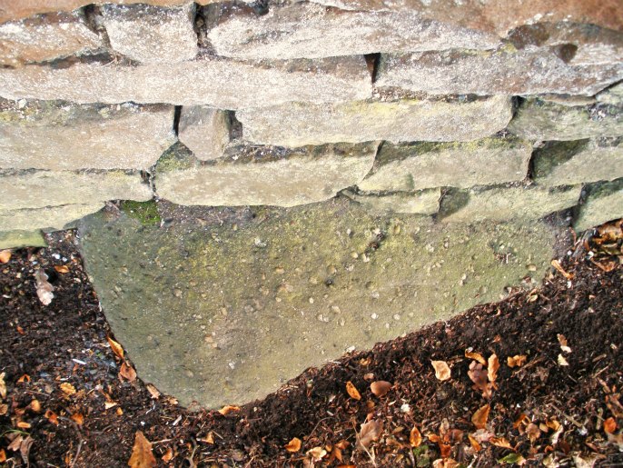
St Mary’s church dates in part from the 13th century, especially the side walls of the nave, but mostly it is a 16th century building.  Monks from Maenan abbey are thought to have built the church. The east window is thought to be from the original church. In 1972 fifteen bones, three skulls and a child’s pelvis were discovered by the north wall where an ancient water stoup is now built into the wall close by the west door. Outside, a small square-shaped medieval stone showing Christ crucified is built into  the wall. Some of the stones from the Roman fort are incorporated into the walls of the church. All in all a very nice little church, in fact, the whole site is well worth a visit, even though not much of the Roman fort survives today.


2 Comments

Y Gaer Roman Fort, Brecon, Powys

SO0033 2966. The “almost” perfectly square-shaped earthworks of the Roman fort of Y Gaer (Brecon Gaer) or Bannium Cicucium are located on a low ridge in a farmer’s field about a quarter of a mile north of the A40, just to the west of Llanspyddid. The town of Brecon lies 1 mile to the east. Y Gaer farm is partly built over the northern defenses and the site is on private land. It was built between 75-80 AD in the area held by the Silures tribe and manned by a garrison of 500 cavalrymen (Ala) from Vettones in Spain, along with some captured prisoners who were put to work on building the fort. The confluences of the rivers Usk and Ysgir straddle the valley close to the fort, something which the Romans were obviously aware of and would have considered to be an excellent place to build a fort.

The fort held a strategic position close to a major Roman road linking other camps and forts at Gobannium and Isca to the east, while  to  the  west  two  temporary marching camps at Y Pigwn and other nearby forts at Alabum, Coelbren and Moridunum. But the first fort here was made of timber with earthen ramparts and two ditches, then in c140 AD this was replaced by a stronger, stone fortification that was built by the 2nd Spanish Augusta legion. However, the occupation here may have come to an end in 200 AD although, evidently, there were two more occupations during the 3rd and 4th centuries AD.

The walls stood to a height of 10 feet and there were guard towers at each rounded corner of the fort and three gatehouses – although four entrances were built in the centre of the N, W, S and E walls, that at the N side now built over by a farm building; altogether the fort measured 615 feet by 460 feet. The headquarters buildings, barrack block and granary were, as always, inside the walled defenses as was the bath-house which was attached to the barracks for ease of use – normally this would have been outside the walls, and outside the N gate was the cival settlement (vicus) for the labourers, many of whom were captured prisoners.

In 1924-5 the site of Y Gaer was excavated by Sir Mortimer Wheeler and most of the buildings uncovered for the period of the dig. A number of antiquities were discovered but, the most impressive artefact was the tombstone of a young cavalryman called Candidus, which is now housed in the Brecon museum. Today some of the walls are still visible, but with more recent stonework being built onto them, and the S and W gates remain as they were found. The earthen defenses are visible along the sides of the fort at the W. S and E sides, that at the N side less so due to the “unfortunate” building of Y Gaer farm.

English: Cicvcivm - Brecon Gaer, near to Abery...

Y Gaer (Brecon Gaer). (Photo credit: Wikipedia)


2 Comments

Castleshaw Roman Fort, Standedge, Greater Manchester

SD9987 0963. High on the windswept Pennine moors to the north of the A62 where Bleak Hey Nook lane intersects with Dirty lane is the area called Castle Hill, Standedge, on the borders of greater Manchester and west Yorkshire. And, located between the two reservoirs (upper and lower), are the rectangular-shaped earthworks of the Roman fort of Castleshaw, known to the Romans as RIGODUNUM – ‘the royal fort’ or ‘the king’s fort’ – the name Castleshaw is of Celtic origins. But long before the Romans settled here at Castleshaw the site was known to have been a Brigantean settlement, later becoming just a little bit of the Roman province of Brittannia.

Castleshaw

Castleshaw (Photo credit: The Armatura Press)

The Romans built the fort here during the Flavian period c79 AD in order to protect their newly constructed road between Chester (Deva) and York (Eboracum) from the Brigantes tribe who had held the area. Upto 50 roman auxiliary soldiers of the Spanish Cohors III Bracaraugustanorum regiment from Lusitania in northern Portugal were stationed here, the rest of the cohort were quartered at MAMUCIUM (Manchester), 10 miles away to the south-west. One wonders what these hardy Spanish soldiers thought to the often bleak weather conditions here on the Pennine moors.

The auxillary fort or ‘fortified encampment’ at Castleshaw measured 380 x 330 feet including the outer vicus, but less than that (360 feet by 300 feet) inside the defences or ramparts – the whole site covering between 2-3 acres (1-2 hectares) in total. Constructed from turf, clay and timber, it has an outer ditch measuring 5 feet wide at the rampart with an outer, smaller ditch. There were two main entrance gates at the western and eastern sides, probably double gates made from local timber and a smaller entrances at the north side; at each of the four corners of the fort there may have been watchtowers? – although only one post hole has been excavated.

A plan of Castleshaw Roman fort drawn by antiq...

A plan of Castleshaw Roman fort drawn by antiquarian Francis Bruton (Photo credit: Wikipedia)

In 90 AD the fort was abandoned for a temporary period, but in 105 AD it was re-occupied and turned in to a fortlet. It was finally abandoned in 120 AD. The buildings inside the fort included a granary at the northern side, a barrack block at the east side, principia and praetorium in the central area and, also various storerooms or workshops at the south-west corner, while outside the fort, at the south side, the “vicus” was the civilian settlement where the families of the soldiers would have lived. There are traces of earthworks at this side and also at the north side but no proper archaeological excavations have taken place either outside the fort or, indeed, inside. I understand that Roman soldiers were not allowed to be married!


Filey Roman Signal Station, Carr Naze, East Yorkshire

Information Board on Filey Brigg.

Information Board on Filey Brigg.

Os grid reference: TA 1268 8163. Close to the cliff edge at Carr Naze (Filey Brigg) at the north-eastern side of Filey and near to the Country Park is the “site of” some faint rectangular earthworks of Filey Roman Signal Station. This was the southern-most signal station of five along the Yorkshire coast, and was in use from roughly 375-410 AD; it was manned by a small garrison of soldiers, with the rocky ‘spittal’ (mooring place) below the cliffs being used as a natural harbour for Roman sailing vessels. Filey’s Roman signal station, along with the four others, would have formed a defense against attacks by sea-borne invaders from across the north sea. The beacon on top of the tower would be lit when invading ships were spotted on the horizon, acting as a warning to the other stations along the coast so that evasive action could be taken. In a recent landslip part of the earthwork (two thirds) at the eastern edge disappeared over the cliff and the rest of the site is in ever constant danger of going the same way.

Carved Roman Stones

Carved Roman Stones in Crescent Gardens, Filey.

The station would have measured 50 metres across with the tower (beacon) at the centre 30 metres high and 14 metres square; the tower being surrounded by a walled structure or courtyard with a gate at the western-side. In the mid 19th century the earthworks were quite visible as was its surrounding bank or rampart – most noticeable at the eastern-side. Upon discovery of the signal station in November 1857 excavations took place at the request of a local reverend gentleman who owned the land and, five large stone blocks were dug up – these most probably supported the first floor of the tower itself; the five stones now stand in Crescent Gardens, Filey, each one having been nicely carved on all sides and having a square aperture 6 inches wide and 3 inches deep at the top, one has a faint carving of what could be a dog chasing a deer! Also, a wall and the foundations of the signal station were discovered some 4 feet below the ground.

Carved Roman Stone in Crescent Gardens, Filey.

Carved Roman Stone in Crescent Gardens, Filey.

Further excavations took place in 1927 and again in 1993-4 by Y.A.T with help from S.A.H.S funded by English Heritage and Scarborough Council – and a number of Roman artefacts were found including bronze coins, pottery and animal bones. Undoubtedly the Roman signal station would have been an impressive sight when fired-up and enough to scare any would-be invaders long before they reached the east coast. The earthworks of a post-Roman building (perhaps a Saxon chapel) can be seen at the east side of the signal station but this is, as yet, unrecorded. A three foot high bronze statue of the god Mercury was found in the eroded cliffs by the signal station – and now resides in The Rotunda Museum, Scarborough, along with a few other Roman finds from Carr Naze. The museum also houses the famous ‘Gristhorpe Man’ which was excavated in 1834. It is the skeleton of a Bronze-Age man who had been buried inside a hollowed-out oak tree near Gristhorpe Cliffs at Cayton, Scarborough (NGR TA 0937 8323). An information board now stands on the site of the Roman signal station, close-by a World War II bomb crater.

Source:

Filey Bay Initiative Leaflet, Discover Filey, 1995. http://www.discoverfiley.org.uk


1 Comment

The Great Stone, Downham, Lancashire.

The Great Stone, Downham

The Great Stone, Downham

SD7820 4440. Embeded beneath the wall surrounding Downham Hall, just by the main entrance on Chatburn road, is a flat, round-shaped stone which, according to legend, marks the grave of two Roman soldiers who were killed by the Brigantes in the late 1st century AD? However, the stone originally came from the fields opposite and had lay (in situ) on or close to the Roman road to Ribchester – the course of which traverses Downham Common.

Apparently the Lord of the Manor had the stone placed under his wall for protection and that’s where it has lain for a hundred years or more. If you look closely at the stone you will see tiny pea-shaped stones (pebbles) embedded into the stone, which is a type of conglomerate. In the fields nearby, lumps of agger are sometimes found – the Romans used this to build their roads.

Some local historians are of the opinion that the round-shaped stone or boulder may have been the base of an ancient cross or, perhaps part of a Roman milestone. But the story that two Roman soldiers are buried beneath seems to have prevailed down the centuries, and it’s a pretty good story – so why spoil it!