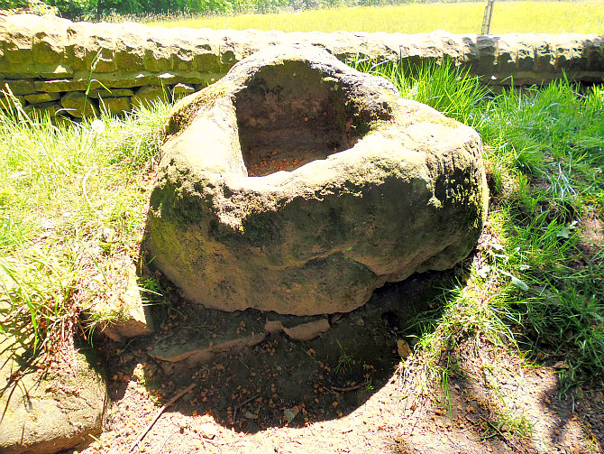
Simon’s Cross near Simonstone, Lancashire.
OS grid reference: SD 7760 3609. Upon White Hill and just beside Shady Walks at the north-side of Simonstone, near Padiham, Lanca-shire, is a large boulder with a deep socket hole. This is, in fact, the cross-base of a Medieval wayside cross which was known locally as ‘Simon’s Cross’, ‘Simon’s Stone’ or sometimes ‘Wart Well’. Very little is known about its history and who it was named for, or who actually erected the cross. There are inscriptions carved into the sides of the cross-base. The stone can be reached from the A671 (Whalley Road) in Simonstone, then via School Lane and Trapp Lane for ¾ of a mile, passing Higher Trapp Hotel on the left. Just before the top of the lane where the woodland begins go through the wooden kissing gate – the cross-base is beside the wall. Just opposite the cross-base is the beginning of a long and overgrown woodland trench, and the track running alongside this is known locally as Shady Walks!
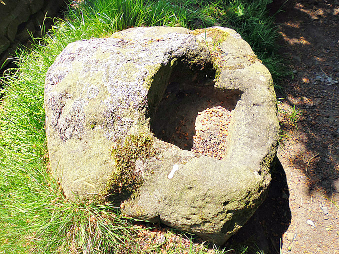
Simon’s Cross (from above).
This large, natural and round-shaped boulder, known as ‘Simon’s Cross’ is roughly 4½ ft wide and just over 2 ft high and is thought to weigh 2-3 tonnes. Its socket hole is 1 ft wide and 10′ deep. But it is not always full of rain-water. When it does contain water it is locally called ‘Wart Well’ as it is said to be a cure for warts, or it used to be? When I visited there was no water in the socket hole. On the side of the boulder the words ‘SIMON’S CROSS’ are carved along with a faint cross symbol and some Latin-type letters: maybe J A M and J W and a date that looks like 1860. The cross-shaft that would have fitted into this boulder having long since disappeared, but where did it go to?
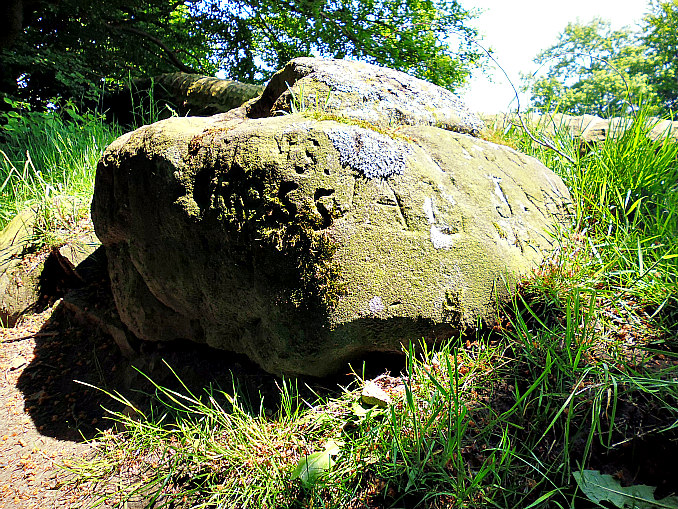
Simon’s Cross (side view).
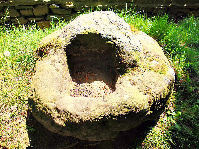
Simon’s Cross (close-up of the ‘Wart Well’).
Simon’s Cross originally marked the parish boundary of Simonstone and Read, and was perhaps set up in the late 13th or early 14th century by Simon de Read, or could it have been Simon de Altham in the 14th century? It could also, perhaps, be named after a member of the Whitaker family of Simonstone? But we may never know. Simonstone takes its name from any of these characters. And maybe the monks of Whalley Abbey had some connection with the cross as it may have stood on land owned by that religious house, but the main landowners between here and Clitheroe were the de Lacys. Maybe this was a wayside cross to which pilgrims on-route to the abbey could congregate at – and say prayers for a safe journey – the cross acting as a sort of waymarker. The stone for the building of Whalley Abbey is ‘said’ to have come from quarries at Read and Simonstone.
“The deep, overgrown trench alongside the path in Shady Walks was a drift mine for the extraction of fire clay”, according to the 1992 book ‘Walks In Lancashire Witch Country’ by Jack Keighley. This industrial quarry working runs beside the woodland track for about ½ a mile.
Sources and related web-sites:-
Clayton, John A., The Lancashire Witch Conspiracy, Barrowford Press, 2007.
http://www.british-history.ac.uk/vch/lancs/vol6/pp411-416
http://www.british-history.ac.uk/vch/lancs/vol6/pp503-507
Keighley, Jack, Walks In Lancashire Witch Country, Cicerone, 1992.

June 24, 2016 at 7:56 am
Reblogged this on Lenora's Culture Center and Foray into History.
LikeLike