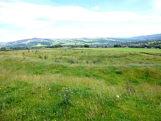
Round Dikes on Addingham Low Moor (from above).
NGR: SE 0551 5012. Quite a substantial Iron Age earthwork situated below Counter Hill on Addingham Low Moor, West Yorkshire, that is locally called ‘Round Dikes’, ‘Round Dikes Camp’ and ‘Round Dikes Settlement’. This enclosed and almost oval-shaped earthwork on the moors to the east of Crossbank Road also supports a Bronze Age burial mound, but unfortunately this is now badly mutilated. There are traces of an associated linear earthwork to the south-east of the site, and another burial mound, although this is now hardly recognizable at ground level. Round Dikes Earthwork can be reached from Crossbank Road, where a footpath runs northeast towards Counter Hill, through a couple of fields and over a couple of wall stiles for 400m. Just before the earthwork, there are some gates and a short muddy path. The grassy earthwork is now in front of you!
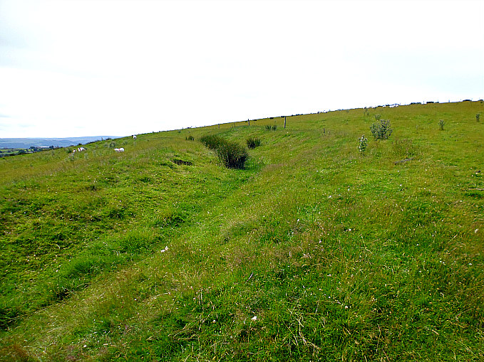
Round Dikes Earthwork, (the north side).
Round Dikes Earthwork roughly measures 87m x 79m and is oval-shaped. It has a well-defined ditch with banks running around an inner area which would have been the camp or settlement’s inner sanctum; the banking at the north side is very prominent and is 4-5 feet high in parts, whereas the banking further around the site is slightly less at 3-4 feet high. However, it is thought this was a non-defensive camp or “entrenchment” probably of the Iron Age, and not of the Roman period. The inner part of the site probably contained maybe nine hut circles and some hearths, according to John Dixon in his work ‘Journeys Through Brigantia’ – Volume One. At the south-east side there is what looks to be an entrance, and close to that and just inside the camp’s enclosure, a spring which is now almost lost in reed beds! The ditch and banking at the south side is almost lost in dense foliage and reed beds, and the spring makes for very boggy conditions here.
It would seem that the people of the Iron Age kept their stock: cattle, sheep, goats, pigs and maybe horses close to them and always within the bounds of their settlements or enclosures.
The author J. C. Barringer in his work ‘The Yorkshire Dales’, says of these Iron Age people and their enclosures: These complexes of small enclosures were bounded by stone banks and contained round huts of about fifteen feet in diameter. The inference to be drawn from the archaeological evidence is that Iron Age peoples occupied many of the limestone plateau above the main valley floors and that they were agriculturalists to the extent of growing crops of oats and perhaps rye in their small enclosures.”
He goes on to say: ‘Their small enclosures near their huts may have been crop growing areas, but most of their territory must have been used for grazing stock. The grazing of hillsides, would of course, hold back tree growth and in the case of goats severely inhibit it, so maintaining the clearance of the woodlands and perhaps increasing it in some areas.”
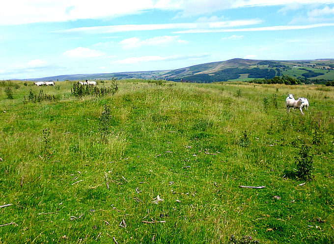
Round Dikes Earthwork. Bronze Age Bowl Barrow (between the sheep!)
Near the south side of the site there is a small but very mutilated mound or bowl barrow which must be ascribed to the Bronze Age. This grassy mound is about 4 feet high but it is very damaged with a hollowed-out part at one side – due perhaps to robbery, or maybe from some illegal archaeological diggings in the past. So the site was obviously in use as a settlement long before the round dikes were built. And 200m further downhill to the southeast there are traces of a linear earthwork which was probably an extended part of the Round Dikes Camp. There is also another tumulus (bowl barrow) just below this earthwork at (grid ref: SE 0584 4993), although this has been largely lost due to ploughing of the field.
About ¾ of a mile to the west, at Woofa Bank, there is another large oval-shaped Iron Age enclosure with associated earthworks over to the north and east, and there is an interesting tumulus (bowl barrow) on the trackway (Millennium Way) to the south.
Sources and related websites:-
Barringer, J. C., The Yorkshire Dales, The Dalesman Publishing Company Ltd., Clapham, 1982.
Dixon, John & Phillip, Journeys Through Brigantia – Volume One – Walks in Craven, Airedale and Wharfedale, Aussteiger Publications, Barnoldswick, 1990.
https://en.wikipedia.org/wiki/Addingham
http://www.pastscape.org.uk/hob.aspx?hob_id=48311
http://www.ancientmonuments.info/en31498-late-prehistoric-enclosed-settlement-known
http://www.armadale.org.uk/rounddykes.htm
Copyright © Ray Spencer, The Journal of Antiquities, 2016 (Updated 2024).
