The Journal Of Antiquities

Ancient Sites In Great Britain & Southern Ireland


Hare Hill Ring Cairn, Near Thornton-in-Craven, North Yorkshire

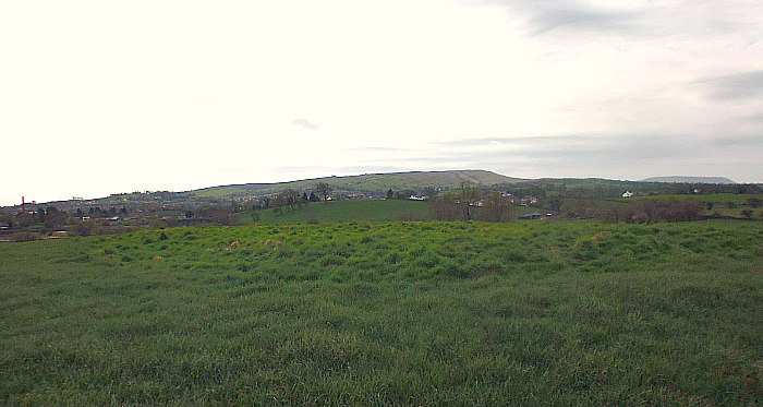
The Hare Hill ring cairn, near Thornton-in-Craven (closer-up).

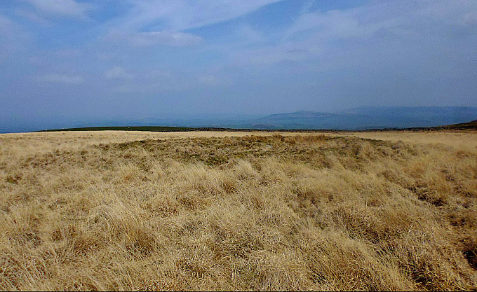
The Hare Hill Ring Cairn, near Thornton-in-Craven, North Yorkshire.

OS Grid Reference: SD 92955 47705.  About ½ a mile to the south-east of Thornton-in-Craven, North Yorkshire,  is Hare Hill and  an early Bronze Age ring cairn or round barrow (tumulus). This ancient monument is on Hare Hill, close to footpaths which head northwest from Clogger Lane near Elslack. However, the burial cairn is now without its mound of earth and stones. At the south-east side is Low Hill, which might be a significant place-name here, and over at the northwest side, Stone Pit Hill. It was excavated back in the 1930s and 40s and many of the finds, including a large funerary urn, were deposited in the Craven Museum at Skipton. From the A56 Skipton Road near Thornton-in-Craven, turn (right) towards Elslack passing the hall, then right again onto Clogger Lane for ¾ of a mile and, after the woodland, take any of three paths (Pennine Way) on your right in a northwesterly direction onto the moor. Hare Hill being the second of the three lows hills in front of you.

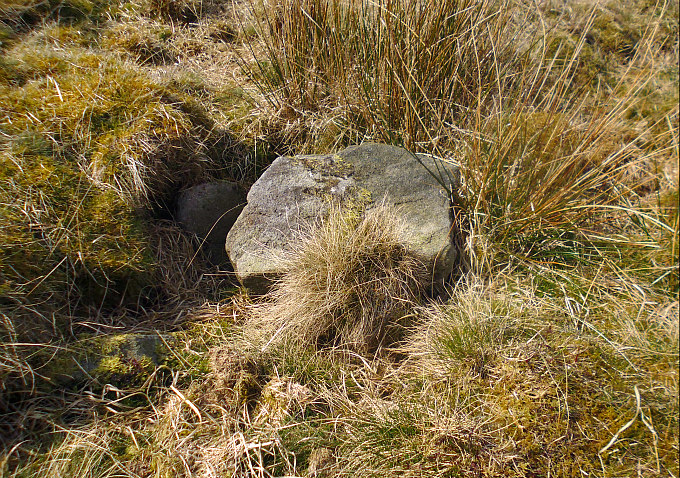
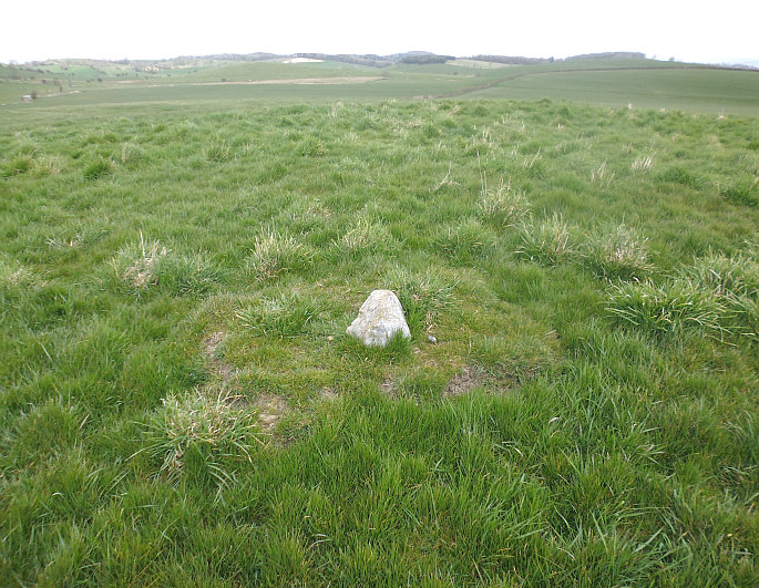
Hare Hill Ring Cairn, Thornton-in-Craven. (Close-up of the cist).

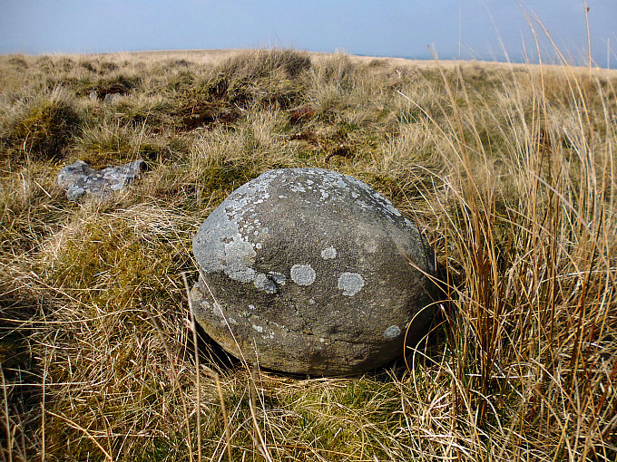
Hare Hill Ring Cairn. Strange round-shaped stone within the barrow

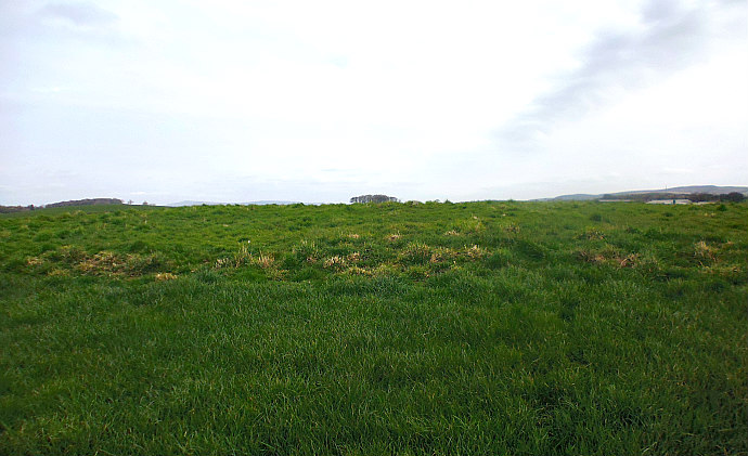
The round barrow monument atop Hare Hill on Thornton Moor     is an early Bronze Age ring cairn or cairn circle that has lost its covering mound of earth and stones, but its outer ditch just about survives at the NW and SW sides, and there is possibly an inner ditch. Its raised bank is about 0.7m (2.3 ft) high, while the whole monument has a diameter of roughly 24m (78.7ft) and a radius across of 13m (42.6 ft) x 12m (39.3 ft). However, considering how long ago that this burial mound was constructed it is in a reasona-bly well preserved state,  just a bit messed-around with in the middle! There are several stones towards the central part of the circle but as to whether these came from the burial cist or from the bank is not certain, and the stones may not be in their original positions? The signs of excavations here are all to clear to see with a small hollow and a large shaped stone above, and smaller ones inside it, which might have been the cist burial, while other small piles of stones can still be seen embedded into the grassy bank. There may have been a settlement in the vicinity of the ring cairn though there are no visible earthworks here.

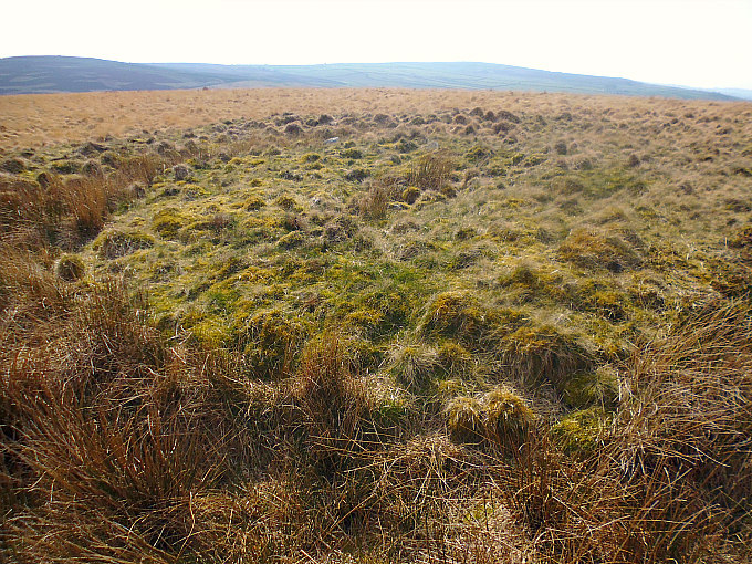
The remains of the bank, ditch and barrow

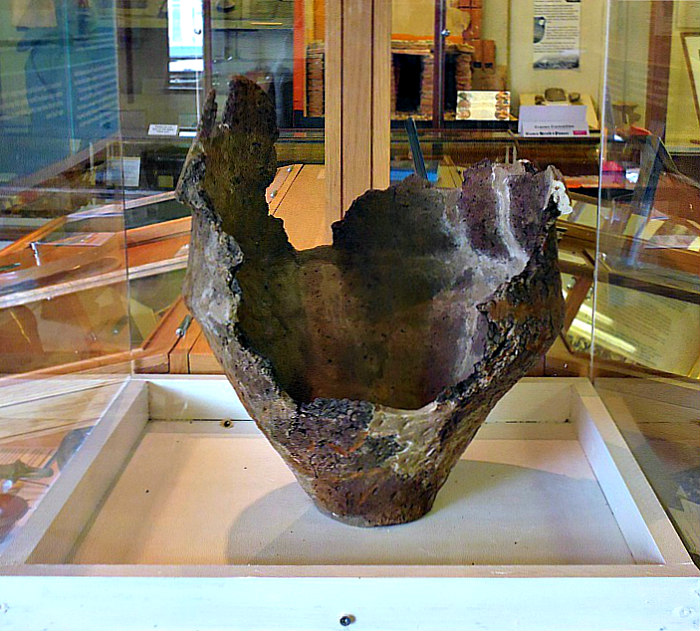
Hare Hill urn in Craven Museum at Skipton.

The ring cairn was excavated back in the 1930s and 1940s by Mr Welbury Holgate (who was accompanied by his sisters) and, over a number of years, there were many interesting finds including a very large collared funery urn with patternation, which broke into many pieces on being unearthed from the stone cist, but it was eventually (partly) restored and deposited in The Craven Museum, Skipton. It’s thought that up to 21, mainly young people, were buried in the cairn between the Late Neolithic and Early Bronze Age periods of pre-history. There were other finds including charcoal deposits, flints, an axehead and bone pins or needles. There is more information on the Hare Hill site on the ‘OneGuyFromBarlick’ website: https://oneguyfrombarlick.co.uk/viewtopic.php?f=59&t=14401     

John & Phillip Dixon (1990) tells us that: “A Bronze Age collared urn displaying cord and jabbed impressions was found in a barrow on Hare Hill, Thornton-in-Craven. This is now on display in the Craven Museum, Skipton.” They also say: “A fine Bronze Age dagger was found in a field below the Manor House Residential Home, just up the road, in the 1960’s (SD 909484).”  

Sources / References & related websites:-

Dixon, John & Phillip, Journeys Through Brigantia Volume One: Walks in Craven, Airedale and Wharfedale, Aussteiger Publications, Barnoldswick, 1990.

https://oneguyfrombarlick.co.uk/viewtopic.php?f=59&t=14401

https://www.megalithic.co.uk/article.php?sid=35748

https://en.wikipedia.org/wiki/Craven

©Ray Spencer, The Journal of Antiquities, 2019.


2 Comments

Gilbeber Hill Earthwork, Near Greenberfield, Lancashire

Gilbeber Hill, near Greenberfield, viewed from the south.

Gilbeber Hill Earthwork near Greenberfield, Lancashire.

OS Grid Reference: SD 87627 48284. About halfway between Greenberfield and Bracewell, in Lancashire, is Gilbeber Hill (sometimes spelt as Gilleber), and an almost square-shaped earthwork consisting of a raised outer bank and, near the centre,   a small raised platform with a little stone. The rough, grassy earth-work has been considered to be a Roman camp, a Medieval enclo-sure, or perhaps a Civil War encampment from the 17th century! Bracewell was originally part of the West Riding of Yorkshire. The Roman road linking Ilkley in the east with Ribchester in the west runs close to Gilbeber Hill, the course of which is still to be found at Brogden Lane to the southwest. From the footpath (at east-side of Sewarage works) on Greenberfield Lane: head across the field to a second wooden gate, then continue on this footpath to the foot-bridge over Stocks Beck. Gilbeber Hill is the low, grassy hill on your left; the footpath runs around the base of the hill towards a third gate and then onto Gisburn Road. A similar earthwork is to be found on Hawber Hill ½ a mile to the northwest.

Gilbeber Hill Earthwork near Greenberfield. The Western side.

Gilbeber Hill Earthwork. The small raised feature at the SW side.

The rectangular-shaped earthwork atop Gilbeber Hill (drumlin) is a raised, grassy area with a visible bank around its edges which measures between 1-2 feet in height, and there are slight traces of an outer ditch. Nearer the centre at the W side is a small, raised square feature (platform) with a little stone standing upon it, but whether this ‘white stone’ was part of the earthwork structure is not known; it may have come from somewhere close by. At the E side is what might be an entrance? The earthwork is roughly 24m x 26m and 632-756 square yards with a parameter length of 101m covering 0.156 acres of the flat hilltop site. But was this a temporary camp from the late Roman period, or perhaps a Romano-British farmstead (similar to Bomber Camp near Coal Pit Lane)? or was it a medieval settlement/enclosure? or could it have been a Civil War encampment from the 1640s? – this we don’t know with any certainty. There don’t appear, however, to have been any Civil War camps in this part of west Craven, and so that theory must be dismissed.

John & Phillip Dixon (1990) say of the earthworks: “Near the settlement of Stock are two hill-top earthworks; one is sited above Stock upon Hawber Hill, the other is sited upon Gilbeber Hill, roughly 30 yards square and 27 yards square respectively. The Gilbeber earthwork displays signs of an outer ditch, and…….commands a view of the surrounding area that is bisected by the Roman road. There are over a dozen such hill enclosure sites in the western central Pennine area and none, other than the Bomber Camp/Primrose Hill sites, have been subject to archaeological study. At this stage it may be reasonable to view the Hawber and Gilbeber site as having their possible origins in the late Roman period. And, in the case of Hawber, may be related to some of the earthwork features around Stock Green that we consider may be a Romano-British settlement similar to that of Bomber Camp.”

John Dixon goes on to add: “Whitaker in his “History of Craven”, states that “tradition holds that they (the Hawber and Gilbeber earthworks) were constructed by the Royalist forces of Prince Rupert during their march through Craven in 1644. They consist of small square encampments and are strengthened by long rectilinear fosses, which descend along the slope of the hills on each side to the plane beneath.”

The PastScape / Historic England Monument No. is: 45403.

Sources / References and related websites:-

Dixon, John & Phillip, Journeys Through Brigantia Volume One: Walks in Craven Airedale and Wharfedale, Aussteiger Publications, Barnoldswick, 1990.

https://www.pastscape.org.uk/hob.aspx?hob_id=45403

https://www.pastscape.org.uk/hob.aspx?a=0&hob_id=45398

© Ray Spencer, The Journal of Antiquities, 2019