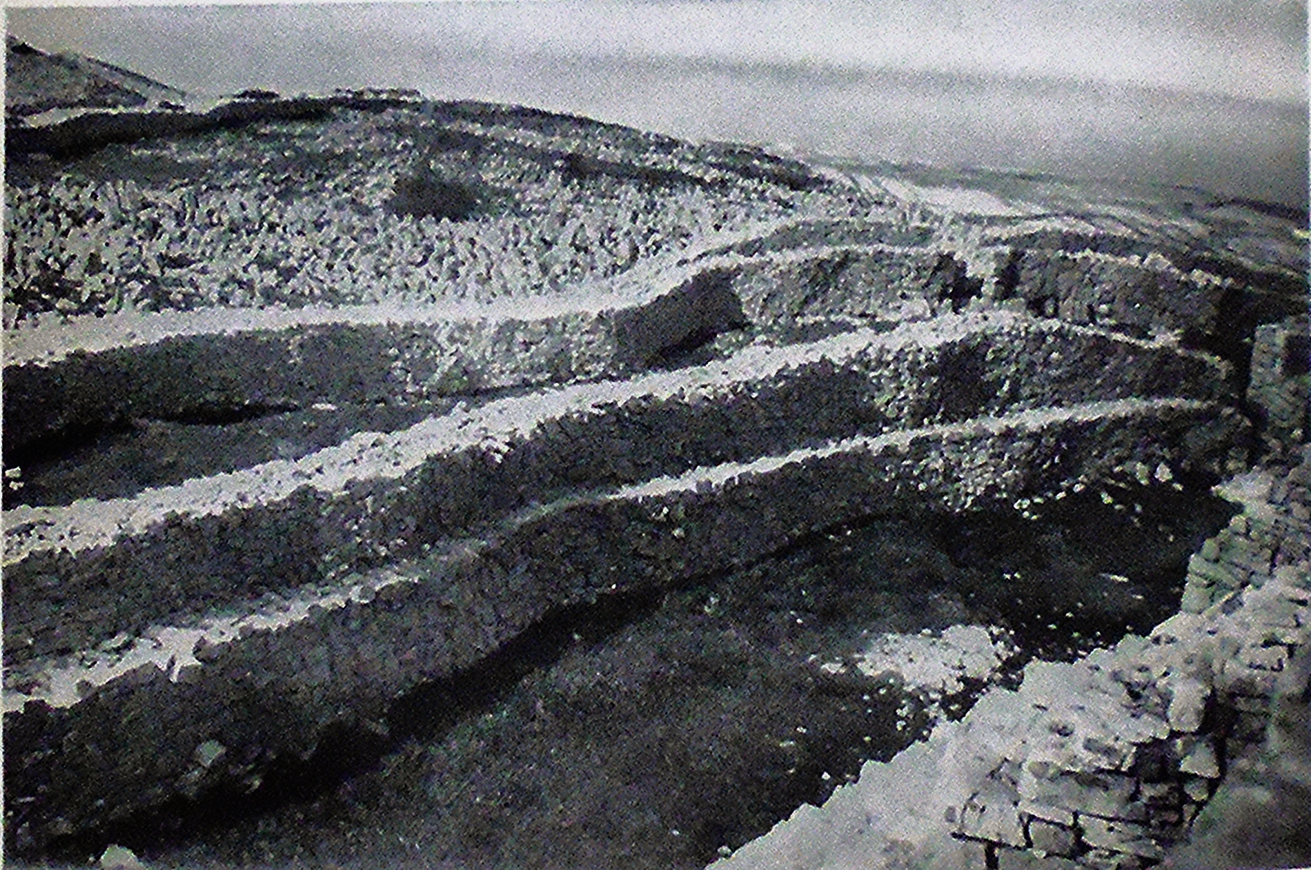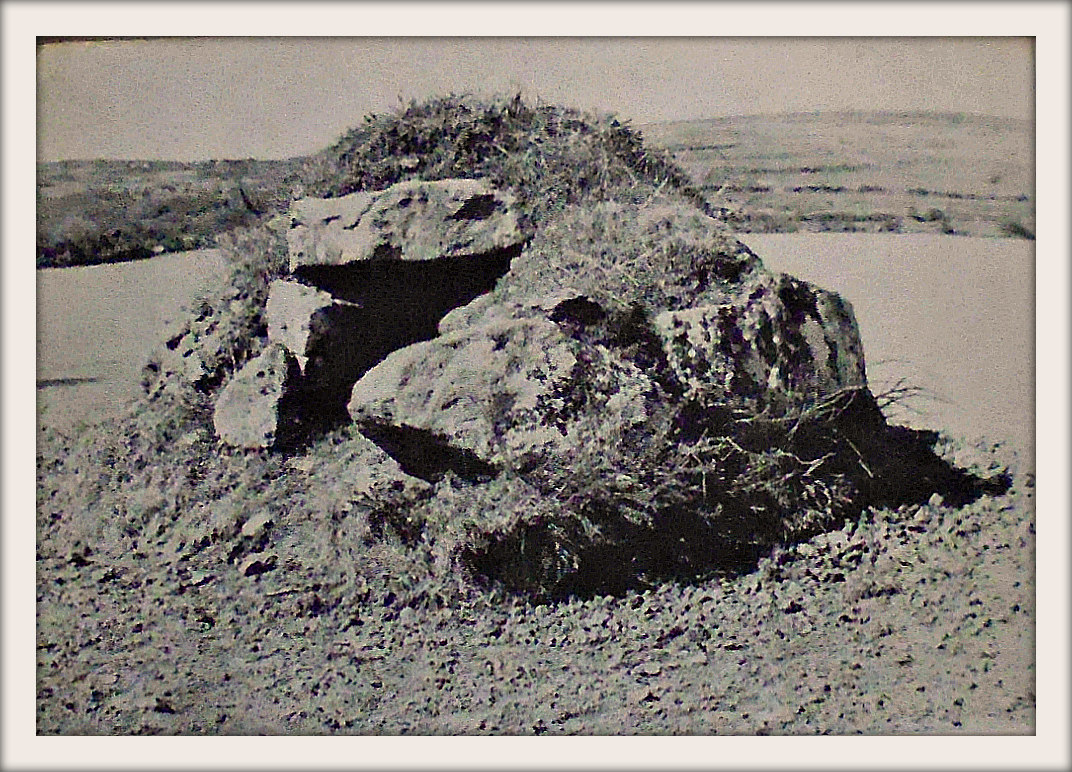
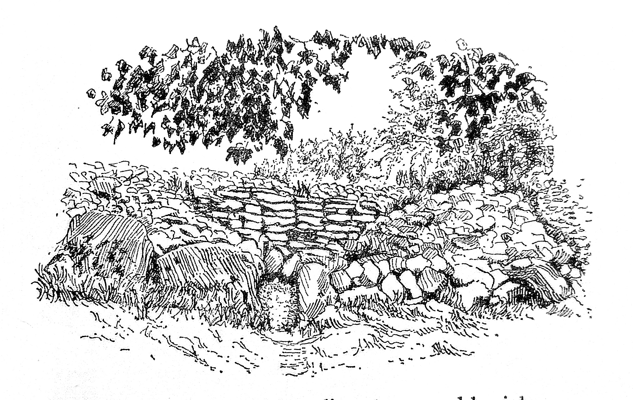
The Journal Of Antiquities

Ancient Sites In Great Britain & Southern Ireland


Clava Cairns (Stones of Clava), Inverness-shire, Scotland.

Clava Cairns (Stones of Clava), Inverness-shire, Scotland.

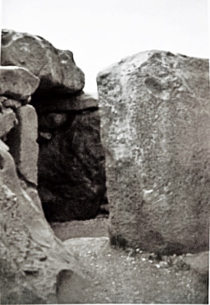
NGR: NH 75737 44432. About 1 mile south-east of the Culloden battle site, across the river Nairn at Balnuaran of Clava, Highland region, Scotland, is a group of prehistoric monuments. The Clava Cairns (also known as Stones of Clava) date from the late Neolithic to early Bronze Age. The group or complex consists of three-chambered burial cairns, the central one of the ring type. They are essentially large, circular piles of stones. Around the edges of the cairns are some upright stones forming a kerb, some of the stones having been replaced and a few went missing altogether. At least one of the cairns at Balnuaran, 7½ miles to the east of In-verness, was excavated in the late 1820s at which time some fragmentary bits of a funerary urn were found, but nothing seems to have been found in the other two cairns when they were excavated in the late 1850s. Some cup marks are visible in one of the passage walls of Cairn II. Visitors can walk along the passageways into the circular centres of the cairns. There is an outer circle of standing stones surrounding the middle ring cairn.

The site is in the care and management of Historic Environment (Scotland). Clava Cairns’ location is beside a country lane to the east of the B851 and B9006 roads on the south side of the river Nairn; the lane itself cuts through the stone circle. A car parking area is provided for visitors to this ancient cemetery.

Timothy Darvill writing in 1988 tells us: “The late Neolithic tombs at Clava, partly restored, stand in a line on a north-east to south-west axis. All three are round in plan and each is surrounded by a stone circle. The central tomb is of the ring-cairn type. Constructed of massive boulders edged with a kerb of even larger stones, the cairn was heaped up to a height of about 1.2m. The central area is edged by flat stones, and during excavation in 1857 was found to contain cremated human bone.  The two outer tombs are typical of the type of monuments generally known as Clava Cairns and as such form part of a widespread late Neolithic tradition of tomb-building in northern and western Britain which also includes the entrance graves of west Penwith….. and the Scilly Isles.  Both the outer tombs at Clava have circular cairns edged with large boulders. In the centre of each is a circular chamber approached by a passage from the southwest, an axis that may be significant as it coincides with the midwinter sunset. Large upright stones formed the walls of the chambers and passages, while the roofs were originally corbelled. Human bone, some cremated, has been found in both of the chambers.”

The Illustrated HMSO Guide to Ancient Monuments of Scotland (1959) discusses Sepulchral Circles and tells us: “A very specialized variety, confined to the coasts of the Beauly Firth and the valleys of the Nairn and Spey, is best represented by the group at Clava under the Ministry’s guardianship. Monuments of this class are generally marked “Stone Circles” on the Ordnance Survey Maps, and some in fact appear today as three concentric rings of great stones. In reality, even these are just the most stubborn remnants of chambered cairns of what Childe once termed the Beauly class. The innermost ring constituted the foundation for a chamber’s wall; the next bounded and supported the cairn that covered it. Only the outer ring originally consisted of free-standing uprights.  In the cases mentioned the smaller boulders forming the cairn have been carted away.

“The inner and middle rings in fact consist of massive rounded boulders set close together. The outermost alone comprises tall monoliths. Stones in one or more rings are quite often adorned with cup marks.  No cairn of the Clava (or Beauly) class has yielded any relics to provide archaeologists with a clue as to the relative age of its erection. They are classed as “Bronze Age” here in view of their relation on the one hand to the Boyne tombs of Eire, on the other to the Recumbent Stone Circles of Aber-deenshire. But of course the same term could be applied just as well to Maes Howe and kindred Orcadian tombs. Nevertheless, apart from a group in Strathspey, near Aviemore, Clava Cairns do seem to lie along a Bronze Age trade route well defined by the distribution of characteristic weapons. The Recumbent Stone Circles exhibit a complementary distribution along the eastern continuation of the same route.
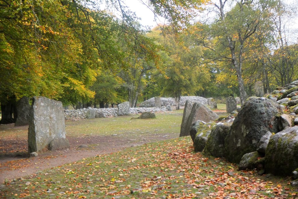
Clava Cairn site. Photo by Jim Barton (Geograph/Creative Commons).

“The Cairns of Clava stand on the flood plain of the Nairn in the narrow gorge immediately below the battlefield of Culloden Moor. They were opened in 1828, when sherds of a rough clay urn, now lost, were recovered from one.  Cairn I,  the most westerly, is surrounded by a circle of 11 upright monoliths; four of the stones had fallen and were replaced last century, perhaps rather out of position; there was probably once a 12th stone. The cairn, with an overall diameter of 53 feet, is surrounded by a kerb of large boulders, interrupted by a gap opposite the tallest uprights. This is the entrance to a passage, bordered by similar boulders, 2 feet wide and once 4½ feet high. It leads to a chamber some 12½ feet in diameter. The ring of large boulders on edge that frames it supports courses of rubble masonry oversailing one another inwards. This masonry must originally have been carried up to form a corbelled dome over the whole space, about 12 feet above the floor. A cup mark is observable on one stone in the chamber wall.

“Cairn II, on the east, agrees with No.1 in its general layout. The passage wall includes a cup-marked stone. 

“Cairn III, in the middle, differs from the foregoing in that no passage gives access to the interior; the kerb and the chamber wall are both unbroken rings. There is no trace of masonry above the uprights surrounding the chamber which is 22 feet across and may never have been roofed. A peculiarity of Cairn III is constituted by three stone “causeways” radiating from the base of the kerb out to uprights in the outer ring on the south, east, and northwest.

“The Clava cemetery comprises other smaller cairns that have never been examined, and that in 1945 were scarcely distingui-shable for scrub and brambles. Moreover, it may join on to another cemetery upstream, which, lying on long cultivated land, is in a still more ruinous conclusion.”

Sources / References & Related Websites:

Darvill, Timothy, AA Glovebox Guide — Ancient Britain, The Publishing Division of the Automobile Association, Basingstoke, Hampshire, 1988.

H.M.S.O., Illustrated Guide To Ancient Monuments of Scotland, H. M. Stationery Office, Volume VI, Edinburgh, 1959.

The AA, Illustrated Road Book Of Scotland, The Automobile Association, London, 1963.

https://www.geograph.org.uk/photo/5943810.  The colour photo (above) of Clava Cairns site is © Copyright Jim Barton and licensed for reuse under this Creative Commons Licence.

https://en.wikipedia.org/wiki/Clava_cairn

https://www.historicenvironment.scot/visit-a-place/places/clava-cairns/

https://www.aberdeenshire.gov.uk/leisure-sport-and-culture/archaeology/sites-to-visit/clava-cairns/

https://www.megalithic.co.uk/article.php?sid=3373

Copyright © Ray Spencer, The Journal of Antiquities, 2023.
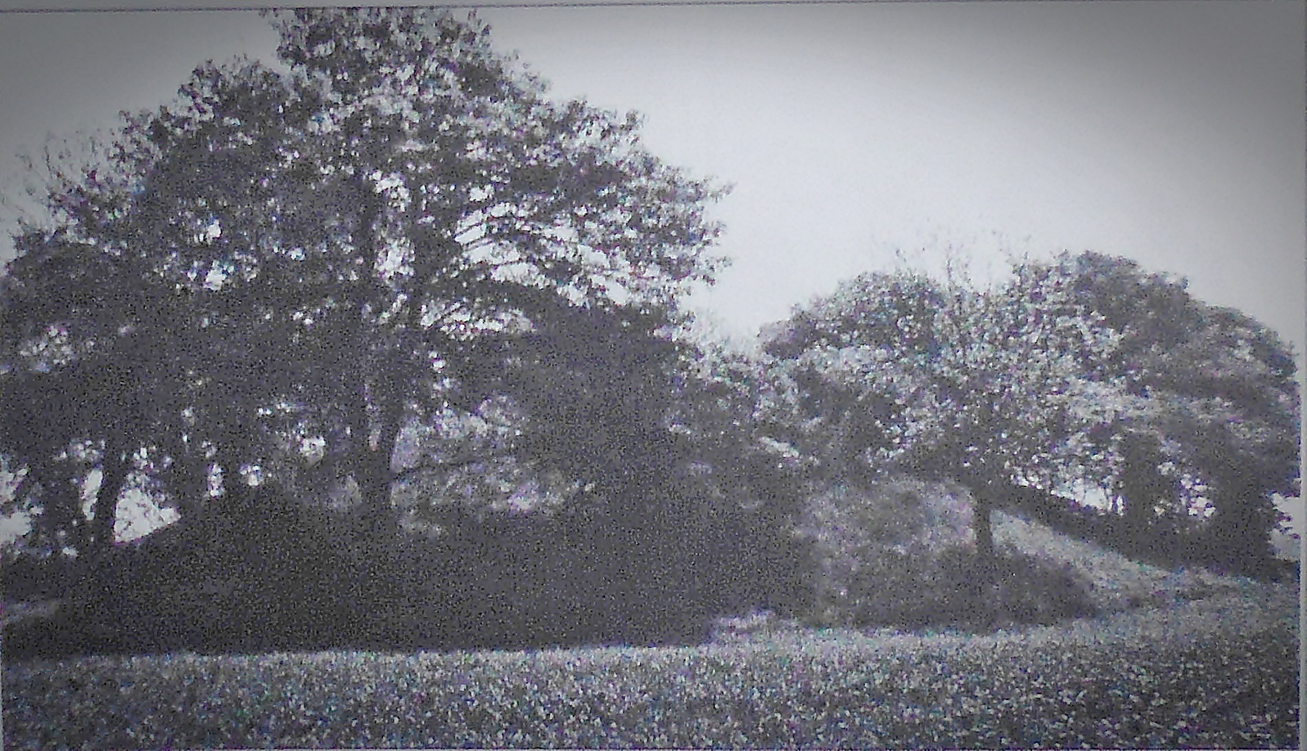


Willy Howe, Near Wold Newton and Burton Fleming, East Yorkshire.

Willy Howe burial mounds, near Burton Fleming, East Yorkshire.

NGR: TA 0616 7234. About 152 metres north of Low Barn Farm (also called Willy Howe Farm), roughly located between Wold Newton and Burton Fleming, in the Great Wold Valley, East Yorkshire, are the large tree-covered mounds or round barrows known as Willy Howe, which date from the mid to late Neolithic age. The site is 295 m to the south of Burton Fleming Lane, close to a farm track. There are numerous far-fetched legends and tall tales associated with the burial mounds (there are actually three mounds together but they are usually classed as one), however, these are “only legends” and in reality, there is no truth whatsoever in any of them, although they are interesting and worth mentioning here. Local people used to think the mound was inhabited by fairy folk and it was thought there was a doorway leading into it.

Excavations at the site have not produced any tangible evidence of burials, although a shaft going down into the mound was discovered, so maybe it was left unfinished and its builders had to leave or flee the area suddenly for some reason, or maybe this was made by the antiquarian excavators. It was excavated in the mid and late 19th century by antiqua-rians of some repute. Willy Howe is a Scheduled Ancient Monument and is under the protection of Historic England (H.E.). There are a few other round barrows not too far away from here, and the famous Rudston standing stone is only 3 miles to the southeast.

Timothy Darvill writing in 1988 says of the site that it is: “another fine middle Neolithic round barrow surviving as a mound nearly 40m in diameter and 7m high. Excavations produced no certain evidence of burials, but a rock-cut shaft rather similar to the one at Duggleby Howe was located under the centre of the mound.” Richard Cavendish writing in 1983 regarding the Rudstone Standing Stone adds that: “About 3 miles (4.8km) to the NW and of the same period is the giant, tree-shrouded barrow called Willy Howe…. 24ft (7.2m) high and 130ft (40m) across.  

Janet & Colin Bord (1991) tell us more and say: “Ancient sites (usually cairns or barrows) were often believed to be fairy haunts, and they were said to dance or make music there. Willy Howe (Humberside) is a prominent round barrow which housed a fairy dwelling, seen by a drunken villager late one night. He heard people singing and went to see who it was. Through an open door in the side of the mound he could see people banqueting at large tables. One of the people saw him and offered him a cup. He took it but threw away the contents, not wishing to come under the spell of the fairies, and ran off with the goblet, which was made of an unknown material. This tale was recorded by William of Newburgh in the twelfth century. Another tale told of people digging into the mound and finding a golden chest. They tried to pull it out with horses, but it sank back into the mound and no one has ever been able to recover it.”

Willy Howe in 2007. Photo by John Phillips (Creative Commons).

The Wikipedia website gives us more information on the site:- “Willy Howe is a large round barrow 7.5 m (25 ft) high, located between Wold Newton and Buron Fleming in the civil parish of Thwing. The mound has been recorded as being excavated several times: by Lord Londes-borough in 1857; and by Canon William Greenwell in 1887. Neither found burials or grave goods; Greenwell found a feature approximating a shallow grave. The structure has a central space, resulting from the 19th-century excavations, additionally, an earthwork ramp created as part of Greenwell’s excavations has also modified the site. Use as a Thingstead during the medieval period has been speculated. Willy Howe is registered on the National Heritage List for England as a Scheduled ancient monument. Its List Entry Number is 1008040.”

Sources / References & Related Websites:-

Bord, Janet & Colin, Ancient Mysteries of Britain, Diamond Books, 1991.

Cavendish, Richard, The English Tourists Board — Discover England — Prehistoric England, Guild Publishing (Book Club Associates), London, 1983.

Darvill, Timothy, AA – Glovebox Guide – Ancient Britain, The Publishing Division of The Automobile Association, Basingstoke, Hampshire, 1988.

https://historicengland.org.uk/listing/the-list/list-entry/1008040

https://en.wikipedia.org/wiki/Willy_Howe

2nd photo down is of Willy Howe in 2007 by John Phillips for Creative Commons. https://en.wikipedia.org/wiki/File:Willy_Howe.jpg

https://www.megalithic.co.uk/article.php?sid=7397

https://www.spookyisles.com/willy-howe/

Copyright © Ray Spencer, The Journal of Antiquities, 2023.
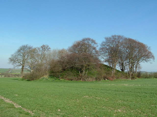

Cup-Marked Rock near Buck Stone Lane, Cowling, West Yorkshire.

Cup mark on boulder near Buck Stone Lane, above Cowling.

NGR: SD 9847 4265. In a field close to Buck Stone Lane about halfway between the villages of Cowling and Sutton, West Yorkshire, there is a large gritstone boulder with a single cup mark carving on it. This large, earthfast glacial erratic boulder is a prominent landmark close to the public footpath which runs between Buck Stone Lane and the monument called Wainman’s Pinnacle, and, can be reached from the small car park at the side of the lane. It is approx. 50 m to the N. of the lane. On the upper side of the boulder there’s a large single cup marking, and, there may be a couple of smaller cups on the lower part of the boulder, but, these must be regarded as “possible cup marks”; there are also some features on the top of the rock that are very likely due to weather-related erosion. There are two more smaller boulders further along the footpath. Is this particular cup-marked boulder the actual ‘Buck Stone’ after which the lane is so named, or, is that stone somewhere further along the lane or on the moor nearby?

These rock art carvings which usually appear as small circular depressions on rocks (they can be larger circular depres-sions too) are also known as petroglyphs, and they date from the late Neolithic to the early Bronze Age, but nothing is actually known about what their purpose was for, and why they were carved; some think they are maps showing where springs, caves, settlements and other features are located, while others think they are maps of the stars in the night sky. These cup and concentric ring designs are similar to the carved mazes and may be linked to those features. There are other rocks and boulders bearing cup marks or cup and ring marks a few miles to the south such as William Walker’s Stone, Winter Hill Stone, Greystones Farm and Cob Stone. See the relevant site pages.

Related site pages:-

See here: https://thejournalofantiquities.com/2021/08/03/william-walkers-stone-far-slippery-ford-newsholm-dean-near-oakworth-west-yorkshire/

Winter Hill Stone: https://thejournalofantiquities.com/2014/09/14/winter-hill-stone-keighley-moor-west-yorkshire/

Grey Stones Farm: https://thejournalofantiquities.com/2016/10/13/greystones-farm-cup-marked-rocks-near-newsholme-dean-west-yorkshire/

Cob Stone: https://thejournalofantiquities.com/2016/10/19/cob-stone-near-far-slippery-ford-newsholme-dean-west-yorkshire/

Copyright © Ray Spencer, The Journal of Antiquities, 2023.
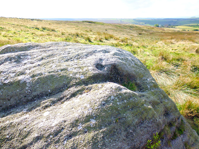


West Kennet Long Barrow, Near Beckhampton, Wiltshire.

The West Kennet Long Barrow. Photo by troxx. Wikimedia-Commons.

West Kennet Long Barrow Entrance.

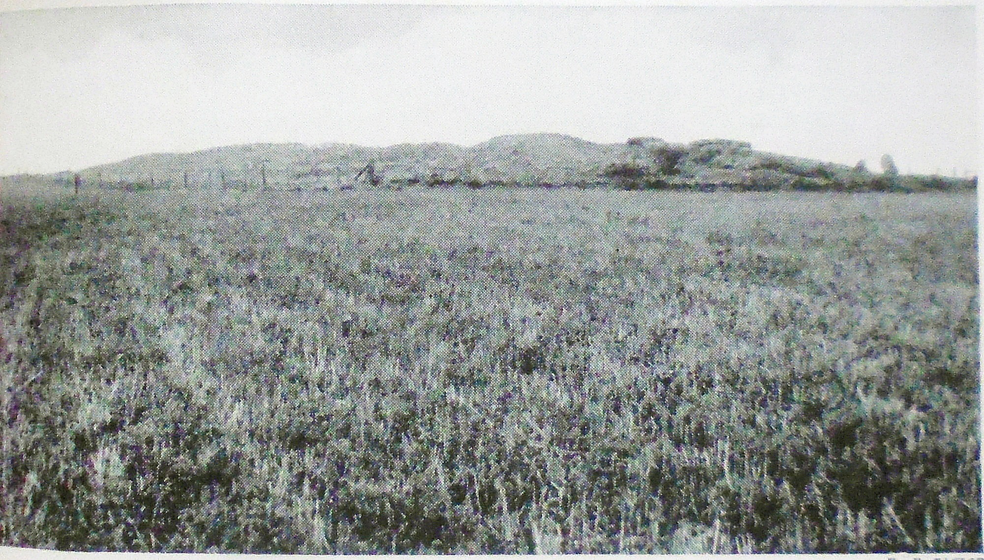
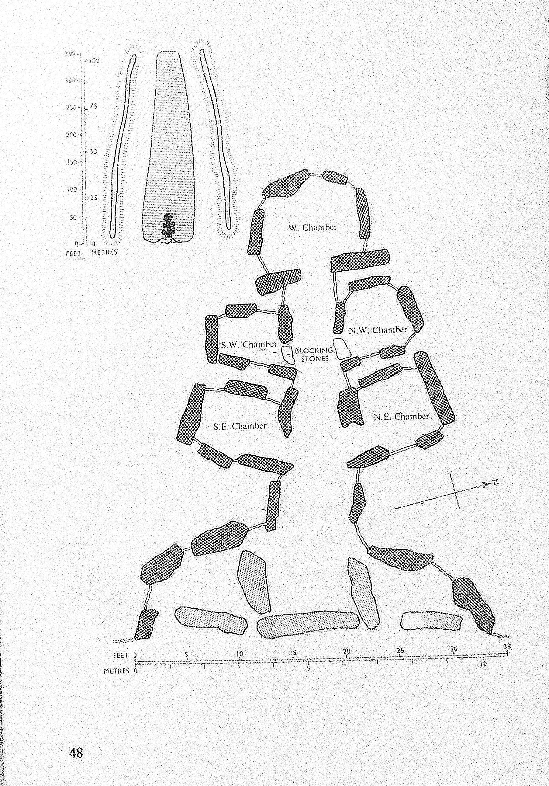
NGR: SU 1051 6775. Located in the grassy meadows and along a footpath across the river Kennet, 850 metres (uphill) to the southeast of Silbury Hill, in Wiltshire, and near the Beckhampton-Bath Road (A4) is the West Kennet Long Barrow, a megalithic chambered tomb dating from the Neolithic age of prehistory. It is the best-known, and the best preserved, of all the Neo-lithic long barrows in Britain. The entrance (portal) to the long mound has very large stone slabs set up against its facade; the original entrance was blocked by large stones, while inside the stone-lined passageway leads to four burial chambers or side chambers (and one large chamber at the far end) which once contained the skeletons and grave goods of some 46 individuals from the stone age 3,700 to 2,000 BC.

Old photo with a view of West Kennet Long Barrow from a distance.

The site, near Marlborough, is just one part of a much larger ancient complex of megalithic monuments, including Avebury, Silbury Hill, Stonehenge, Windmill Hill and Durrington Walls among others. The chalk and boulder-built long barrow was partially excavated in the middle of the 19th century, but, proper Archaeological excavations took place in the mid 195os at which time four burial chambers were excavated. After those more recent excavations, the long burial mound was restored to what it probably originally looked like. It is approximately 347 feet (106 metres) in length and nearly 8 feet (2.4 metres) high. Its chambers extend up to 40 feet (12 metres), while the now silted-up quarry ditches at either side of the barrow are some 30 feet away, but, were originally 12 feet deep and 20 feet wide. The site is in the guardianship of English Heritage but is managed on their behalf by The National Trust. There is “free” access inside the chambered long barrow during daylight hours. Another long barrow at East Kennet (NGR: SU 1163 6685) is on private land about 1½ miles to the southeast at Manor Farm, but, it is not as famous or as well-known, and it has trees growing out of it!

The National Trust & English Heritage publication of 1995 says regarding The History of the site: “It was recorded by John Aubrey, who included a sketch in his unpublished Monumenta Britannica of c1665, and described it ‘on the brow of the Hill, south of West Kynnet, is this monument, but without any name. It is about the length of the former [a barrow near Marlborough]; but at the end, only rude greyweather-stones tumbled together; the barrow is about half a yard high’. William Stukeley made more accurate drawings of the barrow between 1720-24, showing the ditch and the stones. Both Aubrey and Stukeley recorded that the barrow was regularly dug into by a local doctor, probably to supply bones for potions and medicines. Stukeley wrote: “‘Dr Took as they call him, has miserably defaced the South Long Barrow by digging half the length of it. It was most neatly smoothed out to a sharp ridge’”. Dr Toope wrote to Aubrey in 1685 telling him of his discoveries at the nearby Sanctuary, where he had found workmen digging up human bones. He wrote “I quickly perceived that they were humane, and came next day and dugg for them, and stored myself with many bushells, of which I made a noble medicine that relieved many of my distressed neighbours.” Aubrey noted that ‘Dr Toope was lately at the Golgatha again to supply a defect of medicine he had from hence’. At the barrow, much of the disturbance found by the 1955 excavations in the forecourt was probably caused by Toope’s diggings. Stukeley called it the ‘Archdruid’s barrow’ and described it as standing ‘east to west, pointing to the dragon’s head on Overton Hill [the] huge stones piled one upon the other … doubtless in order to form a sufficient chamber for the remains of the person there buried’.

“In 1859, Dr Thurnam excavated the central passage and end-chamber of the barrow in his search for skeletal material of the Ancient British (Crania Britannica, 1865). In 1882, the barrow, together with Silbury Hill, came under the protection of the first Ancient Monuments Act, and this finally stopped the damage done by local people digging for chalk or cutting turf from the mound.  The barrow was most recently excavated by Piggott and Atkinson in 1955-56. Thurnam’s report of the single passage and chamber was inconsistent with evidence from other barrows, which had chambers off the main passage. The 1955-6 work revealed that, indeed, four small chambers, two on either side, were preserved as they had been left in the late Neolithic, 4000 years ago.”

The H.M.S.O. publication from 1970 tells us more about ‘The West Kennet Long Barrow’. It says: “This chambered tomb, the largest in England and Wales, lies about half a mile (0.8 km) south-west of the village of West Kennet. It is reached on foot from the Bath road along a path marked by a finger-post.

Two plans of West Kennet Long Barrow,  Wiltshire.

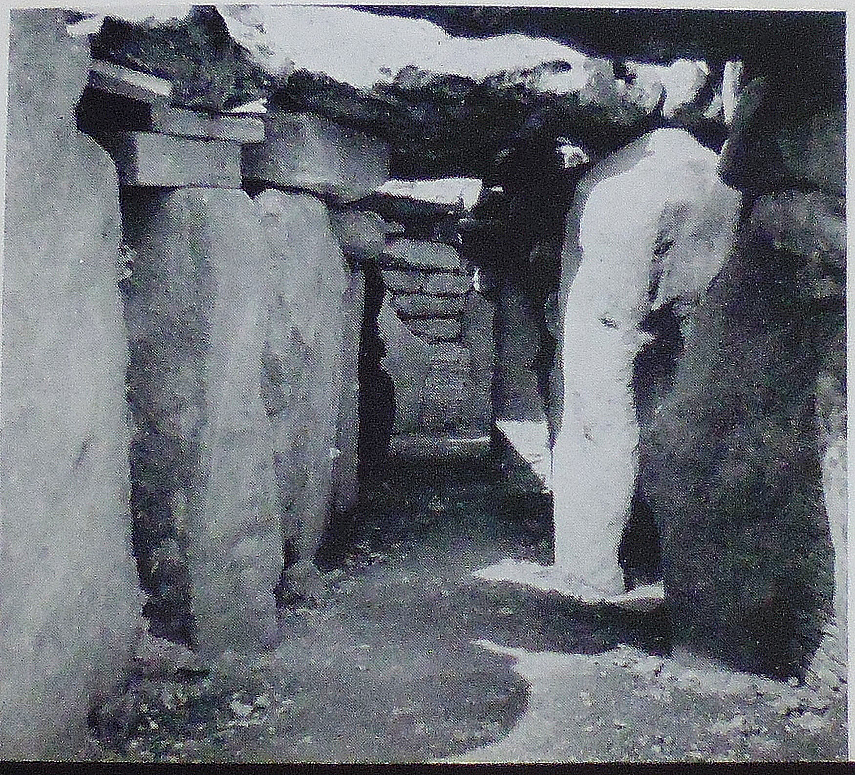
West Kennet Long Barrow (inside the passageway).

“The mound was considerably damaged in the 17th century, and was partially excavated in 1859. The excavation was completed and the tomb restored by the Ministry of Works in 1955-57.  The mound is one of the largest known, measuring 350 ft. (107 m.) in length. It is made of chalk rubble dug out from a ditch on either side, now entirely silted up, piled over a core of sarsen boulders collected from the surface of the surrounding downs. The edge of the mound was originally marked, round the sides and back, by a line of boulders on end, but these have now all disappeared.  The front of the mound at the east end is formed by a façade of large upright stones, with the spaces between them filled with walling of stones brought from seven or eight miles away to the west. In the centre of the façade is a semi-circular forecourt, set back into the mound and bordered by four large slabs set on edge, out of which the tomb chamber opens.  The tomb itself consists of a long passage with two pairs of burial chambers opening off its sides and a larger chamber at the far end. The remains of about thirty skeletons, including ten children, were found on the floors of these chambers, and it is clear that they had been put in the tomb at intervals over a long period of time, the earlier deposits being swept unceremoniously aside to make room for new-comers. A good many bones, and especially skulls, seem to have been taken away while the tomb was still in use. Pottery vessels deposited with some of these burials show that the tomb was used, though perhaps not built, by the Primary Neolithic people. It was probably constructed about 2700 BC, and continued to be used for many centuries. 

“After the last burial had been made, the whole tomb was blocked up in the most elaborate way. The chambers and passage were filled to the roof with chalk rubble containing numerous fragments of broken pottery and animal bones, and when this had been done the entrance-forecourt was first partially filled with boulders and then sealed off with three huge upright stones in line with those of the façade on either side, the centre stone being supported at the back by two uprights which continue the line of the passage. This final blocking seems to have been carried out by the local communities  of Secondary Neolithic and Beaker people, who also built Avebury and the Sanctuary.”

The AA Treasures of Britain (1968) provides more information on the long barrow at West Kennet and the finds. They say it is: “The finest example of many similar Neolithic long barrows, or burial chambers, on the Downs of North Wiltshire, the West Kennet barrow near Marlborough was excavated by Professors Stuart Piggott and R. J. C. Atkinson in 1955-6. The pottery (now in the Devizes Museum) dates from about 3000 to 1600 BC, when the barrow was used for burials by migrant peoples from the Continent who brought with them the knowledge of farming. The pots [found here] were probably used to store grain and milk. Also found was a bell beaker dating from around 2000; two bowls of the Peterborough type; a late Neolithic culture and Windmill type, made by early farmers in Britain around 2500-1800 BC; also part of a Rinyo-Clactonian pot and pieces of broken vessels from various periods of prehistory.”

Sources / References & Related Websites:-

Photo (top left) is by troxx:  https://commons.wikimedia.org/wiki/File:West_Kennet_Long_Barrow_entry.jpg

H.M.S.O., Stonehenge And Avebury, Her Majesty’s Stationary Office, London, 1970.

The AA, Treasures Of Britain – And Treasures Of Ireland, Drive Publications Limited, London, 1968.

The National Trust/English Heritage, The Prehistoric Monuments of Avebury, English Heritage, London, 1995.

https://www.english-heritage.org.uk/visit/places/west-kennet-long-barrow/history/

https://en.wikipedia.org/wiki/West_Kennet_Long_Barrow

https://www.megalithic.co.uk/article.php?sid=175&map=1

https://www.english-heritage.org.uk/visit/places/west-kennet-long-barrow/?utm_source=awin&utm_medium=Affiliate&utm_campaign=Affiliate&awc=5928_1687473422_b8d50561f5552d02d35207261a56e12a

More info here:  https://www.silentearth.org/west-kennet-long-barrow-wiltshire/

And more here:  https://www.mysterious-wiltshire.co.uk/west-kennet-long-barrow/

Copyright © Ray Spencer, The Journal of Antiquities, 2023.

The Discovery of Roman pigs of lead in Upper Nidderdale, North Yorkshire.

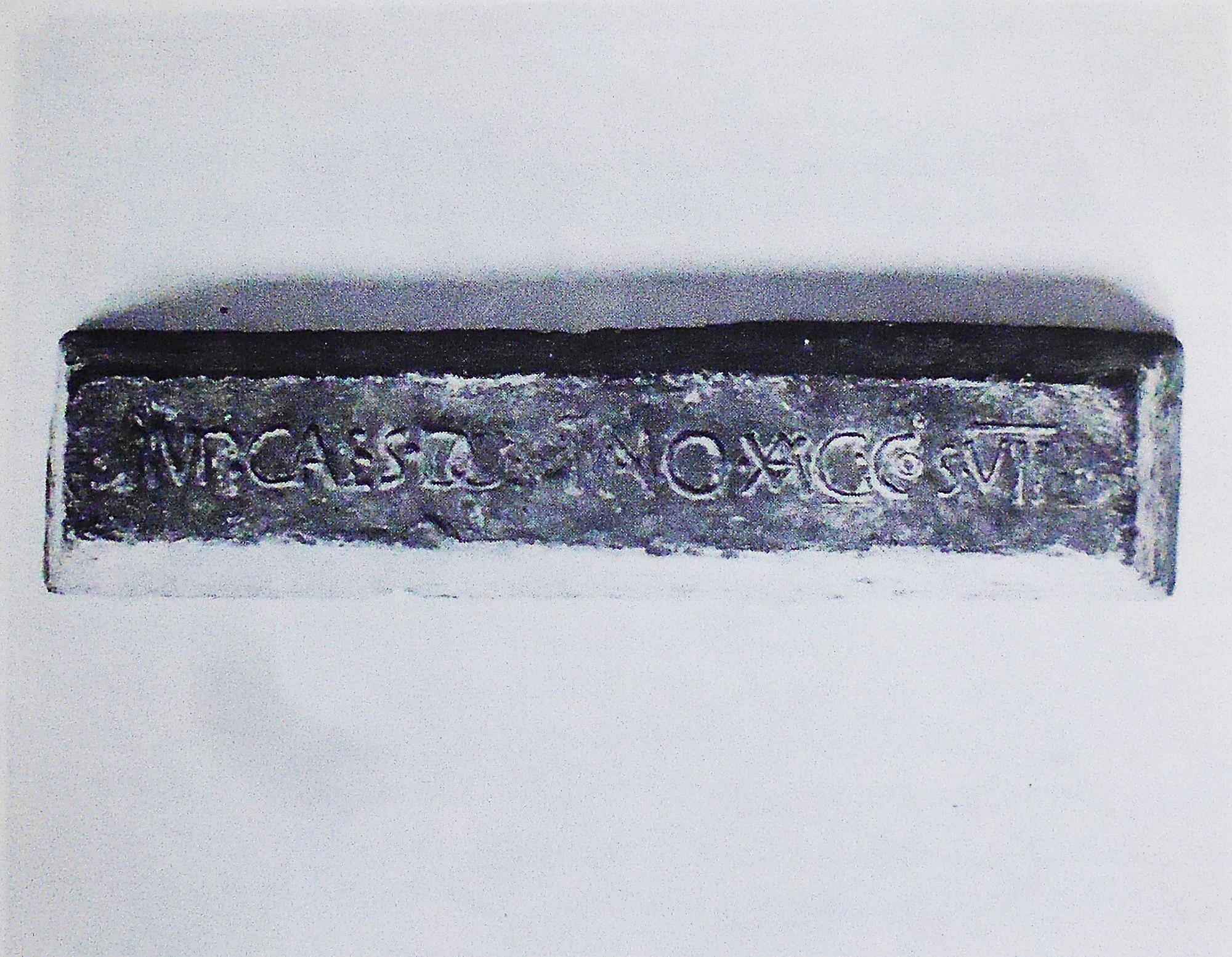
Roman inscribed lead pig from Greenhow, Upper Nidderdale, North Yorkshire.

NGR: SE 115 648. Back in the 1700s three pigs of lead with Latin inscriptions were dug up at Hayshaw Bank in the Greenhow area of Upper Nidderdale, North Yorkshire, which is just 3 miles southwest of Pateley Bridge. Two of these were made by Roman lead smelters in the late 1st century A.D. On the front side of the two lead pigs is the name of the Roman Emperor DOMITIAN, while on the side of both is inscribed in Latin the shortened form of the name of the local Celtic tribe (at the time). It’s thought the Brigantes tribe were forced into slave labour by the Romans after they were conquered in A.D. 74-75 and then put to work mining lead. The third pig, found in 1860 near Pateley Bridge, was of a slightly later date and in-scribed with the name of the Roman Emperor TRAJAN from the early 2nd century A.D. The three lead pigs were dug up by more recent lead miners who were digging in the rich lead and ore-veined moorland in and around Cockhill, Greenhow Hill, and near Pateley Bridge. The Cockhill & Sunside lead mines and smelt mill situated on Greenhow Hill in Upper Nidderdale was established soon after 1776, but it was not leased until 1781. However, the first recorded lead mine known as ‘Prosperous’ was established in that area about 1606. The two late 1st-century lead pigs eventually found their way to museums, but the early 2nd-century pig was apparently lost.

The Pateley Bridge Local History Tutorial Class writing in 1967 tell us more about Lead and Iron Mining in Upper Nidderdale. They say: “Prominent amongst the natural resources of medieval Nidderdale were lead and iron ores. Thin bands of ironstone in the Millstone Grit series outcrop over a large area of the dale, from Blayshaw Bents, west of Ramsgill, to the vicinity of Knaresborough. There are two main groups of lead-bearing veins, one of which runs in the Millstone Grit, roughly down the line of Ashfold Gill, where the Bycliffe Vein of Grassington Moor is continued in the Stoney Grooves, Merryfield and Providence Vein. The other is found mainly in the limestones on the summit of Greenhow Hill. The thick beds of the Carboniferous Limestone which form the western side of the hill are overlain, around Craven Cross, by the Millstone Grit beds, but come to the surface further east in a series of inliers, in which many veins outcrop. The more prominent of these veins would be noticed by the earliest metal-using peoples of the area. It is, therefore, reasonable to suppose that the vein outcrops were worked by the local Celtic tribe, the Brigantes, and consequently were known to their Roman conquerors, for within a few years of the Roman victory over the Brigantes at Stanwick in 74 AD., the new rulers were smelting lead on Greenhow.

“Three pigs of lead smelted by the Romans have been found in the Greenhow area. Two almost identical pigs, weighing 155 and 156 Ibs. respectively, were discovered in 1735 in a hole in the ground on Hayshaw Bank. On the base of each is the inscription, in raised letters: IMP. CAES. DOMITIANO AVG. COS. VII an abbreviation of ‘“Imperatore Caesare Domitiano Augusto Consule Septimum”’, meaning Emperor Domitian’s seventh term as consul, ie. 81 A.D. The word ‘“BRIG”’, presumably short for Brigantes, is also cast on the side of each pig. Both of them are preserved, one in the British Museum, the other in Ripley Castle. A third pig, found on Nussey Knot, was subsequently lost and all that is known about it is that the inscription included the name of Trajan, who was emperor from 91 to 117 A.D.” Just to note here: I understand the Roman pig of lead that resided in Ripley Castle was later given to The Craven Museum at Skipton.

I.A.Richmond writing in 1963 discusses the discovery of a lead pig from A.D. 74 in Flintshire, northeast Wales, but then goes on to say: “The next group of lead pigs is the small group from Yorkshire, which also carry the tribal name of the area, in the form Brig, for metallum Briganticum. They are found in the area between Nidderdale and Wharfedale, which was much exploited in later medieval times for lead also. The earliest dated example is of A.D. 81, exactly ten years after the Roman acquisition of the area. Another, of Trajan (A.D. 98-117), is imperfectly recorded from Pateley Bridge. It is probable that this was not the only lead-bearing area worked in Yorkshire. There is a good local tradition of Roman exploitation of the Swaledale lead deposits, in particular the Hurst Mine; it is connected with a pig of Hadrian, unfortunately never recorded in detail.”

“It is very probable that the Roman camp at Bainbridge may have served as a centre for the lead trade in the surrounding dales from which men were sent into Swaledale to mine for lead. Tradition relates that Hurst Mines in Swaledale was one of the Roman penal settlements where convicts were sent to work, and that buildings in Jerusalem and St Peter’s in Rome were roofed with lead obtained from the Hurst Mines. Residents of Hurst can still show us an iron ring, leaded into the rock, to which prisoners were chained for misdemeanour”, according to Edward R. Fawcett’s manuscript. Mr Fawcett died in 1939 but his work was edited & published by Brian Lee in 1985.

Sources / References & Related Websites:-

Fawcett, Edward R., Lead Mining In Swaledale (Mss. Edt. by Brian Lee), Faust Publications Co. Ltd., Thorneyholme Hall, Roughlee, Burnley, 1985.

Pateley Bridge Local History Tutorial Class, A History of Nidderdale, (Edt. by Bernard Jennings, M.A. University of Leeds), The Advertiser Press Limited, Huddersfield, 1967.

Richmond, I. A., The Pelican History of England — Roman Britain, Penguin Books Ltd., Harmondsworth, Middlesex, 1963.

https://en.wikipedia.org/wiki/Greenhow

Click on here:  https://www.nmrs.org.uk/assets/lookinside/bm60lookinside.pdf

https://www.hdns.org.uk/wildlife-locations/cock-hill-lead-mines/

https://archaeologydataservice.ac.uk/archives/view/greenhow_eh_2006/

Lost lead pigs

Copyright © Ray Spencer, The Journal of Antiquities, 2023.


The Prehistory of Pilling Moss and its Environs – in the County of Lancashire.

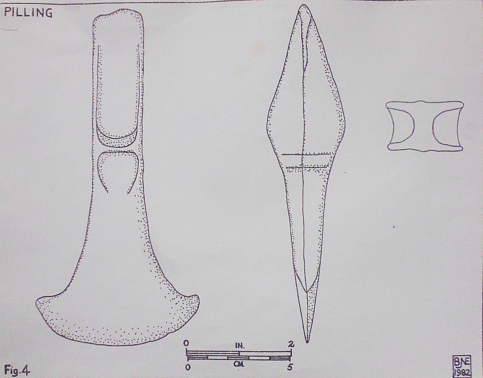
Pilling Moss Bronze Age Axe Head (Illustration).

NGR: SD 463 447. The village of Nateby, Over Wyre, is 2 miles west of the A6 road near Gar-stang, while Pilling Moss is a couple of miles further west from there. Archaeologists consider the low-lying, level area around the Moss as very interesting – after recent excavations found late Mesolithic to early Neolithic settlements and trackways in that area. In the late 1970s a prehistoric settlement was found at Bonds Farm, just east of Stackpool; also a scattering of artefacts was excavated here (animal bones etc) and, at Friars Hill, another settlement, just to the north by (LUAC) – radiocarbon dating gave a date of about 2,345 BC and for Bonds Farm a date of 1,445-1,397 BC. At Manor Farm, Nateby, a few polished axes were excavated and were of a similar date. The area around Bone Hill House near Nateby was perhaps another ancient British settlement? but this place was more recently, in the 18th century, reputedly infamous as a “baby farm”. It was here that a number of babies’ skeletons were dug up from beneath trees in what looked like suspicious circumstances.

At Friars Hill (possibly associated with Cockersand Abbey) further to the north, was another prehistoric settlement; it was discovered that this site had been connected to Pilling Moss by trackways called by Archaeologists ‘Kate’s Pad’; these timber walkways, made from oak trees, were probably built to cope with the constant flooding of the moss and thus better access. These timber structures apparently went several feet down into the moss. In the Roman period it is thought the wooden walkways were strengthened and added to – at this period they were referred to as ‘the Danes Pad’. About a 1½ miles of these ancient timbered structures have been excavated across Pilling Moss.

And at Nateby recent excavations in and around the village have shown that a trackway going through the centre of the village dates from prehistoric times, and, a hill in the village showed signs of settlement. The trackway almost certainly connected with the one mentioned above running from Pilling Moss to Nateby – and then on to the River Wyre at Hambleton.

In 1824 a human head was dug up from Pilling Moss; the skull was of a young girl from the Bronze-Age period that still retained its auburn hair as well as a necklace of jet containing a single amber bead, according to B. J. N. Edwards in (Lancashire Archaeological notes Prehistoric and Roman, Trans. Hist. Soc. Lancashire Cheshire, 121, 99-106, 1969). Archaeologists now consider the skull to have been a ritual bog burial. Also, a dug-out canoe was excavated from Pilling Moss, close to Pressall. This, though, may have dated from the so-called Dark Ages, rather than from prehistoric times.

In the vicinity of Eagland Hill, near Scronkey, on Pilling Moss, Lancashire (NGR: SD 433454), a Bronze Age palstave was discovered during drainage work being carried out there in the early 1980s. Two other Bronze axe blades were found during excavations in the same area in the late 1970s. Pilling Moss was apparently, so we learn, not drained until the 1830s.

B. J. N. Edwards writing in 1982 says: “Readers will recall that the original stimulus for the excavations at Pilling in 1978 and 1979 was the finding of a Bronze Age haft-flanged axe blade. Subsequently, another was found in the same area. These two blades took their places in a line of five similar discoveries running NW-SE through the excavation site. These were then the only Bronze Age axe blades recorded from the Moss apart from a single flat axe. It is a palstave and was found during drainage work in the winter of 1980-81 near Eagland Hill.

“With an overall length of 6.06 inches (16.6cm) and a width across the blade of 3.02 inches (8 cm) it is noticeably larger and heavier than either of the 1977 and 1978 finds referred to above. Its closest parallel in Davey & Foster (Bronze Age Metalwork from Lancashire and Cheshire), Liverpool, 1975) is No 32 from Cartmell, for which the text says “incipient stop-ridge”, though the drawing seems to show a well-developed one.

“The implement has been returned to its finders, to whom the writer is grateful for permission to draw the implement and to search the field in which it was found. The latter activity was unsuccessful as was to be expected since the field concerned still has a considerable depth of peat”, says the writer B. J. N. Edwards.

Somewhere near Pilling Moss, or more likely off the coast at Fleetwood and Knott End, lay the legendary Roman port known as Portus Sentantiorum, but its actual whereabouts remain unknown, and whether the legendary port even existed at all is something that is still open to conjecture, and will be for a long time to come. The legendary or mythical port is mentioned in antiquarian books discussing the lost lands and villages located somewhere off the Lancashire Coast. In the 2nd century AD the Roman cartographer, Ptolemy, set about charting the wild coast of Lancashire; he apparently named what was assumed to be the Ribble Estuary as Belisama, but at that time the river was further to the south, close to what is now Southport, says Kenneth Fields. It has even been thought by some historians that Portus Sentantiorum was located out in the Dee Estuary between Chester and northeastern Wales.

Clifford Oakes (1953) says: “The formation of mosslands is almost certainly due to the impermeable nature of underlying clays at Chat Moss, Pilling Moss, Cockerham Moss and the original Tarleton Moss. The latter has now been largely reclaimed, and heavy root crops, mostly potatoes, are raised where heather, bilberry and sphagnum once flourished.”

Sources & References & Associated Websites:-

Davey & Foster, Bronze Age Metalwork from Lancashire and Cheshire, Liverpool, 1975.

Edwards, B. J. N., Lancashire Archaeological Notes Prehistoric and Roman, Trans. Hist. Soc. Lancashire and Cheshire, 121, 99-106, 1969.

Edwards, B. J. N., Lancashire Archaeological Bulletin, Vol. 8 No. 2,  (Page 30), May 1982.

Fields, Kenneth, Lancashire Magic & Mystery, Sigma Press, Wilmslow, Cheshire, 1998.

Oakes, Clifford, The Birds Of Lancashire, pg 12 (Agriculture), Oliver And Boyd, London, 1953.

Copyright © Ray Spencer, The Journal of Antiquities, 2023.

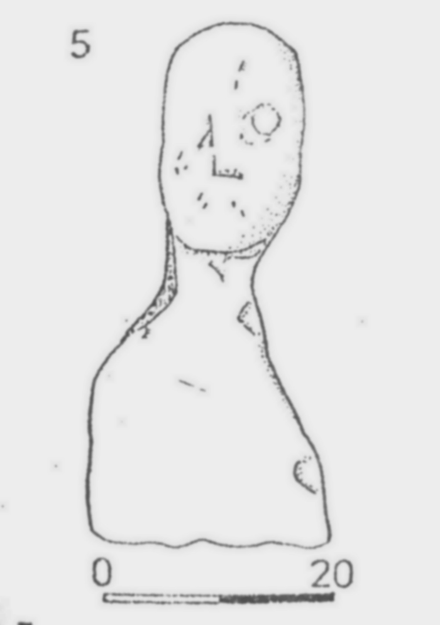
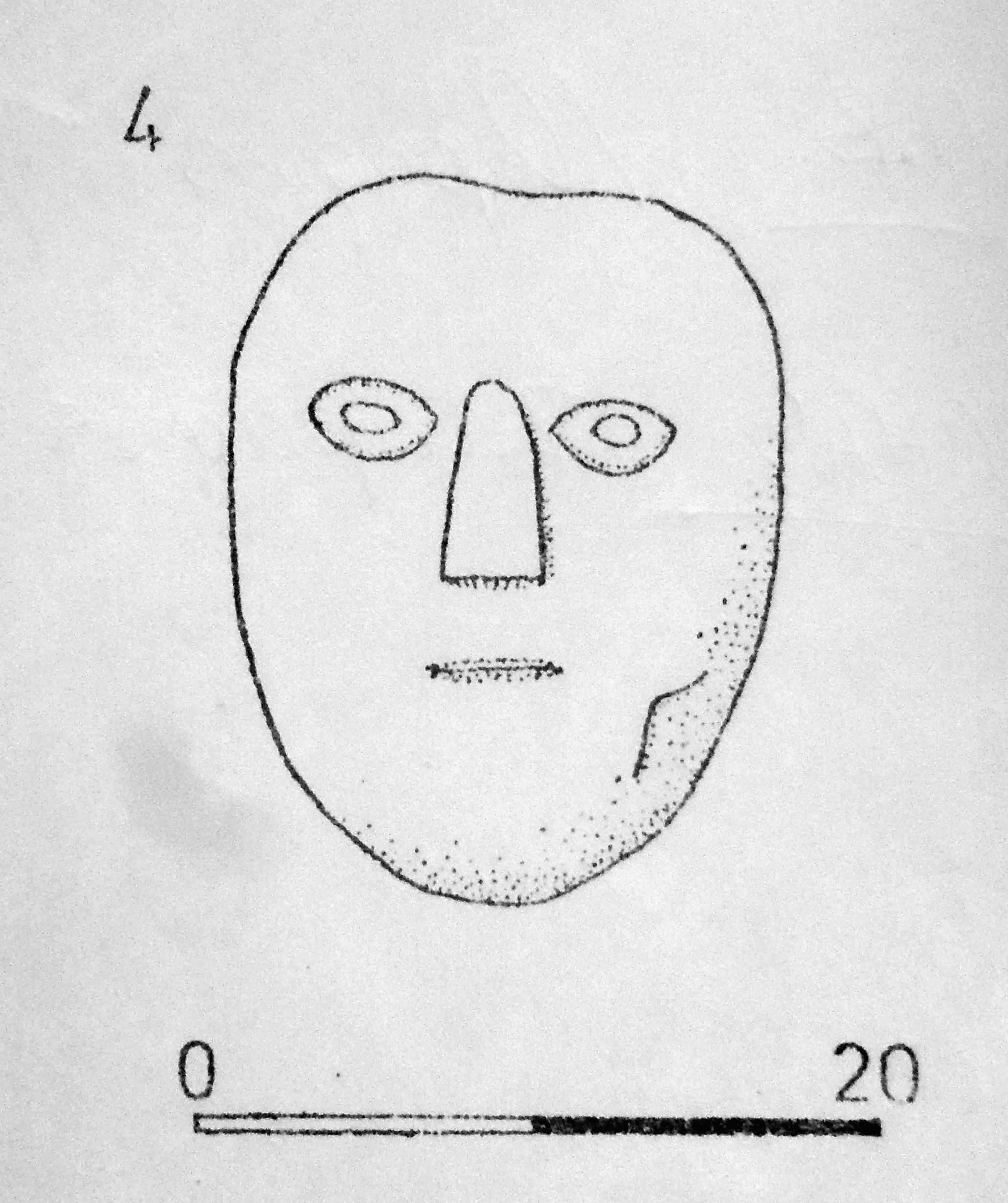
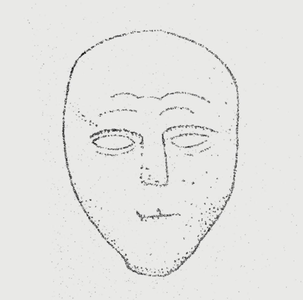
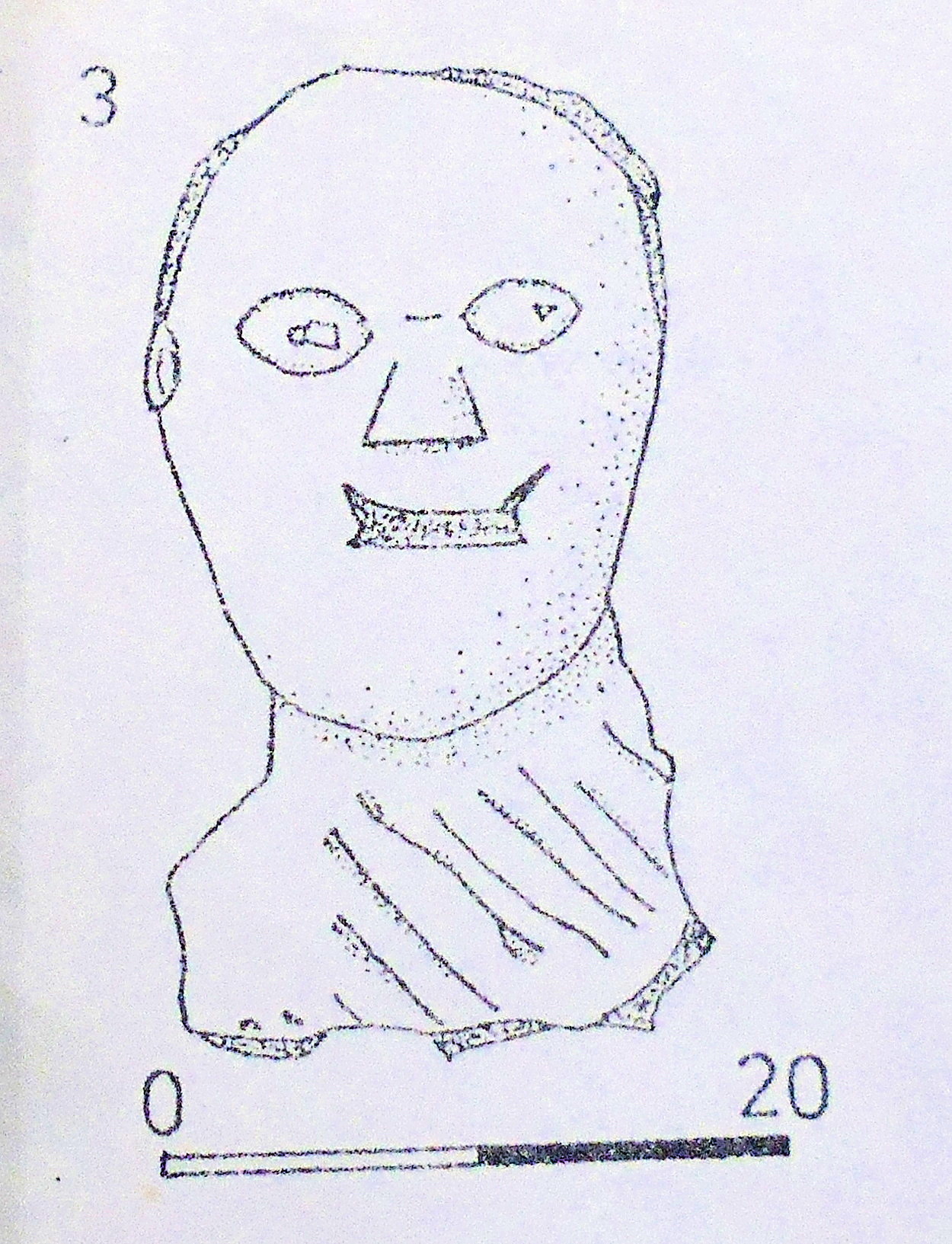
The Carved Stone Heads of Ribchester in Lancashire.

NGR: SD 64977 35007. It is of interest that there seem to be a number of carved stone heads in and around the village of Ribchester in the Ribble Valley, Lancashire. A few of these carved heads may be Medieval in date, while others are probably more recent, but, it is unlikely any of them are actually “Celtic stone heads”, which has sometimes been assumed to be the case by a few local historians. There are two stone heads in the porch of St Wilfrid’s parish church that look to have some great age to them, while the others are located at various halls and farmhouses in and around the village; and another head can be found at Longridge, a few miles away. These stone heads do not, however, date from the Roman period for as we know Ribchester is well-known for its Roman fort of Bremetennacum and also its museum of Roman and prehistoric antiquities, but, it is possible one or two could be Romano-British and, therefore, depict deities from that particular time, which can then be referred to as “Celtic” in origin.

Thornley-with-Wheatley.

Stone head from Hades Farm near Ribchester, Lancs.

Margaret Edwards writing in ‘Lancashire Archaeological Bulletin’, 1987, in the article called ‘The Stone Heads of Ribchester’ gives the following information, which I have sourced. There is a stone head at Hades Farm, Ribchester, at (NGR SD 627364) built into the Farmyard wall there. This head is made of Sandstone and is 33×17 cms. The head has similar examples in Yorkshire at Chapel Allerton (Leeds). A second Sandstone head in the farmyard wall at Hades Farm measures 21×15.5 cms. This head has similar parallels at Arma-ghbragne (Co. Antrim) and Correvilla (Co. Cavan) in Ireland. There is a stone head in a field wall at Thornley-with-Wheatley, near Ribchester. This Sand-stone head measures 38.5×18.5 cms. It is very worn and is known to have been associated with two others but, due to frequent wall demolitions, is now solitary. Two similar heads to this are at Chapel Allerton (Leeds). Photo (right) is the carved stone head from Thornley-with-Wheatley, near Ribchester, Lancashire.

The carved stone head at Longridge Library, Lancashire.

In the Gable wall of Ivy Cottage in the village of Dilworth, near Ribchester (NGR: SD 623375) is another stone head made of Sandstone, which measures 30 cms high. This head is white-washed and inscribed with the date 1856 from when it was built into an adjacent building. A good example of this head was found at Corraghy in Ireland. And another head also in the Gable wall of Ivy Cottage was previously built into the adjacent building. This head is also whitewashed, but this example looks to be Medieval, rather than Celtic. This head has a similar parallel to (Jackson’s) carved head at Bradford. One other carved stone head, with little information, was found in the Ribble Valley, but is now residing in the British Museum. There is, however, a copy in Ribchester Museum. This was a Sandstone head and measured 30×23 cms. It was found between 1870-1880 and may have been found close to the River Ribble in the vicinity of the De Tabley Arms. One interesting stone head can be seen in the early 1960s wall behind Longridge Library (NGR: SD 606373) and was previously built into an earlier 18th-century wall which was demolished to clear the area for the building of the library. It is a Sandstone head and measures 16.5×12 cms. The Longridge stone head is similar to one found at Wardle, near Rochdale, although the exception being that it has ‘hair’! The Wardle stone heads, there are two of them, are on display at the entrance to Touchstones Museum, Rochdale. A similar head to that of Longridge was (Jackson’s) stone head from Keighley, west Yorkshire.

Stone Head at Hades Farm.

John Dixon in his 1993 work ‘Journeys Through Brigantia — The Ribble Valley’ mentions two stone heads in the porch of St Wilfrid’s parish church, Ribchester, Lancashire. He also says regarding Hothersall Hall near Ribchester (NGR SD 63193475) that: “In the fork of a tree on the lane above the hall can be found an horrific and grotesque stone head. This was dug up by a farmer at Hoth-ersall and placed in its present position.” John goes on to discuss the stone heads at Hades Farm. He tells us that: “Set into the gable of the porch at Hades Farm are two fine ‘Celtic’ heads. The owners have no knowledge of their origin, other than that they were once set into a low wall opposite the house. The lower  head is more typically Celtic than the one above, having the wedge-shaped nose and oval eyes.”, says John.

Sources / References & Related Websites:-

Dixon, John & Phillip, Journeys Through Brigantia — The Ribble Valley, Volume Nine, Aussteiger Publications, Barnoldswick, 1993.

Edwards, Margaret, Lancashire Archaeological Bulletin, Vol. 10, No. 4, February 1987.

https://watts.uk.net/hothersallhall.org/history.htm

More info here:  https://brigantesnation.com/celtic-heads

https://artuk.org/discover/curations/take-five-celtic-heads

Copyright © Ray Spencer, The Journal of Antiquities, 2023.

Silbury Hill, Beckhampton, Wiltshire

Silbury Hill.

sunbright57's avatarThe Journal Of Antiquities

SU1000 6850. Silbury Hill is a man-made chalk and clay mound beside the A4 road, 1 mile southeast of Beckhampton. It dates from the Neolithic period of prehistory some 4,700 years ago. This famous conical-shaped hill is 130 feet high or 40 metres and, with its wide outer circular ditch, which is most noticeable at the eastern side and quite often filled with water in wet spells of weather, it covers a total area of about 5 acres (2 hectares). The base of the hill covers 167 metres, while the flat-topped surface is about 100 feet in diameter.

The first phase of building here began in 2,500 BC followed by, perhaps, another three phases of work; thousands of local workers were employed in the construction of the mound which was built in the form of a pyramid in steps or tiers – the steps being cut sarsen stones from nearby quarries. Then these…

View original post 347 more words


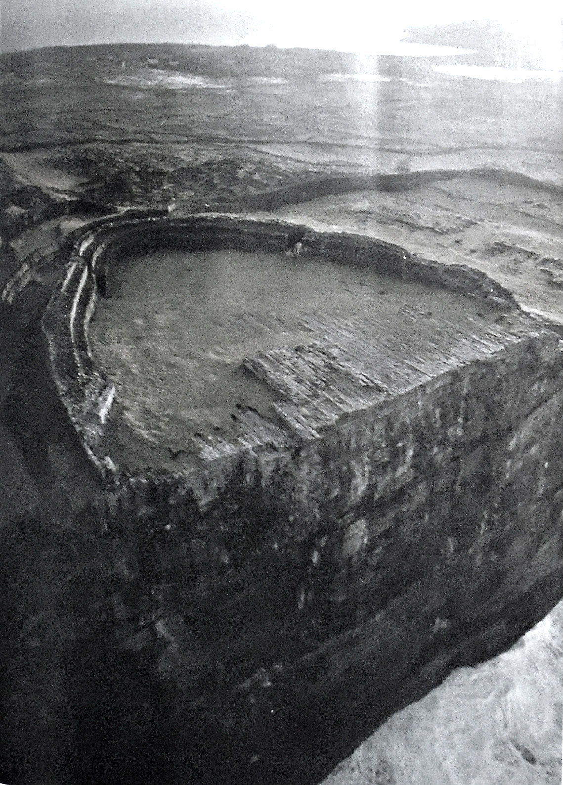
Dun Aengus Fort, Inishmore, Aran Islands, Co. Galway, Southern Ireland (The Republic of Ireland).

Dun Aengus Fort near Kilmurvey in County Galway, Southern Ireland.

Irish Grid Reference: L 8180 0976. The ancient semi-circular shaped fort of Dún Aengus (Fort of Aonghasa), near Kilmurvey, is situated at the edge of a 330-foot high cliff overlooking Galway Bay on Inishmore (Inis More), which is one of the three Aran Islands, in west County Galway, Southern Ireland (The Republic of Ireland), and, is thought to date from the late Bronze Age to the early Iron Age – around 1,000 BCE, or maybe earlier. This spectacular cliff-top hill fortification or Cashel is the best known of all the prehistoric forts on the Aran Islands and is now an archaeological site of great interest. It was an ancient stronghold with some very serious defences: stone ramparts and dry-stone walling made of jagged, tooth-like upright slabs and blocks of Limestone – with the innermost ramparts enclosing an area of around 150 feet in diameter, but the whole site is said to cover 11 acres (6 hectares). Its strategic location on the cliff edge added to the security of the fort and would have allowed its defenders to ‘keep a look out’ for any would-be invaders from all directions, especially landward, but, also seaward too – the sheer cliff face making the hill-fort above unassailable and unattackable to anyone wanting to even attempt it. Dún Aengus ancient hill-fort is located nearly ½ a mile southeast of the village of Kilmurvey (Kilmurvy). The site is in the care of Heritage Ireland.

Treasures Of Britain (1968) tells us that: “The most spectacular of the Aran Islands’ many prehistoric monuments, this dra-matically sited drystone fort encloses nearly 11 acres. It has three rings of defense, the central one reinforced with a line of jagged limestone uprights. The innermost rampart encloses an area about 150 ft in diameter. There are three principal islands: Inishmore to the north-west, Inishmaan in the middle, and Inisheer to the south-east. On all three islands there are numerous early drystone forts…… The exact date of the great forts is unknown, but they are presumed to be of the Iron Age. INISHMORE, Kilronan, the principal town, is in Killeany Bay on the north-east coast. The major monument is the world-famous Dun Aengus, a huge drystone semicircular fort standing on the edge of a 300 ft cliff dropping sheer into the sea. To the north-west is Dun Onaght, a large ring-fort, also restored…… In the centre of the island, near the highest point, is Dun Oghil, a large stone ring-fort…… A mile and a half to the west is the promontory fort of Doocaher, also with a defensive line of spikes, and also restored, with clochans.”

Historic Britain (1956) says: “Research by archaeologists is discovering more and more information about prehistoric civili-zation in Scotland and Ireland. Dun Aengus in the Aran Islands, one of the many prehistoric forts of Ireland, encloses an area of eleven acres on the edge of the cliffs. The outer defences of this vast encampment are shown below (see photo, left). They consist of well-built dry-stone walls in the same tradition as the walls, for instance, of the dwelling places…… in the Orkney Islands.

Close-up of the ramparts of Dun Aengus hill-fort.

The Rough Guide (1999) gives us some very useful information here, saying: “DÚN AENGUS AND THE FORTS: The most spectacular of Aran’s prehistoric sites is Inishmore’s fort of Dún Aengus (signposted from Kilmurvey, three-quarters of a mile), a massive semicircular ring fort of three concentric enclosures lodged on the edge of cliffs that plunge 300ft into the Atlantic. The inner citadel is a 20ft-high, 18ft-wide solid construction of precise blocks of grey stone, their symmetry echoing the almost geometric regularity of the land’s limestone pavementing and the bands of rock that form the cliffs. Standing on the ramparts you can see clearly the chevaux-de-frise outside the middle wall, a field bristling with lurching rocks like jagged teeth, designed to slow down any attack.

“The place is tremendously evocative, and it’s easy to understand how superstitions have survived on the islands long after their disappearance on the mainland. Visible west of the cliffs of Inishmore under certain meteorological conditions is the outline of what looks like a mountainous island. This is a mirage, a mythical island called Hy Brasil that features in ancient Aran stories as the island of the blessed, visited by saints and heroes. Until the sixteenth century Hy Brasil was actually marked on maps”.

Other hill-forts of interest in the area include: Dún Eoghanachta, 1 mile to the northwest, Dún Dúcathair (the Black Fort), 2 miles to the east, near Killeany, and Dún Eochla, 2 miles to the northeast, near Eochaill.

Reader’s Digest (1992) describes the site as: “Dun Aengus is a huge prehistoric cliff fort defended on the landward side by three semicircular rings of massive dry-stone battlements, and a broad band of vicious looking chevaux-de-frise, sharp, upended rocks placed in the ground to impede any enemy. The innermost enclosure is some 50 yards across.”

Sources / References & Related Websites:-

Odhams, Historic Britain – Britain’s Heritage Of Famous Places And People Through The Ages, Odhams Books (Hamlyn), Feltham, Middlesex, 1956.

Reader’s Digest, Illustrated Guide To Ireland, Reader’s Digest Association Limited, London, 1992.

The Rough Guide, Ireland, (Fifth Edition), Rough Guides Ltd., London, 1999.

The AA, Treasures Of Britain And Treasures Of Ireland, Drive Publications Limited, London, 1968.

https://en.wikipedia.org/wiki/D%C3%BAn_Aonghasa

https://www.megalithic.co.uk/article.php?sid=6333395

https://heritageireland.ie/places-to-visit/dun-aonghasa/

https://www.hillforts.co.uk/dunaengus

And more info here: https://www.doolin2aranferries.com/blog/dun-aengus-fort-icon-aran-islands/

Copyright © Ray Spencer, The Journal of Antiquities, 2022.


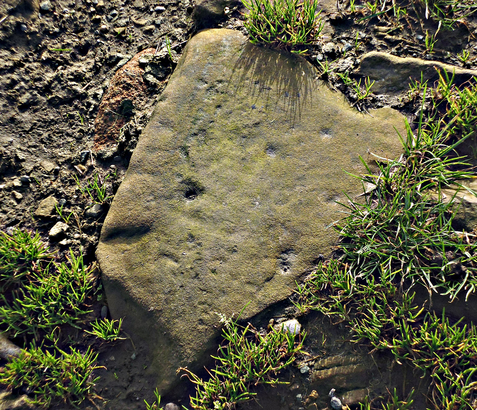
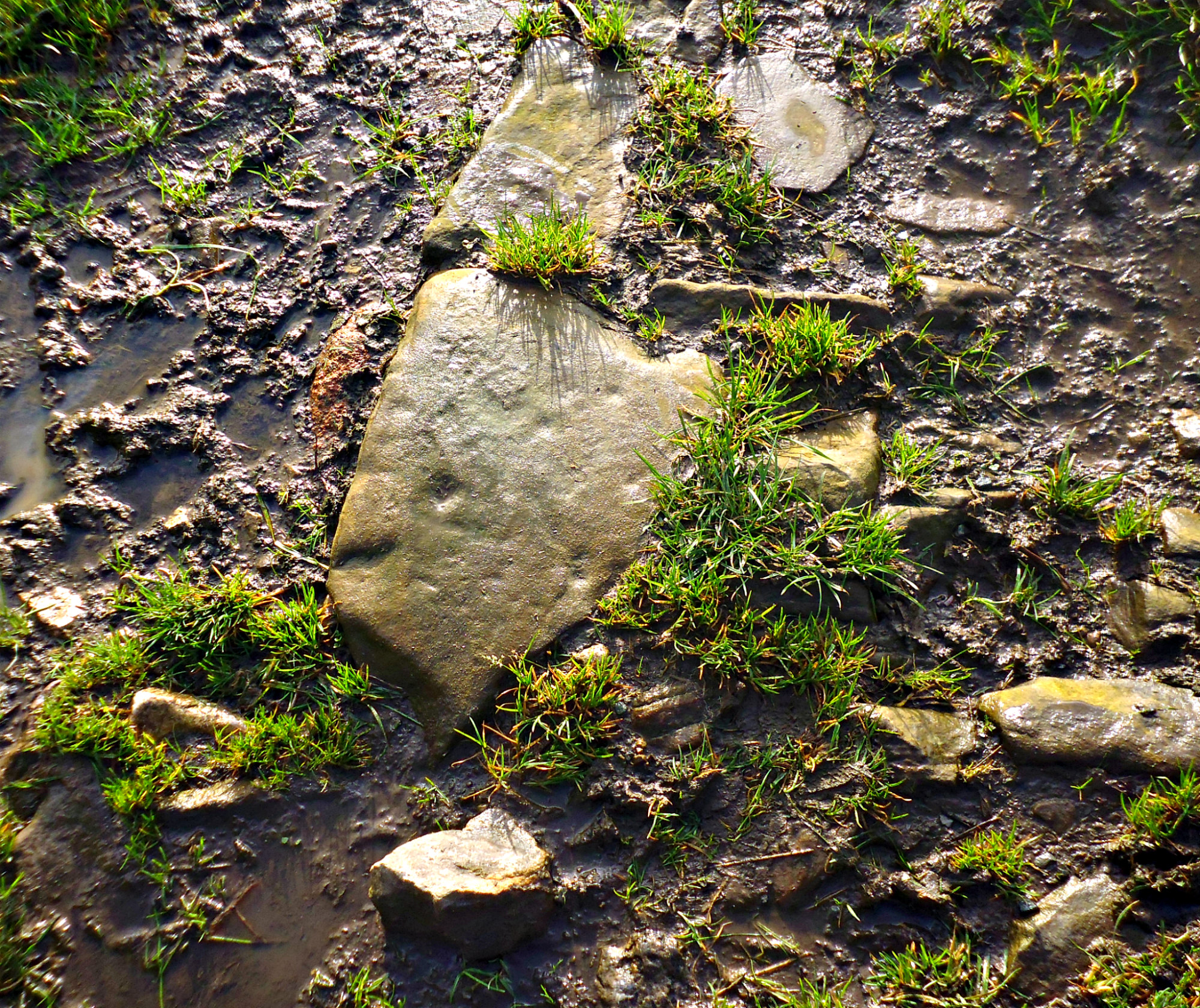
Cup-Marked Stone on Delves Lane, near Nelson, Lancashire.

Cup marked stone on Delves Lane, near Nelson, Lancashire.

Cup-marked Stone on Delves Lane, Nelson.

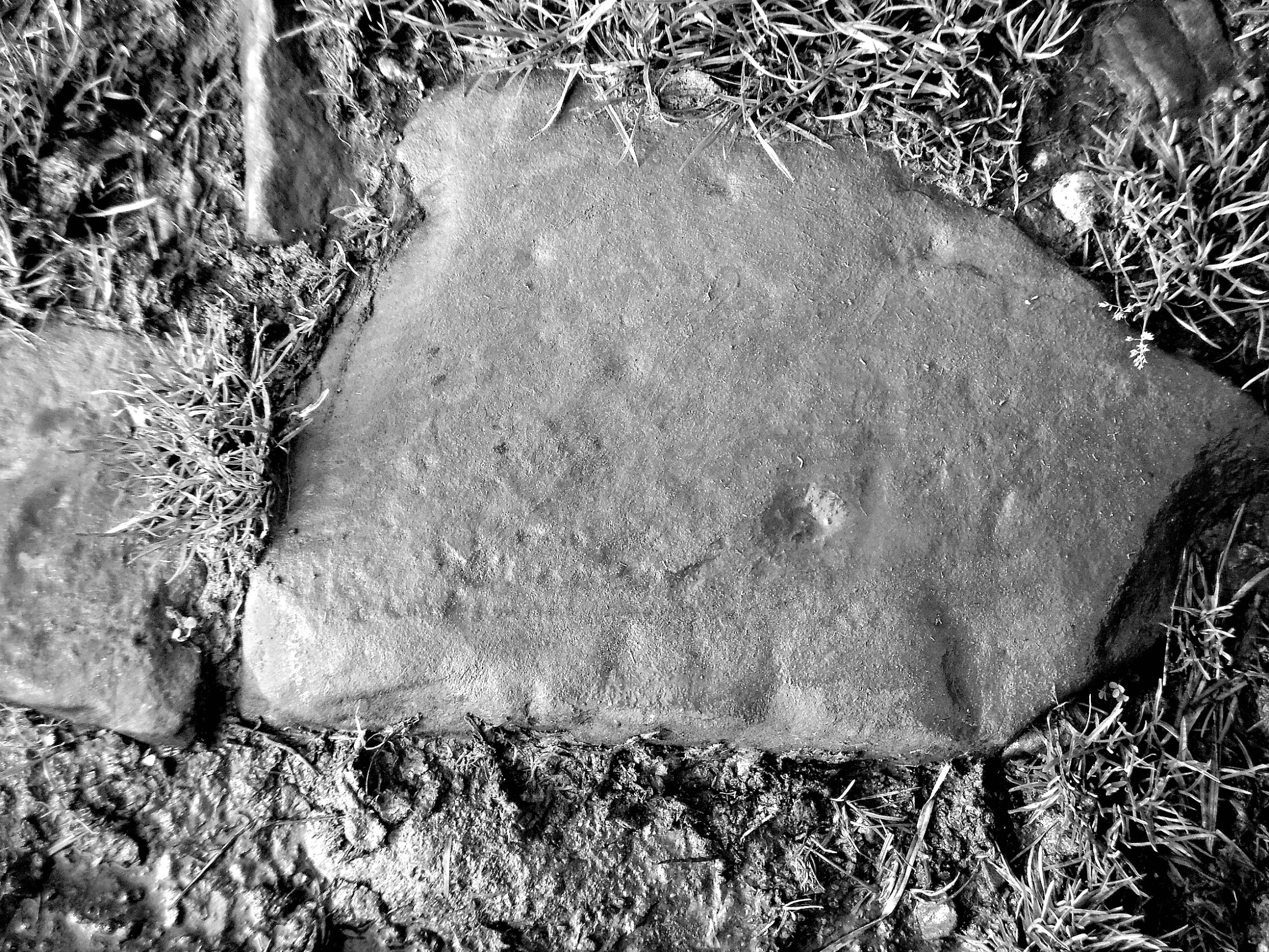
NGR: SD 8909 3701. At the edge of a field beside Delves Lane, near Nelson, in Lancashire, there is a flat, shaped stone on the ground that looks to have “possible” ancient carvings on it. This smooth, strangely-shaped, and worn, rather innocuous-looking stone, is to be found at the edge of a farmer’s field and just inside a metal-gated entrance, and not more than a metre away from the country lane that is over-shadowed by the ancient Walton Spire monolith, over to the north. The stone has one well-defined cup marking and three more tiny, weathered cup markings on it, and also fifth and sixth cup marks together at the far side of the stone. It measures 16 inches long by 12 inches at its widest. All in all though this is a very nice stone; but it is a few miles ‘as the crow flies’ from the moorland where most of these petroglyphs would usually be found.

Cup-marked stone on Delves Lane, nr Nelson, in Black & White.

Not far from here, about 230 metres to the south, is the site of a Bronze Age stone circle at ‘Ring Stones Hill’, and, a bit further along the lane and in the corner of a farmer’s field is the site of a Bronze Age burial mound which has, sadly, been ploughed out. And there are also ancient barrows on nearby Knave Hill. But where the cup-marked stone originated from is anyone’s guess; maybe it came from Boulsworth Hill a few miles away, where a few other carved stones have been found, or, did it come from Catlow, ½ a mile to the south; it was here at Catlow that a Bronze Age burial with collared urns was discovered by quarry workers in the 19th century. But whether this carved stone came from any of these sites is not known for certain. Maybe farmers from the past would know that question – if only we could ask them. There is a wall stile a bit further back along Delves Lane if the gate won’t open! Remember, though, that this is farming land.

Copyright © Ray Spencer, The Journal of Antiquities, 2022.


The Marsden Cross, Marsden Heights, Near Nelson, Lancashire.

The (possible) Marsden Cross base at Marsden Heights, near Nelson, in Lancashire.

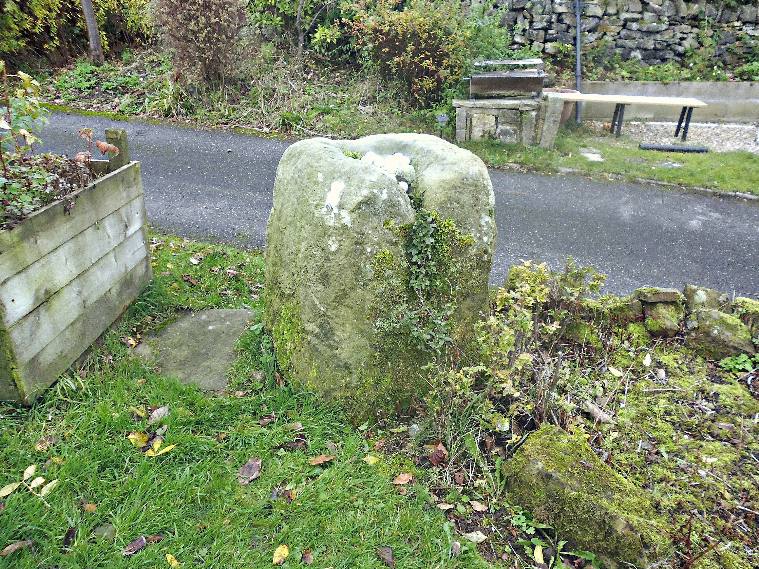
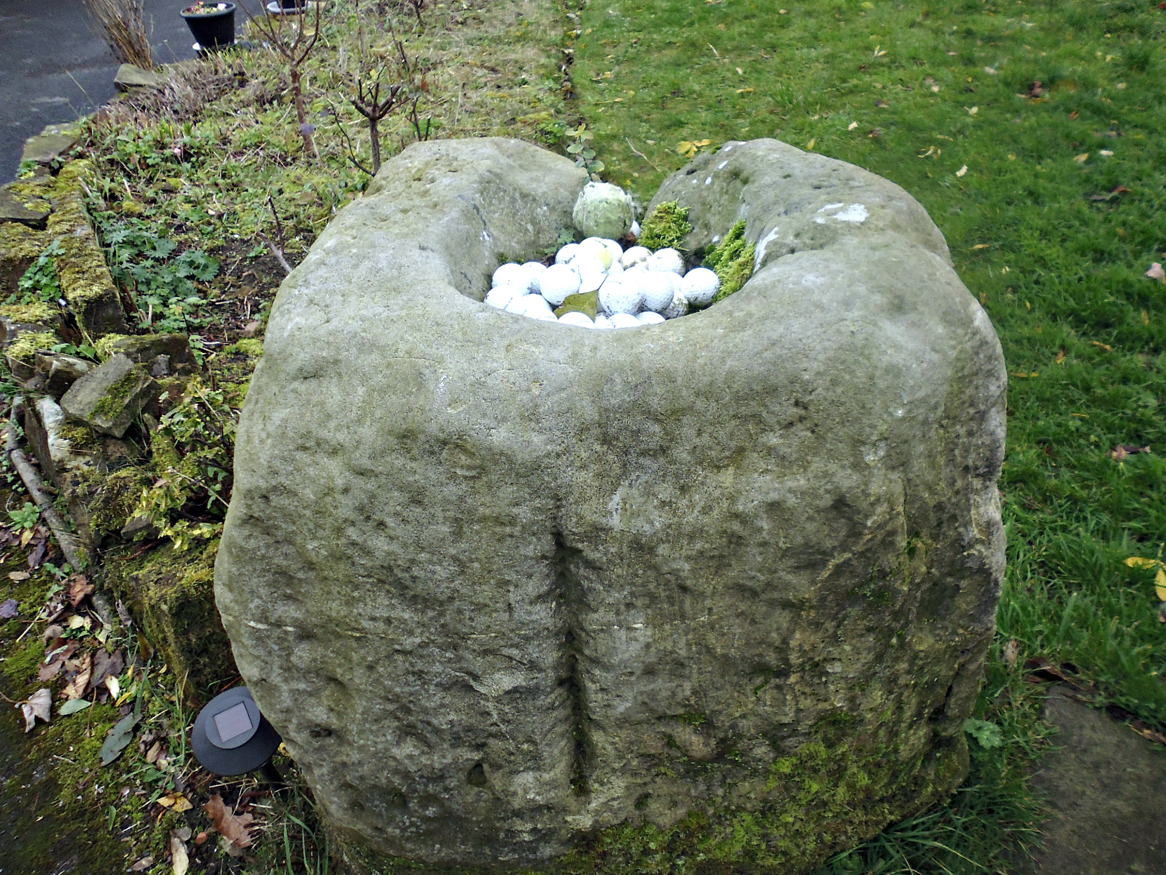
NGR: SD 8651 3612. Some time long ago a Medieval wayside cross known as ‘The Marsden Cross’ or at least the base of that former cross, used to stand at the side of Kings Causeway, Marsden Heights, near Nelson, Lancashire, roughly where the entrance to Nelson Golf Course Club House is today; the golf course was established in 1902. However, the cross base was moved or re-sited a little way along the road possibly in the 19th century? The large, hefty socket stone (cross-base) now resides in a private cottage garden – the former Scarlett Arms public house – a few hundred metres along the road, which is known as Kings Causeway or ‘The King’s Highway’. General James Yorke Scarlett (1799-1871) led the Charge of the Heavy Brigade at the Battle of Balaclava, Crimea in 1854, and is buried in St John’s churchyard, Holme-in-Cliviger. Kings Causeaway was apparently named after King George (not sure which King George) who had travelled along it, a local lady told me. The stone base that supported the cross shaft was placed in the garden of The Scarlett Arms back in the 19th century – having been moved here from its original position further back along the road. It is marked on an old map of 1893 simply as “stone”. But, what actually became of the cross-shaft and its cross-head, if those ever existed, is not known, though it was probably destroyed, broken up, and then Lost-to-Time. Maybe the remains of the cross and shaft are built into a wall or a building somewhere in the vicinity.

Top of the (possible) Marsden Cross base at Marsden Heights.

The large, hefty lump of stone in the garden of Scarlett Cottage – the former Scarlett Arms public house – on Kings Causeway stands between two and three feet tall, and at the top of the stone a basin-shaped socket hole has been carved with a groove (water channel) to allow water to run out of the basin at one side; however, the basin (the possible socket hole) is not particularly deep. The lady who lives at the cottage uses the top of the stone as a receptacle for lost golf balls that come over from the golf course, or, she has collected some of them from the vicinity. So, was a cross shaft ever fixed into the top of this lump of stone? At the other side of the stone a groove runs part way up; the lady at the cottage thought this had been caused when the stone was moved a few metres from its original position at the lower end of her garden, some years back. Another theory is that the basin in the top of the stone was used as a receptacle for vinegar hundreds of years ago during times of plague; coins would be placed in the vinegar so as to sterilise them before they were handed out to those infected by the dreadful disease and, also maybe the poor of the parish: Haggate and Harle Syke. There are two more wayside cross bases, similar to this one, called The Nogworth and Beth Crosses, near Briercliffe, which date from the 13th century, and were set up by the monks of Whalley Abbey (marking the extent of their lands); this may also be the case with the Marsden Cross.

Sources / References & Related Websites:-

Many thanks to the lady at Scarlett Cottage for allowing me to photograph the cross base, and to the lady who informed me with regard to the history of Kings Causeway.

https://en.wikipedia.org/wiki/Haggate

https://www.british-history.ac.uk/vch/lancs/vol6/pp468-473

More Info here:  https://thejournalofantiquities.com/2013/02/21/the-nogworth-and-beth-crosses-briercliffe-lancashire/

Copyright © Ray Spencer, The Journal of Antiquities, 2022.


1 Comment

Maiden Castle Hill-Fort, Near Dorchester, Dorset.

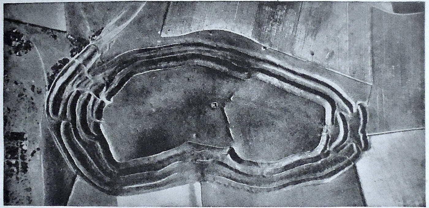
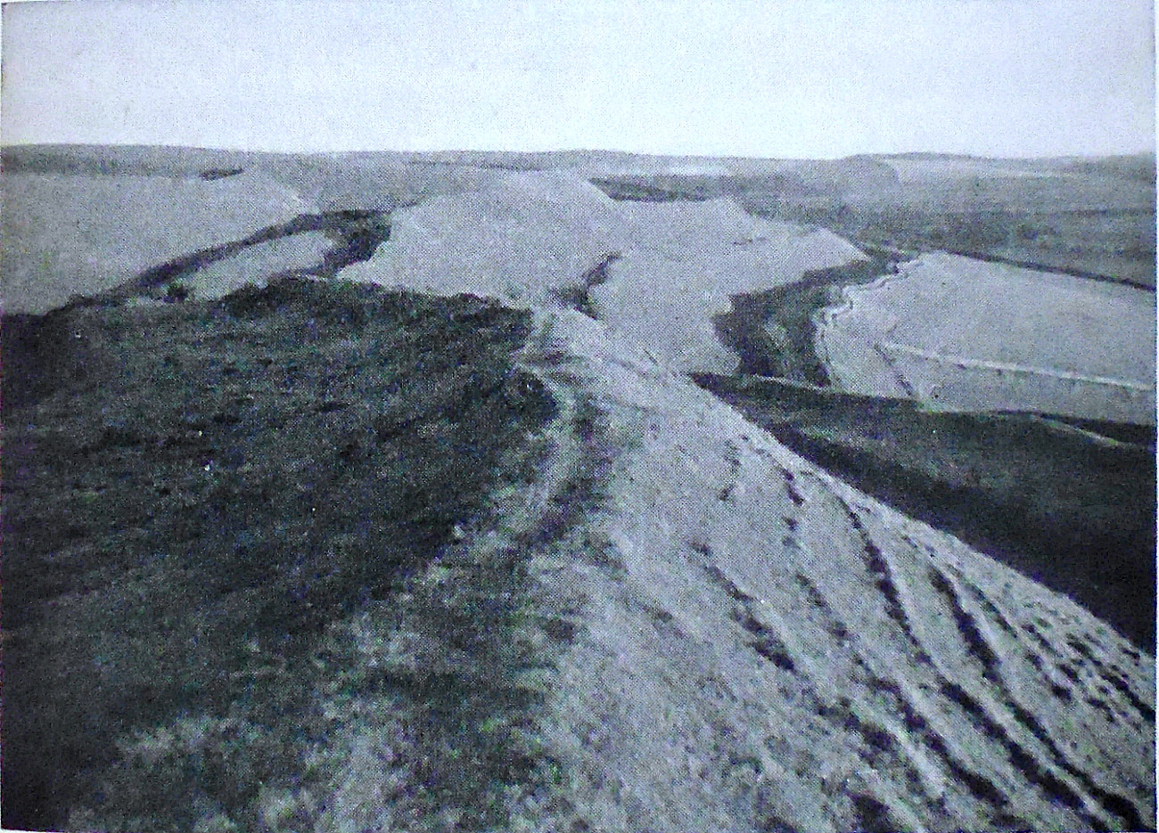
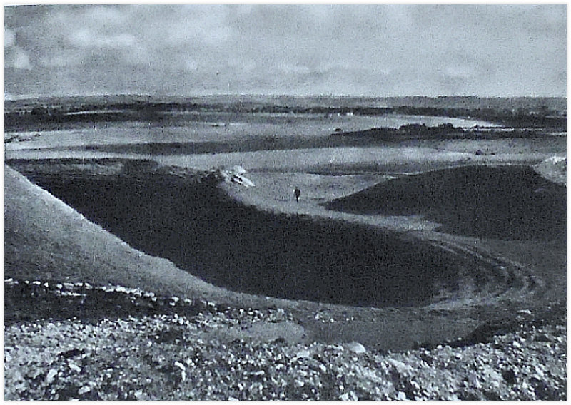
Aerial view of Maiden Castle Hill-Fort, Near Dorchester, in Dorset.

NGR: SY 6688 8845. The spectacular and impressive Iron Age hill-fort of Maiden Castle, with its deep defensive banks, ditches and ramparts, is to be found one and a half miles to the southwest of Dorchester, in Dorset, on Maiden Castle Road. Said to be the largest hill-fort complex in Europe, and, the largest of its kind in Britain. It covers an area of around 47 acres or 190202,252 metres, roughly halfway between the town of Dorchester and the village of Winterbourne Monkton. The hill-fort was most probably built in the middle of the 1st century B.C. and was still being settled well into the Roman period. In the 4th century A.D. a Celtic temple was apparently built at the eastern side of the fort, and inside the hill-fort there is a late Neolithic long barrow, and a Neolithic causewayed enclosure, which dates back to around 3,500 B.C. It would seem that there were other forts here built in stages at different periods back in prehistory, but, the main fort (which we see here today) was built over them and very little can now be seen of those earlier hill-forts and associated settlements. In 1865 the Wiltshire-born Antiquarian Edward Cunnington (1825-1916) carried out the first Archaeological excavations at Maiden Castle and, in more recent times, archaeologist Sir Mortimer Wheeler (1890-1976) excavated at the site in 1936. The hill-fort is in the care of English Heritage.

Maiden Castle Hill-Fort, Dorchester in Dorset.

AA Treasures of Britain (1968) tells us that: “This is perhaps the best-known hill-fort in England. Extensively excavated by Sir Mortimer Wheeler, the long and varied history of the site is well established. Concealed below the rampart of the first Iron Age defences were those of a Neolithic causewayed camp of about 10 acres. Towards the end of the Neolithic period, an enormous long barrow with quarry ditches was built on the hill-top and its line kinks where it crosses the defences of the earlier camp. The first Iron Age hill-fort, of 15 acres, occupied the eastern part of the hill. This comparatively insignificant fort was enlarged and remodelled again and again until, in the days of the last generation before the Roman conquest, the defences received their final refurbishing. The fort was one of the settlements reduced by Vespasian’s 2nd Legion and, outside the east gate, the hastily buried skeletons of the inhabitants killed in the fight were found. Doubtless the chief oppidum (settlement) of the local tribe, the Durotriges, it was then superseded by Dorchester (Durnovaria), the Roman cantonal town, in the valley below. In the second half of the 4th century, a Romano-Celtic temple and priest’s house, the foundations of which can still be seen, were built in the eastern part of the fort. It was near the gates of this hill-fort that great reserves of slingstones were found, proving that, in later Iron Age times, the sling was an important weapon.”

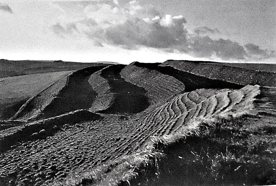
On the earthworks of Maiden Castle Hill-Fort.

Odhams — Romantic Britain (1945) says of Iron-Age hill-forts: “By far the greatest and most imposing of all these earthworks are those of Maiden Castle, near Dorchester. Recent excavations have established that here, 4,000 years ago, was a town covering about fifteen acres and enclosed within triple entrenchments. This Neolithic settlement was apparently raided about 1,900 B.C. Then for fifteen centuries the site was abandoned. Towards the end of the fifth century B.C. it was again occupied and developed into a town with upwards of 4,000 inhabitants. The innermost rampart was given a stone parapet and entrance was gained through a passage between massive stone walls. Inside the great gateway there was a sentry-box on each side. Nearby was a pit containing thousands of sling stones stored ready for defence. Only in Roman times was the place finally abandoned for a site now occupied by modern Dorchester.  Here, perhaps more than anywhere else in Britain, is evidence of the long drawn out centuries and of the labour and life of our prehistoric forefathers.”

Harold Priestley writing in 1976 has the following to say about this hill-fort: “One of the best-known and most remarkable sites in the whole of the British Isles, the eastern part of the hill on which Maiden Castle stands was first enclosed by neolithic peoples as a causewayed camp. Overlying this were found the remains of a very long barrow, 1800 ft (548 m), at the eastern end of which were discovered the remains of a man whose body had been hacked in pieces after death.

“After about 1800 BC the site became uninhabited. The first Iron Age ramparts were erected round about 300 BC and enclosed 13 acres (6 ha) on the E side of the hill. More than a century later the ramparts were extended to cover the whole 45 acres (18.2 ha), and within the fort a large population had its permanent home.

“Early in the 1st century BC new immigrants rebuilt the ramparts, adding an outer bank and ditch, remodelling the entrances and creating the complicated ways between the strong points round the gates. Between 43 and 47 AD during the Roman advance to the W, the fort was stormed by the Romans, the E gate destroyed and later the population was re-housed in the Roman town of Durnovaria (Dorchester). In the 4th century, at the E end, a Celtic-type temple was erected and a small house adjoined it. From the air the fortifications may be seen in all their complexity.”

Bill Anderton (1991) says of Maiden Castle: “This is a huge prehistoric earthwork near Dorchester covering an area of 120 acres, with an average width of 460 metres and length of 900 metres. It is impractical to think that this ‘hillfort’ was originally conceived as a defensive position – it has been estimated that 250,000 men would have been required to defend it. Many of these hillforts have two entrances, one north of east and the other south of west, suggesting some form of ceremonial related to the sun. The labyrinthine east and west entrances may have been built as a way for processional entry by people of the Neolithic era. After AD 367, the Romans built a temple within the enclosure, whose remains are still clearly visible.”

Maiden Castle Hill-Fort.

Odhams — Historic Britain (1956) adds that: “Maiden Castle in Dorset is the largest and the most elaborate of prehistoric earthworks in Britain. It is defended by triple earthen ramparts and ditches, still much in evidence. The fortified east entrance is shown in this picture (left), which also gives an idea of the nature of the defences. These originally had vertical sides, each bank and ditch forming a real obstacle to an attacking enemy. Maiden Castle was a tribal centre and was at the height of its power in the centuries immediately preceding the Christian era. It continued to be occupied during part at least of the Roman domination of Britain.”  

Sources / References & Related Websites:-

AA Treasures of Britain, And Treasures Of Ireland, Drive Publications Limited, London,

Anderton, Bill, Guide To Ancient Britain, W. Foulsham & Co.Ltd., Slough, Berkshire, 1991.

Odhams — Historic Britain, Odhams Books, Feltham, Middlesex, 1956.

Odhams — Romantic Britain, The National Heritage Of Beauty History And Legend, Odhams Press Limited, London, 1945.

Priestley, Harold, The Observer’s Book of Ancient & Roman Britain, Frederick Warne & Co Ltd., London, 1976.

https://en.wikipedia.org/wiki/Maiden_Castle,_Dorset

https://www.english-heritage.org.uk/visit/places/maiden-castle/

https://historicengland.org.uk/services-skills/education/educational-images/maiden-castle-iron-age-hillfort-near-dorchester-11782

https://www.historic-uk.com/HistoryMagazine/DestinationsUK/Maiden-Castle/

More here:  https://temporarytemples.co.uk/project/maiden-castle-dorset-26th-july-2015

Copyright © Ray Spencer, The Journal of Antiquities, 2022.


Roman Altar at St John’s Church, Lund, Salwick, Near Kirkham, Lancashire

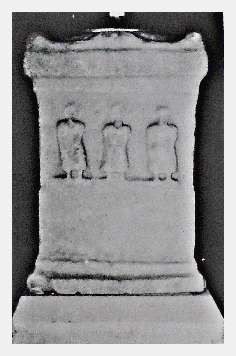
Roman Altar-Stone at Lund Church, Salwick, West Lancs.

NGR:- SD 4632 3138. In the parish church of St. John the Evangelist (Lund) in Salwick, which is located roughly between Preston and Kirkham, in West Lancashire, there is a Roman altar stone that is in use as the font! This altar stone has carvings on three sides: three Roman deities on the front, and, possibly ladies (Vestal virgins?) dancing on its two sides; the three deities may be one and the same mother goddess. The church here was ‘more often’ referred to as the Lund Chapel. It can be found on Church Lane – just off the A583 (Blackpool to Preston road) – north of Clifton village. Salwick, Clifton and Kirkham are Fylde villages. The course of the Roman road from the Wyre Estuary at Poulton to Ribchester runs through Lund (Salwick) and, because of that, there have been a few interesting Roman artefacts found in the area around Lund church. However, nothing much can be seen of the Roman road today. There was a Roman fort at Carr Hill on the north bank of the River Ribble at Kirkham, which is a few miles to the west of Lund, but, again there is nothing much to see there today. Back in the mid-14th century an oratory was in existence at Lund, and in the early 1500s this became a chapel, but, by the early 1800s it was in an abandoned state and had to be demolished. A new church was built soon after and later added to: the nave in 1824 and the tower in 1873.

In an article for ‘Lancashire Magazine’ in July/August 1993, Alan Warwick tells us about the ‘Pagan Past Of A Fylde Church’. He says: “The tranquil, rural setting of Lund Parish Church belies its diverse multi-cultural history, and its links with a pagan past. The area of Lund, hidden off the main Blackpool-Preston road at Salwick, has witnessed Druids, Danes, and Romans come and go, and Christians finally establishing the Parish Church of St. John. Many areas of the Fylde Coast of pre-Roman times were widespread with wooded marshland, whose inhabitants were of Celtic origin. They were the tribespeople of the Setantii, who allegedly dyed their bodies with woad and practised a Druid-type religion.

“Although Christianity was introduced into Britain in Roman times, the earliest records portraying Lund as a place of Christian worship date from the 14th century when, in 1349, an oratory was recorded as having occupied a site near to the present day church. The original chapel was mentioned in documents associated with the partition of the estates of the locally famous Clifton family back in 1516. By this time the chapel had been developed further with the addition of a chantry. By the 1820s, whilst Lund was still encompassed in the parish of nearby Kirkham, the original chapel had fallen into a state of disrepair. Proposals for a new stone-built church were supported by the financial backing of the Birley family of Clifton Hall, who had made their fortune as flax and cotton manufacturers. The old chapel was subsequently demolished in 1824 and the new church built. The church was further developed with the addition of a chancel in 1852, followed in 1873 by a tower.

Warwick goes on to say that: “During the demolition of the old chapel and construction of the new church an old Roman tombstone is alleged to have been discovered. This is hardly surprising considering that a Roman road passed through Lund on its way from the River Wyre to Ribchester. In the Domesday Survey the road was actually referred to as ‘Dane’s Pad’ — well the Danes did use the road to plunder the towns and villages of the Fylde! Many Roman relics, including military items and coins in particular, have been found buried along the route of the road. Perhaps the most significant Roman relic discovered was that of an altar stone near to the church in the 17th century. Mysterious markings — believed to be effigies of Roman pagan gods — decorate the side of the stone. The three-feet high, pale-coloured stone has been used as a font since its discovery and is still in use to this day at the rear of the church.

Shotter writing in 1973 does not tell us much more, he says: “A Roman altar, probably from Kirkham, now does duty as the font of Lund Church. An altar believed to have been found near the line of the Ribchester to Kirkham road at Lund. It is now used as the Font of St. John’s Church, Lund.”

Sources / References & Related Websites:-

Shotter, D. C. A., Romans in Lancashire, The Dalesman Publishing Company Ltd., Clapham, Yorkshire, 1973.

Warwick, Alan, ‘Pagan Past Of A Fylde Church’ in Lancashire Magazine, Volume 16, Number 4, The Ridings Publishing Company, Driffield, Yorkshire, July/August 1993.

Lund Roman Altar, St John’s Church, Clifton, near Preston

https://www.lundparish.org.uk/history

https://lundparish.org.uk/

https://www.genuki.org.uk/big/eng/LAN/CliftonwithSalwick

Copyright © Ray Spencer, The Journal of Antiquities, 2022.


28 Comments

Fingal’s Cave, Staffa, Inner Hebrides, Scotland

Fingal’s Cave on Isle of Staffa, Inner Hebrides.

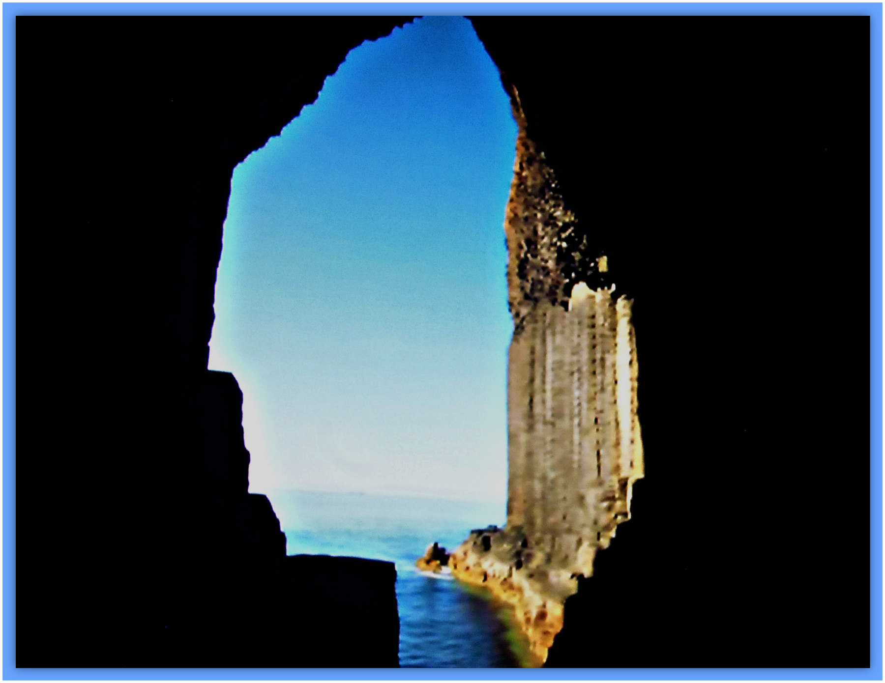
NGR: NM 3245 3503. In the cliffs at the south side of Staffa, Inner Hebrides, Scotland, is the huge sea cave known as ‘Fingal’s Cave’, taking its name from the mythical giant, Fionn mac Cumhail or Finn McCool, but its original name was An Uamh Bhinn – the musical cave. The cave is formed from hexagonal volcanic basalt columns or pillars that are the same as those at the ‘Giant’s Causeway’ in Northern Ireland. In Irish mythology Finn McCool, who was often portrayed as a hunter-warrior, was able to walk or take long strides across his bridge or causeway (he had built it apparently) on the Antrim Coast, to his cave on the Island of Staffa in the Hebrides; it was here that Finn McCool fought a Scottish giant! Staffa, off the Argyll coast, is an uninhabited Hebridean island. The sea cave looks out across the often wild Atlantic Ocean, which is very often rough and stormy, and so it’s not easy to get close up to the cave unless the sea is calm – at which time motorboats from Oban carrying sightseers can get closer to it, and, even allow a few hardy souls to disembark and walk into the cave mouth. The entrance to the cave is 66 feet high, while inside it is said to be around 227 feet long. Fingal’s Cave is in the guardianship of The National Trust for Scotland. There are three other sea caves on the Island of Staffa.

It was the Scottish explorer Sir Joseph Banks (1743-1820) who discovered the cave and named it after the mythical Irish hero, Finn McCool, and not James Macpherson, while Pennant’s tour of 1774 provided the earliest description. In 1830 German composer Felix Mendelssohn (1809-47) composed his famous piece of music: Fingal’s Cave (The Hebrides Overture).

Wonders of the World (1930) tells us that: “The Island of Staffa, lying off the coast of Argyll, is famous for Fingal’s Cave, a marvellous geological formation akin and certainly connected with the Giant’s Causeway of Ireland. Each side of the entrance is flanked by columns or pillars supporting an arch. It is these pillars, reminding us of the basaltic rock formations of the Giant’s Causeway, that have given the island its name, for Staffa is the Scandinavian equivalent for “pillar.” They are sixty-six feet high and forty-two feet apart, and are as perfectly shaped as though the hand of man and not the action of the water had chiselled them. 

“The length of the cave proper is two hundred and twenty-seven feet, and its floor is formed by the water which enters from the sea and throws up “flashing and many-coloured lights against pendent columns,” against the white calcareous stalagmites which form the roof, and against the pillared walls of this weird cave. The lapping of the sea against the base of the cliffs reverberates and re-echoes with a musical intonation, on days of calm, and it swells to a thunderous roar during a storm or tempest which is the more usual condition on this rocky island set in the turbulent waters that wash the rugged west coast of Scotland.” 

Romantic Britain (1939) says, regarding some of the ancient cromlechs in Ireland: “In Romantic tradition they are known as “Giant’s Graves,” and sometimes “Beds of  Diarmuid and Gráinne,” those legendary lovers who fled from Gráinne’s betrothed husband, Fionn MacCool, and were pursued all over Ireland by a revengeful Fionn and his army of Fenians.

Fingal’s Cave and Stormy Seas as seen from above.

Fingal’s Cave, Isle of Staffa (the inside, looking out to the sea).

“The Fianna or Irish Militia headed by Fionn reached the peak point of its glory in the third century A.D. during the reign of Cormac MacArt. Many and marvellous are the stories associated with its fame. The Giant’s Causeway at Antrim is said to have been flung across the sea to Scotland by Fionn, to hasten his hostile encounter with a fearsome Scottish rival. Cloughmore (Big Stone) at Rostrevor, was hurled, it is said, by the Scottish giant at Fionn’s head and just missed it! Fionn retaliated with the Isle of Man which he pulled out of the space now occupied by Lough Neagh. The dolman at Howth, near Dublin, is pointed out as the burial place of Aideen, wife of Fionn’s son Oisin, while Fionn’s two moated palaces were situated at the vantage points of Moyvalley, in Offaly, and the Hill of Allen, in Kildare. Scarce a spot in Ireland does not treasure some legend of the renowned Irish Giant.”

John & Caitlin Matthews, writing in 1988, tell us more about Fingal. They say that: “Fingal Fionn mac Cumhal is sometimes called this in Gaelic Scotland. The name also derived some popularity from the bogus, ‘Ossian’, written by MacPherson in the late eighteenth century; drawing on oral stories about Fianna. James MacPherson fabricated a set of romantic Celtic poems which impressed and fired Europe to a reconsideration of Celtic culture, though his work was soon discovered to be a fake.”

Joyce Miller writing in 2000 tells us more about Staffa, saying: “The romantic, uninhabited island is well known for the extraordinary basaltic column formations. The best known of these is Fingal’s Cave, named after the old hero Fin MacCool. The cave can be viewed from a boat, or from the island if weather conditions permit. Boats leave from Fionnphort on Mull or Iona.”

Sources / References & Related Websites:-

Matthews, John & Caitlin, The Aquarians Guide To British And Irish Mythology, The Aquarian Press (Thorsons), Wellingborough, Northamptonshire, 1988.

Miller, Joyce, Myth and Magic — Scotland’s Ancient Beliefs & Sacred Places, Goblinshead, Musselburgh, Scotland, 2000.

Romantic Britain — The National Heritage of Beauty History And Legend, (Ed: Tom Stephenson), Odhams Press Limited, London, 1939.

The AA, Illustrated Road Book Of Scotland, The Automobile Association, London, 1963.

Wonders Of The World, (Forward by Sir Philip Gibbs, K.B.E.), Hutchinson & Co. (Publishers) For Odhams Press Ltd., 1930.

https://en.wikipedia.org/wiki/Fingal%27s_Cave

https://en.wikipedia.org/wiki/Staffa

More Info here:  https://visitmullandiona.co.uk/listings/fingals-cave/

https://ctdots.eu/places/scotland/fingals-cave-staffa-island-oban/

https://www.atlasobscura.com/places/fingal-s-cave

Copyright © Ray Spencer, The Journal of Antiquities, 2022.


3 Comments

Carn Euny Entrance Grave at Brane in Cornwall.

The Carn Euny Entrance Grave (Chambered Tomb) at Brane in Cornwall.

NGR: SW 40128  28185. In a field to the southwest of Brane in Cornwall is what one might call a rather crudely-built burial mound, but, it is, in fact, a prehistoric chambered tomb dating from the Bronze Age; the small, round-shaped grassy mound with large stones forming the entrance and kerb stones, is locally called the ‘Carn Euny Entrance Grave’ or ‘Brane Entrance Grave’. It is sometimes called ‘Chapel Euny Barrow’. This rather odd little monument is to be found in the West Penwith Peninsula area of Cornwall, 1¾ miles southwest of Sancreed. But despite all that, it is a fascinating megalithic monument, if a bit eroded away around the front entrance leaving the stonework more exposed than it probably should be. However, it is a reasonably well-preserved monument of its type – there are others in west Cornwall and on the Isles of Scilly. Nearby, about ½ a mile NNW of Brane, is the Carn Euny Iron Age village, and, an ancient underground stone-built structure known as a fogou or souterrain, which could be older than the ancient village.

However, in recent times the entrance grave at Brane has been used by farm animals as a shelter, and, in the late 20th century some restoration was needed due to that. There is now a tree growing out of the top of the mound! It would seem likely that an important person from the late Neolithic or early Bronze Age was buried in the chamber, possibly a local chieftain, or the head of a local tribe along with members of his family. The monument stands on ‘Private Land’ some 300m to the southwest of Brane Farm.

James Dyer writing in 1973 & 1977 says: “The finest Cornish example of the small group of entrance graves confined to the Isles of Scilly and west Penwith, consisting of short stone-walled burial passages open at one end and covered by mounds of earth and stones. These are almost certainly the last vestiges of the great passage grave burial chambers found in western and northern Britain. At Brane the passage is 2·3 m long and 1·2 m wide, and is roofed with two large capstones. A kerb of large stone surrounds the barrow which is 2·1 m high and 6·1 m in diameter.”

Harold Priestley writing in 1976 says of Chapel Euny neolithic long barrow: “The barrow, about 20 ft (6.1 m) in diameter and edged with upright stones, has an inner chamber entered at the SE and roof of two capstones”. Just to mention here that it is ‘not’ a long barrow.

Sadly, the burial mound at Brane has largely been overlooked by many archaeologists in favour, perhaps, of the more interesting nearby late Iron Age village of Carn Euny (NGR: SW 4023 2885), with its well-preserved souterrain, the granite stone-walled underground passageway being 66 feet long and leading to an inner chamber. The ancient village or set-tlement here was occupied from around 400 BC to the late Roman period and is very similar to the ancient settlement of Chysauster. It is in the care of English Heritage.

John Michell writing in 2003 tells us that: “The Iron-age village, Carn Euny, west of Penzance, contains a ‘fogou’……..This mysterious class of monument, unique to West Cornwall, consists of an underground chamber, approached by passages. Many old villages and farmsteads had one of these. They may have been storehouses or places of refuge, but more likely they were shrines to the spirits of the underworld, invoked by the Cornish miners.”

Sources / References & Related Websites:-

Dyer, James, Southern England: An Archaeological Guide, Faber and Faber Limited, London, 1973 & 1977.

Michell, John, Prehistoric Sites in Cornwall, Wessex Books, Newton Toney, Salisbury, Wiltshire, 2003.

Priestley, Harold, The Observer’s Book of Ancient & Roman Britain, Frederick Warne & Co Ltd., London, 1976.

https://www.cornwalls.co.uk/history/sites/brane.htm

http://www.megalithics.com/england/brane/brnemain.htm

https://www.megalithic.co.uk/article.php?sid=2263

https://www.english-heritage.org.uk/visit/places/carn-euny-ancient-village/

https://en.wikipedia.org/wiki/Carn_Euny

More info here:  https://www.cornwallheritagetrust.org/our_sites/carn-euny/

Copyright © Ray Spencer, The Journal of Antiquities, 2022.