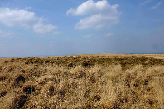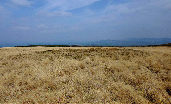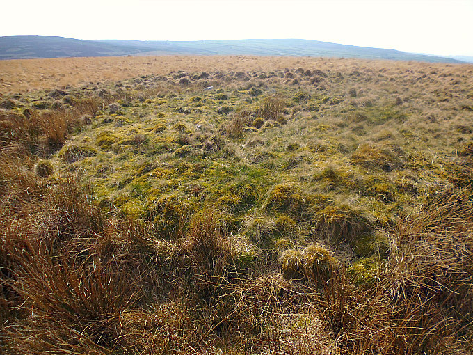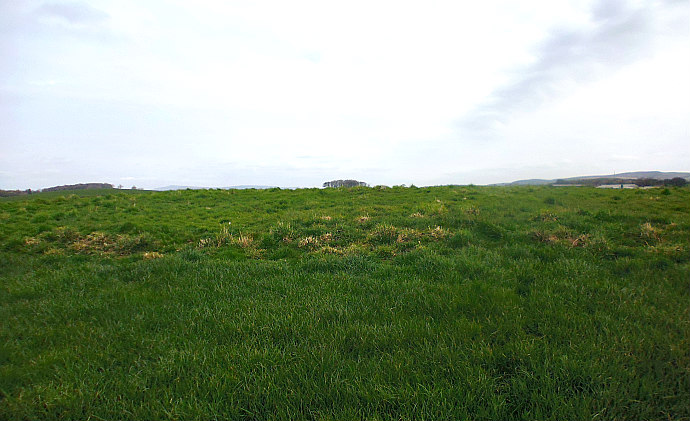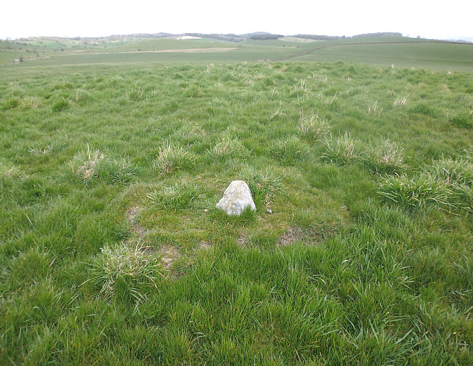
NGR: TA 02821 81006. Early Mesolithic settlement, village, or campsite to the southeast of Seamer and to the east of A64 Stax-ton to Seamer road, in north Yorkshire. This archaeologically important site is close to the south bank of the river Hertford and just west of Star Carr bridge. However, nothing can be seen today in ‘this flat landscape’ but from an aerial perspective there are visible signs of ancient occupation with many crop marks – these archaeological features dating back to around 8,000 BC. Major Archaeological excavations took place at the site in the mid 20th century and, again in more recent years, and many interesting artefacts from the Mesolithic period have been found during those excavations, including antler implements and deer frontlets, which were probably used as ceremonial masks. A long trackway and footpath heads south and then southeast from Chew Lane at Seamer, going under the A64 and crossing over a few watercourses, to reach the site of Star Carr ancient settlement.
Ian Longworth (1969) tells us that: ‘It was the quick and experienced eye of a local man, Mr John Moore, which first spotted the decayed remains of bone and antler exposed in a field ditch at Star Carr—a vital clue to what lay beneath the peaty soil. The excavations, carried out by Professor Clark of Cambridge University, revealed a vivid picture of what a temporary camp of a group of mesolithic hunters was really like. When the ice-sheets covering northern Yorkshire began to melt a vast lake had formed in what is now the Vale of Pickering. This lake had gradually drained away, leaving behind a series of shallow meres and patches of marshland in its place. It was on the northern shore of one of these meres that the hunters made their camp.
“A rough platform of birch brushwood had been laid down and at one point two trees had been placed at right-angles to the platform out into the water to provide a rough landing-stage. Though it is likely that some sort of hut or shelter would have been erected on the platform, no trace remained. The camp covered an area of about 240 square yards and was probably occupied by a group of three or four families during the winter months and early spring for several years.
“Fortunately for the archaeologist, prehistoric man was not a very tidy soul. Things which were broken or dropped usually remained where they had fallen, so that on a camping site like Star Carr, where the bone and organic material is well pre-served, a remarkably full picture of the life of the community could be obtained. The finds show quite clearly how much of mesolithic man’s existence must have been taken up in the quest for food. Meat was still the main source of nourishment, and from the bones of the animals which the hunters had killed and brought back to their camp we know that red deer was the main object of their hunting expeditions. Bones of this animal were one and a half times as numerous as all the other animals put together. Then in order of importance came the wild ox (or Bos primigenius to give it its full Latin name), followed by elk, roe deer, and wild pig.
“Despite the fact that the hunters were living beside a lake, bones of water-fowl and other birds are very few in number and there is no direct evidence of fishing. No fish bones were found but these are too small and soft to survive well under any conditions and there is plenty of evidence amongst the weapons found on the site that fishing must have played an import-ant part in their life.
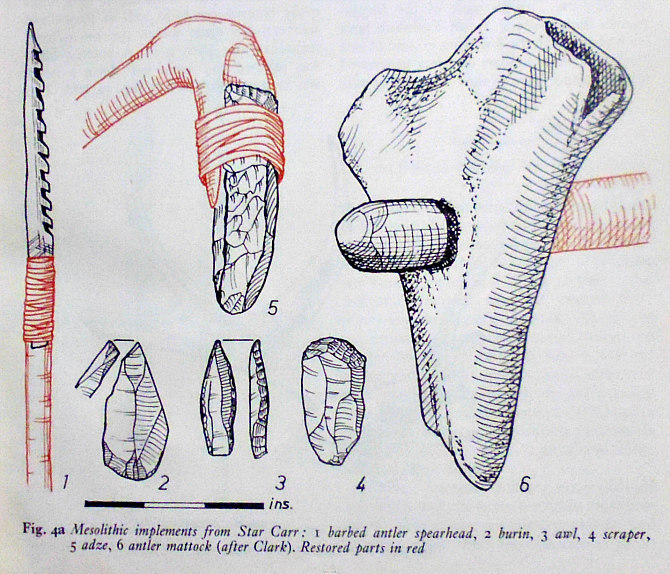
Mesolithic implements (after Clark).
“The people of Star Carr did not just eat the meat and throw away the bones and skins of the animals they had caught. These were far too valuable a source of raw materials for making other things. The antlers of red deer, and to some extent elk, were especially useful. Using a flint burin….to cut deep parallel grooves, long splinters were detached from the red-deer antler and made into barbed spearheads. A simple form of hoe or mattock…..was made from elk antler and was used no doubt for grubbing up edible roots. Leg bones were also made into hollow tools which could be used along with the flint scrapers……for dressing skins. These tools and the flint awls…..are clear evidence that the hunters and their wives wore skin clothing, though none of this survives.
Longworth goes on to say that: “Besides scrapers, burins and awls, flint was also used to make axes and adzes. The two trees which formed the primitive landing-stage showed clear signs that axes had been used to fell them. No boat was found, but a wooden paddle was discovered and no doubt the hunters had a canoe, made from a split tree trunk and hollowed out by means of fire and the flint adzes. Flake knives were also made and small flint points and blades known as microliths.
“‘Microlith’ means literally a ‘small stone’ and is a name given to the small pieces of flaked and trimmed flint used in the composite weapons and tools of the period. Many of the flints must have been used as barbs and tips for arrows. Again, these small flints tell us that the hunters possessed the bow, though no example was found on the site.
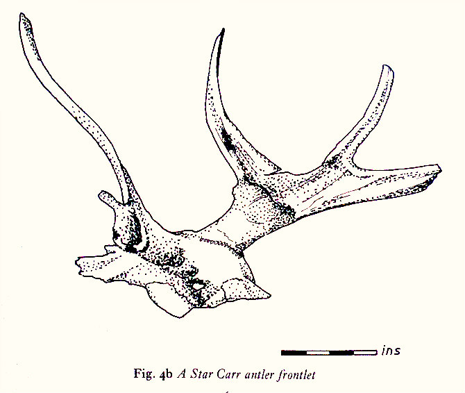
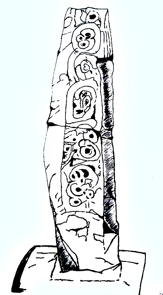
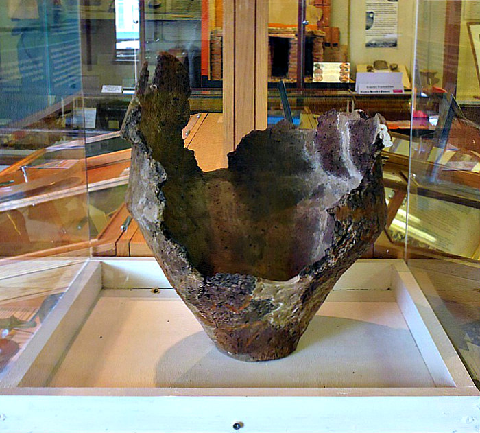
Star Carr Antler Frontlet by Mrs Eva Wilson.
“Particularly interesting were the rolls of birch bark found on the site. Birch bark produces a sticky pitch-like substance and the birch-bark rolls represent the raw material from which this pitch was made. This primitive glue was used, among other things, for attaching the small flints to their wooden arrow-shafts. Indeed, a fragment of flint was found with some birch pitch still attached to it. “Intriguing, too, are twenty stag frontlets……, preserving the stag’s antlers still attached to part of the skull, but deliberately lightened and perforated so that the frontlet could be worn as a mask on the head. They were probably worn by the hunters as they stalked their quarry, and perhaps also in ritual dances before the hunters set off on their expeditions. Amongst modern primitive tribes belief in magic plays an important part in the hunter’s life and controls many of his actions.
“The evidence tells us very little of what Star Carr campers looked like. Besides the skin clothing which would have been essential in the cold winters of this early post-glacial period, beads made of stone, perforated deer teeth and amber were worn. Their life, at least in winter, seems to have left little leisure time for devising other forms of decoration. While man remained dependent upon the whims of nature for his food, leisure must have been hard to win.
“The hunters of Star Carr were proto-Maglemosians; that is to say they belong to a phase earlier than the Maglemosian hunters named after a site found in the Magle Mose (‘Great Bog’) near Mullerup in Zealand, Denmark. There are no settlements dating to this later phase in Yorkshire, although several typical spearheads have been found in the east of the county. Whereas the proto-Maglemosians of Star Carr used antler for their spearheads the Maglemosian harpoons are usually made of bone. They have been found at three sites all in the low-lying plain of Holderness, at Brandesburton, Hornsea, and Skipsea. Though most of the Maglemosian finds made so far in Yorkshire have been confined to the low-lying ground of east Yorkshire, these hunters certainly penetrated further inland. Two of their typical flint axes have been found in the West Riding: one at Rishworth in Calderdale and another on Blubberhouses Moor in mid-Wharfedale. Axes have also been found in the North Riding at Nova, near Pickering, and Cockheads in Glaisdale, as well as Skipsea in the south-east of the county.”
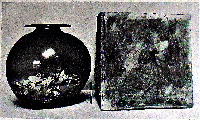
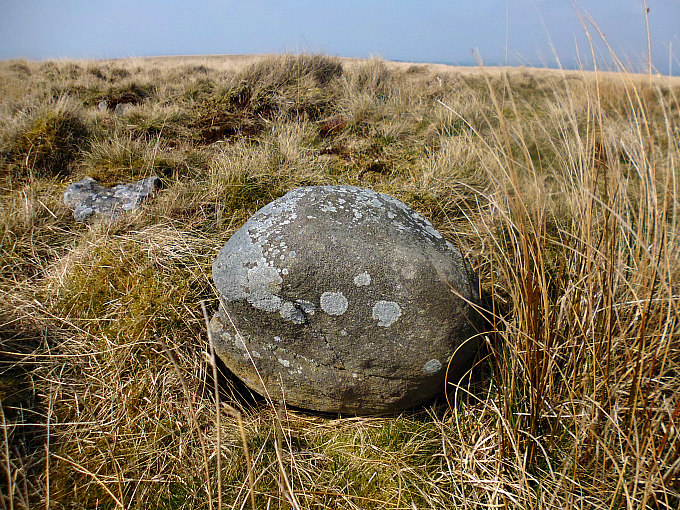
Some 3 miles to the southeast of Star Carr is the site of a Bronze Age round barrow at Folkton Wold (NGR: TA 0591 7775), which has become famous for the so-called Follkton Drums find. When the barrow was excavated: “There were found three chalk-cut idols of the Early Bronze Age. These squat, cylindrical objects had been laid in the grave of a five-year-old child, the smallest touching its head, the two larger at the hips. There is nothing else in the world like them, although we can find parallels for some of their individual designs. In very shallow relief they show a curiously composed arrangement of zigzags, lozenges and other geometric designs, all unquestionably with magical significance; on the raised disk at the top of each idol are circular patterns which can be recognized as eye symbols, while each bears on its side a pair of eyes below heavy arched eyebrows. These unique idols are now in the British Museum…..” says Jacquetta Hawkes (1973).
Sources & Related websites:-
Hawkes, Jacquetta, A Guide To The Prehistoric And Roman Monuments In England And Wales, Cardinal (Sphere Books Ltd), London, 1973.
Longworth, Ian, Regional Archaeologies—Yorkshire, Heinemann Educational Books Ltd., London, 1969. (Line illustrations by Mrs Eva Wilson).
https://en.wikipedia.org/wiki/Star_Carr
https://en.wikipedia.org/wiki/Star_Carr#/media/File:View_of_Star_Carr_site_looking_NWW.
http://www.starcarr.com/history.html
https://historicengland.org.uk/listing/the-list/list-entry/1401425
https://www.megalithic.co.uk/article.php?sid=8353
https://www.megalithic.co.uk/article.php?sid=5139
© Ray Spencer, The Journal of Antiquities, 2019.