The Journal Of Antiquities

Ancient Sites In Great Britain & Southern Ireland


St Boniface, Papa Westray, Orkney Isles

English: St Boniface Kirk, looking towards Westray

St Boniface Kirk, Papa Westray (Photo credit: Wikipedia)
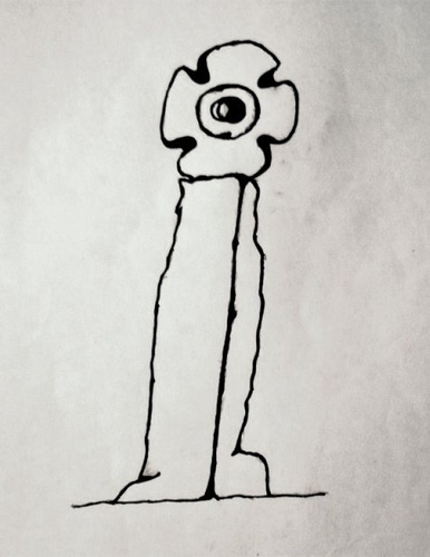
OS grid ref: HY 4882 5270. At the far north-west corner of Papa Westray overlooking the cliffs of Runnapitten, about half a mile north of the hamlet of Holland and a little to the west of Kirk house, stands the tiny medieval church of St Boniface. This was the site of a 7th or 8th century monastery and the probable site of a Pictish settlement. But the area around the church also has some Bronze-Age and Iron-Age antiquities – there was a 10 foot high prehistoric roundhouse, or broch? just east of the church where an Iron-Age settlement existed, though nothing much remains of that now apart from the earthworks. In the churchyard of St Boniface’s there is a Viking hog-back gravestone which would, also, mean there was a Viking settlement here, and part of an early Pictish cross-slab – originally there were two stones with crosses carved onto them excavated in the church-yard. These were removed for safety to nearby museums.

The little church (kirk) dates from the 12th century but there was probably a monastery on the site back in the 7th or 8th century AD, founded by St Boniface, bishop of Ross in Scotland; indeed the place is sometimes called Munkerhouse (monks house). St Boniface and his Celtic monks would have served the Pictish community here and converted this dark age tribe to christianity at the beginning of the 7th century. Historians place the death of St Boniface at c630 AD, though some have placed his death in the early 8th century. He founded over one hundred churches in the north of Scotland, including the one on Papa Westray, Orkney. His feast-day is given as 14th March. In 1700 the little church was enlarged, but by 1930 it had been abandoned and left to become ruinous. However, in 1993 it was fully restored both inside and out, and is now in use once again for services.

Close to the churchyard wall, amongst more modern gravestones, there is a Viking hog-back tomb stone from the 11th or 12th century? although this is now very worn and it is difficult to see any of the carving. According to legend, this marked the grave of Earl Rognavald Brusison who was the nephew of St Magnus the martyr of Kirkwall. Close by, part of a Pictish cross-slab; the main part of the stone being removed for safety to the National Museum of Scotland at Edinburgh. This slab was carved with a circular cross and also an incised cross. In 1966 a second Pictish cross-slab was excavated from the north-east corner of the churchyard. This had a Pictish-style cross and a circle with a small decorative cross inside, but for safety reasons is now housed in the Tankerness House Museum in Kirkwall.

Sources:-

Tait, Charles., The Orkney Guide Book (Edition 2.1), Charles Tait Photographic, Kelton, St.Ola, Orkney, 1999.

Armit, Ian., Celtic Scotland, B T Batsford, London, 2005.

Click on the link for a photo of the hog-back tombstone at St Boniface. http://www.google.com/imgres?num=10&hl=en&biw=1093&bih=503&tbm=isch&tbnid=hdKQOtI930kZnM:&imgrefurl=http://globetrotter-games.com/travel/Photo2002Orkney/OrkneyIndex.htm&docid=c-A3Oe3fBHqsfM&imgurl=http://globetrotter-games.com/travel/Photo2002Orkney/020912_051_Papa_Westray_-_Hogback_at_St_Boniface.jpg&w=400&h=267&ei=k6tgUOzmHuK-0QWvmYCICQ&zoom=1&iact=hc&vpx=637&vpy=166&dur=6330&hovh=183&hovw=275&tx=169&ty=129&sig=116874016552324944431&page=4&tbnh=138&tbnw=173&start=40&ndsp=15&ved=1t:429,r:8,s:40,i:236


St Edward’s Church Crosses, Leek, Staffordshire

OS grid reference: SJ 9835 5662. St Edward’s parish church is located on Church Street the A523 road just to the north-west of the market-place in Leek town centre. In the churchyard stand two ancient preaching crosses from the 7th-11th centuries, one of which is called a Mercian cross, the other is of Anglo-Norse origins, while inside the church there are a number of fragmentary pieces of Anglo-Saxon stone carvings and, also the famous ‘Calvary Stone’ also known as the ‘Tree of Life Stone’, which dates from about the same period – the 10th century.

The tallest of the two churchyard crosses stands at the side of the church near the chancel door. It is 10-11 feet high and stands on a more recent stepped base, the original base being a large unhewn lump of stone with a Latin inscription. This cross has a round-shaped shaft that gradually tapers away, above a prominent collar, towards the top where the wheel-head is broken and missing. Sadly, the cross is now quite worn although some carvings can still be made out near the top of the shaft, especially on the collar, which is an interweaving pattern fashioned in the form of a flowing serpentine with it’s designwork from the Scandinavian school of carving and, above that a single long loop of thick ropework with interlacing inside that on all four faces. Below the decorated collar are three rather crude heads that are different on the north, south and east faces, but each one generally having long, flowing and curling hairstyles. There is an old saying that: “When the churchyard cross shall disappear Leek town will not last another year”. This may happen sooner rather than later as [this cross] is said to be sinking further into the ground every year.

Anglo-Norse Cross at St Edward’s Church, Leek, Staffordshire

The second churchyard cross standing close to the main entrance is 8 foot high on its modern square-shaped base. It is a restored rectangular cross-shaft of what is referred to as “the Mercian type”. The carvings on the front face are a panel of interlacing and interlocking strands. However, on the other faces what is left of any decoration is badly worn away. This cross was found broken in three sections and has had to be restored to as good as can possibly be.

Inside the 13th century church at the north-west corner of the nave is a collection of Anglo-Saxon stones, the best of which is the so-called ‘Calvary Stone’ or ‘The Staff of Life Stone’. This 10th century lump of stone shows Christ carrying his cross, or perhaps it is a figure carrying a long sword or spear with which to kill the mythical serpent, this one looking like a long worm! The head of another serpent can be seen at the bottom of the stone. The carving could, in fact, be a depiction of ‘The Tree of Life’. On the edges of this stone there is some typical Saxon knotwork. There is also a large lump of nicely decorated cross-shaft, and also two other fragments that may have come from Saxon wheel-head crosses.

Sources:-

Pickford, Doug., Staffordshire Its Magic & Mystery, Sigma Press, Wilmslow, Cheshire, 1994.

Biddulph, Elizabeth Ann., Leek’s Forgotten Centuries – It’s Ancient History Unearthed, Spellcraft Books, Leek, Staffs, 1999.


Fat Betty Cross, Danby High Moor, North Yorkshire

NZ6822 0199. The medieval cross known as Fat Betty or White Cross stands beside a trackway on Danby High Moor at the head of the Rosedale Valley to the east of Rosedale Head. It has acted as a wayside cross/marker stone for hundreds of years for travellers going between Rosedale and Westerdale; the nearest village being Botton, a few miles to the north. But it is easy to become lost on these windswept moors and so these crosses and waymarkers would have been a great help to pilgrims and others traversing the North York Moors from medieval times and, indeed, until more recent times, no doubt.

English: White Cross, Rosedale. White Cross is...

Fat Betty or White Cross (Photo credit: Wikipedia)

Fat Betty Cross is about 4 foot high, square and squat in shape, with a funny little round-shaped head or wheel-head on top that has four small indentations that almost look like a human face. The whole thing is really a solid block of stone that is painted white from about halfway up, hence the name “White Cross”. It may have originally had a cross-shaft attached. There are some tiny thin carved crosses on either side, and also some more recent Victorian lettering or graffiti within a carved square panel on the main face. The cross is thought to date from the 12th century and, may well have been placed here as a wayside cross for the nuns at nearby Rosedale Abbey; the religious ladies themselves apparently wore a white habit, so could that be where the name is derived from?

But myths and legends seem to be numerous with regard to the history of the old cross. One legend tells us that two nuns and their attendant from Rosedale abbey found themselves lost in thick fog on the moor; they were eventually found dead and the cross was set up to commemorate them. Another legend says it was named after a nun called Margery or Margaret and originally it was called “Margery Cross”. And yet a third says that a local farmer’s wife died here. Her husband found her dead here and set up the cross in her memory – the farmer’s wife was apparently called Margaret or Betty. There could be some truth in these stories and old legends or maybe not; the real truth is now lost in the mists of time. Two more wayside crosses, Ralph Cross and Old Ralph Cross, stand just a short distance to the west.


The Burnley Cross, Burnley, Lancashire

OS grid reference: SD 8424 3307. Just along from St Peter’s parish church at the north-side of the old Burnley grammar school at the junction of two roads, Bank Parade and Church Street, there is a small secluded, hidden garden surrounded by a wall and railings. Here stands the so-called Burnley Cross or Paulinus Cross and, also there is a 19th century cross-base and the old stone well-head of ‘The Shorey Well’, which used to stand beside the River Brun opposite.

The Burnley Cross, Lancashire

The blackened gritstone cross is about 3 metres in height, it’s thin shaft tapering away towards the top where there is a very mutilated wheel-head. In the centre a small round boss can be seen, but sadly the arms of the cross-head are almost gone. There are some faint traces of carving on the head and also on the shaft, but these are very faint now. The base of the cross is a rectangular, chamfered stone into which the monument is well-socketed. It is thought the cross was originally erected in 1295 for the price of “9 shillings and one penny” opposite St Peter’s parish church, in the area known as ‘top o’th’ town, but in 1617 a new market cross was set-up in Godley Lane, close by Ormerod Road, while the old one was placed in it’s present position in 1880. It’s appearance is said to be similar in design to the Anglian crosses in Whalley churchyard, so this could be why it has been referred to as one of the Paulinus crosses, which would date it, perhaps, to the 11th century. And this, then, is where the confusion arises between that and the old market cross. The octagonal base of the old market cross stands in the grammar school garden. This has one step and a three-course plinth along with a large round, moulded pedestal, rather like a very, very large flower pot! But, clearly the original cross shaft would not have been the right shape for this. So, is this what was referred to as the Paulinus Cross or the Market Cross?

The old stone well-head is all that remains of ‘The Shorey Well’. This was originally located on the bank of the River Brun opposite the old grammar school, and was the main source of clean drinking water for the northern side of Burnley. It could be reached along Shorey Bank, or by crossing over some stepping stones placed in the bed of the river by way of Dawson Square. But, when water pipes were brought in to use in the late 19th century there was no need for the old well; it’s stone surround was taken away and placed here in the little garden beside the grammar school.

The Shorey Well (remains of), Burnley.


Tocca’s Stone, Tockholes, Lancashire

OS grid reference: SD 6584 2302. A couple of miles north-west of Darwen is the village of Tockholes. Winter Hill and it’s famous transmitter is a few more miles east of here. Down Chapels Lane is the church of St Stephen, and in the churchyard can be found a curious-shaped stone on a large base. This is Tocca’s Stone or ‘The Toches Stone’. The monument is not more than 4 foot high now because the top section, which could have been a cross-head, was lost to the local area. It is said to have been erected in the late 7th century AD as a preaching cross by Tocca, a Saxon chieftain – Tockholes ‘Tocca’s hollow’ takes it’s name from him. Most probably the area was ruled by some post-Roman, pagan tribe who were Christianized by wandering missionaries like St Paulinus and St Wilfred. The church of St Stephen is a modern building that replaced an earlier Victorian church. Almost certainly there was a medieval church on this site, perhaps even a much earlier Saxon building. The churchyard has a rare outdoor pulpit, dating from the early 1900s, and some old stone arches from an earlier church.

The Toches Stone, Lancashire

The stone, now alas minus its cross-head stands forgotten in many senses, but long ago it was used by local people because of it’s magical healing powers. People came here to touch the round-shaped stone at the side of the old cross shaft. They believed that if they did this some sort of cure, be it magical or divine, would be bestowed upon them. This is probably why the rounded stone is now so smooth. On the large square stone below the cross stump there is a Victorian inscription that states that the cross was set-up on the parish boundary in AD 684 along with some other details of the history. Two local gentleman apparently donated the oblong shaped-stone and re-erected the cross, but they were said to have quarrelled about the cost of the stone and where it should stand, etc.

About 3 miles south of Tockholes is a 17th century wellhouse in the grounds of Hollinshead Hall. The well, however, is much older in date. On the carved arch inside the building there is an old inscription and a carved lion’s heads over a large basin. The water that once issued from the lion’s mouth was said to have had healing properties. However, today the wellhouse is abandoned and rather forgotten. It is a long time since Catholic pilgrims visited this place of sanctity; one can only peer through the windows into the dark, crumbling building.

Tocca’s Stone, Tockholes, Lancashire


The Sproxton Cross, Leicestershire

SK 8566 2490. The cross stands in St Bartholomew’s churchyard on Saltby road at the far north side of Sproxton village. The A607 road runs along the south-side of the village. Grantham is 5 miles to the north. The 12th century Norman parish church can be found on a hill, just north of Manor farm.

In the churchyard, near the south porch, stands a limestone cross dating from the 10th or 11th century that is referred to as being Anglo-Norse in origin. It stands at 7 foot 9 inches on a 19th century base-stone that is over 2 foot square. Sometimes described as a “weeping cross” because of the way it leans! The monument is said to be the only complete cross in Leicestershire. It’s wheel-head is rather odd-shaped and small in size but very nice all the same; the rectangular shaft has what is called a “raised collar” halfway up.

Of the three faces, the east side is heavily worn, due to it being used as a footbridge over a stream near Saltby; the west face has two creatures, one of which is the eagle of St John the Evangelist. Lower down a standing beast with raised feet that may be a wolf with a broad, curving tail that ends with interlacing. The north face of the cross has interlocking circles. On the side of the cross winding stems forming circles, while the wheel-head also has stems and foliage within the curves.

The Sproxton Cross (After Nichols).

The church of St Bartholomew is a Norman foundation of the 12th century and does not appear to have any earlier, Saxon work. In the south-west wall there is an interesting stone with zig-zag moulding. This is thought to date from the 11th-12th century.


Sources:-

Nichols, John., History and Antiquities of The County of Leicestershire, 1794.

Routh, T.E., Transactions of The Leicestershire Archaeological Society, Vol XX, 1937.


Lonan Church Crosses, Isle Of Man.

SC4273 7937. Lonan old church (Kirk Lonan or Keeil-ny-Traie) is located just 1 mile south of the A2 east-coast road at Ballakilley, 1 mile south of Baldrine and 1 mile east of Onchan. Douglas is 4 miles to the south. The church is partially ruined now but it is still a very interesting site with it’s ancient churchyard and nine Celtic-style crosses and slabs.

The little church, dedicated to St Adamnan or Eunan, dates from the 12th-14th century but there was an earlier 7th century building on this site that stood on a pre-Christian, pagan site; it’s eastern wall is probably the earliest part of the church. St Adamnan, an irish monk, was abbot of Iona in western Scotland between 679-704 AD, though St Patrick’s nephew St Lonan was the first to settle here back in the late 5th century AD. He was apparently third bishop of Mann after St Maughold. St Lonan’s holy well (Chibbyr Onan) can be found just to the south of the church. Thanks to the Rev John Quine, a local antiquarian, the church was saved from complete destruction in 1895.

The most spectacular of the nine crosses (no 73) is in it’s original position at the south side of the kirk-yard. It stands at 8 feet high and has a large equal-limbed Celtic wheel-head cross that is almost completely covered in interlacing, knot-work and plait-work designs. This dates from the 5th century AD. All the other cross-slabs stand against the north wall in the roofed area at the east side of the church. The other eight cross-slabs and fragments, numbered 23, 27, 71, 75, 76, 77, 160 and 177, are heavily worn and only faint carvings can be seen; one has been repaired and shows part of a small wheel-cross, and there are two fragments of ‘The Glenroy Cross’. These show Celtic and Norse workmanship and are more recent in date, probably 8th to 10th century AD. You can see the casts of these cross-slabs at the Manx museum in Douglas.


1 Comment

Kemple End Cross, Bashall Eaves, Lancashire

SD6865 4045. The Kemple End Cross, also known as the Paulinus Cross, stands in the corner of a field beside a wooded area close to Birdy Brow Lane, just up from the Hodder bridge at Bashall Eaves, on the side of Longridge Fell. The town of Clitheroe is 3 miles to the west. A footpath at the northern side of the wooded area heads south-east at Fell Side farm. At first glance the cross looks like a pile of stones but, it is in fact, a pre-Conquest cross dating back to the 7th century AD.

It is an odd-shaped cross with a crude and stubby cross-head on a short shaft that is set into a large, natural socketed base-stone that is not the original, that having vanished long ago to where no one knows. All in all the cross and base are 5 foot high. The cross has weathered over the centuries to what it looks like today. Legend records that St Paulinus, bishop of York, preached here in the 7th century AD during his long mission in the north of England between 619-633 AD when he apparently converted thousands to the Christian faith from Cumbria right across  Lancashire, Yorkshire and to Lincolnshire. But nowadays sheep and cattle use it as a rubbing post! He is famous for baptising King Edwin of Northumbria into the Christian faith at York in 627 AD. St Paulinus died at Rochester, Kent, in 644 AD.

At short distance to the east along a path that leads to a gate there is a standing stone that is pointed at the top and has a large hole near the middle. Could this have been a marker stone for pilgrims visiting the ancient cross, or could it have been used as a gate-post? The stone is much more recent in date.

Kemple End Cross, Lancashire


The Giant’s Grave, Penrith, Cumbria

OS grid reference: NY 5165 3016. A short walk in an easterly direction from market Square and king street (A6) in the centre of Penrith is the ancient church of St Andrew, a Saxon foundation. At the north-side of the church stands a slight mound on top of which are two pillar-crosses and four hogback gravestones – collectively known as the Giants Grave. These stones are said to have been placed over the burial site of Owain Caesarius, legendary and heroic king of Cumbria during the early 10th century, who was said to have been a giant of a man. Also in the churchyard is the Giant’s Thumb, a damaged Anglo-Norse wheel-headed cross dating from 920 AD.

The Giant’s Grave, Penrith.

The two tall and slender pillar-crosses standing 15 feet apart are now heavily worn and it is difficult to make out the carvings on them, but they have been dated to around 1000 AD and are Anglo-Norse in origin. Both crosses have sustained some damage – the taller cross with a badly damaged head is between 11 and 12 foot high, while the smaller cross, also without its head is between 10 and 11 foot high. Set between them, spaced 2 feet apart, and embedded into two long slabs are four hogback gravestones with curved upper edges and some rather nice carvings, including spiralling and circles with crosses or interlacing inside them. These graves represent Viking houses with carved sections depicting the life of the person(s) buried beneath them, often  with intricate symbols and patterns; the stones here may represent four wild boars killed by king Owain in Inglewood Forest.

Hogback Gravestone, Penrith.

Close by stands the Giant’s Thumb which also commemorates Owain Caesarius who was a legendary, perhaps mythical, king of Cumbria from 920-937 AD. This 6 foot high monument is another pre-Conquest cross with part of its wheel-head now missing. It stands upon a 19th century Victorian base with an inscription. According to local legend, the cross was set-up at the time of Owen’s accession to the throne of Cumbria. However, some historians have argued that Owain or Ewan was, actually, Owain ap Urien the son of king Urien of Rheged in the 6th century AD, who was probably of Welsh/Irish descent. Rheged was a part of the old north country, known to the bards as Hen Ogledd, which covered a large part of northern England and southern Scotland, in particular Rheged was centred on Cumberland and Westmorland, its people speaking the old Brythonic language. King Urien of Rheged ruled from 550-590 AD.


St Kennara’s Cross, Kirkinner, Galloway

NX4241 5119. Just off the main street (A746 Whithorn road) in Kirkinner 3 miles south of Wigtown stands the parish church of St Kennera (Cinnera). The 19th century church stands on the site of a 13th-14th century foundation and perhaps an even earlier monastic cell where lived the 4th century hermitess, St Kennera. Inside the church stands a 4 foot high cross-slab dating from the 10th century AD. Carved on the stone there is a Celtic style disc-headed cross. The stone slab had apparently stood at the western side of the church for some time before being brought into the church for safety.

In the 4th century St Kennara left Scotland to become a missionary in the Rhineland. She was educated along with St Ursula and St Regulus (Rule) – later becoming a follower of St Ursula. According to the well-told legend Ursula was murdered with 11,000 holy hand-maidens at Cologne (c383 AD) by the Huns and Kennara was one of these martyred maidens. The legend goes on to say that the saint was strangled with a towel or napkin and her body buried in a stable that belonged to the pagan king of the Huns – his horse then refused to enter the stable  while her holy body lie there. St Kennara’s feast-day is usually held on 29th October.


Mount Cross, Cornholme, West Yorkshire

Mount Cross, West Yorkshire

Mount Cross, West Yorkshire

SD9146 2782. Mount Cross also known as ‘Idol Cross’ and ‘Stiperden Cross’ stands at the southern edge of Stansfield Moor 2 miles north of Cornholme, close to the Long Causeway, Todmorden. The ancient cross is located near Kebs Road to the east of Lower Mount Farm. It is a 5 foot high free-standing cross although some stones are wedged in at the base to stop it from falling over – the wheel head measures 65cm by 38cm in diameter. Although the carvings on the cross are quite worn there are traces of roll-moulding, vine scroolls and also what may be an incised calvary cross.

The cross, now a registered ancient monument, is thought by some historians to date back to the 7th century AD when it was used as a preaching cross by St Paulinus; the general consensus is that it dates from the 10th or 11th century. It was discovered buried beneath The Great Bridestones to the south-east – a place that was associated with pre-Christian pagan practices; this is perhaps why Mount Cross has also been connected with the same sort of goings on and why it has often been called a “Rude Stone” although in Christian times a “Rood Cross”. The monument lies on an old causeway that links both Yorkshire and Lancashire, so it would have also made a good marker stone or guide post for travellers crossing the moors. Mount Cross is said to be the oldest religious monument in the Todmorden area.


St Andrew’s Church, Kildwick, West Yorkshire

Cross fragments in St Andrew's Church, Kildwick.

Cross fragments in St Andrew’s, Kildwick.

OS grid reference: SE0109 4586. Inside the church of St Andrew on Skipton road at Kildwick (Childeuic), near Keighley, west Yorkshire, are several lumps of stone that have Anglian/Viking decoration. They are most probably cross-shaft fragments that date from the mid 10th century AD and are carved with scrollwork designs, interlacing and cable-moulding etc. One of the lumps of stone shows Christ holding an L shaped object, perhaps representing the Resurrection. Another shows a man with arm upheld, and a beast on each side, possibly representing Christ as the Good Shepherd. These pieces of cross-shaft may have once formed part of the Saxon churchyard cross that was erected in 950 AD when the first church was built.

Cross fragment with figure of Christ.

Cross fragment with figure of Christ.

    These fragments of ancient crosses are at the south side of the church near the Choir Vestry. They were discovered built into the interior wall above the chancel arches (south side) in 1901 – during restoration work, and had been used as masonry when the church was lengthened in the 15th century. Also found in 1901 were some pieces of a stone coffin lid that was covered with herring-bone patterns – again probably dating from the late Saxon period, while a stone in a recess near the top of the doorway has a maltese cross and a St Andrew’s cross carved onto it. The Octagonal font is of the 15th century and has a shield on each side with monograms or emblems. Close by there is an oak chest with three locks. The lid has a slot for “Peter’s Pence” moneys given as contributions for the support of the Pope in the Middle Ages.

Sources and related websites:-

Wood, Alec, History and Description of the Parish Church of St Andrew Kildwick-in-Craven, 1996.