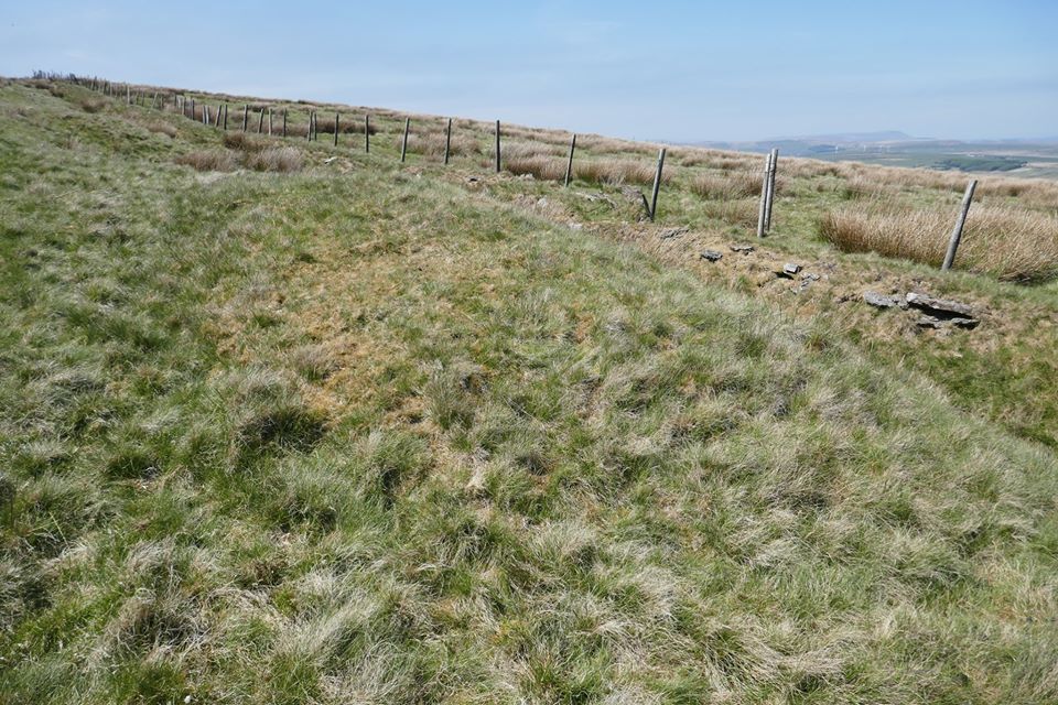
Possible Burial Mound on Cowpe Lowe, in Rossendale. Photo copyright: Stephen Oldfield.
NGR:- SD 8265 2067. Recently a friend, Stephen Oldfield, has brought to my attention that there are two “possible” Bronze Age burial mounds (barrows) at the southeastern side of Cowpe Lowe, near Waterfoot, Rossendale, Lancashire. One of these mounds looks more like a long barrow – while the other a bit further along is a smaller, circular mound. There is also evidence of early human activity on the summit of Cowpe Lowe from as far back as the Mesolithic, with a number of finds coming to light in recent years, which would suggest, then, that there was a settlement on the summit of the hill. The hill itself is 440m high (1,444 feet), and is just a couple of miles southwest of Waterfoot and overlooks the town of Rawtenstall in the Rossendale Valley. Some of the finds from Cowpe Lowe were deposited in The Whitaker Museum, Rawtenstall. Stephen Oldfield gives directions, saying to: “Follow the fence (keeping it on your right) from the ‘nick’ between Black Hill and Cowpe Lowe and climb upwards onto Cowpe Lowe and you will pass it [the mound]. There is another smaller one further on.”
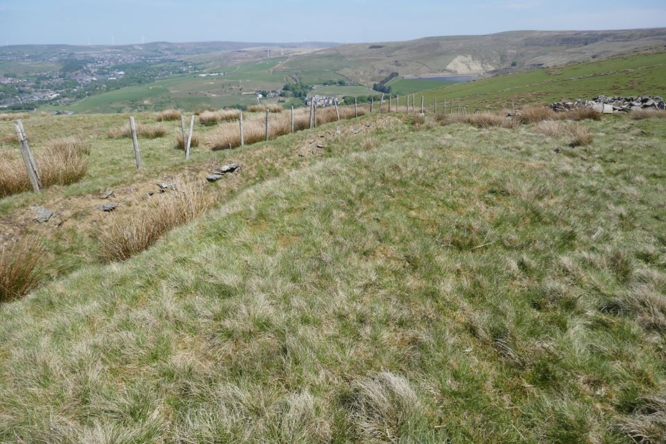
Possible Burial Mound on Cowpe Lowe. Photo Copyright: Stephen Oldfield.
The two grassy mounds (possibly Bronze Age barrows) are situated some 280 metres along a footpath to the northeast of the OS Trig Point (SD 82349 20639) on Cowpe Lowe’s south side. These mounds do not appear on any maps and would be easily missed if you didn’t know what you were looking for because there are many quarry mounds on the hill’s summit. Nor are they mentioned by archaeologists so obviously they have not been examined or excavated and, with that being the case, nothing is known about them, despite the many finds of flints and arrow-heads on the hill’s windswept summit. But are they actually burial mounds from the prehistoric age?, or just grassed-over quarry mounds that are now long forgotten? Stephen Oldfield says regarding the possible barrows: “these two are isolated lined-up E.W. and facing the High Point of Top Leach – and the ground where my uncles found scores of arrowheads in the 1960s.”
References & Related Websites:-
Many thanks to Stephen Oldfield for the use of his two photos and comments etc. Thanks mate.
http://www.hill-bagging.co.uk/mountaindetails.php?qu=S&rf=16512
More info here: https://www.springhillhistory.org.uk/resources/up-to-1066/Early-settlements.pdf
http://trigpointing.uk/trig/2475
Copyright © Ray Spencer, The Journal of Antiquities, 2020.
