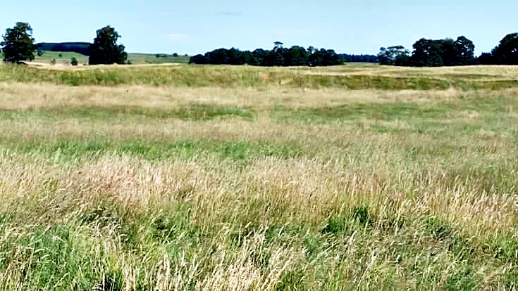
The defensive ramparts of Ardoch Roman fort(s), near Braco, Scotland. Photo courtesy of the late Patrick John Leonard.
NGR: NN 8389 0993. On the moorland a little to the north of Braco, Perth and Kinross, Scotland, are the very substantial earthworks of the Roman forts of Ardoch (ALAVNA), which are located beside the A822 Crieff road. The forts stand in the grounds of Ardoch House. These multiple Roman fort(s) here at Ardoch were all built on top of each other, and their defences extended and strengthened each time. The earthworks are in a well-preserved state, with the ramparts consisting of grassed-over banks, some up to 15 feet high, and ditches spanning a considerable area of ground in the usual sort of ground plan of a Roman fort – with rounded corners like a playing card. The whole site is roughly 300m x 217m (984 ft x 712 ft). However, the south and western sides of the site are now, sadly, almost devoid of any earthen banks and ditches, with trees taking their place. Further to the north and east of the site, there are the faint earthworks of another five or six temporary Roman camps, which together are even larger than the Ardoch fort, but they were obviously not as important. These six military sites and two signal towers were built after 80 AD, and continued to be garrisoned by thousands of Roman legionaries and auxiliaries into the late 2nd and early 3rd centuries AD, the soldiers probably coming from different parts of the Roman Empire. Ardoch Roman forts, temporary camps and signal towers stand in a north-easterly alignment and make up the Ardoch annexe at the southern section of The Gask Ridge. A Roman road runs in a north and then north-easterly direction to Perth. The Roman forts are in private ownership – part of the Ardoch House Estate.
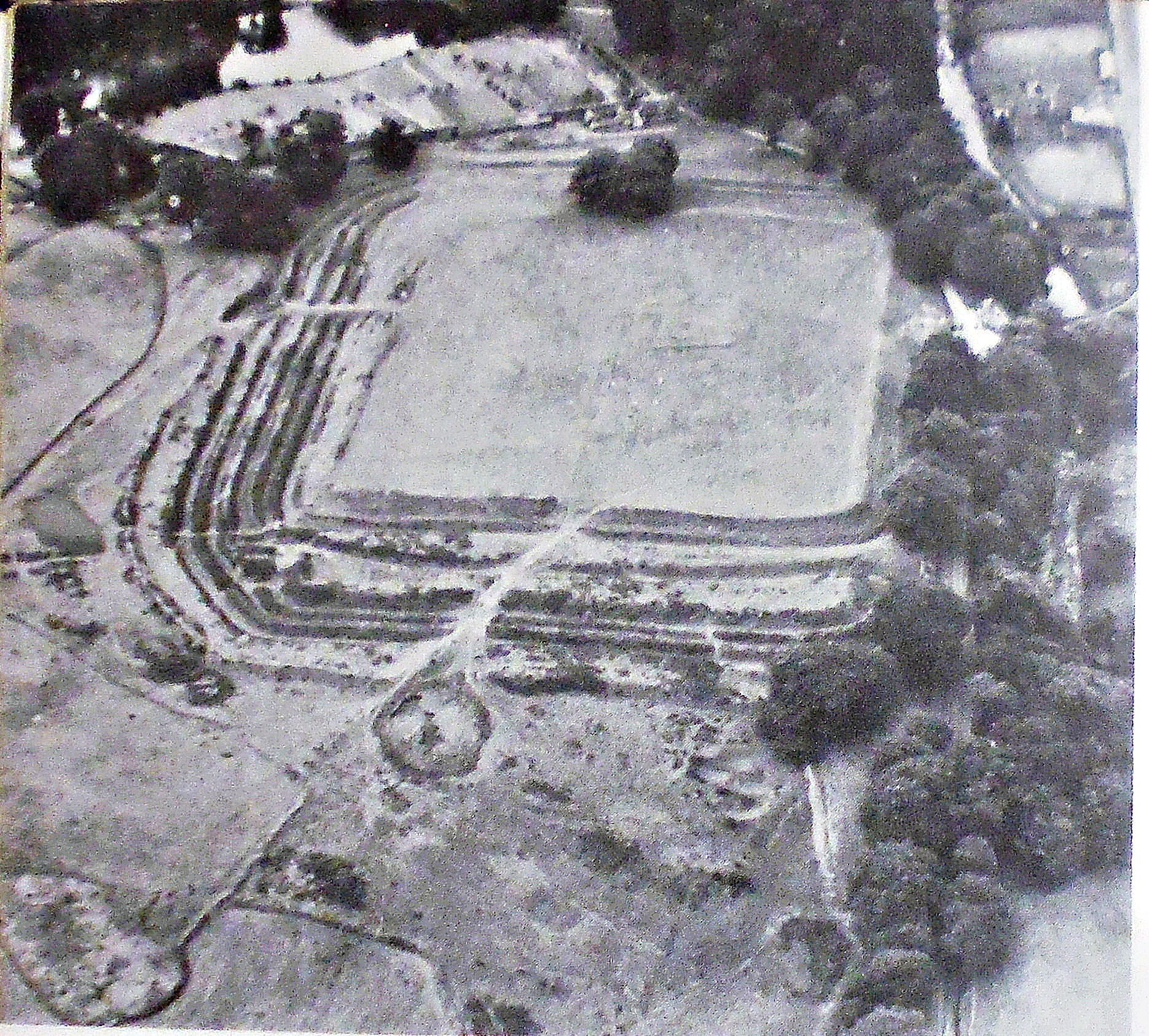
Ardoch Roman Fort(s) near Braco, Scotland (as seen from above).
Peter Clayton, writing in 1976, tells us more about Ardoch Roman Fort and the surrounding area. He says that “Crossing over the Antonine Wall at Rough Castle and 18 miles directly to the north is the Roman fort of Ardoch (NN 839099), near to Braco. It is one of a series of forts thrown forward into hostile territory on a line going up into Angus. As such they must have resembled the French Foreign Legion Forts in Algeria in the 1930s. There is not a stone building or wall to be seen at Ardoch, but for all that it is one of the most spectacular Roman sites in Britain. The ramparts were built of turf on a stone base, like the Antonine Wall. They followed the usual playing card shape and had an area of 75 x 79 yards with the customary military buildings within. Outside the fort area on the north and east side are a series of five parallel ditches; presumably there was a similar system on the south and west sides, but here the evidence has been largely obliterated. A turf rampart further out encloses the whole defence system. The ground to the east and south of the fort was marshy, which meant that there was less chance of attack from those directions; consequently, the ditches on these two sides are closer together than those on the north side. The fort itself served as a permanent legionary base but beyond it, to the north, are the remains of five larger temporary camps of varying dates. Two of them – 13 acres and 29 acres respectively, the second one being an enlargement of the smaller – date from Agricola’s advance into Scotland. Even larger camps in the group can be ascribed to the campaigns of Septimius Severus in AD 208-9. All the camps overlie each other to a greater or lesser degree, and this does make their interpretation at ground level rather difficult.”
Peter Clayton (1976) adds to the above, and says: “The Roman fort at Ardoch, a forward base 18 miles – a day’s march – from the Antonine Wall.”
David E. Johnston (2002) says of the Ardoch Roman fort: “The impressive visible remains belong to the later second century − the Antonine successor to an Agricolan fort. The multiple earthworks are finest on the eastern side; at the north-east corner, the slight outermost bank may be medieval (like the remains of a chapel in the centre of the fort) and the two outermost ditches (with bank) are possibly Agricolan. The irregular spacing of the northern defences betrays a reduction of the fort from 3.6 to 2.3 hectares, both phases being Antonine; the three outermost ditches, with remains of corners at north-west and north-east, belong to the larger fort. Two later ditches cross the space between these and the main inner rampart, which originally had a stone facing. Internal buildings of masonry have been excavated but are not visible. The fort was built for a mixed garrison of auxiliaries and legionaries.
To the north and north-east are very faint traces of a large annexe with a watchtower and no less than six overlapping marching camps – a complex covering the first to third centuries. The chronology is still disputed, and the traces are difficult to follow on the ground.”
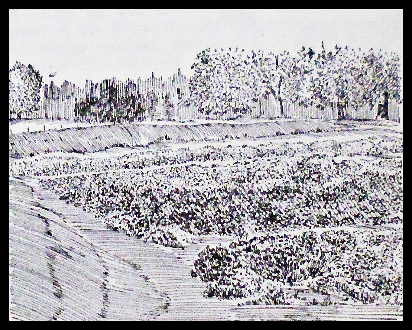
Ardoch/Braco Roman earthworks.
The AA (1963) tell us that: “To the east of the old bridge over the Kniak Water is the great Roman station of Ardoch, in the grounds of Ardoch House. The earthworks are of great strength, and are among the most striking of their kind in Great Britain. Coins excavated here date from the period of Hadrian. A little further to the north-west is another Roman Camp, known as the Great Camp, adjacent to which is another example, the two camps together being considered to have had space for nearly 40,000 troops at a time.”
N.G.R. Coordinates for possible temporary Roman camps to the north and northeast of Ardoch:- A possible Roman camp at NN 83981021 and a possible military complex of Roman camps at NN 84101060. There is also a possible Roman fortlet or camp further to the northeast at NN 87071294, and several miles further to the northeast of Ardoch is the Parkneuk Roman signal station/watchtower NN 91671855, while a little further to the east, still, is the Ardunie Roman Signal station/watchtower at NN 946187.
Sources / References and Related Websites:-
Clayton, Peter, Archaeological Sites Of Britain, Weidenfeld And Nicolson, London, 1976.
Johnston, David E., Discovering Roman Britain, Shire Publications Ltd., Princess Risborough, Buckinghamshire, 2002.
The AA, The Illustrated Road Book of Scotland, AA Publishing, London, 1963.
https://en.wikipedia.org/wiki/Ardoch_Roman_Fort
https://www.undiscoveredscotland.co.uk/braco/ardochromanfort/index.html
https://www.roman-britain.co.uk/places/ardoch/
More info here: https://scarf.scot/regional/pkarf/perth-and-kinross-archaeological-research-framework-case-studies/the-gask-ridge-ardoch-fort/
https://portal.historicenvironment.scot/apex/f?p=1505:300:::::VIEWTYPE,VIEWREF:designation,SM1601
© Copyright Ray Spencer 2026.

