The Journal Of Antiquities

Ancient Sites In Great Britain & Southern Ireland


Stanwick Iron Age Hillfort, North Yorkshire

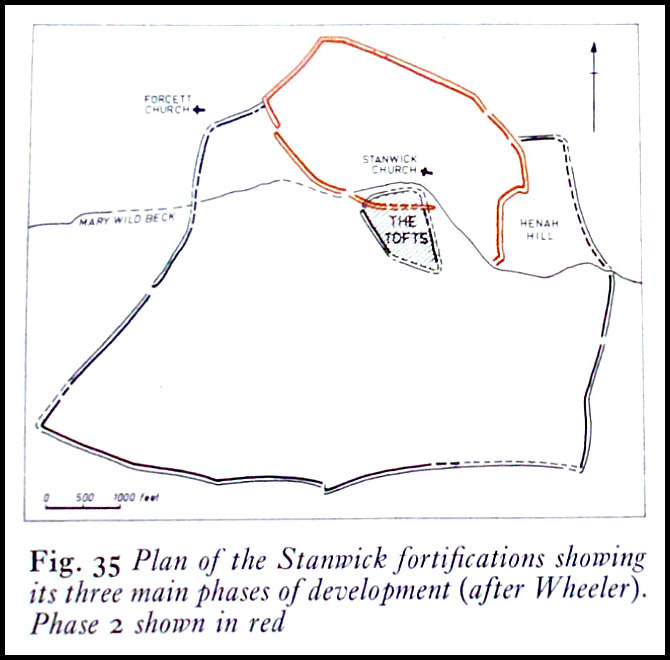
Plan of Stanwick Fortifications (after Wheeler)

Plan of the Stanwick Fortifications (after Wheeler)

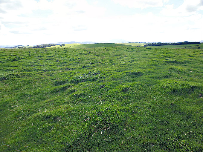
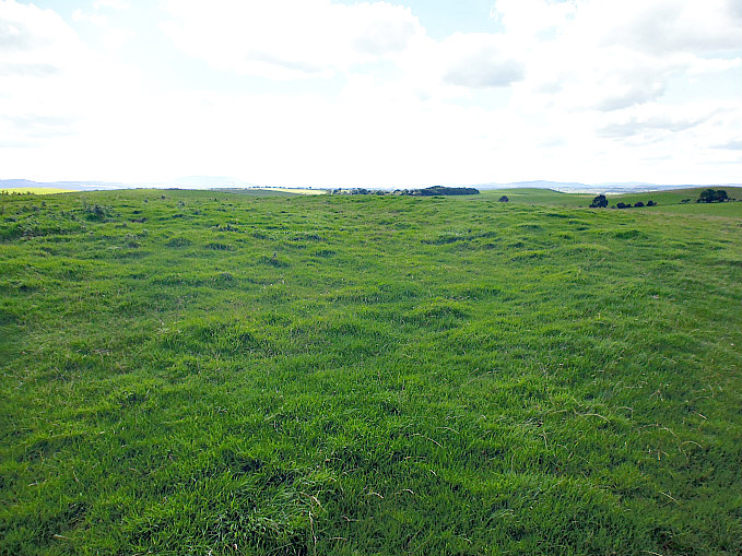
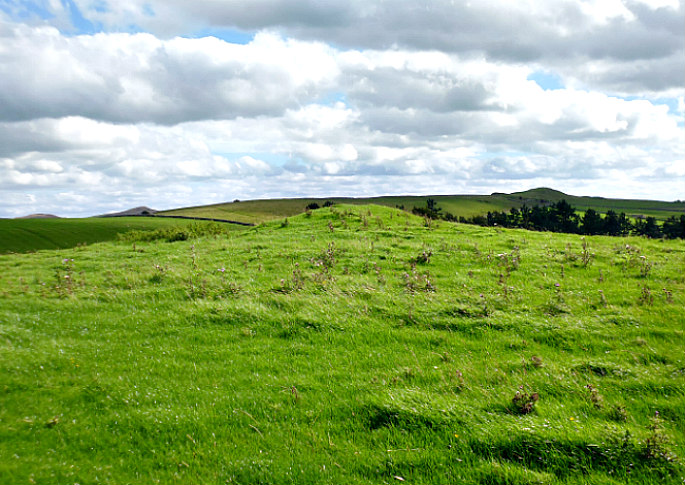
   OS Grid Reference: NZ 1820 1161. The Stanwick “late” Iron Age hillfort, also known as Stanwick Camp, lies some 8 miles to the north of Richmond, north Yorkshire, covering a large area of more than 700 acres and up to 5 miles in length, north of the village of Stanwick St John, with the earthworks spreading out from the hillfort itself. The hillfort or oppidum was built by the Brigantes tribe of northern England in three different phases roughly between 47-72 AD, with the first phase of the fort being at Toft Hill. The Brigantian leader Venutius, husband of Queen Cartimandua, was “thought” to have been defeated and killed by Roman troops from York at Stanwick in 74 AD – at about the same time that parts of the fort were destroyed by fire, but the fire was ‘probably not started by the Romans’ – although Quintus Petillius Cerialis, who was Roman Governor of Britain (71–74 AD), might have had a hand in that destruction at some point. Cartimandua maybe settling in at her base of Castle Hill (Almondbury) after 69 AD? 
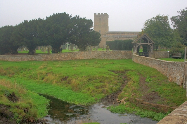
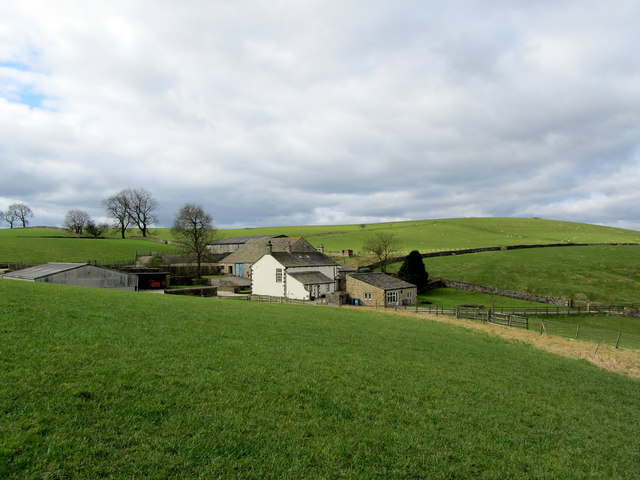
Mary Wild Beck and Stanwick Church by

Mary Wild Beck and Stanwick Church by Mick Garratt (Geograph).

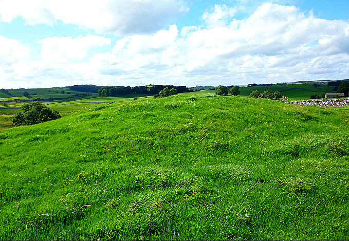
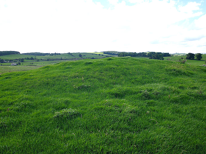
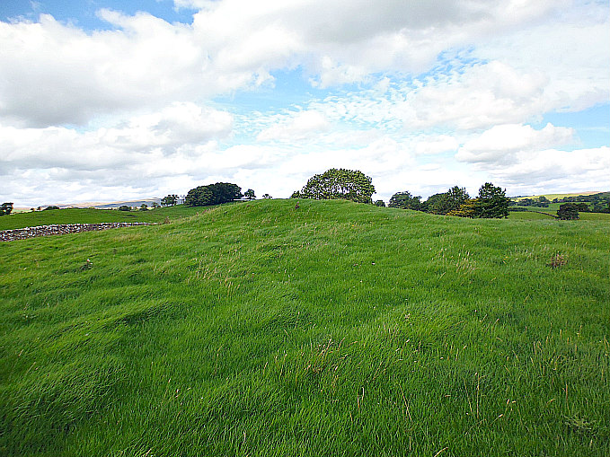
   Stanwick hillfort and its associated earthworks officially start at the village of Forcett from where there are some well-defined footpaths taking in the ancient monument, traversing its impressive and quite formidable ramparts and ditches. But the medieval church of St John the Baptist at Stanwick St John is the place to head to, and just to the south-west lies the hillfort known as Toft Hill (the Tofts), although there are grassy earthworks all around here running for several miles. Locally these earthworks are called Jack-Dike Arches. And there are ancient burial mounds which perhaps date back the late Bronze Age and the late Iron Age. Stanwick hillfort and its associated earthworks were excavated by Sir Mortimer Wheeler in 1951-52. In more recent times 1981-86 excavations were carried out by Durham University. St John’s Church at Stanwick houses a number of antiquities including a 9th century Anglo Saxon cross-shaft.

   Harold Priestley in ‘The Observer’s Book of Ancient & Roman Britain’, says of the Stanwick site: “If not the most impressive to view, this fortified area is the largest and greatest engineering feat of the Iron Age tribes. It started as a 17-acre (6.9-ha) fort in the early 1st century AD, and was twice extended until the fortification enclosed no less than 747 acres (302 ha). It is believed to have been the rallying-point of the Brigantes under their king Venutius who revolted against the Emperor Vespasian in AD 69. His queen, Cartimandua, had taken the side of the Romans and may have set up her headquarters at the fort at Almondbury near Huddersfield.

   “In about AD 50-60 (after the Roman conquest of the S of Britain) another 130 acres (53 ha) to the N of the fort were enclosed by a bank and ditch except on the SE where a stream, the Mary Wild Beck, acted as a barrier. The fortifications between the old and new sections were demolished. Part of this bank and ditch have now been restored.
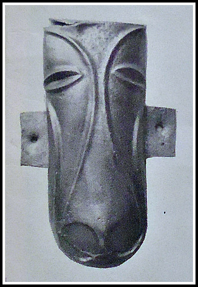
Horse's-head plaque, Stanwick, north Yorks.

Horse’s-head plaque, Stanwick

   “The final huge extension covering some 600 acres (243 ha) was made to the S of the Beck and brought into the fortified area a rough quadrilateral of land capable of accommodating an army and pasturing horses and cattle. It was enclosed within a bank and ditch with an in-turned entrance on the S. There are signs that the fortifications were attacked by the Roman commander Cerialis before this section was completed. Part of the ramparts then appear to have been deliberately destroyed. No account of this campaign has ever been found, but the fall of Stanwick opened the way to the N for the Roman armies.”

   Author Ian Longworth in his work ‘Regional Archaeologies – Yorkshire,’ says of the Stanwick fortifications: “The fortifications lie on a rolling piece of land between the modern villages of Aldburgh St John and Caldwell. The site was hardly chosen for its commanding position, for the ground here does not rise above 100 feet. Rather it was chosen as being near a good supply of water, the Mary Wild Beck. In their final form, discounting a later addition on the south side, the earthworks enclosed an area of over 700 acres, but the first fortification was a more modest affair enclosing 17. This more or less coincides with a rough field known  as ‘the Tofts’ south-west of Stanwick church. The defences were impressive, for a man standing on the bottom single ditch would look up to a rampart rising to a height of 24 feet. Naturally access had to be provided across the rampart and a gateway left at the western angle. To strengthen this point the flanks of the gateway were revetted with dry-stone walling.
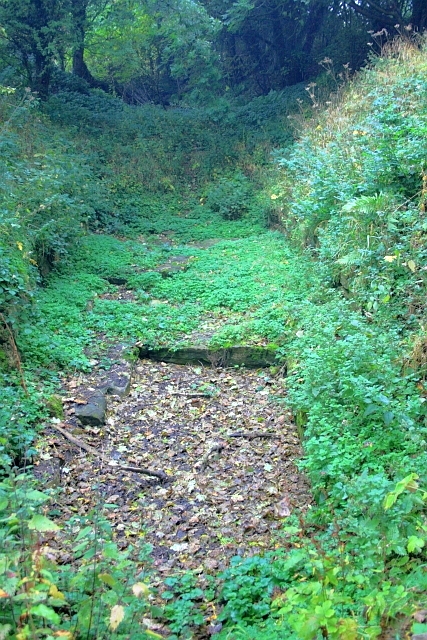
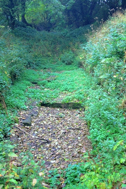
Stanwick Iron Age Fortifications by Mick Garatt (Geograph).

Stanwick Iron Age Fortifications by Mick Garratt (for Geograph).

   “Although only a small portion of the area was examined, a series of drainage ditches were found inside the enclosure together with the remains of a round timber hut with an entrance facing east. This was set within a circular drainage ditch, which would have taken the water dripping from the conical roof. An interesting feature which emerged from the excavations at Stanwick was that only a quarter of the pottery recovered was home-made and these were mainly rough cooking-pots. The remainder of the pottery had all been imported. These imported wares included Butt Beakers from south-east England and fine red Samian Ware made towards the end of the first century A.D. in Gaul. The builders of the fortifications then had wide trading contacts with other tribes living farther south. This first fortification was probably built as a centre for anti-Roman resistance in northern Brigantia, shortly after the Roman invasion of A.D. 43.

   “At a later date the fortifications were greatly enlarged. An enclosure of 130 acres was built to the north to supplement the first fortifications. This new enclosure cut off the northern end of the earlier work and, where this lay within the new  enclosure, the old ramparts were flattened. The new enclosure was deliberately built to include some 300 yards of the Mary Wild Beck and, along this stretch, the brook and its marshy borders formed the only defence. Towards the western angle the new rampart was side-stepped to provide an entrance. This new rampart, which had originally been marked out with a small bank and ditch, was revetted in front by vertical dry-stone walling to a height of about 15 feet. Between the rampart and the ditch lay a berm—a flat space about 1 foot wide. The vertical height from the bottom of the ditch to the top of the rampart when first erected must have been something like 28 feet.

   “Near the entrance a pool of muddy water had collected in the bottom of the ditch. This had helped to preserve the organic objects that had either fallen or been thrown in. An oak dish was found and fragments of basketry, as well as an iron sword in a bronze-bound scabbard made of ash wood. Near the sword lay a skull showing very definite signs that its owner had met with a violent death. The skull had been slashed twice across the eye and a third blow had sliced of a piece of frontal bone which lay nearby. The head had been severed from the body between the fourth and fifth vertebrae. The victim was perhaps a criminal or prisoner and may well have suffered the fate of having  his head stuck on a pole at the gate.

   “The final stage of the construction was marked by a huge extension to the enclosure with a bank-berm-and-ditch defensive system to the previous fortification. The new fortifications  enclosed some 600 acres and provided ample pasturage for horses and cattle. The entrance lay in the middle of the south rampart in the form of a Z-shaped breach, but no gates were found. This final reconstruction was never completed. The causeway across the ditch opposite the gate had been roughly hacked through and blocks lay where they had been hurriedly levered up. The occupants had clearly had no time to finish their work before being called upon to defend themselves.

   “It was probably Venutius who extended the fortifications at Stanwick and then extended them again in and after A.D. 69 when he was gathering his allies for a final stand against the Romans. The unfinished state of the last phase of the defences shows that the final battle came before the Brigantes were completely ready, and the deliberate destruction of part of the ramparts shows only too clearly the ultimate result of the conflict. The actual struggle is not documented by the historians, but the Roma victory must have been complete, for by A.D. 80 Agricola was campaigning in Scotland. A Scottish campaign would have been out of the question if the Brigantes were still menacing the supply routes to the south.”

   The great Mr Arthur Raistrick in his work ‘The Pennine Dales’, tells us more about Stanwick. He tells us that: “At Stanwick, a prominent point, Toft Hill, had been converted into a defensive hill-fort, and one of the leaders of the fort builders was buried there, his body accompanied by his chariot. Many ornaments of bronze, some with stylized horse-head motifs, buried with him, were from the harness and chariot trappings.” Could this burial mound have contained the remains of Venutius, leader of the Brigantes, whom it was believed was killed by the Romans in 74 AD?
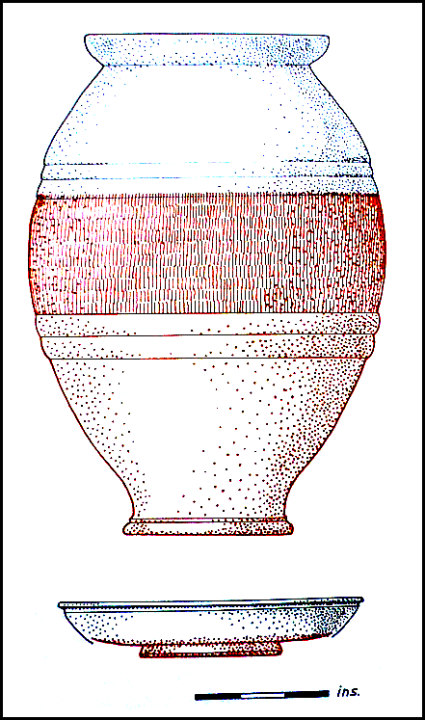
Butt beaker and Samian bowl from Stanwick (After Wheeler).

Butt beaker & Samian bowl, Stan-wick (After Wheeler).

   Author Jaquetta Hawkes writing in 1975 says that: ‘The history of the Stanwick earthworks are revealed by Sir Mortimer Wheeler’s digging leads into the Roman conquest of Britain at a point where the pro-tagonists are known by name, thanks largely to the writings of Tacitus. Having conquered the lowlands, the Roman army was now thrusting into the highland zone. At this point the [Brigantes], probably the largest of all the British tribes and occupying much of northern England, were ruled over by Venutius and his queen, Cartimandua. Friendly policy towards the Romans had brought them the status of a client kingdom. In 51 AD Caractacus, the heroic leader of British resistance, asked for asylum at the court of Queen Cartimandua. She then handed him to the Romans in chains. The Brigantes were now in turmoil, with the pro-Roman policy still maintained by the queen, but now opposed by her husband and the elite of his warriors. Venutius and Cartimandua separated in violent hostility. Venutius then succeeded Caractacus as leader of the resistance, while the queen took his squire Vellocatus as her consort for bed and throne.

   Hawkes goes on to say that: ‘With Roman support Cartimandua was able to hold out in the old Brigantian capital (possibly Almondbury), but the Brigantes and others rallied to Venutius. He later attacked Cartimandua with great success and she had to be rescued by Rome. As Tacitus put it on behalf of Rome ‘The Throne was left to Venutius, the war to us.’ But he was not allowed long to enjoy his victory. The Ninth legion came from York and ended the great Brigantian resistance for good.” 

I would like to thank the late John Dixon, and family, for their bringing about of this site page through books and literature greatly received.

Sources of information and related websites:-

Barringer, J. C., The Yorkshire Dales, The Dalesman Publishing Company Ltd., Clapham, 1982.

BBC Publication, Roman Britain, The British Broadcasting Corporation, London, 1966.

Hawkes, Jacquetta, A Guide To The Prehistoric And Roman Monuments In England And Wales, Cardinal (Sphere Books Ltd), London, 1975.

Longworth, Ian H.,  Regional Archaeologies: Yorkshire, Heinemann Educational Books  Ltd., London, 1969. 

Priestley, Harold, The Observer’s Book of Ancient & Roman Britain, Frederick Warne & Co Ltd., London, 1976.

Raistrick, Arthur, The Pennine Dales, Arrow Books Ltd., London, 1972.

Ramm, Herman, Roman York – From A.D. 71, Yorkshire Architectural and York Archaeological Society, York, 1979.
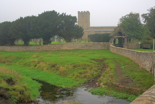
Mary Wild Beck and Stanwick Church

Stanwick Iron Age Fortifications

Stanwick Hill Fort, Forcett, North Yorkshire

https://en.wikipedia.org/wiki/Stanwick_Iron_Age_Fortifications

Stanwick Fortifications, North Yorkshire

http://www.academia.edu/4032642/New_Geophysics_Results_at_Stanwick_Oppidum_North_Yorkshire

http://www.english-heritage.org.uk/visit/places/stanwick-iron-age-fortifications/

                                                                           © Ray Spencer, The Journal Of Antiquities, 2017.

2 Comments

Tintagel Head Celtic Monastery, Cornwall

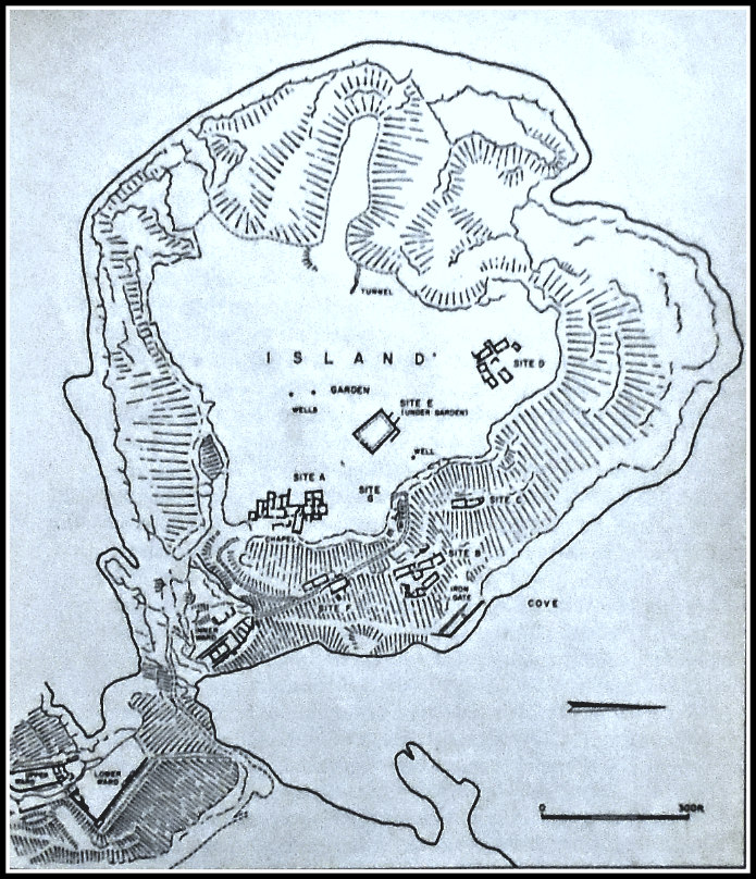
Map of Tintagel Island in Cornwall.

Map of Tintagel Island in Cornwall.

   OS Grid Reference: SX 05003 89064. On the rocky, windlashed headland of Tintagel-Head, in Cornwall, near the ruins of Tintagel Castle which was built in c 1145, are the scant foundations of what was considered to be a Celtic monastery, dating from the beginning of the 6th century AD. This was probably a high-status Dark Age monastery with royal connections. There are also the walls of a 12th-century chapel of St Julitta which is attached to the monastic buildings. It has always been assumed that the monastery here on Tintagel Head was founded in 500 AD by St Juliot, Julitta, or Julianta, a princess who hailed from south Wales, and might be one and the same as St Uletta. Tintagel Castle has long had “romantic” associations with King Arthur and Merlin the Magician. Today the monastic remains lie on Tintagel Island, which is all but cut-off from the rest of the headland where the castle ruins are situated. There is limited access from the castle to Tintagel Island through a deep chasm in the headlands via a footpath and bridge, but its very precarious and great care “should” be taken, especially if weather conditions are against you.

   The monastic site here at the south side of Tintagel Island, with its rectangular-shaped buildings all joined together, was excavated in the 1920s and 30s by C. A. Raleagh Radford (1900-1999) – at which time it was thought to be a high status Celtic monastery, but more recently a few historians have opted for the possibility that it might have been a trading centre due, perhaps, to the large amounts of pottery (known as Tintagel Pottery) found at the site, says Geoffrey Ashe ‘A Guidebook to Arthurian Britain’. Another large building (site E) that was a part of the monastery lies beneath a garden, while other little clusters of buildings (sites B.C. and F) lie to the S and SE of the main monastic site, which is known as site A. These clusters of buildings were probably the monastery’s farm and stables. By the 9th century it seems the monastery here at Tintagel was abandoned, its buildings left to go back to nature and the mists of time, but to be re-invigorated again in the 1920s by an archaeological dig! 

   There is a lot of very good field information on the Celtic monastery at Tintagel in the work ‘The Quest for Arthur’s Britain’, edited by Geoffrey Ash. It says that with regard to excavations on the island: “These excavations showed that the headland of Tintagel had been the site of an extensive Celtic monastery. Four different phases identified in one of the buildings indicated a long period of occupation. Imported pottery from the east Mediterranean established an initial date in the fifth or early sixth century. A silver penny of King Alfred (871-99)—the latest artifact antedating the castle—may represent no more than the loss by a pilgrim to a deserted oratory which was no longer the centre of a living community. Pottery of the twelfth century and later, though relatively common on this site, was never found in the layers associated with the monastery.

   “The Celtic monastery of Tintagel was bounded on the landward side by an earthen bank, now crowned by the thirteenth-century curtain, and by a broad, flat-bottomed ditch. The upper part of the existing bank is a twelfth-century heightening, but the base, some 30 feet across and 8 feet high, dates from the fifth or sixth century. Like its medieval successor, the monastic bank ran from the edge of the scarp overlooking the eastern valley to within a short  distance of the protruding boss of rock, leaving the same narrow entry. Early texts often speak of the monastic vallum, a term indicating the enclosure which fenced in the cashel or settlement occupied by the community. It seems always to have been a physical barrier, an earthen bank, a rampart of turf or a hedge. But it also had a spiritual meaning, separating the city of God from the world outside.

   “Within the enclosure the monastery consisted of groups of buildings, each with its special function. Eight such groups were located, of which six were explored and planned; the other two had been too far destroyed by the medieval castle. Two further sites were noted in folds of the cliff, and others probably await identification.

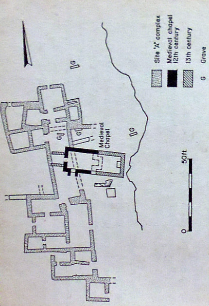
Plan of Celtic monastery at Tintagel, Cornwall.

Plan of Celtic monastery at Tintagel, Cornwall.

   “The first and largest site examined lay on the eastern edge of the plateau; it was centred on the twelfth-century chapel. The Celtic site consisted of a long range of buildings facing east on to a court which was bounded on the far side by the cliff, here forming the edge of the plateau. The range was approached from the south by a path running along the edge of the plateau; this is now reached by a modern zigzag approach rising up from the inner ward of the castle. The original way is likely to have been along the plateau, which has here been destroyed by the encroachment of the sea. At the south end of the range of buildings, a small square room thrust forward from the general line, together with the stub of a wall, suggest a gate with a lodge providing access to the court. With the court, a much-ruined stretch of walling immediately south of the later chapel is probably part of an older oratory. Beside it is the base of a square block of masonry, a tomb shrine or leacht. These tomb shrines are a normal feature in Celtic cemeteries; they housed the relics of saints or founders.

   “On the far side of the chapel a number of graves have been discovered. The oratory with the tomb of the saint would be the primary objective of visiting pilgrims. In its immediate vicinity one would expect to find the various buildings catering for their needs. There would be a treasury containing other relics, perhaps possessions of the saint. There would also be a sacristy, where the vessels needed for the service of the oratory would be stored. A guesthouse for the refreshment of pilgrims might also be found in this area, together with rooms needed by those members of the community charged with the care both of the pilgrims and of the lay community, of which the pastoral care was the responsibility of the monastery.

   “On this basis, it may tentatively be suggested that the southern end of the range, with a large central hall and smaller rooms grouped on one side and to the back, represents the guesthouse. The central part, now appearing as a single room, has been much damaged by the later chapel. Originally it may well have been subdivided, and here, in the vicinity of the oratory, one might expect the treasury and sacristy. This would leave the smaller rooms at the north end for the needs of those members of the community whose duties were with the lay world. This range had a long history. Four distinct building phases could be recognized. Normally the phases indicated adaption, while retaining the main structure of older date. Even so, a life of some three centuries is not likely to be too long for the existence of this community, and it could well have been in being for a far longer period.”

   And what about the founder/foundress of the Celtic monastery on Tintagel Head. Who was St Juliot or Julitta? The thinking is that the founder was St Uletta (Ilid). She was, according to legend, one of the many daughters of King Brychan Brycheaniog and was the founder of the first church at Llanilid in the Vale of Glamorgan in Wales, and is commemorated there with St Curig. In c 500 AD she went with other members of her family to Cornwall. We know that she was close, spiritually, to her sister St Morwenna and her brother St Nectan. It seems, however, that in Cornwall her original name was St Juliana (Iludiana) and over time the name became Juliot and Julitta; and soon after her arrival in Cornwall she established the monastic community at Tintagel.

   But St Juliot has been much confused with an early 4th-century Christian martyr called St Julitta, who was commemorated with her three-year-old son St Cyricus in the west country. Their cultus was brought to Cornwall in the Middle Ages. St Juliot, however, is perhaps the patroness of Luxulyan church, Cornwall, with a feastday on the sunday nearest 29th June, according to David Farmer ‘Oxford Dictionary Of Saints’.  In Cornwall St Juliot (Julitta) is sometimes referred to as a “martyr” due to confusion, again, with the 4th-century saint of the same name. St Juliot is also commemorated at Lanteglos-by-Camelford, Cornwall, where a holy well is named for her. And St Juliot in the Valency Valley, north-east Cornwall, is named after the saint. A few historians have suggested that St Juliot was, in fact, a male saint! St Julitta’s feastday at Llanilid church in Mid Glamorgan, Wales, is given as 30th June.

Sources and related websites:

Ashe, Geoffrey,  A Guidebook to Arthurian Britain, Longman Group Limited, London, 1980.

Farmer, David, Oxford Dictionary Of Saints, Oxford University Press, 2004.

https://en.wikipedia.org/wiki/Saint_Ilid

https://en.wikipedia.org/wiki/St_Juliot

http://www.thisisnorthcornwall.co.uk/king_arthur.html

Jones, Sally, Legends of Cornwall, Bossiney Books, St Teath, Bodmin, Cornwall, 1980. 

Spencer, Ray, A Guide to the Saints Of Wales and the West Country, Llanerch Enterprises, Felinfach, Lampeter, Dyfed, 1991.

The Quest for Arthur’s Britain, (Edited by Geoffrey Ashe), Paladin Frogmore, St Albans, Herts, 1976.

Westwood, Jennifer, Gothick Cornwall, Shire Publications Ltd., Princess Risborough, Bucks, 1992.

                                                                 © Ray Spencer, The Journal Of Antiquities, 2017.

1 Comment

Cashtal-yn-Ard, Near Glen Mona, Isle Of Man

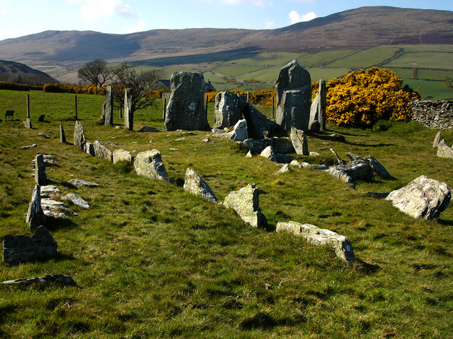
Cashtal-yn-Ard, Isle of Man (photo by Chris Gunns (Wikipedia)

Cashtal-yn-Ard (photo by Chris Gunns – Wikipedia)

   OS Grid Reference: SC 46222 89226. The ancient burial chamber known as ‘Cashtal-yn-Ard’ stands on the edge of a hill to the northeast of Glen Mona, just to the south of Cornaa in the parish of Maughold, and close to the eastern coastline of Isle of Man. It is said to date back some 4,000 years to the New Stone Age (the Neolithic). It is quite a large megalithic structure at 130 feet in length. The name ‘Cashtal-yn-Ard is thought to mean ‘The Castle of the Heights’. However, today this megalithic burial cairn is minus its conical mound of earth and stones, but it still looks very impressive. From the A2 Laxey to Ramsey road at Glen Mona village: take the country lane towards Cornaa for 1 mile. Halfway along, and just after and opposite the entrance to Rhenab Farm on the left-hand side, walk northwest up the footpath for 180m to the southern edge of the hill – there in front of you stands the chambered burial cairn of Cashtal-yn-Ard.

   Cashtal-yn-Ard is a large, oblong shaped chambered cairn dating from the late Neolithic Age – roughly between 1,800-2,000 BC. It covers a large area some 40m (131 ft) long and 14m (46 ft) wide, and still has its outer kerb stones, forecourt, entrance and 5 burial chambers (compartments). The side stones (or slabs) of these burial chambers are angled inwards and some have jagged edges, though sadly all but one of the roof-slabs have been lost, although this long flat-slab might not be the original one. Some of the large standing stones at the entrance have been re-erected or replaced. However, its large conical mound of earth and stones, probably more stones than earth, has gone – the stones now lost to local walls and maybe farm buildings? The monument is very well-preserved and is said to be the largest of its kind in Britain.

   Here at Cashtal-yn-Ard it is thought chieftains of the New Stone Age (the Neolithic) were buried maybe with members of their close families. Indeed during excavations back in 1932-35 funerey urns and other artefacts were found. It was also excavated more recently in 1999. At the E. side there is a small grassy mound consisting of earth and stones.  The orientation of this monu-ment is said to be almost W-E. There are two more Neolithic tombs on the island – similar in size to this one.

   In the publication ‘The Ancient And Historic Monuments of the Isle of Man’, there is more information on this site. It says that this is an: “Outstanding example of a megalithic chambered cairn, of ‘Clyde-Carlingford’ type, burial place of chieftains of the New Stone Age, about 2000 B.C. A semi-circular forecourt at the western end gives access, through a ‘portal’ of two standing stones, to a burial chamber of five compartments, originally slab-roofed. Here unburnt bones, pottery and flints were found. East of the the burial chambers is a mound of earth and stones reddened and fused by heat. The whole monument, apart from the forecourt, was originally covered by a massive oblong cairn 130 feet long.”

Sources and related websites:-

Hulme, Peter J., More Rambling In The Isle Of Man, The Manx Experience, Douglas, Isle of Man, 1993.

The Ancient And Historic Monuments – of the Isle of Man, (Fourth (Revised) Edition, The Manx Museum And National Trust, Douglas, 1973.

The Viking Heritage – Isle Of Man – Millennium Of Tynwald, Shearwater Press, Douglas, Isle of Man, 1979.

https://de.wikipedia.org/wiki/Cashtal_yn_Ard

http://www.megalithic.co.uk/article.php?sid=5944

http://www.iomguide.com/cashtalynard.php

http://www.isle-of-man.com/manxnotebook/history/arch/aj16n4.htm

                                                                                       © Ray Spencer, The Journal of Antiquities, 2016.


St Fillan’s Holy Well And Chapel, Kilallan, Renfrewshire, Scotland

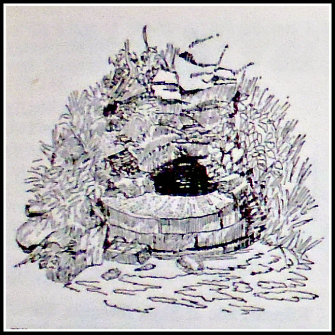
St Fillan's Holy Well at Kilallan, Renfrewshire, Scotland.

St Fillan’s Holy Well at Kilallan, Renfrewshire, Scotland.

OS Grid Reference: NS 3840 6899. The healing well of St Fillan lies at the edge of a wooded area 140 metres to the east of the ruined and roofless chapel, also named for the saint, at the east-side of Kilallan Farm, and near the village of Kilmacolm in the parish of Houston, Renfrewshire. And 55 metres to the south of the holy well, beside Corsliehill Road, is the famous St Fillan’s Seat, a large rock shaped as such. St Fillan or Foelan was an 8th century saint from Munster in Ireland. The little hamlet of Kilallan (meaning the cell of Fillan) with its old ruined church of St Fillan and graveyard was a holy and sacred site and also a place of pilgrimage in the Middle Ages – as was the nearby holy well and rock-seat. The church was last used for services in the latter part of the 18th century. Although the church is without its roof it does still retain some interesting medieval features, and there used to be a 10th century stone here. The holy well, ruined chapel and stone seat lie just off Corsliehill Road in the vicinity of Kilallan Farm, some 2 miles to the south-east of Kilmacolm, near Houston.

The holy well of St Fillan was almost certainly a pre-Christian spring that was used by the saint himself in the 8th century for baptismal purposes. It’s water flowed from beneath a rock in the ground and into a round-shaped brick and stone basin. Long ago the holy water apparently miraculously cured children of rickets when they were bathed there; pieces of cloth and rags being hung on trees beside the well as votive offerings, although this ceased at the end of the 17th century when the local priest filled the well with stones. The water was also used for baptisms in the nearby church of St Fillan, which now stands roofless beside Kilallan farm. The well gets a brief mention in Janet & Colin Bord’s work ‘Sacred Waters’.

St Fillan’s Old Church at the east-side of Kilallan (Kilellan) Farm (NS 38268 68934) is now roofless but the walls you see here are still very sturdy and solid-looking. This building stands on the site of an older, medieval church, but there are still parts of this “older” building in the fabric of the walls. The doorway is said to date from 1635. In the churchyard wall there is a ancient baptismal font, or stoup, from the older church; and there used to be a 10th century stone standing inside the present edifice, but this seems to have been removed for safety reasons. In 1772 St Fillan’s was finally abandoned to the elemants. The British Listed Buildings site says of this: “Church ruin; roofless; walls and major part of gables remain; dated lintel “1635”. Later E gable, thick crowstepped W gable, with bipartite window at clerestory level. N wall with tomb of Fleming of Barochan family. Doorways in N and S walls. Moulded cornice to all but E. 3 doors to S blocked up. Stone stoup built into wall. Early gravestones in kirkyard.” Historic Scotland Building ID is:- no 12897. (See the link below*).
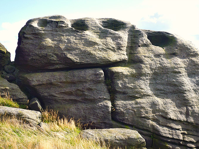
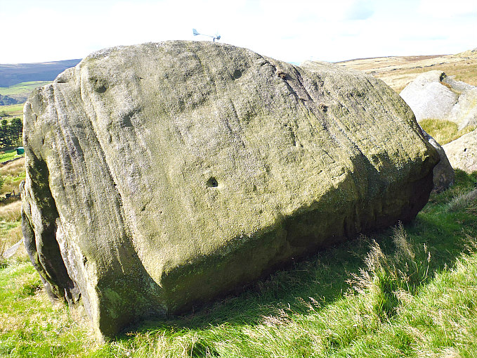
St Fillan's Seat beside Corsliehill Road, Kilallan, Renfrewshire

St Fillan’s Seat beside Corsliehill Road, Kilallan, Renfrewshire

A little further to the south-east of the ruined chapel, beside the road and opposite the farm building, is a large flat rock of ancient origins that is locally called St Fillan’s Seat or Chair at (NS 38419 68937). Legend records that the holy man sat here and baptized the local children. We don’t, however, know a great deal about the life of the saint other than he was born in (c703) and was a monk at Cluain Moescna, Co. Westmeath, but in his youth (c717 AD) sailed from Ireland to Scotland and was accompanied by his mother, St Kentigerna, and his uncle, St Comgan. We know that Fillan buried his uncle on the Island of Iona. His father was said to have been Feriach. There are though another 14 saints called Fillan, Foelan and Faelan. At least two of these came to Scotland between the 6th and 8th century AD. This has undoubtedly led to confusion, but St Fillan of Kilallan was abbot of Glendochart, Perthshire, and died in 776 AD. His feastday is generally 9th January but sometimes 19th Jan, whereas the other St Fillan was a disciple of St Columba – probably at Pittenweem – in Fife. He died in 593 AD  and is honoured on either 20th or 25th June.

The author Donald Attwater in his work ‘A Dictionary Of Saints’, adds more to the information but, perhaps, adds to that confusion regarding the 8th century St Fillan. He says that: “Fillan was abbot of a monastery near St Andrews; was a solitary in Perthshire, and was buried in Strathfillan, also in Perthshire.”

Sources and other related websites:-

Attwater, Donald, A Dictionary Of Saints, Burns & Oates, London, 1958.

Bord, Janet & Colin, Sacred Waters, Paladin, London, 1986.

MacKillop, James, Dictionary Of Celtic Mythology, Oxford University Press, Oxford, 1998.

The AA, Illustrated Road Book Of Scotland, The Automobile Association, London, 1963.

http://www.britishlistedbuildings.co.uk/sc-12897-killellan-kirk-and-churchyard-houston#.WE3p5C975jo

https://canmore.org.uk/site/42250/kilallan-st-fillans-church-and-churchyard

https://canmore.org.uk/site/42246/kilallan-st-fillans-well

https://en.wikipedia.org/wiki/Houston_and_Killellan

History

http://www.guard-archaeology.co.uk/news13/kilallanNews.html

                                                                                       © Ray Spencer, The Journal Of Antiquities, 2016.


1 Comment

Currer Woods Rock Carving, Steeton And Eastburn, West Yorkshire

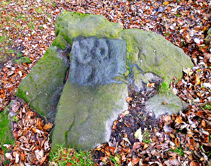
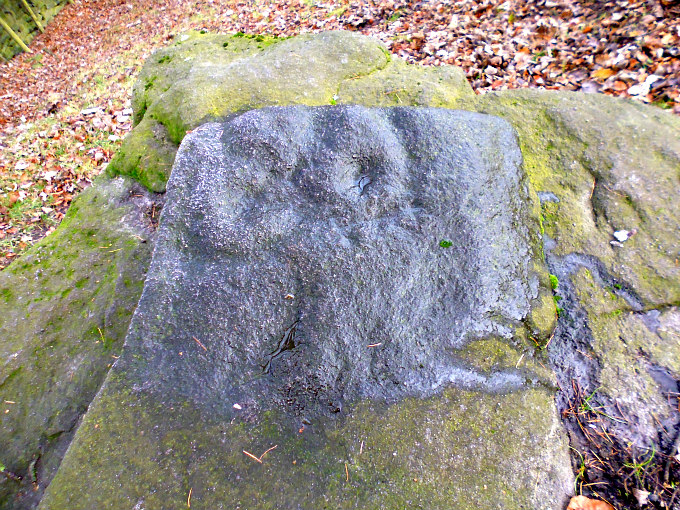
Currer Woods Rock Carving, near Eastburn, West Yorkshire.

Currer Woods Rock Carving, near Eastburn, West Yorkshire.

   OS grid reference: SE 02514 43844. A very strange little rock carving almost hidden away in a secluded corner of a field at the southern edge of Currer Woods, at Steeton, west Yorkshire. This seems to be one on its own, and there don’t appear to be any other carvings at this location, although you never know. To reach the stone carving walk up the footpath on the opposite side of the B6265 road from Airedale Hospital in Steeton; the path runs south up to the western edge of Currer Woods. Or you can reach it via Redcar Lane and then Intake Lane: take that same foot-path from the stile beside the rough track; going down the slope for a while, then via off north-east along the edge of Currer Woods and through the field with rocks; the carving is in the next field along, close to the wall, in what is a secluded corner with trees over-hanging the site.

Close up of the Currer Woods Rock Carving, near Eastburn.

Close up of the Currer Woods Rock Carving, near Eastburn.

   This interesting little rock carving can be found on a cluster of gritstone rocks close to a wall and just out of the tree-line. It would seem that the rock upon which the carving is situated has suffered from damage by being broken off in two or three places at one end, but thankfully the carving, which consists of maybe two or three tiny cup-marks which are partially surrounded by half rings or arcs, has not been destroyed and seems to be intact. From a distance it has the appearance of a face with eyes and a nose – the nose being formed by a notch just below but whether this was part of the original carving – I don’t know. It might be part of the stone itself? Or maybe it was meant to be. It was discovered in 2009 by Paul Bennett of  ‘The Northern Antiquarian’, whilst taking shelter from heavy rain! But for the rain it might never have been spotted. (See the link below). There do not appear to be any more rock carvings here, but further to the west (220m) on the slope above Eastburn Crags there might be a few “possible” cup-markings but these look to be more recent in date, and others have probably been caused by erosion. I have not, as yet, investigated any of the large moss-covered rocks in Currer Woods itself.

Sources and other related websites:-

Currer Woods Stone, Steeton, West Yorkshire

https://en.wikipedia.org/wiki/Eastburn,_West_Yorkshire

https://en.wikipedia.org/wiki/Steeton_with_Eastburn

                                                                   © Ray Spencer, The Journal Of Antiquities, 2016.


1 Comment

Kid Stone, Sutton Moor, West Yorkshire

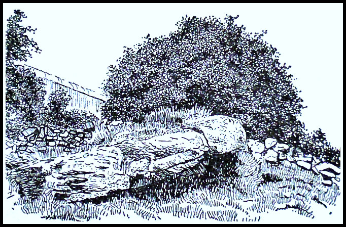
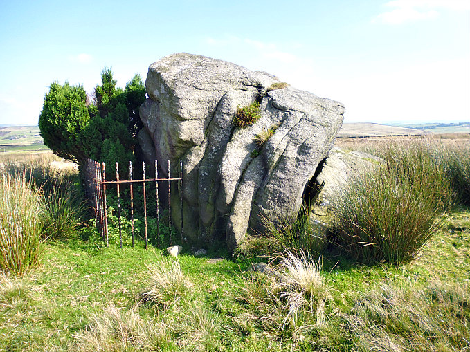
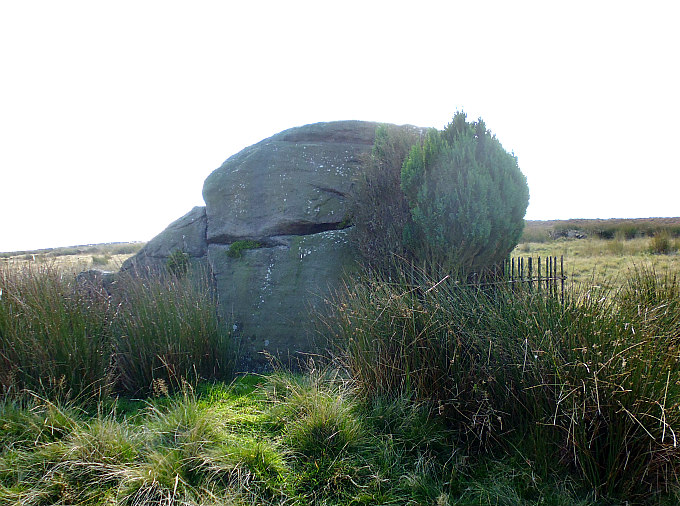
Kid Stone on Sutton Moor, West Yorkshire.

Kid Stone on Sutton Moor, West Yorkshire.

   OS grid reference: SD 99631 41759. A glacial erratic rock at the east side of Kid Stone Hill, above Long Gate, on Sutton Moor, West Yorkshire. It has been a parish boundary stone and way-marker for a long, long time, although the actual boundary is ‘now’ some distance away to the south. There are “possible” faint cup-markings on the flat side of the rock, and at the other side there is a curious granite memorial stone to a local sheep farmer and a yew tree within some iron railings. The ‘Kid Stone’ might get its name from ‘a young goat’, or maybe some other localised name – similar perhaps to ‘Buck Stone’, ‘Cat Stone’ and ‘Wolf Stones’ to name but a few on the moor. To reach the stone: follow the footpath from Buckstone Lane towards Hitchin Stone, then south-east towards Quicken Stone, and then via off east across the moor onto Kid Stone Hill – the stone is in front of you. Or take the footpaths going north-west from Long Gate just above Far Slippery Ford.

Kid Stone on Sutton Moor (with yew tree).

Kid Stone on Sutton Moor (with yew tree).

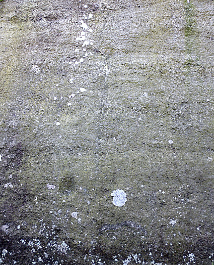
Kid Stone on Sutton Moor (possible faint cup-marks)

Kid Stone on Sutton Moor (possible faint cup-marks)

   The weather-beaten glacial erratic boulder known as ‘Kid Stone’ stands on the eastern side of Kid Stone Hill, on Sutton Moor. It stands upon the windswept moor at around 352 feet and is over 1,100 feet above sea level. Originally, this large gritstone rock marked the parish boundaries of Sutton and Newsholme, but today this boundary is a hundred yards or so further to the south. Geologically speaking the boulder was deposited here by a retreating glacier moving in a southward direction some 12,000 years ago; this glacier is sometimes referred to locally as ‘the Giant of Rombald’s Moor’ – to the north-east – as it came from there, although the boulder might have been scooped up from somewhere else along the way! The boulder is heavily worn, cracked, and has large grooves and channels running down its sides due to weather-related erosion (lots of rain). On its flat face there are a few “possible” faint cup-marks, or are these perhaps just more signs of erosion? 

   At one side of the boulder, inside some iron railings, there is a small yew tree growing and down at the base an odd/curious granite memorial stone to a local sheep farmer, Walter Rochester Airey, who died in 1994, but in what circumstances is not known. He lived at the farm back up the lane: New Bridge Farm on Buckstone Lane, Sutton-in-Craven. The memorial message on the stone says:- “In Loving Memory of Walter Rochester Airey, d 1994.”

Sources of information and related websites:-

https://www.sutton-in-craven.org.uk/historyDR.asp

https://en.wikipedia.org/wiki/Sutton-in-Craven

© Copyright, Ray Spencer, 2016.


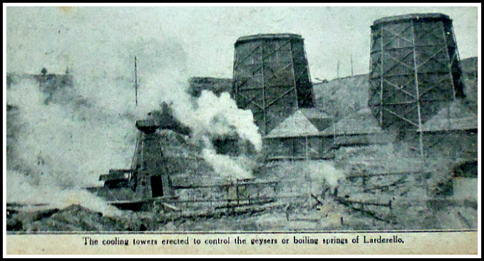
Harnessing a Volcano by Fabricio Sarti.

Larderello, Italy (volcanic geyers & cooling towers).

Larderello in Italy.

“The following is an account of the remarkable industrial and commercial uses to which Italian engineers have succeeded in putting the volcanic forces which exist in the sub-soil of certain parts of Italy, together with some of the grotesque mishaps which were brought about by the applica-tion of volcanic power to domestic purposes.

    “If you could be heated, laundried, lighted, bathed, and have your cooking done, without any trouble, and all for next door to nothing; if into the bargain you could raise spring cabbages for a mere trifle, and new potatoes all the year round, not to speak of obtaining all the motive and hydraulic power you required, you would probably wish to move into a neighbourhood where such desirable conditions prevailed.

    “As a matter of fact, there is a place where all this—and a great deal more exists, but it is situated in a somewhat inaccessible part of Italy, rather too far off, under existing conditions, to catch the Tube to the City, or the Elevated Railroad to Broadway.

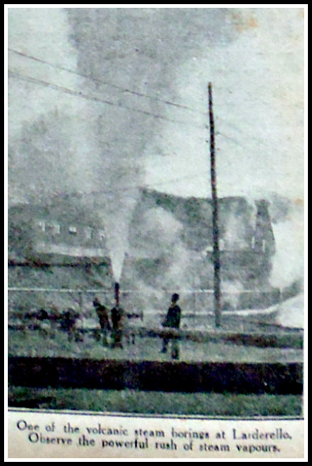
Larderello, Italy, (volcanic steam geyser).

Larderello, Italy, (volcanic steam geyser).

   “The district of Pisa, in Tuscany, is largerly of volcanic origins. In some parts of the province, and more especially in the neighbourhood of the little town of Larderello, the boiling  springs which exist in the subsoil issue to the surface in the form of numerous and powerful “gushers” or “geysers” of hot  vapour or steam. These gushers, or jets of steam, are known locally as “saffioni,” and the evaporated steam finds its way into a large number of small pools or “lagoni.” Though these jets of steam issuing through fissures in the granite, must have existed for many thousands of years, it was not  until about a hundred years ago that they were discovered to contain a substance of great commercial value. Some scientists visiting the pools, or “lagoni,” found out  that the waters contained, in a state of dissolution, a very considerable quantity of boracic acid. It was soon discovered that the boracic acid came from the jets of steam issuing from the soil near by, and, provided means could be invented to evaporate the waters of the “lagoni,” the boracic acid would fetch a good price.

   “Boracic acid was discovered in 1702, but as it has never been found possible to synthesize the product with a view to its artificial manufacture, chemists are dependent upon natural sources for its supply. Until comparatively recent times, boracic acid was in great request as an antiseptic, but has now been replaced by other and more powerful substances. Boracic acid continues, however, to be in great demand, both in its crude form and in the form of the various boraxes derived from it, for soldering, enameling, glazing, and dyeing purposes. It is likewise used in the manufacture of soap, and even as a substitute for that useful article.

   “Most of the boracic acid in use to-day comes from Italy, especially from the Pisa district. Recently, huge deposits have been located in Asia Minor, but the war has prevented the development of these deposits for industrial purposes.

   “The “saffioni” found around about Larderello are saturated with the acid, which, as the steam evaporates into the pools, settles at the bottom of the “lagoni.” It is supposed that the streams of hot steam passing at great pressure, and at a high temperature, through the underground fissures of the rock, act as a dissolvent upon the tourmaline in the granite, and separate the acid from the boron, carrying it automatically along to the surface.

   “The first attempts made to evaporate the waters of the “lagoni,” so as to secure the acid, were very primitive. Ovens were bored around the pools. These ovens were filled with wood, and kept alight until the waters had evaporated. This was a long and tedious process, and by the time the boracic acid was secured it proved so costly as scarcely to pay for production.

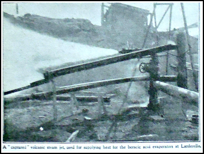
Larderello, Italy (a captured volcanic steam jet).

Larderello, Italy (a captured volcanic steam jet).

   “Other and more modern processes were afterwards tried, but none of them proved satisfactory until an Italian engineer hit upon the very simple idea of utilizing the “saffioni,” or steam jets themselves, as the heating power for the evaporization of the acid-laden waters. The natural pools into which the jets of steam projected the acid they contained were abandoned altogether, and around the aperture of each “saffioni” or jet of hot vapour, as it issued from the soil, there were built small reservoirs of rough masonry jointed with clay.These were filled with water from the pools, and the action of the hot vapour churning the water soon brought it almost to boiling-point. At the end of twenty-four hours it was found that the water contained about one and a half per cent. of acid. By means of a wooden pipe the water was conveyed into a second reservoir built round a second “saffioni,” where it was further enriched by acid. After being transferred into half-a-dozen different reservoirs built round different jets, the water was sent into a decanting tub or basin, where it deposited the earthy impurities held in suspense.

   “From the decanting basin the water is sent into special evaporators. These evaporators consist of long wide sheets of un-dulated lead, two hundred and fifty feet in length and eight feet wide, turned up at each side. These leaden sheets are placed on an incline, and the acid-charged waters trickle slowly over the wavy sheets of lead, which are heated by hot steampipes passing underneath. As the acid-charged water trickles over the hot, wavy, leaden plates it evaporates under the action of the heat, and deposits the boracic acid.

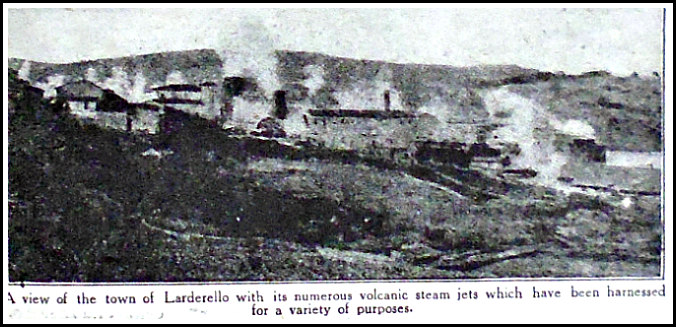
The Town of Larderello, Italy, with its volcanic steam geysers.

The Town of Larderello, Italy, with its volcanic steam geysers.

   “The hot steam is derived directly from the natural vapour underground, but instead of utilizing the ordinary “saffioni,” or vapour-jets, for the purposes, it was considered preferable to make separate artesian borings to a distance of one-hundred feet or so underground. The steam was tapped with such force, that unless special precautions had been taken beforehand the rush of subterranean vapour would have caused a serious accident. Indeed, the artesian borings brought up steam-jets with a pressure of no less than nine atmospheres at a speed of one-hundred and seventy-five yards to the second, and at the great heat, in some borings, of one-hundred and ninety degrees Centigrade or six-hundred and forty degrees Fahrenheit.

   “The discovery that such vast subterranean power lay at the disposal of the engineers soon led to the installation of powerful dynamos. It was first found necessary to purify the stream of its gaseous matters, for otherwise the machinery would have quickly become corroded.

   “Within a few years the engineers had tapped, by short artesian borings, quite a number of “hydro-volcanic” power-jets. A single one of these, the “Ponta Anna” bore, produces two-thousand three-hundred horse-power, whilst another, the “Venella” bore, produces one-thousand two-hundred and sixty horse-power. 

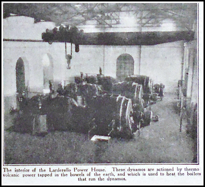
Interior of the Larderello power house.

Interior of the Larderello power house.

   “The power-houses were soon supplying hydro-volcanic energy to a considerable number of factories, and in what was formerly a deserted district there sprang up the town of Larderello. Not only so, but there ensued the natural desire to turn this volcanic power to domestic use, and some of the engineers and factory managers had their dwellings fitted up with piping, so as to get heat in winter and fuel for cooking, for the heat is sufficiently great to bake a joint in an oven in half an hour. It is, however, dangerous to “monkey about” with the subterranean forces of Nature, and early experiences were accompanied by a number of accidents and mishaps.

   “One of the factory engineers, whose house had been fitted with the hydro-volcanic heating apparatus, was aroused in the middle of a heavy sleep by a roaring sound like a locomotive blowing off steam. He turned on the electric light—which was also supplied by the dynamos worked by volcanic power—to discover a geyser of boiling water bubbling up in the middle of his bedroom and filling the room with steam. He had just time to jump out of bed and make his way out into the street in his dressing-gown, when the geyser assumed gigantic proportions and burst with a roar through the roof of the house, soon reducing the entire building to pulp. It seems that, in some way, the control cap of one of the main tubes, as the steam issued from the bore, had become partially unscrewed, with the result that the full force of the bore had found its way into the engineer’s house and burst the hot-water piping under the floor of his bedroom.

   “It took several hours before the geyser could be got under control.

   “On another occasion an Italian cook, on returning from market and entering her kitchen, was horrified and amazed to discover the whole of her pots and pans on the long kitchen range jumping about as though bewitched. The range was heated by steam radiators from one of the volcanic bores, and the metal of the radiators was of an undulating wavy form. Owing to a sudden increase in the subterranean velocity of the steam jet from the bore, the steam had ruptured the control cocks and had come throbbing through the heaters in jerks, imparting a gyratory movement to every one of the kitchen utensils on the range.

   “One morning, too, a stout factory manager had such a fright, whilst in his bath, that he resolved never again to take any baths the water of which was supplied by hydro-volcanic process. The bath was fitted with a hot and cold douche apparatus which, instead of descending from the roof over the bath, came from an aperture in the bottom of the bath-tub, in the form of an “ascending” douche, as it is called.

   “On that particular occasion the main geyser from one of the bores had suddenly taken on a “spurt” of two or three minutes, causing the hot water in the main pipe to rush with increased velocity, and rupturing the control tap. The water, in the form of a hot and cold mixed “douche,” suddenly shot up from below the bath with such tremendous force as to rupture the rivets and send the man taking his bath three or four feet into the air before he could recover himself. Happily the mixture of cold with hot water prevented what might have been a serious accident.

   “The municipal laundry, in which all the hot water is supplied from the bores, is another luxury due to the existence of hydro or thermo-volcanic power. Before the scientific system of controlling the steam at the output of the bores was brought to its present state of perfection, it not infrequently happened that a sudden wave  of “power” would play havoc with the machinery which supplied the hot water to the laundry. On one occasion all the “laundry” of the town of Larderello was sent flying in all directions, and there being a high wind blowing at the time – many of the articles were recovered in the plain several miles away. All these little mishaps no longer occur, so perfectly are the main thermic-power bores now under control. 

   “The Larderello “saffioni” are invaluable to the local market gardeners, who are so able to regulate the heat of their hot-houses as to produce fruit and vegetables in abundance all the year round.

   “The Larderello vapour jets and the intelligent industrial use to which they have been put by Italian engineers have attracted the attention  of scientists to the immense possibilities that lie in the systematic and rational utilization of the hidden subterranean forces of Nature.”

Source of information:-

Sarti, Fabricio, The article ‘Harnessing a Volcano’ was published in ‘The Wide World Magazine – An illustrated Monthly Of True Narrative’, Vol. XLII – October 1918 To March 1919. George Newnes Ltd., Southampton St., Strand, London.

                                                                  © Ray Spencer, The Journal Of Antiquities, 2016.


1 Comment

Doubler Stones, Addingham High Moor, West Yorkshire

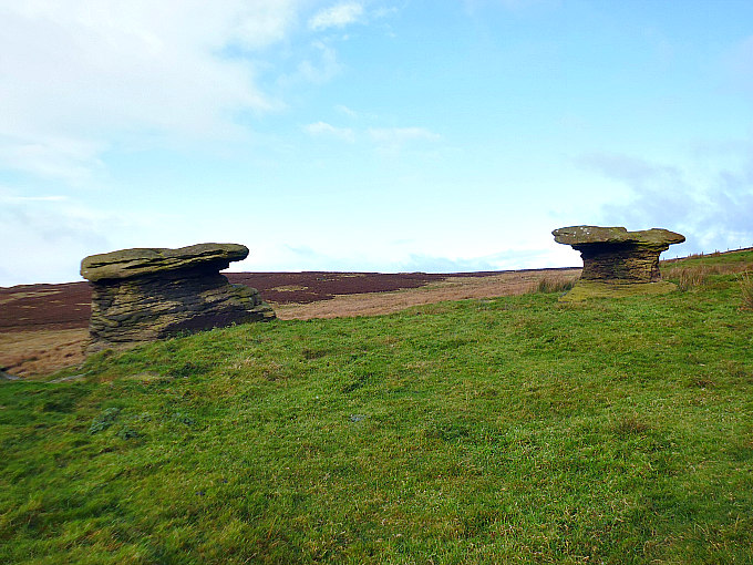
Doubler Stones on Addingham High Moor, west Yorkshire.

Doubler Stones on Addingham High Moor, west Yorkshire.

   OS Grid Reference: SE07230 46525. On the windswept Addingham High Moor, west Yorkshire, there stands the heavily weather-worn rocks known as ‘Doubler Stones’ – part of an outcrop of grit and sandstone rocks; their enigmatic rock-shapes being something of a great curiousity to moorland walkers down the years. These strange, weathered stones lie at the south-western edge of Rombald’s Moor. At least one of the Doubler Stones has cup-and-ring carvings, and a few other rocks here and further up the hill might have “possible” faint cup-marks. To reach the stones from the town of Silsden: take the Bolton Road going north-east, then east along Brown Bank Lane, then take Light Bank Lane over the moor to the south-east. Just after White Crag House: take the concrete track up to the gate, then walk along here to the house on the left. Take one of two footpaths north for a short while to Doubler Stones. 

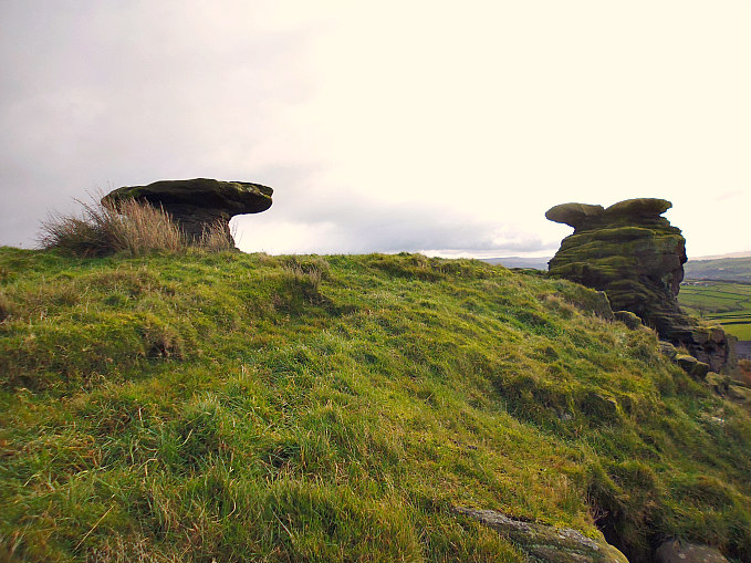
Ghostly shaped Doubler Stones in west Yorkshire.

Ghostly shaped Doubler Stones in west Yorkshire.

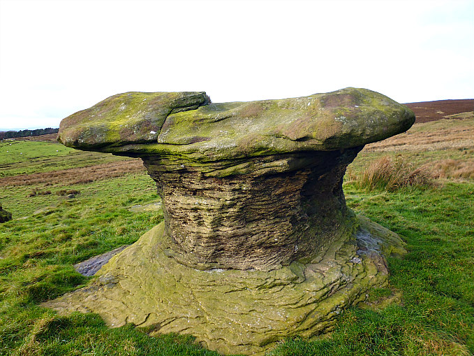
   These strange-shaped rocks are part of an outcrop of gritstone and sandstone rocks that stand like weather-worn sentinels watching over the moorland. They have taken on the shape of giant mushrooms or salt and pepper pots, but here they are locally called ‘Doubler Stones’ but whether this is because there are two of them – is not certain. It’s more likely that the name “Doubler” is derived from saucer or dish-shaped stones and this is indeed what they are; the tops of the stones are gritstone rocks that are now eroded and saucer-shaped, while the lower parts are made of very soft Sandstone, and this is why the middle sections have eroded down quite severly and become, over thousands of years, like ‘thin waistlines’ or bottle-neck shapes. One of the Doubler Stones has what looks to be a cluster of tiny cup-marks and a few other “possible” cups with rings and interlinking channels or grooves. A few other rocks here might have faint cup-marks – although these could be geological features. Another outcrop of rocks just up the moor to the east is also of interest as there are a few more “possible” cup-markings on the larger rocks.

One of the Doubler Stones on Addingham High Moor.

One of the Doubler Stones on Addingham High Moor.

   The author Paul Bennett in his renowned work ‘The Old Stones of Elmet’, gives his account of Doubler Stones: “One of the stones is a giant earth-fast mushroom, eight feet tall, whose upper surface is covered in a number of cup-markings. Ten yards away at the small crag we find the second Doubler Stone, atop of which are two large ‘bowls’ and perhaps some faint cup-markings, but these are debatable.” Bennett goes on to say that: “Nicholas Size (1934) described the stones to be haunted. It is very likely that this site would have possessed the spirits of some ancestral being, hero or other diety in ancient times. Ritual magickians have used the Doubler Stones to great effect. Amidst a decidedly yin landscape, the Doublers intrude with a potent yang quality. A brilliant site and well worth visiting!”

Sources and other related websites:-

Bennett, Paul, The Old Stones of Elmet, Capall Bann Publishing, Milverton, Somerset, 2001.

Doubler Stones, Ilkley Moor, West Yorkshire

http://www.stone-circles.org.uk/stone/doublerstones.htm

http://www.happyhiker.co.uk/MyWalks/WestYorkshire/SteetontoIlkleyviaDoublerStones/Hiking%20Pages%20-%20Steeton%20to%20Ilkley%20via%20the%20Doubler%20Stones.htm

                                                                          © Copyright, Ray Spencer, The Journal Of Antiquities, 2016.


The Lake of Soda by George Frederic Lees

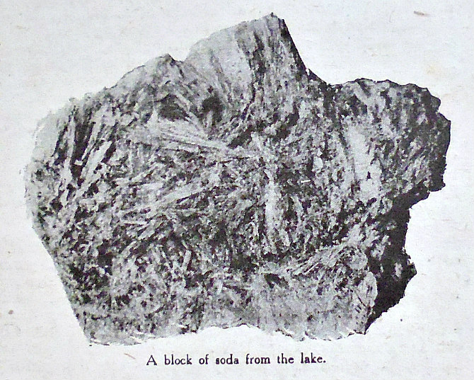
A block of Soda from the lake.

A block of Soda from the lake.

                               The Story of a Wonderful Natural Curiosity of British East Africa                                      “The following  article is a  striking instance of  the immense and  sometimes  inexhaustible wealth which is waiting to be exploited in British possessions in Africa. Much of that wealth is  still hidden, but in the case of Lake Magadi—a lake of solid natural soda covering an area of some thirty square miles—it was there for any enterprising explorer to discover and report to the right quarters. The story of the commercial development of this great Colonial asset adds a fresh chapter to the ever-enthralling romance of British industry.

   “In every quarter of the City of London, Romance is to be found by those who search for it dili-gently. Many an engrossing story of adventure or exploration, involving the lives of men, the overcoming of wellnigh insu-perable difficulties, and the expenditure of vast sums of money, which in itself  required no small amount of courage, lies hidden in office records, until the historian of the so-called minor events of the world happens upon it and forthwith disen-tangles it from a mass of commercial verbiage, always tedious of perusal and often covered with the dust of years. A romantic episode may lurk beneath the most innocent-looking phrase in the minute – book of a board of directors—some such common-place note as this:

    “”The attention of the board, at its meeting on such-and-such a date, was called to the commercial possibilities of this or that, in consequence of which they decided to dispatch a confidential agent to the spot mentioned to verify the statements made to them.”

   “Could there be a less promising starting-point for a story of discovery and adventure? So devoid of the slightest tinge of romance is such a bald statement that there is a risk of the searcher passing it over disdainfully. And yet, if he continues his investigations, he may indeed find that a very pretty tale of human endeavor, coupled with the unfolding of many curious said-issues, hangs thereon for his own and his readers’ delectation.

   “To take a concrete case, it happened that, some ten years ago, a certain explorer entered the office of a firm of City mer-chants, and made certain “”representations of the great importance and value”” of a curious lake in British East Africa. So it was set down in the minute-book, but what he actually said to the heads of the firm was somewhat as follows:—

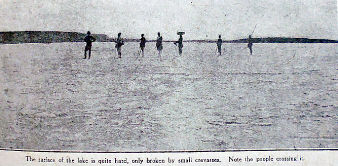
Lake Magidi in Uganda.

Lake Magadi in Uganda.

   “”The lake looks for all the world like an ice-field, and when the photographer showed us his  prints I might have imagine, but for the figures of the natives with their bare legs and scantily-clothed bodies, that we were a part of explorers in the Arctic regions. Mile upon mile of the great white expanse of soda and the hot springs of Magadi stretch around, with here and there a big block of alkaline deposit. A most remarkable sight. There must be millions upon millions of tons of the stuff. Of course, it opens up vast possibilities commercially. Only you will have to get the soda to the coast and so on to the ships, and that means building a branch to the Uganda Railway’s ocean port at Kilindini, or thereabouts.”

   “This declaration naturally aroused the greatest interest. It is not every day that a discovery with “vast possibilities commercially” is announced in the City, and if this lake of soda did really exist, was not a mere figment of the explorer’s imagination, his listeners had no need to be told that it might become a veritable gold-mine. The demand for soda is universal. Instinctively the partners began to pass the manifold users of soda in review.

   “Soda crystals are used in practically every household the world over for washing purposes. Carbonate of soda (otherwise known as soda ash) and caustic soda are largely used in numerous industries, as, for instance, by soap, glass, and paper makers, as well as by textile manufacturers for printing, bleaching, and dyeing, etc; whilst bicarbonate of soda is used for the manufacture of baking powder and mineral water.

   “The prospect was alluring. True, this commercial proposition  would mean the investment of a few hundred thousand pounds—probably up to half a million sterling—in addition to a good deal of hard work. But think of the return : a steady annual profit running into millions ! Unquestionably (the firm decided, after discussing the matter in all its bearings) they must institute an inquiry and, if the report they had heard were substantiated, see what could be done to secure the rights over these invaluable soda deposits.

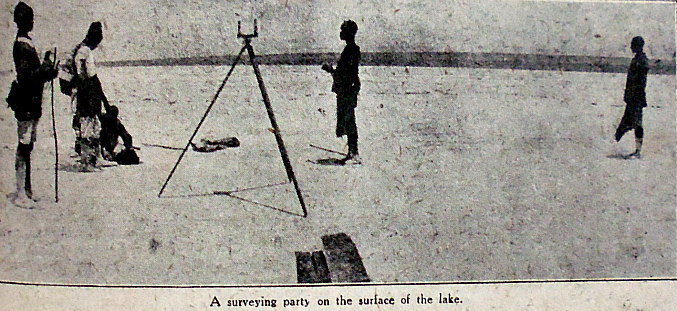
Surveying party on Lake Magadi in Uganda.

Surveying the lake.

   “Accordingly, Messrs. M. Samuel and Co. sent a confidential representative to British East Africa to verify the explorer’s statements. And this he did, many months later, by bringing back with him large samples taken from thirty-five different places over the whole area of Lake Magadi, which he described in even more glowing colours than his predecessor had done.

   “This conclusive evidence clinched the matter. The firm at once entered on protracted negotiations with the Colonial Office, and obtained from the Crown Agents for the Colonies, acting on behalf of the Government, an agreement, giving them the option of acquiring  direct from the Government about three hundred and twenty-four square miles of territory, including Lake Magadi, for a period of ninety-nine years, with the right of working the soda (subject to the rights of natives to take soda from the deposit for their own purposes), and of constructing a line of railway connecting the deposit with the main line of the Uganda Railway.

   “These preliminary steps having been taken, a fully-equipped surveying expedition was sent out in November, 1909, under Mr. Frederic Shelford, a well-known railway engineer who had done valuable survey work in Africa. The other leading members of the expedition were Mr. W. H. Levy and Mr. A. E. Herz, two directors of the company that had been formed to exploit the lake of soda; Mr. A. H. Endemann, who had studied on the spot the question of the most suitable mechanical appliances for dealing with the deposits; and Mr. Arthur Trobridge, who  had been engaged in the soda business for many years, and whose report was therefore looked forward to with considerable interest.

   “The expedition reached its destination, after an uneventful march from Magadi Junction, the nearest point on the Uganda Railway, on December 1st, and found , immediately prior to its arrival, that considerable rain had fallen. Consequently the whole of the lake, inclusive of some sand flats at its southern end, was covered with water, in depth from six inches to one foot. This was distinctly disappointing. However, it soon became evident that this was only a temporary inconvenience, and, indeed, by the time the explorers left the district ten days afterwards the water had considerably subsided, and a large area of the surface was already dry.

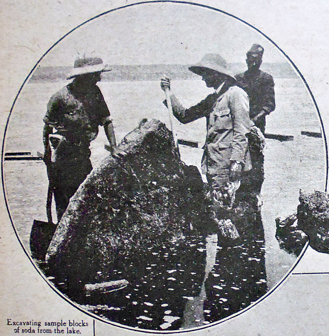
Excavating soda blocks from Lake Magadi.

Excavating soda blocks from Lake Magadi.

   “According to Mr. Trobridge, who drew up an exceedingly interesting report, the surface of the lake always become dry in this way shortly after the stoppage of the rains; and this conclusion was borne out by his former visit in October, 1904, “”when the whole of the surface was dry with the exception of a margin about thirty yards wide. The solid portion, which comprised practically the whole of the lake, was perfectly level and dry on the surface; but wherever the surface was broken up liquor rose to its level, and when the crystalline blocks were removed the liquor drained from the interstices of the crystals. The great purity of the crystalline soda is un-doubtedly due to the presence of this comparatively large quantity of soda in solution —technically known as ‘mother liquor’—distributed throughout the mass. Apart from the fact that the surface of the soda deposit becomes dry very soon after the rains have ceased. I also ascertained that during the rains the surface is never covered with so much water as to interfere in any way with the economic working of the deposit. For many years Indians have been removing soda from the lake, and they do so without paying any attention to the season.”

   “As to the chemical and physical character of the soda, they were found to be uniform over the whole surface of the deposit, as has been confirmed by the examination of numerous samples taken at widely-distant points both in 1909 and on the occasion of Mr. Trobridge’s previous visit in 1904. The crystalline deposit cleaved readily into blocks from which the “mother liquor” drained rapidly, leaving a friable mass of crystals.

   “The explorers also came to the noteworthy conclusion that there was good reason to assume that the deposit of soda extends to the full depth of the lake, the above-mentioned “mother liquor” only filling the interstices of the crystals. They sank a bore-hole in the lake through a continuous mass of crystalline soda to a depth of nine-feet, but with the primitive boring tools at their disposal they found it very difficult to proceed farther. Indeed, in view of the enormous bulk of soda thus disclosed they saw no practical object to be attained by boring to a greater depth.

   “Further, there were evidences, runs the report, that the quantity of soda already in the lake is being continually augmented. In addition to many surface springs and streams discharging considerable quantities of soda into the lake, there were evidences of large springs in the bed of the lake itself, which intrude saturated soda liquor. On the removal of the soda already crystallized the liquor which takes its place at once starts to reform the crust. The Indians engaged in this soda industry informed Mr. Trobridge that the crystalline mass is replaced so rapidly that they rework the same spots year after year. Of this he found full confirmation on examining several poles which they had been using to break up the soda and had left in the holes thus made. These poles were firmly set in a solid mass of crystals which had been formed around them, and Mr. Trobridge and his colleagues removed several large blocks of soda in which such poles were embedded. On examination they found this reformed soda of the same composition and purity as the permanent deposit.

   “In view of the fact that the crystalline soda is divided into several distinct horizontal layers, which are readily separated from each other, and for economy in working. Mr. Trobridge recommended that operations be confined to the upper layers, which he estimated contain about forty million tons in sight. As this vast quantity would be continually replaced, the lower layers would appear to have little more than theoretical interest. Should, however, it be deemed necessary to work these lower layers to the depth of nine feet, as disclosed by their bore-hole, he estimated that the total crystalline soda would be about two hundred million tons.

   “Two hundred million tons of soda capable of being converted, by very simple treatment, into a “soda ash” of great density, and equal in chemical purity to any soda ash on the market—a practically inexhaustible stock, since, as soon as part of the deposit is removed, it begins to form again. Think of the enormous profit to be drawn from such a source of wealth as that. Counting all expenses, the fortunate merchants who had got wind of this business deal came to the conclusion that a profit of at least twenty shillings per ton of soda products might be expected. Rarely does it fall to the lot of a City firm to see a profit of at least two hundred millions sterling in view.

   “Mr. Frederic Shelford’s report on the feasibility and cost of constructing the branch railway whereby the vast soda deposits of Lake Magadi could be rendered accessible was equally encouraging. He examined the country between the lake and the Uganda Railway, and eventually selected a route which was afterwards carefully surveyed in detail by the railway survey party.

   “No further evidence was required to prove that a great industrial future awaited the properly-organized exploration of this lake of soda of British East Africa. So work was started on the railway, which in due course was completed; wharves at the coastal terminus and oil tanks at Kilindini were constructed, and works, offices, etc., were erected at Magadi. Moreover, the company that had been formed erected extensive works at Irlam, near Manchester, and in Calcutta for the manufacture of soda crystals and bicarbonate of soda from Magadi soda ash. In brief, after 1911-12 the business was in full swing and quickly proved that those who had embarked on the enterprise were not mistaken in taking a sanguine view of the future prospects of this part of East Africa. But with the coming of war, work was naturally interfered with. Lake Magadi, lying within thirty miles of the frontier of German East Africa, came within the war zone, and what that means need not be unduly dwelt upon. Suffice it to say that the branch line from the lake to the Uganda Railway and vice versâ was found useful for the transport of other things than soda.”

Source of information:-

Lees, George Frederic, The article ‘The Lake of Soda’ was published in ‘The Wide World Magazine – An Illustrated Monthly Of True Narrative’, Vol. XLII – October 1918 To March 1919. George Newnes Ltd., Southampton St., Strand, London.

                                                 © Ray Spencer, The Journal Of Antiquities, 2016.


Dragon Stone, Near Steeton, West Yorkshire

Dragon Stone - cup-marked rock near Steeton, west Yorkshire

Dragon Stone (cup-marked rock) near Steeton, West Yorkshire

    OS grid reference: SE 03604 03695. In a farmer’s field above Little Snowden Hill, near Steeton, west Yorkshire, there is a cluster of rocks in an area of rough ground which have prehistoric cup-marks, one of these rocks being locally known as ‘Dragon Stone’. And in the next field along there is another cluster of rocks which also look to have faint cup-marks. This so-called ‘Dragon Stone’ has several quite prominent little cups and there are also some grooves which may be part of the carvings here. However, these carved rocks are on private farm-land and there is no designated footpath. To reach the rocks you “might” be able to walk along the overgrown track leading off from Hollins Bank Lane, nearly opposite the entrance to Tower Farm, if the wooden gate opens? Walk along the track past the house and barn of Hollins Bank Farm, then soon after the wooded area you’ll need to via off across the field to the south for 90m beyond the first field wall. Otherwise, you’ll need to find another way of reaching the site from the lane, if that’s possible?

Dragon Stone, near Steeton, west Yorks.

Dragon Stone, near Steeton, west Yorks.

Cup-marked rock opposite Dragon Stone.

Cup-marked rock opposite Dragon Stone.

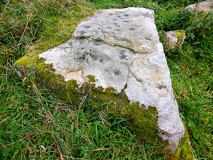
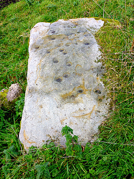
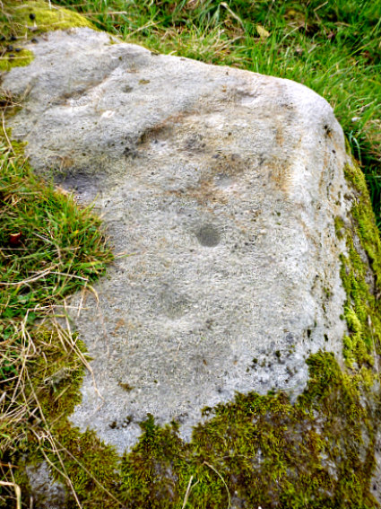
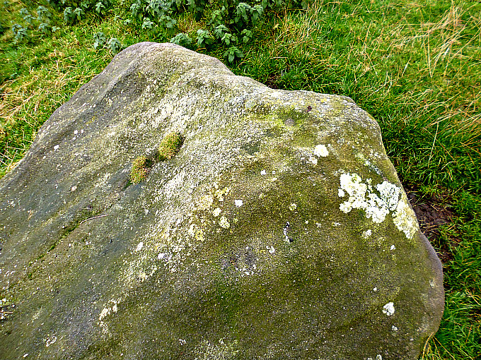
    In the corner of a farmer’s field above Little Snowden Hill there is an outcrop of gritstone rocks, or a cluster of rocks maybe. One of these known as ‘Dragon Stone’ bears many ancient cup-markings (rock-art). There are as many as 20 cup-marks on the this worn, flat rock, and around the sides and in the middle there are faint grooves running in a sort of circular fashion, but whether these were caused by erosion, or whether they are part of the carving, is not really known; and there is a crack in the rock which adds to the strange look of the stone. And why it is locally called ‘Dragon Stone’ is not known, although the rock might take on the look of a dragon at certain angles. On another rock, just opposite, and close by the wall there are a few more cup-marks, maybe up to 4 or more, although these can only be seen in a certain light and at an angle. This rock also has one or maybe two faint bowl-shapes made by erosion though these are often hidden away under a layer of lichen and grass. In the field beyond the wall (at SE 0354 4360) another cluster of rocks, one of which at least shows signs of a few faint cup-marks.

Sources and related websites:-

Dragon Stone, Steeton, West Yorkshire

Bowl Stone, Steeton, West Yorkshire

https://en.wikipedia.org/wiki/Steeton,_West_Yorkshire

© Copyright, Ray Spencer, 2016.


Cob Stone, Near Far Slippery Ford, Newsholme Dean, West Yorkshire

Cob Stone near Grey Stones Lane, Far Slippery Ford.

Cob Stone near Grey Stones Lane, Far Slippery Ford, west Yorkshire.

    OS grid reference: SE 00549 40890. In a field beside Grey Stones Lane and below an outcrop of rocks called Grey Stones Hill, near Far Slippery Ford, west Yorkshire, is a gritstone rock that is locally called Cob Stone. Whether it takes its name from a small round loaf of bread, or something else, I don’t know with any certainty, but I am also told that the word “Cob” means ‘Devil’ in this part of the country, so it could mean “Devil’s Stone”. The rock has a cluster of quite well-defined cup-marks on top and maybe a few fainter cups-marks lower down. To reach the stone you can take the footpath going east from Long Gate Lane at Far Slippery Ford. This will bring you to the bottom of the field. Other than that, you could see if the wooden gate opens on Grey Stones Lane next to the track going down to Grey Stones Farm. If it opens, then please make sure it is secured after entering, and on going back out again!

Cob Stone, beside Grey Stones Lane (cluster of cup-markings).

Cob Stone, beside Grey Stones Lane (cluster of cup-markings).

Large boulder near Cob Stone (with pos- sible cup-markings)

Large boulder near Cob Stone (with “possible” cup-markings).

    Cob Stone or Devil’s Stone is a glacial erratic gritstone rock that was deposited by a retreating glacier many thousands of years ago at the end of the last Ice Age. On top of the stone there is a cluster of 7 or 8 small cup-marks and further down a few fainter cups can just be made out. However, these faint cup-marks might have been caused by erosion – it’s often difficult to tell one way or the other, and the rock itself is now very smooth on its side due to thousands of years of weathering. Some 68m to the south-west there is an even larger boulder; maybe it’s another Cob Stone?, and this is indeed roughly shaped like a loaf of bread! This large boulder looks to have a few cup-marks on top and on its side, or are these due to erosion? And there are a few other rocks in the same field that have “possible” cup-markings; it’s just a case of walking around and looking closely at the many small and large rocks, and there are indeed “many” to look at. Cob Stone is recorded in Boughey & Vickerman’s  2003 survey.

    And of further interest to the lover of rock-art is another large rock some 80 metres to the south-east. This can be found at the north side of the large barn belonging to Greystones Farm. See the link below:-

Cup-Marked rock in the field near Cob Stone.

Cup-Marked rock in the field near Cob Stone, Grey Stones Lane near Far Slippery Ford.

Stone near Cob Stone (possible faint cup-marks)

Stone near Cob Stone at Grey Stones Lane, Far Slippery Ford (possible faint cup-marks)


Sources and related websites:-

Cob Stone Field, Keighley, West Yorkshire

Greystones Farm Cup-Marked Rocks, Near Newsholme Dean, West Yorkshire

                                                                            © Ray Spencer, The Journal Of Antiquities, 2016.


Greystones Farm Cup-Marked Rocks, Near Newsholme Dean, West Yorkshire

Greystones Farm Cup-Marked Rock (beside the large barn).

Greystones Farm Cup-Marked Rock (beside the large barn).

    OS Grid Reference: SE 00621 40844. Located beside the large barn of Greystones Farm, on Greystones Lane, is a gritstone rock which has several prehistoric cup-marks. A few other rocks is the same field also appear to have faint cup-marks, and one of these large rocks, locally called Cob Stone, also has “possible” cup-marks. Just above the farm there is an outcrop of gritstone rocks called Greystones Hill. The farm is a ¼ of a mile north of Far Slippery Ford, and the hamlet of Newsholme Dean is about 1 mile to the east on Todley Hall Road. To reach the site travel down Long Gate, then onto Coppy Lane and then Greystones Lane. Walk down the rough farm-track towards Greystones Farm, making sure the wooden gate is secured behind you. Via off the track to the large barn on the left – the cup-marked stone is beside this barn. You can also reach it via the footpath from Long Gate at Far Slippery Ford.

Greystones Farm Cup-Marked Rock (beside the large barn).

Greystones Farm Cup-Marked Rock (beside the large barn).

Greystones Farm Cup-Marked Rock (close up)

Greystones Farm Cup-Marked Rock (close up)

    Located at the north side of  Greystones Farm barn is a  large, weathered gritstone rock bearing several well-defined ancient cup-marks: as many as 15 tiny cups on the flat face of this soft rock. What these carvings represent we don’t really know: maybe they represent a sort of map of the stars, or they are just ancient graffiti or doodlings, or they are a map showing ancient springs, caves, or trackways.  Or do they perhaps represent something  else.  The whiteness, or greyness, of the rock is caused by weather related exposure over thousands of years – the exposed parts of the rock have been washed by rain to the colour that we see today, and so we have “greystones” which is sometimes spelt as “graystones”. A few of the larger rocks up the slope of the same field appear to also have cup-marks, although now very faint. One stone in particular called Cob Stone, near the top of the field at the other side of the track (SE 00553 40888) has eroded cup-marks on top. These cup-marked rocks were recorded and numbered by Boughey & Vickerman in their survey of 2003. (See The Northern Antiquarian link below).

Sources and related websites:-

Cob Stone Field, Keighley, West Yorkshire

http://www.pastscape.org.uk/hob.aspx?hob_id=1084602

                                                                   © Ray Spencer The Journal Of Antiquities.


1 Comment

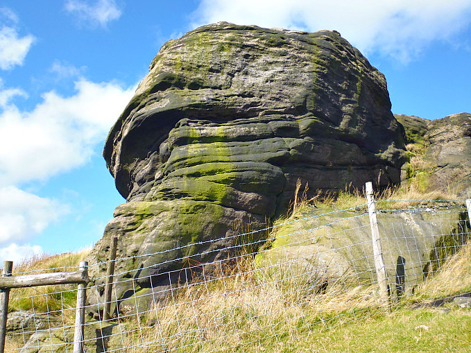
Hawks Stones, Stansfield Moor, Near Todmorden, West Yorkshire

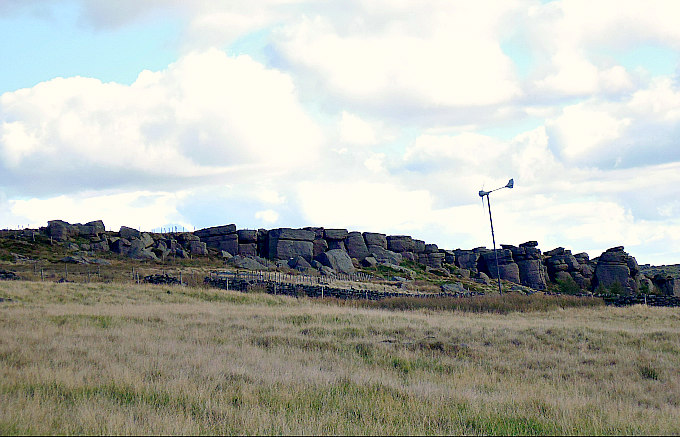
Hawks Stones (as seen from Kebs Road, near Todmorden).

Hawks Stones (as seen from Kebs Road, near Todmorden).

Hawks Stones, near Todmorden (strange shaped rocks).

Hawks Stones, near Todmorden (strange shaped rocks).

    OS grid reference: SD 9233 2735. A gritstone outcrop at the western edge of Stansfield Moor above Kebs Road, near Todmorden, in west Yorkshire. Like its near neighbour, Bride Stones, Hawks or Hawk Stones has many strange-shaped weather worn rocks and boulders that were first laid-down many millions of years ago, and then fashioned by a retreating glacier during the last Ice Age – some 13,000 to 15,000 years ago. There are the usual naturally-formed rock basins, and a few of the larger boulders appear to have ancient cup-marks, although it is often hard to differentiate between erosion-related holes and man-made rock-art. To reach Hawks Stones take the footpath from Kebs Road going east up the slope near the “old” Sportsman public house, then after 60m follow the ridge – going north-north-east to where you will soon reach the gritstone outcrop. However, the farmer has put up a lot of barbed-wire fencing, which makes it difficult, if impossible, to access some parts of the site.

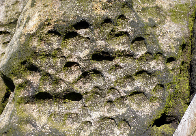
Possible cup-marked rock at Hawk Stones, near Todmorden.

Possible cup-marked rock at Hawks Stones, near Todmorden.

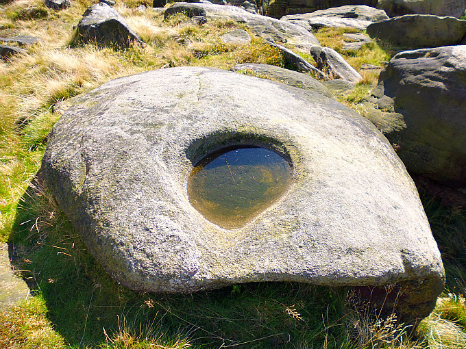
Rock basin at Hawks Stones, near Todmorden, west Yorkshire.

Rock basin at Hawks Stones, near Todmorden, west Yorkshire.

    Hawks or Hawk Stones over to the east of Todmorden is an outcrop of millstone grit rocks and boulders that have taken on the form of some strange and odd shapes over many thousands of years; the erosion caused by weathering has added to the general eerie look of the place, which has, perhaps, been associated with the druids and their ritual and sacrificial worship back in the mists of time. The many rock pools and basins that are worn into the rocks maybe adding to that strange, mysterious feeling that one gets when visiting these lonely, moorland places. Some of the larger rocks and boulders look to have “possible” prehistoric cup-marks, some being more pronounced, while others are much more fainter. Or could these have been made by weather-related erosion over thousands of years? The place-name Hawks or Hawk Stones is thought ‘not’ to be associated with, or named after, the bird of prey!

    The Local author Geoff Boswell in his book ‘There and Back’, thinks that Hawk Stones are well-named: “because this area is the natural habitat of many moorland birds.”

Hawks Stones (naturally formed rock basins).

Hawks Stones (naturally formed rock basins).

Hawks Stones (possible cup-marks, or something else).

Hawks Stones (cup-marks, or something else).

    Author Paul Bennett in his outstanding work ‘The Old Stones of Elmet’, says that Hawk Stones are: “Illustrated on the 1717 Greenwood map, this huge outcrop of rocks was first described as “druidical” by Watson (1775), by inference to the local folklore of them being sites of ancient worship—which they may well have been. These sentiments were later echoed by Crabtree (1836). Then in 1864, the historian and folklorist, Thomas Wilkinson, gave a lecture to the Lancashire and Cheshire Historical Society, where he drew attention to the folklore of  these rocks. He was particularly interested in the “druidical rock basins” carved atop of some of them—or cup-and ring stones. The etymology of the site relates to “hollows” and not hawks as its name implies, which may be a description of such basins.”

Sources and related websites:-

Bennett, Paul, The Old Stones of Elmet, Capall Bann Publishing, Milverton, Somerset, 2001.

Boswell, Geoff, There and Back, Delta G, Todmorden, 2000.

http://www.walkingenglishman.com/westyorkshire02.htm

The Bridestones, Near Todmorden, West Yorkshire

                                                          © Ray Spencer, The Journal Of Antiquities.


1 Comment

Steeling Hill Earthwork, Near Coniston Cold, North Yorkshire

Steeling Hill Enclosure, near Coniston Cold, North Yorks.

Steeling Hill Enclosure, near Coniston Cold (north-side).

    OS grid reference: SD 8859 5515. A large earthwork or enclosure located on the crest of Steeling Hill above the A65 near Coniston Cold, North Yorkshire. This flat-topped hill on the opposite side of the lane from Kelber Farm was once the enclosure, settlement or camp of an ancient tribe, but unfortunately nothing much is known of its history. It was almost certainly a strategically placed encampment overlooking the valley below and in this sense it may have been a defensive site, although its low, almost non existent outer ditch, is barely visible today at ground level. At its centre there is a round-shaped feature but what this was is uncertain. It might actually be a more modern feature.

    To reach the earthwork from the A65 just to the south of Coniston Cold: go along the farm track/footpath nearly opposite The Coniston Hotel towards Kelber farm for 240m, then on the right-hand side go through the gate and head up the grassy hill-side for 220m to a second gate. You can reach the site from here. There is, however, no proper designated footpath up to the hill; and so please remember to ‘fasten the gates’ behind you.

Steeling Hill Earthwork (viewed from the south)

Steeling Hill Earthwork (viewed from the south)

Steeling Hill Earthwork (from the south-west).

Steeling Hill Earthwork (from the south-west).

    This very large rectangular earthwork on the top of Steeling Hill covers a large area of the summit and measures roughly 280m x 138m (918 ft x 452 ft), whilst the smaller, circular feature in the middle measures 74m x 60m (242 ft x 196 ft). The inner part of the earthwork/enclosure is raised by a few feet above the outer ditch, if it was ‘ever’ meant to be a ditch, but at the S and E sides this is much less noticeable. And as to the circular, slightly raised feature at the centre, and its distinct ditch – could this have been an inner enclosure, or maybe a living area with a hearth? Or could this be a more recent feature?

    So was this an Iron Age enclosure, or was it a Brigantian settlement?, or maybe something else; it looks to be an unlikely candidate for a Roman camp. Perhaps it was ‘a plain and simple animal enclosure’. But as ever there is a lack of any information regarding this earthwork, only the words ‘earthwork’ or ‘enclosure’ are mentioned on Ordnance Survey maps. There are though one or two other, similar, earthworks in this area, one in particular being near Cobers Laithe at Swinden, near Nappa.

Other related websites:-

http://www.kirkbymalham.info/KMI/malhamdale/speight.html

http://www.skiptoncastle.co.uk/history-of-craven.asp?page=17

https://en.wikipedia.org/wiki/Coniston_Cold

Kelber Farm

                                                             © Ray Spencer, The Journal Of Antiquities.


1 Comment

Lower Colgarth Hill Burial Mound, Near Bell Busk, North Yorkshire

Lower Colgarth Hill, near Bell Busk (burial mound)

Lower Colgarth Hill, near Bell Busk (burial mound)

    OS grid reference:- SD 90489 57365.  At the foot of Lower Colgarth Hill beside Carseylands road about halfway between Bell Busk and Airton, north Yorkshire, there is a large and prominent Bronze Age burial mound (tumulus), which is close to a footpath and a ruined barn called Allamire Laithe. The burial mound is also called a bowl barrow or round barrow in archaeological terms, although this one is more like a long barrow, due to its size. You will also notice, although quite faint at ground level, that there are ancient cultivation terraces in this field and those close by. From here you get a good view over the River Aire. From Carseylands Hill road, at the south-side of the ruined barn, go 48m up the footpath to where there is a small boulder in the opening of the wall, then via off to the south for 35m – and you will soon see the grassy mound in the field just ahead of you.

Lower Colgarth Hill, near Bell Busk (a large grassy burial mound).

Lower Colgarth Hill, near Bell Busk (and the large, grassy burial mound).

Lower Colgarth Hill near Bell Busk (the long-shaped burial mound)

Lower Colgarth Hill (and the long-shaped burial mound)

    The burial mound (tumulus) here at the foot of Lower Colgarth Hill is rather oddly-shaped, especially at its SW side, where it may have been dug into at some point in the past, although originally it was almost certainly bowl-shaped or bowl barrow-shaped; at a distance it has the look of a long barrow because of this. It measures roughly 11m (36 ft) long and 5.6m (18 ft) wide and is about 5 feet high. This was probably the place where a chieftain or a high-ranking individual of a local tribe was buried – either in the late Neolithic or the Bronze Age. Maybe more than one individual was buried in the mound and, or, quite possibly other members of the chieftain’s family.

Lower Colgarth Hill (and the grassy mound).

Lower Colgarth Hill (and the grassy mound).

    However, nothing more seems to be known about the burial mound on Lower Colgarth Hill – which seems to have been overlooked by antiquarians of the past few centuries, although Harry Speight does mention some other ancient sites in Craven; and I don’t know whether the tumulus ‘here’ has ever been excavated.  The cultivation terraces in the same field, and in other fields close by, are obviously very ancient. They are of a similar age, perhaps, to the ancient field systems in the Grassington area, which are considered to be Iron Age. Some cultivation terraces, however, are of a more recent age, probably Medieval?

Sources and related websites:-

http://www.kirkbymalham.info/KMI/malhamdale/speight.html

http://www.skiptoncastle.co.uk/history-of-craven.asp?page=17

http://www.docbrown.info/docspics/dales/dspage52.htm

                                                              © Ray Spencer, The Journal Of Antiquities.